365
Hikes #74 & #75
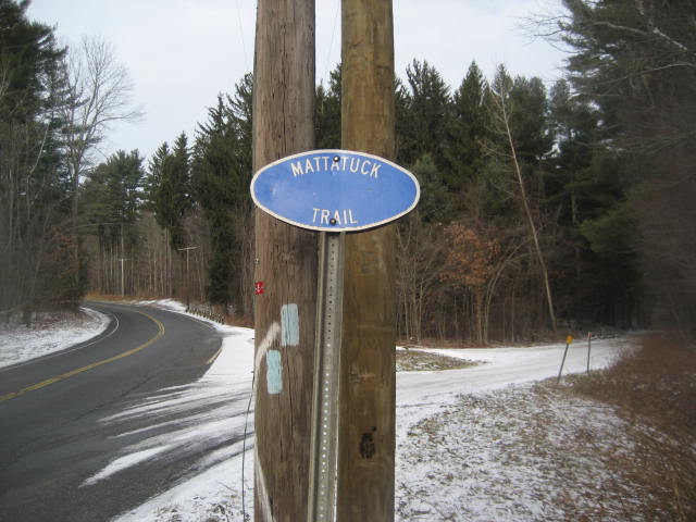
Mattatuck Trail
Northfield Road (Watertown, CT) to Slab Meadow Road (Morris, CT) .:. Hiked 12/28/2013
Distance: 12.26 Miles Round Trip (Approx. 6.3 Miles One Way)
Slab Meadow Road (Morris, CT) to Bissell Road (Litchfield, CT) .:. Hiked 12/29/2013
Distance: 12.1 Miles Round Trip (Approx. 6 Miles One Way)
Date Published: 12/30/2013
As we approached the final weekend of 2013, I was still 27 miles short of my goal of 365 miles in 365 days. I had a couple of days off at the end of the year so I wasn’t overly concerned I would miss my goal. But, I wanted to be 100% certain I was going to hit it. So, as Jaci and I were getting ready for bed on Christmas Eve, I decided I would have enough time to sneak in a quick hike on Christmas morning. That day, I packed up Roscoe and we hit up 5.22 miles at Gay City State Park in Hebron. I had travelled the trails there before (back in November of 2012), so I was familiar with the area and we were able to tackle the Red Loop Trail in a little more than two hours. That hike, which brought the miles to my goal down to about 22, was the start of the final push…
Hikes #74 & #75
Mattatuck Trail
Northfield Road (Watertown, CT) to Slab Meadow Road (Morris, CT) .:. Hiked 12/28/2013
Distance: 12.26 Miles Round Trip (Approx. 6.3 Miles One Way)
Slab Meadow Road (Morris, CT) to Bissell Road (Litchfield, CT) .:. Hiked 12/29/2013
Distance: 12.1 Miles Round Trip (Approx. 6 Miles One Way)
Date Published: 12/30/2013
As we approached the final weekend of 2013, I was still 27 miles short of my goal of 365 miles in 365 days. I had a couple of days off at the end of the year so I wasn’t overly concerned I would miss my goal. But, I wanted to be 100% certain I was going to hit it. So, as Jaci and I were getting ready for bed on Christmas Eve, I decided I would have enough time to sneak in a quick hike on Christmas morning. That day, I packed up Roscoe and we hit up 5.22 miles at Gay City State Park in Hebron. I had travelled the trails there before (back in November of 2012), so I was familiar with the area and we were able to tackle the Red Loop Trail in a little more than two hours. That hike, which brought the miles to my goal down to about 22, was the start of the final push…
Hike # 74
Three days after the hike on Christmas Morning, I was feeling good about hitting my goal. I had roughly 22 miles of hiking planned and I knew that there was always additional mileage on these hikes. I can only recall one occasion where I ended up with less mileage than I expected. And, I had a back-up plan in the event hikes # 74 and # 75 ended up being less mileage than I expected.
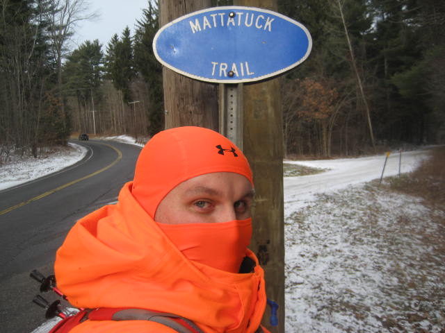
The morning of hike # 74, I made my way over to where I had encountered the police officer one week earlier. The Walk Book refers to this area as Northfield Road, but the roads in the area (off of Route 109 in Thomaston) are unmarked and gated off. Last week, there was still a good amount of snow left over and the snow banks formed by the snow plows made it difficult to park without blocking the gate. This week, I was fortunate because the banks were completely melted and I was able to park off of the side of the road without blocking the gate. I got Roscoe out of the car and we hit the trail.
We started by heading due east, around the gate and down the access road. I wasn’t overly familiar with the area, but I had done some scouting around Black Rock Lake (not to be confused with Black Rock Pond) the week before. So, I knew I eventually had to make a right turn on the next access road and head south. I found the road after walking about half a mile. I made the right, and after another 4/10 of a mile (when I found the trail where I had left off one week earlier), made another right…now heading northwest.
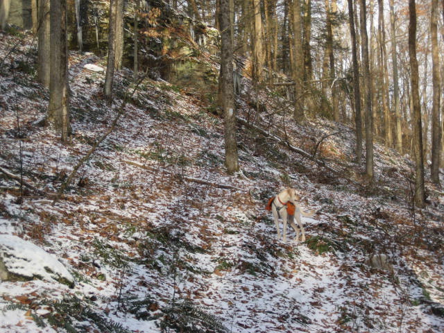
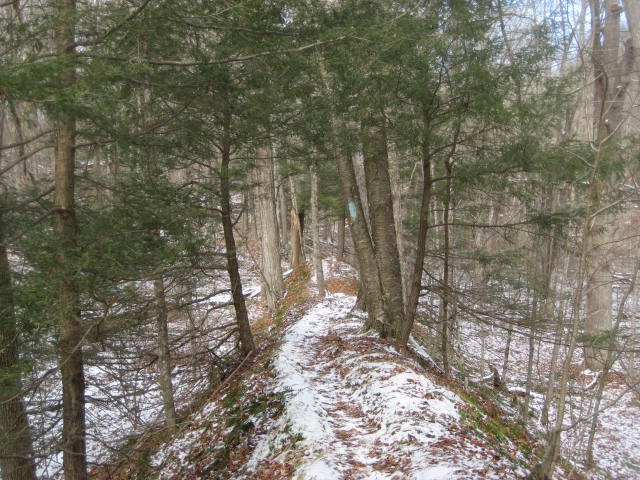
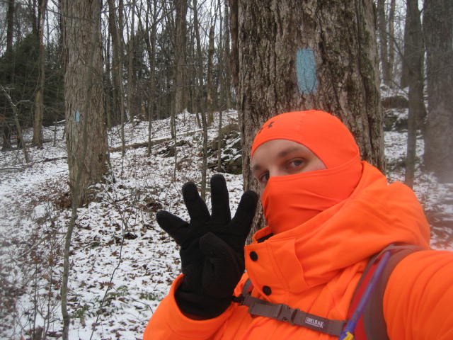
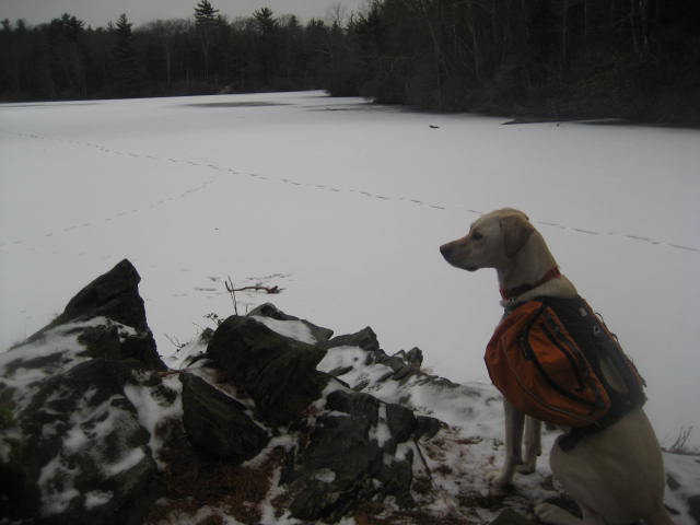
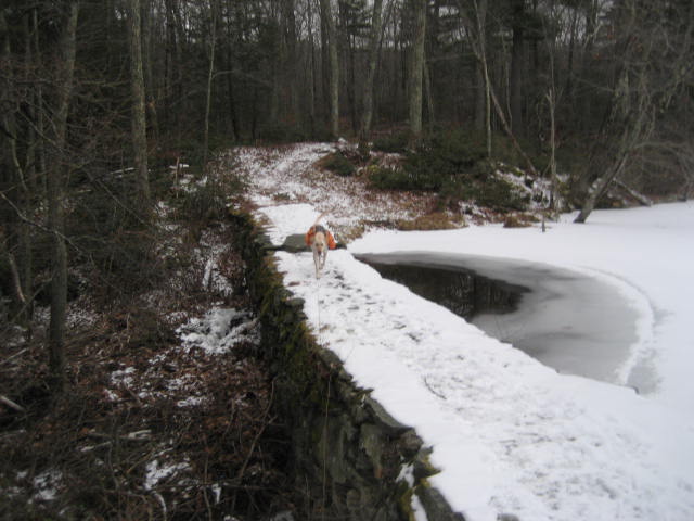
This section of the Mattatuck is probably the most difficult I’ve experienced since I started my journey from Peterson Park in Wolcott several weeks ago. It is very hilly and it gains over 400 feet in elevation as it covers the 5+ miles from Northfield Road to Slab Meadow Road. Perhaps the most difficult subsection is around the 1.5 mile mark (2.4 mile mark if you count the walk along the access roads), where the trail switchbacks up to the top of a ridge. You can see the ridge I’m talking about to the left of center in the photo of Roscoe below.
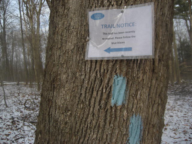
Around the 2.9 mile mark, as the trail approached Gilbert Road, we encountered a re-route which added some additional distance (roughly half a mile). I was disappointed this re-route wasn’t mentioned on the CFPA’s website, which I’ve learned to check before setting out each time. An extra half mile both ways is a pretty significant re-route, especially on a 10+ mile hike like this one.
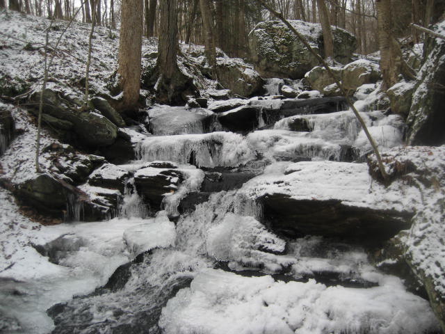
Around the 3.1 mile mark, we reached Gilbert Road and made a right. Due to the re-route, the trail now follows the road for a stretch instead of just crossing right over it. We made our way downhill and, around the 3.5 mile mark, made a left to re-join the original trail. Here the trail crosses French Brook (one of many brook crossings which make this hike challenging) and there is a neat waterfall.
Somewhere in the next subsection, we left Watertown behind and entered the town of Morris, Connecticut. Around the 4.0 mile mark, we encountered Morris Brook (another challenging brook crossing) and eventually made our way across Route 109.
Here the trail follows a dirt road (Pitch Road) for a stretch before making a hard left after Slab Meadow Brook (finally, a bridged crossing). The trail then runs parallel to Pitch Road for the next two miles. Luckily, the road isn’t very busy and the trail runs far enough away that I barely even noticed it was still there. A nice distraction is provided by the fact that the trail runs along a long, narrow ridge which the Walk Book refers to as Goat Path. It isn’t very high, but it is pretty steep on both sides and I found it to be a very unique experience.
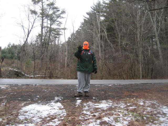
Around the 5.2 mile mark, the trail crosses another dirt road (Farnham Road). After another 1.3 miles, we finally reached our turn around point for the day. I took a minute to confirm the parking location was a good one for my next hike, snapped my “Section Four = Complete” photo, and made my way back to the car.
Hike # 75
The following morning, I was eager to begin what I believed would be a very challenging hike. I had roughly 10 miles to go to hit my goal of 365 miles in 365 days. And, the hike I had planned would take me over roughly 12.6 miles of trail in Litchfield, Connecticut.
If you are from Connecticut, you probably recognize Litchfield as the county located in northwest Connecticut which always gets more snow than the rest of the state. That area of the state is home to some of the higher snowfall totals because it is also home to some of Connecticut’s highest elevations. I had just gotten my butt kicked by the Mattatuck a day earlier and I was ready for a second helping. However, it wasn’t nearly as difficult as I expected.
I started by parking the car right next to the trail off of Slab Meadow Road in Morris. There is only room for one car at the trailhead, but there is plenty of additional parking where the paved portion of Slab Meadow Road ends...which is only a short road walk from the trailhead. The first mile of this hike is easily the most difficult.
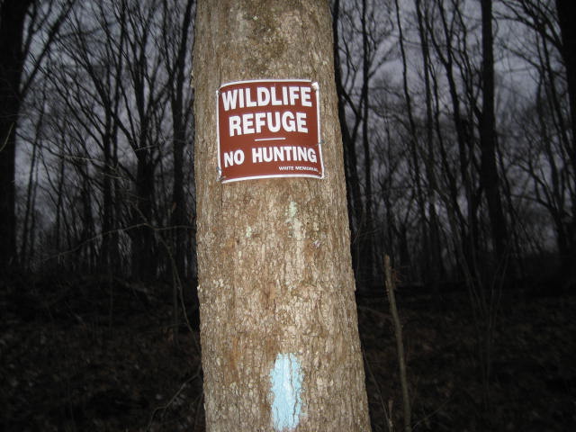
From the parking location, the trail climbs over pretty hilly terrain for about 4/10 of a mile before entering land owned by the White Memorial Foundation.
I started by parking the car right next to the trail off of Slab Meadow Road in Morris. There is only room for one car at the trailhead, but there is plenty of additional parking where the paved portion of Slab Meadow Road ends...which is only a short road walk from the trailhead. The first mile of this hike is easily the most difficult.
From the parking location, the trail climbs over pretty hilly terrain for about 4/10 of a mile before entering land owned by the White Memorial Foundation.
|
|
The White Memorial Foundation, which is a 4,000 acre wildlife sanctuary, was originally established by Alain and May White in 1913. In 1964, the White Memorial Conservation Center was established at their former home. Today, the conservation center operates a nature museum with exhibits including local history, conservation, and ecology. I have to give credit to the Whites and the people responsible for maintaining these lands today. I’ve seen quite a few of these sanctuaries since I started hiking, but this one is MASSIVE. I don’t know how they keep it all maintained, but my time spent there was very enjoyable.
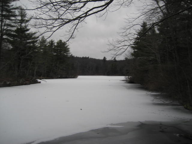
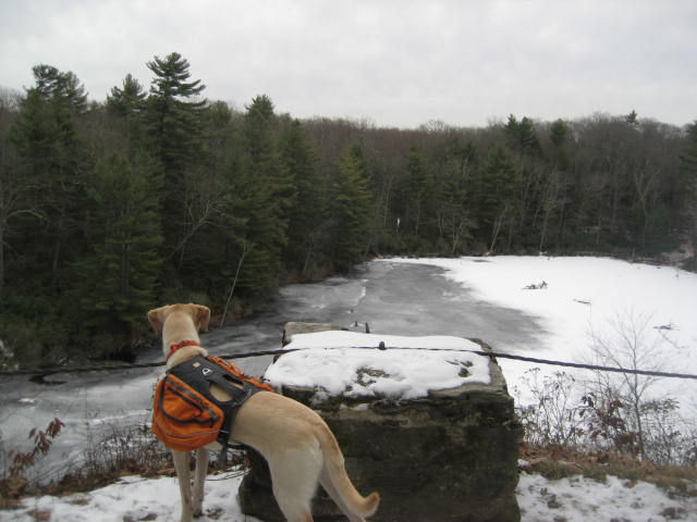
The next 5.5 miles of trail, from about a half mile off of Slab Meadow Road all the way up to Bissell Road in Litchfield, is within White Memorial Foundation land. Like I said, this place is…MASSIVE. And, it is also beautiful. The first highlight for me came when we approached the area of Beaver Pond...not just a beaver pong…but, THE Beaver Pond. About 7/10 of a mile in, the trail brushes along the shores of this sizeable pond and crosses a spillway.
The next 5.5 miles of trail, from about a half mile off of Slab Meadow Road all the way up to Bissell Road in Litchfield, is within White Memorial Foundation land. Like I said, this place is…MASSIVE. And, it is also beautiful. The first highlight for me came when we approached the area of Beaver Pond...not just a beaver pong…but, THE Beaver Pond. About 7/10 of a mile in, the trail brushes along the shores of this sizeable pond and crosses a spillway.
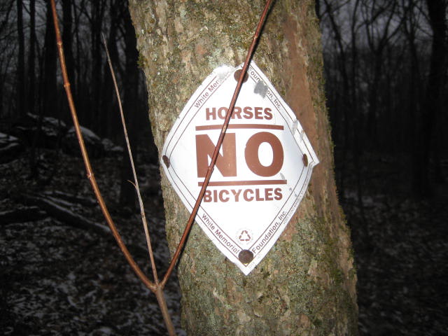
On the southwestern shore of the pond, the trail makes a hard right turn. It becomes a gravel road here and, sadly, it will remain that way for the rest of the trip. This was my first clue that today’s hike wasn’t going to be as challenging as I first thought. Probably the only challenging part is that the blazes are few and far between. I kept waiting for the trail to turn away from the gravel road but it never did. So, I was probably more worried about missing a blaze than I should’ve been.
Around the 2.3 mile mark, we came to an area which overlooks Plunge Pool.
Around the 2.3 mile mark, we came to an area which overlooks Plunge Pool.
Shortly after, the trail starts to gradually descend (over the course of a mile or so) as it heads down to the Route 63 road crossing. As we approached the road, we saw the first of many information/map displays which are scattered throughout the foundation land at various road crossings. Note, there are also additional parking locations on each side of each road crossing…with plenty of room for multiple cars. Parking will not be a problem if you are interested in exploring the White Foundation.
On the western side of Route 63, as it heads generally northwest, the trail continues to follow the wide gravel road. Some sections are really flat and I found it hard to believe I was hiking in Litchfield. Don’t get me wrong, the land here is beautiful, but the hiking was only a fraction as difficult as I thought it would be…which is to say it wasn’t difficult at all. I even saw an elderly woman making her way down the gravel road in sneakers…I must’ve looked like an idiot with my Camelback and trekker poles (which I never used after entering the foundation lands).
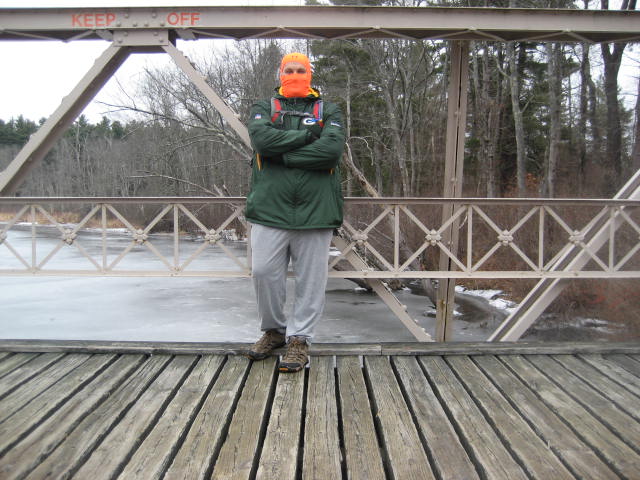
Around the 5 mile mark, the trail came to a neat section where it crosses a plank bridge. I stopped to take a 10 second self-time photo. Note, the “Keep Off” is directed at people who feel the need to climb to the top of the bridge and jump off of it to the water below.
On the western side of Route 63, as it heads generally northwest, the trail continues to follow the wide gravel road. Some sections are really flat and I found it hard to believe I was hiking in Litchfield. Don’t get me wrong, the land here is beautiful, but the hiking was only a fraction as difficult as I thought it would be…which is to say it wasn’t difficult at all. I even saw an elderly woman making her way down the gravel road in sneakers…I must’ve looked like an idiot with my Camelback and trekker poles (which I never used after entering the foundation lands).
Around the 5 mile mark, the trail came to a neat section where it crosses a plank bridge. I stopped to take a 10 second self-time photo. Note, the “Keep Off” is directed at people who feel the need to climb to the top of the bridge and jump off of it to the water below.
After the bridge, the trail incorporates a few of the dirt roads which lead to parking areas within the White Memorial Foundation land. But, traffic is still minimal…which was nice. Around the 6 mile mark, we reached Bissell Road. Here, the trail actually stops and starts again a few miles to the northwest. I hope to pick up that next section of trail soon, but this was the end of the line for this hike. I snapped my “Section Five = Complete” photo and started making my way back to the car.
Along the way, I added a small amount of distance to my trip back by exploring the lands within the White Memorial Foundation. I still had a good amount of energy left so I was willing to explore any side trail I saw along the way. In the end, as I made my way back through the area around the Plunge Pool overlook, I passed mile 365 for the year.
After almost 50 different hikes in Connecticut, Massachusetts, Delaware, Maryland, and Vermont, I reached my goal for the year. I find it fitting that this incredible journey of 2013 started on a hike down by the shoreline which was far more difficult than I expected and ended in the northwest corner of the state on a hike which was far less difficult than I expected. In a nutshell, that’s what hiking is all about and I wouldn’t have wanted to pass my goal in any other way.
Total Miles in 2013: 367.22
