A Walk in the Clouds
Hike # 106
Mount Greylock State Reservation
Adams, MA
Hike Distance: 12.78 Miles
Date Hiked: 6/15/2014
Date Published: 6/19/2014
Note: The hike described in the following recap is not recommended for beginners.
Long-time readers of my recaps might recall that my goal for 2014 is to hike to higher elevations. As we approach the mid-point of the year, I’m happy to report I’ve added several more elevations of 1000+ feet. And…as a result…Soapstone Mountain, which sat at # 4 on my “Peaks” list to start the year, has dropped to # 15. For my next hike, I was ready to push it even lower down the list and…in the process…check off the box next to my first state high point.
Mount Greylock (elevation: 3,491 feet) is the highest natural point in Massachusetts. Geologically it is considered part of the Taconic Mountains but, due to its location, it is more commonly associated with the Berkshire Hills. Several trails traverse the mountain, which allow for a combination of loop hikes. I decided to see just how hard I could push myself and opted to start on the Appalachian Trail.
After driving for more than two hours, from central Connecticut to northwestern Mass (I-91 North to Route 2 West), I located my pre-determined parking spot off of Pattison Road (just west of the Mount Williams Reservoir). I geared up, got Roscoe out of the car, and we hit the trail.
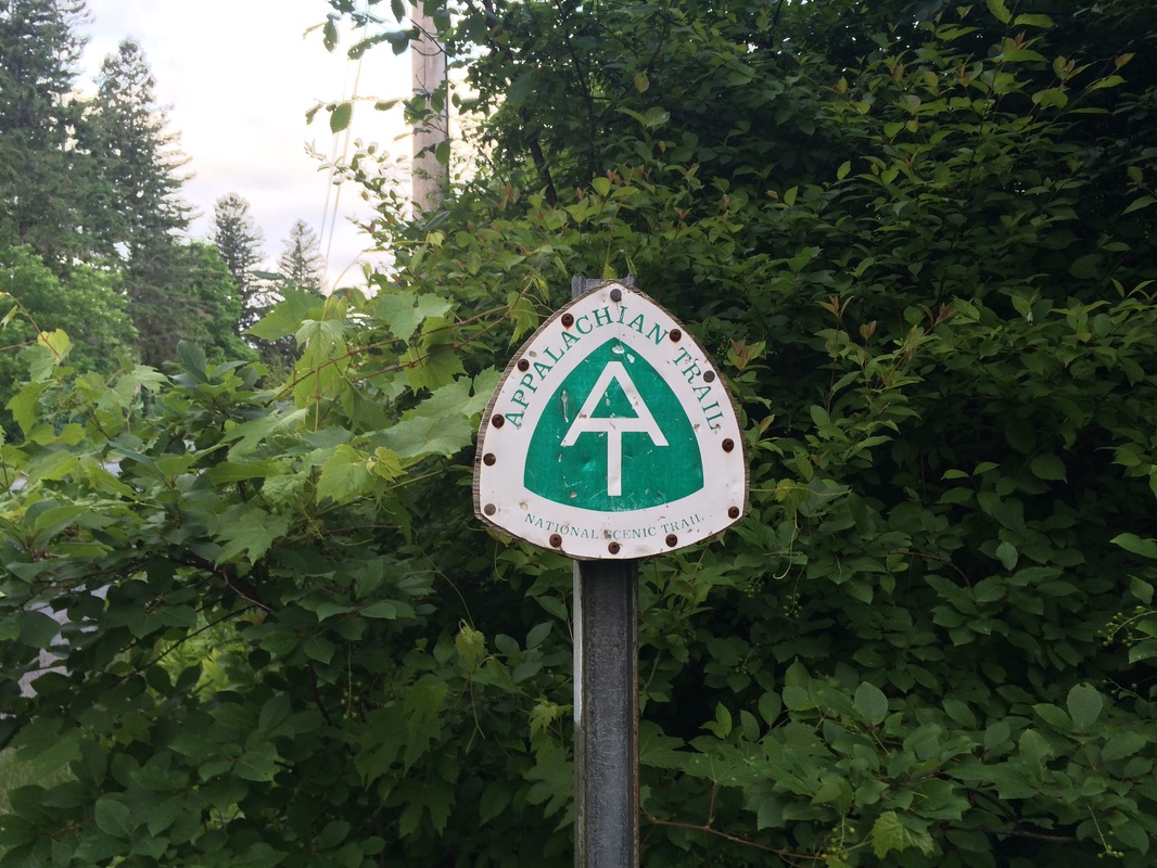
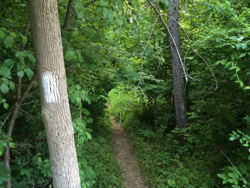
We started by crossing Pattison Road and heading due south on the AT…
Hike # 106
Mount Greylock State Reservation
Adams, MA
Hike Distance: 12.78 Miles
Date Hiked: 6/15/2014
Date Published: 6/19/2014
Note: The hike described in the following recap is not recommended for beginners.
Long-time readers of my recaps might recall that my goal for 2014 is to hike to higher elevations. As we approach the mid-point of the year, I’m happy to report I’ve added several more elevations of 1000+ feet. And…as a result…Soapstone Mountain, which sat at # 4 on my “Peaks” list to start the year, has dropped to # 15. For my next hike, I was ready to push it even lower down the list and…in the process…check off the box next to my first state high point.
Mount Greylock (elevation: 3,491 feet) is the highest natural point in Massachusetts. Geologically it is considered part of the Taconic Mountains but, due to its location, it is more commonly associated with the Berkshire Hills. Several trails traverse the mountain, which allow for a combination of loop hikes. I decided to see just how hard I could push myself and opted to start on the Appalachian Trail.
After driving for more than two hours, from central Connecticut to northwestern Mass (I-91 North to Route 2 West), I located my pre-determined parking spot off of Pattison Road (just west of the Mount Williams Reservoir). I geared up, got Roscoe out of the car, and we hit the trail.
We started by crossing Pattison Road and heading due south on the AT…
|
|
I have to admit to being less
prepared for this hike than for any other hike I’ve done in recent memory. I still had a map and I still had plenty of
knowledge about the area, but I wasn’t exactly sure how much distance I would
find between Pattison Road and the summit of Mount Greylock. So, when I saw the sign in the picture
below…and learned I would be hiking approximately 11.2 of rugged trail out and
back…I grew a little concerned…
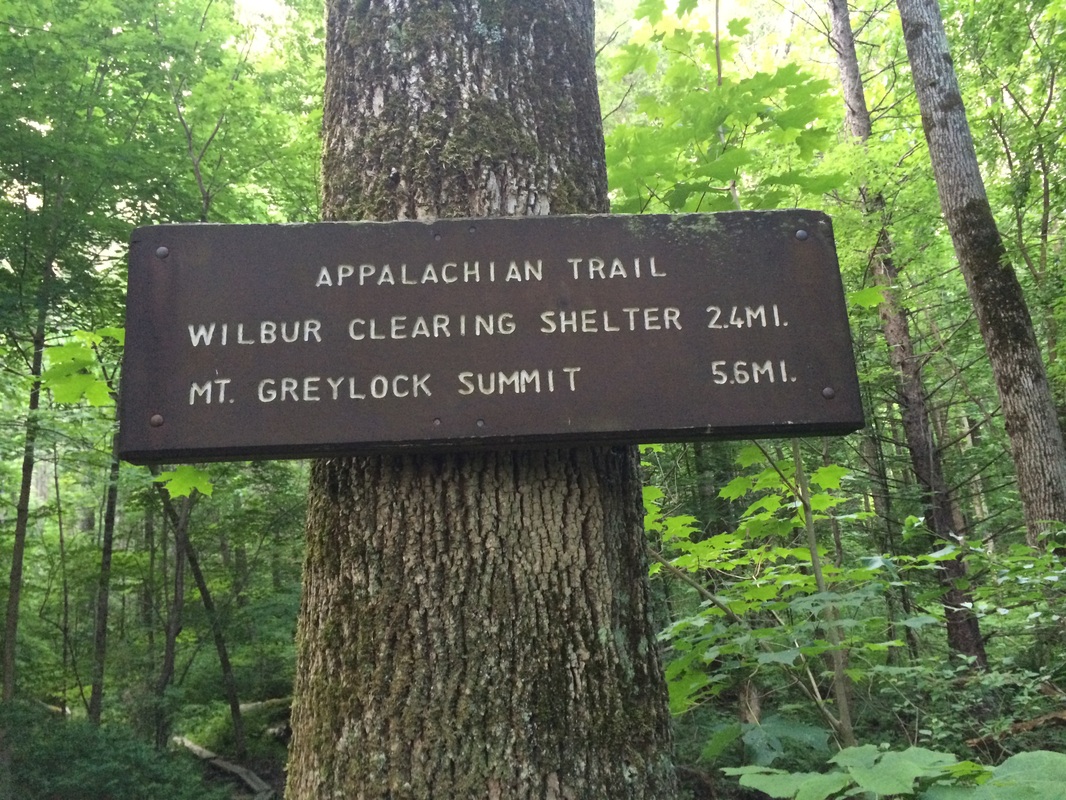
I’ve done my fair share of 11+
mile hikes before. And, I’ve hiked on
the AT before. But, something told me
the AT here in northwestern Mass would be a little more challenging than the
sections of the AT I’ve completed in Connecticut. I also had to consider the fact I wanted to
be back at the car by noon in order to make it to my parent’s for a Father’s
Day Cookout by 3pm. So, I put a little
hop in my step.
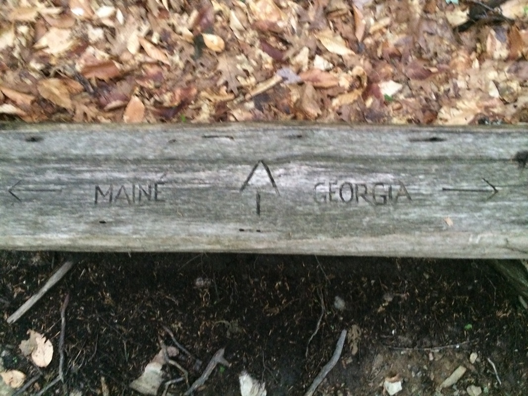
Approximately 8/10 of a mile in, we passed a bench which confirmed we were heading south towards the Mount Greylock summit and…well beyond that point, Georgia…
Approximately 8/10 of a mile in, we passed a bench which confirmed we were heading south towards the Mount Greylock summit and…well beyond that point, Georgia…
If you have time to spare and
are out of breath at this point, I would suggest stopping for a minute and
resting on this bench. The next mile or
so is pretty much straight uphill, over a series of extended switchbacks, and
it was possibly the toughest climb I’ve ever made. Once you reach the top of this steep incline
(roughly 1.9 miles in), the trail makes a hard left turn and starts to head
back downhill. Before making the left
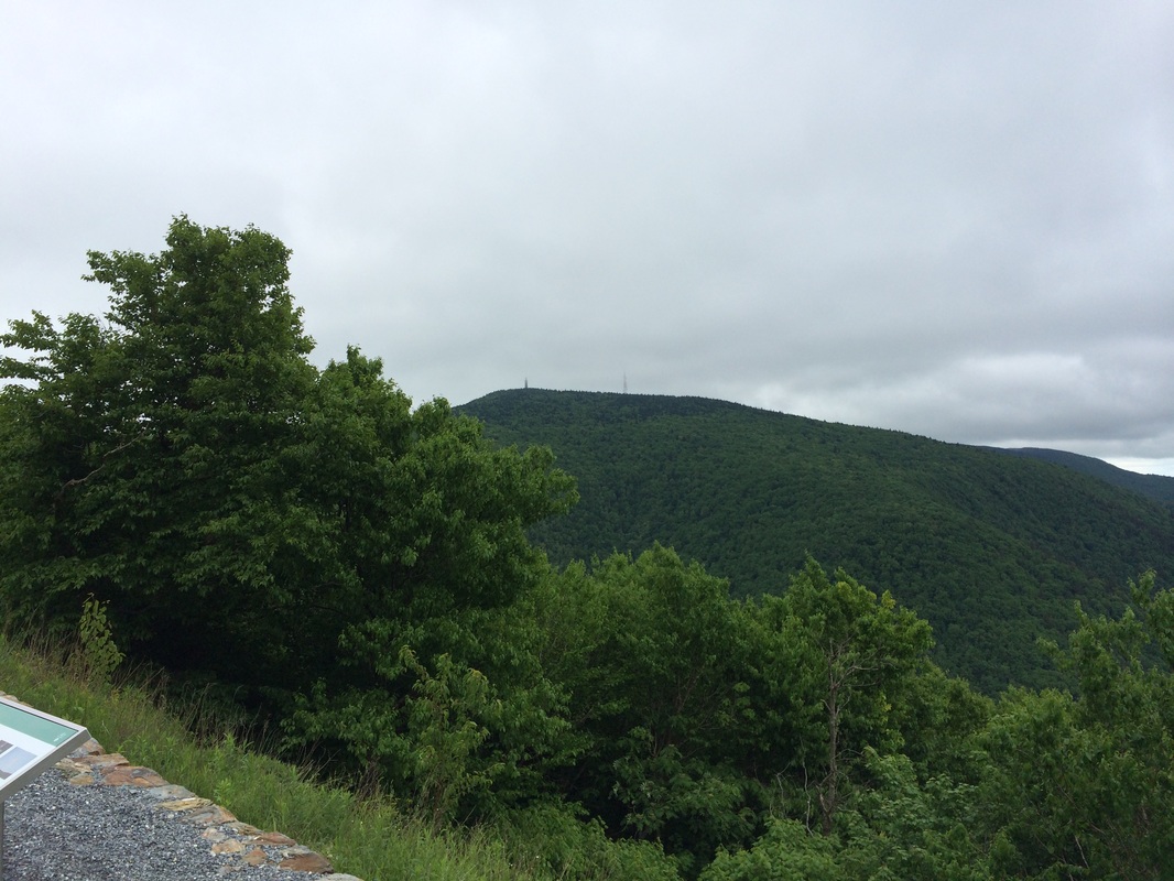
turn, I recommend staying straight for a few feet in order to take advantage of
the western view where the AT converges with the Mount Prospect Trail…
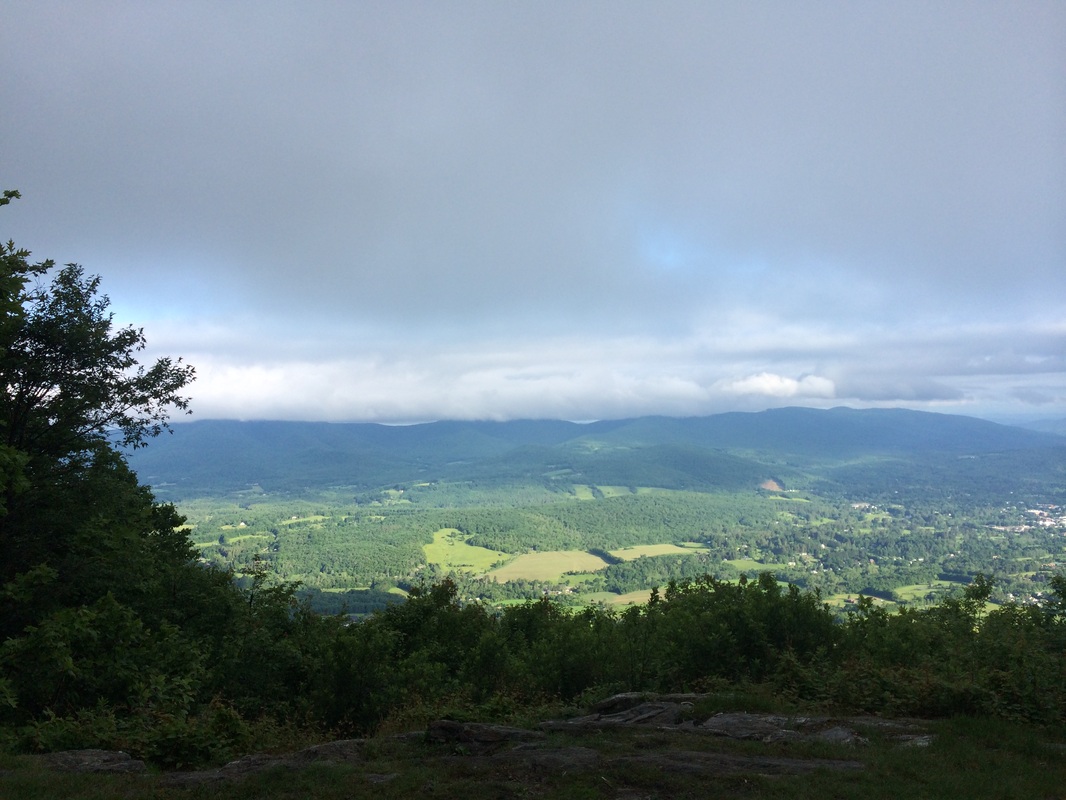
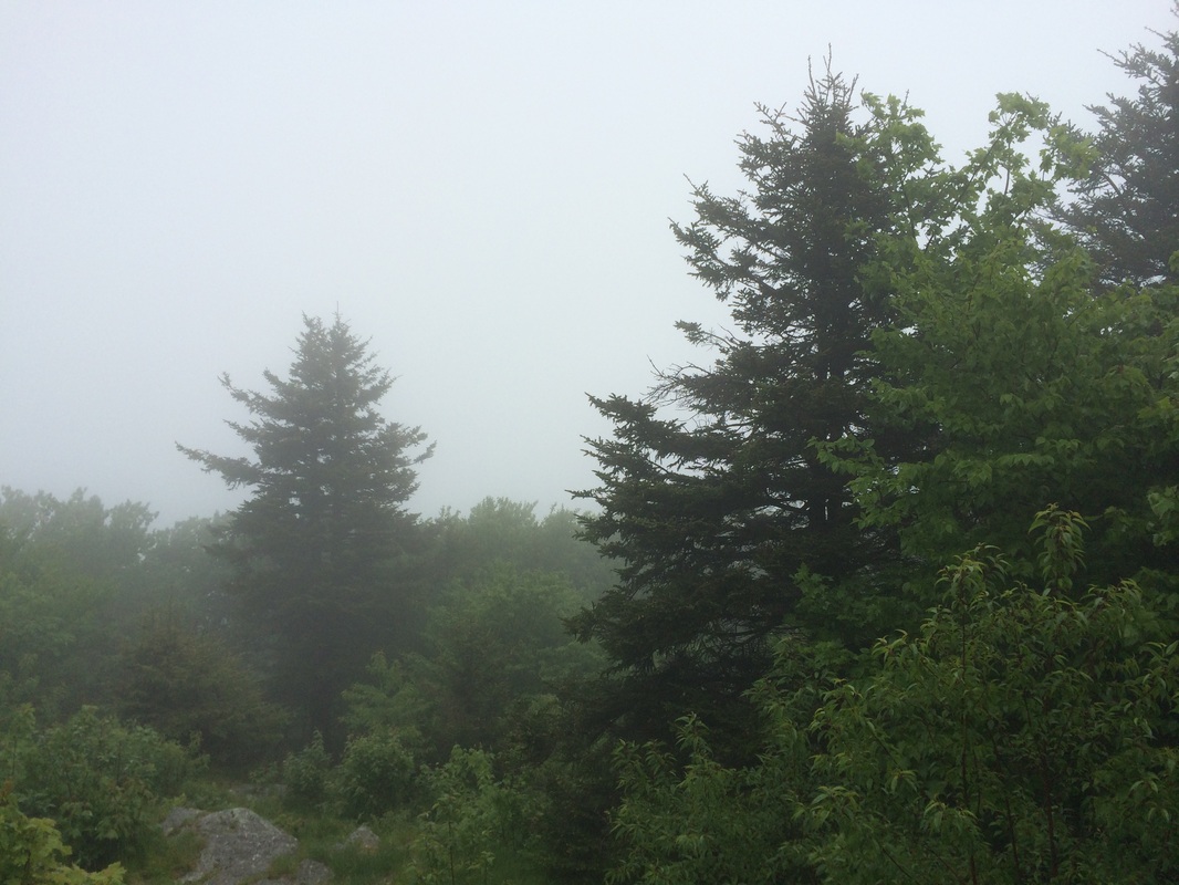
Noticing the clouds moving in
from the west, and having noticed the cloud cover near the summit of Mount Greylock
on the drive to the parking location, I grew concerned this might be our only view
of the day. But, we marched on all the
same.
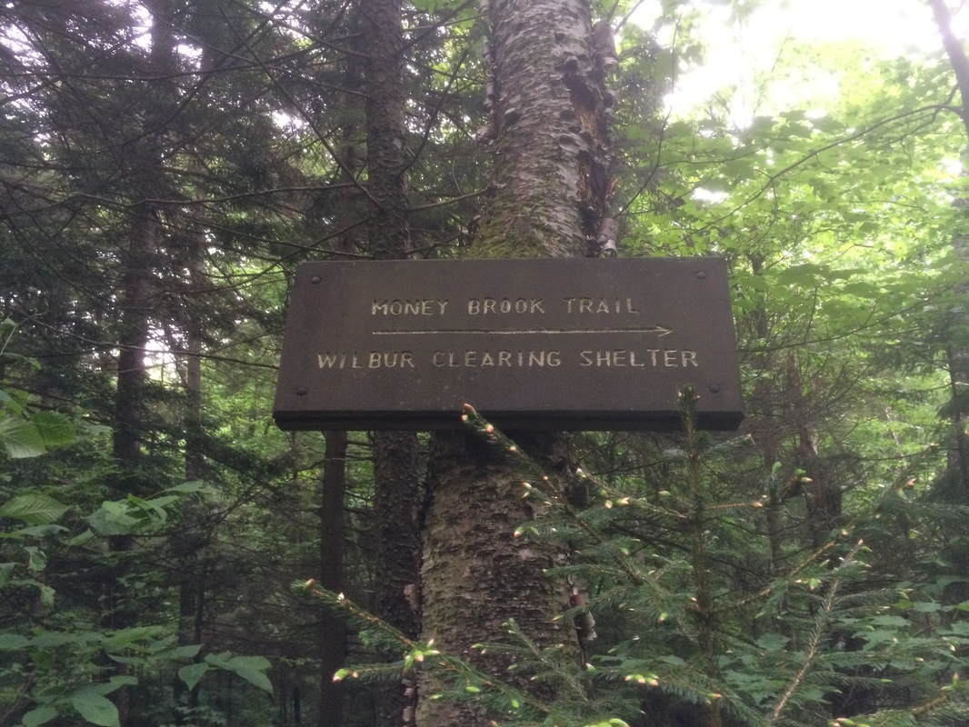
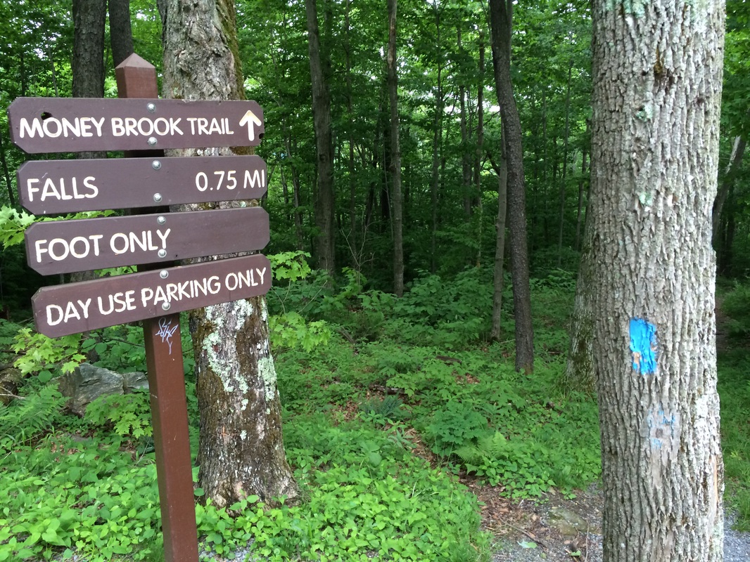
As I noted earlier, the trail descends from the view point for roughly 3/10 of a mile. Then, roughly 2.2 miles in, we came to a trail junction. Here, the Money Brook Trail comes in from the right…
As I noted earlier, the trail descends from the view point for roughly 3/10 of a mile. Then, roughly 2.2 miles in, we came to a trail junction. Here, the Money Brook Trail comes in from the right…
Turning slightly left from the
trail junction, we continued to follow the white blazes of the AT. This section of trail ascends again, but it
does so gradually until it reaches and crosses Notch Road at approximately the
2.5 mile point…
Note: a sign at the AT/Money
Brook Trail junction advises it is only 1/10 of a mile from the trail junction
to Notch Road, but MapMyHike tells me it is 3/10 of a mile. And, it felt like more than 1/10 of a
mile. So, mileage may vary here.
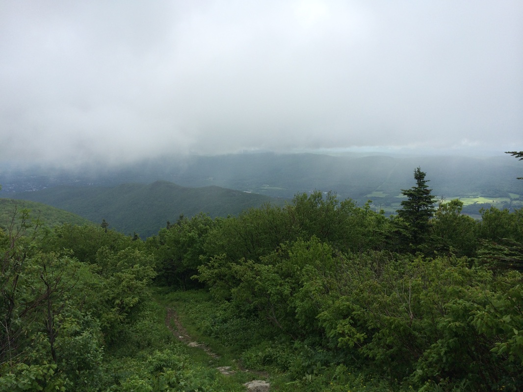
After crossing Notch Road, the trail starts to climb steeply again. Along the way, it grew increasingly cloudy and I grew even more concerned about the upcoming views.
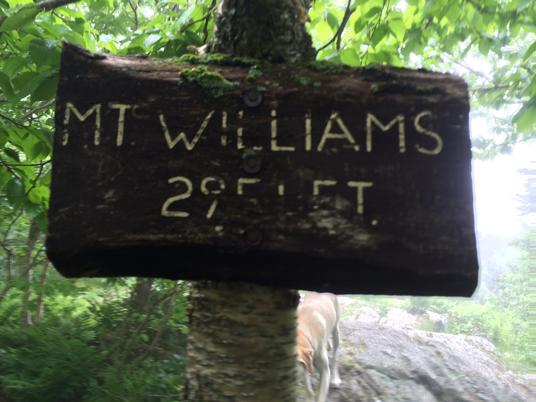
Roughly 3.3 miles in, we reached the summit of Mount Williams (elevation: 2,951 feet). I imagine there is a really nice view to the northeast here, but the cloud cover made it so I could barely see 20 feet in front of my face…
After crossing Notch Road, the trail starts to climb steeply again. Along the way, it grew increasingly cloudy and I grew even more concerned about the upcoming views.
Roughly 3.3 miles in, we reached the summit of Mount Williams (elevation: 2,951 feet). I imagine there is a really nice view to the northeast here, but the cloud cover made it so I could barely see 20 feet in front of my face…
|
|
We didn’t linger very
long. There was another hiker here who
stopped in the hope the cloud cover would burn off as the sun continued to
rise, but I was up against the clock and couldn’t afford to wait for clouds
which may or may not dissipate. So, we
continued on.
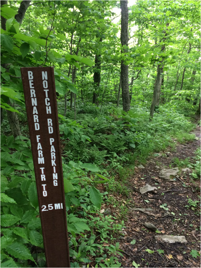
Approximately 3.7 miles in, we crossed the Bernard Farm Trail…
Approximately 3.7 miles in, we crossed the Bernard Farm Trail…
The walk from the Bernard Farm
Trail to the next way point (the Bellows Pipe Trail junction) was mostly just a
ridge walk, which was nice because it allowed us to pick up the pace a little. There were still a few ups and downs here and
there, but nothing compared to what we experienced earlier in the day.
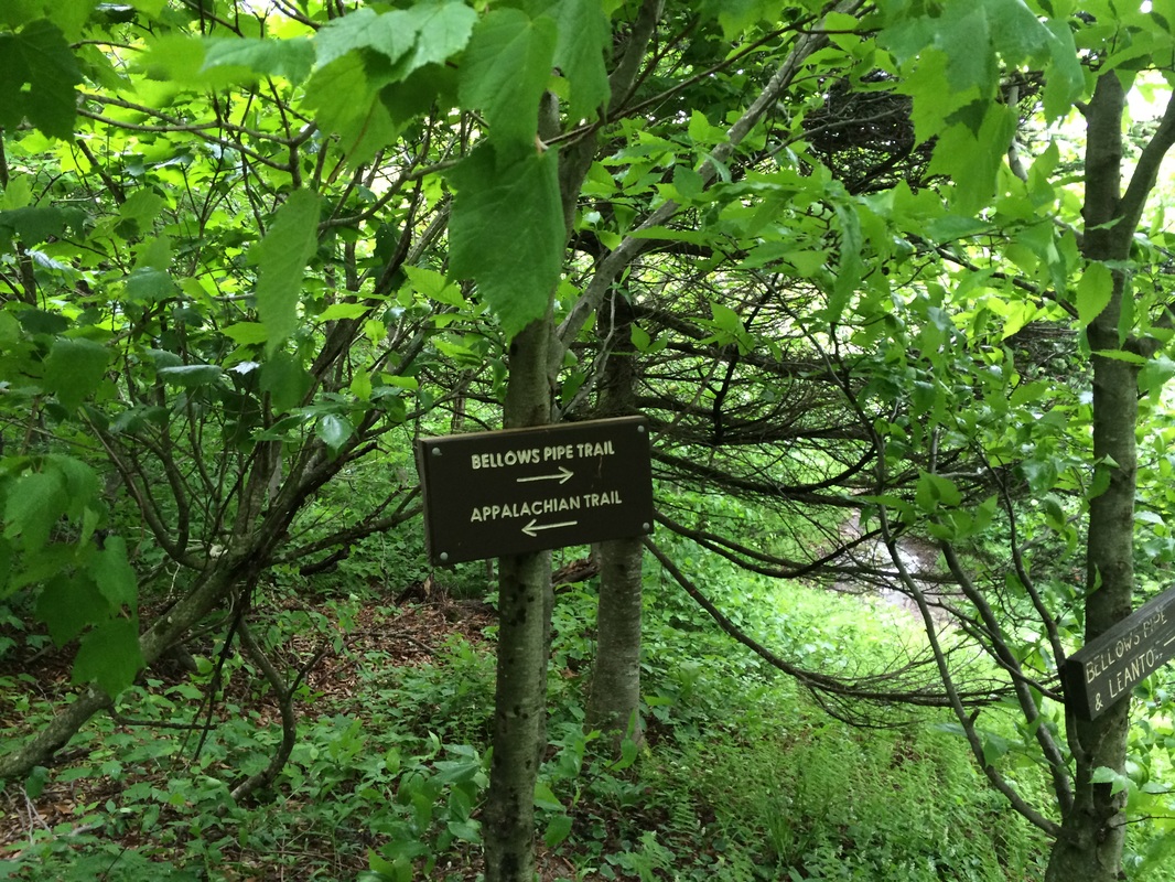
Roughly 5.4 miles in, we reached the junction with the Bellows Pipe Trail…which was followed shortly by the junction with the Thunderbolt Ski Trail…
Roughly 5.4 miles in, we reached the junction with the Bellows Pipe Trail…which was followed shortly by the junction with the Thunderbolt Ski Trail…
Here, the trail became steep once
again…but I knew, at 5.4 miles in, we were approaching the summit so I kept
pushing…onward and upward.
Approximately 5.8 miles in, we crossed Notch Road for the second time. Before crossing, I turned back to take in the view down the Thunderbolt Ski Trail. The clouds were blocking most of the view but I was able to get a good idea of just how high up we were…
Approximately 5.8 miles in, we crossed Notch Road for the second time. Before crossing, I turned back to take in the view down the Thunderbolt Ski Trail. The clouds were blocking most of the view but I was able to get a good idea of just how high up we were…
I would be lying if I told you
I didn’t think at all about taking the road the rest of the way to the
summit. Instead, I took a deep breath
and continued along the AT. This very
last section was steep, but it was short.
Before I knew it, we were at the top of the steep incline and following
signs for the summit. Then, as we turned
a corner and passed some trees, I saw the Veterans War Memorial Tower through
the fog…
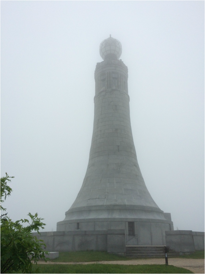
Originally designed by
architects from Boston, and constructed from 1931 to 1932 for $200K, the
Veterans War Memorial Tower stands 92 feet tall. It was formally dedicated in 1933 before a
crowd of 1200 people. The tower’s
beacon, possibly the most powerful light in Massachusetts, was intended “to
shine each night, perpetually, to honor the memory of fallen heroes and to
guide aviators in their lone night-time journeys over the treacherous mountain
range.” Except for a few weeks in the
spring and fall, when the light is dimmed to avoid confusing migrating birds,
the beacon continues to shine each night as a memorial to casualties of all
wars.
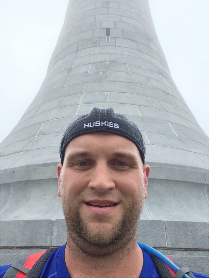
I was disappointed to find the tower wasn’t open (not that it would’ve made the views any better) but I did manage to get a selfie in front of it…
I was disappointed to find the tower wasn’t open (not that it would’ve made the views any better) but I did manage to get a selfie in front of it…
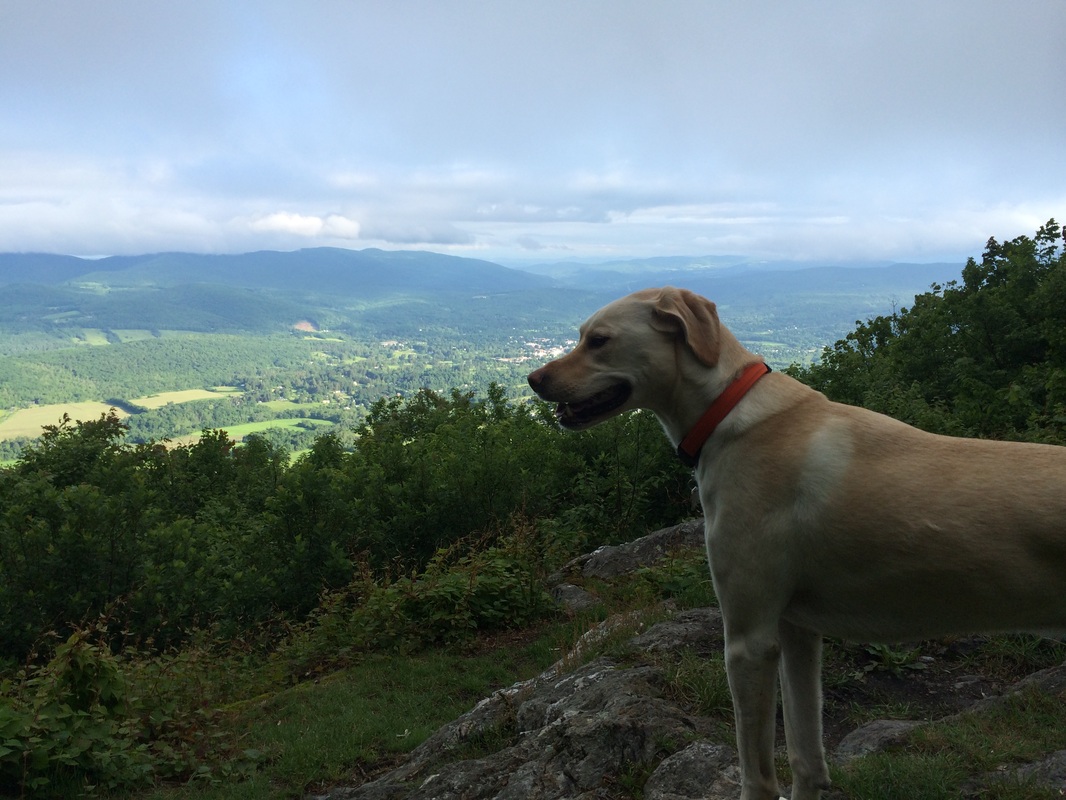
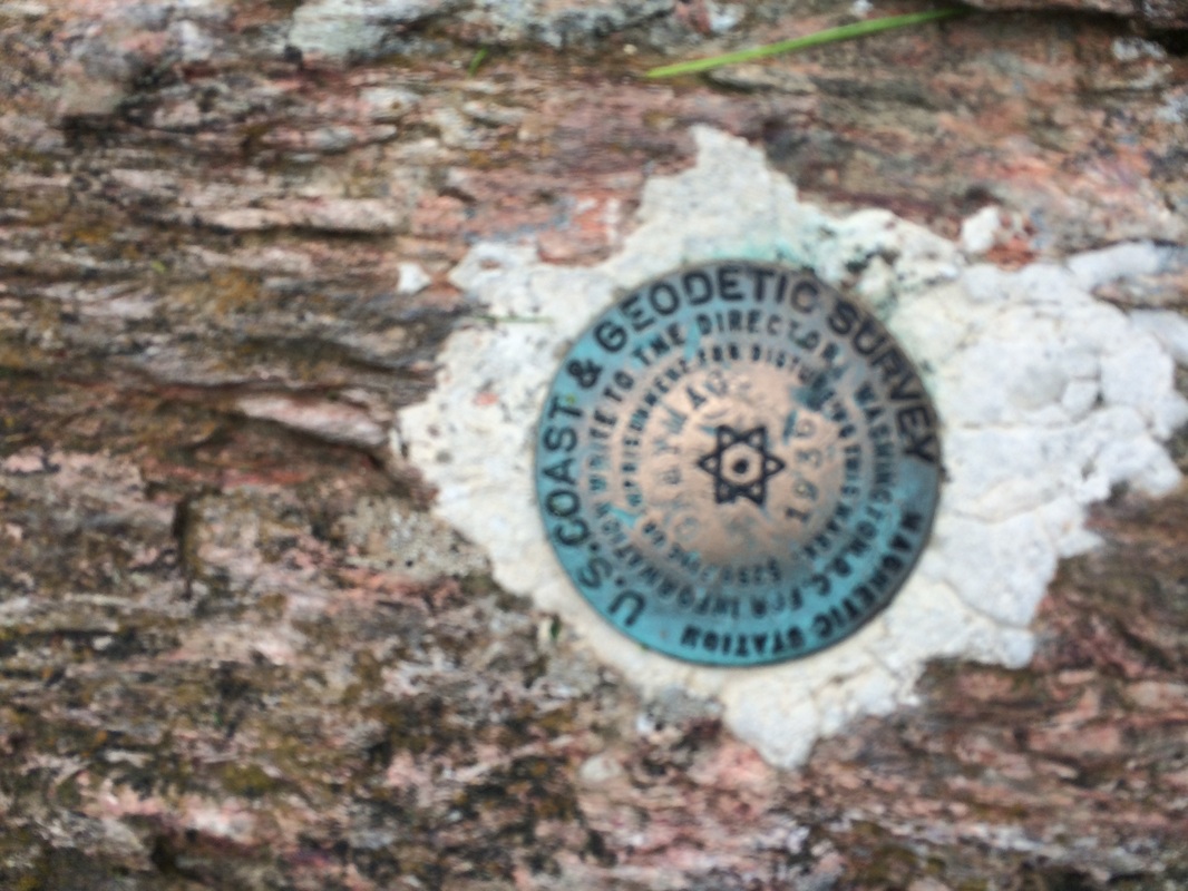
We explored the area around the
summit for a bit, hitting the 6.0 mile point of our hike in the process. At the top, I found a U.S.G.S. survey marker
while Roscoe tried to enjoy the view (or what little view we had). There is a nice panoramic picture on the east
side of the summit which points out several landmarks (including Mount Snow and
Mount Haystack in Vermont, Mount Monadnock in New Hampshire, Boston, Mount Tom,
and the ridge which makes up the Shenipsit Trail in Connecticut). If only I could see through the cloud
cover. Oh well, now I have an excuse to
return one day…maybe I’ll even take a vehicle to the top next time…

Once we were done with the area
around the tower, we made our way quickly over to Bascom Lodge…
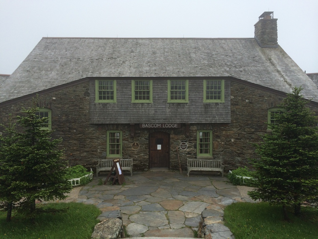
Originally built from 1932 to
1938, using local materials, Bascom Lodge was designed by an architect from
nearby Pittsfield after the previous summit house burned down in 1929. Today Bascom Lodge is run by the Bascom Lodge
Group, in partnership with the Massachusetts Department of Conservation and
Recreation’s Historic Curatorship Program.
The lodge accepts reservations for lodging, dinner, weddings,
anniversaries, family gatherings, and corporate events.
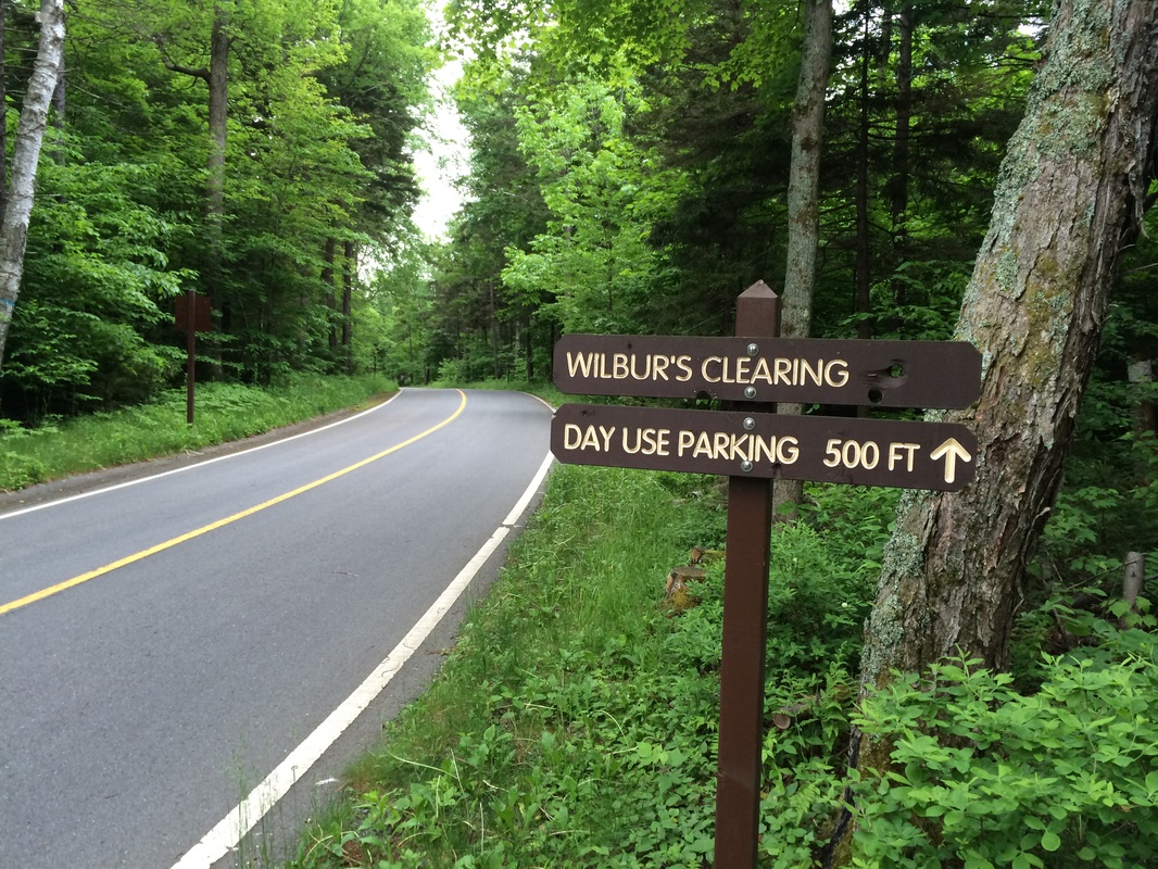
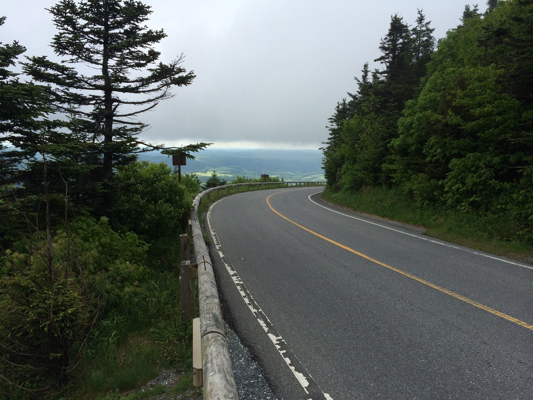
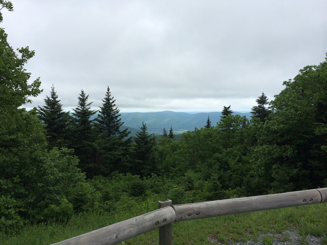
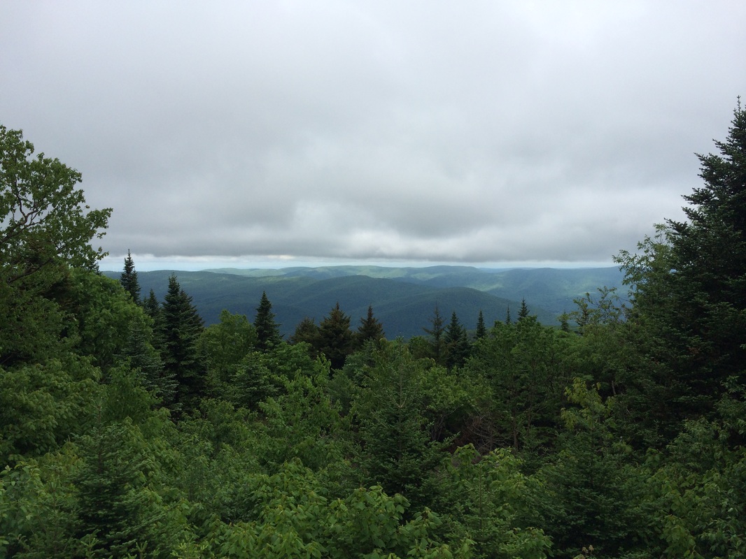
From the area of the lodge, I tried to figure out the easiest way back to the car and elected to follow Notch Road for a stretch. Along the way, I paused every now and then to enjoy some of the roadside views. At one point, I could even see back up to the summit of Mount Greylock (in the third picture below, look for the War Memorial Tower)…
From the area of the lodge, I tried to figure out the easiest way back to the car and elected to follow Notch Road for a stretch. Along the way, I paused every now and then to enjoy some of the roadside views. At one point, I could even see back up to the summit of Mount Greylock (in the third picture below, look for the War Memorial Tower)…
After 3.2 miles of road walk
(10 miles overall), I found the Money Brook Trail and decided to follow it,
knowing it would eventually connect me back with the AT…
After another 2/10 mile or so
and we reached the point where the Money Brook Trail comes to a “T” junction…
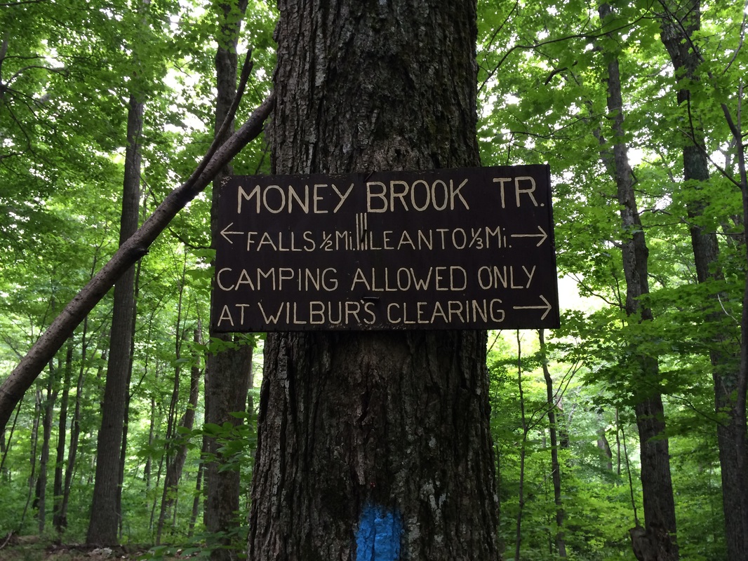
If we made a left, the trail
would bring us to Money Brook Falls in 1/2 of a mile. While I really wanted to see the falls, I was
running out of time and, more importantly, energy. I also knew there would be at least one more
climb before the final descent. So, I
elected to turn right and the falls for another time.
After another 4/10 of a mile on the Money Brook Trail, we made our way back to the AT and made a left. Now roughly 10.7 miles in, we started the climb back to the western overlook at the Mount Prospect Trail junction. Once there, I took a minute to catch my breath/enjoy one last view. After a few minutes, which…honestly…was more than I could spare, we started the final descent back to the car. This was a long, steep descent and it was absolute murder on my knees. I’m not quite sure how, after descending steeply for the final hour of this hike, I then made the 2 hour drive home.
All in all this was an enjoyable trip. I have a hard time putting this hike in my top 5 because I really didn’t get to enjoy all of the views...and I completely missed the view from the summit of Mount Greylock. It felt like a lot of senseless climbing and torture without any of the usual payoff. I hope to return to the summit of Mount Greylock on a clear day and take in all of the views. Until next time…
For a map of this hike, along with elevation data, please click here.
Total 2014 Distance: 281.58
