Eagles Beak
Hike # 86
Mattabesett Trail
Route 154/Saybrook Road to Millers Pond State Park (Haddam, CT)
Distance: 5.52 Miles
Date Hiked: 1/26/2014
Date Published: 1/29/2014
After a week away from the Mattabesett, I was excited to continue my sections hikes along one of Connecticut’s most popular long-distance trails. I met up with my friend Mark at the Millers Pond State Park parking location off of Foot Hills Road in Haddam/Durham (from what I can tell, the parking location is on the town line…GoogleMaps says Durham…Walk Book Map says Haddam…Haddam/Durham it is). We left my vehicle in the lot and drove over, in Mark’s car, to where we last left off (near Seven Falls State Park).
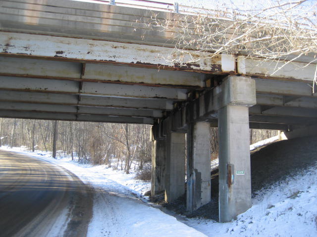
The first sub-section of this hike follows a series of roads for roughly a mile and a half. We made the most of this walk, catching up on movies and discussing the other hikes I’ve done since our last hike together two weeks prior. We followed the blazes (on telephone poles) up Thayer Road and Nedobity Road, crossing under Route 9 in the process. I stopped to take a picture. Sadly, since I forgot to charge my camera battery overnight and because it was bitterly cold; this is the only picture I have from this hike.
Hike # 86
Mattabesett Trail
Route 154/Saybrook Road to Millers Pond State Park (Haddam, CT)
Distance: 5.52 Miles
Date Hiked: 1/26/2014
Date Published: 1/29/2014
After a week away from the Mattabesett, I was excited to continue my sections hikes along one of Connecticut’s most popular long-distance trails. I met up with my friend Mark at the Millers Pond State Park parking location off of Foot Hills Road in Haddam/Durham (from what I can tell, the parking location is on the town line…GoogleMaps says Durham…Walk Book Map says Haddam…Haddam/Durham it is). We left my vehicle in the lot and drove over, in Mark’s car, to where we last left off (near Seven Falls State Park).
The first sub-section of this hike follows a series of roads for roughly a mile and a half. We made the most of this walk, catching up on movies and discussing the other hikes I’ve done since our last hike together two weeks prior. We followed the blazes (on telephone poles) up Thayer Road and Nedobity Road, crossing under Route 9 in the process. I stopped to take a picture. Sadly, since I forgot to charge my camera battery overnight and because it was bitterly cold; this is the only picture I have from this hike.
After crossing under Route 9, Nedobity Road ascends at a pretty good rate. So, even though this is a road walk, we were huffing a bit. Around the one mile mark, the trail makes a right turn (west) and follows Brainard Hill Road. We continued to follow Brainard Hill Road for another half mile, passing some nice houses and a random farm with cows, until we reached the spot where the trail turns left (south) and heads into the woods.
Finally, we were doing some actual hiking. And, the first part of the trail here doesn’t disappoint. We crossed an old rock dam, and descended a bit to cross a brook. Man, I wish I had picture of this dam…ugh.
After crossing the brook, the trail heads uphill through a pretty thick stand of mountain laurel. This was nothing like our previous hike on the Mattabesett but it was still impressive. I was thankful that someone had travelled the trail a few days earlier because, otherwise…with the snow covering the trail…I don’t think I could have found my way.
The Walk Book mentions a rock formation called “The Pavement” somewhere in this section, but it isn't as flat as you might expect. And, to be honest, I wasn't sure if what we saw was even it. I later confirmed it was. Our next highlight, and really the only other highlight of this hike, was Eagles Beak Point (elevation: 600 ft). There is a rock formation here, which we climbed to the top of and had a nice view to the south and east. The person whose footprints we were following didn’t appear to take in this overlook. From what I can tell, the name Eagles Beak Point doesn’t have anything to do with any eagles in the area. I think it is named Eagles Beak Point because the trail, when viewed on a map, looks the beak of an eagle (or any other bird, for that matter).
From Eagles Beak Point (around the 2.6 mile mark), there really isn’t much else to see on this hike. There are a couple of neat rock formations, some climbs and some descents…but overall this was just a quiet walk in the woods. Eventually, we made our way out to Foot Hills Road (around the 4.0 mile mark). We made a right (west) and followed the road about three quarters of a mile.
After about 7/10 of a mile, we reached the intersection of Foot Hills Road and Wiesse Albert Road. Here the trail makes a 45 degree left turn on Wiesse Albert Road and then quickly turns right to re-enter the woods. At this point, we entered Millers Pond State Park property.
Along the way, we crossed several side trails which are not required for completion of the CT400 until we came to the white-blazed Miller Pond State Park Trail. This short 1/3 of a mile trail is great for access to/from the Mattabessett and the lot where we left my vehicle. We made a right, heading north for the first time, and shortly reached my car…passing by some families who were ice fishing on Millers Pond in the process.
This hike wasn’t a complete bust. Yes, it was cold. Yes, there was snow which made it difficult to climb some of the steeper sections. Yes, my camera battery died two seconds in. But, we got to enjoy a great view from Eagles Beak Point and I enjoyed our brief time in Millers Pond State Park. I’m really looking forward to the next hike when we will get to see a little more of Millers Pond.
For a map of this hike, along with elevation data, please click here.
Total 2014 Distance: 73.11 Miles
