The End is Only the Beginning
Pachaug Trail
Hike # 82
Green Fall Pond (Voluntown, CT) to Beach Pond (Exeter, RI)
Section Distance, Per CFPA Walk Book: 4.5 Miles
Hike Distance: 6.14 Miles
Date Hiked: 1/18/2014
Hike # 83
Beach Pond (Exeter, RI) to Shetucket Turnpike (Voluntown, CT)
Section Distance, Per CFPA Walk Book: 5.3 Miles
Hike Distance: 9.85 Miles (Out-and-Back)
Date Hiked: 1/19/2014
Hike # 84
Shetucket Turnpike (Voluntown, CT) to Cedar Swamp Road/Pharisee Rock Trail (Sterling, CT)
Section Distance, Per CFPA Walk Book: 6.2 Miles
Hike Distance: 12.03 Miles (Out-and-Back)
Date Hiked: 1/20/2014
Date Published: 1/22/2014
The Pachaug Trail, located in eastern Connecticut, covers more than 25 miles from Green Fall Pond in Voluntown to Pachaug Pond in Griswold. Located almost entirely within the Pachaug State Forest, it makes what looks like a horseshoe shape, and it is close to many side trails and crossover trails (including the Nehantic, Quinebaug, and Narragansett), which allow for many possible loop hikes.
My adventure along the Pachaug started when I met up with my dad and his friend Allan on a rainy Saturday morning. We made our way, in separate vehicles, from Coventry where my parents live to the large parking location at Beach Pond, just over the Connecticut/Rhode Island border in Exeter. We dropped my Dodge Journey there and the three of us made our way towards another parking location, near Green Fall Pond, in my dad’s Toyota Tundra. Along the way, we realized the forest road which leads from Route 138 to the pond was gated off. So, we ended up spotting my dad’s truck near the intersection of Fish Road and Green Fall Road (where the Walk Book map notes a Toll Booth). This would add a lengthy (1.6 mile) road walk to the hike, but it was pretty flat so I knew we would survive the additional distance.
My adventure along the Pachaug started when I met up with my dad and his friend Allan on a rainy Saturday morning. We made our way, in separate vehicles, from Coventry where my parents live to the large parking location at Beach Pond, just over the Connecticut/Rhode Island border in Exeter. We dropped my Dodge Journey there and the three of us made our way towards another parking location, near Green Fall Pond, in my dad’s Toyota Tundra. Along the way, we realized the forest road which leads from Route 138 to the pond was gated off. So, we ended up spotting my dad’s truck near the intersection of Fish Road and Green Fall Road (where the Walk Book map notes a Toll Booth). This would add a lengthy (1.6 mile) road walk to the hike, but it was pretty flat so I knew we would survive the additional distance.
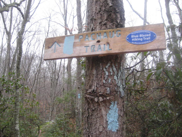
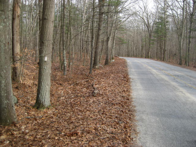
After heading southeast on Green Fall Road for the initial 1.6 miles, we came to the parking area near Green Fall Pond. Here, the Green Fall Pond Trail (blue/orange-blazed) follows the road for a stretch. After a turn to the north, we finally reached the start of the Pachaug Trail…or was it the end?
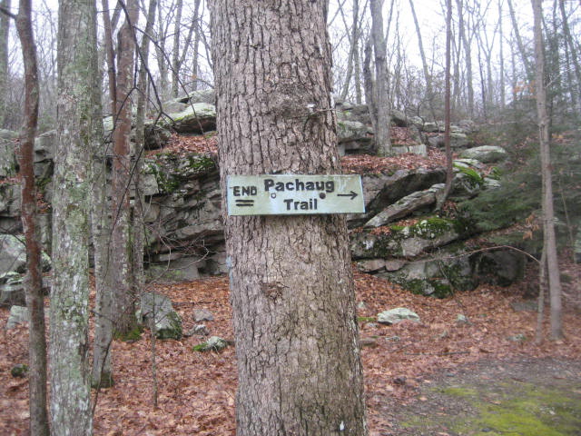
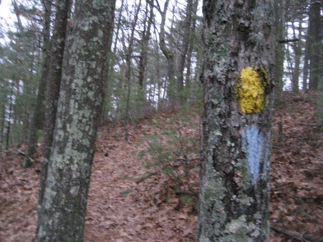
I found the Pachaug Trail sign here interesting because, the way the trail is laid out in the Walk Book, this should be the beginning…not the end. I found this even more amusing later, when upon returning home, I noticed a picture of this sign is actually in the Walk Book itself. So, as it turns out I will be travelling this trail backwards, from end to beginning.
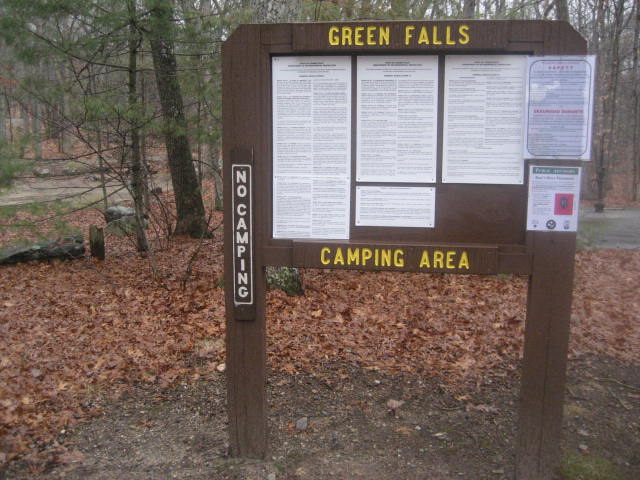
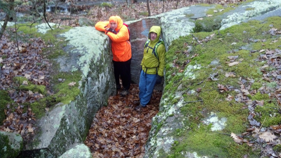
We had a lot of fun as we set out on the trail. There is a curious sign near the start which reads “Green Falls Camping Area…No Camping” and a neat rock formation which we passed right through. The trail surprised me a bit, turning out to be a lot more rugged than I originally expected. That’s not to say it is actually rugged…I just wasn’t expecting much at all.
We had a lot of fun as we set out on the trail. There is a curious sign near the start which reads “Green Falls Camping Area…No Camping” and a neat rock formation which we passed right through. The trail surprised me a bit, turning out to be a lot more rugged than I originally expected. That’s not to say it is actually rugged…I just wasn’t expecting much at all.
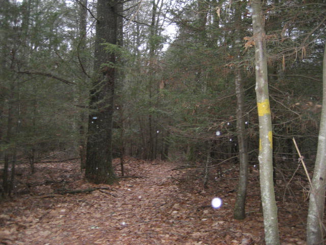
The first mile or so of the trail heads generally due north, but there are a few twists and turns thrown in for good measure. Around the 1.1 mile mark of the trail (2.7 mile mark of our hike), we came to a trail intersection. Here, the blue/red-blazed Pachaug-Nehantic Crossover Trail heads off to the left, where it will later meet up with the Nehantic Trail. If we wanted, we could follow the crossover trail and end up back at my dad’s truck, completing a massive loop. But, we elected to turn right and continue following the Pachaug.
Around the 2.5 mile mark of the trail (4.1 mile mark of our hike), we crossed Route 138. The next section of the trail was really wide, really flat…and pretty boring. By this time we were also really soaked from the rain. The trail here basically follows a series of ATV trails. Keep an eye out for “turn blazes” as the trail tends to switch from ATV trail to ATV trail.
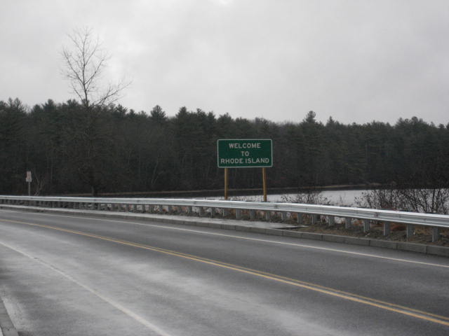
Around the 3.9 mile mark of the trail (5.5 mile mark of our hike), we came out to Route 165. Here, the trail turns right (east) and follows the road for 6/10 of a mile to Beach Pond. Along the way, it crosses the Connecticut/Rhode Island border.
Around the 3.9 mile mark of the trail (5.5 mile mark of our hike), we came out to Route 165. Here, the trail turns right (east) and follows the road for 6/10 of a mile to Beach Pond. Along the way, it crosses the Connecticut/Rhode Island border.
We made our way back to where I left my car earlier in the day. We were all happy to be out of the rain.
For a map of this hike, along with elevation data, please click here.
.:. .:. .:.
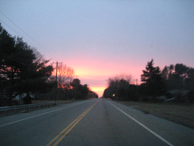
The following day, I was up early and left the house under the cover of darkness. As I was driving down Route 138/165, towards the Beach Pond parking location, the sky came alive with pinks and purples.
I parked, geared up, and started out shortly after sunrise.
From the Beach Pond parking lot, the Pachaug follows the north side of Route 165 for a stretch before entering the woods on the left. There is a quick, short climb which wasn’t overly difficult and provides for some great views overlooking the pond. Also, this section of trail is joined by the yellow-blazed Tippecansett Trail (Rhode Island).
From the Beach Pond parking lot, the Pachaug follows the north side of Route 165 for a stretch before entering the woods on the left. There is a quick, short climb which wasn’t overly difficult and provides for some great views overlooking the pond. Also, this section of trail is joined by the yellow-blazed Tippecansett Trail (Rhode Island).
The first section of the trail swings this way and that as it avoids private property. It looks crazy on the map, but the general idea is that it heads from the southeastern edge of the pond to the boat lunch on the northern edge of the pond in a counter-clockwise direction. At times, it travels right along the edge of the pond. Other times, it travels so far from the pond that you almost forget you are making your way around a pond. Also, the pond covers more than 390 acres so this isn’t exactly a short process.
As I was making away through this section of the trail, it started to snow a bit. It was only flurries, but I love hiking while snow is falling. Around the 1.8 mile mark, the trail brought me back to Connecticut. I stopped to take a picture of the tree which marks the boundary.
As I was making away through this section of the trail, it started to snow a bit. It was only flurries, but I love hiking while snow is falling. Around the 1.8 mile mark, the trail brought me back to Connecticut. I stopped to take a picture of the tree which marks the boundary.
Around the 3.2 mile mark, the trail reaches the boat lunch on the northern edge of the pond. Here, it follows the road north for a minute before re-entering the woods near the northwest corner of the boat lunch parking lot.
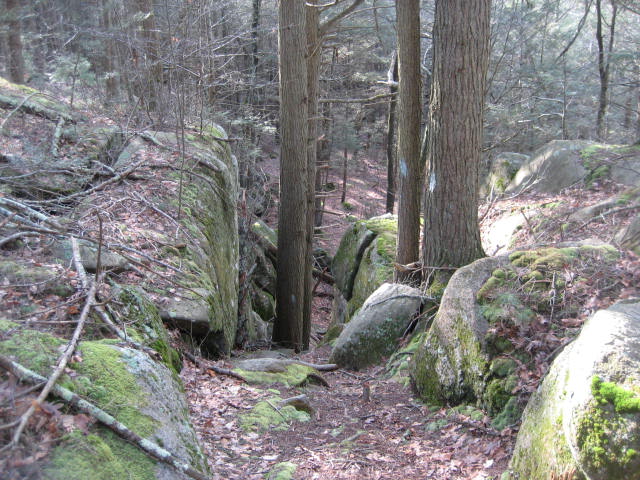
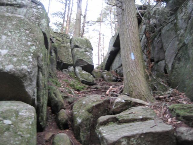
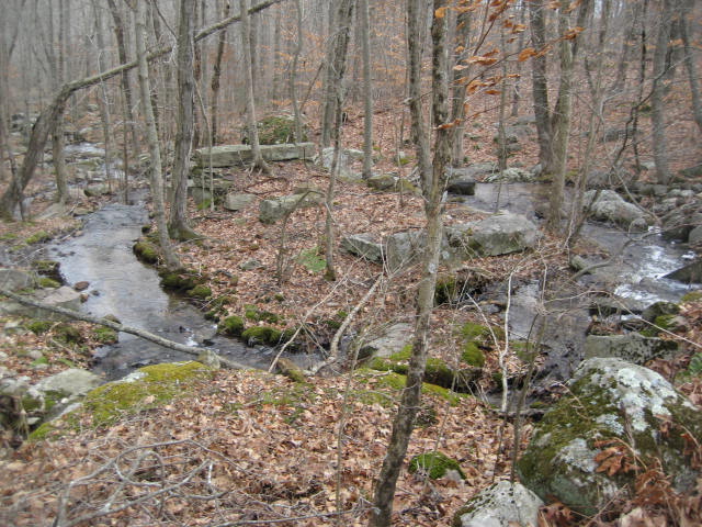
Over the next 1.2 miles, the trail ascends overall…but you’ll have a hard time noticing because there are a lot of small ups and downs. The Walk Book even notes one of these downs as a “short, narrow, deep gorge”. I enjoyed this section, but it really only goes down to come right back up…which I found to be frustrating…and I avoided it on the trip back.
Over the next 1.2 miles, the trail ascends overall…but you’ll have a hard time noticing because there are a lot of small ups and downs. The Walk Book even notes one of these downs as a “short, narrow, deep gorge”. I enjoyed this section, but it really only goes down to come right back up…which I found to be frustrating…and I avoided it on the trip back.
Around the 5.3 mile mark, the trail crosses Shetucket Turnpike. This was where I intended to stop and turn around, but I first wanted to explore the area and make sure there was ample parking for my next hike. There is a small lot (with room for maybe five cars) off of Shetucket Turnpike and I decided it would be perfect.
As I started back, I crossed Shetucket Turnpike and noticed a couple of deer carcasses off to the side of the trail. A few more feet down the trail and I found some old bones. I’m not sure how I missed them on my first pass. My advice…if you are hiking this trail during hunting season, wear lots of orange. That should go without saying, but dead game has a funny way of serving as a reminder.
As I started back, I crossed Shetucket Turnpike and noticed a couple of deer carcasses off to the side of the trail. A few more feet down the trail and I found some old bones. I’m not sure how I missed them on my first pass. My advice…if you are hiking this trail during hunting season, wear lots of orange. That should go without saying, but dead game has a funny way of serving as a reminder.
For a map of this hike, along with elevation data, please click here.
.:. .:. .:.
The following morning, Martin Luther King Day, I was planning to get up early and get another early start. I was off from work, but I had a hard time getting out of the house. I don’t know what it was, but I just wanted to sleep in. Then, once I finally got up, I just wanted to watch news/weather programs like I would on a regular Monday.
I eventually made it out to the car and drove to the parking area off of Shetucket Turnpike. If you are going to use this parking location, you should note there is a Dead End sign as Shetucket Turnpike crosses over Wylie School Road. Just ignore it. If Shetucket Turnpike eventually dead ends, I didn’t see it.
As I exited the car and started to gear up, I noticed another dear carcass and several carcasses of Canadian Geese…again, you’ll want to make sure you are wearing orange as you complete these sections.
From the parking lot off of Shetucket Turnpike, the trail heads due north along a wide path/ATV trail for about 1,000 feet. Just before a clearing, it turns right.
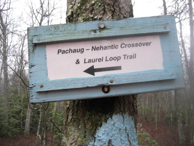
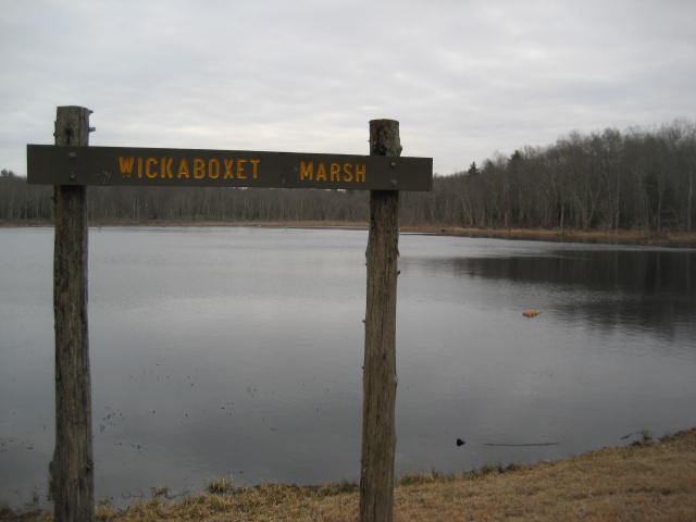
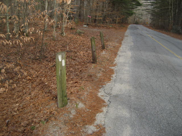
About a half of a mile in, the trail comes to the northwestern edge of a marsh. The Walk Book notes that this is Erickson Wildlife Marsh, but a sign in the area claims it is Wickaboxet Marsh (and GoogleMaps calls it Wiclcabouet Marsh). Regardless, you’ll know you’re in the correct area because there is a rather large causeway which runs along the northwestern edge of the marsh. Also, look for this sign…
I eventually made it out to the car and drove to the parking area off of Shetucket Turnpike. If you are going to use this parking location, you should note there is a Dead End sign as Shetucket Turnpike crosses over Wylie School Road. Just ignore it. If Shetucket Turnpike eventually dead ends, I didn’t see it.
As I exited the car and started to gear up, I noticed another dear carcass and several carcasses of Canadian Geese…again, you’ll want to make sure you are wearing orange as you complete these sections.
From the parking lot off of Shetucket Turnpike, the trail heads due north along a wide path/ATV trail for about 1,000 feet. Just before a clearing, it turns right.
About a half of a mile in, the trail comes to the northwestern edge of a marsh. The Walk Book notes that this is Erickson Wildlife Marsh, but a sign in the area claims it is Wickaboxet Marsh (and GoogleMaps calls it Wiclcabouet Marsh). Regardless, you’ll know you’re in the correct area because there is a rather large causeway which runs along the northwestern edge of the marsh. Also, look for this sign…
The trail, now heading northeast, crosses a forest road (which I later used as a shortcut on the way back) and circles around Dawley Pond, though the pond is never visible from the trail.
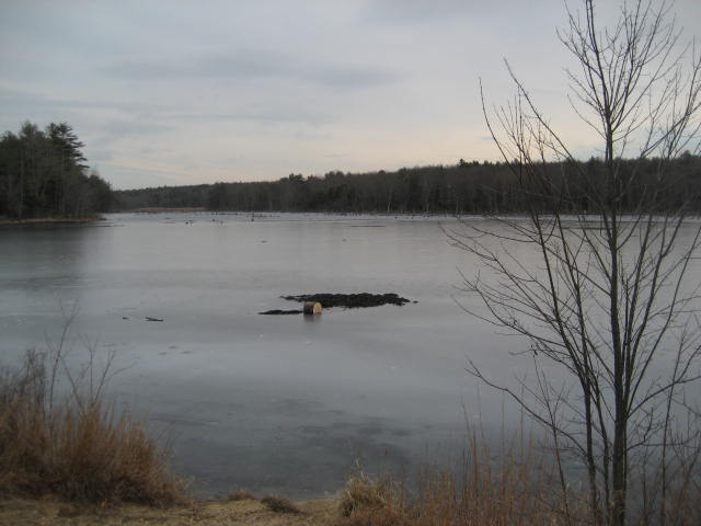
Around the 1.9 mile mark, the trail reaches the southwestern edge of Great Meadow Pond.
Around the 1.9 mile mark, the trail reaches the southwestern edge of Great Meadow Pond.
The trail crosses a “bridge” made of two old trees and follows a long causeway before coming to another ATV Trail (called a cart path in the Walk Book). The trail follows these ATV trails for a long time and I’m surprised I didn’t see an ATV/Dirt Bike rider at all throughout the day.
Around the 3.0 mile mark, the trail comes out to a forest road and follows it for more than a mile. Note: this is a change from the Walk Book.
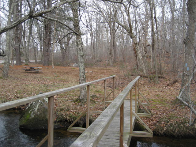
Just before the intersection of the forest road and Brown Road, the trail turns right and descends to Wood River. I crossed a footbridge and entered the Porter Pond picnic area. There is another parking location here, which I guess explains why the trail diverts this way when it easily could’ve stayed on the forest road and crossed Brown Road. After all, once the trail leaves the picnic area, it only turns left (down Brown Road) and heads back towards the forest road. Maybe this little diversion made sense back when the trail didn’t follow the forest road exactly…but it seemed so ridiculous to follow the road for so long and then divert to the picnic area only to double back…I mean, I could see Brown Road from where the trail inexplicably turned right to go the picnic area. Seriously, make this an access trail or something.
Around the 3.0 mile mark, the trail comes out to a forest road and follows it for more than a mile. Note: this is a change from the Walk Book.
Just before the intersection of the forest road and Brown Road, the trail turns right and descends to Wood River. I crossed a footbridge and entered the Porter Pond picnic area. There is another parking location here, which I guess explains why the trail diverts this way when it easily could’ve stayed on the forest road and crossed Brown Road. After all, once the trail leaves the picnic area, it only turns left (down Brown Road) and heads back towards the forest road. Maybe this little diversion made sense back when the trail didn’t follow the forest road exactly…but it seemed so ridiculous to follow the road for so long and then divert to the picnic area only to double back…I mean, I could see Brown Road from where the trail inexplicably turned right to go the picnic area. Seriously, make this an access trail or something.
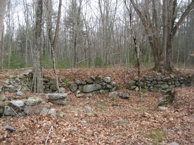
From Brown Road, the trail continues generally northwest a good distance from Porter Pond. The pond was visible, at times, but only because it is the thick of winter. Somewhere in the next section, I came to cellar hole and wondered if this is the“abandoned farm” to which the Walk Book refers.
Around the 5.0 mile mark, the trail comes to an intersection. The white-blazed Pharisee Rock Trail actually starts here, though there is no indication of it. It just looks like an ATV trail (with no blazes) which leads from/to Cedar Swamp Road. I was planning to hike the Pharisee Rock Trail, but since I wasn’t sure if this was it, I made a left and elected to continue on the Pachaug Trail. I followed the blue blazes for a little while longer, passing the south side (back) of an old cemetery until I reached Cedar Swamp Road. Once I reached the road, I knew I had passed the Pharisee Rock Trail so I decided to make a right and follow the road until I came to the white blazes.
I continued to follow Cedar Swamp Road until the white blazes indicated I should turn left.
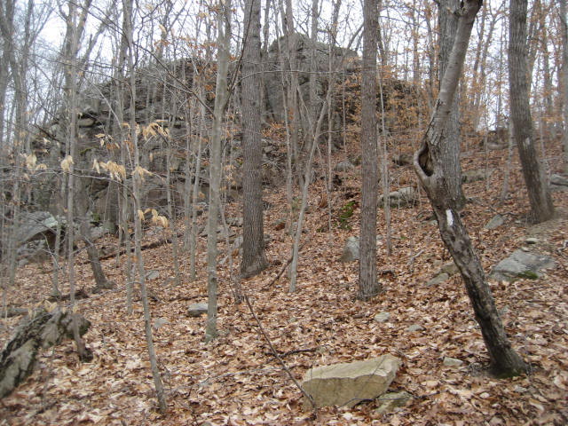
Now, back in the woods, I followed the Pharisee Rock Trail for the next 7/10 of a mile until I reached Pharisee Rock (elevation: 560 feet). Along the way, I passed over an old stone dam. To the right of the dam, I could make out an old foundation of what the Walk Book says is a “Sap Mill”. Apparently, the mill extracted acid for use in making a black dye for textiles.
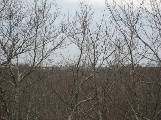
Once I reached the top of Pharisee Rock, I could just make out (through the trees) a large farm over on Ekonk Hill. Hopefully you can see it in the picture below. After three days of hiking, this was the only “view” I was afforded.
I took a minute to catch my breath and started on my journey back to the Shetucket Turnpike parking location. It was a long trip, but the trail through this entire section is REALLY flat so I was able to cover a lot of ground quickly.
For a map of this hike, along with elevation data, please click here.
I really enjoyed my first three hikes along the Pachaug Trail. Each section held some surprises and I’m curious to see if that carries over to the remaining sections.
Last year at this time, I covered 26 miles over a four day weekend (I took an extra day off from work). This year, I covered more than 28 miles in just three days. I would say that is a pretty good improvement. Additionally, I’m about 15 miles ahead of my 2013 pace. So, I’m really excited to see if I can outpace myself.
Last year at this time, I covered 26 miles over a four day weekend (I took an extra day off from work). This year, I covered more than 28 miles in just three days. I would say that is a pretty good improvement. Additionally, I’m about 15 miles ahead of my 2013 pace. So, I’m really excited to see if I can outpace myself.
Total 2014 Distance: 61.93 Miles
