The Final Four: Bullets on the
Trail
Hike #133
Mattabesett Trail
Route 17 to Route 68 (Durham, CT)
Hike Distance: 6.7 Miles
Section Distance (Per CFPA Walk Book): 6.5 Miles
Date Hiked: 4/26/2015
Date Published: 4/26/2015
Hike #133
Mattabesett Trail
Route 17 to Route 68 (Durham, CT)
Hike Distance: 6.7 Miles
Section Distance (Per CFPA Walk Book): 6.5 Miles
Date Hiked: 4/26/2015
Date Published: 4/26/2015
Note: The day before the hike described
in this recap, I took Roscoe to Case Mountain in Manchester, Connecticut. While there, I re-hiked some of the trails
which I’ve previously recapped (Hikes # 7, 8 and 9). I’m not going to recap those trails again here. However, that hike added 10.1 miles to my
total for 2015, bringing my mile count to 201.4.
Since October of 2012, my friend Mark and I have been slowly making our way along the Mattabesett Trail. Starting with this hike, only four hikes remain until we complete our goal. For this section, we (sans Roscoe) would pick up where we last left off, at the small parking location off of Stagecoach Road in Durham. From there, we would make our way over three steep hills to Route 68.
After spotting my car at the trailhead off of Route 68, I jumped in Mark’s car and we made our way over to Stagecoach Road.
To reach the parking location from Hartford:
Take I-91 South to Route 9 South and take Exit 13 in Middletown. Then, take Route 17 South for 10.5 miles and turn left at the second sign for Stagecoach Road. The parking location is about a 1/4 mile from the turn on the right hand side of the road.
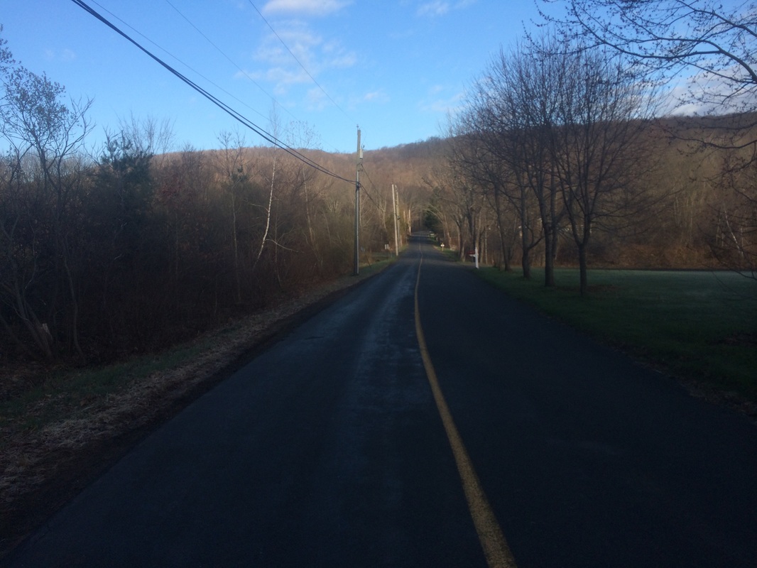
We geared up and hit the trail, heading due west on Stagecoach Road back towards Route 17…
Since October of 2012, my friend Mark and I have been slowly making our way along the Mattabesett Trail. Starting with this hike, only four hikes remain until we complete our goal. For this section, we (sans Roscoe) would pick up where we last left off, at the small parking location off of Stagecoach Road in Durham. From there, we would make our way over three steep hills to Route 68.
After spotting my car at the trailhead off of Route 68, I jumped in Mark’s car and we made our way over to Stagecoach Road.
To reach the parking location from Hartford:
Take I-91 South to Route 9 South and take Exit 13 in Middletown. Then, take Route 17 South for 10.5 miles and turn left at the second sign for Stagecoach Road. The parking location is about a 1/4 mile from the turn on the right hand side of the road.
We geared up and hit the trail, heading due west on Stagecoach Road back towards Route 17…
Last
week, while nearing the mid-point of our hike, we also walked down this same
road. So, we were doing a bit of
re-tracing our steps, but the extra road walk was good in that it allowed us to
stretch our legs before the first steep hill.
Approximately 2/10 of a mile in, we made a right and followed Route 17 due north…
Approximately 2/10 of a mile in, we made a right and followed Route 17 due north…
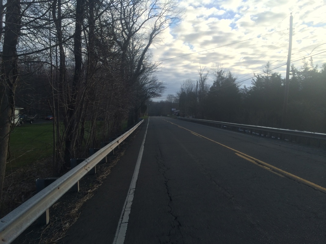
Route
17 is a fairly busy road and is one of the reasons I decided to make Roscoe sit
this one out. Later, shortly before
leaving the road, some jerk in a Camaro thought it would be funny to speed up
and buzz us as he passed by…good times!
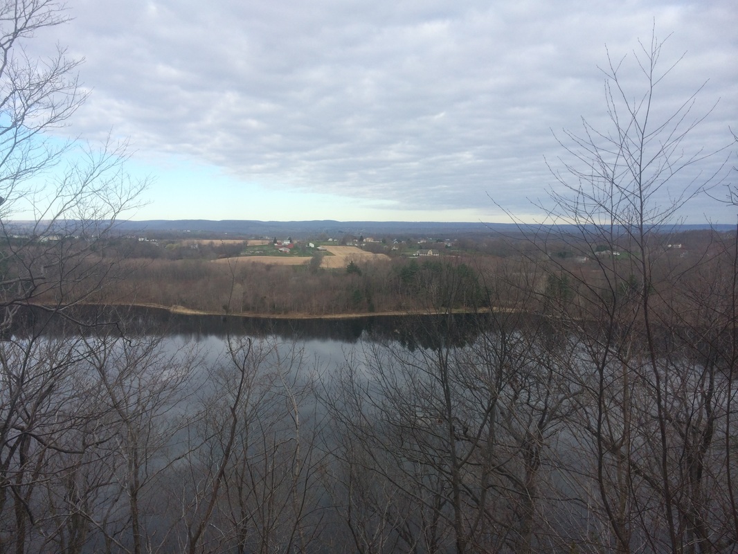
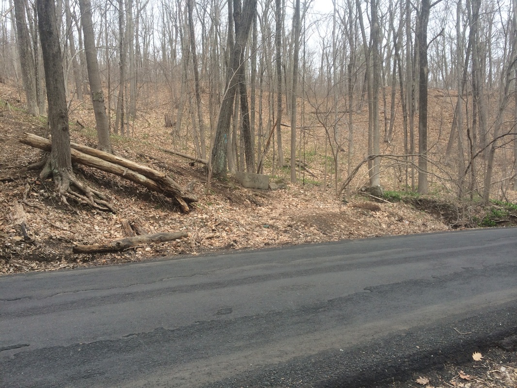
Roughly 1/2 of a mile in, we turned left to enter the woods. We climbed for a bit, crossed a brook, and climbed some more. For the next 9/10 of a mile or so, we gradually climbed what the Walk Book lists as Pistapaug Mountain. Initially leading us in a southwesterly direction, the trail eventually turned to the northeast. Looking at the map, the trail could easily just head northwest from Route 17 but...if it did...it would bypass one of the viewpoints in this section.
Approximately 1.4 miles in, we took a short side trail west to the viewpoint overlooking Pistapaug Pond…
After
a quick breather, we made our way back to the Mattabesett.
Roughly 2.3 miles in, after turning to the west and descending a steep section, we crossed Howd Road…
Roughly 2.3 miles in, after turning to the west and descending a steep section, we crossed Howd Road…
On
the other side of Howd Road, we found ourselves climbing again.
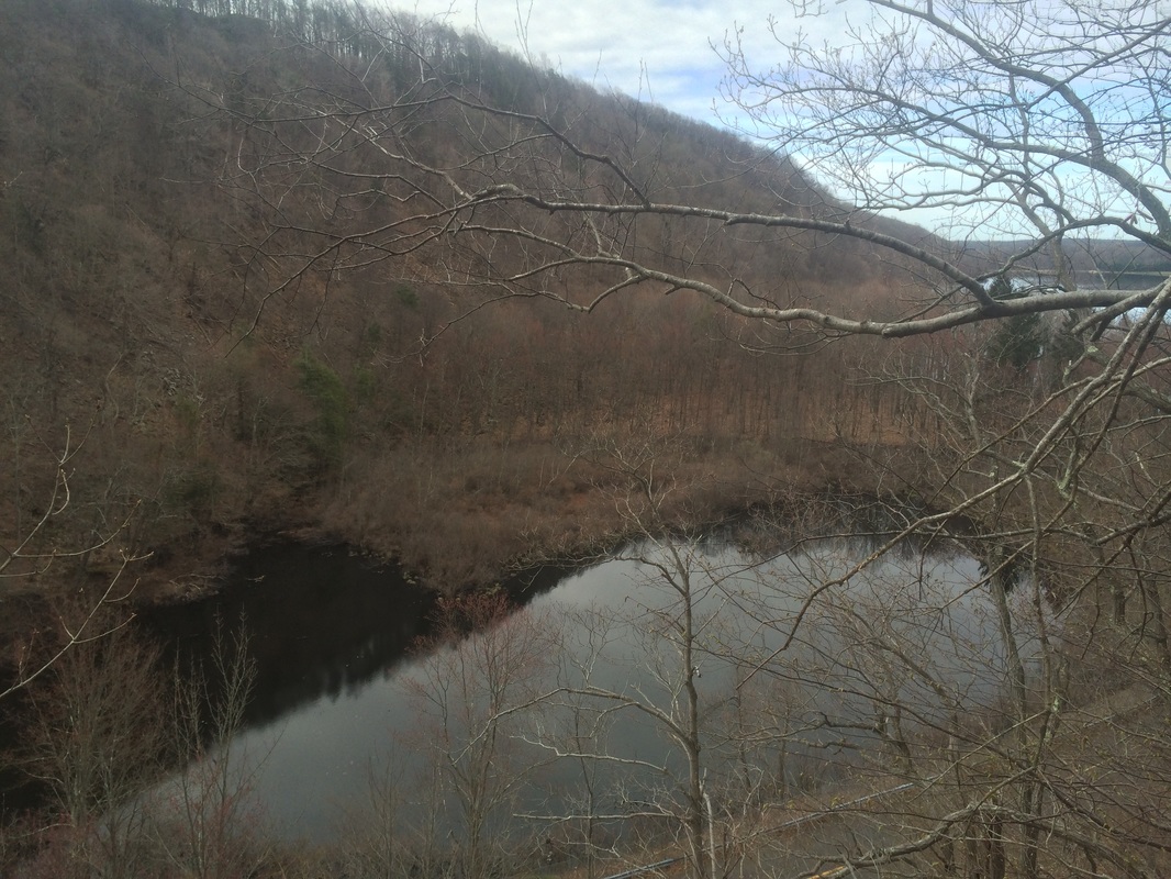
Approximately 2.5 miles in, we passed a second viewpoint of Pistapaug Pond and another, smaller pond in the area. This view allowed us to look back over the ridge where we were standing about ten minutes earlier…
Approximately 2.5 miles in, we passed a second viewpoint of Pistapaug Pond and another, smaller pond in the area. This view allowed us to look back over the ridge where we were standing about ten minutes earlier…
The
next 1.6 miles didn’t offer much in the way of highlights. But, we did cross over into Wallingford for a
bit before crossing back to Durham.
Having done my research prior to the hike, I knew we were closing in on an interesting historical marker. I didn’t know exactly where we would find it, but somewhere in this next stretch is a woods road (Wadsworth Farm Road). And, on that woods road, we could find a marker noting the fact that George Washington once used this route. So, Mark pulled up his geocache app to see if it could help us find the exact location. We both got a chuckle when the app pointed out a geocache location named “Bullets on the Trail”. I suggested this name might have something to do with the firing range (another reason to leave Roscoe at home) we’d heard last week and were now approaching (as if on cue, off in the distance, shots started to ring out). So, the shooting range either moved recently or wasn’t as close to the trail as I expected (still, as you probably inferred from the sub-title of this recap, the geocache location name stuck).
Roughly 4.1 miles in, we came to what appeared to be a woods road. Assuming this was Wadsworth Farms Road, we decided to split up and search for the marker. I drew the short straw as Mark eventually found it, about 100 yards west of the Mattabesett…
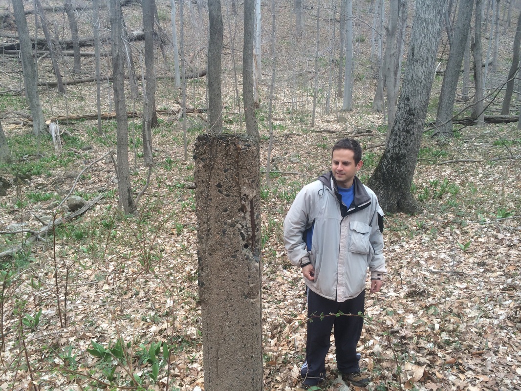
We
were a little disappointed to find nothing more than a stone pillar, but still
excited about this little piece of Connecticut history. What wasn’t exciting was the steep incline we
found just about 1/2 of a mile to the north of Wadsworth Farm Road.
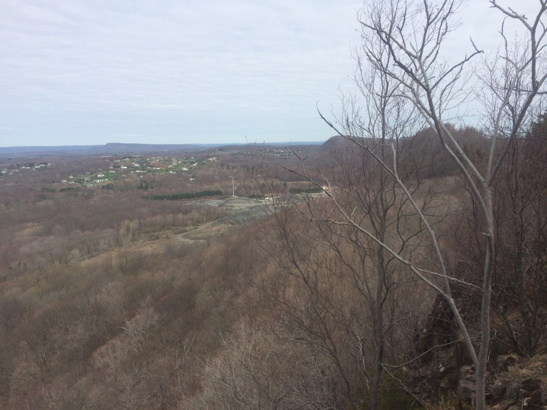
Approximately 4.7 miles in, at the top of a grueling climb, we reached the final viewpoints of this hike…
Approximately 4.7 miles in, at the top of a grueling climb, we reached the final viewpoints of this hike…
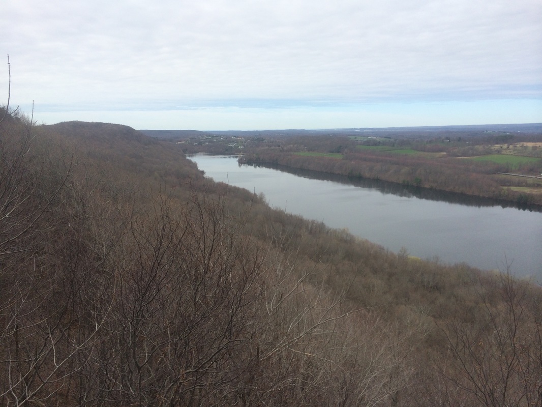
To
the south we could barely make out what might be downtown New Haven and the
Long Island Sound. Closer to our current
location, we could clearly see Ulbrich Reservoir. A few more steps, and a short side trail allowed
a view to the north, of the Tilcon Quarry…
Earlier,
we spotted my car down the road from the quarry so I knew we were nearing the
end of our hike. We still had to
navigate a few ups and downs, but the general trend from here was downhill.
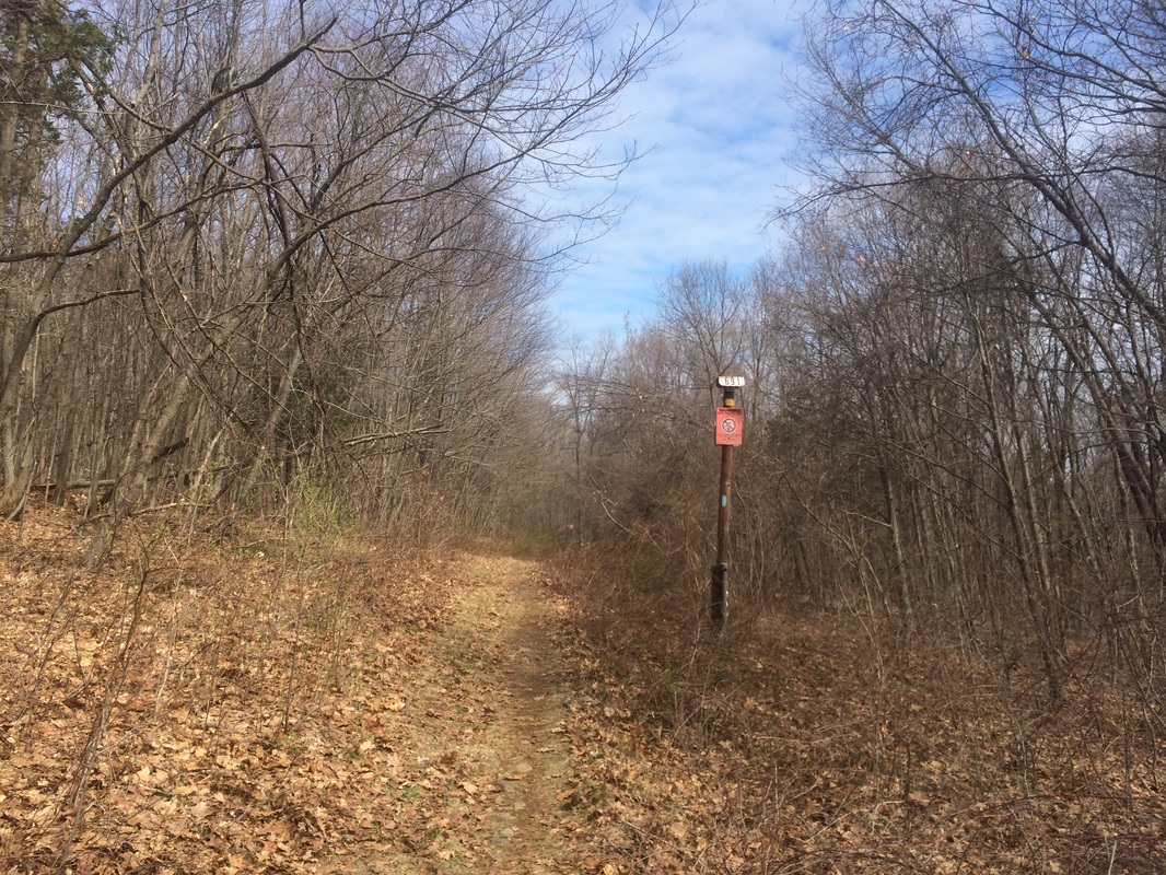
Roughly 6.3 miles in, we turned left at this utility right-of-way…
Roughly 6.3 miles in, we turned left at this utility right-of-way…
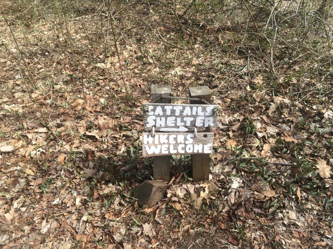
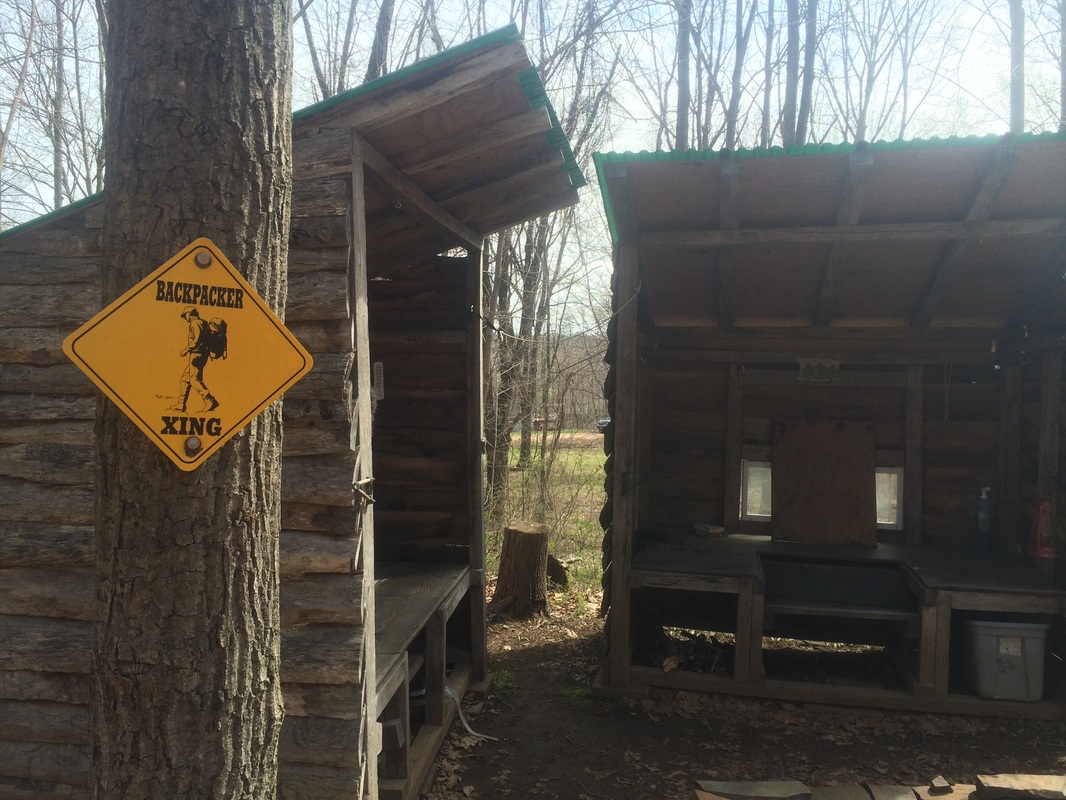
…and
6.4 miles in, we reached Cattails Shelter…
|
|
I’m
not sure how many people are thru-hiking or overnighting on the Mattabesett,
but it is still pretty cool this thing is here.
We took a minute to sign the trail log and inspect the other interesting
items around the camp before making our way back to the trail.
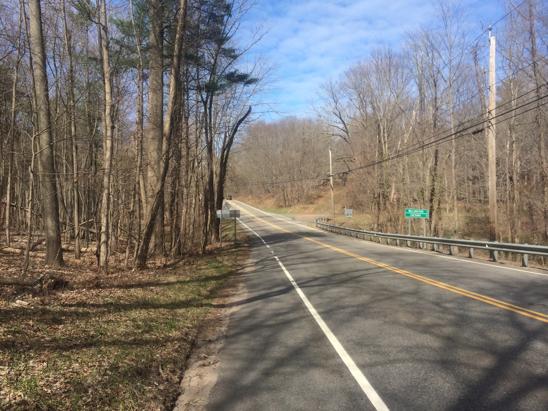
Approximately 6.5 miles in, we reached Route 68 and turned left to make our way to where I earlier left my car…
Approximately 6.5 miles in, we reached Route 68 and turned left to make our way to where I earlier left my car…
This
was a fun, yet physically demanding hike.
With only three Mattabesett hikes left, I’m savoring every moment…even
the missing sign at the George Washington side trail.
Until next time…
Until next time…
For a map of this hike, along with elevation data, please click here.
Total 2015 Distance: 208.1
(291.9 to Goal)
