Gator Bait
The Florida Trail/Lake Okeechobee Scenic Trail
Okeechobee, Florida
Hike # 94
Hike Distance: 12.79 Miles
Date Hiked: 3/28/2014
Date Published: 4/17/2014
The Florida Trail/Lake Okeechobee Scenic Trail
Okeechobee, Florida
Hike # 94
Hike Distance: 12.79 Miles
Date Hiked: 3/28/2014
Date Published: 4/17/2014
After the harsh winter we had in the northeast, I had to
get away from the cold, snowy conditions…if only for a little while. So, I spent March 26th through
April 1st in Port St. Lucie, Florida with my mom visiting my
grandparents at their winter home. Almost
immediately after our flights were booked, I started searching for suitable
hiking in the area. In order to do any hiking on this trip, I was going to have
to borrow my grandparents’ vehicle. So, I
kept my search restricted to the areas closest to their retirement community.
Fortunately for me, they live within an hour drive of Lake Okeechobee.
Lake Okeechobee, or "The Big O", is the largest freshwater lake in the state of Florida…the seventh largest freshwater lake in the United States…the second largest freshwater lake in the continental United States…and THE largest freshwater lake contained completely within a single one of the lower 48 states. “The Big O” covers roughly 730 square miles, or about half the size of Rhode Island. It holds, at its capacity, a trillion gallons of water…is the headwaters of the Everglades…and, perhaps most notably, is visible from space.
Lake Okeechobee is enclosed by the 30 foot high Herbert Hoover Dike, which was built by the U.S. Army Corps of Engineers in 1928, after a hurricane destroyed the previous dike and flooded the surrounding communities, claiming 2500 lives in the process. The dike, which cost about $165 million to construct, is now home to a section of The Florida trail…a 1000+ mile long National Scenic Trail, which stretches from Big Cypress National Preserve in Naples to Fort Pickens at Gulf Islands National Seashore in Pensacola Beach.
The Lake Okeechobee Scenic Trail, which circles the entire perimeter of the lake is so noteworthy to the residents of the area that there is even an annual event called the Big O Hike, in which people thru-hike around the whole lake, camping overnight near the trail as they make their way. Since I had at most half a day to commit to the cause, I elected to do only one section. The section which I selected (described perfectly over at floridahikes.com), took me from the lock at Henry Creek to the lock at Taylor Creek. My original plan was to keep going for a couple of miles after I reached the Taylor Creek lock…but, as you will see, I came to a dead end.
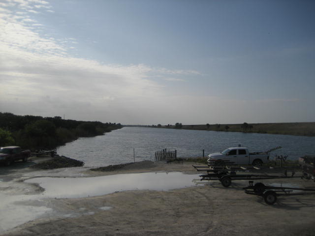
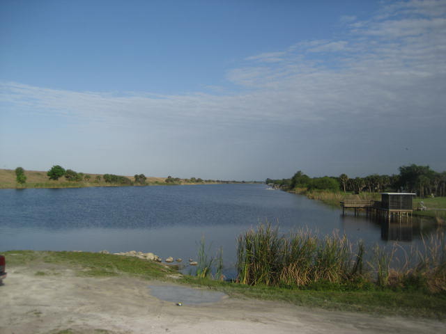
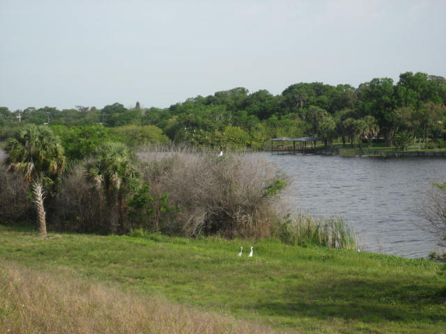
I made the hour long drive from Port St. Lucie to the Henry Creek lock. After some difficulty finding the parking location at Henry Creek, I eventually found it. As I was gearing up, I took a minute to add some sunblock to the exposed parts of my body (I brought a long sleeve polyester shirt and long pants…so, basically just my neck). I also took a couple of pictures of the canal, called the Rim Canal, at the parking location.
Lake Okeechobee, or "The Big O", is the largest freshwater lake in the state of Florida…the seventh largest freshwater lake in the United States…the second largest freshwater lake in the continental United States…and THE largest freshwater lake contained completely within a single one of the lower 48 states. “The Big O” covers roughly 730 square miles, or about half the size of Rhode Island. It holds, at its capacity, a trillion gallons of water…is the headwaters of the Everglades…and, perhaps most notably, is visible from space.
Lake Okeechobee is enclosed by the 30 foot high Herbert Hoover Dike, which was built by the U.S. Army Corps of Engineers in 1928, after a hurricane destroyed the previous dike and flooded the surrounding communities, claiming 2500 lives in the process. The dike, which cost about $165 million to construct, is now home to a section of The Florida trail…a 1000+ mile long National Scenic Trail, which stretches from Big Cypress National Preserve in Naples to Fort Pickens at Gulf Islands National Seashore in Pensacola Beach.
The Lake Okeechobee Scenic Trail, which circles the entire perimeter of the lake is so noteworthy to the residents of the area that there is even an annual event called the Big O Hike, in which people thru-hike around the whole lake, camping overnight near the trail as they make their way. Since I had at most half a day to commit to the cause, I elected to do only one section. The section which I selected (described perfectly over at floridahikes.com), took me from the lock at Henry Creek to the lock at Taylor Creek. My original plan was to keep going for a couple of miles after I reached the Taylor Creek lock…but, as you will see, I came to a dead end.
I made the hour long drive from Port St. Lucie to the Henry Creek lock. After some difficulty finding the parking location at Henry Creek, I eventually found it. As I was gearing up, I took a minute to add some sunblock to the exposed parts of my body (I brought a long sleeve polyester shirt and long pants…so, basically just my neck). I also took a couple of pictures of the canal, called the Rim Canal, at the parking location.
|
|
Once I was done taking pictures, I hit the trail…err,
pavement. That’s right, the entirety of
this hike takes place along a paved pathway.
That’s okay. I have no problem
labeling this glorified bike path walk as a hike because it was a long walk
through some areas with natural wildlife and, in the end, I drank all of the
water in my Camelbak…which has happened only on two or three other hikes. So, while this wasn’t the most rugged/remote
region I’ve ever hiked, it was still physically demanding in its own right.
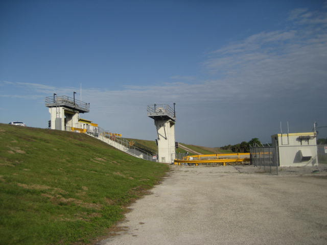
I started by crossing a small bridge over the canal and ascending to the top of the dike. Once at the top, I made a hard right and walked through lock S-136, which you can see in the picture below. Anglers and other boaters can take the lock to get from the canal, which makes a rim around the lake (thus, the Rim Canal), to the lake. I was disappointed when, on my return trip through the area, I just missed a boat coming back from the lake…and missed an opportunity to see how these things work up, close and personal.
I started by crossing a small bridge over the canal and ascending to the top of the dike. Once at the top, I made a hard right and walked through lock S-136, which you can see in the picture below. Anglers and other boaters can take the lock to get from the canal, which makes a rim around the lake (thus, the Rim Canal), to the lake. I was disappointed when, on my return trip through the area, I just missed a boat coming back from the lake…and missed an opportunity to see how these things work up, close and personal.
When I was about twelve or thirteen years old, my family
spent some vacation time in the area around Niagara Falls. I recall being fascinated by the fact that
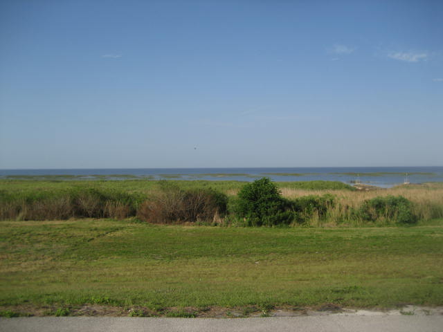
the Great Lakes are so large people are unable to see across. I had a similar experience here, at Lake
Okeechobee. Somewhere across the lake is
the western shore…but I couldn’t see it.
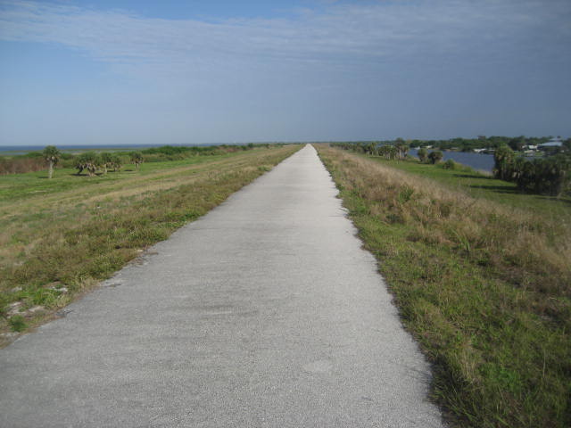
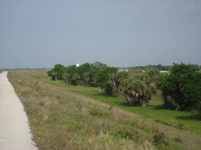
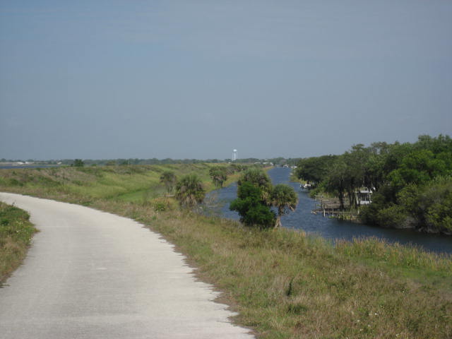
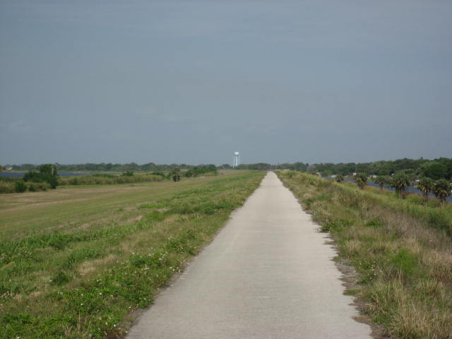
The first part of this hike was very flat and very
straight. The rest of the hike would
remain flat (I gained maybe 90 feet of elevation over the entire 12 mile out
and back) but in a little while the trail would slightly turn to the left. For now, I took a picture of how flat the
area is…and of the shadow I was casting on the ground as I made my way along
the trail.

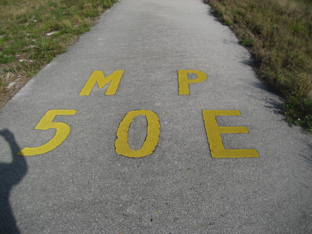
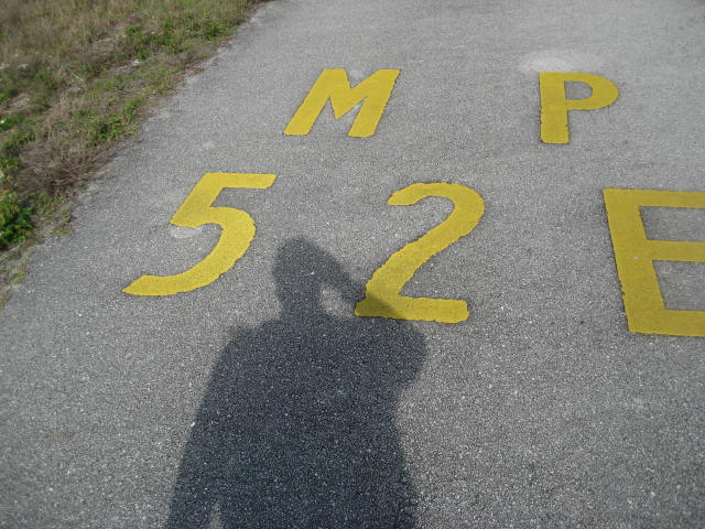
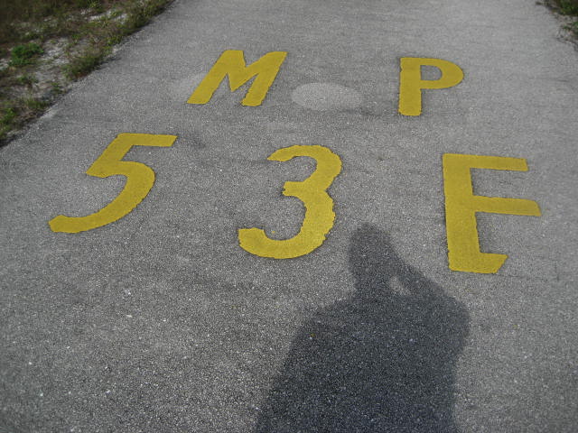
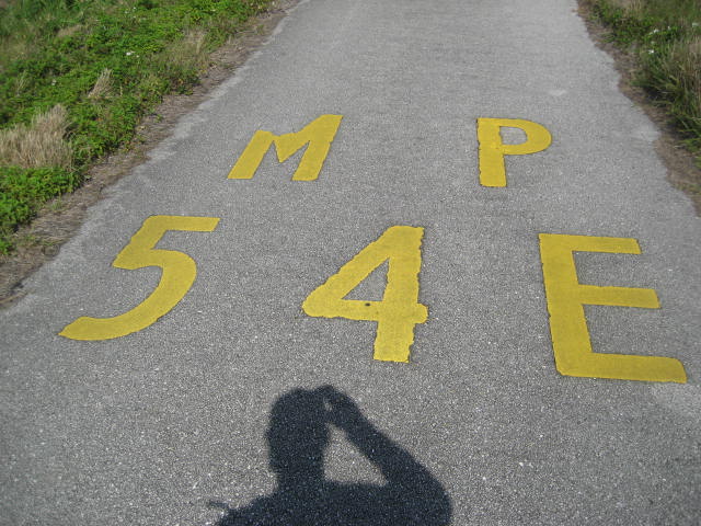
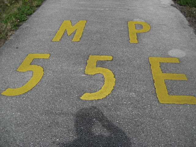
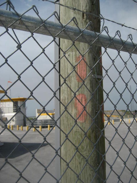
Early on, I noticed these mile markers on the
ground. In addition to my MapMyHike app,
these would help me keep track of the distance.
Later, I also used them to show just how far into the distance I could
see. And, on my return trip, I used them
to count down the distance back to the car.
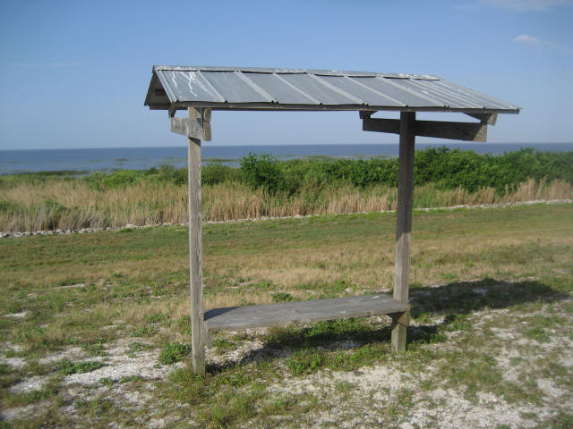
Approximately 1 mile in, I reached the first landmark
noted on the guide on floridahikes.com. I
found this covered bench to be at almost exactly the distance the guide advised
it would be. It was encouraging to see
early indications of being able to rely on the guide. I was, however, disappointed to find that the
bench didn’t offer much shade. If you
are making this trip without sun block, good luck to you…because I didn’t find
any shade until I reached Taylor Creek, the mid-point of my journey. I was thankful I thought ahead by packing a
long sleeve polyester shirt.
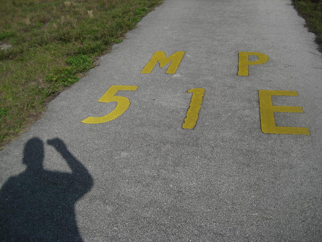
A few more steps to the north, and I encountered the
second mile marker of the hike.
At around the 1.5 mile point of the hike, the trail
started to curve slightly to the left.
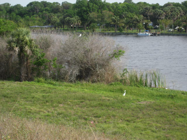
It was here that I found, exactly where the guide foretold they would
be, a colony of cattle egrets. The guide
explains that this colony never fails to return to this exact spot. “Arrive at daybreak”, the guide advises, “and
you’ll see them rise into the skies in unison to feed in the marshes”. Sadly, I had slept a little later than I
originally intended (I was, after all, on vacation). So, I was only able to see a handful of
stragglers.
|
|
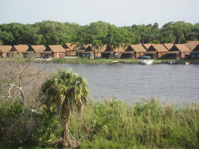
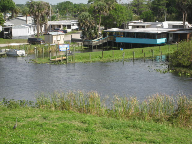
Roughly 2 miles in, I passed a log cabin community,
which was on the other side of the Rim Canal from where I was standing.
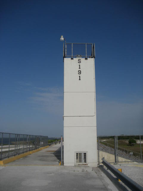
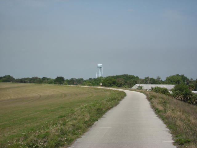
I also passed another mile marker (#52) and got my first
glimpse of both the S-191 lock at Nubbin Slough (still about a mile and half
away) and the water tower at Treasure Island (4 miles away). In the picture below, the tops of both
structures can be seen (the lock is just to the left of center frame and the
water tower is just to the right).
A mile later, now roughly more than 3 miles from where I
started, I passed mile marker #53 and snapped another picture of the S-191
lock…now only about a half of a mile away.
|
|
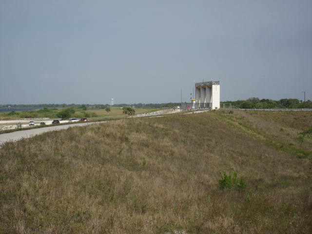
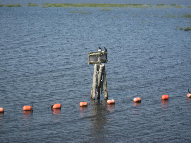
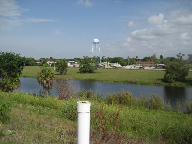
Then, about 3.7 miles in, I finally reached the S-191
lock and Nubbin Slough, which the guide calls the “fishingest place on the
dike.” As I passed through on the way
out, I did see a lot of fishers…both of the human and ornithological
variety. I was most impressed by what I
saw in the water on my way back through the area later…but, more on that in a
bit. For now, enjoy these pictures I
took…including one which shows how much closer I was to the water tower, even
though I was still about 2 miles from it.
|
|
It wasn’t long before I was passing mike marker #54 and
taking another shot of the water tower, now about a mile and a half away.
|
|
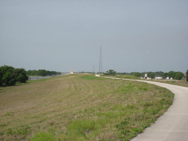
Approximately 4.9 miles in, the trail made a quick
little detour to cross over a water control structure. Who am I kidding? By the standards of this hike, this is a
hairpin turn. Look for Butch’s Fish
Camp, on the other side of the canal.
|
|
Soon after passing Butch’s Fish Camp, I passed mile
marker #55 and took another shot of the water tower, now within one mile of my
location.
|
|
After staring at the water tower for the last 4 miles
and wondering if I would ever reach it, I finally passed it and quickly put it
in my rearview.
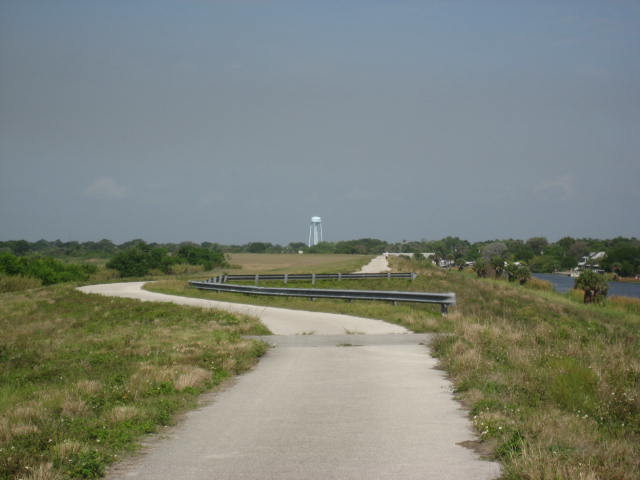
Now, I could shift my attention to the water control
structure in the distance. The
structure, at Taylor Creek, was still about a half a mile away from the water
tower…and it stood out to me because I knew I would leave the dike at that
point.
It wasn’t long before the trail led me to the Taylor
Creek lock and I encountered my first (and only) trail blaze of the day.
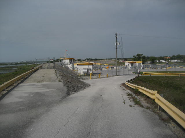
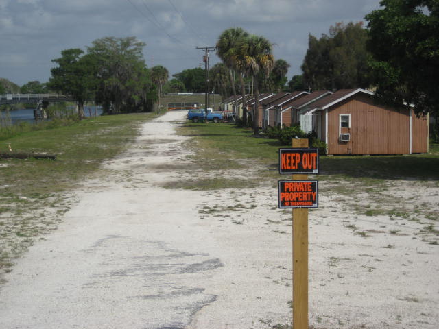
Unfortunately, my excitement about encountering my first
blaze was soon squashed by the fact that the trail dead ended. Here, at about the 6 mile point, the trail
comes to some cabins…which, according to the Florida hikes online guide, once
served as housing for the workers constructing the dike. Sadly, there are “No Trespassing” signs here and…since
I wasn’t prepared for this…I wasn’t sure where to go.
No problem, I had pretty much had my fill at this
point. So, I took a few minutes to cool
off in the shade of some trees (potentially trespassing in the process but I
didn’t care). Once I had my fill, I started
on my journey back. But, while the trail
might’ve ended at this dead end, the magical moments did not.
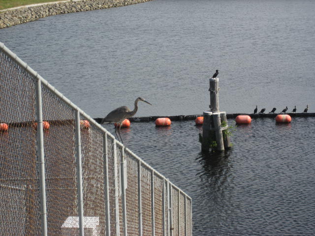
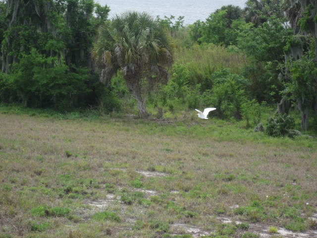
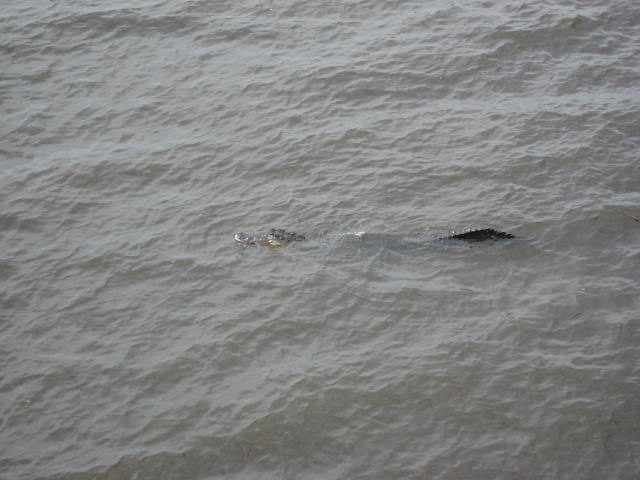
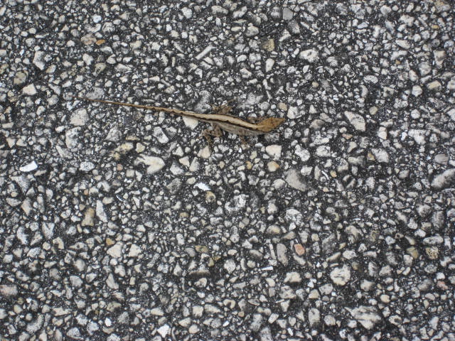
On the trek back to the Henry Creek parking location, I had three notable nature moments…the last of which made this hike worth the miles of straight, flat virtual nothingness. First, a trio of cattle egrets played their version of leap frog while doing that ridiculous thing birds do where they fly away to a safe distance from you only to land in your path again…and repeat the process. Seriously, why do birds do that? Next, I got a cool picture of a gecko. I’m still not sure if he was alive because he absolutely refused to move, but maybe I’ll add this to the “like when you see it” photos which seem to inundate Facebook. Lastly, as I was passing back through the area of S-191 and Nubbin Slough, the human anglers were nowhere to be found…and, only a few birds remained…but an angler of a different type had moved in. In the water of the spillway, at a safe distance of about 50 feet, with a 20 foot high concrete wall and a 6 foot high chain-link fence between us, was a real-life…wild…alligator.
On the trek back to the Henry Creek parking location, I had three notable nature moments…the last of which made this hike worth the miles of straight, flat virtual nothingness. First, a trio of cattle egrets played their version of leap frog while doing that ridiculous thing birds do where they fly away to a safe distance from you only to land in your path again…and repeat the process. Seriously, why do birds do that? Next, I got a cool picture of a gecko. I’m still not sure if he was alive because he absolutely refused to move, but maybe I’ll add this to the “like when you see it” photos which seem to inundate Facebook. Lastly, as I was passing back through the area of S-191 and Nubbin Slough, the human anglers were nowhere to be found…and, only a few birds remained…but an angler of a different type had moved in. In the water of the spillway, at a safe distance of about 50 feet, with a 20 foot high concrete wall and a 6 foot high chain-link fence between us, was a real-life…wild…alligator.
|

|
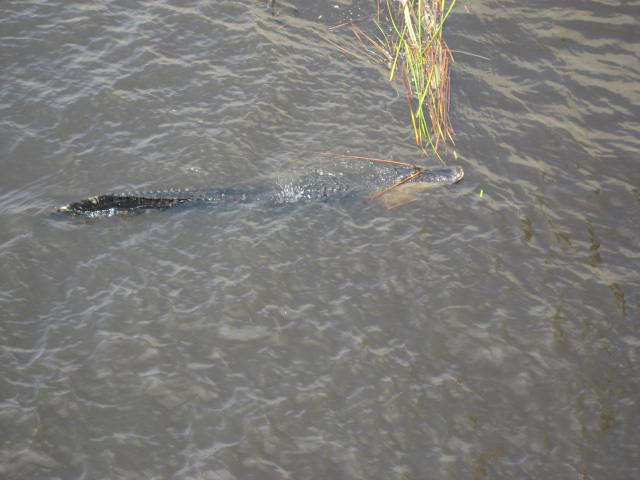
I couldn’t have asked for a better way to encounter a
gator. Anybody can buy their way in to a
gator farm…and I’m sure plenty of people who live in Florida have seen them
unexpectedly in their swimming pools.
But how many people can say they’ve seen an alligator in its natural
environment? Certainly not to many
people from our neck of the woods, anyway. And,
he was a pretty good-sized gator, to boot.
It was hard to tell exactly how long, from where I was standing, but I
would estimate he was 8 to 10 feet long.
And, what happened next, I will remember for all my days…if only because
it was the cherry on top of my gator ice cream.
As I was getting a closer look at the gator…still safely on the side of the dike, protected by concrete and fencing…a group of what I’m assuming were local teens approached from the top of the dike and one of the young ladies said, in a perfect southern accent, “Oh loooooooook, it’s a gator…y’aaaaaall!” Florida, I love you…and I’ll be back to do some more hiking with you…I promise...
As I was getting a closer look at the gator…still safely on the side of the dike, protected by concrete and fencing…a group of what I’m assuming were local teens approached from the top of the dike and one of the young ladies said, in a perfect southern accent, “Oh loooooooook, it’s a gator…y’aaaaaall!” Florida, I love you…and I’ll be back to do some more hiking with you…I promise...
For a map of this hike, along with elevation data, please click here.
Total 2014 Distance: 161.06 Miles
