Granite State
Hike # 108
Mount Monadnock
Jaffrey, NH
Hike Distance: 2.76+ Miles
Date Hiked: 8/30/2014
Date Published: 8/31/2014
Prior to this hike, I took a two month break from hiking. Those of you familiar with this site might recall I wasn't as happy with my last hike, up to the summit of Mount Ascutney in Vermont, because the heat and bugs finally got to me. But, two months off from hiking doesn't mean I was idle this summer. In fact, I was probably more active this summer than I've been in the last five years. And, as a result, I'm down to nearly 270 pounds...inching ever closer to the 100 pound loss mark.
Over the course of the last two months, I played softball competitively in two leagues (one Men's League, one Coed). Both teams made it to the Championship Round...and the Coed team won it all for the first time in the three years since I've been playing with them. Yours truly even had the game winning base hit in the bottom of the 7th inning of the Championship Game. For the season, I batted over .570 in both leagues, with 10 homeruns (combined)...including a couple of inside the park jobs in the Coed League. I'm still not anywhere near the fastest person on the team...but I've come a LONG way from the guy who could barely run down the first base line three seasons ago. Even after all that, I was still eager to get back to hiking. So, when a friend from work invited me to join her and her husband as they made their way up to the summit of Mount Monadnock, I jumped at the chance.
I've actually had Monadnock (elevation: 3,165 feet) on my mind for a long time. Some of you are probably aware the Metacomet Trail, which I completed last April, becomes the Monadnock Trail when it reaches Massachusetts. After winding through Massachusetts, it leads to New Hampshire and Monadnock. I had planned to travel the other miles of the Monadnock Trail before tackling Mount Monadnock, but plans change. I was ready for my first hike in the Granite State.
The morning of the hike, I planned to get up early (setting my alarm for 4:15am). But, we were at a wedding the night before and I never heard my alarm (or, I heard it and turned it off instead of hitting the snooze button). I felt bad because I told my hiking partners I would meet them at their cottage at 7:00am but I was about 40 minutes late. So, we didn't set out on the trail until roughly 8:10. It was a foggy morning, but I was hopeful the fog would burn off by the time we reached the summit.
Typically I would take my time carefully planning a summit hike, but my hiking partners are very familiar with the mountain. So, I let them plan the hike and just went with it. We parked at the parking location near the Old Toll Road (note: there is a fee to park here) and set out, following the Old Halfway House Trail. The trail, which heads due north, runs parallel to the gravel Old Toll Road (open to authorized vehicles only). I was disappointed to see more people taking the road than the trail, but it gave us an opportunity for some solitude.
We followed the Old Halfway House Trail for roughly 1.2 miles, before reaching the intersection with the Cart Path...
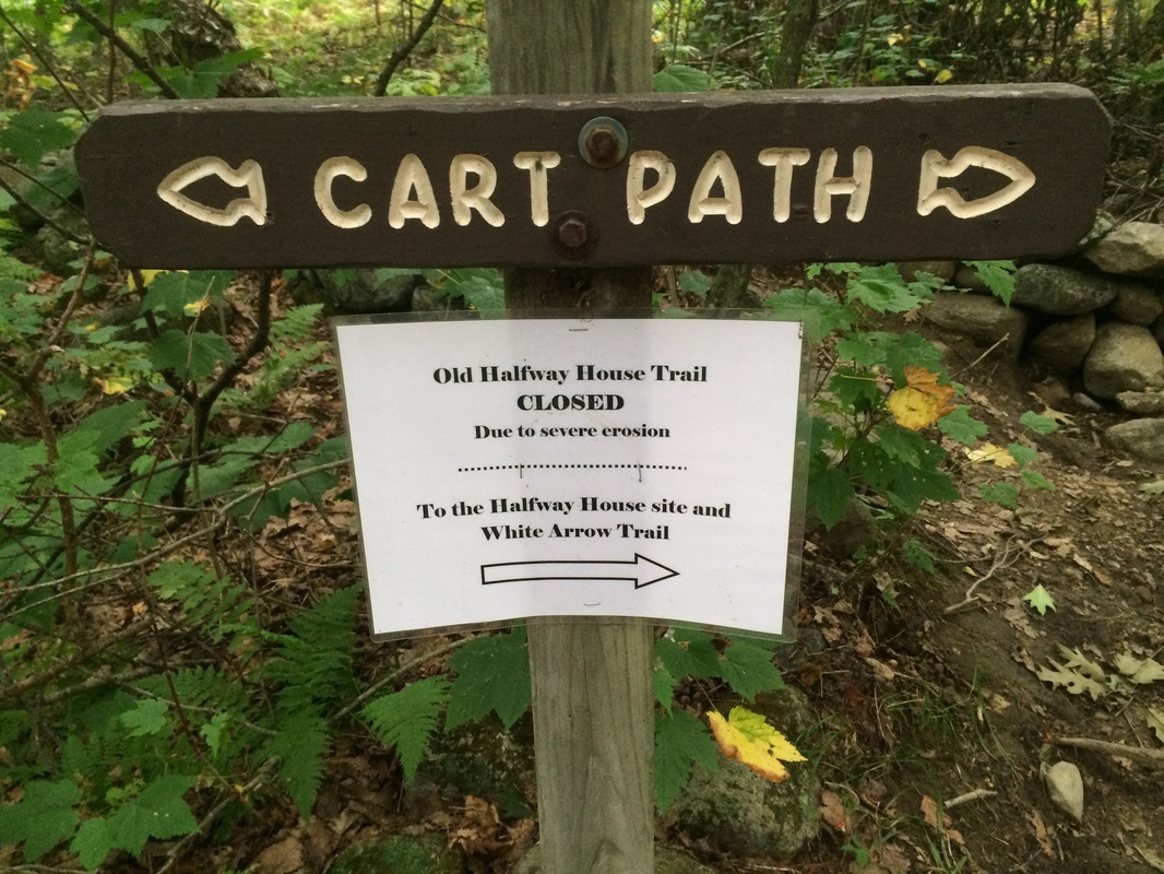
Our original plan, according to my guides, was to continue on the Old Halfway House Trail until we reached the Halfway House site. However, as you can see from the sign in the photo above, the next section of trail was closed because of erosion. So, we turned right, following the detour along the Cart Path.
After a short walk to the east, we made our way out to the Old Toll Road and turned left (heading north again) to follow it until we reached the old Halfway House site...
After a short walk to the east, we made our way out to the Old Toll Road and turned left (heading north again) to follow it until we reached the old Halfway House site...
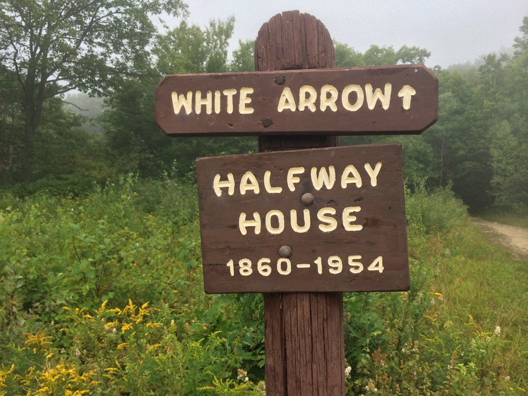
The Halfway House, originally constructed in 1858, opened in 1860 and served as a hotel for more than 90 years. It burned down in 1954 and the road was later closed to the public.
From the Halfway House site, we continued north for a bit until we reached the Monte Rosa and Fairy Spring trails...
From the Halfway House site, we continued north for a bit until we reached the Monte Rosa and Fairy Spring trails...
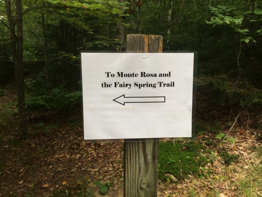
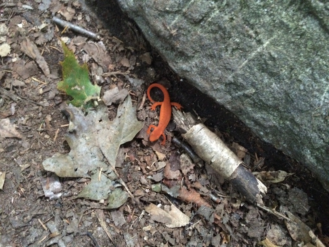
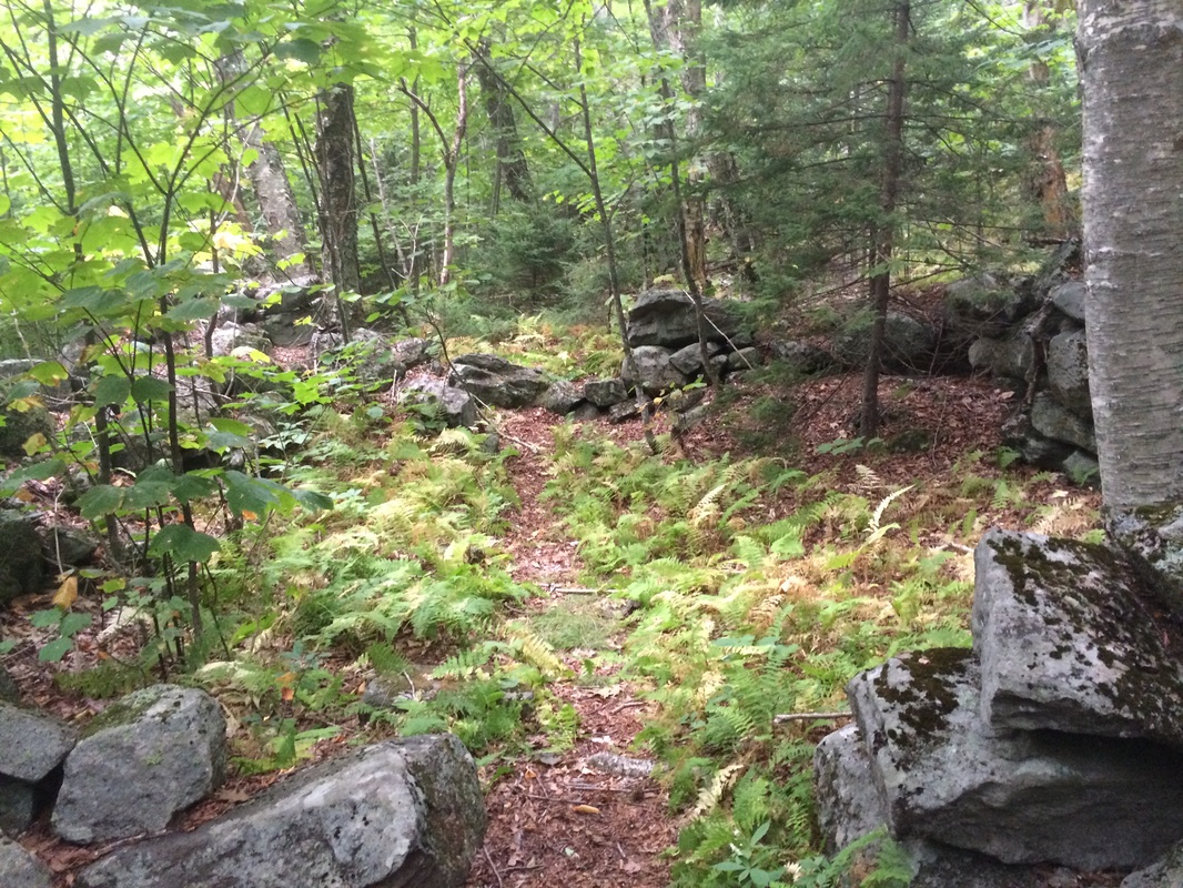
Now, approximately 1.5 miles in, we made the left turn and elected to follow the Fairy Spring Trail. We made our way through some mossy areas and I stopped to take a photo of an Eastern Newt...
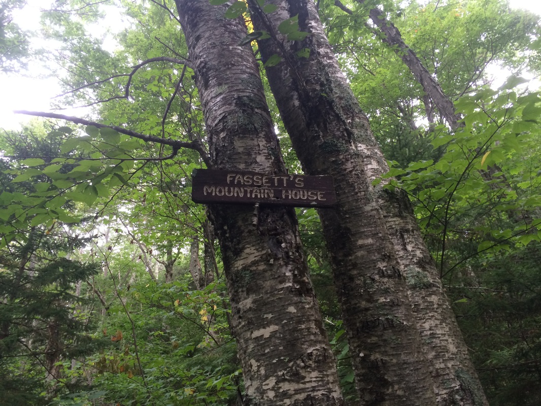
Roughly 1.6 miles in, still climbing, we reached another historical site. Fassett's Mountain House, a stone cabin which was built prior to the Halfway House, once stood here...
|
|
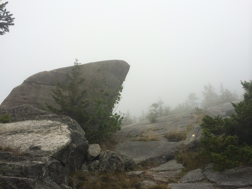
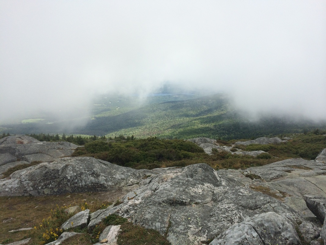
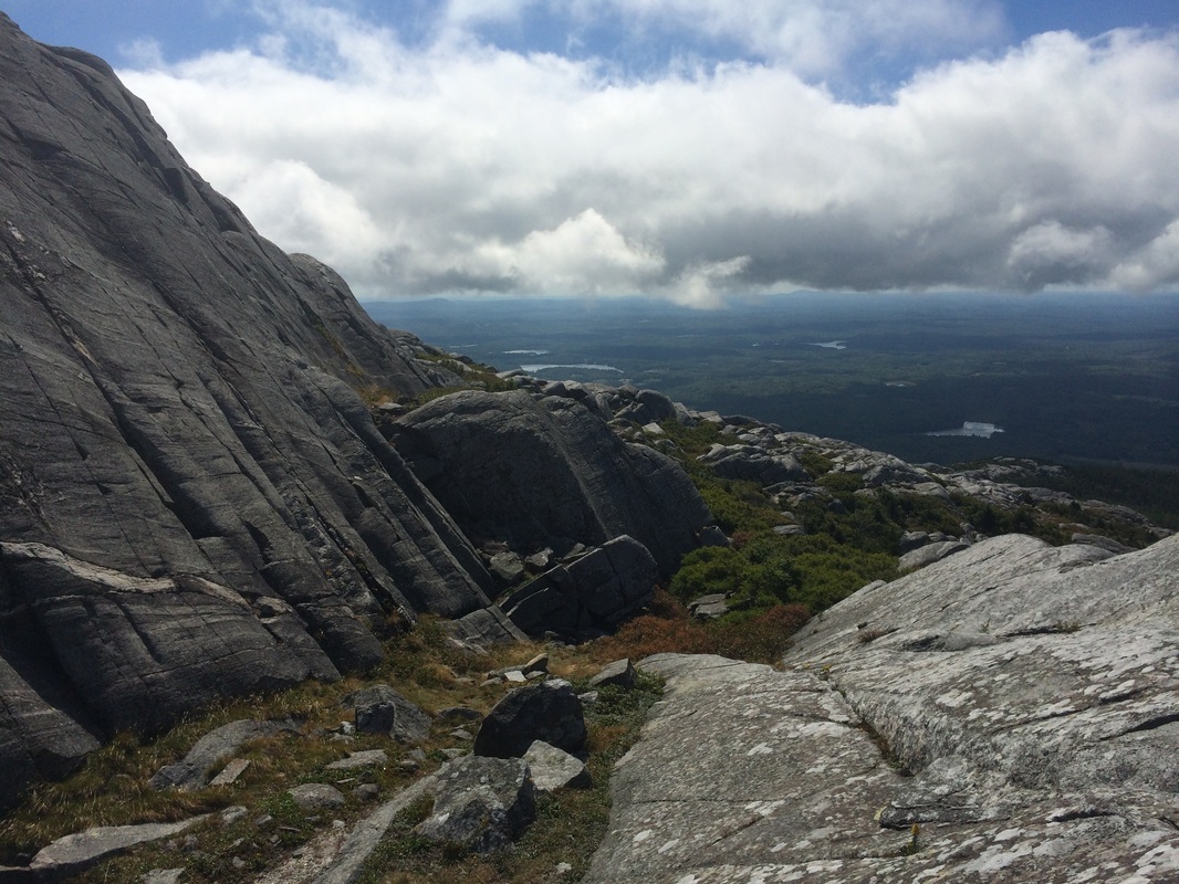
We continued to climb, getting closer to the exposed sections of the mountain. Near the top, the trail ducks out on to an exposed section before entering a section of pine. As you can see from the pictures, the fog was still out in full force, which caused some of the rocks to be a little slick...
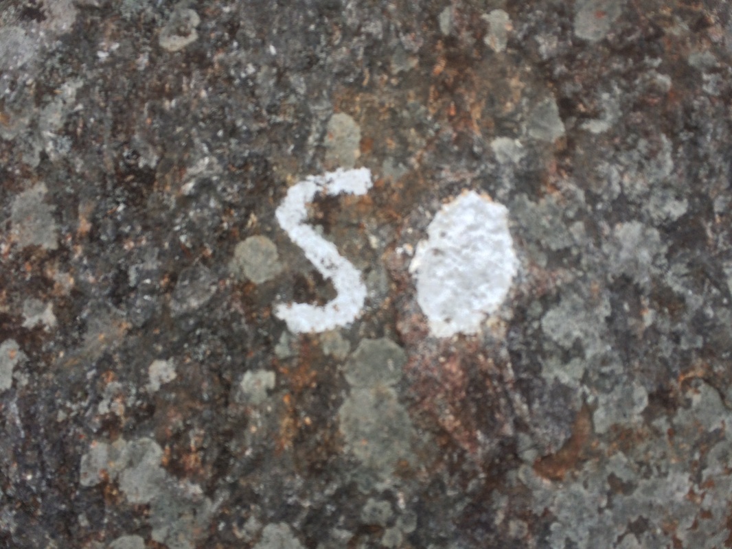
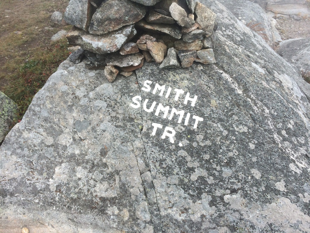
Approximately 1.9 miles in, we reached the intersection with the Smith Summit Trail. We started following the white blazes, which were sometimes accompanied by a little "S"...
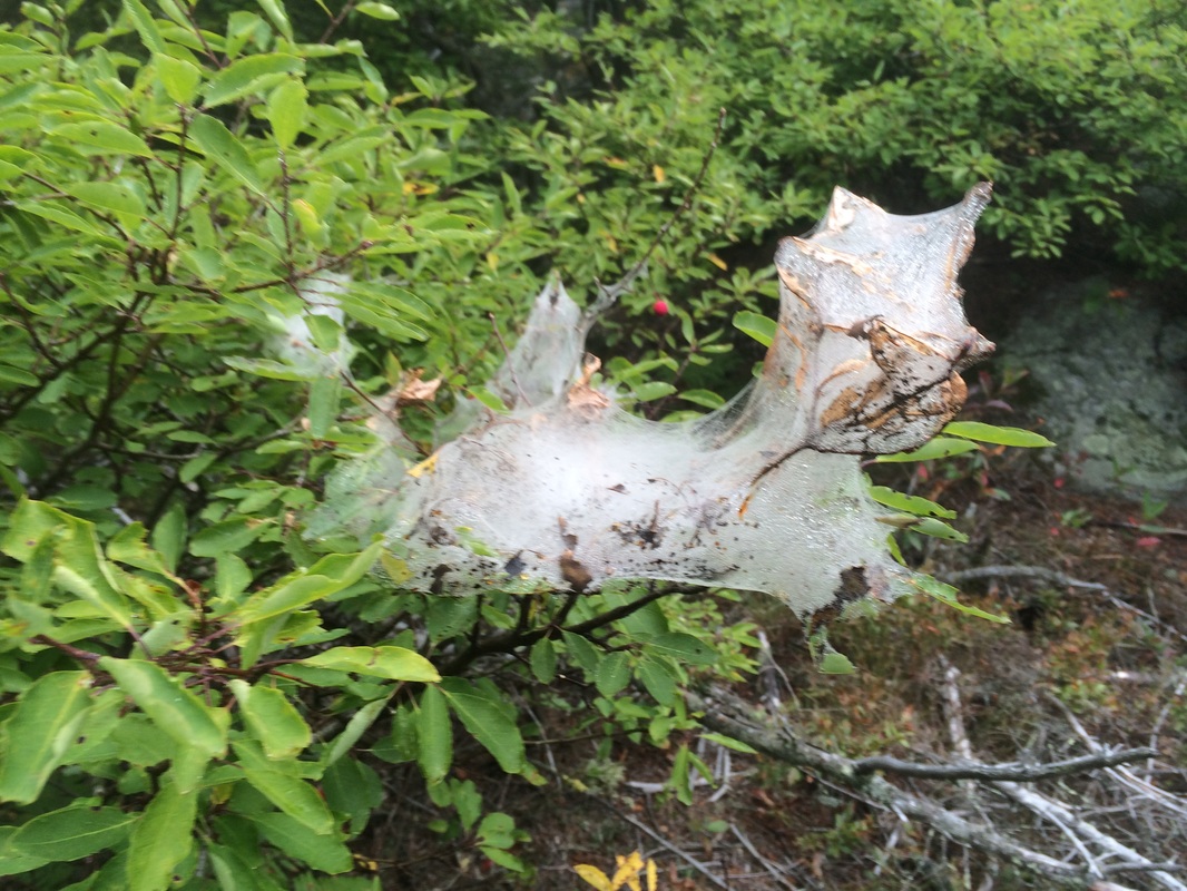
When we entered the pine stand, we were welcomed by an Eastern Tent Caterpillar nest, which was soaked from the early morning fog...
Leaving the stand of pine behind, we reached the final exposed section which would take us to the summit...
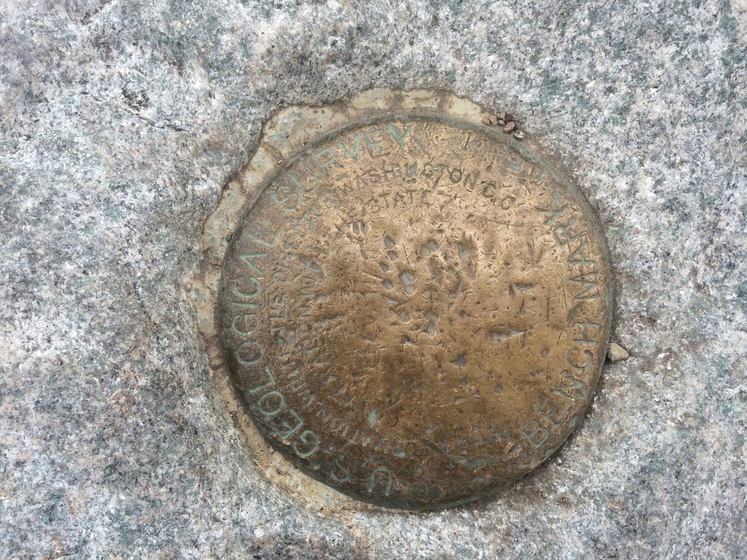
Approximately 2.7 miles in, we reached the summit. I stopped to get a photo of the USGS benchmark (you know I love these things)...
Then, I took a few seconds to get my customary summit selfie (summelfie)...
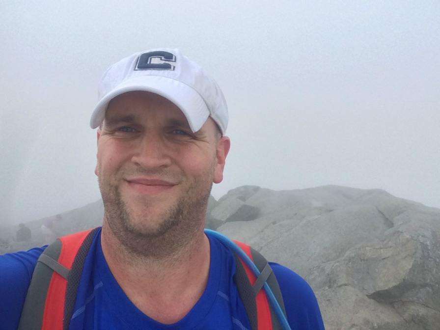
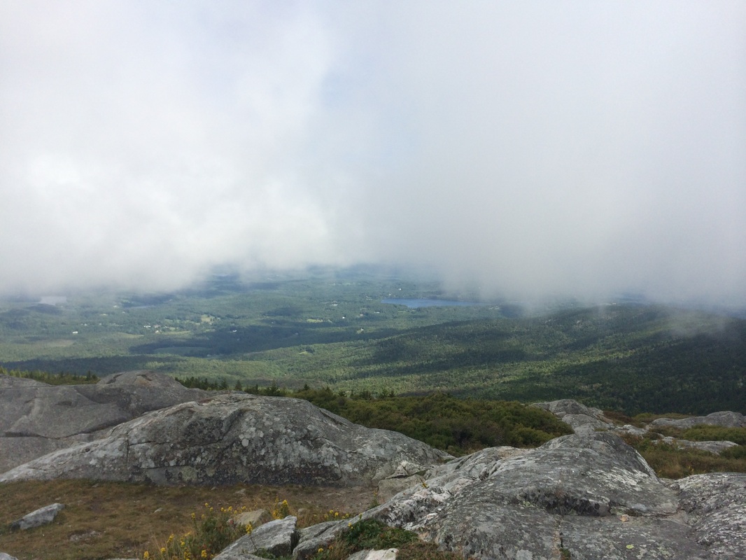
As you can see, the fog still hadn't cleared. But, we got the sense it would. So, we waited...
|
|
And waited...
|
|
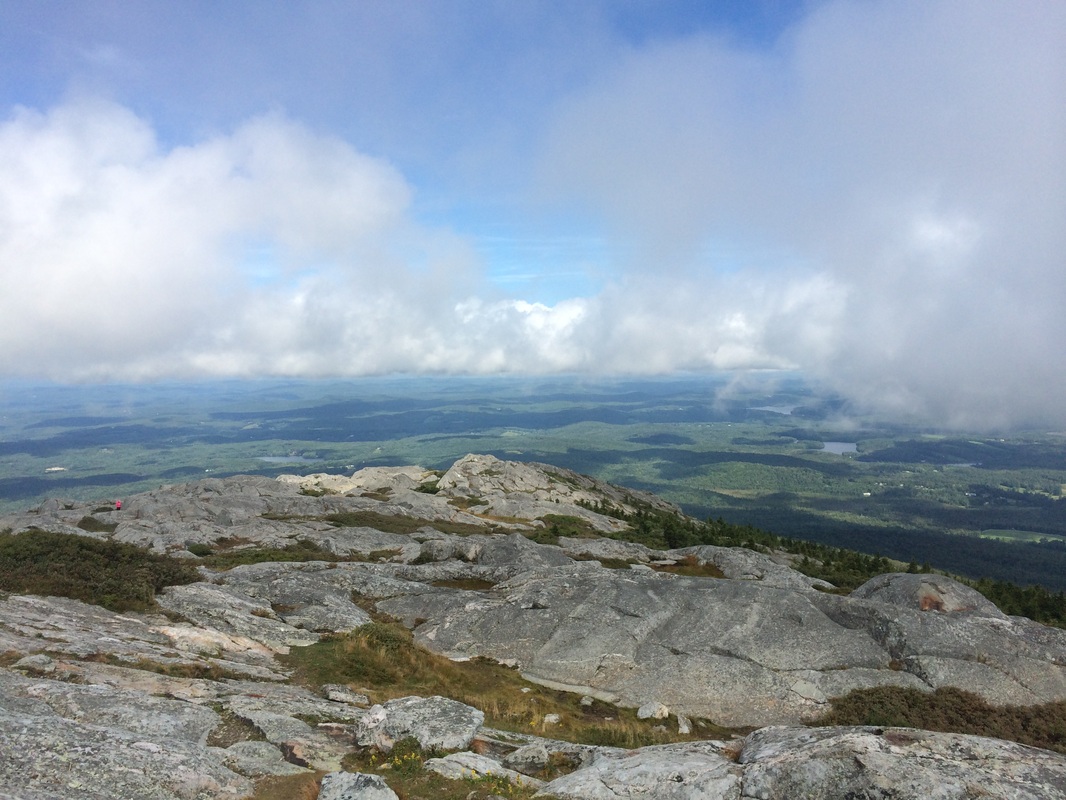
And, after about 15 minutes of waiting/chatting/snacking, the sky cleared enough for us to enjoy 360 degree views...
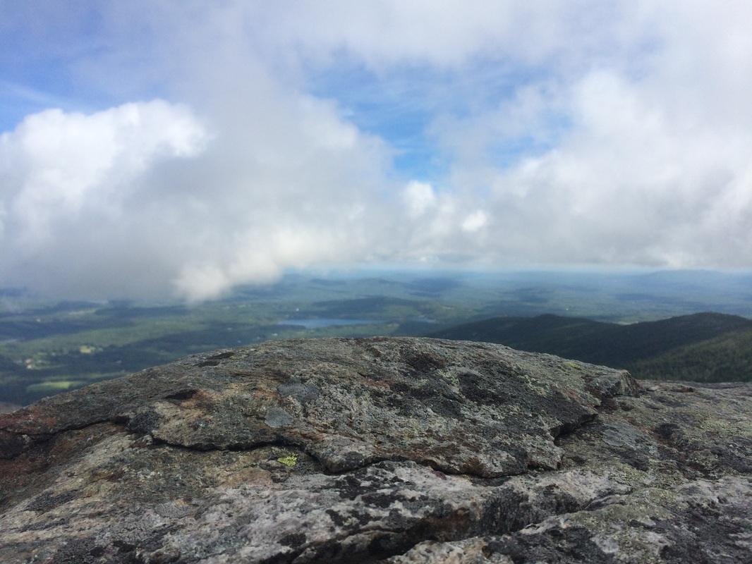
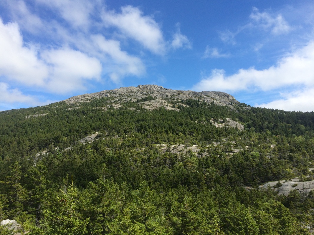
After my experience on Mount Greylock a few months prior to this hike, I was thrilled that I took the time to wait for the morning fog to burn off. We enjoyed the views for a bit then started to make our way back down. Rather than head straight back to the car, we took a short detour over to Monte Rosa (elevation: 2,540 feet) and took in the spectacular view of Monadnock's summit...
From Monte Rosa, we continued back down to the parking location. All told, we probably did more than 6 miles of hiking, but I stopped my MapMyHike app while we were waiting for the fog to clear at the summit, so I only have data for the climb up. I'm only going to take credit for the 2.76 mile climb up and hope that this doesn't cost me a personal record at the end of the year.
For a map of this hike, along with elevation data, please click here.
Total 2014 Distance: 294.58+
