Graveyard Shift
Tunxis Trail (Southington Region)
Hike # 92
Hike Distance: 11.42 Miles
Date Hiked: 3/22/2014
Date Published: 4/6/2014
The 79 mile Tunxis Trail system is divided into four regions and consists of 18 total trails. The trails are primarily woodland paths with several outstanding viewpoints. Highlights of the system include Julian's Rock and Norton Outlook (both of which provide 180 degree views up to 50 miles on a clear day), a steep box ravine known as Devil's Kitchen, a uniquely rugged section known as the Mile of Ledges, an historical landmark known as Tory Den, and huge boulders known as Indian Council Caves.
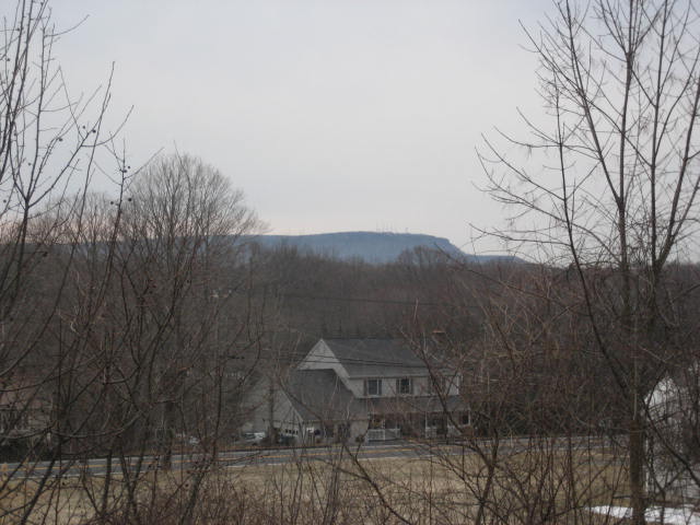
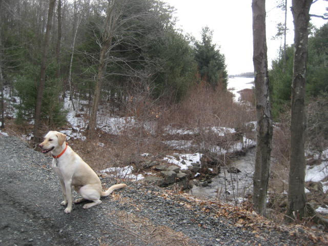
With a plethora of highlights to look forward to, I started my journey on the Tunxis in the southernmost region, parking my vehicle just off of Whitman Road in Southington. The view from this parking location is one of the best parking location views I've encountered. In the distance, I could see my old friend the Metacomet Ridge...specifically, West Peak over in Meriden. I took the picture below, geared up, and Roscoe and I hit the trail.
Tunxis Trail (Southington Region)
Hike # 92
Hike Distance: 11.42 Miles
Date Hiked: 3/22/2014
Date Published: 4/6/2014
The 79 mile Tunxis Trail system is divided into four regions and consists of 18 total trails. The trails are primarily woodland paths with several outstanding viewpoints. Highlights of the system include Julian's Rock and Norton Outlook (both of which provide 180 degree views up to 50 miles on a clear day), a steep box ravine known as Devil's Kitchen, a uniquely rugged section known as the Mile of Ledges, an historical landmark known as Tory Den, and huge boulders known as Indian Council Caves.
With a plethora of highlights to look forward to, I started my journey on the Tunxis in the southernmost region, parking my vehicle just off of Whitman Road in Southington. The view from this parking location is one of the best parking location views I've encountered. In the distance, I could see my old friend the Metacomet Ridge...specifically, West Peak over in Meriden. I took the picture below, geared up, and Roscoe and I hit the trail.
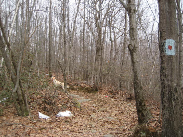
The trail here starts by heading due south from the parking lot. It cuts through a small overgrown field before reaching the woods.
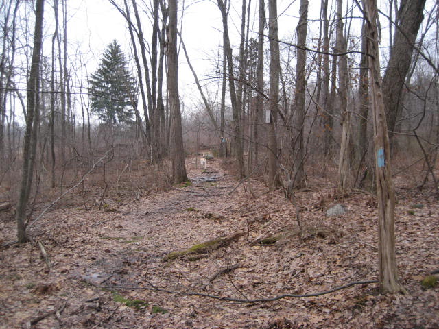
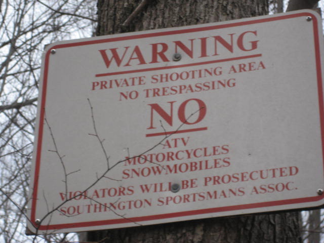
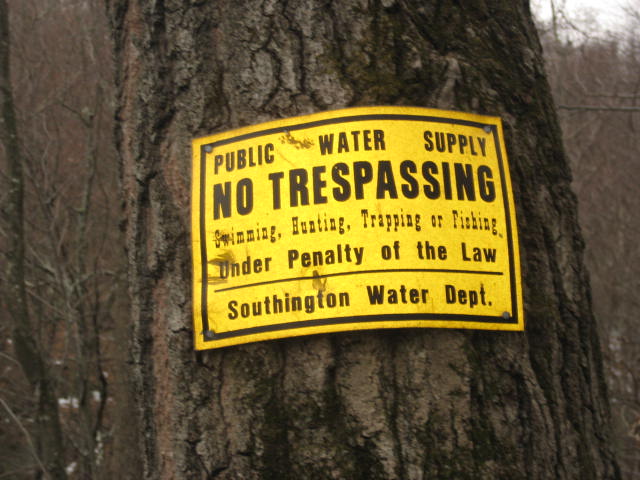
Shortly, the trail turns west and starts heading uphill. There are several signs in the area urging people to stay on the trail. As you work your way uphill, you will signs on the right which were put there by the Southington Sportsman Association. And, to the left, you will signs which were put up by the Southington Water Department.
|
|
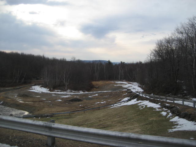
Roughly 1.5 miles in, the trail comes to a fork. I had to do a little looking around before I confirmed the trail goes to the left and follows the gravel road uphill.
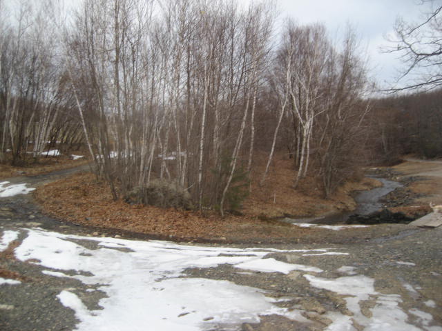
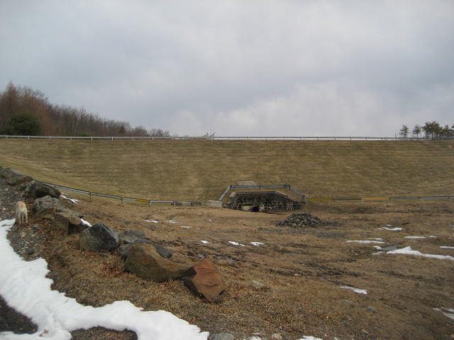
Shortly after the fork, the trail passes the base of the New Britain Reservoir dam. To give you an idea of the size of the dam, I made sure Roscoe was in the picture below. He is to the far left, doing his best to blend in with the snow.
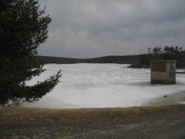
At 1.6 miles, the trail reaches the southwest corner of the reservoir. I took a picture of the still frozen water and turned to see West Peak in the distance...barely visible above the treetops in the picture on the right below.
|
|
To the left of the dam there is another trail, the blue/red-blazed Stonehouse Trail. Roscoe and I made the left turn and started following this trail.
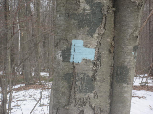
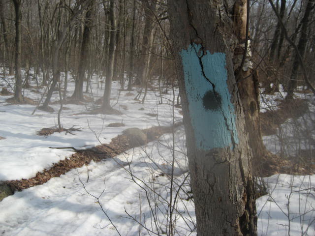
For the next 1.3 miles, we followed the Stonehouse Trail...first west then north. I was a little disappointed we were unable to locate the main attraction of this trail, several stone foundations (which give the trail their name). The trail itself, however, is one big historical highlight. Formerly known as Old King's Highway, the wooded path dates back to 1753. At roughly the 2.9 mile point of our hike, we came to this strange "Tetris"-looking blaze.
At this point, the Stonehouse Trail ends and the blue-blazed Woodtick Trail comes in from the right. Confusingly, the Woodtick Trail continues to follow the Old King's Highway. So, even though I never turned and continued walking due north, I was on a new trail. Even more confusingly, the Woodtick Trail doesn't carry any other color of blaze. So, I can see where a lot of people would confuse this trail with the mainline Tunxis Trail. Fortunately, I had done my research ahead of time and I was carrying a map...so I was prepared for this turn of events. So, we marched on...continuing down the Old King's Highway.
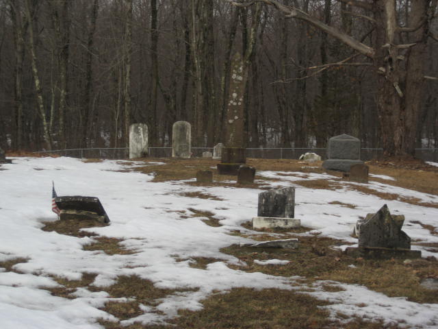
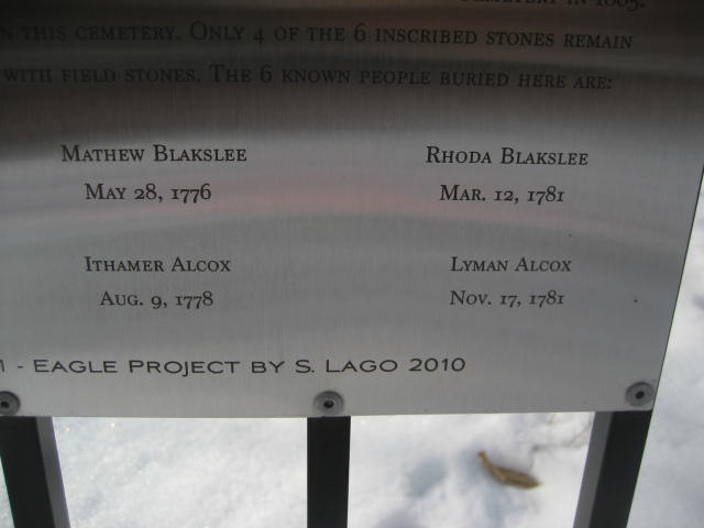
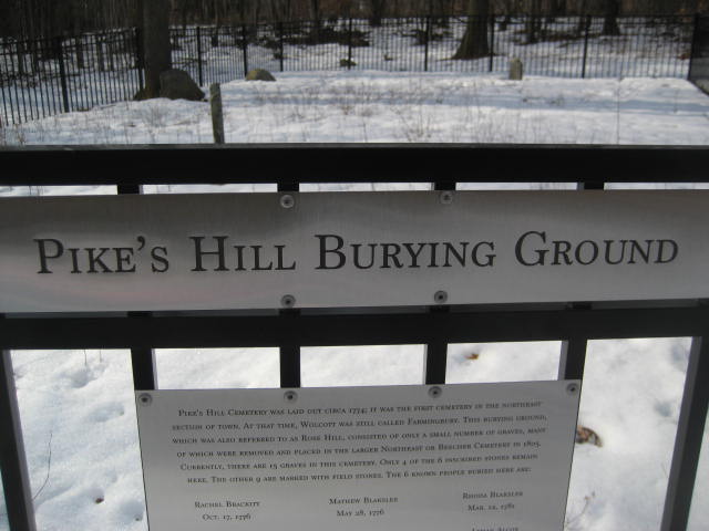
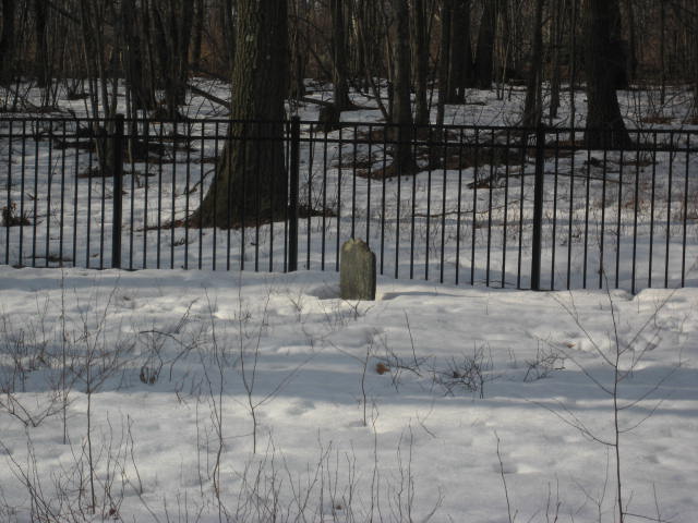
Over the next 9/10 of a mile, the trail heads mostly downhill as it leads to Woodtick Road in Wolcott. Along the way, it passes by a pair of very old cemeteries. The second, Pike's Hill Burying Ground, is where the ancestors of Louisa May Alcott (of "Little Women" fame) are buried. Look closely and you will see the name Alcox.
At roughly 3.8 miles in, we reached Woodtick Road.
|
|
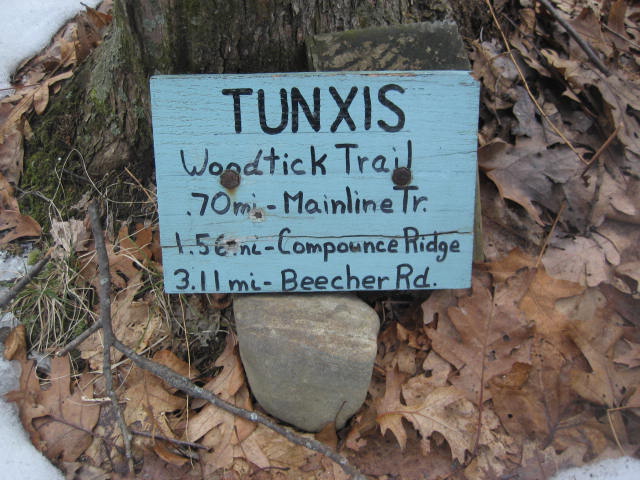
From Woodtick Road, we double back and retraced our steps to the junction with the Stonehouse Trail. Once there, we turned left and continued to follow the remaining section of the Woodtick Trail. There is a sign here which provides some distances.
We followed the Woodtick Trail, now heading due east, for 7/10 of a mile until we connected back with the Tunxis Mainline Trail. We made a left and followed a gravel service road around the northwest corner of the reservoir.
Even after my rather lengthy detour to follow the Stonehouse and Woodtick Trails, we only skipped about 6/10 of a mile of the mainline (and I knew I would make that up on the journey back to my vehicle).
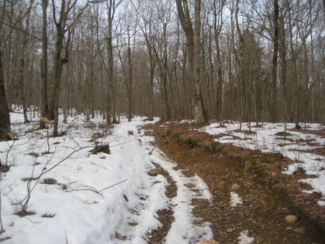
The next 1.8 miles of the mainline trail were mostly uneventful. There is a lot of damage to this section of the trail because of ATVs. So, I spent a lot of time trying to figure out the best path around some massive mud holes. There is also a noted high point in the Walk Book, Libby's Lump (elevation: 870 feet). But, sadly, there isn't a view from the top. There used to be another trail here (the Compounce Ridge Trail), but it was closed in 2012 due to a private property issue. So, I made a note to return should that trail ever re-open.
Once we reached the blue/black blazes of the Bobcat Trail, we also reached my planned turn around point. Here, there is a break in the Tunxis mainline (it starts up again about 5 miles to the northwest, off of Marsh Road in Plymouth), and I didn't want to start working on the Bobcat Trail just yet. Even though the Bobcat Trail is only 7/10 of a mile long, that meant I would have to cover an additional 1.4 miles (out and back). I had already hiked about 7.2 miles and I still had to hike 4 more miles back to my car. Also...since I was already making up one side trail...why not just save this one for a future hike, too?
We turned and made our way back to the Whitman Road parking location, sticking to the mainline the whole way back...which allowed me to make up the 6/10 of a mile of the mainline I bypassed earlier.
All in all, I enjoyed my first hike on the Tunxis. There are still plenty of miles to go so there is a lot to look forward to. The next section will include Tory Den, which is of historical significance in the state of Connecticut.
All in all, I enjoyed my first hike on the Tunxis. There are still plenty of miles to go so there is a lot to look forward to. The next section will include Tory Den, which is of historical significance in the state of Connecticut.
For a map of this hike, along with elevation data, please click here.
Total 2014 Miles: 135.69
