The Greenhorn 500, Part 1:
Miles 0.0 through 4.5
Hike #120
Nehantic-Pachaug Crossover Trail, Pachaug Trail, Nehantic Trail
Voluntown, CT
Hike Distance: 4.5 Miles
Date Hiked: 1/1/2015
Date Published: 1/2/2015
Hike #120
Nehantic-Pachaug Crossover Trail, Pachaug Trail, Nehantic Trail
Voluntown, CT
Hike Distance: 4.5 Miles
Date Hiked: 1/1/2015
Date Published: 1/2/2015
For the first hike of 2015,
and my first effort at hiking 500 miles in the calendar year, I decided to head
down to the southeast corner of the state and check out the Nehantic Trail.
From the Walk Book:
The Nehantic Trail extends from Green Fall Pond in Voluntown to Hopeville Pond State Park in Griswold. Running over 13 miles, the trail connects three public recreational areas in and around Pachaug State Forest: Hopeville Pond State Park, Pachaug State Forest Chapman Area and Mount Misery, and Pachaug State Forest Green Fall Pond Recreation Area. The Nehantic, the adjoining Narragansett Trail and Pachaug Trail, side trails, and woods roads add up to more than 50 miles of pathways covering much of the 30,000 acres of Pachaug State Forest – allowing for many weekends of exploration!
I was familiar with the area described in the Walk Book because I had spent time there in January and February of 2014, while hiking the Pachaug Trail. The southern terminus of the Nehantic Trail is only a few yards away from the southern terminus of the Pachaug Trail. So, I made my way back to the area hoping the Nehantic would offer a different flavor from the Pachaug, or that I wouldn’t remember too much of the Pachaug to make the Nehantic boring. I parked just off of Green Fall Road at the intersection of the road and the Nehantic-Pachaug Crossver Trail, near the foundation of an old tool booth.
To reach the Parking Area from Hartford:
Follow Route 2 east to I-395 North. From I-395 North, take exit 85 and go straight at the end of the exit ramp. At the next light, turn right on Route 138 and follow that through Voluntown Center (where Routes 138, 165 and 49 converge). Stay on Route 138 and bear right at the fork where Route 165 continues straight. Turn right on unpaved Green Fall Road and follow it to a stop sign. The old toll booth foundation is to the left of the stop sign. The small parking area is to the right of the foundation.
On the first of my Pachaug hikes back in January of 2014, I parked here with my dad and our friend Allan. On that hike, due to the fact that the road was gated off, we started by following the unpaved road on foot for about a mile and a half before beginning any actual hiking. For some reason I can’t recall all these months later, Roscoe sat out the January 2014 hike. This time, Roscoe was with me…my dad and Allan were not…the road wasn’t gated off (although I still parked in the same spot)…and the real hiking started almost immediately. Already things were different, and that was exciting!
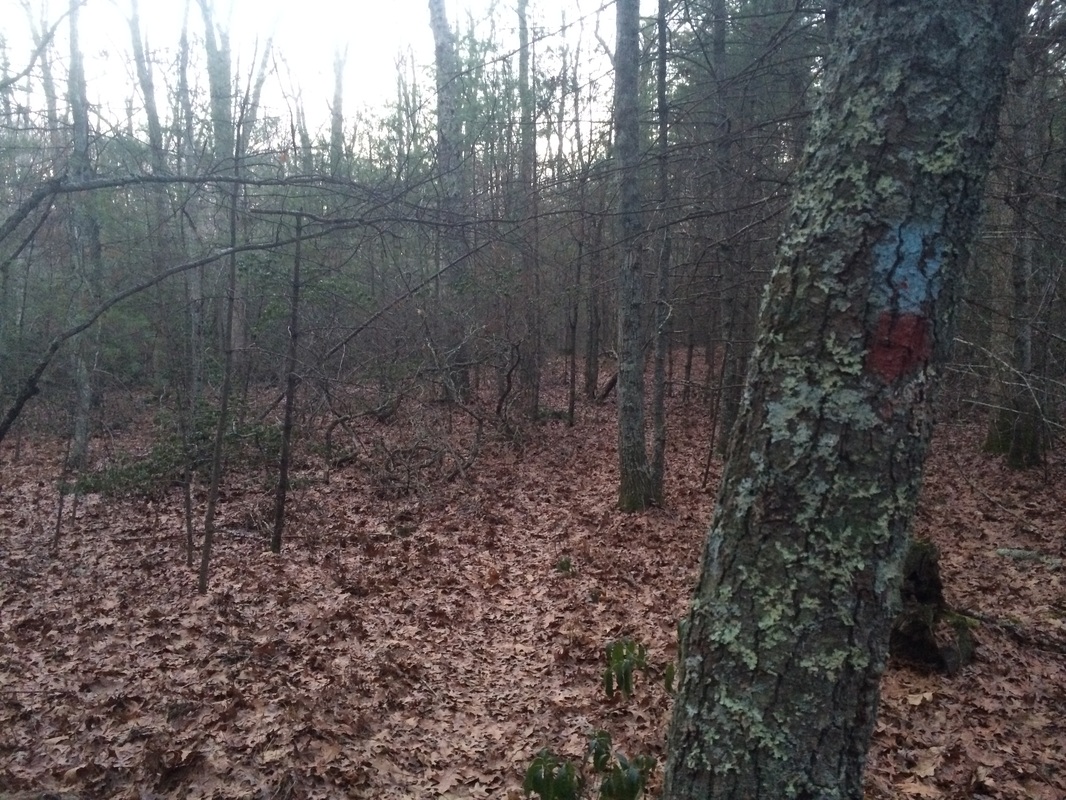
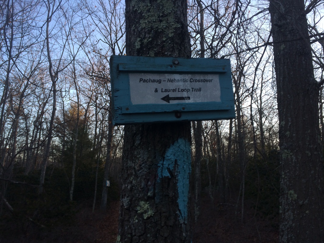
We started the hike by heading due east, following the blue-and-red blazes of the Nehantic-Pachaug Crossover Trail…
From the Walk Book:
The Nehantic Trail extends from Green Fall Pond in Voluntown to Hopeville Pond State Park in Griswold. Running over 13 miles, the trail connects three public recreational areas in and around Pachaug State Forest: Hopeville Pond State Park, Pachaug State Forest Chapman Area and Mount Misery, and Pachaug State Forest Green Fall Pond Recreation Area. The Nehantic, the adjoining Narragansett Trail and Pachaug Trail, side trails, and woods roads add up to more than 50 miles of pathways covering much of the 30,000 acres of Pachaug State Forest – allowing for many weekends of exploration!
I was familiar with the area described in the Walk Book because I had spent time there in January and February of 2014, while hiking the Pachaug Trail. The southern terminus of the Nehantic Trail is only a few yards away from the southern terminus of the Pachaug Trail. So, I made my way back to the area hoping the Nehantic would offer a different flavor from the Pachaug, or that I wouldn’t remember too much of the Pachaug to make the Nehantic boring. I parked just off of Green Fall Road at the intersection of the road and the Nehantic-Pachaug Crossver Trail, near the foundation of an old tool booth.
To reach the Parking Area from Hartford:
Follow Route 2 east to I-395 North. From I-395 North, take exit 85 and go straight at the end of the exit ramp. At the next light, turn right on Route 138 and follow that through Voluntown Center (where Routes 138, 165 and 49 converge). Stay on Route 138 and bear right at the fork where Route 165 continues straight. Turn right on unpaved Green Fall Road and follow it to a stop sign. The old toll booth foundation is to the left of the stop sign. The small parking area is to the right of the foundation.
On the first of my Pachaug hikes back in January of 2014, I parked here with my dad and our friend Allan. On that hike, due to the fact that the road was gated off, we started by following the unpaved road on foot for about a mile and a half before beginning any actual hiking. For some reason I can’t recall all these months later, Roscoe sat out the January 2014 hike. This time, Roscoe was with me…my dad and Allan were not…the road wasn’t gated off (although I still parked in the same spot)…and the real hiking started almost immediately. Already things were different, and that was exciting!
We started the hike by heading due east, following the blue-and-red blazes of the Nehantic-Pachaug Crossover Trail…
From the Walk Book:
This blue-and-red blazed trail provides a connector between the Nehantic and Pachaug Trails, a little more than one mile north of Green Fall Pond. When taken in conjunction with the Laurel Loop, it makes a circular hike of about 3.5 miles. Parking is available off Fish Road at the western terminus.
Prior to the hike, I was aware of the parking off Fish Road but elected not to park there. I also wasn’t going to do the 3.5 mile loop outlined in the trail description, but I was going to use the Crossover Trail to connect with a really short section of the Laurel Loop. From there, my plan was to use the Pachaug Trail to connect in with the Nehantic, making a loop hike of my own.
Approximately 6/10 of a mile in, we passed what looked like gravestones…
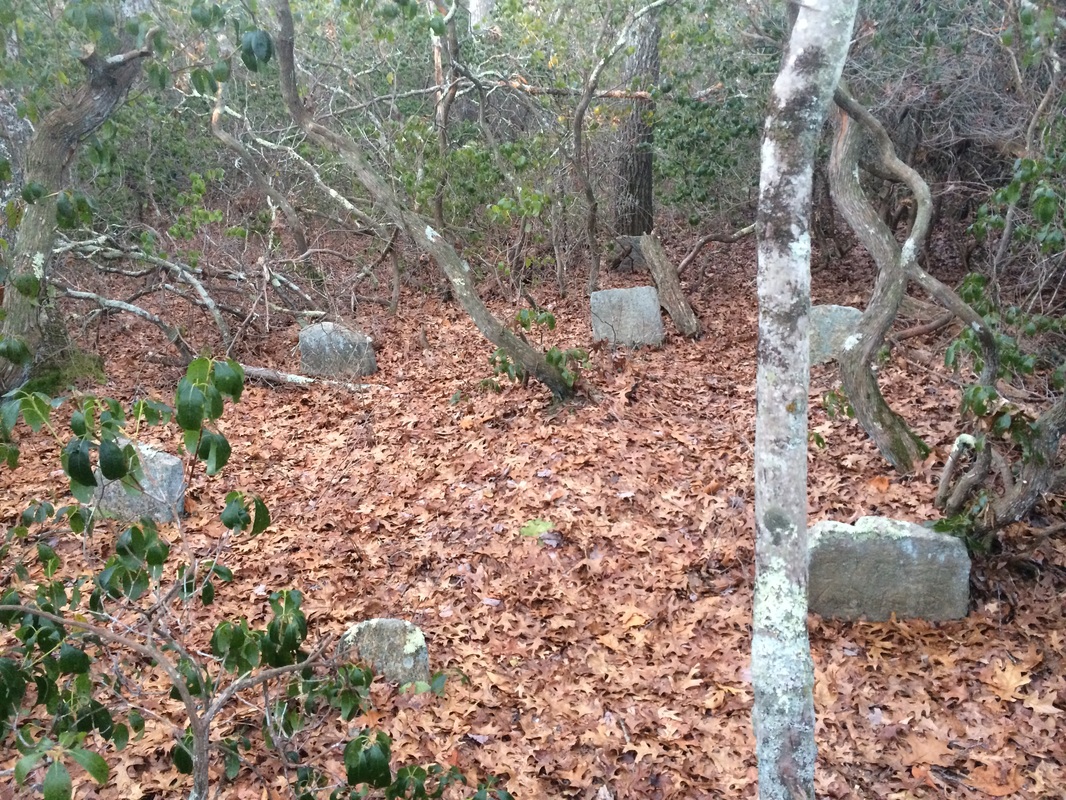
Shortly after, we passed an
old homestead…which made me wonder even more about the headstone looking rocks we’d
passed earlier. Upon my return home, I
looked more closely at the rocks and they seem to bear inscriptions. Is this a final resting place? Or, is it someone’s sick
joke? The Walk Book doesn’t mention
anything about a graveyard near the trail, so this mystery will go unsolved for
now.
Roughly 1.1 miles in, after skirting stone walls and passing what might be an old foundation, we reached the eastern terminus of the Nehantic-Pachaug Crossover Trail at the intersection of the Laurel Loop Trail…
Roughly 1.1 miles in, after skirting stone walls and passing what might be an old foundation, we reached the eastern terminus of the Nehantic-Pachaug Crossover Trail at the intersection of the Laurel Loop Trail…
There wasn’t a sign or
anything to mark the trail intersection, but I had my map to verify this was
it. I made a right and followed the
Laurel Loop for about 300 yards (per the Walk Book).
Approximately 1.2 miles in, we reached the intersection of the Pachaug Trail, at this sign…
Approximately 1.2 miles in, we reached the intersection of the Pachaug Trail, at this sign…
A left here would take me
east then north along the Pachaug. But,
having already hiked that trail, I had planned to stay straight and follow the Pachaug south until I reached
Green Fall Pond.
In the year since I travelled this section of the Pachaug, I had forgotten about the little tricky sections sprinkled here and there along the way. Maybe that was because I was heading the opposite way this time? Or, maybe it was all of the miles of hiking in between? Either way, all I really remember from that first Pachaug hike is how badly it rained. So, this was a nice section do-over…not boring at all.
Roughly 2.1 miles in, nearing the Green Fall Pond Camping Area, we made a hard right on an unpaved road…
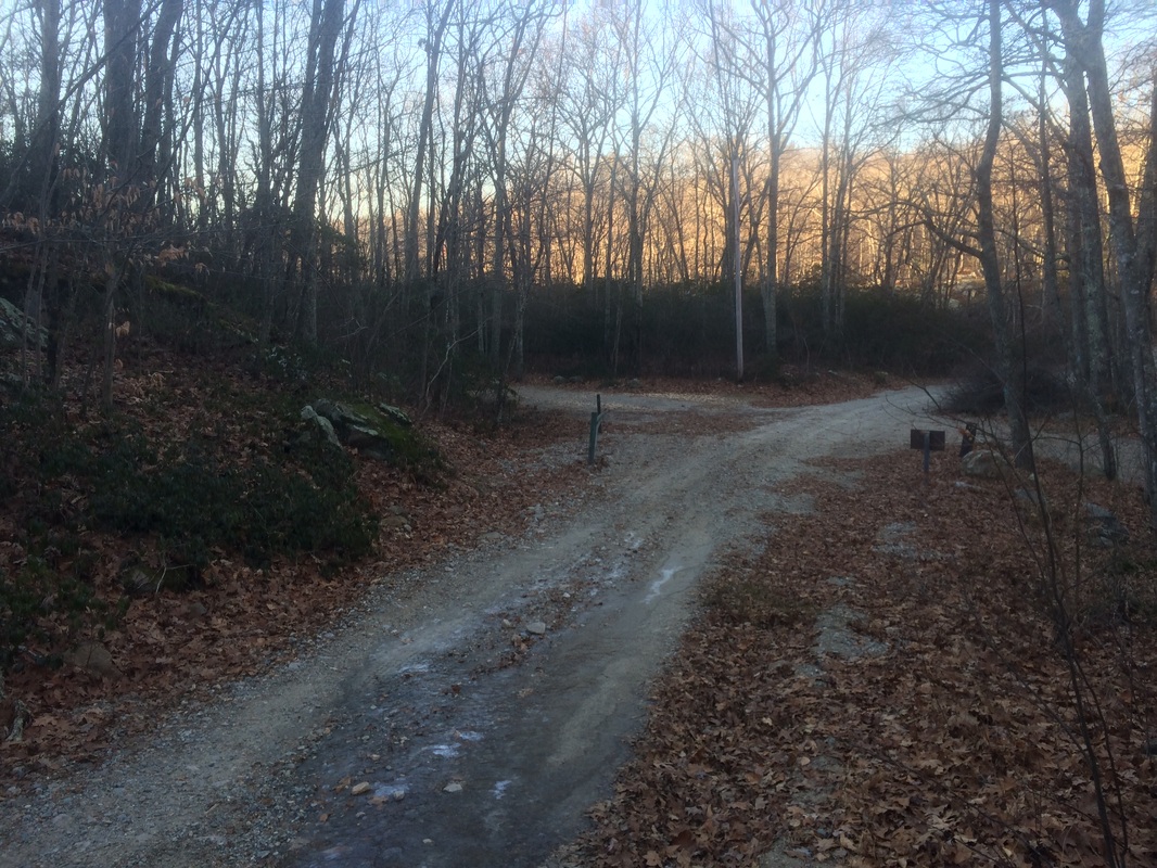
I believe this road is an
extension of Green Fall Road, but I'm not 100% certain of the name. Regardless, staying on this road would eventually lead me back to the parking area. But, I had other plans.
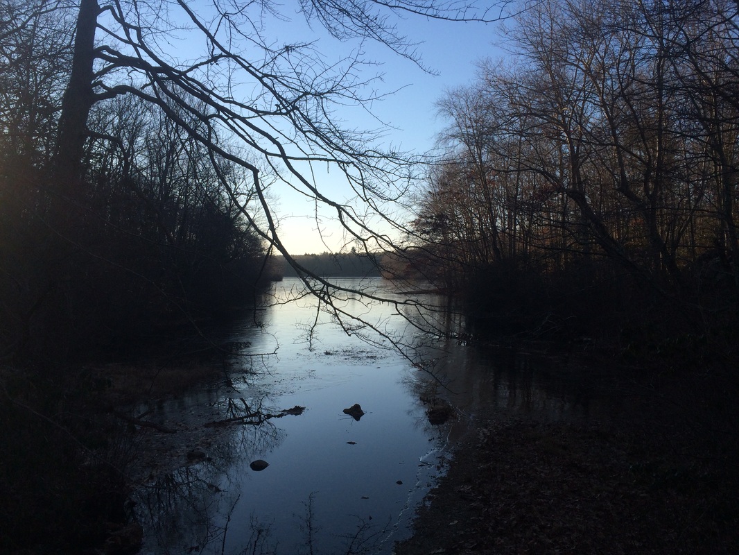
Approximately 2.3 miles in, after passing Green Fall Pond and taking the picture at the top of this recap, we reached the southern terminus of the Nehantic Trail…
Approximately 2.3 miles in, after passing Green Fall Pond and taking the picture at the top of this recap, we reached the southern terminus of the Nehantic Trail…
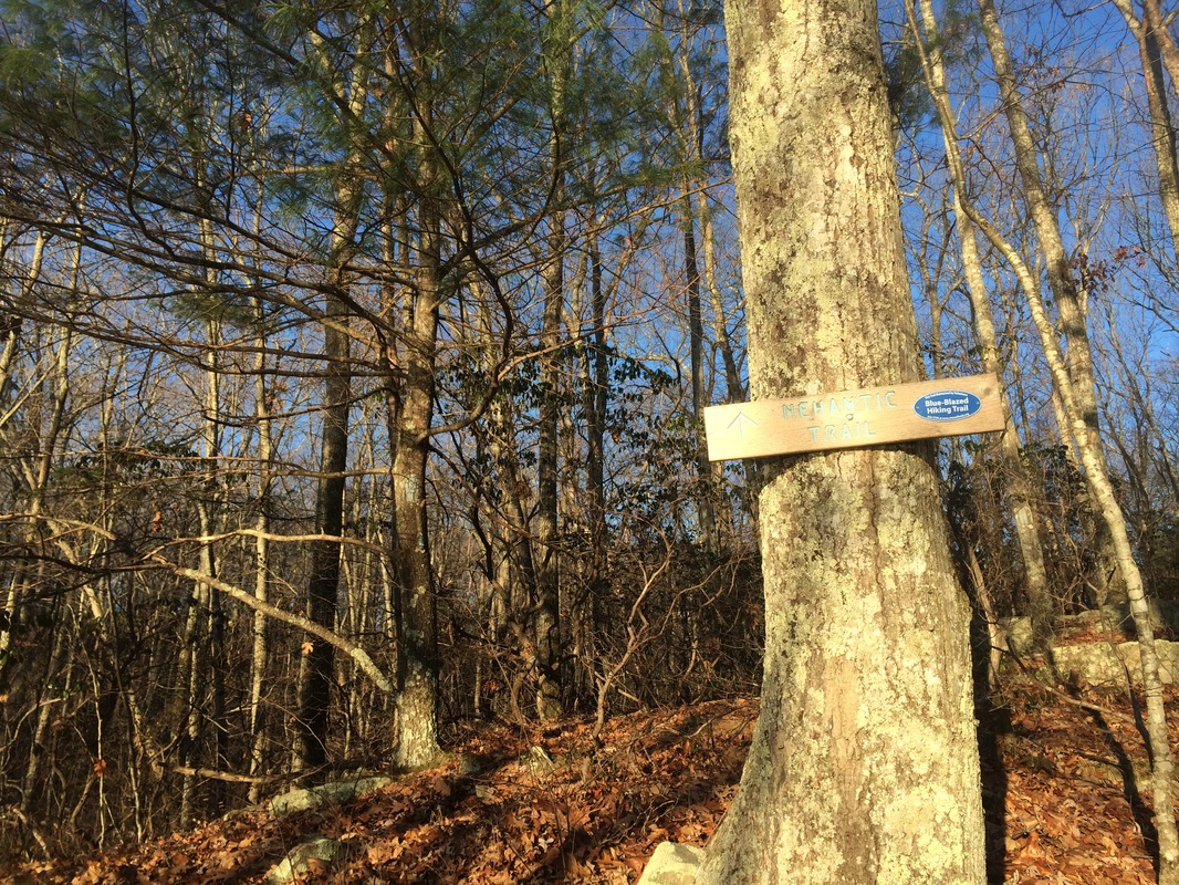
The Walk Book describes the
Nehantic Trail from south to north. So I
had made all this effort (okay it was only 2.3 miles overly fairly flat terrain
but you get the point) in order to cover the trail as it is laid out.
We started our journey on the Nehantic by heading up a short hill in a northwesterly direction. There are some cool rock features near the start of the trail and it crosses a small brook. It has been dry around here recently so the brook crossing was very easy (I was overdue for an easy brook crossing).
Roughly 2.6 miles in, we crossed the unpaved Green Fall Road and joined a woods road on the other side. I stopped to take a picture of the road crossing but cut that plan short when I thought I heard a car coming down the road. Recalling the open gate from when I parked, this was a very real possibility. Roscoe was off-leash and I didn’t feel like putting the leash on him so we hustled across the road to the safety of the other side, sans photo. Only later did I realize it was the sound of the wind in the trees. Haha!
The Walk Book through the next section describes a ledge overlooking a swamp, but I don’t recall noticing a swamp. Did I mention it has been really dry around here? I did, however, notice how closely the trail comes to the road at times. There wasn’t any traffic (or wind) but the unpaved road is visible from a few sections of the trail.
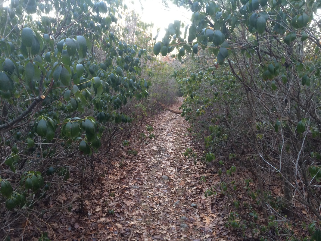
Approximately 4.3 miles in, shortly after passing the western terminus of the Nehantic-Pachaug Crossover, we reached Fish Road…
We started our journey on the Nehantic by heading up a short hill in a northwesterly direction. There are some cool rock features near the start of the trail and it crosses a small brook. It has been dry around here recently so the brook crossing was very easy (I was overdue for an easy brook crossing).
Roughly 2.6 miles in, we crossed the unpaved Green Fall Road and joined a woods road on the other side. I stopped to take a picture of the road crossing but cut that plan short when I thought I heard a car coming down the road. Recalling the open gate from when I parked, this was a very real possibility. Roscoe was off-leash and I didn’t feel like putting the leash on him so we hustled across the road to the safety of the other side, sans photo. Only later did I realize it was the sound of the wind in the trees. Haha!
The Walk Book through the next section describes a ledge overlooking a swamp, but I don’t recall noticing a swamp. Did I mention it has been really dry around here? I did, however, notice how closely the trail comes to the road at times. There wasn’t any traffic (or wind) but the unpaved road is visible from a few sections of the trail.
Approximately 4.3 miles in, shortly after passing the western terminus of the Nehantic-Pachaug Crossover, we reached Fish Road…
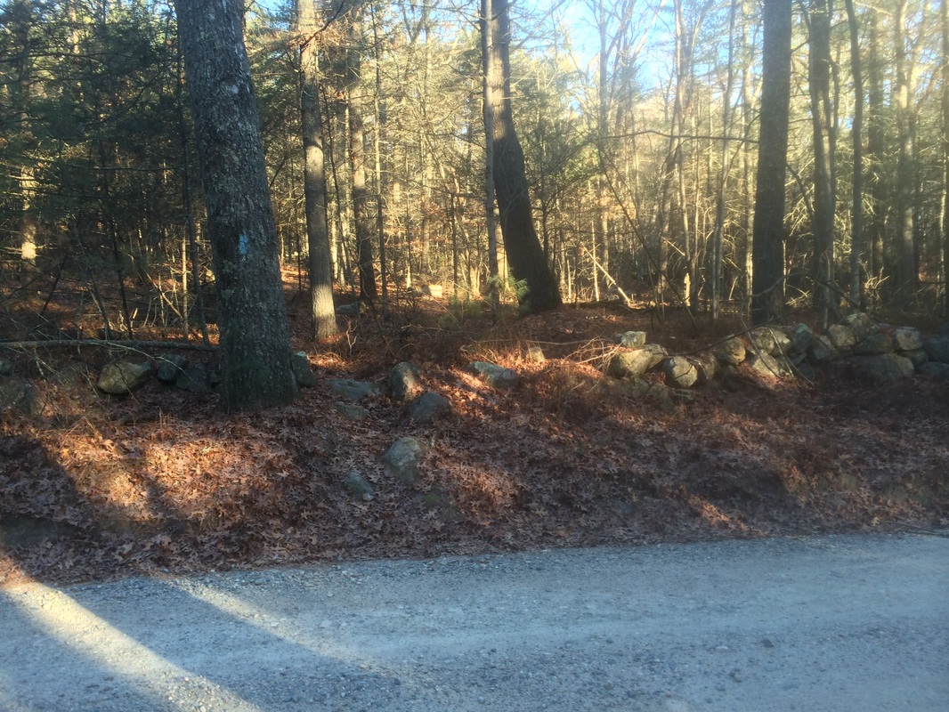
As you might be able to tell
from the picture, the Nehantic continues on to the north of Fish Road. But, this was the end of the line for
today. Planning to pick up the trail
from this point on my next Nehantic hike, I doubled back briefly then made a
left on the Crossover Trail to return to the car.
My time on the Nehantic was brief, but it was a good choice for the first hike of 2015. The generally flat terrain was great; especially considering my back still isn’t 100%. I’m looking forward to the next hike and continuing my attempt at 500 miles in 2015!
Until next time…
My time on the Nehantic was brief, but it was a good choice for the first hike of 2015. The generally flat terrain was great; especially considering my back still isn’t 100%. I’m looking forward to the next hike and continuing my attempt at 500 miles in 2015!
Until next time…
For a map of this hike, along with elevation data, please click here.
Total 2015 Distance: 4.5 miles
(495.5 to Goal)
