New Heights in the New Year
Hike #77
Mattatuck Trail
Flat Rocks Road to Mohawk Trail Junction (Cornwall, CT)
Distance: 12.85 Miles Round Trip (Approximately 6.8 mile one way)
Hiked: 1/1/2014
Date Published: 1/3/2014
Hike #77
Mattatuck Trail
Flat Rocks Road to Mohawk Trail Junction (Cornwall, CT)
Distance: 12.85 Miles Round Trip (Approximately 6.8 mile one way)
Hiked: 1/1/2014
Date Published: 1/3/2014
My first hike of 2014 would be the last of my section hikes on the Mattatuck Trail. I was both excited for the first hike of the New Year and sad that this would bring the Mattatuck to a close. I’ve really enjoyed my time on the trail as I trekked northwest from Wolcott through Plymouth, Thomaston, Watertown, Morris, and Litchfield. Sadly, all good things must come to an end. And, it was time to complete the final section of another long-distance trail.
If you’ve read through my previous re-caps, you already know how the Mattatuck has a couple of breaks. I encountered the first break as I was finishing up Hike # 75 at Bissell Road in Litchfield. The trail begins again for a short 1.9 mile stretch over Prospect Mountain (also in Litchfield). On the west side of Prospect Mountain, I encountered the second break while on Hike # 76b. When the trail begins again, for a third time, it does so in a different town…Cornwall, Connecticut.
The start of this section can be found on Flat Rocks Road. There is a small parking location where the trail begins with room for maybe three cars.
The Walk Book lists the distance from Flat Rocks Road to the Mohawk Trail junction, where the Mattatuck ends, at 5.9 miles. But, while I was researching this hike, I noted a re-route listed on the CFPA’s website. Sadly, the trail notice didn’t indicate exactly how much distance this re-route would add to my trip. So, while I knew it would be longer than 5.9 miles one way, I didn’t know exactly how much longer. Regardless, I was determined to finish this section in one shot in an attempt to avoid the long drive (1 hour and 15 minutes) from our house in East Hartford to Cornwall.
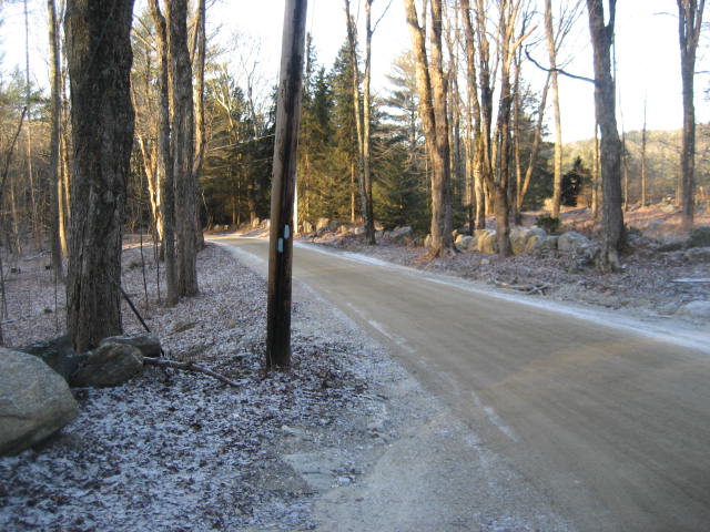
As Roscoe and I set out, the temperature was hovering around 15 degrees. The trail starts by immediately turning right (north) and following a dirt road, which my MapMyHike app tells me is Great Hollow Road.
If you’ve read through my previous re-caps, you already know how the Mattatuck has a couple of breaks. I encountered the first break as I was finishing up Hike # 75 at Bissell Road in Litchfield. The trail begins again for a short 1.9 mile stretch over Prospect Mountain (also in Litchfield). On the west side of Prospect Mountain, I encountered the second break while on Hike # 76b. When the trail begins again, for a third time, it does so in a different town…Cornwall, Connecticut.
The start of this section can be found on Flat Rocks Road. There is a small parking location where the trail begins with room for maybe three cars.
The Walk Book lists the distance from Flat Rocks Road to the Mohawk Trail junction, where the Mattatuck ends, at 5.9 miles. But, while I was researching this hike, I noted a re-route listed on the CFPA’s website. Sadly, the trail notice didn’t indicate exactly how much distance this re-route would add to my trip. So, while I knew it would be longer than 5.9 miles one way, I didn’t know exactly how much longer. Regardless, I was determined to finish this section in one shot in an attempt to avoid the long drive (1 hour and 15 minutes) from our house in East Hartford to Cornwall.
As Roscoe and I set out, the temperature was hovering around 15 degrees. The trail starts by immediately turning right (north) and following a dirt road, which my MapMyHike app tells me is Great Hollow Road.
|
|
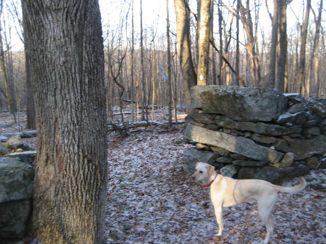
The trail follows Great Hollow Road for about 1/10 of a mile before making a slight right turn (heading northeast) and crossing a stone wall. Around the 7/10 of a mile mark, the trail crosses another (larger) stone wall near a brook and turns left (northwest). Here it follows the large stone wall for a while. Later, it crosses through a break in the wall…
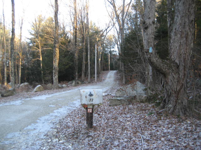
Now the trail follows the large stone wall on the opposite side but still heads in the same direction. At the north end of the wall, the trail makes a hard right and heads northwest. Around the 1.0 mile mark, the trail turns right on to a dirt road. 2/10 of a mile later, the trail comes to College Street.
I was caught a bit off guard here as I was expecting to make a left on College Street (as the Walk Book instructs). But, instead, the blazes told me to make a right. Reviewing the Walk Book notes, I noticed it does mention something about a “wet and difficult passage” so I was thankful to find that I would be avoiding that section. So, the trail follows College Street to the southeast for about 2/10 of a mile before re-entering the woods on the left.
I believe the College Street re-route to be very recent as 1.) it wasn’t listed on the CFPA website along with the other re-route I was expecting later on this hike and 2.) there didn’t seem to be a lot of foot traffic through this next subsection. Additionally, the blazes looked freshly painted and there were a lot of ribbons still hanging from the trees. To be honest, there isn’t much of a trail here at all…but there are blazes and they are generally easy to follow. The trail heads generally southeast then switches back to the northeast.
Around the 1.9 mile mark, the trail comes out to an old woods road and makes a left turn. 2/10 of a mile later, it makes a right on a different woods road (Perkins Road, according to the map in the Walk Book). If you haven’t already realized it, there are a lot of turns on this section of the Mattatuck.
Roscoe and I followed Perkins Road downhill for about 4/10 of a mile. Now at the 2.5 mile mark, we came to the re-route I expected to find…thanks again to the trail notice on the CFPA website. Before turning right and following the trail, I stopped to check out the path the trail used to take. Again I was thankful for a re-route, because it looked to me like the trail previously went right through a marsh.
Because of the re-route, the trail again heads to the southeast, up and down some hilly terrain, and through a thick stand of mountain laurel before it comes out to Great Hill Road (around the 3.0 mile mark). The trail follows the road for a stretch before making a right on Camp Road (towards YMCA Camp Mohawk).
We followed Camp Road for about 4/10 of a mile before making a right on a gravel road which leads to Mohawk Pond. Around the 3.6 mile mark, the trail leaves the gravel road and re-enter the woods. Here, it travels around the southwestern and western edge of the pond and starts to ascend to the summit of Mohawk Mountain, crossing over to the town of Goshen in the process.
The ascent to Mohawk Mountain is not continuous. There are several places where, after a brisk climb, the trail flattens out or descends. One such instance is when the trail reaches a gravel road (Wadhams Road) and turns right. After following the road downhill for about 1/10 of a mile, it makes a left turn (re-entering the woods) and climbs several hundred feet.
Around the 4.3 mile mark, the trail makes a hard left turn and continues to climb as it re-enters Cornwall before a short descent where it again meets up with Wadhams Road. I immediately made a mental note to just follow the road on my return trip.
The trail doesn’t follow the road for very long and, after a slight left turn (at approximately the 5.0 mile mark); it begins the final climb to the summit. Over the next 4/10 of a mile, the trail climbs more than 200 feet in elevation. But all of our hard work was rewarded with some spectacular views to the south and north. Sadly, my camera battery was done for and I only have a good picture of the view to the south…
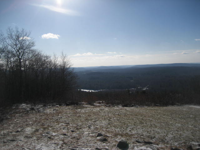
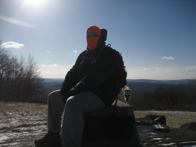
While we were at the summit, I was also able to get the picture at the top of this recap. I was expecting to be able to head up even higher, but the lookout tower at the top of the mountain looked to be enclosed by a barbed-wire fence. Once I returned home, I tried to research why the tower would be blocked off and, at the time of publishing this recap, I’m still not sure if it is open or closed to the public. I promise to do more research on this and, if it is open to the public, return someday. I didn’t let the disappointment of not climbing the fire tower get me down. I mean, here I was…only a day after breaking my personal best for elevation in CT…setting a new personal best…1683 feet.
From the summit, the trail follows an unnamed gravel road to the west for a bit before leaving the gravel road and descending to an area known as The Pinnacle (elevation: 1650 feet). Long-time readers of this blog will recall several other “Pinnacles” I encountered when I was just starting out as a truly novice hiker. I was happy to add this “Pinnacle” to the list.
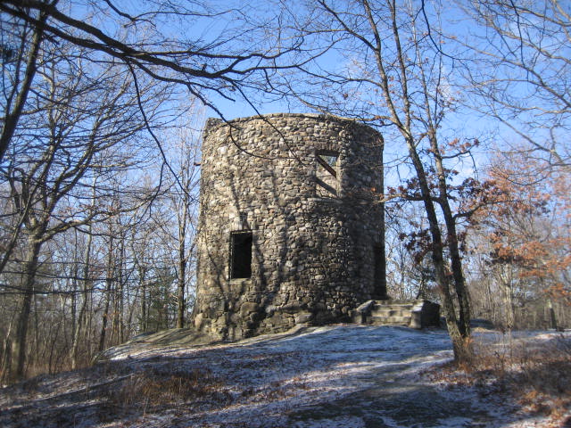
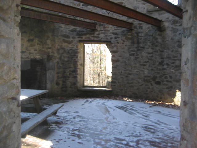
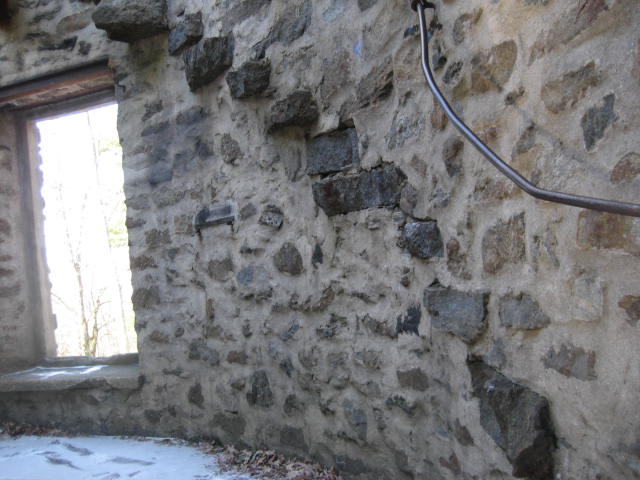
A little further down the mountain, around the 6.3 mile mark, the trail comes to a tower of a different sort. At 1510 feet, the trail passes right by Cunningham Tower. According to the Walk Book, the tower was built by Seymour Cunningham in 1915 while he was trying to purchase enough land for a private estate on Mohawk Mountain. His attempt to own the entire mountain was opposed by the residents of Cornwall and, upon losing in court, Cunningham sold the land to Alain White (a name which should be familiar to those of you who read through my recap for Hike # 75, when I travelled through White Memorial Foundation land).
From the summit, the trail follows an unnamed gravel road to the west for a bit before leaving the gravel road and descending to an area known as The Pinnacle (elevation: 1650 feet). Long-time readers of this blog will recall several other “Pinnacles” I encountered when I was just starting out as a truly novice hiker. I was happy to add this “Pinnacle” to the list.
A little further down the mountain, around the 6.3 mile mark, the trail comes to a tower of a different sort. At 1510 feet, the trail passes right by Cunningham Tower. According to the Walk Book, the tower was built by Seymour Cunningham in 1915 while he was trying to purchase enough land for a private estate on Mohawk Mountain. His attempt to own the entire mountain was opposed by the residents of Cornwall and, upon losing in court, Cunningham sold the land to Alain White (a name which should be familiar to those of you who read through my recap for Hike # 75, when I travelled through White Memorial Foundation land).
From Cunningham Tower, the trail continues heading north and downhill. Eventually, it comes out to Toomey Road (a paved road which leads to and from the summit) and follows that to the north. As I approached the end of the trail (approximately 6.8 miles from where I started), I heard a sound I had never heard before while hiking…the sound of snow making machines.
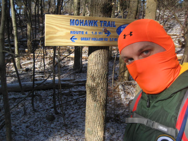
The end of the Mattatuck Trail, which ends at the junction with the Mohawk Trail, is within shouting distance of Connecticut’s Mohawk Mountain Ski Area. I heard a few people enjoying themselves and I was tempted to follow the Mohawk Trail for a bit so I could scout out the ski area, but the trail was basically a sheet of ice…probably from the runoff/re-freezing of the water which originated from the snow guns…so I decided it could wait for another day. I did, however, take a photo to mark the end of my journey.
The end of the Mattatuck Trail, which ends at the junction with the Mohawk Trail, is within shouting distance of Connecticut’s Mohawk Mountain Ski Area. I heard a few people enjoying themselves and I was tempted to follow the Mohawk Trail for a bit so I could scout out the ski area, but the trail was basically a sheet of ice…probably from the runoff/re-freezing of the water which originated from the snow guns…so I decided it could wait for another day. I did, however, take a photo to mark the end of my journey.
As I turned to head back to my car, I told the Mohawk Trail I would “come back for you”. My hope is to tackle that trail sometime later this year. But, I think I’m going to wait until it gets a little warmer before I head back to this area of the state. I think it would be a mistake not to take advantage of the fact that the air is always a bit cooler come late spring/early summer. I’ll probably head up this way again when Central CT gets too “buggy”…we’ll see if I can wait that long.
I’d like to close out this recap by posting my goal for 2014. Those of you who frequent these recaps know about my goal for 2013 (365 miles in 365 days…which I nailed), so I thought I would let you in on my new goal. For 2014, instead of distances, I’m shooting for “new heights”. What I mean by that is I want to take my current list of top peaks and absolutely destroy it. For example, up until only a few days ago, Soapstone Mountain in Somers was my highest CT elevation (and 3rd overall). I want to climb so many more peaks with higher elevations that it pushes Soapstone Mountain out of my top 25. I realize that isn’t a “goal” in the sense that hiking 365 miles in 365 days is…but it is a goal nonetheless. And, I will still continue to track my mileage for the year in the event that I surpass my 2013 mileage in the process. Let’s see how I do…
I’d like to close out this recap by posting my goal for 2014. Those of you who frequent these recaps know about my goal for 2013 (365 miles in 365 days…which I nailed), so I thought I would let you in on my new goal. For 2014, instead of distances, I’m shooting for “new heights”. What I mean by that is I want to take my current list of top peaks and absolutely destroy it. For example, up until only a few days ago, Soapstone Mountain in Somers was my highest CT elevation (and 3rd overall). I want to climb so many more peaks with higher elevations that it pushes Soapstone Mountain out of my top 25. I realize that isn’t a “goal” in the sense that hiking 365 miles in 365 days is…but it is a goal nonetheless. And, I will still continue to track my mileage for the year in the event that I surpass my 2013 mileage in the process. Let’s see how I do…
For a map of this hike, along with elevation data, please click here.
Total 2014 Mileage: 12.85
