Hike #1
Trail: Metacomet
Section: Rt. 372 (Plainville, CT) to Prattling Pond Road (Farmington, CT)
Distance: 6.3 miles
Date Hiked: 10/15/2011
Date Published: 12/14/2012
Trail: Metacomet
Section: Rt. 372 (Plainville, CT) to Prattling Pond Road (Farmington, CT)
Distance: 6.3 miles
Date Hiked: 10/15/2011
Date Published: 12/14/2012
I don’t remember all of the specifics, but I first became interested in hiking this section of the Metacomet when I heard that there was an old Nike Missile base along the way. While looking for information about the base, I found a website called CT Museum Quest, or CTMQ. You can visit the site at http://www.ctmuseumquest.com/. In summary, the site is a personal blog by a guy from West Hartford named Steve who is determined to dispel the myth that there is nothing to do in CT. Cool idea. In the fourteen months since I started hiking, I’ve relied on Steve’s blog a lot. And, this particular hike happened well before I purchased the Connecticut Forest & Park Association’s Walk Book. So, I relied heavily on Steve’s blog for information on this hike.
Once I told Jaci of my plan and asked her to drop me off at the Rt. 372 trail head, she insisted on joining me on the adventure. Remember this for later…in no way did I beg, plead or bargain with her to have her come along. She went of her own free will.
Prior to this fine October Saturday, my only experience with hiking was a few quick hikes in areas like Rocky Neck State Park in Lyme and the Heublein Tower Trail in Simsbury. Both of these trails I like to call “touristy”. Meaning on any given day, you are bound to run into more than just a handful of people who are also hiking. Some days on the Heublein Tower Trail, you can see over 100 people. So, these trails aren’t what most people would call “rugged”. I’ll delve more into the Tower Trail in a later blog. But for now, just know that Rocky Neck and the “Tower Trail” are fairly simple hikes. Other than those hikes, I didn’t have a lot of other hiking knowledge to draw upon.
On top of that, we’d recently watched the movie 127 Hours so our biggest concern was getting stuck in the middle of the woods with no means of reaching the outside world. Looking back on it now, it’s funny to think that we actually texted my friend Tim to let him know where we were going, how long we expected to be gone, and when to send out the search party if he didn’t hear from me. Knowing what I know about the hike now, I probably didn't need to do that. That said, anyone new to hiking should always tell at least one person where they are going and how long they will be gone. As you will come to find out from my experiences, you just never know what could happen.
The truth about this section is that you are never so deep into the woods that you don’t hear the highway, barking dogs, or the occasional gas-powered lawn tools. This, being October in New England, it was leaf-blower month. As close as you are to civilization, the trail can still be rocky in areas. So, I wouldn't recommend this to anyone as a first hike. There are plenty of other trails in the area for beginners, many of which I will cover on this site. You can start there.
Before we even dropped off my car, we knew we were in trouble. I had done a lot of research before the hike and I knew that the NBC TV towers were the halfway point of the trip. As we were dropping off my car in Farmington, we could see the towers and they seemed light years from where we were. Regardless, we left my car at the small commuter lot on Rt. 4 in Farmington and drove due South on I-84 (84 is technically an East / West highway, but those of you familiar with CT know that this doesn’t always apply…especially in the case of I-95). As we drove, we could see the previously mentioned towers and I couldn’t help but think (again) how far off in the distance they seemed. Eventually, we parked across from the Blue “Metacomet Trail” Oval on Rt. 372 in Plainville.
The trail immediately crosses an old railroad track and skirts along a fence. This is followed by a somewhat strenuous climb. This climb will be pretty challenging for those of you who are out of shape (like Jaci and I were at the time). Fortunately for you, about halfway up, there is a little area where you can rest. It overlooks the trail you just hiked and the lot where we parked our car. Take a minute and check out the cactus growing on this little overlook. Yes, there is cactus in Connecticut. Who knew?
Once you reach the top of the first summit, the trail gets easier for the next several miles. There will be another, very challenging descent / climb section close to the halfway point, but we’ll get to that. For now, the trail crosses over an ATV / Jeep trail several times and eventually leads to a nice overlook to the West. There is even a swing for you to rest and catch your breath.
After about a mile and a half, the trail eventually makes it to the Nike Missile Base. I won’t say I was disappointed, but it wasn’t as cool as I thought it would be. I didn’t expect to see turrets, radar towers and soldiers (if you go here expecting to see these things, you will be severely disappointed). And, I knew there wasn’t much here before we even left the house. But, regardless, I was still disappointed. It’s basically just a barb wire fence on top of a cliff.
A few more steps down the trail there is a much better experience. It is here that you can encounter one of several overlooks called “The Pinnacle” in Connecticut. At the time of this publishing, I’m aware of several but I’ve only hiked to the top of one other “Pinnacle”…and it just happens to also be on the Metacomet (I’ll blog about that at a later date).
Somewhere in the next stretch is a place called Hospital Rock. You have to go off-trail to find it and there isn’t a lot of information about how to get there (I think those who have been there are not forthcoming with information because they are concerned about graffiti, vandalism, etc.). At the time, I wasn’t comfortable going off-trail so we elected to save Hospital Rock for another day. But, you can read about it…as I did…at http://www.ctmuseumquest.com/?page_id=1292.
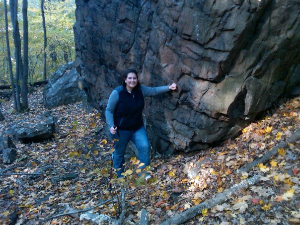
A mile or so from “The Pinnacle”, you will encounter an area called Rattlesnake Cliffs. It is here that Jaci and I spent a while trying to figure out where the trail went. If you miss the turn like we did, and stay straight, you will cross a power-line cut and find a cool ledge overlooking an old quarry. There is also a very cool view of Downtown Hartford. It is, however, off-trail. So, we explored the area for a few minutes, took a drink of water, and eventually doubled back to find that the trail goes down, down, down a steep cliff face. Expert hikers will find this to be a breeze, but novice hikers will struggle here. And, struggle we did. But, we took our time (as you should) and eventually made our way to the bottom…only to stare back up at the cliff on the opposite side.
Eventually, we began our ascent...and looking back on it now, this is one of the cooler climbs I’ve experienced. But, at the time, it was a nightmare. One of the cool features is a little rock formation (about 1/3 of the way up) that you have to climb through…as in, you climb over one section of the rock while ducking to keep from hitting your head on the other section of the rock. I had to take off my pack to fit through, but Jaci made it through without any trouble. She did, however, struggle with the rest of the climb and fell a bit behind. Normally, I wouldn’t point that out. It’s not like I need to brag about being in better shape than anybody (at the time; I was weighing in at over 350 pounds). I tell you that she fell behind in order to tell you that it was at this point that I saw the biggest, blackest, stretched-out bike tire lookingest snake I have ever seen in my life.
Those of you who know Jaci well, know how much she hates snakes and I remember thinking to myself “please don’t let her see it...please don’t let her see it…please don’t let her see it” and…he was gone. Once he realized I wasn’t food (and was blocking the sun he so desperately craved), he moved off in the other direction and was out of sight by the time she rounded the last turn at the top of the climb. Crisis averted. Or so I thought…
Once you reach the top of the climb there is a geo-cache box with a notebook. We each took the time to sign it and turned around to be on our way. It was at this time that we saw another couple hiking the opposite direction on the trail.
I’m not an expert in snakes so, at the time, I didn’t know what kind of snake I had seen. I didn’t know if it was poisonous. But, I thought I had to, at least, give the other couple a heads up…so, confession time. I told Jaci what I had seen and she proceeded to freak out…in spite of my best efforts to keep her calm.
Eventually, she relaxed enough for me to strike up a conversation with the other couple. I told them about the snake. The female hiker theorized it was a Black Racer, common in these parts (I found out later it was more likely I saw a Black Rat Snake…they are bigger and slower, according to what I read about both snakes). While we were chatting, I realized the female hiker looked familiar. So, I asked if her name was what I thought her name was and it was. Make sense? Good. Basically, she is the friend of an ex-girlfriend of mine who I hung out with a handful of times ten years ago. It was a pretty cool “blast from the past” moment...right there in the middle of the woods. Then, we were on our way.
Shortly after the climb, you pass by Will Warren’s Den…which is cool in that it is one of only a handful of actual caves here in CT. You can read more about Will Warren and the folklore surrounding his den at http://www.ctmuseumquest.com/?page_id=932.
Shortly after that, you reach the TV towers and the unofficial halfway point. The area around the towers is a cool experience because they look so much smaller when you're on the highway. From the ground around the tower, they appear to go up forever. I took a minute to ponder what it must be like to be the guy who climbs the ladder on the side of the tower (for maintenance?). I have an immense fear of heights and don’t even like to stand too close to the cliffs on top of some of these ledges. Eventually, I got vertigo just from looking up and staring. So, we moved along.
A half mile later, the trail heads across Route 6. There is room for a few cars here if you wanted to use this as an alternative spot to park. At a distance of 4.1 miles, it would certainly save you a lot of time. But, we had already committed to the 6.3 distance. So, we trekked on.
I don’t recall much about the next mile of the trail other than we crossed an area where there was a “bed” of worms. Did you know that a group of worms is called a bed? Well, now you do. Educational. Once we got to that area, Jaci freaked out because they were big and they reminded her of snakes. Irrational fears are funny when they are other people’s irrational fears. But, at the time, I was tired and hungry…which means I was also cranky…and not the good, understanding husband I am usually. So, I hurried her along.
At about the 5 mile mark, the trail runs past 50 Cent’s house in Farmington. I forget who the house originally belonged too (Oprah?) but Mike Tyson also lived there at one point. It was pretty cool. I was tempted to yell out and try to convince him to give me a spot on his next album, but decided it best to just keep my head down and hike on.
After a quick road hike, the trail eventually passes through what looks like someone’s front yard. I’m always impressed that people allow hikers to just cut through their yards. I’m the guy who put up a fence when we noticed foot tracks in the snow through our backyard. So, I always make a point to thank the land owner if I see them out in their yards.
The last section of the hike is an interesting one. It cuts through the area of the Hill-Stead Museum and it looks like there is some nice hiking along some of the alternate trails. Maybe one day we...I…will return to explore the area. For now, we just kept hiking until we eventually came to Route 4…crossed it…and made our way back to the car. Jaci went straight for salvation. I decided to take 30 seconds and continue on the actual Metacomet a little longer. It ducks through a hole in a fence and skirts along Route 4 before reaching Prattling Pond Road. I turned right on Prattling Pond Road, crossed Route 4 again…and returned to the car.
Once I told Jaci of my plan and asked her to drop me off at the Rt. 372 trail head, she insisted on joining me on the adventure. Remember this for later…in no way did I beg, plead or bargain with her to have her come along. She went of her own free will.
Prior to this fine October Saturday, my only experience with hiking was a few quick hikes in areas like Rocky Neck State Park in Lyme and the Heublein Tower Trail in Simsbury. Both of these trails I like to call “touristy”. Meaning on any given day, you are bound to run into more than just a handful of people who are also hiking. Some days on the Heublein Tower Trail, you can see over 100 people. So, these trails aren’t what most people would call “rugged”. I’ll delve more into the Tower Trail in a later blog. But for now, just know that Rocky Neck and the “Tower Trail” are fairly simple hikes. Other than those hikes, I didn’t have a lot of other hiking knowledge to draw upon.
On top of that, we’d recently watched the movie 127 Hours so our biggest concern was getting stuck in the middle of the woods with no means of reaching the outside world. Looking back on it now, it’s funny to think that we actually texted my friend Tim to let him know where we were going, how long we expected to be gone, and when to send out the search party if he didn’t hear from me. Knowing what I know about the hike now, I probably didn't need to do that. That said, anyone new to hiking should always tell at least one person where they are going and how long they will be gone. As you will come to find out from my experiences, you just never know what could happen.
The truth about this section is that you are never so deep into the woods that you don’t hear the highway, barking dogs, or the occasional gas-powered lawn tools. This, being October in New England, it was leaf-blower month. As close as you are to civilization, the trail can still be rocky in areas. So, I wouldn't recommend this to anyone as a first hike. There are plenty of other trails in the area for beginners, many of which I will cover on this site. You can start there.
Before we even dropped off my car, we knew we were in trouble. I had done a lot of research before the hike and I knew that the NBC TV towers were the halfway point of the trip. As we were dropping off my car in Farmington, we could see the towers and they seemed light years from where we were. Regardless, we left my car at the small commuter lot on Rt. 4 in Farmington and drove due South on I-84 (84 is technically an East / West highway, but those of you familiar with CT know that this doesn’t always apply…especially in the case of I-95). As we drove, we could see the previously mentioned towers and I couldn’t help but think (again) how far off in the distance they seemed. Eventually, we parked across from the Blue “Metacomet Trail” Oval on Rt. 372 in Plainville.
The trail immediately crosses an old railroad track and skirts along a fence. This is followed by a somewhat strenuous climb. This climb will be pretty challenging for those of you who are out of shape (like Jaci and I were at the time). Fortunately for you, about halfway up, there is a little area where you can rest. It overlooks the trail you just hiked and the lot where we parked our car. Take a minute and check out the cactus growing on this little overlook. Yes, there is cactus in Connecticut. Who knew?
Once you reach the top of the first summit, the trail gets easier for the next several miles. There will be another, very challenging descent / climb section close to the halfway point, but we’ll get to that. For now, the trail crosses over an ATV / Jeep trail several times and eventually leads to a nice overlook to the West. There is even a swing for you to rest and catch your breath.
After about a mile and a half, the trail eventually makes it to the Nike Missile Base. I won’t say I was disappointed, but it wasn’t as cool as I thought it would be. I didn’t expect to see turrets, radar towers and soldiers (if you go here expecting to see these things, you will be severely disappointed). And, I knew there wasn’t much here before we even left the house. But, regardless, I was still disappointed. It’s basically just a barb wire fence on top of a cliff.
A few more steps down the trail there is a much better experience. It is here that you can encounter one of several overlooks called “The Pinnacle” in Connecticut. At the time of this publishing, I’m aware of several but I’ve only hiked to the top of one other “Pinnacle”…and it just happens to also be on the Metacomet (I’ll blog about that at a later date).
Somewhere in the next stretch is a place called Hospital Rock. You have to go off-trail to find it and there isn’t a lot of information about how to get there (I think those who have been there are not forthcoming with information because they are concerned about graffiti, vandalism, etc.). At the time, I wasn’t comfortable going off-trail so we elected to save Hospital Rock for another day. But, you can read about it…as I did…at http://www.ctmuseumquest.com/?page_id=1292.
A mile or so from “The Pinnacle”, you will encounter an area called Rattlesnake Cliffs. It is here that Jaci and I spent a while trying to figure out where the trail went. If you miss the turn like we did, and stay straight, you will cross a power-line cut and find a cool ledge overlooking an old quarry. There is also a very cool view of Downtown Hartford. It is, however, off-trail. So, we explored the area for a few minutes, took a drink of water, and eventually doubled back to find that the trail goes down, down, down a steep cliff face. Expert hikers will find this to be a breeze, but novice hikers will struggle here. And, struggle we did. But, we took our time (as you should) and eventually made our way to the bottom…only to stare back up at the cliff on the opposite side.
Eventually, we began our ascent...and looking back on it now, this is one of the cooler climbs I’ve experienced. But, at the time, it was a nightmare. One of the cool features is a little rock formation (about 1/3 of the way up) that you have to climb through…as in, you climb over one section of the rock while ducking to keep from hitting your head on the other section of the rock. I had to take off my pack to fit through, but Jaci made it through without any trouble. She did, however, struggle with the rest of the climb and fell a bit behind. Normally, I wouldn’t point that out. It’s not like I need to brag about being in better shape than anybody (at the time; I was weighing in at over 350 pounds). I tell you that she fell behind in order to tell you that it was at this point that I saw the biggest, blackest, stretched-out bike tire lookingest snake I have ever seen in my life.
Those of you who know Jaci well, know how much she hates snakes and I remember thinking to myself “please don’t let her see it...please don’t let her see it…please don’t let her see it” and…he was gone. Once he realized I wasn’t food (and was blocking the sun he so desperately craved), he moved off in the other direction and was out of sight by the time she rounded the last turn at the top of the climb. Crisis averted. Or so I thought…
Once you reach the top of the climb there is a geo-cache box with a notebook. We each took the time to sign it and turned around to be on our way. It was at this time that we saw another couple hiking the opposite direction on the trail.
I’m not an expert in snakes so, at the time, I didn’t know what kind of snake I had seen. I didn’t know if it was poisonous. But, I thought I had to, at least, give the other couple a heads up…so, confession time. I told Jaci what I had seen and she proceeded to freak out…in spite of my best efforts to keep her calm.
Eventually, she relaxed enough for me to strike up a conversation with the other couple. I told them about the snake. The female hiker theorized it was a Black Racer, common in these parts (I found out later it was more likely I saw a Black Rat Snake…they are bigger and slower, according to what I read about both snakes). While we were chatting, I realized the female hiker looked familiar. So, I asked if her name was what I thought her name was and it was. Make sense? Good. Basically, she is the friend of an ex-girlfriend of mine who I hung out with a handful of times ten years ago. It was a pretty cool “blast from the past” moment...right there in the middle of the woods. Then, we were on our way.
Shortly after the climb, you pass by Will Warren’s Den…which is cool in that it is one of only a handful of actual caves here in CT. You can read more about Will Warren and the folklore surrounding his den at http://www.ctmuseumquest.com/?page_id=932.
Shortly after that, you reach the TV towers and the unofficial halfway point. The area around the towers is a cool experience because they look so much smaller when you're on the highway. From the ground around the tower, they appear to go up forever. I took a minute to ponder what it must be like to be the guy who climbs the ladder on the side of the tower (for maintenance?). I have an immense fear of heights and don’t even like to stand too close to the cliffs on top of some of these ledges. Eventually, I got vertigo just from looking up and staring. So, we moved along.
A half mile later, the trail heads across Route 6. There is room for a few cars here if you wanted to use this as an alternative spot to park. At a distance of 4.1 miles, it would certainly save you a lot of time. But, we had already committed to the 6.3 distance. So, we trekked on.
I don’t recall much about the next mile of the trail other than we crossed an area where there was a “bed” of worms. Did you know that a group of worms is called a bed? Well, now you do. Educational. Once we got to that area, Jaci freaked out because they were big and they reminded her of snakes. Irrational fears are funny when they are other people’s irrational fears. But, at the time, I was tired and hungry…which means I was also cranky…and not the good, understanding husband I am usually. So, I hurried her along.
At about the 5 mile mark, the trail runs past 50 Cent’s house in Farmington. I forget who the house originally belonged too (Oprah?) but Mike Tyson also lived there at one point. It was pretty cool. I was tempted to yell out and try to convince him to give me a spot on his next album, but decided it best to just keep my head down and hike on.
After a quick road hike, the trail eventually passes through what looks like someone’s front yard. I’m always impressed that people allow hikers to just cut through their yards. I’m the guy who put up a fence when we noticed foot tracks in the snow through our backyard. So, I always make a point to thank the land owner if I see them out in their yards.
The last section of the hike is an interesting one. It cuts through the area of the Hill-Stead Museum and it looks like there is some nice hiking along some of the alternate trails. Maybe one day we...I…will return to explore the area. For now, we just kept hiking until we eventually came to Route 4…crossed it…and made our way back to the car. Jaci went straight for salvation. I decided to take 30 seconds and continue on the actual Metacomet a little longer. It ducks through a hole in a fence and skirts along Route 4 before reaching Prattling Pond Road. I turned right on Prattling Pond Road, crossed Route 4 again…and returned to the car.
