Hike #26
Case Mountain Trails (Manchester, CT)
Distance: 1.84 miles
Date Hiked: 12/29/2012
Date Published: 1/18/2013
Case Mountain Trails (Manchester, CT)
Distance: 1.84 miles
Date Hiked: 12/29/2012
Date Published: 1/18/2013
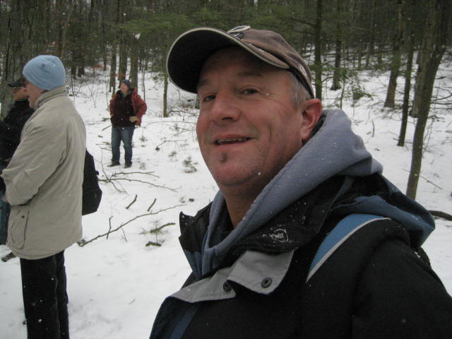
A few weeks before this hike, I had heard that the Connecticut Forest & Park Association (CFPA) was having a "Walk CT: Family Ramble Historical Hike" through the area around Case Mountain in Manchester. Roscoe wasn't allowed on this trip, so I asked Jaci if she wanted to come. And, up until the day of, she was on board. But, she ended up not feeling well so I was joined by my dad. He looked excited for our first hike together.
I wasn't sure what to expect on this hike. The CFPA website indicated this hike was open to families or singles. All in all, I would say about 30 people turned out. I also wasn't sure which trails we would take but I knew that we would explore the White Trail and make our way up to the viewpoint on Lookout Mountain. Finally, I wasn't sure what the weather would do since the forecast called for snow all day but it didn't actually start snowing until about ten seconds before the hike started.
From the Spring Street parking area, we made our way north over Birch Mountain Brook. My MapMyHike wasn't fully cooperative and I didn't get it to start working until we reached our first stop.
Right on Spring Street in Manchester are the original homes of the Case family. Famous for the paper mill built by the Case Brothers in the 1860s and 1870s, the area is now on the National Register of Historic Places. You can read more about that over at http://www.manchesterhistory.org/reprints/MHS3_CaseBros.html
In fact, most of the information we learned that day is readily available online. But, there was something cool about hearing it directly from someone familiar with the area and its history...all while hiking with my pops.
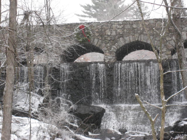
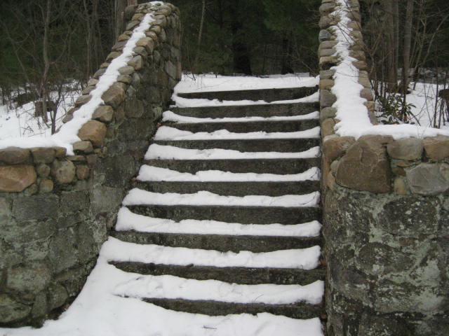
From the "mansions" on Spring Street, we made our way over a footbridge (the one with the wreath on it in the first picture on this page). This bridge has a "no tresspassing" sign. But, since we were on a guided tour, I figured we had permission to be up there. We passed some cool steps which led to what looked like a bamboo forest. According to our guide, these used to be tennis courts. The area is pretty overgrown now. I don't think anyone will be playing tennis up there anytime soon.
From the Spring Street parking area, we made our way north over Birch Mountain Brook. My MapMyHike wasn't fully cooperative and I didn't get it to start working until we reached our first stop.
Right on Spring Street in Manchester are the original homes of the Case family. Famous for the paper mill built by the Case Brothers in the 1860s and 1870s, the area is now on the National Register of Historic Places. You can read more about that over at http://www.manchesterhistory.org/reprints/MHS3_CaseBros.html
In fact, most of the information we learned that day is readily available online. But, there was something cool about hearing it directly from someone familiar with the area and its history...all while hiking with my pops.
From the "mansions" on Spring Street, we made our way over a footbridge (the one with the wreath on it in the first picture on this page). This bridge has a "no tresspassing" sign. But, since we were on a guided tour, I figured we had permission to be up there. We passed some cool steps which led to what looked like a bamboo forest. According to our guide, these used to be tennis courts. The area is pretty overgrown now. I don't think anyone will be playing tennis up there anytime soon.
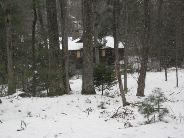
From here, we followed a carriage path (not to be confused with the Carraige Trail) around the area of Case Pond. Some sections of the retaining wall were in need of repair and had broken off...falling down the hill and into the pond. We continued to follow the carriage path until we came to an abandoned cottage. According to our guide, this was originally a summer cabin for the Case family. Later, it became someone's home. But, after the oil company refused to continue serving the home (they had trouble getting up there in the winter), the home owner was forced to vacate. At the time, the town was concerned the area would be sold and developed. So, they stepped in and purchsed the home and the surrounding property...which makes me happy because it makes it so that I can hike these woods. Sadly, some vandals got into the house and destroyed some of the leftover belongings, forcing the town to board up the windows and put up a fence.
From the cabin, we made our way out to the White Trail and then the Blue Trail (The Shenipsit Trail). I've written about both of these trails in previous recaps. So, I won't talk about them again. But, I will mention that these trails were a lot more challenging in the snow. Still, nothing a novice hiker can't handle, just slightly more difficult.
On the way up, I was discussing my adventures along the Shenipsit with my dad and one of our fellow hikers was surprised to learn that the trail we were on went all the way down to Cobalt. She was from Portland and seemed excited to know that she could hike from there to Manchester. So, I hit her with the fact that the trail also continues north to within a few miles of the Massachusetts border. Look at me...being all knowing about the Shenipsit...haha...who would have ever thought?
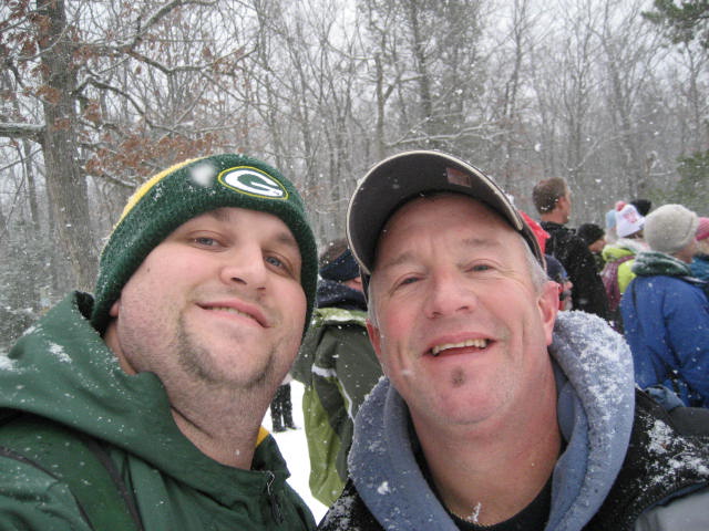
Anyway, we continued following the Blue Trail up to where it connects with the Yellow Trail and then followed that over to the viewpoint on Lookout Mountain. On a clear day, downtown Hartford and Main Street in Manchester are visible. On this day, however, the only view was of the falling snow...which was coming down pretty good. So, instead of a picture of the view...we took a picture of the coolest looking objects in the area. :)
On the way up, I was discussing my adventures along the Shenipsit with my dad and one of our fellow hikers was surprised to learn that the trail we were on went all the way down to Cobalt. She was from Portland and seemed excited to know that she could hike from there to Manchester. So, I hit her with the fact that the trail also continues north to within a few miles of the Massachusetts border. Look at me...being all knowing about the Shenipsit...haha...who would have ever thought?
Anyway, we continued following the Blue Trail up to where it connects with the Yellow Trail and then followed that over to the viewpoint on Lookout Mountain. On a clear day, downtown Hartford and Main Street in Manchester are visible. On this day, however, the only view was of the falling snow...which was coming down pretty good. So, instead of a picture of the view...we took a picture of the coolest looking objects in the area. :)
Once we were done enjoying the "view" we made our way back out to Spring Street via the White Trail.
This was a nice hike. What it lacked in distance it made up for in information. I felt it was a great way to wrap up my hiking for 2012. And, I look forward to more of these CFPA guided hikes in 2013!
This was a nice hike. What it lacked in distance it made up for in information. I felt it was a great way to wrap up my hiking for 2012. And, I look forward to more of these CFPA guided hikes in 2013!

