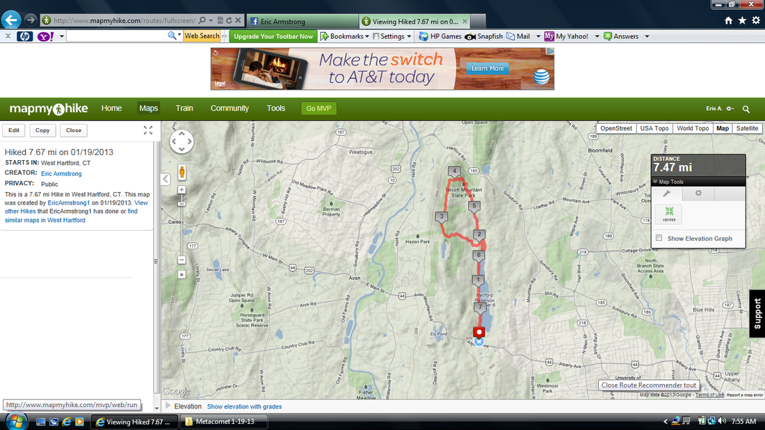
Hike #32
Trail: Metacomet
Section: Hartford Reservoir # 6 to Alternate Trail North Junction
Distance: 7.67 miles
Approx Time to Complete: 3.25 hours
Date Hiked: 1/19/2013
Date Published: 1/28/2013
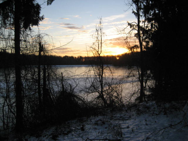
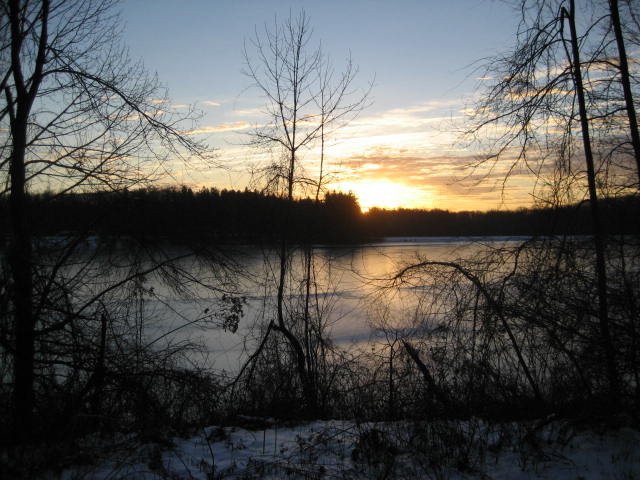
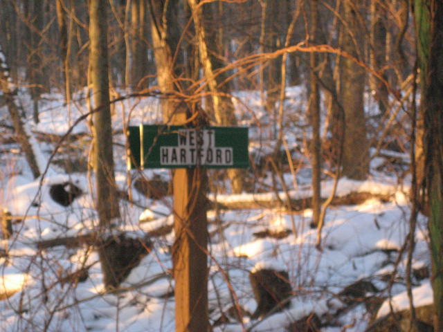
For this hike, I would be picking up the Metacomet Trail from the parking area by Hartford Reservoir #6 (right off of Rt. 44 in West Hartford. This is where, one week earlier, the group I was hiking with left off (Hike # 29). I had tried to put together another group hike, but everyone else was busy so it was just me and Roscoe. In a way, this worked to my advantage because I was able to hit the trail just before dawn and saw an amazing sunrise over the reservoir. I took the pictures you see below but they really don’t show just how amazing it was.
Trail: Metacomet
Section: Hartford Reservoir # 6 to Alternate Trail North Junction
Distance: 7.67 miles
Approx Time to Complete: 3.25 hours
Date Hiked: 1/19/2013
Date Published: 1/28/2013
For this hike, I would be picking up the Metacomet Trail from the parking area by Hartford Reservoir #6 (right off of Rt. 44 in West Hartford. This is where, one week earlier, the group I was hiking with left off (Hike # 29). I had tried to put together another group hike, but everyone else was busy so it was just me and Roscoe. In a way, this worked to my advantage because I was able to hit the trail just before dawn and saw an amazing sunrise over the reservoir. I took the pictures you see below but they really don’t show just how amazing it was.
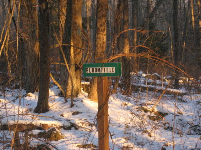
The first mile and a half or so is very easy going. The trail basically just follows a dirt road that meanders along the western edge of the reservoir. As we walked, we crossed from West Hartford into Bloomfield. I stopped to take a picture of the marker showing the boundary line
between the two towns.
between the two towns.
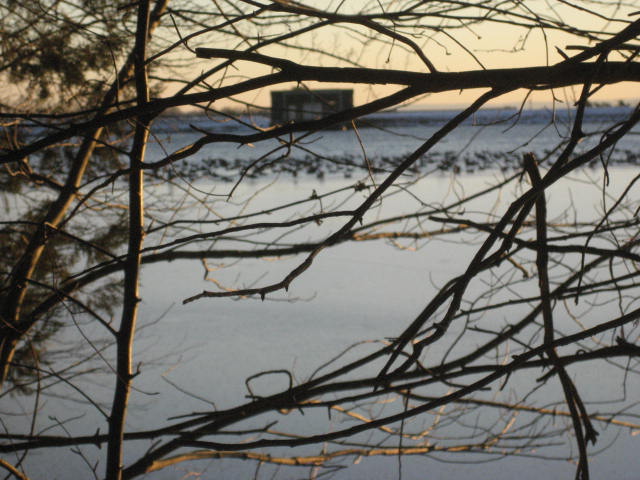
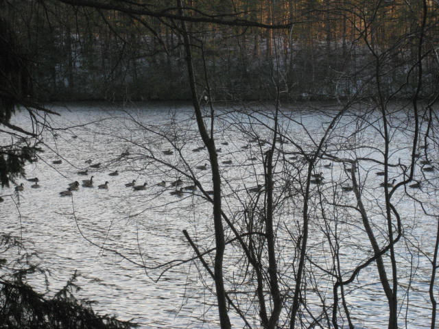
As we strolled along this initial stretch, I began to see what looked like stones which stretched the entire width of the reservoir. They looked
almost as if you could hop from one stone to the next all the way from the western shore to the eastern shore…assuming you had good
balance. As we got closer to the “stones” on the western shore, I began to hear the familiar honking of Canadian Geese. Come to find out, the geese were just hanging out in the area where the water had frozen to ice. I’m not exaggerating when I tell you there were about 500 geese just hanging out. I took a couple of pictures.
After the first mile and a half, the main Metacomet trail makes a slight left turn and heads into the woods. It also climbs, gradually over the next half mile or so.
At around the two mile mark, the trail makes a hard left and starts heading west. It also starts to climb more quickly. Over the course of the next mile or so, it will continue to ascend all the way to Heublein Tower. On the way up, I was keeping an eye to the northwest. And, at one point, I could just make out the top of the tower over the tree line. Unfortunately, it didn’t stand out well enough to show up in the pictures I
took.
This section of the trail was familiar to me. Back in October, with the leaves changing over, I took a trip up to the tower via the Tower Trail. After visiting the tower, I made my way down this same section. It is a lot more challenging going up. But, I’m in much better shape than I was back then. So, it wasn’t too bad.
Around the two and half mile mark, I crossed the power line and gas pipeline cuts I am, at the point, all too familiar with. I’ve blogged about them before because I’ve crossed these guys at least a dozen times since starting out on the Metacomet Trail…at least; I assume they are the same cuts.
Shortly after the power line/gas pipeline combo, the trail crosses a road but it is closed to vehicular traffic so you don’t need to worry about getting hit. Last time I went through the area, I did see a maintenance truck coming up the hill…but I think that was a rare occasion.
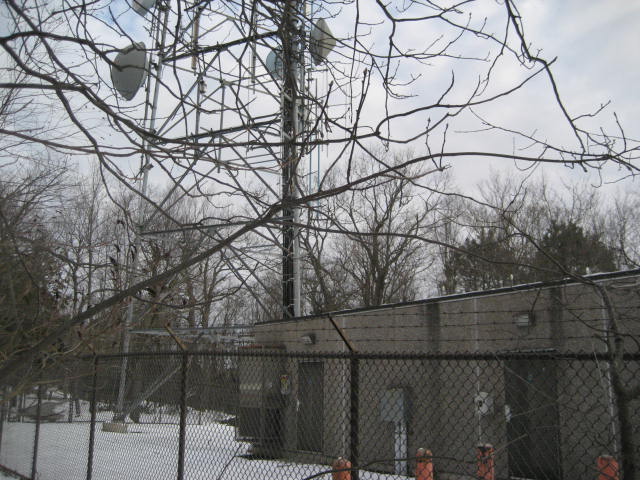
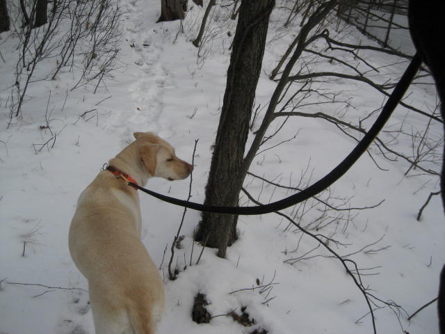
Regardless, once the trail crosses the road it turns ever so slightly to the right and starts to head northwest. It also continues to ascend (gradually again at this point) before coming to a communications tower. I snapped a picture of that, followed by a picture of Roscoe’s leash to show just how windy it was on top of the mountain.
At around the two mile mark, the trail makes a hard left and starts heading west. It also starts to climb more quickly. Over the course of the next mile or so, it will continue to ascend all the way to Heublein Tower. On the way up, I was keeping an eye to the northwest. And, at one point, I could just make out the top of the tower over the tree line. Unfortunately, it didn’t stand out well enough to show up in the pictures I
took.
This section of the trail was familiar to me. Back in October, with the leaves changing over, I took a trip up to the tower via the Tower Trail. After visiting the tower, I made my way down this same section. It is a lot more challenging going up. But, I’m in much better shape than I was back then. So, it wasn’t too bad.
Around the two and half mile mark, I crossed the power line and gas pipeline cuts I am, at the point, all too familiar with. I’ve blogged about them before because I’ve crossed these guys at least a dozen times since starting out on the Metacomet Trail…at least; I assume they are the same cuts.
Shortly after the power line/gas pipeline combo, the trail crosses a road but it is closed to vehicular traffic so you don’t need to worry about getting hit. Last time I went through the area, I did see a maintenance truck coming up the hill…but I think that was a rare occasion.
Regardless, once the trail crosses the road it turns ever so slightly to the right and starts to head northwest. It also continues to ascend (gradually again at this point) before coming to a communications tower. I snapped a picture of that, followed by a picture of Roscoe’s leash to show just how windy it was on top of the mountain.
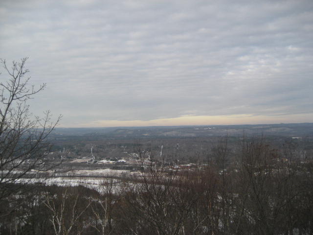
I also took a picture of the view of the Farmington River Valley. I’ve taken plenty of these before. But, this is the first I’ve taken in the middle of January.
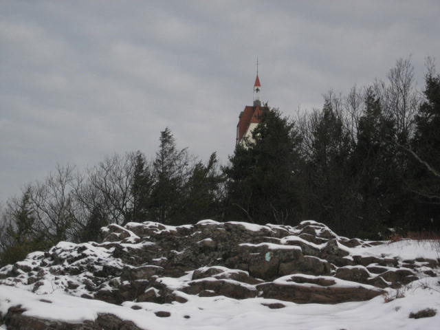
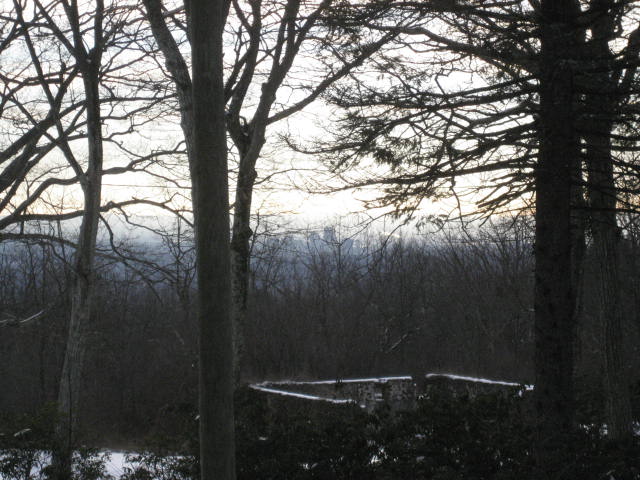
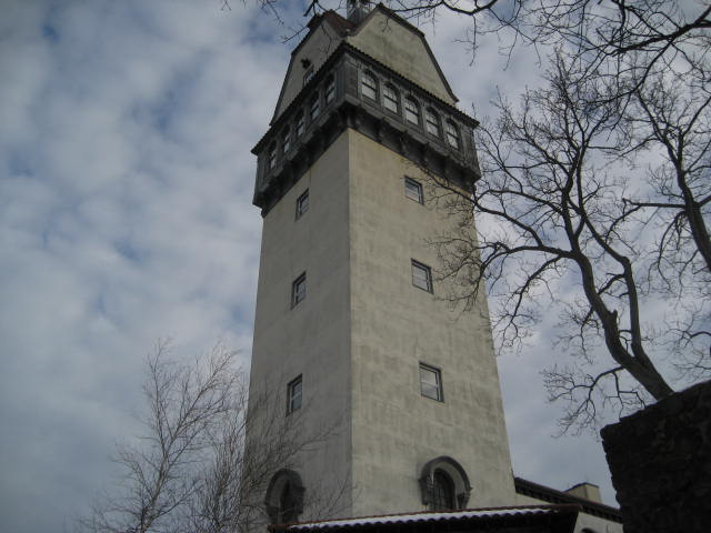
I got a
bit crazy with the camera at this point. The following pictures are of the tower (at a distance), downtown Hartford (you can
see the outline through the trees), and the tower (close-up).
see the outline through the trees), and the tower (close-up).
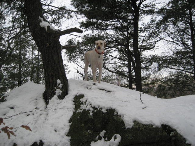
From the area of the tower, the Metacomet Trail turns away from the Tower Trail. I was actually surprised to find this out. I had always thought that the Metacomet Trail and the Tower Trail followed the same path down to the parking area on Summit Ridge Drive. So, even though I thought I would be covering trail I already covered, I was happy to know that this would be new trail to me. Roscoe was, apparently, also excited…as he quickly climbed to the top of this rock to claim his place as king of the mountain.
Shortly before the four mile mark, the trail makes a right turn and heads back to the east. It also
starts to descend. Over the next half mile or so, it continues to descend and eventually turns to
the right again…heading south. Here, it starts to descend more rapidly. At this point, I was
on the eastern side of the ridge.
on the eastern side of the ridge.
Eventually, the trail will swing lazily back to the east for a bit. And, if you stick to the Metacomet, it will swing back to the north again. However, I was looking for the blue and red blazed alternate trail, which would take us south and back to the car. At around the four and half mile mark, I found it. We made the right turn and started following the alternate trail due south.
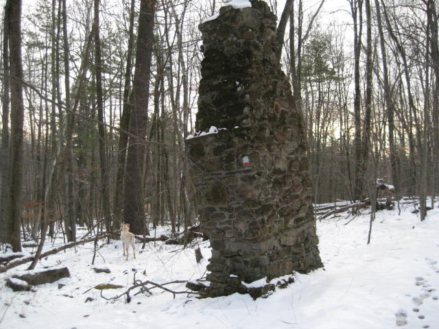
I was (again) traveling on familiar trail. Back in October, I had used the alternate trail to complete my loop hike. On that day, I had taken this
trail south to north. Today, I was traveling north to south but I was experiencing all of the same “highlights”. In the picture below, you can see the old chimney which Jaci called too “Blair-witchy” back in October. I like this picture better because, if you can find Roscoe, you can see just how big this old chimney is.
As we made our way along the alternate trail (over the next mile or so), we crossed back over my favorite power line cut. I was sad to see a dead raccoon in the middle of the cut. I have never seen a raccoon in the wild and I was hoping to come across a live one before I saw a dead one. Aside from my own personal selfishness, I found it odd that this guy had died where he did. He didn’t appear to have been killed by any predators. And, there appeared to be plenty food and water in the area. I was also miles from the closest road so it wasn’t like he was road kill or anything. Strange.
Eventually, we made our way back to where the alternate trail meets up with the reservoir and followed the western edge (back on the actual Metacomet) to the car.
Note: The last three miles of this hike are very flat and very straight. If you aren’t CT400 obsessed (and you have a second vehicle), I would suggest parking one of them at the parking area in Penwood State Park. You could cut considerable time and distance off of your trip. And, the actual Metacomet north of the junction with the alternate trail is a much more enjoyable experience.
Distance to 2013 Goal: 332.08 miles