Hike #35
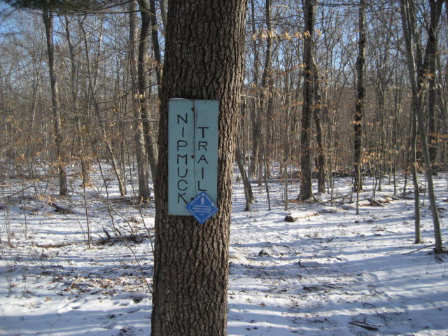
Trail: Nipmuck
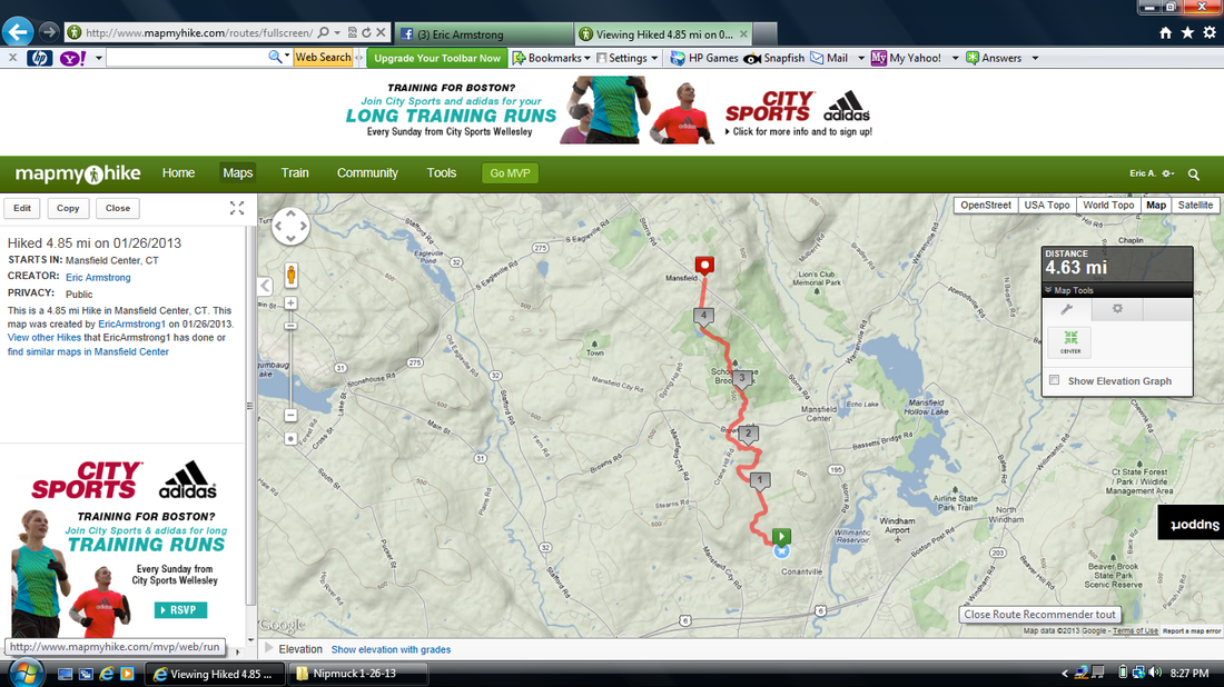
Section: Puddin’ Lane (Mansfield, CT) to Mansfield Historical Society (Mansfield, CT)
Direction of Travel: South to North
Distance: 4.85 miles
Approx Time to Complete: 2.75 hours
Date Hiked: 1/26/2013
Date Published: 1/31/2013
Trail: Nipmuck
Section: Puddin’ Lane (Mansfield, CT) to Mansfield Historical Society (Mansfield, CT)
Direction of Travel: South to North
Distance: 4.85 miles
Approx Time to Complete: 2.75 hours
Date Hiked: 1/26/2013
Date Published: 1/31/2013
Ahhhhhhh, the start of a new trail! And, I was going to do it right this time! South to North…Beginning to End…Start to Finish…as it was intended. Only, when I got up on this morning…I didn’t even know for sure that I was going to hike this trail. Make sense? Okay, I’ll start over.
Every other “Long-Distance” Trail I’ve hiked so far (including the Metacomet, Mattabesett, and Shenipsit), I’ve started in the middle and made my way randomly through the sections. Even with the Natchaug (which I originally started at the beginning), I ended up hiking section # 2 in the opposite way of which it was intended. With the Nipmuck, I wanted to start from section #1 and work my way north…covering the sections in the exact order and direction in which they were intended.
However, when I woke up on this Saturday morning, I was intending to complete section #3 of the Natchaug Trail (after I got my haircut, of course). Since I only had the one car, that section hike would have been an “out and back” that would have brought me and Roscoe just short of ten miles.
When I got back in the car after my haircut, I was surprised to find a text message from my dad asking if I was going hiking. I was thrilled at the prospect of hiking with my dad so I immediately called him. And, he was on board to join me. Roscoe and I made our way over to my parent’s house (they live within five minutes of my barber) and waited for my dad to finish breakfast. As excited as I was, I think Roscoe was even more excited that his “Grampy” was coming with us. Don’t hate on our dog love.
Anyway, now that I had two cars available, I decided to begin my journey along the Nipmuck. I also thought, based on what I had read, this would make a good hike with my dad because he would enjoy some of the “highlights” described in the CFPA Walk Book. So, we made our way from their house…dropped my car at the Mansfield Historical Society (after initially driving by it)…and parked the truck on Puddin’ Lane in Mansfield. At first, I was worried about what we might find when we got to the trail head (assuming we could even find it) but we didn’t have any trouble parking at all. It helped that it was roughly 14 degrees outside when we started and we were the only idiots hiking the trail that day.
According to the CFPA Walk Book, the Nipmucks (for who this trail is named), were an Algonquin Indian Tribe that lived in what is now central Massachusetts. The Nipmuck Trail, which extends north from Mansfield to the Nipmuck State Forest in Union (where I had been spending my time hiking the trails of Bigelow Hollow State Park recently), is roughly shaped like an upside-down fork. There are two southern branches. The West Branch, which starts on Puddin’Lane, is the trail we would be hiking today. The East Branch, which starts at the Department of Environmental Protection parking lot on North Windham Road, would have to wait for another day.
A good portion of the trail we would be travelling on the Wast Branch is protected by Joshua’s Trust, which (again, according to the CFPA Walk Book) was established in 1966. With the purpose of protecting and preserving historic sites and natural resources, Joshua’s Trust is named for the son of Uncas, the Mohegan Sachem. The trust honors Joshua’s act of bequeathing a tract of land roughly equal to the towns of Ashford, Columbia, Coventry, Lebanon, Franklin, Mansfield, Scotland, and Windham to a group of settlers from Norwich. Today, the trust oversees more than 1,000 acres of land.
The trail starts by heading north and, over the course of the next half mile or so, makes its way to a connector trail. If you are hiking the trail in anything other than 14 degree weather (like we were) you might have trouble parking at the southern trailhead. If so, there is an alternate parking area on Jacobs Hill Road. The connector trail (which comes in from the left) connects the main Nipmuck Trail with that parking area.
From the connector trail, we made a slight right and followed the trail to the northeast. Here, the trail also descends to Sawmill Brook. We followed the brook for another half mile or so before we came to a power line cut. Shortly after, we came to a marshy area. The trail loops around the marsh on the western edge.
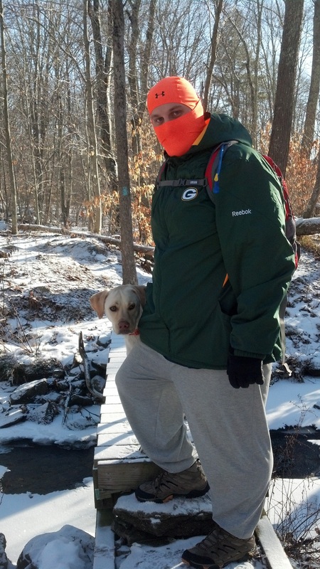
Roughly a mile and a quarter in, we followed the trail when it turned right (east) and crossed Sawmill Brook. The CFPA Walk Book has a note about crossing the brook on stepping stones, but (as you can see from the picture below) there is most definitely a bridge here. Cross on the stones if you wish, but I wasn’t interested in falling in the water with the temperature in the teens…even if we were only a mile or so in.
A good portion of the trail we would be travelling on the Wast Branch is protected by Joshua’s Trust, which (again, according to the CFPA Walk Book) was established in 1966. With the purpose of protecting and preserving historic sites and natural resources, Joshua’s Trust is named for the son of Uncas, the Mohegan Sachem. The trust honors Joshua’s act of bequeathing a tract of land roughly equal to the towns of Ashford, Columbia, Coventry, Lebanon, Franklin, Mansfield, Scotland, and Windham to a group of settlers from Norwich. Today, the trust oversees more than 1,000 acres of land.
The trail starts by heading north and, over the course of the next half mile or so, makes its way to a connector trail. If you are hiking the trail in anything other than 14 degree weather (like we were) you might have trouble parking at the southern trailhead. If so, there is an alternate parking area on Jacobs Hill Road. The connector trail (which comes in from the left) connects the main Nipmuck Trail with that parking area.
From the connector trail, we made a slight right and followed the trail to the northeast. Here, the trail also descends to Sawmill Brook. We followed the brook for another half mile or so before we came to a power line cut. Shortly after, we came to a marshy area. The trail loops around the marsh on the western edge.
Roughly a mile and a quarter in, we followed the trail when it turned right (east) and crossed Sawmill Brook. The CFPA Walk Book has a note about crossing the brook on stepping stones, but (as you can see from the picture below) there is most definitely a bridge here. Cross on the stones if you wish, but I wasn’t interested in falling in the water with the temperature in the teens…even if we were only a mile or so in.
At this point, as it heads east for a bit, the trail becomes an old woods road. It follows the road for about a quarter of a mile before it intersects with a yellow-blazed alternate trail. The alternate trail, which apparently was a Boy Scout project, provides an alternate trail up to Wolf Rock.
My dad and I, being the tough men that we are (hiking in the 14 degree weather), decided the alternate trail was beneath us. We stuck to the main Nipmuck and ascended to the top of Wolf Rock. It wasn’t the easiest climb I’ve ever done, but I also fail to see the need for the alternate trail. I guess, if you are traveling with little kids, it makes sense…but I’ve also seen kids as young as five or six climb the steeper of the trails leading up to Heublein Tower. So, again, I say I fail to see the need for it.
My dad and I, being the tough men that we are (hiking in the 14 degree weather), decided the alternate trail was beneath us. We stuck to the main Nipmuck and ascended to the top of Wolf Rock. It wasn’t the easiest climb I’ve ever done, but I also fail to see the need for the alternate trail. I guess, if you are traveling with little kids, it makes sense…but I’ve also seen kids as young as five or six climb the steeper of the trails leading up to Heublein Tower. So, again, I say I fail to see the need for it.

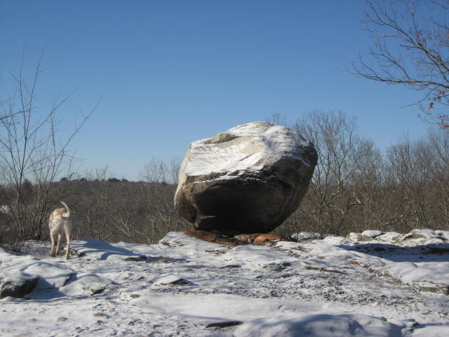
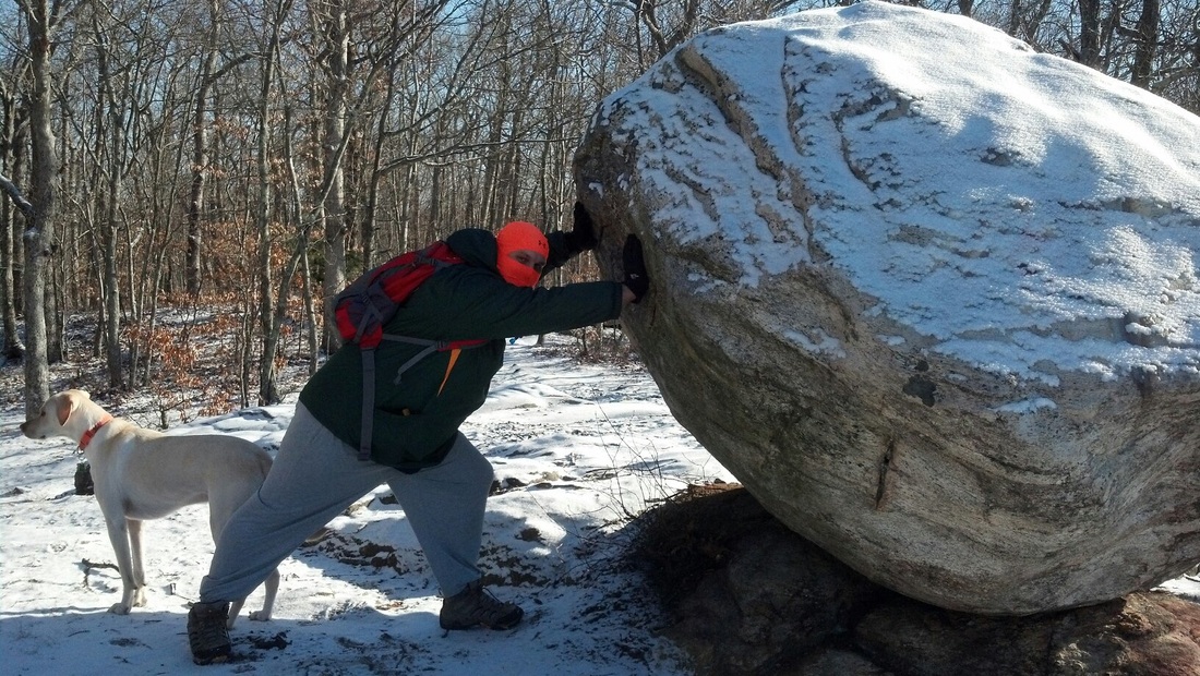
We spent some time hanging out in the area of Wolf Rock, discussing how the rock got there. After some theorizing, we thought we found some
notches (you can kind of see them in the last picture above) on the side of the rock which faces north…and we believe this is where someone fastened some iron hooks. That way, the rock could be carried by crane or some other piece of construction equipment. Reflecting on this now, I find it odd that there just happens to be a road in the area called Crane Hill Road. Curious.
The CFPA Walk Book attempts to play up the mystique of the area by talking about former wolf dens at the bottom of the cliff. I won’t pretend to be an expert in wolf dens (although I do like wolves…and have some knowledge about them), but I didn’t see anything that even remotely resembled a wolf den. I’m not sure why they would feel the need to embellish about the area. So, I won’t go as far as to call them liars. But, the whole thing is just a bit much.
Regardless of who or what put the rock there…and if there are former wolf dens in the area…the view from the top of the ledge is spectacular. At an elevation of only 509 feet, this proves that it isn’t always about the elevation. A good view is a good view. Of course, the picture below doesn't do it justice.
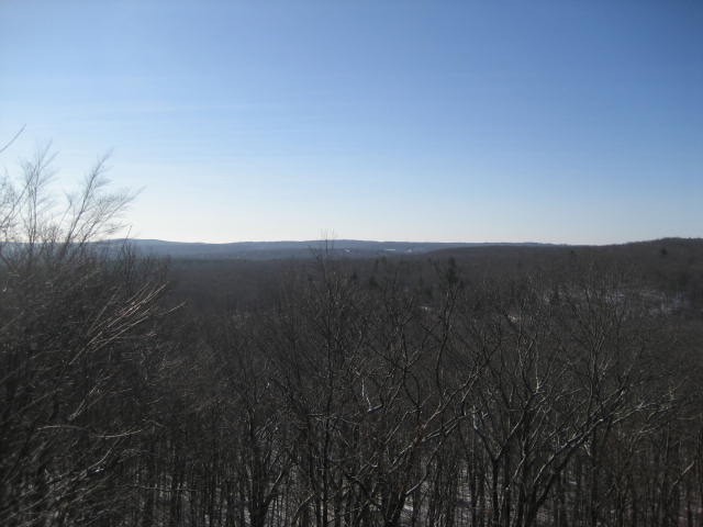
As we were packing up to leave the area, I decided (at the last minute) to pop out my binoculars and see if could locate the campus of Eastern Connecticut State University. I read somewhere that, on a clear day, the campus is visible from the top of the ledge. And, I can confirm that it is…in fact…visible. At first, we weren’t 100% certain…but the clock tower and blue rooftops are unmistakable. Pretty cool.
From the area of Wolf Rock, the trail heads northwest and eventually descends (via an unnecessary staircase) to Crane Hill Road. We crossed the road and made our way through a rock jungle, being careful not to twist our ankles.
A quarter of a mile after crossing Crane Hill Road, we came to Browns Road…but not before one of those awkward trail moments where you feel like you are cutting through someone’s yard (if you look to the left of the picture below, you can see a wood fence). Fortunately, the trail is marked well and nobody seemed to care that we were traveling through their yard on this cold January day.
The trail follows Browns Road (as a road walk) for about 50 feet and then re-enters the woods on the left. At this point, we had reached the halfway point of our trip.
Shortly after Browns Road, the trail travels through Schoolhouse Brook Park. The park, which is on town-owned land, has a number of trails which intersect with The Nipmuck. All of the trails are clearly marked and, even though we thought we lost our way once, we did not.
Around the three and a quarter mile mark, we crossed Clover Mill Road. There is some additional parking here (for maybe one or two cars). It is marked on the CFPA Walk Book map but not noted in the write up. If you are interested in a shorter hike, you could use this as a second vehicle location.
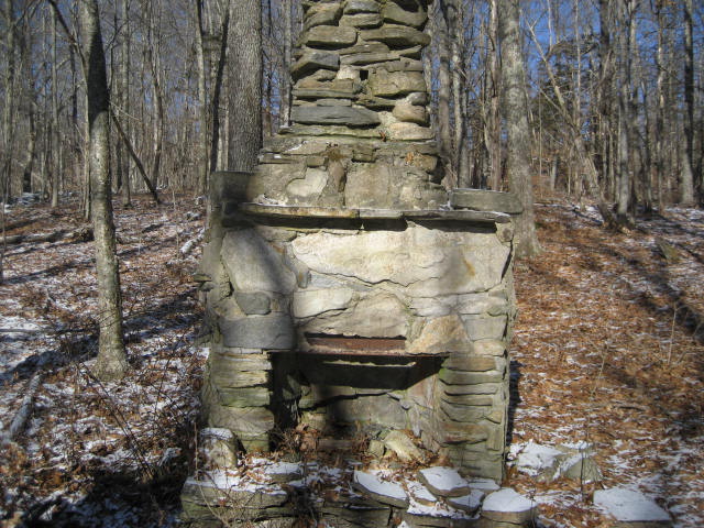
Shortly after re-entering the woods, the trail crosses a stream. After crossing the stream, we noticed some old chimneys up on a hill and took a short side trail to the right so we could check them out.
Shortly after Browns Road, the trail travels through Schoolhouse Brook Park. The park, which is on town-owned land, has a number of trails which intersect with The Nipmuck. All of the trails are clearly marked and, even though we thought we lost our way once, we did not.
Around the three and a quarter mile mark, we crossed Clover Mill Road. There is some additional parking here (for maybe one or two cars). It is marked on the CFPA Walk Book map but not noted in the write up. If you are interested in a shorter hike, you could use this as a second vehicle location.
Shortly after re-entering the woods, the trail crosses a stream. After crossing the stream, we noticed some old chimneys up on a hill and took a short side trail to the right so we could check them out.
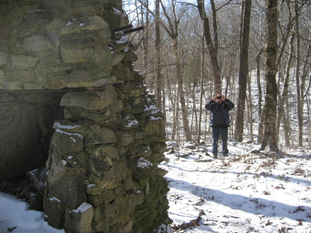
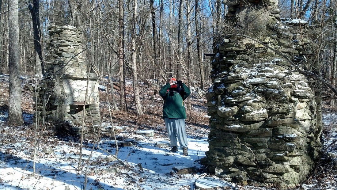
Are we the only guys who take pictures of each other while taking a picture? For the record, this was totally spontaneous and I know my dad got as much of a kick out of this as I did. This, on top of many other things about him, is why my dad is the best!
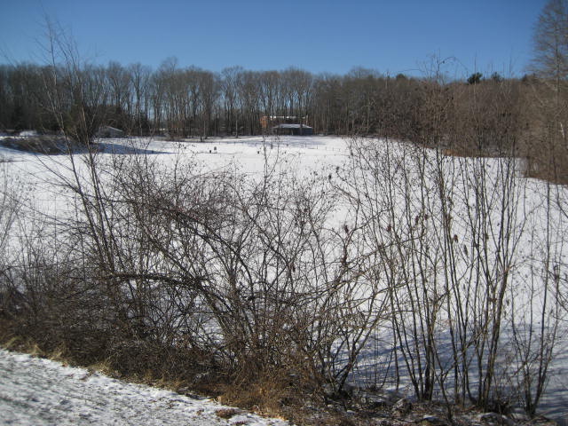
We made our way back to the Nipmuck and started making our way uphill, following the stream as we went along. Along the way, we noticed an old dam…which had been torn down (either naturally or not-so-naturally). Further uphill, we noticed another (notably more recent) dam and eventually came to Bicentennial Pond. On these hikes, I don’t remember everything I previously read about in the Walk Book so I was pleasantly surprised by this development. Of course, it was frozen so it just looks like a field...but I assure you this is, in fact, a pond.
We made our way back to the Nipmuck and started making our way uphill, following the stream as we went along. Along the way, we noticed an old dam…which had been torn down (either naturally or not-so-naturally). Further uphill, we noticed another (notably more recent) dam and eventually came to Bicentennial Pond. On these hikes, I don’t remember everything I previously read about in the Walk Book so I was pleasantly surprised by this development. Of course, it was frozen so it just looks like a field...but I assure you this is, in fact, a pond.
After we were done exploring the area of the pond, we made our way back to the Nipmuck and followed it…heading north now. A couple of deer scurried off and we both agreed that we were glad to see them. Personally, I went through a long stretch of hikes where I didn’t see any deer. And, I was glad my dad got to see them.
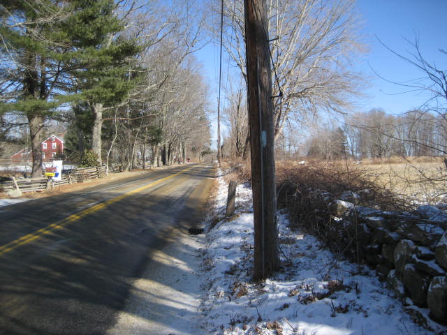
Just before the four and a half mark, and the intersection with Spring Hill Road, the trail comes to a pipeline cut and someone’s backyard. Someone placed a blue arrow on a tree to mark where the trail goes to make sure that hikers don’t cross on to the landowner’s property. When you get to this point, just head towards the field in the area (see below).
Just before the four and a half mark, and the intersection with Spring Hill Road, the trail comes to a pipeline cut and someone’s backyard. Someone placed a blue arrow on a tree to mark where the trail goes to make sure that hikers don’t cross on to the landowner’s property. When you get to this point, just head towards the field in the area (see below).

Just before actually passing the field, we made a left and follow a rock wall (at this point, you should see the blazes). We followed along the rock wall and made our way out to Spring Hill Road.
We made a right and started the road walk which would end our trip. We stopped, though, when we heard and saw a helicopter coming our way. We had heard him earlier in the day so we stopped to watch him fly over head. He saw us and pulled a few maneuvers which we thought were meant to entertain us. That was probably something I will never again experience while hiking…and I thought it was pretty cool. Sadly, at the time, I didn’t think to take out my camera.
After our own personal air show, we continued hiking along Spring Hill Road. It wasn’t long before we made our way out to Rt. 195, crossed it and made it back to my car.
On the way back to my dad’s truck, we reflected on how cool this hike was. He seemed genuinely excited about it and I was excited that he was excited. Later, after I returned home and took a quick nap, I called him to see if he would be interested in picking up the trail the next day where we left off. And, he said he was. Sweeeeeeeeet!
Stay tuned as we continue our journey along the Nipmuck Trail…
Distance to 2013 goal: 313.66