Hike #36
Trail: Nipmuck
Section: Mansfield Historical Society (Mansfield, CT) to Old Turnpike Road (Mansfield, CT)
Direction of Travel: South to North
Distance: 5.65 miles
Approx Time to Complete: 2.75 hours
Date Hiked: 1/27/2013
Date Published: 2/1/2013
Trail: Nipmuck
Section: Mansfield Historical Society (Mansfield, CT) to Old Turnpike Road (Mansfield, CT)
Direction of Travel: South to North
Distance: 5.65 miles
Approx Time to Complete: 2.75 hours
Date Hiked: 1/27/2013
Date Published: 2/1/2013
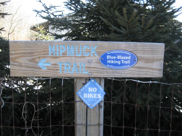
A day after our first adventure along the Nipmuck Trail, my dad joined Roscoe and I as we made our way along section # 2. We still had a section of the West Branch left to tackle, before we started in on the East Branch, so we started our hike where we left off the day before…at the Mansfield Historical Society.
Before we made our way over to the Historical Society, we left his truck in a small parking area off of Old Turnpike Road, just off of Rt. 44 (near the intersection with Rt. 195). There were a few small parking locations along the side of the road. We choose one that was about halfway between where the trail reaches Old Turnpike Road and where the road intersects with Rt. 44. Our reason for doing this was because it allowed us to break the road walk along Old Turnpike Road up over the course of two trips. Which makes sense because we didn’t really want to end this trip on a long road walk…and we didn’t really want to start our next hike through the area with a long road walk. Logical.
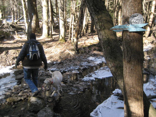
From the lot behind the Mansfield Historical Society, the trail heads north for a minute, but quickly turns to the right and follows an old woods road in a northeasterly direction. The trail descends gradually as it follows the woods road. In fact, we spent most of our day descending…which was earned by ascending the whole day on our previous hike.
I noticed several deer tracks in the area and they seemed to be fresh. As I’ve written previously, I am not an expert tracker. But, something about the way the snow around the tracks was kicked up, led me to believe that these deer tracks were so fresh that the deer were running away from…us. And, not to toot my own horn, but it wasn’t long before we saw proof positive that those tracks were fresh. Off in the distance, we saw a whole herd running off in the other direction. There was no way for us to count all of them, but there was at least 8 or 9 deer. I was excited about this development because it either matches or beats the largest number of deer I’ve seen in one place. It was a cool moment, especially given how early it happened into our hike.
About a half of a mile into the hike, we came to a gas pipeline right-of-way. Soon after, we reached the junction of the East and West branches…which is called the “North/South Junction”.
Before we made our way over to the Historical Society, we left his truck in a small parking area off of Old Turnpike Road, just off of Rt. 44 (near the intersection with Rt. 195). There were a few small parking locations along the side of the road. We choose one that was about halfway between where the trail reaches Old Turnpike Road and where the road intersects with Rt. 44. Our reason for doing this was because it allowed us to break the road walk along Old Turnpike Road up over the course of two trips. Which makes sense because we didn’t really want to end this trip on a long road walk…and we didn’t really want to start our next hike through the area with a long road walk. Logical.
From the lot behind the Mansfield Historical Society, the trail heads north for a minute, but quickly turns to the right and follows an old woods road in a northeasterly direction. The trail descends gradually as it follows the woods road. In fact, we spent most of our day descending…which was earned by ascending the whole day on our previous hike.
I noticed several deer tracks in the area and they seemed to be fresh. As I’ve written previously, I am not an expert tracker. But, something about the way the snow around the tracks was kicked up, led me to believe that these deer tracks were so fresh that the deer were running away from…us. And, not to toot my own horn, but it wasn’t long before we saw proof positive that those tracks were fresh. Off in the distance, we saw a whole herd running off in the other direction. There was no way for us to count all of them, but there was at least 8 or 9 deer. I was excited about this development because it either matches or beats the largest number of deer I’ve seen in one place. It was a cool moment, especially given how early it happened into our hike.
About a half of a mile into the hike, we came to a gas pipeline right-of-way. Soon after, we reached the junction of the East and West branches…which is called the “North/South Junction”.
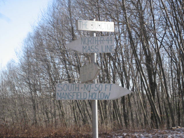
From here, we could've made a right turn and followed the East Branch through Mansfield Hollow State Park. But, we were saving that hike for another day. We made a slight left turn and continued making our way north, back to the truck which we left a little over 5 miles from here.
Over the next quarter of a mile or so we continued following the woods road as it made its way northwest. Eventually, we came to a sharp right turn and followed it. We were now following a different woods road, but it would lead us back to the same gas pipeline right-of-way we saw at the North-South Junction. The CFPA Walk Book notes some recent logging in this area and I can only assume that the last half mile or so was a reroute. When I look at my MapMyHike map, the section I just described looks really out of place. I'm not sure if it translates to the map below, but if you look right around the one mile mark, you should be able to make it out.
Once we reached the pipeline right-of-way (the second time), we made a left and followed the pipelines out to Bousa Road.
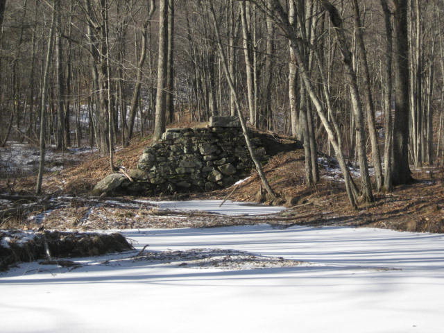
After we crossed Bousa Road, the trail re-entered the woods and came to what looked like the foundations of an old bridge. As we looked across the Fenton River, we could see similar foundations directly on the opposite side. There is also a more modern bridge in the area so it made sense that this was once a bridge. Now the only question is if this was used for vehicle traffic or railroad traffic. Later, I searched Google in an attempt to find out, but the only thing that I came up with was a picture someone painted. Below is a picture from the western edge of the river.
From the old bridge foundation, the trail actually doubles back towards the road for a stretch and required us to cross the new bridge. It doesn’t double back quite as far as the road, but it goes back far enough to use the dirt area just off the road in order to cross the river. This section seemed almost as out of place as the earlier reroute we experienced. The only reason I can think of to do this is to make sure that people see both foundations of the old bridge. I can’t complain about that because it was pretty cool.
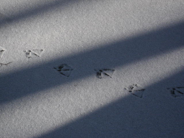
As we were making our way to the concrete bridge abutment, a couple of mallard ducks took off from the river. I hadn’t seen them until they took off and, when they did; it scared the“you-know-what” out of me. I took the picture below as we were crossing the bridge abutment. I like it because you can see our shadows at the edge of the river.
As we were making our way to the concrete bridge abutment, a couple of mallard ducks took off from the river. I hadn’t seen them until they took off and, when they did; it scared the“you-know-what” out of me. I took the picture below as we were crossing the bridge abutment. I like it because you can see our shadows at the edge of the river.
Once on the other side of the river, we passed through the area of the other old bridge strut. And, I took another picture…this time, looking back at the area we passed through earlier. If you look closely, you can see the rock Roscoe was standing next to in the previous picture.
Not too far from the area of the old bridge, we found some duck tracks on the ice covering the river. I would venture to guess that these were the same ducks that caught me by surprise moments earlier.
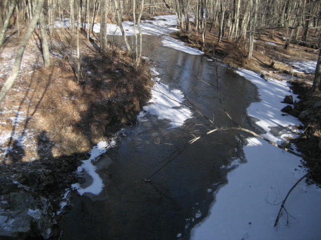
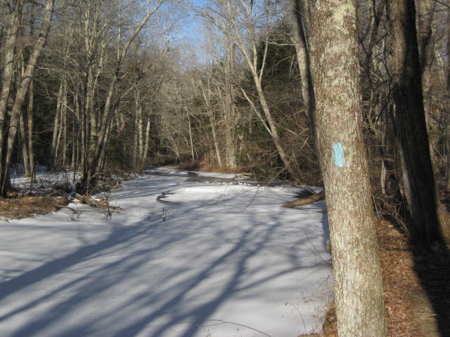
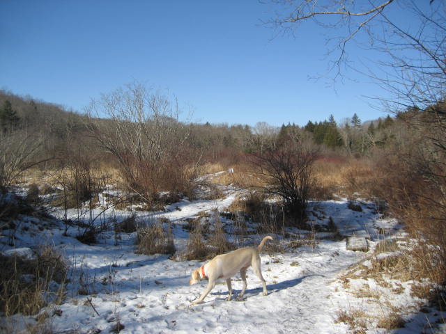
From here, the trail generally follows the Fenton River for the next three miles. But, to say that implies that there isn’t much else to see in that entire span…which couldn’t be any further from the truth. Before we get into the detailed stuff, here are a few pictures of the (partially frozen) river…
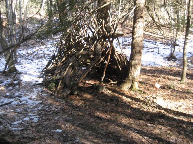
As we followed the trail along the eastern bank of the river, we were also only a short distance from Chaffeeville Road. Occasionally we would hear a car pass by, but the traffic wasn’t too heavy so it was nice. We came across a random tent looking structure someone made out of tree branches. This lead to my dad and I discussing how, if I lost everything tomorrow, I would live in something similar to this…instead of under a bridge or on a city park bench. I really hope I never have to make that decision, either way.
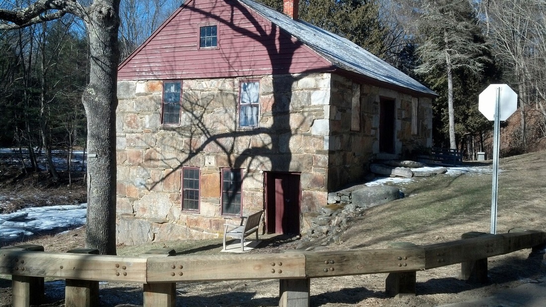
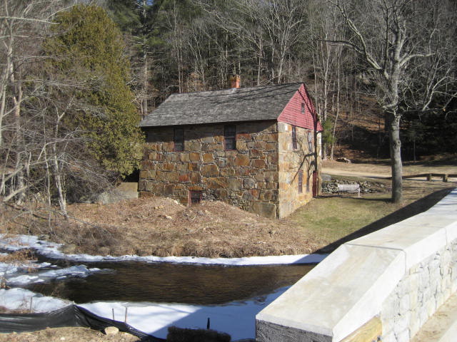
Roughly two and a half miles into our hike, we came to the Gurleyville Grist Mill. According to the CFPA Walk Book, the Gurleyville Grist Mill is an eighteenth-century structure that belonged to the father of Connecticut Governor Wilbur Cross. It now belongs to Joshua’s Trust (which I wrote about in my hike #35 recap) and it is one of few remaining grist mills in New England. When I got home, I found some more information about the mill (including tours) over at http://www.joshuaslandtrust.org/gristmill.html
From the mill, we made a left turn and followed Stonemill Road for a bit. We crossed over a bridge which was built in 2012. As one would expect, it looked brand new. After we crossed the bridge, the trail made a right turn and followed someone’s driveway for a second before bypassing their keypad/gate set-up and re-entering the woods on the right. We tried our best to get a good look at the house behind the gate, assuming it was most likely huge, but the forest was too thick and the house was up on a hill. Later, when I looked for the house on Google Maps, I could see they had tennis courts and everything. It must be nice to have money.
About a half of a mile later, we reached and crossed Gurleyville Road. The trail makes a right turn and follows the road for a stretch before turning left into the woods on the other side. There is an additional parking location here if you wanted to make this hike shorter.
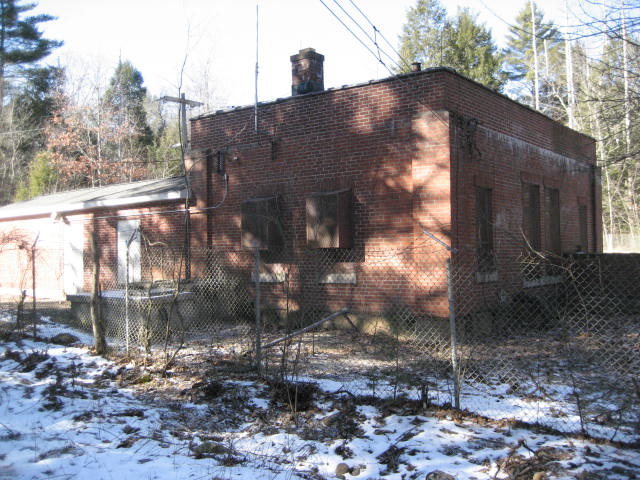
We continued our trek north and followed the Fenton River through the UCONN Forest. One of the “highlights” along the way included a brick building, which we both believed to be some kind of water pump for the nearby Storrs campus.
About a half of a mile later, we reached and crossed Gurleyville Road. The trail makes a right turn and follows the road for a stretch before turning left into the woods on the other side. There is an additional parking location here if you wanted to make this hike shorter.
We continued our trek north and followed the Fenton River through the UCONN Forest. One of the “highlights” along the way included a brick building, which we both believed to be some kind of water pump for the nearby Storrs campus.
We also came to a marshy area, which both of us agreed would be a good spot for birding in the spring.
Shortly after the marshy area, we re-entered the woods and continued to follow the river. There was one steep section where the trail follows closely to a ledge overlooking the river. We proceeded with caution through the area but it wasn’t overly dangerous. This was, by far, the most “dangerous” section of the day and it wasn’t even that bad. Just take your time and don’t be stupid through here.
We eventually made our way back out to Old Turnpike Road, made a right, and followed the road back to my dad’s truck.
Now that we’ve covered the entire length of the West Branch (and some of the main trail), we’re going to double back and pick things up from the beginning of the East Branch. I’m excited about that section of the trail because it cuts through Mansfield Hollow State Park. I’ve driven through the area…which is really nice…a couple of times, but never hiked it. Also, my dad thinks Roscoe will have a blast. So, stay tuned for that…
Distance to 2013 goal: 308.01

