Hike #37
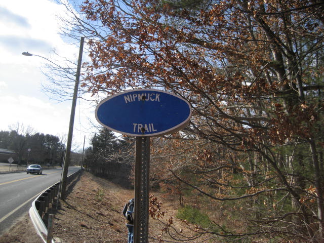
Trail: Nipmuck (Includes Fenton River Trail)
Section: North Windham Road (Mansfield, CT) to Iron Truss Bridge - North (Mansfield, CT)
Direction of Travel: South to North
Distance: 6.80 miles
Approx Time to Complete: 3.25 hours
Date Hiked: 2/2/2013
Date Published: 2/3/2013
Trail: Nipmuck (Includes Fenton River Trail)
Section: North Windham Road (Mansfield, CT) to Iron Truss Bridge - North (Mansfield, CT)
Direction of Travel: South to North
Distance: 6.80 miles
Approx Time to Complete: 3.25 hours
Date Hiked: 2/2/2013
Date Published: 2/3/2013
Section #1 of the Nipmuck Trail East Branch was a bit of a later start than what I'm accustomed to. For starters, I had to take my car in for a tune up/oil change. So, I didn’t even get to my parents’ house until 10 o’clock. Normally, I would have covered a couple of miles of trail by that time. We did, however, eventually make it to the trail. Better late than never.
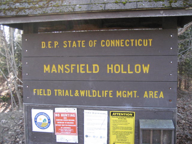
Before we started our hike, we left my car in a parking lot near a baseball field off of Rt. 89 (Warreville Road). The fields are just beyond Southeast School. From there, Roscoe and I hopped in my dad's truck and we made our way over to the DEP parking lot (off of North Windham Road).
Before we started our hike, we left my car in a parking lot near a baseball field off of Rt. 89 (Warreville Road). The fields are just beyond Southeast School. From there, Roscoe and I hopped in my dad's truck and we made our way over to the DEP parking lot (off of North Windham Road).
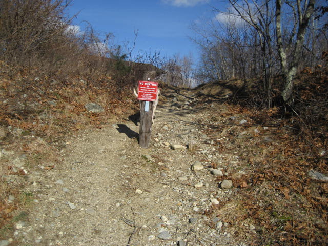
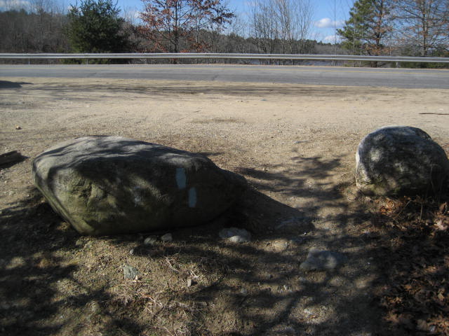
The East Branch of the Nipmuck begins in the northwest corner of the lot. Look for the blue blaze on this wooden post...
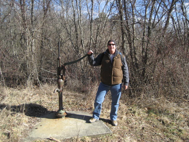
After climbing the small hill, we came to this old water pump...
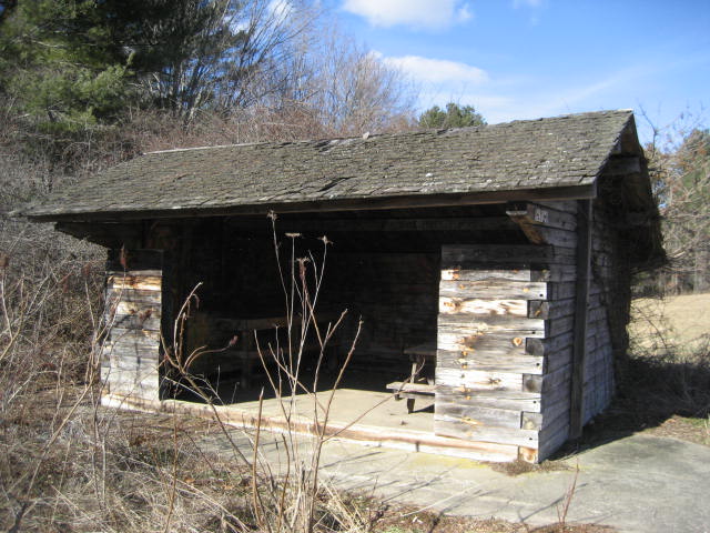
And this lean-to looking thing...
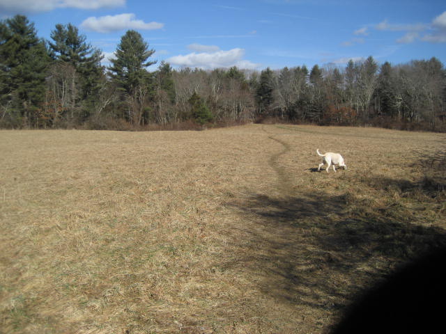
From here, the trail comes to this large open field and cuts through it in a northeasterly direction...
On the other side of the field, the trail re-enters the woods and follows a farm road along the edge of other fields in the area. After about a tenth of a mile, we made a left turn and entered a wooded area. In the process, we also followed along a ridge overlooking a pond to our left. As we made our way through the area, we heard strange sounds coming from the pond. Roscoe was, to say the least, on edge...
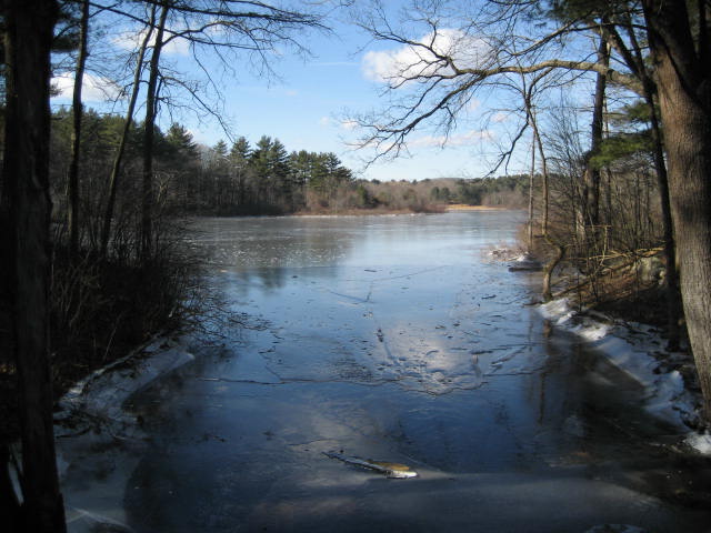
As we continued to make our way along the ridge, we began to think that maybe the sounds we were hearing were from the ice cracking as the sun warmed the pond. Once we descended the ridge and came to this inlet, we confirmed our thoughts as the ice was cracking within ten feet of us. It was loud and it made a cool "whirring" sound at points, which I thought was cool.
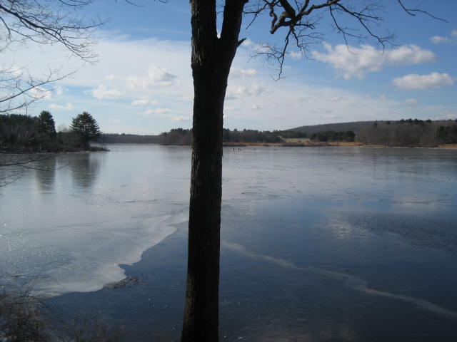
From the inlet, we climbed again briefly and eventually came to another lookout of Mansfield Hollow Lake. From this view, we could see the dam and levee to the southwest. Sadly, the picture I took doesn't show them all that well. But, if you look to the right of the tree in the center, you can see a couple of people who were out on the ice fishing. We thought that was gutsy because the ice didn't look that thick...and, we had heard it cracking the entire time we were hiking.
From the viewpoint, we made a right turn and headed west but quickly turned to the south. This was the first of many switchbacks we would encounter throughout the day. It was also becoming more clear how hilly this section was going to be.
The elevation never changes more than about a hundred feet, but there are a ton of ups and downs over this hike.
About a mile and three quarters in, we came to Bassett Bridge Road. We made a left and walked along the road for a stretch...
The elevation never changes more than about a hundred feet, but there are a ton of ups and downs over this hike.
About a mile and three quarters in, we came to Bassett Bridge Road. We made a left and walked along the road for a stretch...
Along the road, we passed several other people walking their dogs and Roscoe got excited. These were the first people we had seen all day, even though there were a lot of cars in both parking areas.
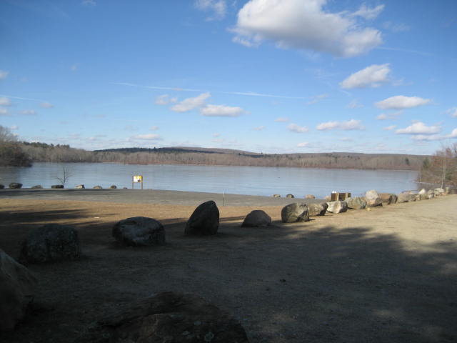
We passed through the parking area near the boat lunch and I snapped a picturesque shot of the area around the lake...
We passed through the parking area near the boat lunch and I snapped a picturesque shot of the area around the lake...
From here, the trail re-enter the woods around the western edge of the lake. Again, we climbed a few hills...descended...and climbed a few more. We made a few lefts...then a right...and another left. Like I said earlier, this is very curvy...and very hilly going.
Roughly three and a quarter miles in, we came to some playing fields on the other side of this gate...
Roughly three and a quarter miles in, we came to some playing fields on the other side of this gate...
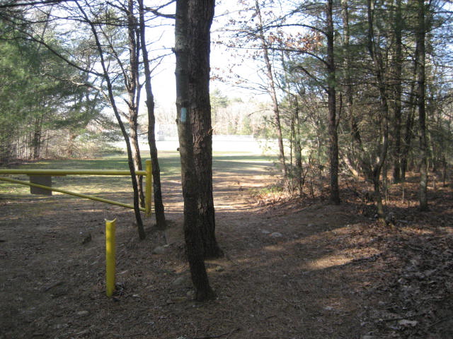
The blaze on the tree here is a little misleading in that the trail actually makes a right turn and sticks to the outter edge of the fields. We made our way around the perimeter and back to where my car was waiting. Normally, this would be the end of the line. But, we planned ahead so that we would cover some of the trail to the north of Warrneville Road. There is an alternate trail in the area. And, we would be covering this area twice regardless. So, I figured we could bang it out now rather than wait. In hindsight, it was really hard for us (especially Roscoe) to see my car and just walk by it. But we trekked on.
We re-entered the woods on the north side of Rt. 89 (Warrenville Road) and descended to the area of this levee/spillway...
We re-entered the woods on the north side of Rt. 89 (Warrenville Road) and descended to the area of this levee/spillway...
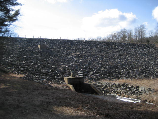
There is a wood bridge in this area which is in need of repair. For now, it serves its purpose, which was to get us over the stream and into the next section of woods.
It wasn't too long before we reached the south intersection of the Fenton River Trail. Later, when this trail intersects with the Nipmuck again, we would use it to make our way back to the car. For now, we stayed to the right and continued following the Nipmuck.
About a half of a mile from where we left my car, we came to the first of two iron truss bridges...
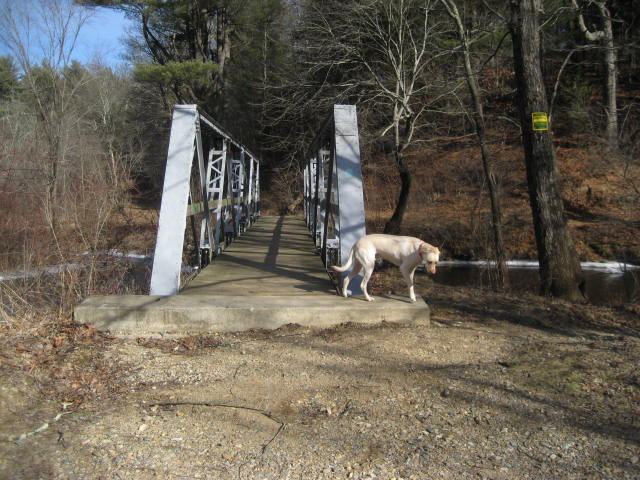
The trusses on these bridges, which were moved to the area in 1997, were originally constructed by the Berlin Construction Company in 1901. According to the CFPA Walk Book, they originally crossed the Mount Hope and Willimantic Rivers as vehicle bridges before being reinstalled here. I thought this was cool but it wasn't as cool as I originally thought it would be when I first about them. I guess, in my mind, I was picturing them to hang higher over the river...I dunno. Either way, the fact that these were recycled and used to build safe crossings for hikers like us is pretty cool.
Shortly after we crossed the bridge, we found several shotgun shells in the middle of the trail. Later, we crossed paths with a couple who found a dead deer. I'm not sure what happened here, but it looked like the deer was attacked by something. My dad thought that it was just hunters, but I found it strange that there was deer fur everywhere.
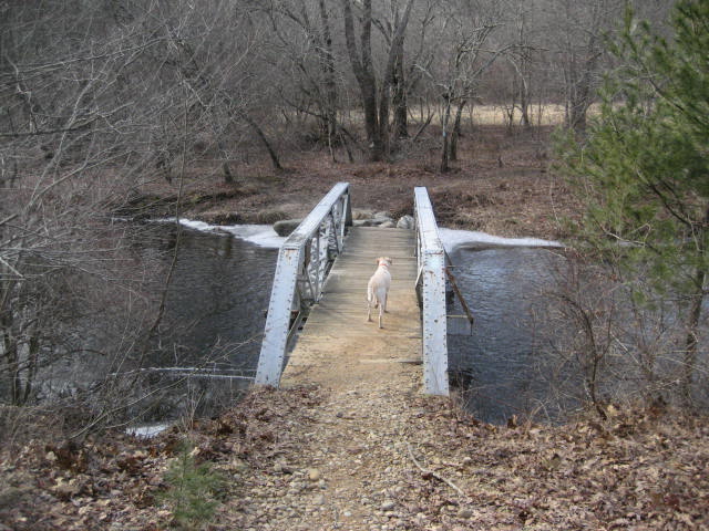
About three quarters of a mile after crossing the first iron truss bridge, we came to the other one. This one was even closer to the water than the first...
Shortly after we crossed the bridge, we found several shotgun shells in the middle of the trail. Later, we crossed paths with a couple who found a dead deer. I'm not sure what happened here, but it looked like the deer was attacked by something. My dad thought that it was just hunters, but I found it strange that there was deer fur everywhere.
About three quarters of a mile after crossing the first iron truss bridge, we came to the other one. This one was even closer to the water than the first...
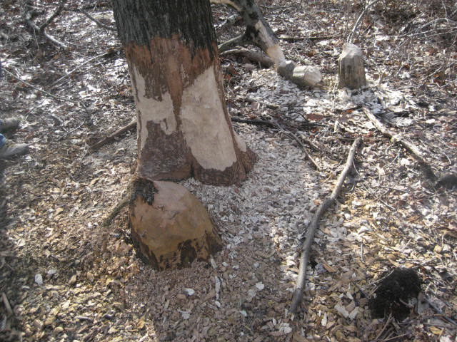
After we crossed the bridge, we made a left and started following the Fenton River Trail back to the car. Along the way, we encountered some evidence of beavers...
The Fenton River Trail, which is about a mile long, is a nice alternate trail. The name implies that it follows along the river, but it doesn't for very long. Having walked along the banks of the river for what seemed like an eternity on our last hike, I was thankful for this. It does take in a good amount of the river, but also works its way uphill (inland) a little which allowed us to experience some of the other ecology in the area.
Eventually, we made it back to the Nipmuck and followed the familiar trail back to my car.
All in all, this was a very nice hike. While the area north of Warrenville Road didn't live up to my expectations, the area around Mansfield Hollow surpassed them in every way. And, I think maybe the only reason why the area north of Warrenville Road felt like a letdown is because the first part of our hike was so great.
Stay tuned as the next hike along the Nipmuck brings us beyond the area of the second iron truss bridge to "50 Foot Rock".
Distance to 2013 goal: 301.21

