Hike #39
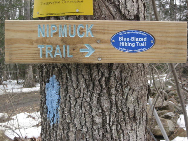
Trail: Nipmuck
Section: Route 44 (Mansfield, CT) to Rt. 74 (Ashford, CT)
Distance: 5.27 miles
Approx Time to Complete: 3.25 hours
Date Hiked: 3/3/2013
Date Published: 3/5/2013
Trail: Nipmuck
Section: Route 44 (Mansfield, CT) to Rt. 74 (Ashford, CT)
Distance: 5.27 miles
Approx Time to Complete: 3.25 hours
Date Hiked: 3/3/2013
Date Published: 3/5/2013
Finally! After four weeks of waiting in anticipation, we were confident that the snow (which, for those of you who weren’t already aware, had fallen up to 3 feet in some parts of the state) had melted to a level at which we could reasonably hike. All week long, the weather reports called for the day of the hike to be the warmest of the week (and also the clearest). But, the night before I saw something that said it might rain…or snow…or sleet…or all three. Luckily, it never did rain or sleet. And, whatever snow we did get was “flurries”at best. Honestly, I think we ended up seeing about as many “flakes” as miles we covered.
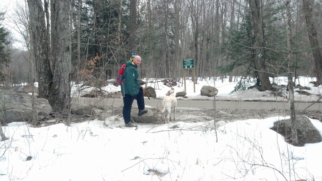
We started by leaving my dad’s truck on the northeast side of Rt. 74 (Nott Highway) in Ashford. There is parking here for about four cars. From there, we took my car and drove the short distance over to where we left off on Hike # 36. The parking location is on Old Turnpike Road, which is just off of Rt. 44 in Mansfield. There are a few spots off of the side of Old Country Road. And, since we were the only ones out hiking this area, we had our pick. I choose a spot just east of the bridge which crosses the Fenton River (Brook?). Roscoe was beyond antsy but we made him wait a few more seconds while we geared up.
The start of our hike consisted of a short road walk, in a northeasterly direction, up Old Turnpike Road. We made a left on Route 44, followed that for a bit, and then crossed where the trail crosses the road. This is a very busy road so I was a bit concerned about Roscoe, but I remembered his leash this time and he handled it like a champ.
After the Route 44 crossing, the trail straddles along a tree line and someone’s private driveway as it heads north. As we walked along, we heard a dog barking from inside one of the houses. Eventually, as we were just about to leave the area of the property, a very big dog came bounding down to check on us. Roscoe wanted to play but we had many miles of snow covered trail to hike. So, we kept moving. At this point, we also crossed over into Willington, which is the first time we’ve hiked outside of Mansfield since starting the Nipmuck Trail.
The next three quarters of a mile or so meander along the Fenton River. My dad and I joked about how we had crossed the river several times since we first started hiking the Nipmuck. Eventually, the trail makes a slight right and starts to head northeast, while the river makes a slight left and heads northwest. After walking along its edges for a good portion of our previous hikes, this was the last we would see of the Fenton River.
From the edge of the river, the trail also begins to climb. This is a very gradual climb but the snow was deeper than we expected and we were very much out of shape because of the four week layoff. We stopped frequently to rehydrate and discuss current events, a.k.a. catch our breath. And, when I say “we”, I mean me and my dad. Roscoe, of course, charged ahead because he has something other than air flowing through his lungs…energizer batteries or something.
Around the one and a quarter mile mark, the trail doubles back and heads to the southeast for a stretch before turning slightly left and heading in a more easterly direction. This section of trail, before the two mile mark, is really nice. We saw signs of deer and other game everywhere. At one point, my dad even saw an owl, but it took off and flew away from us. He attempted to call it back but was unsuccessful.
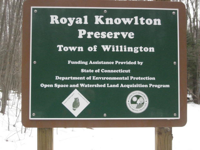
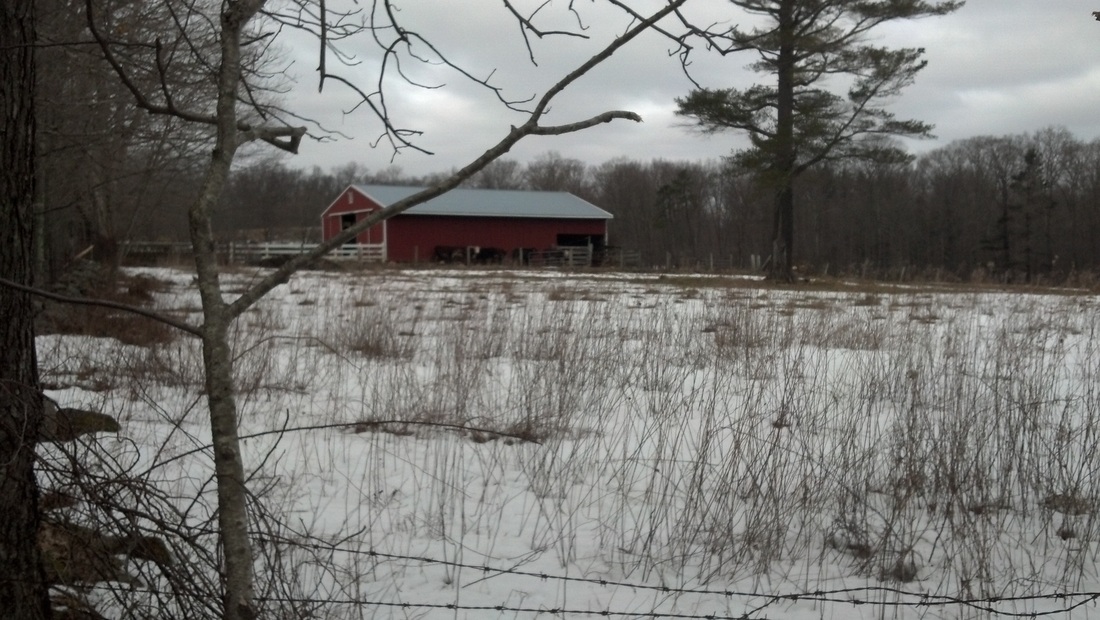
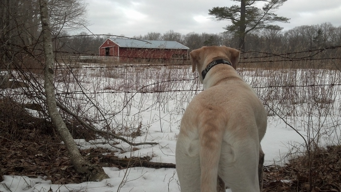
About a mile and half into our hike, we came to and crossed Mason Road, a dirt road. We were entering into the Royal Knowlton Preserve, as you can see from the pictures below…
We started by leaving my dad’s truck on the northeast side of Rt. 74 (Nott Highway) in Ashford. There is parking here for about four cars. From there, we took my car and drove the short distance over to where we left off on Hike # 36. The parking location is on Old Turnpike Road, which is just off of Rt. 44 in Mansfield. There are a few spots off of the side of Old Country Road. And, since we were the only ones out hiking this area, we had our pick. I choose a spot just east of the bridge which crosses the Fenton River (Brook?). Roscoe was beyond antsy but we made him wait a few more seconds while we geared up.
The start of our hike consisted of a short road walk, in a northeasterly direction, up Old Turnpike Road. We made a left on Route 44, followed that for a bit, and then crossed where the trail crosses the road. This is a very busy road so I was a bit concerned about Roscoe, but I remembered his leash this time and he handled it like a champ.
After the Route 44 crossing, the trail straddles along a tree line and someone’s private driveway as it heads north. As we walked along, we heard a dog barking from inside one of the houses. Eventually, as we were just about to leave the area of the property, a very big dog came bounding down to check on us. Roscoe wanted to play but we had many miles of snow covered trail to hike. So, we kept moving. At this point, we also crossed over into Willington, which is the first time we’ve hiked outside of Mansfield since starting the Nipmuck Trail.
The next three quarters of a mile or so meander along the Fenton River. My dad and I joked about how we had crossed the river several times since we first started hiking the Nipmuck. Eventually, the trail makes a slight right and starts to head northeast, while the river makes a slight left and heads northwest. After walking along its edges for a good portion of our previous hikes, this was the last we would see of the Fenton River.
From the edge of the river, the trail also begins to climb. This is a very gradual climb but the snow was deeper than we expected and we were very much out of shape because of the four week layoff. We stopped frequently to rehydrate and discuss current events, a.k.a. catch our breath. And, when I say “we”, I mean me and my dad. Roscoe, of course, charged ahead because he has something other than air flowing through his lungs…energizer batteries or something.
Around the one and a quarter mile mark, the trail doubles back and heads to the southeast for a stretch before turning slightly left and heading in a more easterly direction. This section of trail, before the two mile mark, is really nice. We saw signs of deer and other game everywhere. At one point, my dad even saw an owl, but it took off and flew away from us. He attempted to call it back but was unsuccessful.
About a mile and half into our hike, we came to and crossed Mason Road, a dirt road. We were entering into the Royal Knowlton Preserve, as you can see from the pictures below…
We continued to hike for another mile or so before we came to another road crossing (Marsh Road). This time the road was paved.
Shortly after the Marsh Road crossing, the trail makes a sharp right turn and heads south by southeast for a stretch. Later, when we turned back towards the north and then made another sharp right to the east, I proposed that this was little“detour” was due to the trail being moved. I’m still not 100%, but it sure looks like the trail was re-routed when I look at it on the map. Later, around the 3.5 mile mark, we would experience what felt like another obvious re-route. But, I’m getting ahead of myself.
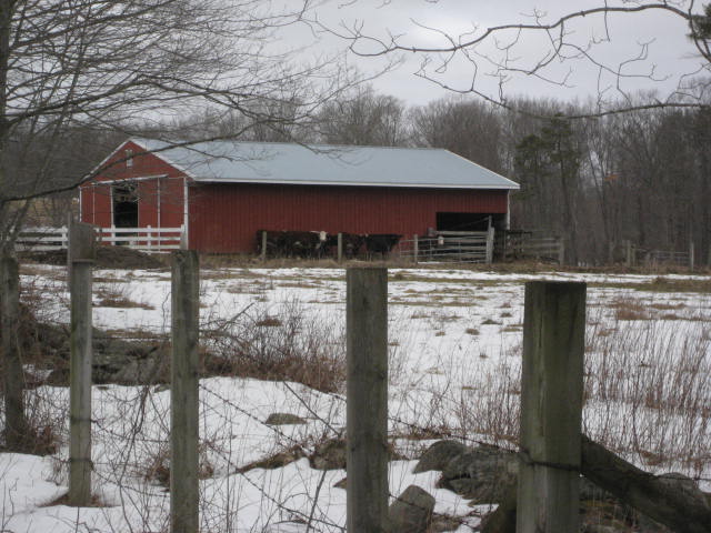
Somewhere between the 2.5 mile mark and 3.5 mile mark, the trail brushes up against some farmland. We stopped to check out some cows (I counted six) which were huddling together to stay warm. We both tried to get a picture of them, but I’m not sure if you can see them in the pictures. Judge for yourself below…
Shortly after the Marsh Road crossing, the trail makes a sharp right turn and heads south by southeast for a stretch. Later, when we turned back towards the north and then made another sharp right to the east, I proposed that this was little“detour” was due to the trail being moved. I’m still not 100%, but it sure looks like the trail was re-routed when I look at it on the map. Later, around the 3.5 mile mark, we would experience what felt like another obvious re-route. But, I’m getting ahead of myself.
Somewhere between the 2.5 mile mark and 3.5 mile mark, the trail brushes up against some farmland. We stopped to check out some cows (I counted six) which were huddling together to stay warm. We both tried to get a picture of them, but I’m not sure if you can see them in the pictures. Judge for yourself below…
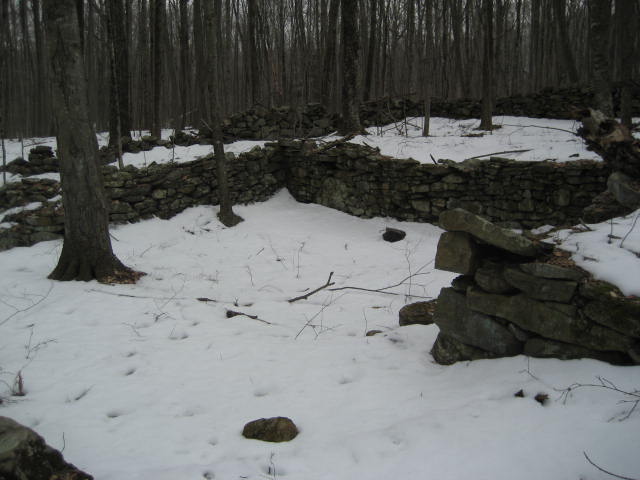
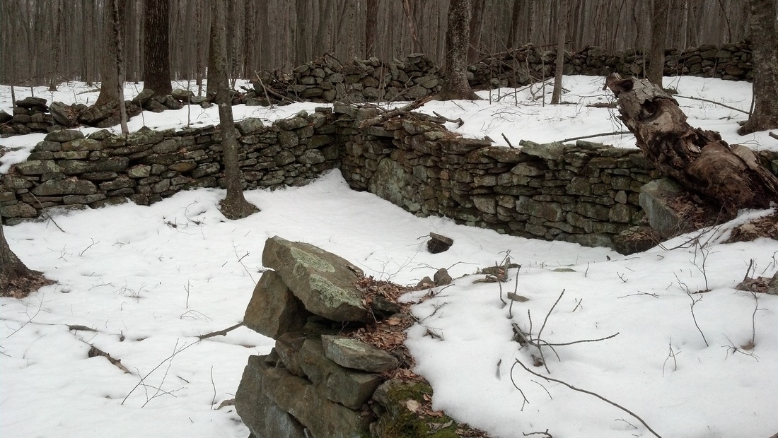
Soon we came to the other re-route I mentioned. The trail here crosses through a couple of rock walls and skirts around a couple of others. Here, we began to gradually descend so we figured we had reached the back leg of our trip.
Eventually, we came to an old cellar (I love these things!) and stopped to take some pictures…
Eventually, we came to an old cellar (I love these things!) and stopped to take some pictures…
From here, we followed an old woods road and what looked like a whole series of old farms for a quarter of a mile before making a right hand turn and descending (over the course of a half mile or so) to Knowlton Brook. We followed along the edge of the brook for a while before coming to Rt. 74. There was a metal structure just before we reached the road. The trail uses a wooden bridge, which is placed in the middle of the metal structure to cross a small stream. I’m still not sure what the structure used to be. But, my dad thinks it is an old railroad bridge. And, I’ll buy that until someone tells me otherwise.
We crossed (the very busy) Rt. 74 and made our way along the side of the road until we were back at my dad’s truck.
This trip wasn’t overly difficult, but the long layoff and the snow made it tough going. By the time we were down, I felt as if I had travelled twice as many miles. All the same, it was great to finally get back out and do some real hiking. Hopefully the snow will continue to melt and we can get in some more miles soon…
Distance to goal: 287.90
