Hike #40
Old Furnace Trail
Killingly, CT
Distance: 4.10 miles
Approx Time to Complete: 2 hours
Date Hiked: 3/16/2013
Date Published: 3/17/2013
Old Furnace Trail
Killingly, CT
Distance: 4.10 miles
Approx Time to Complete: 2 hours
Date Hiked: 3/16/2013
Date Published: 3/17/2013
My only goal for this, my 40th, hike was to complete the Old Furnace Trail start to finish. I had planned to do this hike back on President’s Day while I was off from work, but the leftover snow from the blizzard of 2013 (which hit us on February 9th) was still too deep. And, as a result, any and all hiking was put on hold for a couple of weeks.
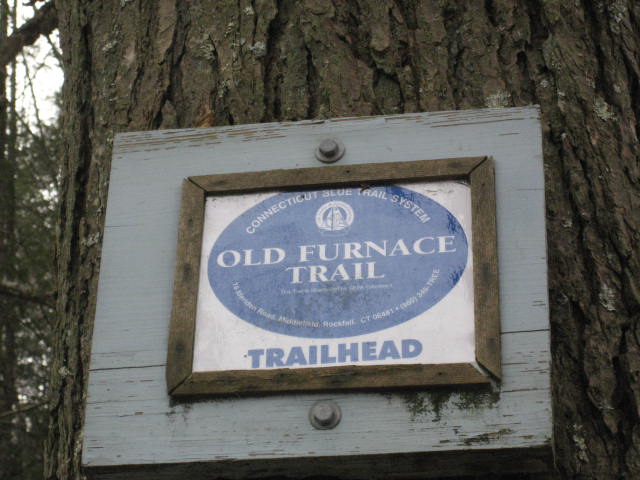
The Old Furnace Trail is a 2.1 mile trail that cuts through Old Furnace State Park in Killingly, Connecticut. It is required hiking in order to complete the CT400. The CFPA Walk Book explains that the trail crosses a strong, fast running stream over partially submerged, slippery rocks and that this crossing can be dangerous, especially when water levels are high. The Walk Book also explains that the ridge ascent from the stream or from the pond parking area is difficult for those who are not surefooted. Personally, I found neither of these obstacles overly difficult and really enjoyed this hike.
I wasn’t originally going to hike on this day, as the weather called for rain and or snow. So, we made hiking plans with a group of friends in Middletown for the following day. But, after I saw how nice the day was shaping up to be, I just had to get out and go hiking.
This was also one of our latest starts ever as I had used the early morning to get my haircut, work on a History paper that was due in two weeks, and hit up the indoor batting cages in preparation for the upcoming softball season. Thankfully, we recently moved the clocks ahead an hour so I wasn’t in any danger of losing sunlight.
From our house in East Hartford, Old Furnace State Park is about an hour away. Roscoe suffered through the long drive and was overly excited when we “finally” pulled into the parking lot, which is on South Frontage Road, just off Rt. 6 not too far from where it crosses I-395. There is plenty of parking here.
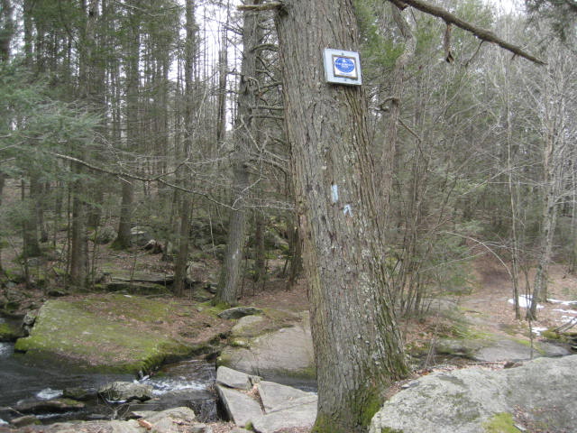
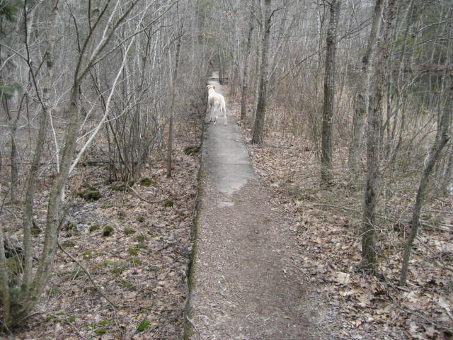
We made our way to the south, away from South Frontage Road, and followed a dirt path which lead us to the aforementioned dangerous stream crossing. I didn’t find the crossing to be overly difficult. And, Roscoe made it several times without any trouble. All the same, you should exercise caution when you come to this area.
The Old Furnace Trail is a 2.1 mile trail that cuts through Old Furnace State Park in Killingly, Connecticut. It is required hiking in order to complete the CT400. The CFPA Walk Book explains that the trail crosses a strong, fast running stream over partially submerged, slippery rocks and that this crossing can be dangerous, especially when water levels are high. The Walk Book also explains that the ridge ascent from the stream or from the pond parking area is difficult for those who are not surefooted. Personally, I found neither of these obstacles overly difficult and really enjoyed this hike.
I wasn’t originally going to hike on this day, as the weather called for rain and or snow. So, we made hiking plans with a group of friends in Middletown for the following day. But, after I saw how nice the day was shaping up to be, I just had to get out and go hiking.
This was also one of our latest starts ever as I had used the early morning to get my haircut, work on a History paper that was due in two weeks, and hit up the indoor batting cages in preparation for the upcoming softball season. Thankfully, we recently moved the clocks ahead an hour so I wasn’t in any danger of losing sunlight.
From our house in East Hartford, Old Furnace State Park is about an hour away. Roscoe suffered through the long drive and was overly excited when we “finally” pulled into the parking lot, which is on South Frontage Road, just off Rt. 6 not too far from where it crosses I-395. There is plenty of parking here.
We made our way to the south, away from South Frontage Road, and followed a dirt path which lead us to the aforementioned dangerous stream crossing. I didn’t find the crossing to be overly difficult. And, Roscoe made it several times without any trouble. All the same, you should exercise caution when you come to this area.
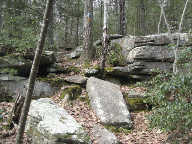
This is the “official” start of the Old Furnace Trail. After the stream crossing, the trail continues to head due south for a short stretch before coming to another, smaller stream crossing. On the way out, I goofed and took the small, wood foot bridge you see below. But, the trail actually crosses the stream a little further to the east, over a bridge fashioned out of some old tree trunks. I made sure to take the correct crossing on the way back.
After the second stream crossing, the trail beings to wind to the east and then back again to the south, all while climbing what I thought was a pretty gradual ascent. I was still getting back into hiking shape after a long layoff due to the deep snow. But, I never felt short of breath. And, when we got to the top of a small overlook (about three quarters of a mile into our hike), I was surprised to see how much climbing we had already done.
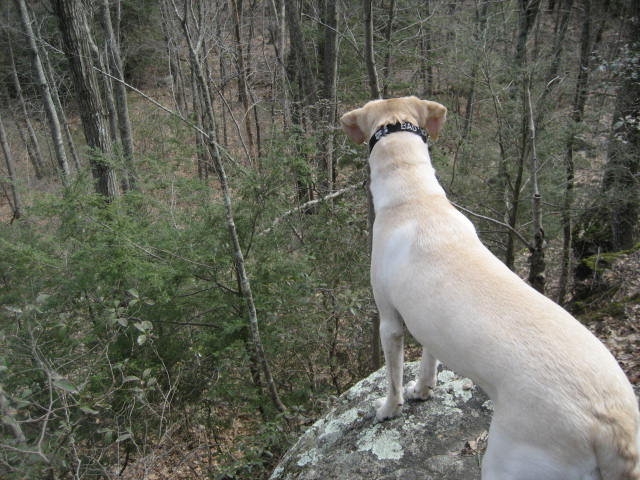
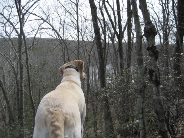
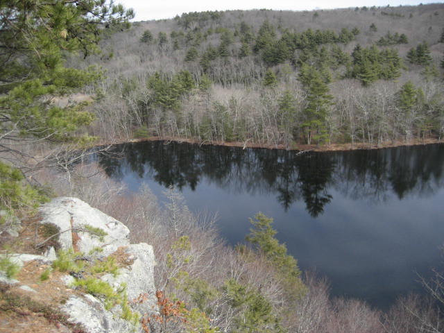
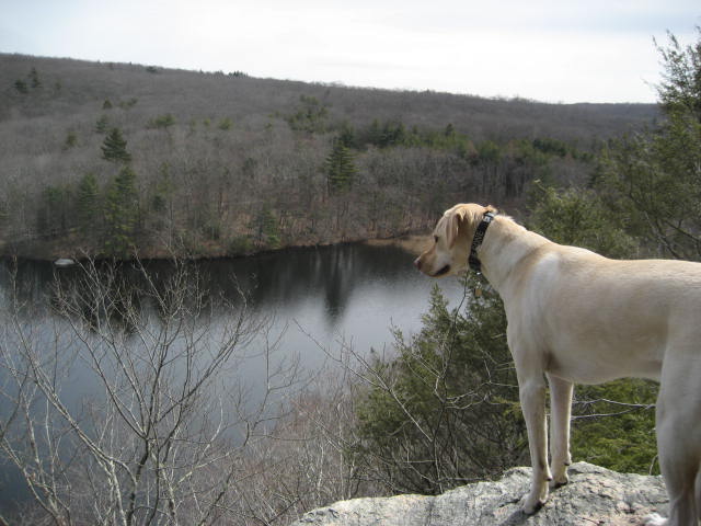
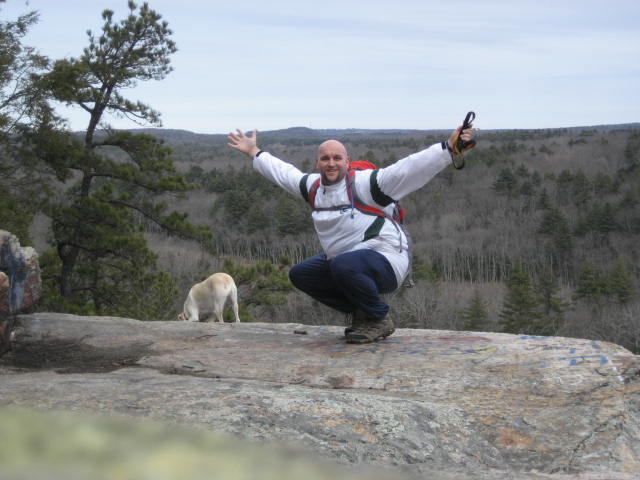
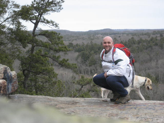
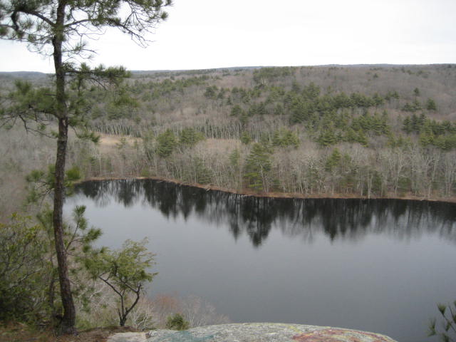
From the small overlook, we followed the trail a little deeper into the woods. We also continued our climb. At one point, I noticed a really nice overlook which was just a bit off trail. So, we followed a little side trail to this spectacular view.
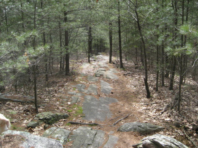
From the second lookout, the trail starts to descend. I took a few pictures of the descent, which wasn’t overly challenging, but some spots made me slightly concerned about the trek back. Again, I’m not nearly in the hiking shape I was in a month ago. So, even the little challenges like those you see below were of (minor) concern.
Now at the bottom of our descent, the trail made a right turn a swung back towards the northwest. After only a short distance, the trail will turn and swing back towards the southeast. Looking at this on the map, it looks like an obvious re-route. I’m not sure why this was done (property ownership?) but this is a nice little section of trail so I was happy for the additional distance (even if it feels really out of place…which it does).
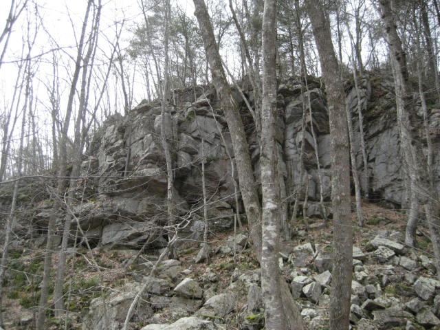
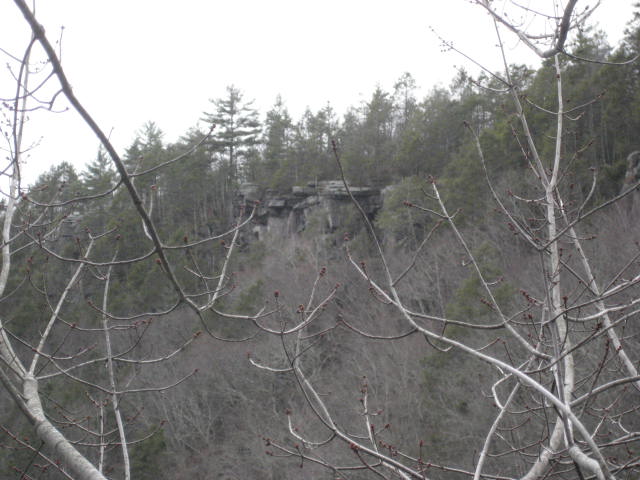
We passed by a cool looking set of cliffs, which you can see below.
We passed by a cool looking set of cliffs, which you can see below.
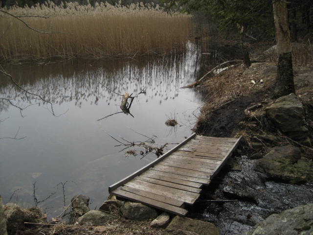
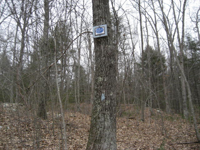
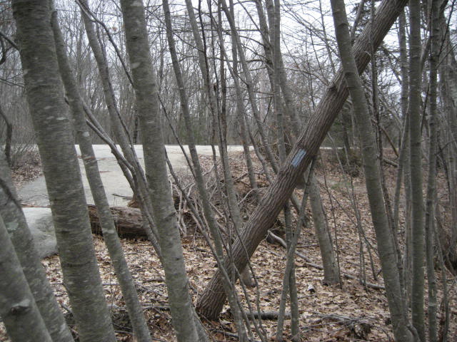
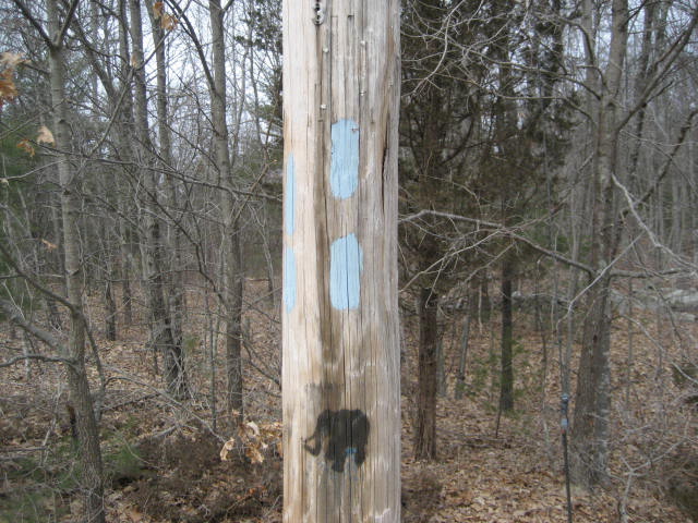
I was really hoping the trail would go over them, but it didn’t. It just meanders along until it comes to Squaw Rock Road. I took a series of pictures since I wasn’t really sure (at the time) where the “true” end of the trail was. In the first picture, I spotted the “Old Furnace Trailhead” sign, similar to the one I had seen back when I first started the trail. But, there was an additional blaze on a half-fallen tree (second picture). And, finally, I found a blaze on a telephone pole right on the side of Squaw Rock Road (third picture). I believe this to be the southern terminus of the trail.
If we had two vehicles, this would've been the end of the line. But, we did not. So, we started making our way back to the car. Who really wants to drive an hour just to hike for a couple of miles, anyway?
I was feeling really adventurous. So, instead of following the blue blazes back to the car, I opted for a few of the side trails I had seen along the way. Some of the trails were blazed, others were not. It was one of only a handful of “no map, no blazes…no problem” moments I’ve ever had. Obviously, I don’t recommend this to anyone...espeically not if you are a novice hiker. But, if you ARE going to take any of the side trails, I would encourage you to stick to the main trail the whole way out. That way, you’ll at least have an idea of the trail layout and will know when to double back in the event you get lost.
We started by taking an un-marked trail to the left. I passed it on the way out (it was on my right at the time) and thought it probably led back to the Old Furnace Trail. We picked it up around the area of the southern Old Furnace Trailhead sign. You’ll know you’re on the right one when you start to descend and come within about 50 feet of I-395. There were a couple of forks in the trail through here. We stayed to the right each time and eventually, after about half of a mile, the alternate trail led us back to the familiar blue blazes.
The second detour I took was just before the ascent back up to the ridge views. There was a left hand turn which allowed me to cut out some of the steps I had already taken. It also made the climb a little steeper so this was hardly cheating. So much for my worry about being out of shape…I was actually making the trip back MORE challenging.
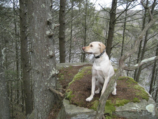
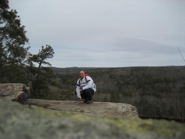
The third detour I made was when we started approaching the area of the ridge views. Instead of following the blue blazes, I elected to follow a yellow-blazed path in the area. And, then, I even strayed from that path and followed an un-marked path which sticks tightly to the ledges. My gamble paid off as we experienced some really awesome views. And, I got some really cool pictures.
I was feeling really adventurous. So, instead of following the blue blazes back to the car, I opted for a few of the side trails I had seen along the way. Some of the trails were blazed, others were not. It was one of only a handful of “no map, no blazes…no problem” moments I’ve ever had. Obviously, I don’t recommend this to anyone...espeically not if you are a novice hiker. But, if you ARE going to take any of the side trails, I would encourage you to stick to the main trail the whole way out. That way, you’ll at least have an idea of the trail layout and will know when to double back in the event you get lost.
We started by taking an un-marked trail to the left. I passed it on the way out (it was on my right at the time) and thought it probably led back to the Old Furnace Trail. We picked it up around the area of the southern Old Furnace Trailhead sign. You’ll know you’re on the right one when you start to descend and come within about 50 feet of I-395. There were a couple of forks in the trail through here. We stayed to the right each time and eventually, after about half of a mile, the alternate trail led us back to the familiar blue blazes.
The second detour I took was just before the ascent back up to the ridge views. There was a left hand turn which allowed me to cut out some of the steps I had already taken. It also made the climb a little steeper so this was hardly cheating. So much for my worry about being out of shape…I was actually making the trip back MORE challenging.
The third detour I made was when we started approaching the area of the ridge views. Instead of following the blue blazes, I elected to follow a yellow-blazed path in the area. And, then, I even strayed from that path and followed an un-marked path which sticks tightly to the ledges. My gamble paid off as we experienced some really awesome views. And, I got some really cool pictures.

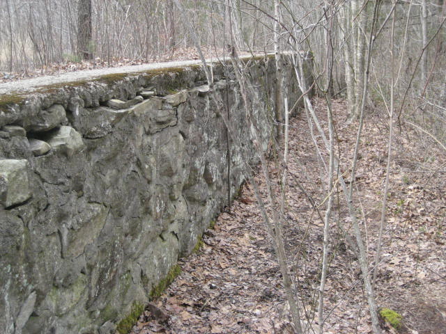
From the ledges, I stuck to the un-marked trail as it descended. In some areas, it was fairly steep. So, this particular path won’t be for everyone. But, I was rewarded with another payoff...as we came to this old dam wall.

From the area where Roscoe is playing in the water, the un-marked trail makes a sharp left and follows along the side of the dam wall. Before we left the area, however, I stopped to take a picture of the cliffs we were previously standing atop.
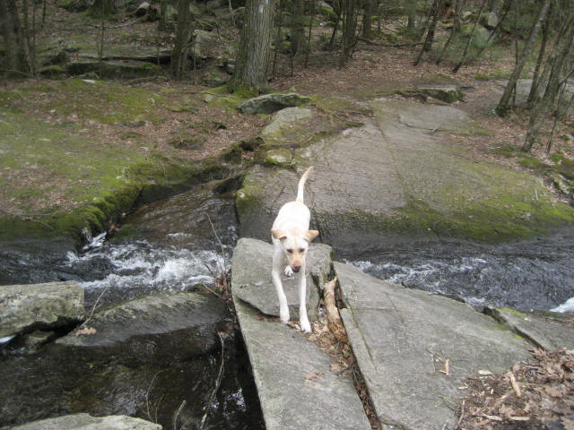
We made our way through a soggy area and, eventually, linked back up with the blue-blazed Old Furnace Trail. On the way out, I made sure to cross the stream correctly and Roscoe decided to go for a quick swim in a small pond area. So quick, in fact, that he was done before I could get a picture of it. It was encouraging to see him swimming without any coaxing from me. My little boy is growing up so fast!
Distance to goal: 283.80
Distance to goal: 283.80
