Hike #41
Trail: Mattabesett
Section: River Road to Bear Hill Road (Middletown, CT)
Distance: 4.96 miles
Approx Time to Complete: 3.75 hours
Date Hiked: 3/17/2013
Date Published: 3/18/2013
Trail: Mattabesett
Section: River Road to Bear Hill Road (Middletown, CT)
Distance: 4.96 miles
Approx Time to Complete: 3.75 hours
Date Hiked: 3/17/2013
Date Published: 3/18/2013
St. Patrick’s Day 2013! Frequent followers of my hiking adventures have probably noticed by now I’ve been spending a lot of time hiking with my dad and Roscoe along the Nipmuck Trail. That is, hiking the Nipmuck Trail whenever we weren’t taking long breaks between hikes due to the leftover snowfall from the Blizzard of 2013. At this point, we had reached somewhat of an impasse with the Nipmuck because the next section is 6.8 miles. And, while we’ve hiked sections of trail that long before, we haven’t done it in quite some time. And, after our two week due to the deep snow, I figured it was best to build our legs back up a little more before we tackled an almost seven mile hike…oh boy, if only I knew then what I know now.
So, long story short, I scoured the CFPA Walk Book for a shorter distance hike. And, after searching for a while, I landed on page 1…the first trail section description of the first trail in the book…the Mattabesett.
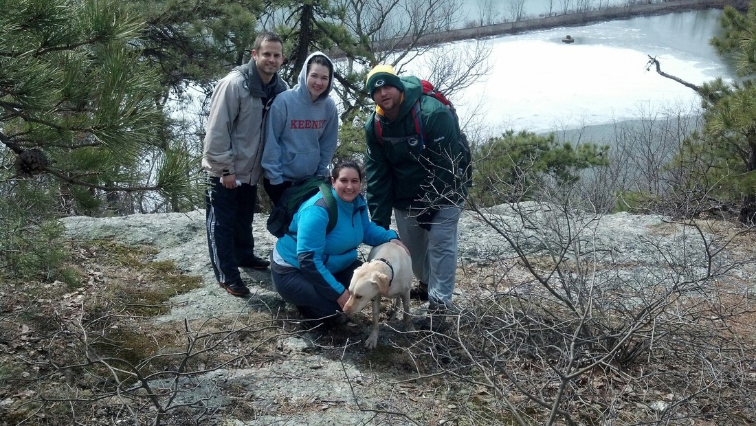
Some of you may also recall that I had previously hiked a section of the Mattabesett way back on Hike # 6, in October of 2012. Hang on…that can’t be right…can it…35 different hikes over the last six months? Ok, I guess that is correct. Anyway, on that trip, Jaci and I made our way with her friend from college (Mark) from one side of Higby Mountain to the other. Since Mark has previously expressed interest in hiking the Mattabesett, I thought I would give him a call. His wife, Pam (Jaci’s college roommate) was also interested in coming this time, so that meant Jaci would be joining us as well…bringing our total count to five humans and one, overly excited canine.
The morning of the hike, my dad met us at our house and we two car caravanned down to Middletown. Mark and Pam, who live in Middletown, met us at Middlesex Community College…which isn’t too far from where we dropped Mark’s car and my dad’s truck. There are several parking locations on Bear Hill Road, but the one right next to the trail looked pretty muddy. Luckily, my dad is an expert at spotting additional parking locations so we didn’t have to worry about digging out any cars after we were done with this trip. Good thing, too, cause I don’t think we could have found the energy if you took what each of us had left in the tank and combined it. From Bear Hill Road, we all piled into the Jeep and made our way over to River Road.
The trail head at River Road marks the official start of the Mattabessett Trail. From River Road, it winds over 50 miles (in a horseshoe looking kind-of way) through the towns of Middletown, Haddam, Durham, Madison, Guilford, North Branford, Wallingford, and Meriden before ending where the Metacomet Trail begins, at the Berlin Turnpike in Berlin. Once complete, I will have knocked off a huge chunk of the miles required to complete the CT400…and, I’ll also get a cool-looking Mattabesett Trail completion patch from the CFPA. So, with that goal in mind…let’s get started…
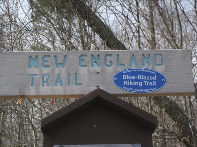
The trailhead off of River Road recently went through some relocation. Hikers used to have to walk a bit of road before starting the trail. Now, the trail starts right near the parking location (which is big enough for plenty of vehicles). The trail was also recently (within the last five years or so) approved for federal funding. The Mattabesett, along with the Metacomet and the Monadnock Trail in Massachusetts are now designated as “The New England Trail”, which is cool.
So, long story short, I scoured the CFPA Walk Book for a shorter distance hike. And, after searching for a while, I landed on page 1…the first trail section description of the first trail in the book…the Mattabesett.
Some of you may also recall that I had previously hiked a section of the Mattabesett way back on Hike # 6, in October of 2012. Hang on…that can’t be right…can it…35 different hikes over the last six months? Ok, I guess that is correct. Anyway, on that trip, Jaci and I made our way with her friend from college (Mark) from one side of Higby Mountain to the other. Since Mark has previously expressed interest in hiking the Mattabesett, I thought I would give him a call. His wife, Pam (Jaci’s college roommate) was also interested in coming this time, so that meant Jaci would be joining us as well…bringing our total count to five humans and one, overly excited canine.
The morning of the hike, my dad met us at our house and we two car caravanned down to Middletown. Mark and Pam, who live in Middletown, met us at Middlesex Community College…which isn’t too far from where we dropped Mark’s car and my dad’s truck. There are several parking locations on Bear Hill Road, but the one right next to the trail looked pretty muddy. Luckily, my dad is an expert at spotting additional parking locations so we didn’t have to worry about digging out any cars after we were done with this trip. Good thing, too, cause I don’t think we could have found the energy if you took what each of us had left in the tank and combined it. From Bear Hill Road, we all piled into the Jeep and made our way over to River Road.
The trail head at River Road marks the official start of the Mattabessett Trail. From River Road, it winds over 50 miles (in a horseshoe looking kind-of way) through the towns of Middletown, Haddam, Durham, Madison, Guilford, North Branford, Wallingford, and Meriden before ending where the Metacomet Trail begins, at the Berlin Turnpike in Berlin. Once complete, I will have knocked off a huge chunk of the miles required to complete the CT400…and, I’ll also get a cool-looking Mattabesett Trail completion patch from the CFPA. So, with that goal in mind…let’s get started…
The trailhead off of River Road recently went through some relocation. Hikers used to have to walk a bit of road before starting the trail. Now, the trail starts right near the parking location (which is big enough for plenty of vehicles). The trail was also recently (within the last five years or so) approved for federal funding. The Mattabesett, along with the Metacomet and the Monadnock Trail in Massachusetts are now designated as “The New England Trail”, which is cool.
The trail starts heading west and almost immediately we were climbing uphill. As it climbs, the trail gradually swings to the northwest and meets up with the old section of trail. From there, it continues to climb for the next mile or so. At times, the climb is gradual. At other times, it is not so gradual.
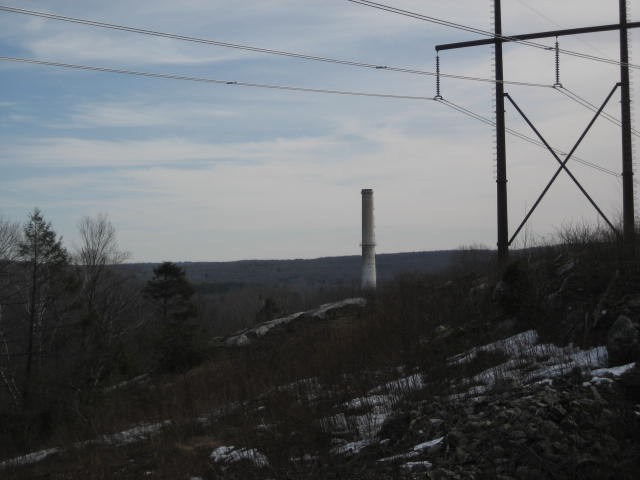
About three quarters of a mile in, we turned back to the southeast and crossed a power line cut. The views up here were nothing spectacular, but we were able to see the TV towers in Farmington (which Jaci and I passed by on Hike #1). We could also see the power plant smoke stack in the picture below. At the bottom of the hill, next to the power plant, was our Jeep. After a quick rest, everyone else was ready to go. I hung back to take in the view for a little while longer. For me, the view of the power plant from here (what little I could actually see of it) was cool because, several months back, on one of my hikes along the Shenipsit Trail, I could see this same power plant from a viewpoint in East Hampton. I tried my best, using my monocular, to see the hill I was standing on back in December, but I couldn’t locate it and the group was pushing ahead.
About three quarters of a mile in, we turned back to the southeast and crossed a power line cut. The views up here were nothing spectacular, but we were able to see the TV towers in Farmington (which Jaci and I passed by on Hike #1). We could also see the power plant smoke stack in the picture below. At the bottom of the hill, next to the power plant, was our Jeep. After a quick rest, everyone else was ready to go. I hung back to take in the view for a little while longer. For me, the view of the power plant from here (what little I could actually see of it) was cool because, several months back, on one of my hikes along the Shenipsit Trail, I could see this same power plant from a viewpoint in East Hampton. I tried my best, using my monocular, to see the hill I was standing on back in December, but I couldn’t locate it and the group was pushing ahead.
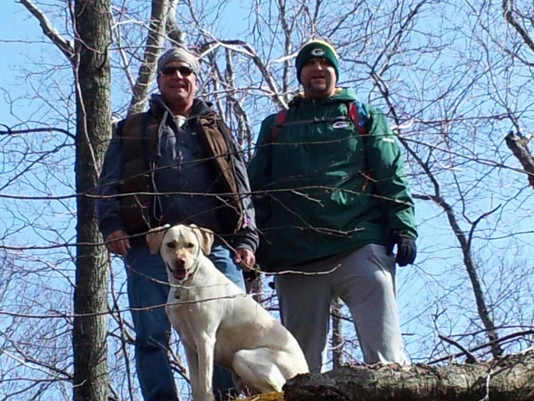
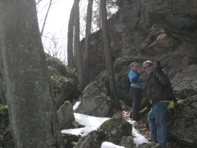
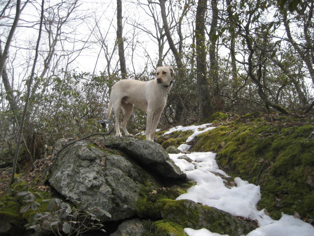
Immediately after the power line cut, the trail climbs only to descend again. This seemed really out of place when we could have just followed the flat area for a bit. Nobody complained too much, but this would become a recurring theme later. The trail flattened out for a bit, but we were soon climbing again for about another mile or so. Our pace was also slowed by the snow that (five weeks later) is STILL leftover in some spots…crazy. Along the way, we climbed some of the cool-looking rock formations just off trail. I really like this picture of me with my dad and Roscoe.
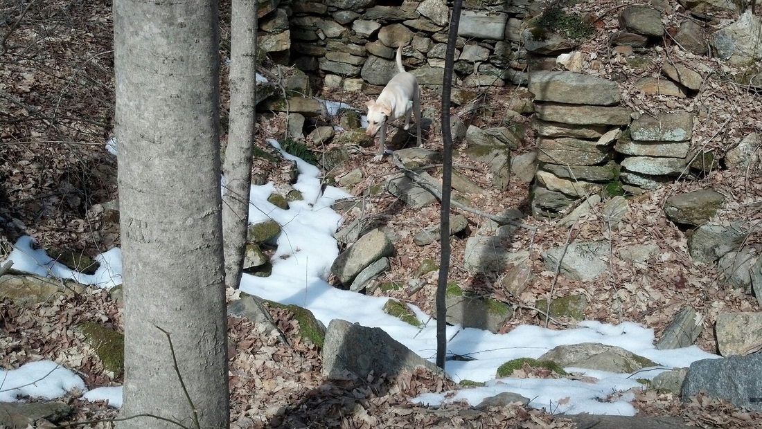
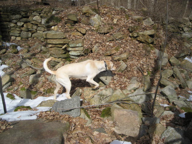
Just before the two mile mark, we spotted an old foundation just off trail. So, we took a minute to check it out. I think it’s funny that Roscoe doesn’t hesitate to explore this person’s basement…but he won’t go in ours.
Shortly after the foundation, the trail skirts along another set of power lines. About a half mile or so later, just over the two and half mile mark, we crossed Reservoir Road. I explained to Jaci that she could follow the road down to where the trail crosses it again later, but Pam wanted to stay on the trail and Jaci didn’t want to go by herself (not that I blame her). I think she regretted it later because the trail was about to get really rugged. This probably isn’t overly rugged for anyone who has done a lot of hiking. But, this next section was right up there with some of the most rugged hiking I’ve done so far. I give Jaci credit for seeing it through.
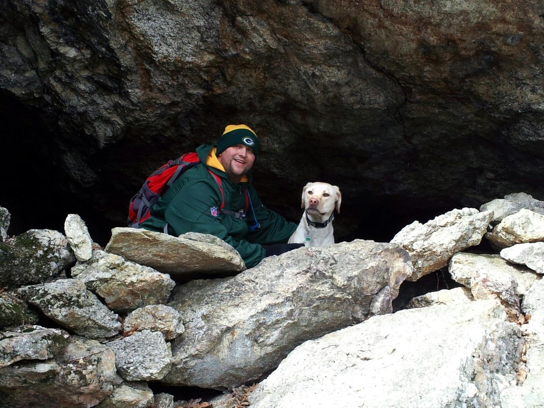
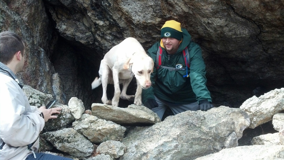
Along with the rugged sections of the trail, there are also some really cool highlights. About three miles in to our journey, we came to what the walk book calls “Rock Pile Cave”. It is really more of an overhang than a cave, but there is a way to crawl through one large entrance and out the side. Or at least we could see light coming through the other side. I don’t think anyone else was willing to try and squeeze through and I am definitely too big. Regardless, we got some cool pictures. I like the one where Roscoe is in “take-off”mode, jumping over the rock pile.
Along with the rugged sections of the trail, there are also some really cool highlights. About three miles in to our journey, we came to what the walk book calls “Rock Pile Cave”. It is really more of an overhang than a cave, but there is a way to crawl through one large entrance and out the side. Or at least we could see light coming through the other side. I don’t think anyone else was willing to try and squeeze through and I am definitely too big. Regardless, we got some cool pictures. I like the one where Roscoe is in “take-off”mode, jumping over the rock pile.
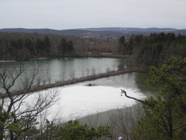
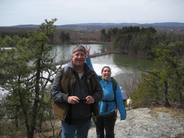
After we explored the “cave” for a bit, we started to climb to the top of a really nice view of Asylum Reservoir #1. Pictures of the climb and the view are below. I really enjoyed it up here. We could see downtown Middletown, including Middlesex Hospital and the Arrigoni Bridge (which you can read more about at http://www.portlandct.org/buildingbridge.htm). Sadly, I couldn’t get a good shot of the bridge…so I ripped one from the Middletown Press website…just so you get an idea of what it looks like.
Once we had our fill of view, we descended a very steep decline. You can kind of see Jaci through the trees in the first picture. The second picture is me looking back at the way back up after climbing down (if you end up going the opposite way…good luck).
After the descent, we crossed a stream. After crossing, Pam mentioned that she was hoping someone would balance beam it across a fallen tree in the area. I was still on the other side so I said I would do it. And, my dad felt that he should do it to so he came back and did it. I loved everyone’s commitment on this hike. It was awesome!
After the stream crossing, we climbed another ridge only to quickly descend again. We had reached the second crossing of Reservoir Road. I should note that there is another trail in the area; the blue-yellow blazed Reservoir Loop, which I hope to cover on a future hike in the area. At Reservoir Road, the two trails intersect. We stayed on the Mattabesett, climbed some more, descended again and crossed over the Reservoir Loop trail a few more times.
I had read that the last mile or so of this section is pretty flat, and I have to say that it is…but only in comparison to the ups and downs of the other portions of this hike. There are still a lot of hills in this area, and after using up most of our energy and the climbs and descents to and from the ledges, we were all pretty frustrated. Mark and Pam seemed to be doing okay, but the Armstrong clan was struggling…even Roscoe seemed to be slowing down.
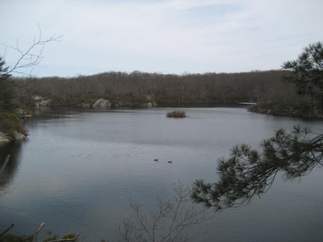
Eventually, we came to the area of Asylum Reservoir #2 and I got a picture of some geese doing their thing. I was jealous, but it was cold so I wasn’t jealous enough to take a dip.
I had read that the last mile or so of this section is pretty flat, and I have to say that it is…but only in comparison to the ups and downs of the other portions of this hike. There are still a lot of hills in this area, and after using up most of our energy and the climbs and descents to and from the ledges, we were all pretty frustrated. Mark and Pam seemed to be doing okay, but the Armstrong clan was struggling…even Roscoe seemed to be slowing down.
Eventually, we came to the area of Asylum Reservoir #2 and I got a picture of some geese doing their thing. I was jealous, but it was cold so I wasn’t jealous enough to take a dip.
From the reservoir, we crossed Brooks Road, climbed one last short(er) hill and made our way to Bear Hill Road, where Mark’s car and my dad’s truck were waiting for us.
In hindsight, we probably could have hiked the 6.8 miles of the Nipmuck in less time than it took us to hike the 4.9 miles of the Mattabesett. But, I believe this error on my part was meant to be. On the positive side, after more than 150 miles of hiking the trails in the CFPA Walk Book East, I’ve finally completed the first section of the first trail in the book. I’ve had the book for six months now…it was about time I put a check box on page 1…
Distance to goal: 278.84
