Hike #42
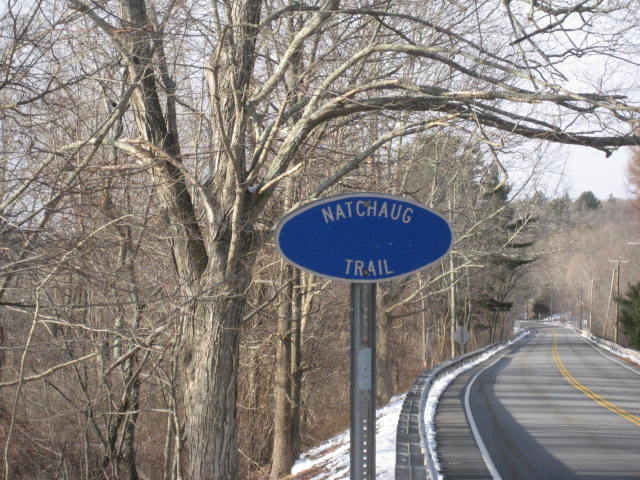
Trail: Natchaug
Section: Nathaniel Lyon Memorial Park to Rt. 44 (Eastford, CT)
Distance: 8.8 miles
Approx Time to Complete: 4 hours
Date Hiked: 3/23/2013
Date Published: 3/24/2013
Trail: Natchaug
Section: Nathaniel Lyon Memorial Park to Rt. 44 (Eastford, CT)
Distance: 8.8 miles
Approx Time to Complete: 4 hours
Date Hiked: 3/23/2013
Date Published: 3/24/2013
It has been a while since I've hiked on the Natchaug Trail. When I last hiked it, on Hike # 20, it was still 2012 and Roscoe came home with some nasty chaffing from his new orange (safe from hunters) vest. That day, we parked at Nathaniel Lyon Memorial Park and made our way south along the trail. On this hike, I parked in almost the same exact spot and we made our way due north along the trail to Rt. 44.
Adding some intrigue to this hike, it snowed again last week. So, if it looks a little odd that there is more snow on the ground in these pictures than in the pictures from last weekend's hikes, that's why. March in New England...gotta love it!!!
There weren’t a lot of highlights on this hike, but I was able to cover 8.8 miles in less than four hours, which is in complete contrast to my last hike (the one through Middletown with a group of friends and famil). That said, there were still some highlights and some things to point out along the way. So, let’s get started…
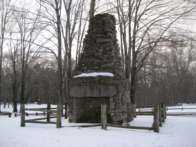
Before we even left the parking lot of Lyon Memorial Park, we were treated to our first highlight, which is an old chimney situated right in the middle of the parking lot. I had seen it before but, at the time, I didn’t have my camera. So, I wasn’t able to get any pictures of this giant…
Adding some intrigue to this hike, it snowed again last week. So, if it looks a little odd that there is more snow on the ground in these pictures than in the pictures from last weekend's hikes, that's why. March in New England...gotta love it!!!
There weren’t a lot of highlights on this hike, but I was able to cover 8.8 miles in less than four hours, which is in complete contrast to my last hike (the one through Middletown with a group of friends and famil). That said, there were still some highlights and some things to point out along the way. So, let’s get started…
Before we even left the parking lot of Lyon Memorial Park, we were treated to our first highlight, which is an old chimney situated right in the middle of the parking lot. I had seen it before but, at the time, I didn’t have my camera. So, I wasn’t able to get any pictures of this giant…
From the area of the chimney, the trail heads due west for about a tenth of a mile. It wasn’t long before we made a slight right turn and started to leave the area of the park. The woods here are pretty thick, but the trees are still lacking leaves so we were able to enjoy a view across the Natchaug Valley. The sun, which had just come up about half an hour earlier, was shining brightly on the hill across the Still River. In about an hour, I would be making my way up and across that hill. For now, I just drank in the beautiful morning. I also turned back to the southeast to take this picture of the rising sun…
Over the first three quarters of a mile, the trail descends and, since I only had one car, this meant I would be ending my hike with a climb. That’s right, this was an out and back hike…and, I have to admit that I was not looking forward to ending it with a climb. Additionally, due to an error in the CFPA Walk Book (which I’ll discuss later), I was expecting this to be a 10.8 mile hike. To be honest, I was dreading this climb on the way back. But it ended up not being all that bad.
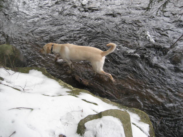
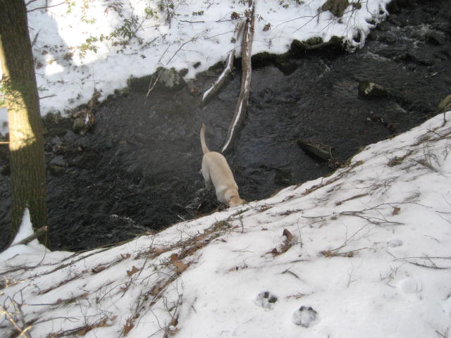
After climbing again for a short stretch (maybe a quarter of a mile or so), the trail descends again to the bank of the Still River. On Hike #20, Roscoe played in this same river (a little further to the south) a bit. So, I gave him a few minutes to enjoy the water on this hike as well…
After climbing again for a short stretch (maybe a quarter of a mile or so), the trail descends again to the bank of the Still River. On Hike #20, Roscoe played in this same river (a little further to the south) a bit. So, I gave him a few minutes to enjoy the water on this hike as well…
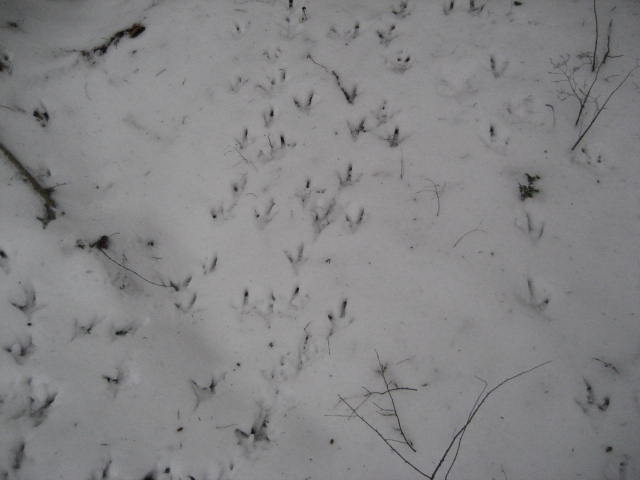
A little further up the trail, we found a plethora of turkey tracks in the snow. I guess these guys use the river as a water source…
Around the two and half mile mark, the trail comes to Pilfershire Road. No this isn’t Middle Earth…just Eastford, CT. We followed the road to the left, over the bridge which crosses the Still River…
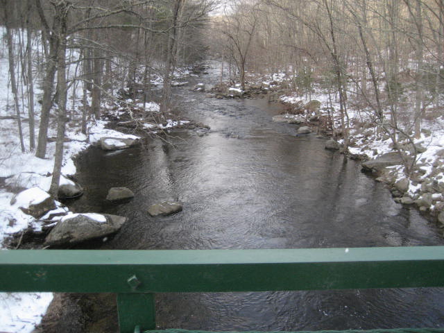
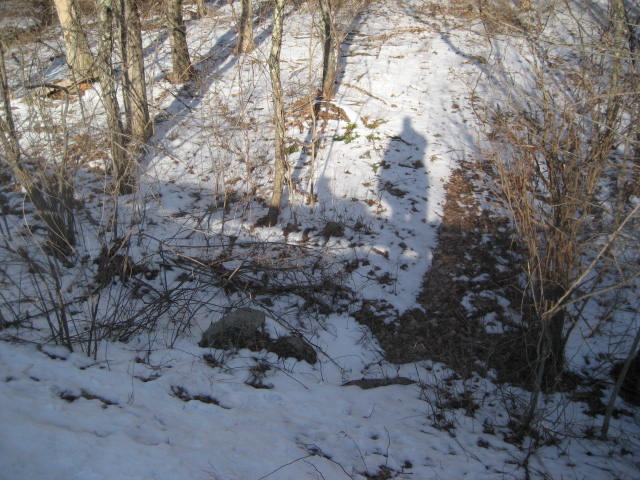
Now on the other side of the river, we made another left and followed General Lyon Road until it turns into Chaplin Road (Rt. 198). Here the CFPA Walk Book overstates the mileage. It says that the road walks (including Pilfershire, General Lyon, and Chaplin Roads) total to 1.3 miles. In fact, it is only a third of a mile. I didn’t even register this until I got to Rt. 44 and MapMyHike told me the entire journey from Lyon Memorial Park was only 4.4 miles. Anyway, we eventually came to the spot where the trail turns away from Chaplin Road and reenters the woods. I stopped to take a picture of the hike down the embankment because I thought it looked cool that you could see our shadows…
After a while, around the three and a half mile mark, we came to nice field. As we were approaching, a hawk (possibly a Red-Tailed but I’m not certain) took off from one of the trees overhead. I would have another run in with what I believe was the same hawk again later on my trip back. Sadly, she was too fast and I am too slow with the camera.
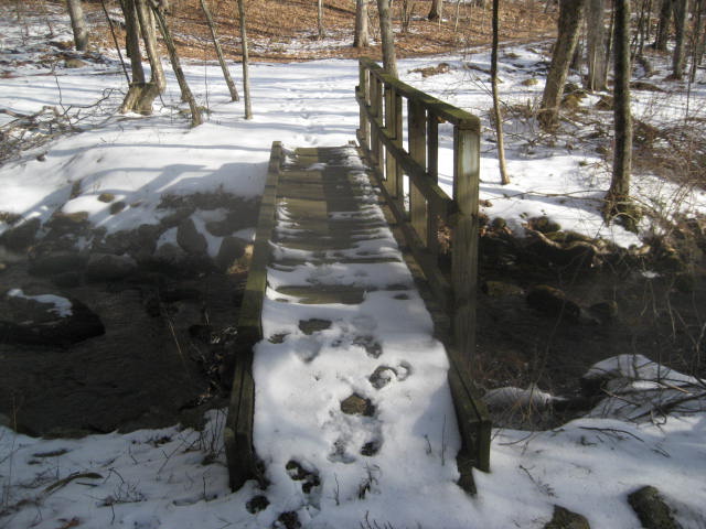
After the field, the trail crosses Stones Brook. There is a cool footbridge here. Hidden behind the handrail, on the other side, is a trail log. I missed it on the way out, but saw it on the way back and stopped to leave a message…
After the field, the trail crosses Stones Brook. There is a cool footbridge here. Hidden behind the handrail, on the other side, is a trail log. I missed it on the way out, but saw it on the way back and stopped to leave a message…
Shortly after the bridge, the trail makes a sharp left turn and turns away from the woods road it was following. We climbed and I took a look back, now looking across the valley from the opposite way I was looking before. Here the trail follows a ridge through some laurel. Roscoe took the time to climb down an embankment and play in the water some more…
Two seconds after I took that picture, he scaled from the water straight up the side of the embankment and was by my side. I feel so inferior when he shows off like that.
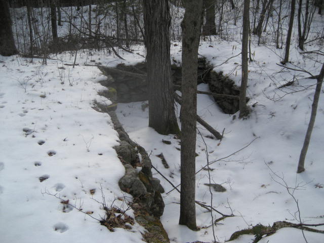
Shortly after, we came to another woods road. The trail follow the road for a bit before making a slight left and passing this cellar dwelling, which is just off the trail, to the right…
Shortly after, we came to another woods road. The trail follow the road for a bit before making a slight left and passing this cellar dwelling, which is just off the trail, to the right…
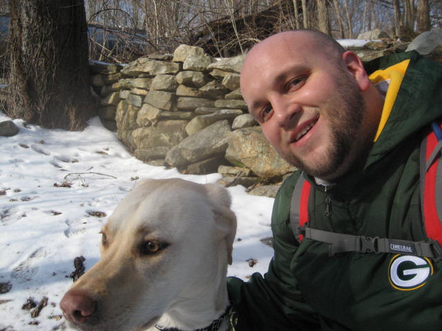
The path which passes the cellar dwelling seemingly only connects the one woods road to another. But, I was thankful that someone took the time to make it so that I didn’t have to hike the woods road the whole time. We followed the second woods road and, after a short while, reached the Rt. 44 crossing. I originally planned to make this crossing on my next trip through the area, figuring it would be early morning when I got there, but the traffic was so light I decided just to cross it now. Once on the other side, I took the picture below and removed a few layers for the hike back…
As I mentioned, the hike back was highlighted by realizing that there was a trail log on the footbridge which crosses Stones Brook. I took a few minutes to flip through it and then left a message of my own. You know I had to promote this site…

From the bridge, we made our way back along the trail until we made it back to my car. All in all, it was a solid day of hiking. I was a little disappointed that I lost two miles due to the error in the Walk Book (I had been looking forward to a 10+ mile hike all week). But, after struggling to cover just five miles last Sunday, I was glad I was able to cover 8.8 miles in four hours. Additionally, there are only two more sections before this trail intersects with Nipmuck Trail. And, they are shorter sections. So, I’m thinking I can cover them both in one final hike.
One final note, the map below only shows my hike out to Rt. 44. I was worried that my phone would die before I made it back to my car. So, you don’t get to see the full mileage. But, you can get an idea of the terrain you are dealing with.
Distance to goal: 270.04
One final note, the map below only shows my hike out to Rt. 44. I was worried that my phone would die before I made it back to my car. So, you don’t get to see the full mileage. But, you can get an idea of the terrain you are dealing with.
Distance to goal: 270.04
