Hike #44
Trail: Nipmuck
Section: Route 74 (Ashford, CT) to Eastford Road (Ashford, CT)
Distance: 6.8 miles
Approx Time to Complete: 4 hours
Date Hiked: 4/6/2013
Date Published: 4/6/2013
Trail: Nipmuck
Section: Route 74 (Ashford, CT) to Eastford Road (Ashford, CT)
Distance: 6.8 miles
Approx Time to Complete: 4 hours
Date Hiked: 4/6/2013
Date Published: 4/6/2013
The first weekend of April…and spring is in the air…so, my dad and I decided to take Roscoe and continue our journey along the Nipmuck Trail. It had been over a month since we completed the previous section (on Hike # 39) so we were anxious to get back to it. Fortunately, we were going to have near perfect weather for this hike.
We started by leaving my dad’s truck at a small parking location to the southeast of the trail on Eastford Road in Ashford. There are only two small parking locations here so parking is very limited. Fortunately, we arrived early and were the first car there. From Eastford Road, we made our way back in my car to the trailhead off of Rt. 74 and hit the trail.
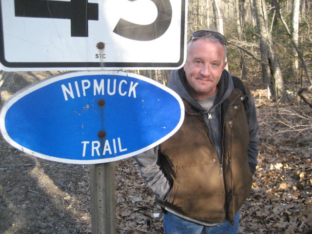
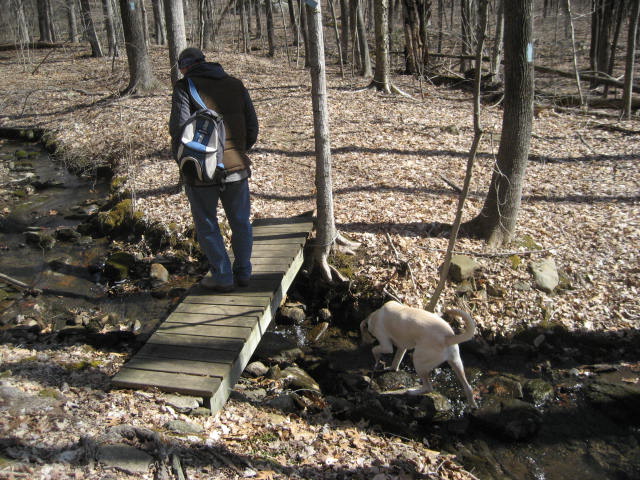
The first part of our hike was actually a short road walk along Rt. 74. You should exercise caution as, apparently, drivers in the area like to fly by hikers on the side of the road doing 60mph. We hopped over the guardrail and set off on the trail, but not before I took the picture of my dad you see above.
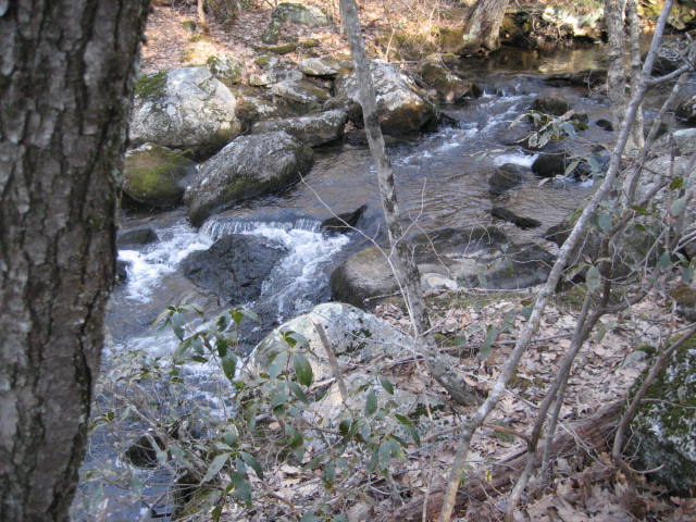
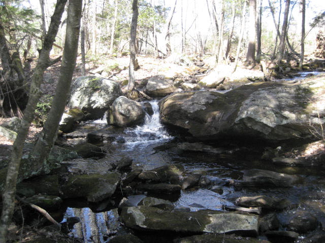
The trail follows along this brook for a stretch…
We started by leaving my dad’s truck at a small parking location to the southeast of the trail on Eastford Road in Ashford. There are only two small parking locations here so parking is very limited. Fortunately, we arrived early and were the first car there. From Eastford Road, we made our way back in my car to the trailhead off of Rt. 74 and hit the trail.
The first part of our hike was actually a short road walk along Rt. 74. You should exercise caution as, apparently, drivers in the area like to fly by hikers on the side of the road doing 60mph. We hopped over the guardrail and set off on the trail, but not before I took the picture of my dad you see above.
The trail follows along this brook for a stretch…
Other than the walk along the brook, there wasn’t much to see in the first mile and a quarter. However, this was a very enjoyable section of woods. Around the 1.2 mile mark, we came to the first road crossing of the day, Perry Hill Road. Perry Hill is a paved road so we held Roscoe back until we could confirm that there were no cars coming.
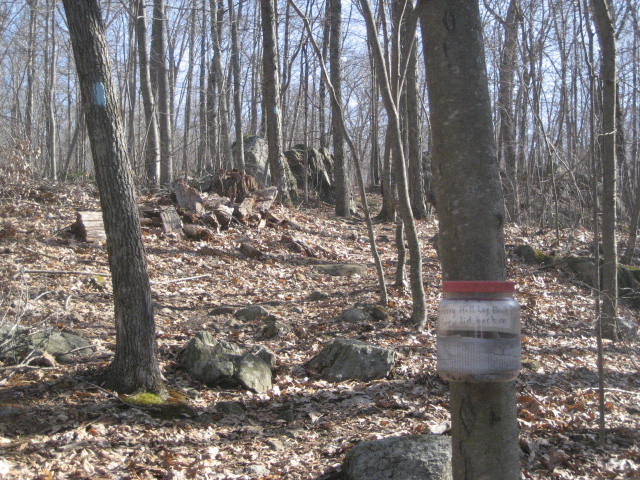
After we crossed the road, we came upon this jar with a trail log in it…
After we crossed the road, we came upon this jar with a trail log in it…
I stopped to leave a quick note in the log and, in the process, paused my Map My Hike app. I forgot to turn it back on when I was done. So, for about a half of a mile we lost some elevation data. So, don't panic when you see the elevation changes on the map at the end of this post. Later, my neglect would lead to more problems as I would be forced to stop the app when my phone battery started to die. As a result, the map is about a mile or so short of the true mileage. I assure we did complete the whole 6.8 mile section. As much as my dad joked about needing lifestar, we didn’t actually just stop in the middle of the woods.
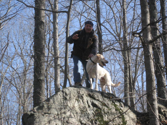
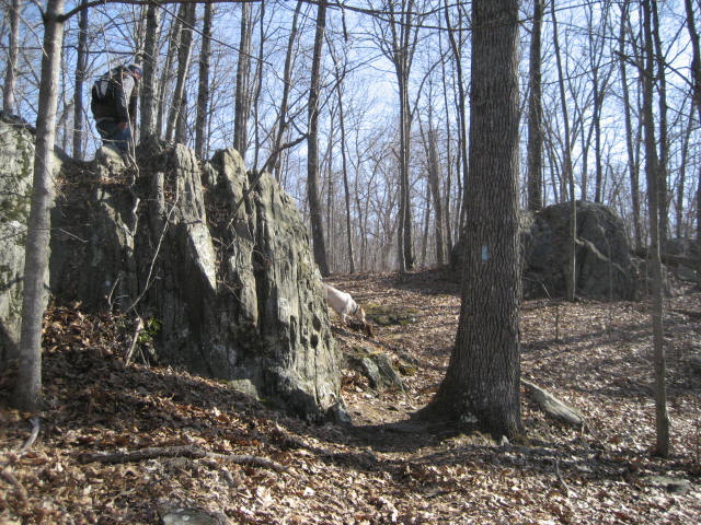
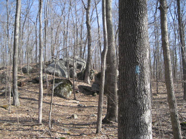
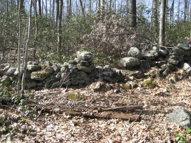
Over the next mile or so, we did some climbing and some descending, but nothing overly complicated. This was really a fairly easy walk through the woods of eastern Connecticut. We passed some cool rock formations and took some pictures along the way…
Over the next mile or so, we did some climbing and some descending, but nothing overly complicated. This was really a fairly easy walk through the woods of eastern Connecticut. We passed some cool rock formations and took some pictures along the way…
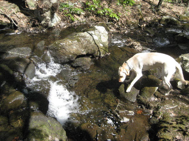
There were also some bridges over streams...
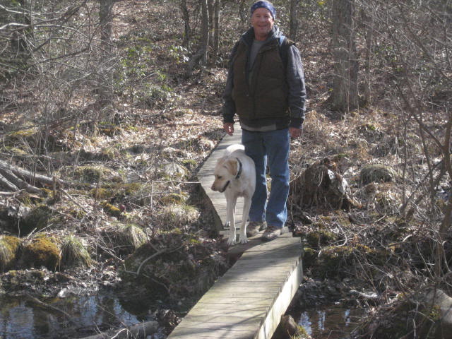
For one member of our party, those bridges were "optional"...
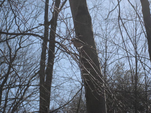
Somewhere around the three mile mark, we came to an area with a lot of birds, particularly chickadees. One, which originally landed right next to us, only to then take off once we got our cameras ready, regained his bravery and returned to a branch right next to our heads. Somehow, the picture still didn’t come out as good as I thought it would…
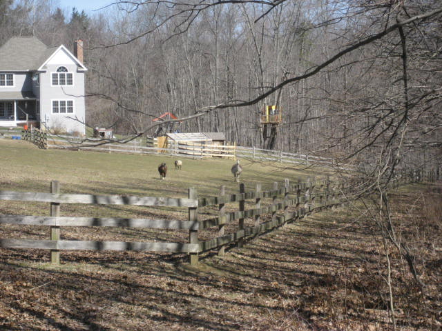
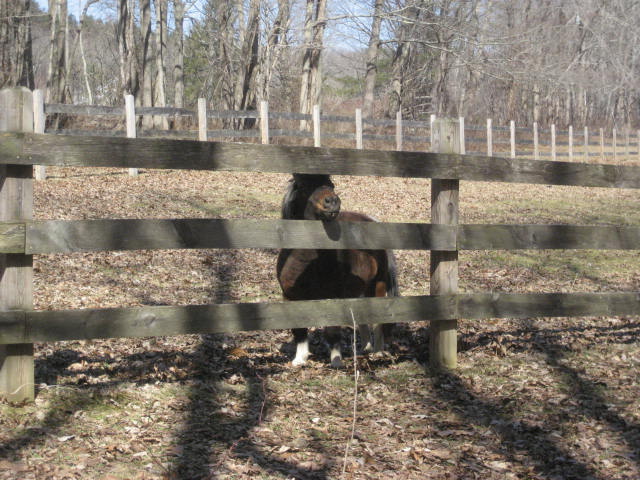
Around the three and a half mile mark, the trail crosses Westford Hill Road. Instead of heading immediately back into the woods on the other side, the trail follows along the edge of someone’s property. These might be the coolest homeowners in all of Connecticut. Not only do they have a llama, but they will see your llama and raise you one miniature…flippin’…pony!
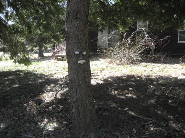
Around the three and a half mile mark, the trail comes out to Oakes Road and follows that for a bit. The road is a dirt road and it doesn’t appear to be travelled all that often…so this wasn’t the worst road walk in the world. Eventually, we came to Route 89 and made a left hand turn. The trail only follows 89 for about 100 feet before turning right on Iron Mine Lane. We passed some tree faces along the way…
Iron Mine Lane eventually becomes a private road. So, the trail makes a hard left turn and enters a section of the Natchauge State Forest. As we were following an old woods road, an animal that looked like it could be a coyote crossed the trail in front of us. This is either the second time I’ve seen a coyote while hiking…the first time I’ve seen a coyote while hiking…or I’ve never seen a coyote while hiking. Just like on Hike # 2, while following the Salmon River Tail, I wasn’t able to confirm that it was definitely a coyote. My dad is certain that it was.
Around the 5 and a three quarter mile mark (5.5 according to the Walk Book), there is a side trail to Pixie Falls. The two things Connecticut is really lacking are actual caves and actual waterfalls. We call a bunch of stuff caves and falls that really aren’t. So, I wasn’t too disappointed when we got to Pixie Falls and saw this…
Around the 5 and a three quarter mile mark (5.5 according to the Walk Book), there is a side trail to Pixie Falls. The two things Connecticut is really lacking are actual caves and actual waterfalls. We call a bunch of stuff caves and falls that really aren’t. So, I wasn’t too disappointed when we got to Pixie Falls and saw this…
Shortly after we made our way back to the main Nipmuck, I had to save my hike map and close the app. I really need to look into a phone with a better battery.
Somewhere in the next stretch, according to the walk book, is a place called “Ladies Room Rock”. I would love to tell you exactly why they call it that, but we weren’t able to locate it. We did, however, find a group of guys setting up tents. Personally, I think it is still a little too chilly for setting up a tent in the woods. Talk to me again around Memorial Day.
We crossed another bridge, passed a few more rock formations and eventually came to where the trail intersects with the Natchaug Trail…
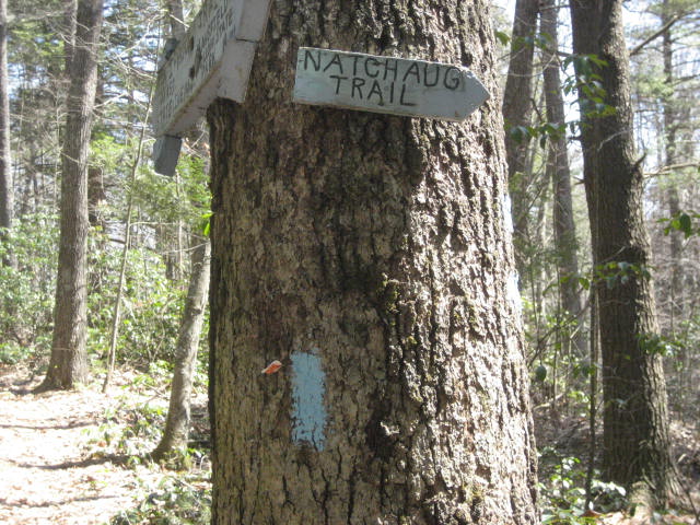
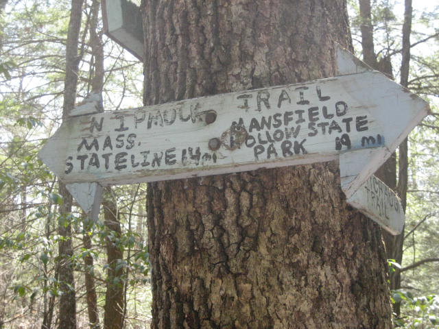
Frequent followers of my hiking adventures, will recognize the Natchaug Trail from hikes # 18, 20, and 42. That trail starts 19 miles away in the James L. Goodwin State Forest near Route 6 in Chaplin, Connecticut. At this point, I’ve covered all but 6 or 7 miles of it. My plan was to cover these next few miles of the Nipmuck and then do the remaining section of the Natchaug. I hope to finish off that trail soon.
On another side of the same tree, someone was kind enough to post the miles covered so far on the Nipmuck…and the miles remaining…
On another side of the same tree, someone was kind enough to post the miles covered so far on the Nipmuck…and the miles remaining…
From the intersection of trails, we continued north along the Nipmuck and made our way back to my dad’s truck. Next up for the Nipmuck Trail is a 9.5 mile section through the Yale Forest. After that, it is on to the section in Bigelow Hollow and the MA border.
This is a very exciting time for me…as I am nearing the completion of three “long-distance” trails (the Nipmuck, the Natchaug, and the Metacomet). I’m glad that I’ve had my dad as company along the Nipmuck. And, I can’t wait to finish it off…
Distance to 2013 goal: 257.31
This is a very exciting time for me…as I am nearing the completion of three “long-distance” trails (the Nipmuck, the Natchaug, and the Metacomet). I’m glad that I’ve had my dad as company along the Nipmuck. And, I can’t wait to finish it off…
Distance to 2013 goal: 257.31
