Hike #45
Trail: Metacomet
Section: CT/MA Border to Rt. 20 (East Granby, CT)
Direction of Travel: North to South
Distance: 7.24 miles
Approx Time to Complete: 3.25 hours
Date Hiked: 4/7/2013
Date Published: 4/7/2013
Trail: Metacomet
Section: CT/MA Border to Rt. 20 (East Granby, CT)
Direction of Travel: North to South
Distance: 7.24 miles
Approx Time to Complete: 3.25 hours
Date Hiked: 4/7/2013
Date Published: 4/7/2013
The FINAL section of the Metacomet Trail…but not MY final section of the Metacomet Trail...the final section as in “if I were to walk the Metacomet from the start (off of the Berlin Turnpike) to the end”, this would be the end. Ya dig?
As if that wasn’t confusing enough, I elected to do this section “backwards”. There is a two and a quarter mile road walk in this section which, if I followed the trail as the Walk Book has it laid out, would be at the end of this hike. If I can avoid it, I prefer not to end my hikes with road walks. And, since this one was a long road walk, I figured reversing the hike would be a good way to stretch my legs before I started any actual hiking.
We started the morning by dropping my car off at the corner of Rt. 20 (Turkey Hill Road) and Newgate Road in East Granby. Previously, on hike #33, I left my car here and made my way back to it heading north from Penwood State Park. This time, I hopped in the Jeep with Jaci and we made our way north to the border of Massachusetts on Watertown Road (which is Longyard Road once it crosses over in to MA). Roscoe and I hopped out of the Jeep at the border, said goodbye to Jaci, and started on our journey south.
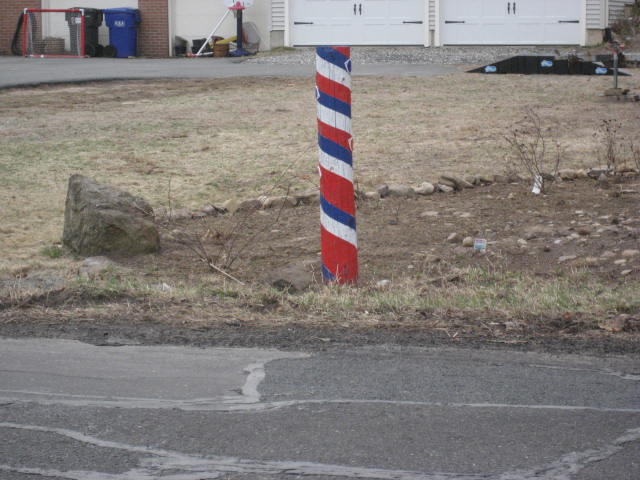
Our first landmark was a cool looking post which was painted red, white, and blue. U-S-A! U-S-A! U-S-A!
As if that wasn’t confusing enough, I elected to do this section “backwards”. There is a two and a quarter mile road walk in this section which, if I followed the trail as the Walk Book has it laid out, would be at the end of this hike. If I can avoid it, I prefer not to end my hikes with road walks. And, since this one was a long road walk, I figured reversing the hike would be a good way to stretch my legs before I started any actual hiking.
We started the morning by dropping my car off at the corner of Rt. 20 (Turkey Hill Road) and Newgate Road in East Granby. Previously, on hike #33, I left my car here and made my way back to it heading north from Penwood State Park. This time, I hopped in the Jeep with Jaci and we made our way north to the border of Massachusetts on Watertown Road (which is Longyard Road once it crosses over in to MA). Roscoe and I hopped out of the Jeep at the border, said goodbye to Jaci, and started on our journey south.
Our first landmark was a cool looking post which was painted red, white, and blue. U-S-A! U-S-A! U-S-A!
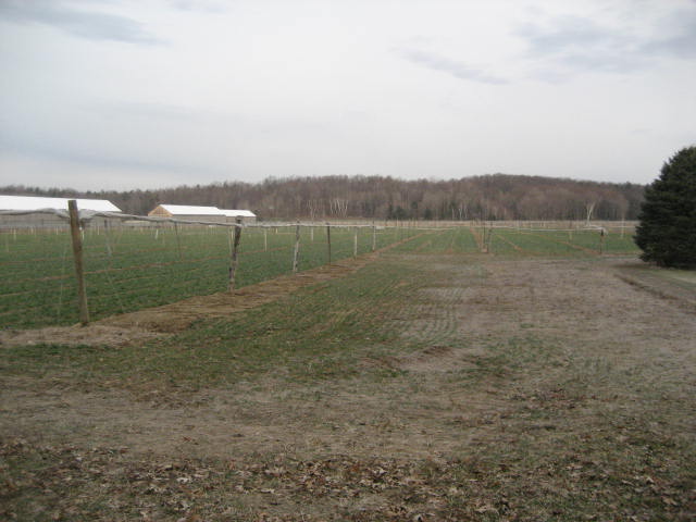
We also passed by a tobacco farm. I bet not a lot of people outside of Connecticut know that the state is full of these farms…
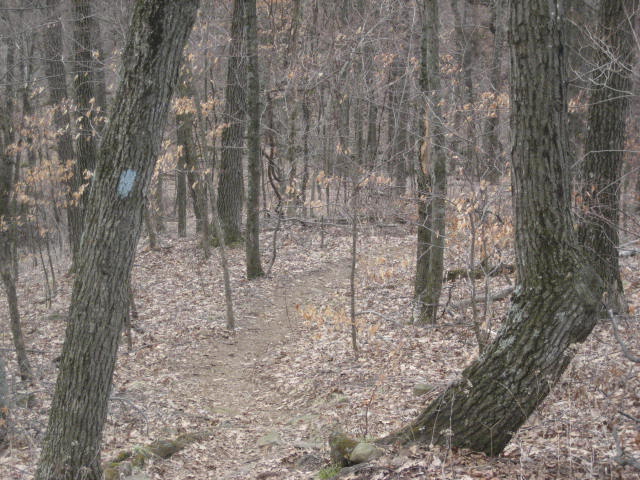
Finally, we came to our first blue blaze of the day…
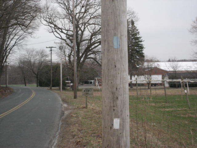
We continued walking down the road, following the occasional blue blaze on a telephone pole until West Suffield Mountain finally came into view…
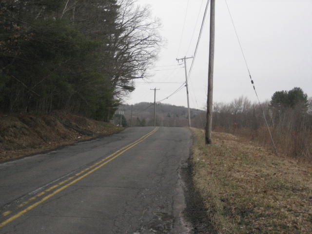
Eventually, Watertown Road changed over to Mountain Road (although we stayed straight). Along Mountain Road, we stopped to chat with an older gentleman who jokingly asked if I was delivering his paper. So, I jokingly replied “No, just this dog…”
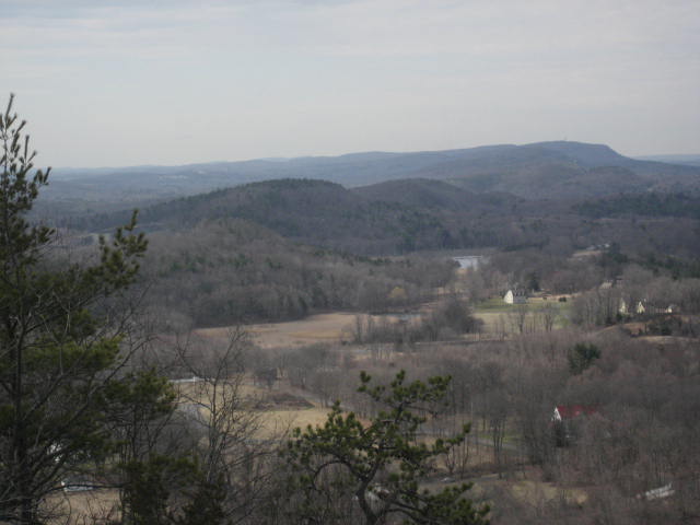
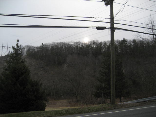
After our quick chat, the road started to head uphill and I stopped to get a quick picture of the sun through the haze over Suffield Mountain. I don’t know the exact specifics of the property ownership in the area, but it would be nice if the trail was moved to head over Suffield Mountain. That way, we could do away with this 2+ mile road walk.
After our quick chat, the road started to head uphill and I stopped to get a quick picture of the sun through the haze over Suffield Mountain. I don’t know the exact specifics of the property ownership in the area, but it would be nice if the trail was moved to head over Suffield Mountain. That way, we could do away with this 2+ mile road walk.
Once the trail reaches the intersection of Mountain Road and Phelps Road, we made a hard right turn and began the first actual hiking of the day. This being the Metacomet, we were in for a good climb over a series of switchbacks.
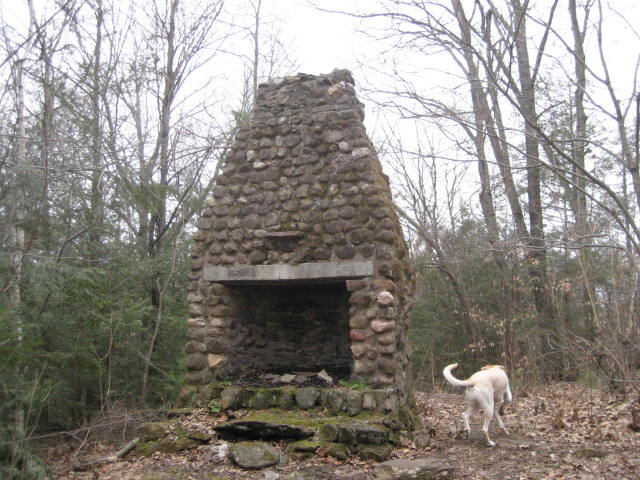
The trail through here is nice and it wasn’t long before we came to a short side trail, which led to the remains of an old summer cottage…
The trail through here is nice and it wasn’t long before we came to a short side trail, which led to the remains of an old summer cottage…
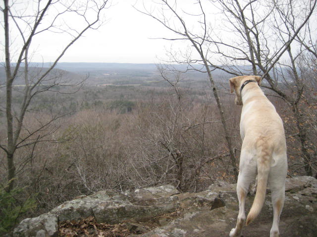
Around the three and a half mile mark, we crossed the summit of West Suffield Mountain (691 feet). Along the way, we enjoyed a few limited views to the west. The ridge you see in the distance is the Tunxis. Once I finish off the hikes in the Walk Book East (and get my hands on the Walk Book West), I will be hiking along that ridge…
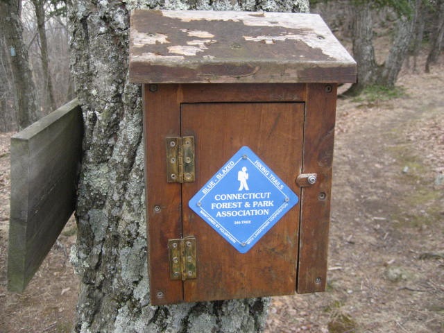
Shortly after, we came to a trail log. Someone was kind enough to put the GPS coordinates on the tree next to the log. In case you were curious EXACTLY where I was at the moment I took the pictures below…
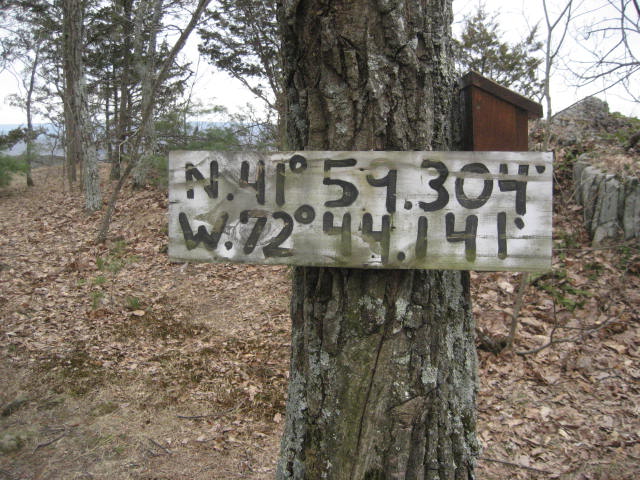
I added a quick note to the trail log and we were on our way.
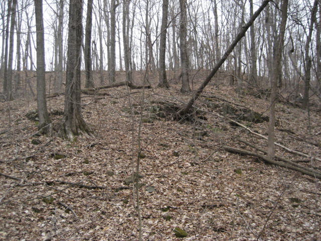
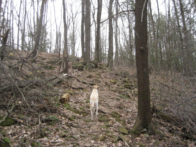
Somewhere in the next section there was a crazy descent. It doesn’t look that bad from the top (first picture below). But, when I reached the bottom I looked back (second picture) and was impressed by how much ground we covered in so little time…
Somewhere in the next section there was a crazy descent. It doesn’t look that bad from the top (first picture below). But, when I reached the bottom I looked back (second picture) and was impressed by how much ground we covered in so little time…
Of course, once we reached the bottom, that meant we had to climb back up. After all, this is the Metacomet…
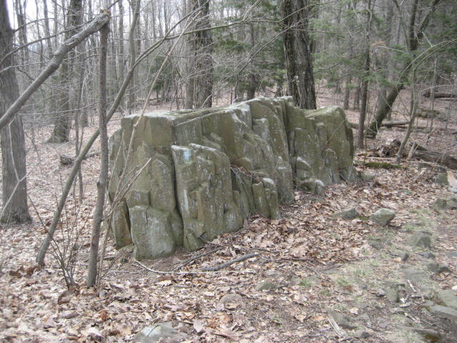
Around the four mile mark, we came to a cool stone marker in the middle of the woods. This marker designates the boundary between the towns of Suffield (S.) and East Granby (E. G.)…
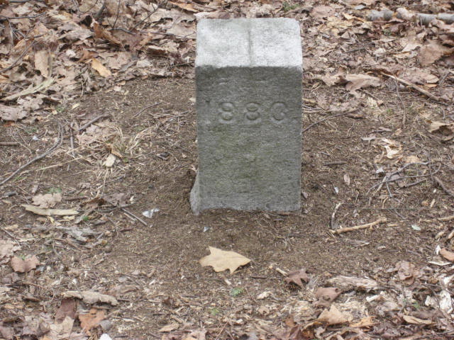
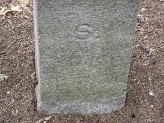
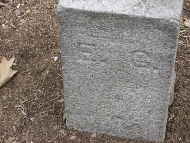
The marker was somewhat challenging to find coming from the north. I imagine it is easier to spot coming from the south, but I actually walked by it at first. It wasn’t until I saw the rock formation in the picture below and snapped a picture of it that I noticed the marker. So, if you are travelling north to south, and you see this rock formation, turn around and you should see the marker…
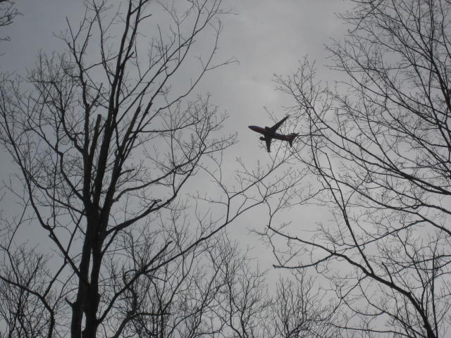
Earlier in the week, as I was discussing my hiking plans with a coworker who lives in the area, I mentioned how I was looking forward to the possibility of having planes from Bradley International Airport fly directly over my head. I had that experience the last time I was hiking the Metacomet to the south of this section (Hike # 33) and I was hoping to have it again. Well, ask and you shall receive…
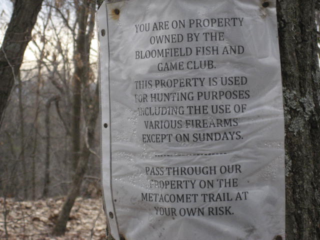
Shortly after, we came to this interesting warning sign. I found it interesting because…well, because isn’t ALL hiking “at your own risk”?
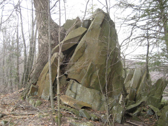
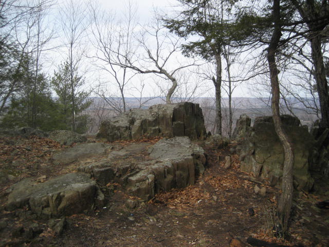
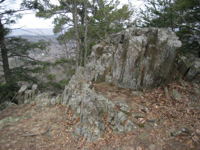
Over the next two to two and half miles, we passed some cool looking rock formations…
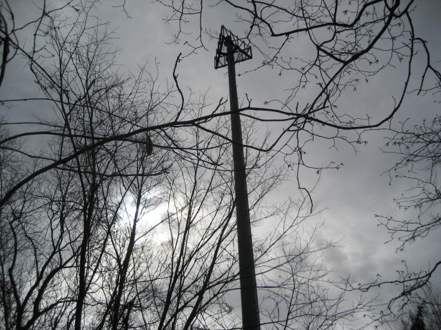
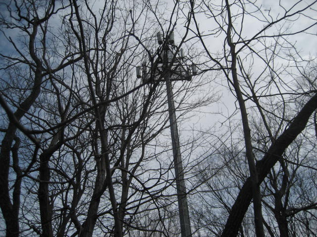
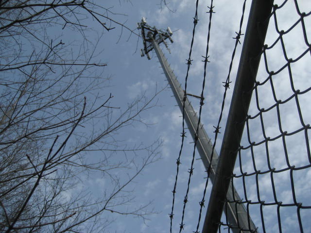
And then some not so cool looking cell/radio towers…
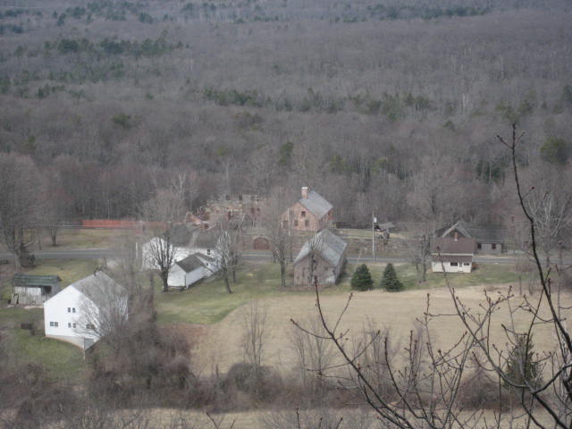
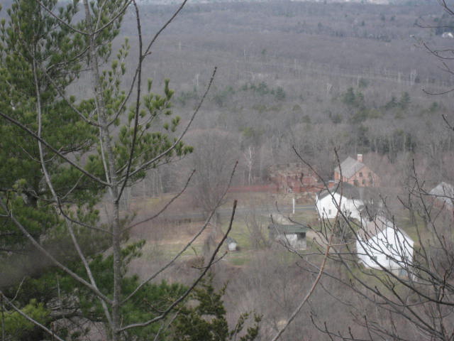
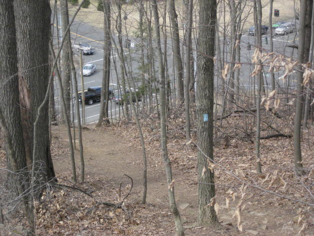
We also came to the two major highlights of this hike. The first was an overlook of Old Newgate Prison in East Granby. Old Newgate, which opened as a copper mine in 1705, became Connecticut's first prison in 1773. It has been closed for restoration for as long as I can remember. And, I’ve never actually been inside so this was a nice way to see what it looks like. As usual, my pictures don’t do it justice (it is the red building with the brick wall on the other side of the street) but you can read more about it at http://www.cultureandtourism.org/cct/cwp/view.asp?a=2127&q=302258
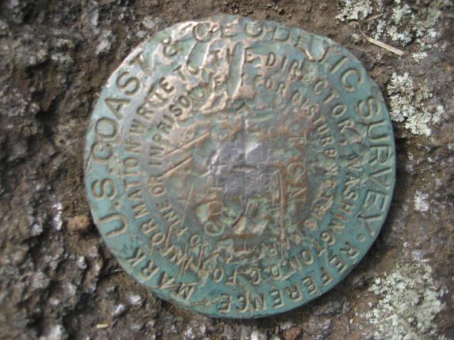
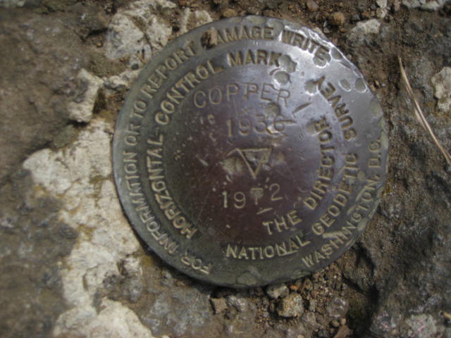
The second major highlight was a pair of USGS survey markers at the high point of Copper Mountain (also called Peak Mountain), which is 672 feet high. According to the Walk Book, the first marker below is from 1936. The second one then, I believe, must be from 1972. Either way, these things have been here for a while…and that is cool…
The final overlook of the day included a view to the south, which allowed me to take in some of the sections of the Metacomet I had already travelled. In the picture below, atop the ridge to the right of frame, barely visible is Heublein Tower…

From the view to the south, we started our descent. Along the way back to the car, the ridge flattens out for a bit, which allowed me to put some hop in my step. As usual, my phone battery was dying and I didn’t want to have to stop my MapMyHike app before I got back to my car. Still, I slowed up a bit when I heard the call of a Red-Tailed Hawk. Eventually, I did see it (again, ask and you shall receive) but I wasn’t quick enough to get a picture.
It wasn’t long before we came to the point where the trail makes a hard right and descends to the intersection of Rt. 20 and Newgate Road…
It wasn’t long before we came to the point where the trail makes a hard right and descends to the intersection of Rt. 20 and Newgate Road…
There we found my car, hopped in, and made our way back home.
Distance to 2013 goal: 250.07
Distance to 2013 goal: 250.07
