Hike #46
Trail: Metacomet
Section: Castle Craig (Meriden, CT) to Ragged Mountain Preserve (Berlin, CT)
Direction of Travel: South to North
Distance: 10.88 toal miles (roughly 7.9 along the Metacomet)
Approx Time to Complete: 5.5 hours
Date Hiked: 4/13/2013
Date Published: 4/20/2013
Trail: Metacomet
Section: Castle Craig (Meriden, CT) to Ragged Mountain Preserve (Berlin, CT)
Direction of Travel: South to North
Distance: 10.88 toal miles (roughly 7.9 along the Metacomet)
Approx Time to Complete: 5.5 hours
Date Hiked: 4/13/2013
Date Published: 4/20/2013
My plan for this section of the Metacomet started back in November, on Hike # 17. On that hike, I started at the very beginning of the Metacomet and attempted to work my way over 13 miles, but came up short and had to stop when I reached Castle Craig. So, on this day, my plan was to start near Hubbard Park in Meriden, work my way up to Castle Craig via the road, and work my way over to Ragged Mountain along the blue blazed Metacomet.
Before I type anything else, I have to stop here and give credit to Jaci. Not only was she willing to let me go hiking on this day, her birthday, but she was even willing to get up early and drop me off in Meriden. Pretty special.
So, we dropped my car at the entrance to the Ragged Mountain Preserve Trail (on West Lane in Berlin), I jumped in the Jeep with Jaci and Roscoe, and we made our way down to the drop off point. Roscoe and I said goodbye to Jaci and hit the trail, but not before hitting the road. By road I mean the road which leads up to Castle Craig. I think at certain times of the year you can drive a car up this road, but it was early in the season. Since we didn’t need to worry about any cars, I let Roscoe run off leash.
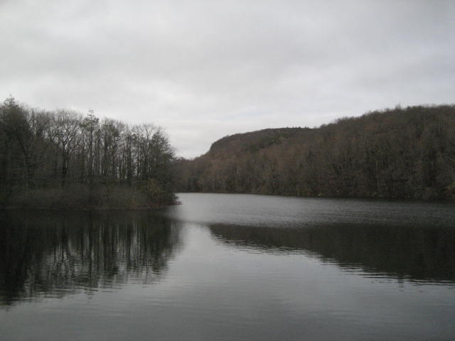
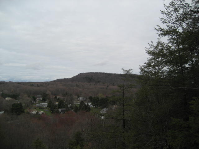
Before we got too far from the drop off point (near where the trail crosses Park Road), I stopped to take this picture of Merimere Reservoir. As you can tell from the picture, it was a cloudy but calm day…
Before I type anything else, I have to stop here and give credit to Jaci. Not only was she willing to let me go hiking on this day, her birthday, but she was even willing to get up early and drop me off in Meriden. Pretty special.
So, we dropped my car at the entrance to the Ragged Mountain Preserve Trail (on West Lane in Berlin), I jumped in the Jeep with Jaci and Roscoe, and we made our way down to the drop off point. Roscoe and I said goodbye to Jaci and hit the trail, but not before hitting the road. By road I mean the road which leads up to Castle Craig. I think at certain times of the year you can drive a car up this road, but it was early in the season. Since we didn’t need to worry about any cars, I let Roscoe run off leash.
Before we got too far from the drop off point (near where the trail crosses Park Road), I stopped to take this picture of Merimere Reservoir. As you can tell from the picture, it was a cloudy but calm day…
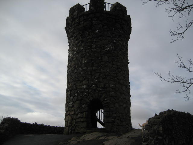
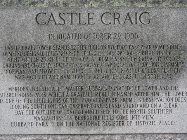
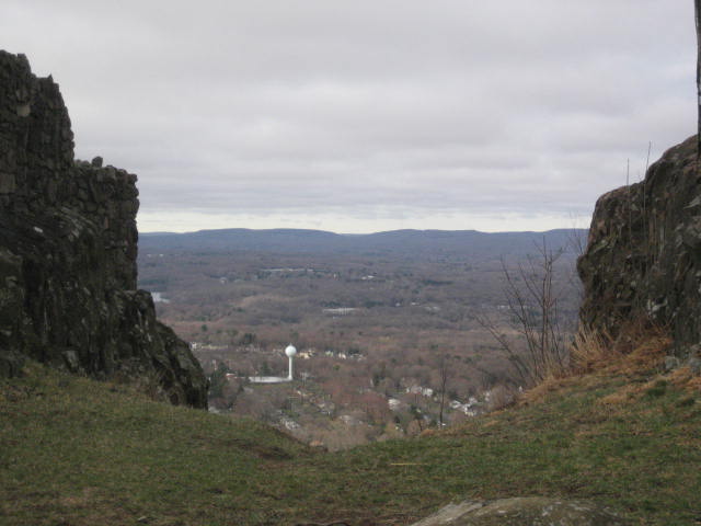
For the first mile and three quarters of this hike, we followed the road as it climbed up to Castle Craig. The castle, which is really just a round tower, was built using the native traprock which can be found all along the Metacomet. It stands 32 feet tall and its construction was supervised by local industrialist Walter Hubbard, for which Hubbard Park, the park surrounding Castle Craig, is named. After my "failure" on my previous hike through the area, I started to get giddy as the tower came into view…
Back in November, when I was up here last, the gate to the tower was locked and I wasn’t able to climb the stairs to the top. This time, as we approached, I could see that the gate was open so I took a few pictures, climbed the steps to the top, and took a lot more pictures (including another shot of Merimere Reservoir and Sleeping Giant)…
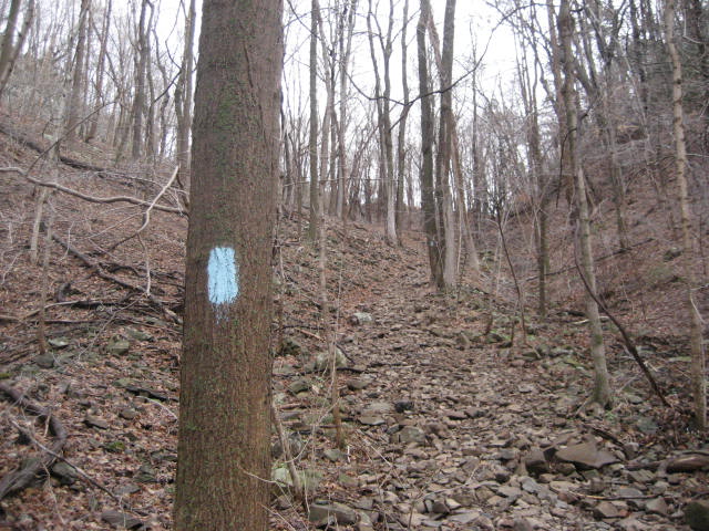
After we were done sight-seeing, we made our way back down to the base of the tower and resumed our trip along the Metacomet. The trail makes its way back along the edge of the park road Roscoe and I had used to make our way up (we even saw the blue blazes just off the road on the way). So, we were basically doubling back at this point.
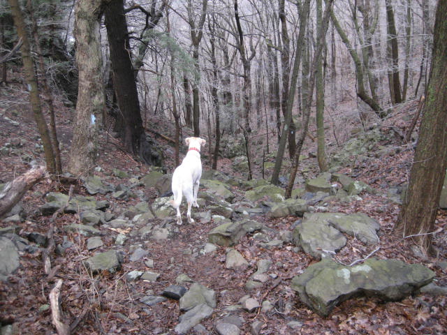
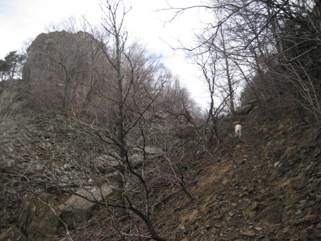
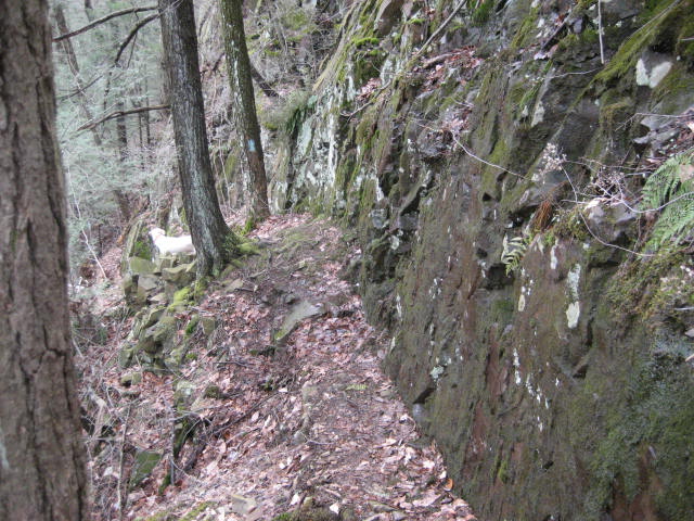
This section of trail is pretty rugged. There were a lot of ups and downs and a lot of sections with loose traprock. Adding a degree of difficulty was the fact that it had rained pretty much all week and, more recently, the night before this hike. I would advise that, if you are new to hiking, you should only hike this trail on a dry day. I slipped more times than I could count and, while not an expert hiker, I consider myself a pretty experienced hiker at this point.
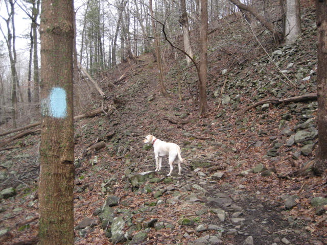
Also along this next section is one of the most frustrating parts of the Metacomet. Here, the trail makes a hard left turn and descends steeply about 400 feet…
This section of trail is pretty rugged. There were a lot of ups and downs and a lot of sections with loose traprock. Adding a degree of difficulty was the fact that it had rained pretty much all week and, more recently, the night before this hike. I would advise that, if you are new to hiking, you should only hike this trail on a dry day. I slipped more times than I could count and, while not an expert hiker, I consider myself a pretty experienced hiker at this point.
Also along this next section is one of the most frustrating parts of the Metacomet. Here, the trail makes a hard left turn and descends steeply about 400 feet…
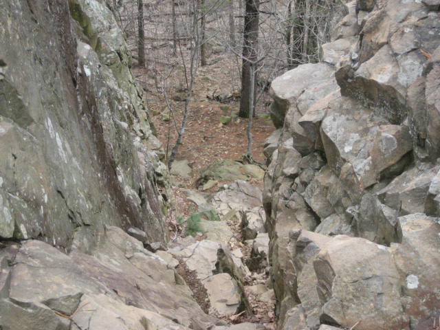
Once you reach the bottom (and look back up the trail, like in the second picture above), you will find that you are only down here for about 50 feet before you start to climb right back up…
...and up...
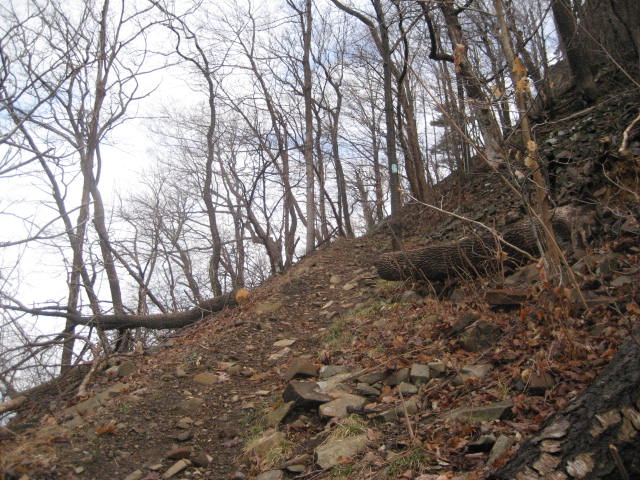
...and up!
The good news is that there was a reward for all that effort. It came in the form of West Peak, which, at 1020 feet, is my third highest elevation reached (although it would drop to fourth the day after this hike when, on another hike, my dad and I climbed to 1050 feet). If you haven’t had a look at my “Peak” list in a while, you should take minute to check it out. I’ve added quite a few "peaks" to the list since I first started tracking them over the winter.
Here, the trail meets back up with a section of the park road. So, basically...if you wanted to make your way from East Peak (Castle Craig) to West Peak, you could just follow the park road. Those of you who are looking to complete the whole Metacomet and the CT400 will need to follow the trail down, over, and up up up. But, don’t let the pictures turn you away. It really wasn’t all bad…and that’s coming from a guy who is (still) 300+ pounds. You can do it.
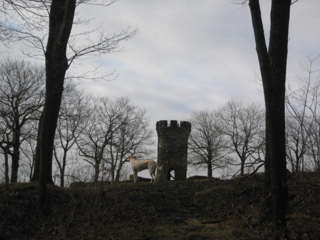
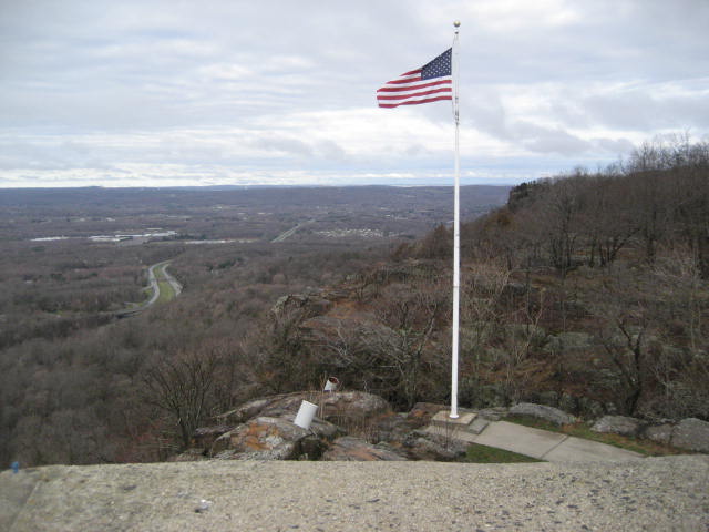
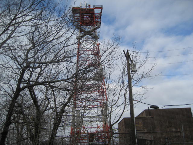
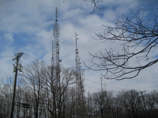
In order to catch my breath after the intense climb, I stalled by taking some pictures of the various towers on top of West Peak…
Here, the trail meets back up with a section of the park road. So, basically...if you wanted to make your way from East Peak (Castle Craig) to West Peak, you could just follow the park road. Those of you who are looking to complete the whole Metacomet and the CT400 will need to follow the trail down, over, and up up up. But, don’t let the pictures turn you away. It really wasn’t all bad…and that’s coming from a guy who is (still) 300+ pounds. You can do it.
In order to catch my breath after the intense climb, I stalled by taking some pictures of the various towers on top of West Peak…
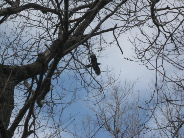
As I approached the towers, I heard a familiar bird call. I grew very excited as, the last time I heard this particular bird call, I wasn’t sure yet what type of bird it was and I never saw it. This time, I was determined to locate the bird and, hopefully, get a picture. This mystery bird I type of is "my" mystery bird, the one I first heard all the way back on Hike # 15…but still had yet to see...the Raven.
As I continued to get closer to the tower which I believed to be housing the Raven, I slowly reached in to my pocket to get my camera. As I was pulling out the camera I spotted him. And, he must have known because he jumped off of the tower and took flight. Fortunately, I was quick with my camera (for the first…and probably only time ever) and I got this shot of him as he flew about 20 feet over my head…
As I continued to get closer to the tower which I believed to be housing the Raven, I slowly reached in to my pocket to get my camera. As I was pulling out the camera I spotted him. And, he must have known because he jumped off of the tower and took flight. Fortunately, I was quick with my camera (for the first…and probably only time ever) and I got this shot of him as he flew about 20 feet over my head…
We spent the next mile or so walking along West Peak. There is a curious bit of Connecticut folklore connected to this section of trail. According to legend, there is a small black canine that wanders the area. The “Black Dog of West Peak”, as it is known, has reportedly been seen by many people who, as with most of these strange sighting reports (aliens, bigfoot, etc.), tried to follow it and were unable to get recorded evidence. The dog supposedly leaves no footprints and makes no sound when it barks. It is also said that multiple encounters with the Black Dog of West Peak may result in death. I don’t believe in any of this nonsense, but I suppose if I did I would be happy to be in the company of a white dog who leaves muddy footprints in the back of my car and very much makes a sound when he barks…
Eventually, the trail descends to this gas pipeline…
We crossed a stream, followed a woods road for a bit, and eventually made our way out to Edgewood Road. From there, we followed Edgewood Road for just under a mile and a half before crossing Route 364 near Timberlin Golf Course. Just before re-entering the woods and leaving the golf course behind, I took this picture. Four!
We listened to the sound of golf balls being struck as we made our way through the woods. I really enjoyed the trail here. I didn’t have the map memorized so when I noticed a blue blaze on top of the ridge next to me my original thought that there must have been a re-route. Then I realized that the section on top of the ridge is part of a switch back, which I love. For me, there is nothing like being able to look out over the trail you just passed a few minutes earlier.
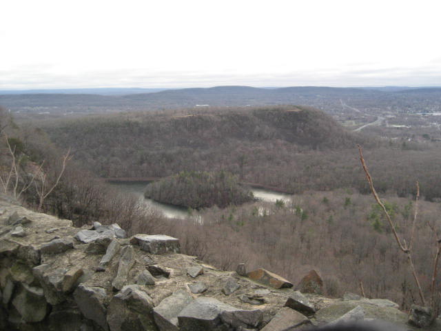
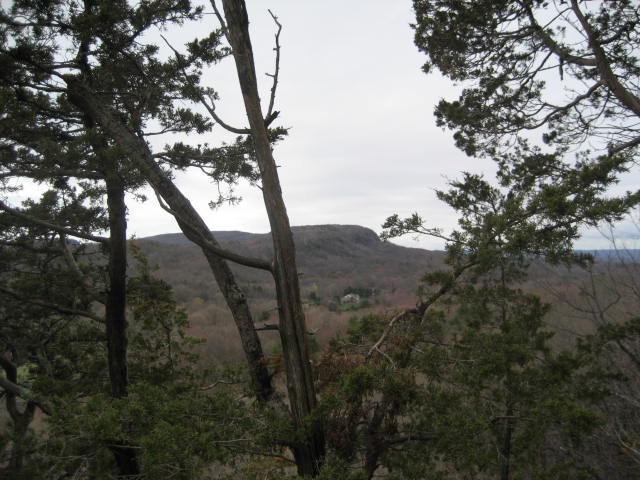
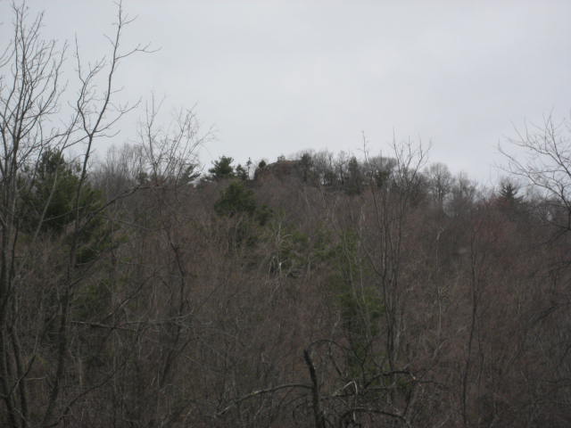
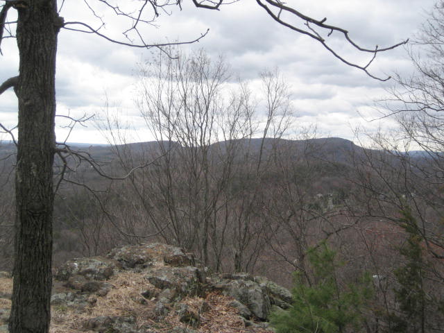
We continued up the trail, approaching the summit of Short Mountain (520 feet), and came to this overlook. In the picture below, you can see West Peak. Only a few hours earlier, I was standing on top of that peak watching a Raven fly over my head…
We continued up the trail, approaching the summit of Short Mountain (520 feet), and came to this overlook. In the picture below, you can see West Peak. Only a few hours earlier, I was standing on top of that peak watching a Raven fly over my head…
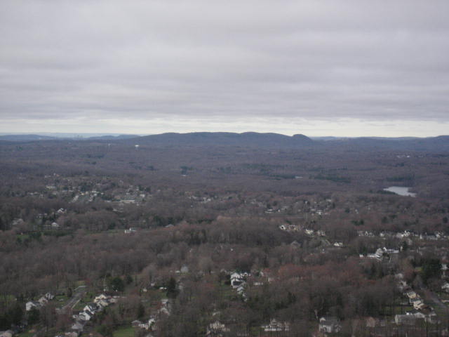
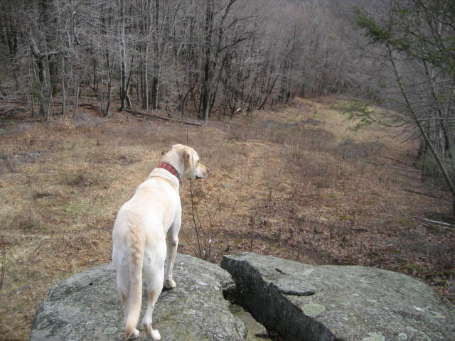
As we made our way along the trail, we also came to an overlook which provided a view of Ragged Mountain, to the north. In a few more hours, I would be on top of that peak overlooking the entire trail I covered today…
Getting there, however, would be a bit of a challenge. First, we encountered this rather dangerous looking ledge walk. Roscoe didn’t have any trouble with it but I wasn’t very happy when he felt the need to cross, come back, and re-cross it. So, I hurried across…
There is also an extremely dangerous descent, of which, for some reason, I don’t have any pictures. My only thought on this is I was all business at that point.
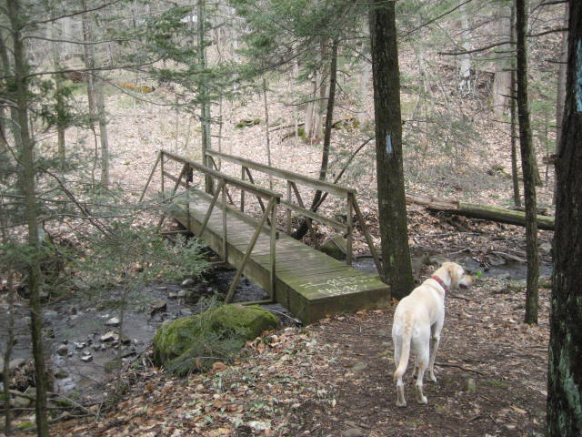
After the descent, the trail becomes considerably less challenging. We came to this cool looking bridge crossing and stopped to rehydrate. Later , I would drink my Camelbak dry (a first)…
After the descent, the trail becomes considerably less challenging. We came to this cool looking bridge crossing and stopped to rehydrate. Later , I would drink my Camelbak dry (a first)…

Shortly after the bridge (Ross Bridge, as the walk book calls it), the trail comes out to a paved private drive and heads uphill to Carey Street. It follows Carey Street for a bit and then turns right on to another (unpaved, this time) private drive.
From the entrance to this drive, there is a view of the top of Ragged Mountain, as seen below...
From the entrance to this drive, there is a view of the top of Ragged Mountain, as seen below...
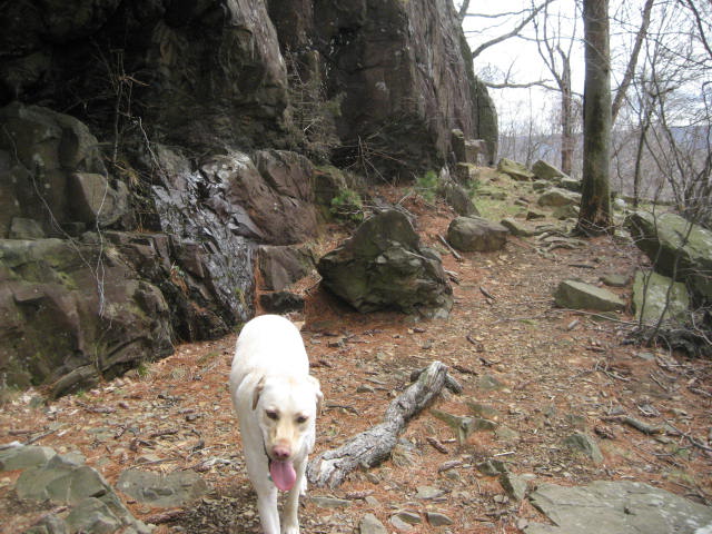
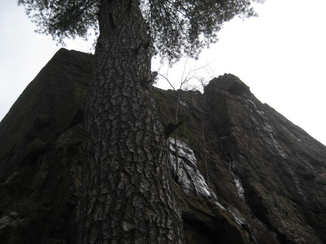
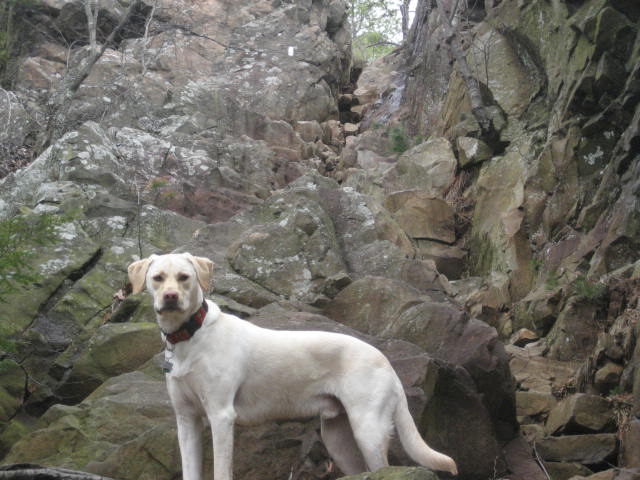
To reach the top, there is a double cliff where you climb for a bit (moderately steep) to the base of a small cliff and then climb (very steeply) over a section of rocks to reach the higher cliff. We paused at the small cliff to take some pictures…
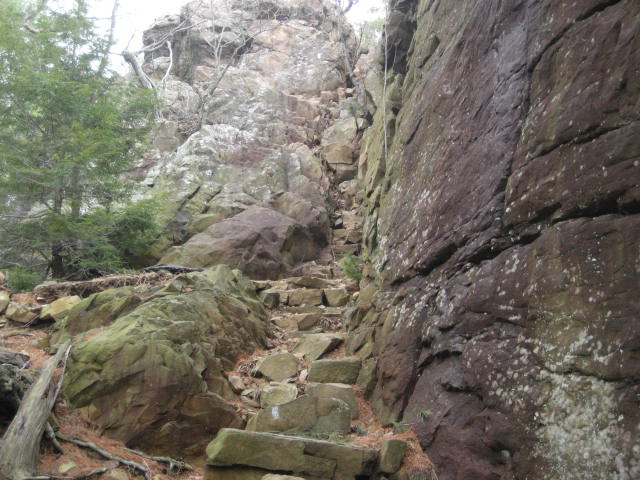
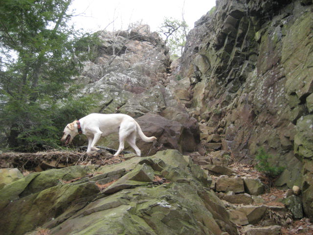
Yes, the trail does go up that very steep, very narrow stair-case looking rock section. And, while the stair-case is as close as it comes to a description, this thing is nothing like any staircase I’ve ever seen. It gets narrower and narrower as you approach the top. And, the “steps” get taller and more misshapen. With the rocks still slippery from the overnight rainfall, we attempted to climb to the top but Roscoe seemed to be having difficulty and I was getting visions of our New Year’s Day debacle (Hike # 27). So, after considering my options, I decided to head back down to the safety of the small cliff.
I refused to give up that easily. I was just in the area a few weeks ago and I knew that, if I could find another way to get to the top of the cliff, I could tie Roscoe to a tree, climb back down the proper trail, and then climb back up by myself. So, we searched around the area a bit and eventually found our way to the top.
As we were nearing the top, another dog owner commented how we picked an awfully steep way to come up. I replied by explaining that I tried to follow the trail but it was even steeper…and the dog refused to follow. When in doubt, blame it on the dog.
In all seriousness, I did do exactly as I planned and tied Roscoe to a tree so I could climb down the trail and back up the correct way. I just wouldn’t be able to sleep at night if I sent away for my Metacomet completion patch and didn’t actually complete every step of the trail. I would be misleading you if I didn’t tell you that I removed my pack to make the climb a little easier on my tired, aching body.
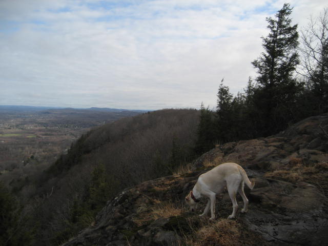
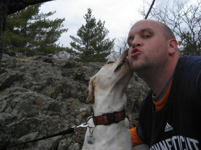
Now that we reached the summit of Ragged Mountain, we were only a couple of miles from the car. But, before we finished off this epic hike, I stopped to take a few more pictures…
I refused to give up that easily. I was just in the area a few weeks ago and I knew that, if I could find another way to get to the top of the cliff, I could tie Roscoe to a tree, climb back down the proper trail, and then climb back up by myself. So, we searched around the area a bit and eventually found our way to the top.
As we were nearing the top, another dog owner commented how we picked an awfully steep way to come up. I replied by explaining that I tried to follow the trail but it was even steeper…and the dog refused to follow. When in doubt, blame it on the dog.
In all seriousness, I did do exactly as I planned and tied Roscoe to a tree so I could climb down the trail and back up the correct way. I just wouldn’t be able to sleep at night if I sent away for my Metacomet completion patch and didn’t actually complete every step of the trail. I would be misleading you if I didn’t tell you that I removed my pack to make the climb a little easier on my tired, aching body.
Now that we reached the summit of Ragged Mountain, we were only a couple of miles from the car. But, before we finished off this epic hike, I stopped to take a few more pictures…
Now that this section is complete, I only have one more section of the Metacomet left. The cool thing about the remaining section (and in no way was this by design) is that I will end the trail right where Jaci and I first started back in October of 2011.
Distance to 2013 goal: 239.19
Distance to 2013 goal: 239.19
