Hike #49
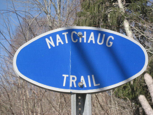
Trail: Natchaug
Section: Rt. 44 (Eastford, CT) to Nipmuck Trail (Ashford, CT)
Distance: 11.7 miles
Approx Time to Complete: 5 hours
Date Hiked: 4/25/2013
Date Published: 4/26/2013
Trail: Natchaug
Section: Rt. 44 (Eastford, CT) to Nipmuck Trail (Ashford, CT)
Distance: 11.7 miles
Approx Time to Complete: 5 hours
Date Hiked: 4/25/2013
Date Published: 4/26/2013
On the morning of this hike, I had an appointment scheduled to see the doctor. There, I weighed in at less than 300 pounds for the first time in a long time…at least 5 years. So, I was extra motivated and probably bit off more than I could chew on this one. Roscoe and I also got started a bit later than usual and had to hurry in order to make it back to the car in time for me to get to softball practice. So, if you are keeping score at home, I ran 2 miles before the doctor…hiked almost 12 miles…and then went to softball practice. I meant to post this recap when I got home last night after practice…but I fell asleep as soon as I sat down on the couch.
This “final” section of the Natchaug Trail runs from Route 44 in Eastford to the Nipmuck Trail in Ashford. And, because it runs into the Nipmuck, you have a couple of options in terms of how you handle the section. If you have two cars, you could park one along Eastford Road in Ashford and, once you reach the intersection with the Nipmuck, continue north on that trail for about a half mile before you reach the parking location. I didn’t have a second car so I parked at the trailhead on Route 44, made my way to the Nipmuck intersection, and doubled back to the car. I don’t recommend this as there aren’t a ton of highlights in this section and it was a little overkill to have to do this section twice.
That said, I will always remember this section of the Natchaug as it allowed me to complete a trail I had been working since early December. That hike, # 18, took me through the James L. Goodwin State Forest...in the first snowfall of the winter. Now that I’ve completed it, the Natchaug is...and will forever be...the second “long-distance” trail I’ve completed (the Shenipsit was the first).
Another personal note about this trail, during most of my other hikes there was snow on the ground. For this final section, it was roughly 70 degrees and there wasn’t a cloud in the sky. I found that to be an intersting contrast...especially since this was the last section.
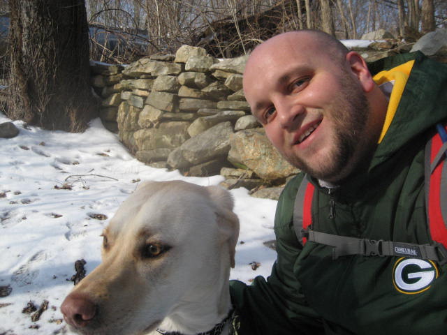
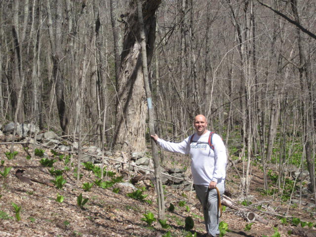
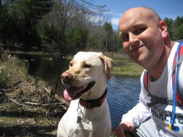
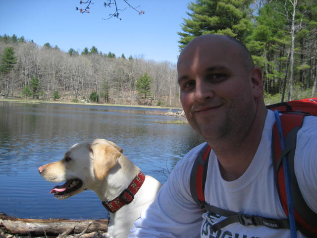
Roscoe and I had barely even started when I stopped to take the second picture below. On my last hike through the area, Hike # 42, we stopped along a rock wall and took a picture. On this hike, I used the rock wall as a make-shift camera stand. I’m reposting the first picture here for those who aren't familiar with the seasonal weather of New England. What a difference a month makes…
This “final” section of the Natchaug Trail runs from Route 44 in Eastford to the Nipmuck Trail in Ashford. And, because it runs into the Nipmuck, you have a couple of options in terms of how you handle the section. If you have two cars, you could park one along Eastford Road in Ashford and, once you reach the intersection with the Nipmuck, continue north on that trail for about a half mile before you reach the parking location. I didn’t have a second car so I parked at the trailhead on Route 44, made my way to the Nipmuck intersection, and doubled back to the car. I don’t recommend this as there aren’t a ton of highlights in this section and it was a little overkill to have to do this section twice.
That said, I will always remember this section of the Natchaug as it allowed me to complete a trail I had been working since early December. That hike, # 18, took me through the James L. Goodwin State Forest...in the first snowfall of the winter. Now that I’ve completed it, the Natchaug is...and will forever be...the second “long-distance” trail I’ve completed (the Shenipsit was the first).
Another personal note about this trail, during most of my other hikes there was snow on the ground. For this final section, it was roughly 70 degrees and there wasn’t a cloud in the sky. I found that to be an intersting contrast...especially since this was the last section.
Roscoe and I had barely even started when I stopped to take the second picture below. On my last hike through the area, Hike # 42, we stopped along a rock wall and took a picture. On this hike, I used the rock wall as a make-shift camera stand. I’m reposting the first picture here for those who aren't familiar with the seasonal weather of New England. What a difference a month makes…
The trail heads generally northwest for the first quarter of a mile. Then, it passes through a stone wall and makes a hard left. It also heads uphill here for a bit. Then, it makes a right turn and descends. Just before the half mile mark, we came to Bigelow Brook…
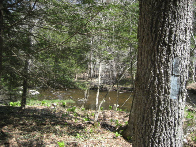
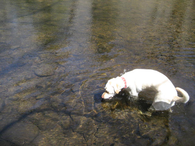
Bigelow Brook is the same brook where we stopped for lunch with my dad about a week and half earlier, on Hike # 47. So, we were already seeing signs of how the Natchaug and the Nipmuck would eventually meet up.
The trail generally follows the brook for the next two miles. Along the way, it occasionally works its way uphill and away from the brook, but quickly turns back towards the brook and downhill. This can either be fun or frustrating, depending on your mood. For me, nothing was going to bring me down from the excitement high I was on. Just before the two and a half mile mark, we crossed Ashford Road…
The trail generally follows the brook for the next two miles. Along the way, it occasionally works its way uphill and away from the brook, but quickly turns back towards the brook and downhill. This can either be fun or frustrating, depending on your mood. For me, nothing was going to bring me down from the excitement high I was on. Just before the two and a half mile mark, we crossed Ashford Road…
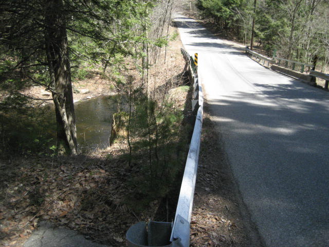
Just before the road, one of the homeowners had set up some chairs along the brook. I wasn’t sure if the chairs were put there for hikers, or if they were intended solely for the use of the homeowner. And, honestly, it didn’t matter because we did not have time to rest...so, we marched onward.
The trail on the other side of Ashford Road only follows the brook for about a tenth of a mile before it makes a left hand turn and climbs steeply for a bit. A few months ago, this would have been a struggle. But, on this day, I felt like I covered ground at a pretty good pace.
About three and a quarter miles in, the trail comes to what the walk book describes as a “scenic view to the north”. I was a little disappointed to find only a large open field and not much of a view. I could make out some of the other ridgelines in the area, but this wasn’t quite the view I was expecting…
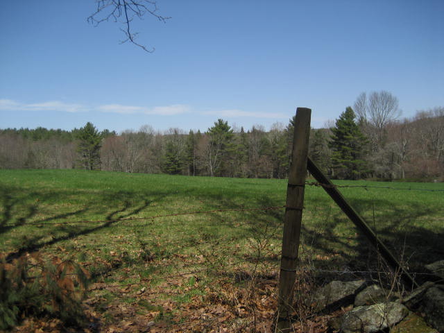
There were a lot of barbed wire fences around the area of the field and certain sections of the trail over the next half mile. I was concerned that Roscoe would take off and run into one, so I kept a watchful on him and made sure he was under the control of my voice. I came close to putting him on leash a couple of times.
Roughly three and three quarters of a mile in, we came to unpaved Moon Road. We made a right turn and followed the road for about 100 feet before making a left and heading back into the woods.
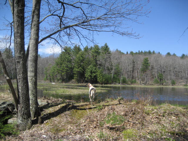
Around the four and three quarter mile mark, we came to this pond…which, according to the Walk Book, is man-made…
Roughly three and three quarters of a mile in, we came to unpaved Moon Road. We made a right turn and followed the road for about 100 feet before making a left and heading back into the woods.
Around the four and three quarter mile mark, we came to this pond…which, according to the Walk Book, is man-made…
Around the five mile mark, the trail follows several old woods roads and, at one point, I missed where the trail turned left off one of the roads. I didn’t lose too much time as I quickly realized the mistake and doubled back. The Walk Book describes another overlook in this next section but there really wasn’t much to see. Also, at this point, I was really hustling and didn’t have time to stop and take pictures of “half-views”.
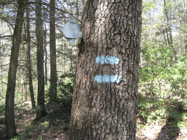
Eventually, we reached the halfway point of our trip for the day…also known as the end of the Natchaug Trail. There is a final blaze on the side of a tree where the Natchaug intersects with the Nipmuck. I stopped to take a few pictures…
Eventually, we reached the halfway point of our trip for the day…also known as the end of the Natchaug Trail. There is a final blaze on the side of a tree where the Natchaug intersects with the Nipmuck. I stopped to take a few pictures…
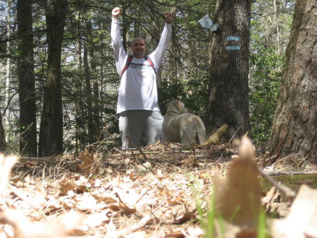
That was it…I had covered all 19.2 miles of The Natchaug Trail…from Route 6 in Chaplin to Hampton, through Eastford and into Ashford…over the course of five months...and I was now done. Well, almost done…I still had to do all 5.85 miles of this section again in order to get back to my car. And, I had to hustle because the day was fading and softball practice was calling. So, off I went…
Distance to 2013 goal: 210.24
