Hike #51
Trails: Nipmuck and Bigelow Hollow Ridge Trail (Blue/Orange)
Distance: 8.38 miles
Approx Time to Complete: 5 hours
Date Hiked: 5/4/2013
Date Published: 5/6/2013
Trails: Nipmuck and Bigelow Hollow Ridge Trail (Blue/Orange)
Distance: 8.38 miles
Approx Time to Complete: 5 hours
Date Hiked: 5/4/2013
Date Published: 5/6/2013
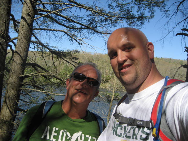
I’ve been spending a lot of time lately finishing up some of the “Long-Distance Trails” I've been working on. So, once my parents returned from their vacation in Florida, I called my dad to set up our final hike on the Nipmuck.
We originally started our journey way back in the middle of January on a day when the weather was clear but it was really cold…like 14 degree cold. Since that day, we've worked our way through the towns of Mansfield, Willington, Ashford, Eastford, and Union…roughly 38 miles North to South from a street with a curious name…Puddlin’ Lane…to one of Connecticut’s State Parks with a curious name…Bigelow Hollow.
Those of you familiar with my site will recognize Bigelow Hollow as the place where Roscoe and I made a couple of trips back in January. On the first of those hikes, I had originally planned to hike the Blue/Orange Ridge Trail. But, my plans changed when I wasn’t able to locate the trail. My plan for this hike was to use that trail to make our way back to the car…that is, once we finished off the Nipmuck…and, assuming I could find the Blue/Orange Trail this time.
We parked my car (this was the only time along the Nipmuck we only needed one car) at the parking location to the northeast of Bigelow Pond. There are multiple parking locations throughout the park which you can use, but I chose the one closest to the start of the Ridge Trail. As you will see as I make my way through this recap, we travelled the Ridge Trail in the opposite direction of which it is described in the Walk Book. So, the start of the Ridge Trail would actually be the end of our hike.
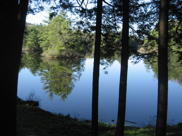
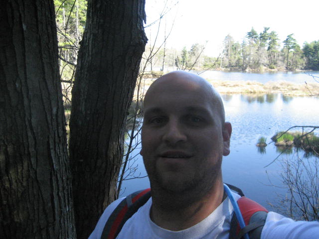
We started out at 8:15 am by making our way along the yellow blazed Bigelow Pond Loop Trail. I'd already done this trail, back on Hike # 34, but I thought it would be better to show my dad some of the other trails within Bigelow Hollow, instead walking along the main park road. Regardless, our goal was to work our way due south until we reached the area of the park entrance and could pick up the Nipmuck Trail where we had last left off. Along the way, we stopped to enjoy some of the early morning views of Bigelow Pond…
We originally started our journey way back in the middle of January on a day when the weather was clear but it was really cold…like 14 degree cold. Since that day, we've worked our way through the towns of Mansfield, Willington, Ashford, Eastford, and Union…roughly 38 miles North to South from a street with a curious name…Puddlin’ Lane…to one of Connecticut’s State Parks with a curious name…Bigelow Hollow.
Those of you familiar with my site will recognize Bigelow Hollow as the place where Roscoe and I made a couple of trips back in January. On the first of those hikes, I had originally planned to hike the Blue/Orange Ridge Trail. But, my plans changed when I wasn’t able to locate the trail. My plan for this hike was to use that trail to make our way back to the car…that is, once we finished off the Nipmuck…and, assuming I could find the Blue/Orange Trail this time.
We parked my car (this was the only time along the Nipmuck we only needed one car) at the parking location to the northeast of Bigelow Pond. There are multiple parking locations throughout the park which you can use, but I chose the one closest to the start of the Ridge Trail. As you will see as I make my way through this recap, we travelled the Ridge Trail in the opposite direction of which it is described in the Walk Book. So, the start of the Ridge Trail would actually be the end of our hike.
We started out at 8:15 am by making our way along the yellow blazed Bigelow Pond Loop Trail. I'd already done this trail, back on Hike # 34, but I thought it would be better to show my dad some of the other trails within Bigelow Hollow, instead walking along the main park road. Regardless, our goal was to work our way due south until we reached the area of the park entrance and could pick up the Nipmuck Trail where we had last left off. Along the way, we stopped to enjoy some of the early morning views of Bigelow Pond…
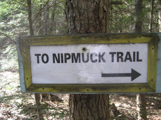
About a quarter of a mile into our hike, we reached one of the other parking areas near Bigelow Pond and, at this point, we started to make our way back to the main park road. We followed it for a short stretch (much shorter than on our last hike through the area) and eventually came to another parking area, which was followed by a short hike along the white access trail that connects to the Nipmuck.
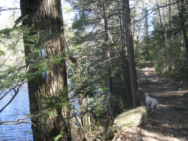
The first section of the Nipmuck in Bigelow Hollow is nice. It isn’t too hilly, but it climbs and descends gradually enough that you start to feel it in your legs. I had spent Thursday night running a lot of bases at my softball game (we scored 36 runs) so I was already feeling it in my legs as soon as I woke up. We enjoyed this hike along the east ridge of Bigelow Hollow and it reminded me a lot of my hike along the East Ridge Trail (White Blazed) back on Hike # 30.
Two miles into our hike, we came to the area designated as a helicopter landing zone, which is basically just an open field in the middle of the park. Shortly after, the trail led us down to the edge of Breakneck Pond…
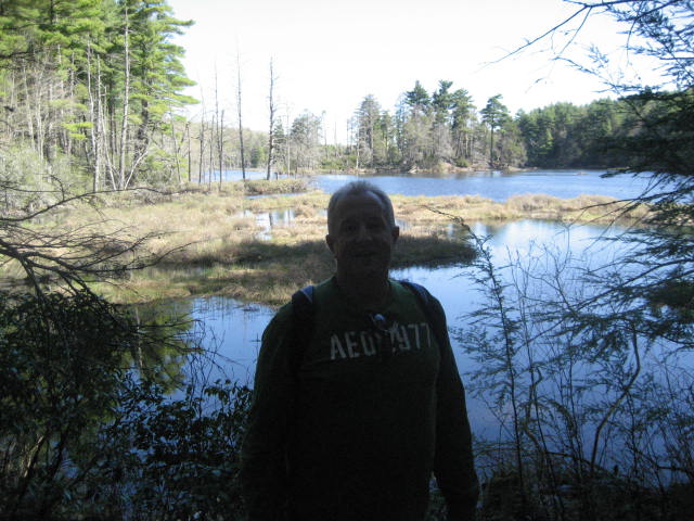
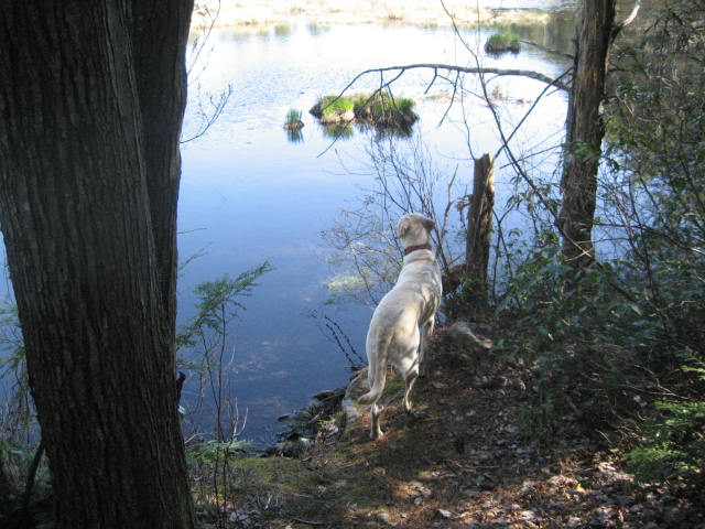
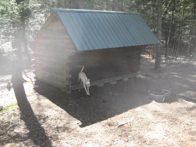
The trail follows the pond, which is long, for almost the next two miles. This section would be monotonous if it weren’t for a couple of cool pond overlooks and a camping shelter…
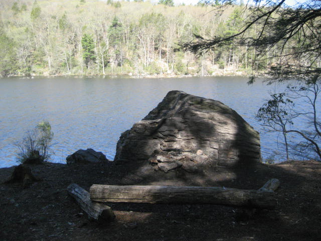
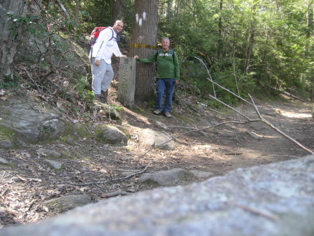
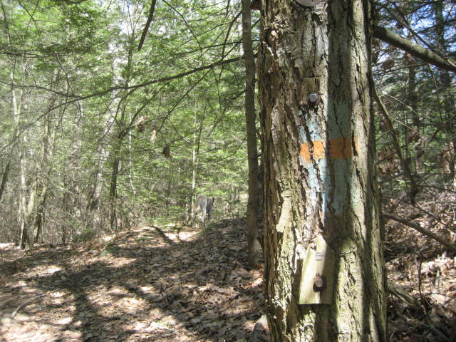
At around the three and three quarters of a mile mark, we reached the end of the Nipmuck Trail. There are three ways to know you are in the right spot. First, the final blue blaze looks like the one you see in the first picture below. As you can see in the picture, the blaze is somewhat obscured by a branch from another tree. The second way to know is that you will start to see Blue Blazes with White Dots in the middle. This is the start of a new trail…the Breakneck Pond View Trail, which Roscoe and used to make our way back to the car previously. The final way to know is the cool stone marker which marks the boundary between Connecticut and Massachusetts (second picture)…
We would have stopped to celebrate, but we still had a lot of hiking to do. And, it was getting warmer so the bugs were starting to have their say every time we lingered. From the marker, we followed the Breakneck Pond View Trail for a short stretch and debated whether or not we were ready to stop for lunch. We ended up deciding to hold off.
I was concerned about the next stretch because I wasn’t able to find the Blue Orange Trail on my previous trip through the area. But, I found it without any trouble this time. Learn from my mistake and know that the map through the area isn’t exact. It makes it look like the Blue/White Trail and the Blue/Orange Trail split from the dirt road at the exact same point. They do not. In order to pick up the Blue/Orange Trail, you have to stay on the dirt road for about ten more feet. Complicating matters is the fact that the first blaze of the Blue/Orange Trail looks like this…
I was concerned about the next stretch because I wasn’t able to find the Blue Orange Trail on my previous trip through the area. But, I found it without any trouble this time. Learn from my mistake and know that the map through the area isn’t exact. It makes it look like the Blue/White Trail and the Blue/Orange Trail split from the dirt road at the exact same point. They do not. In order to pick up the Blue/Orange Trail, you have to stay on the dirt road for about ten more feet. Complicating matters is the fact that the first blaze of the Blue/Orange Trail looks like this…
I’m probably one of only a handful a people who even had this problem since most people probably pick up the Ridge Trail back where it beings. So, really, it is my own fault for trying to switch up the trails. But, it isn’t possible to pick them all up from their start…unless you work your way back on the same trail you take out every time.
I really enjoyed the Ridge Trail. It is very hilly, winds this way and that, and travels through many different types of forest. One of my favorite parts was when the trail led directly through two large boulders…
I really enjoyed the Ridge Trail. It is very hilly, winds this way and that, and travels through many different types of forest. One of my favorite parts was when the trail led directly through two large boulders…
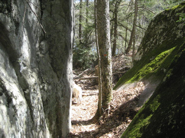
The rocks in this area, which I believe is called Cat Rocks, were massive. As we hiked along, my dad and I pondered how they got there and, more importantly, how they don’t come tumbling down the cliff.
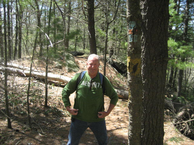
The trail drops back into Connecticut before making its way back up to Massachusetts and then heads due south again. As we were crossing back over into Connecticut for the last time, we stopped to take a picture of the yellow band on the tree. And, my dad pondered how far we were from the nearest gym…
The trail drops back into Connecticut before making its way back up to Massachusetts and then heads due south again. As we were crossing back over into Connecticut for the last time, we stopped to take a picture of the yellow band on the tree. And, my dad pondered how far we were from the nearest gym…
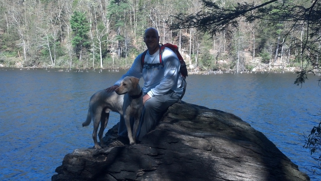
The Ridge Trail is unique for the trails in the park in that it is the only trail in the park that allows you to experience the bottom/middle of the ridge and then switches back to let you experience the top of the ridge. Previously, we had crossed through two boulders at the bottom of Cat Rocks. Shortly after, we were standing on top of Cat Rocks and enjoying the view of the ridgelines in the area...
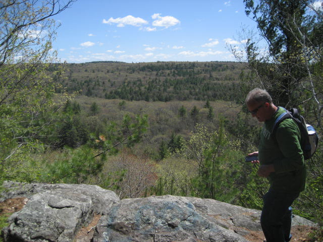
It is difficult to see in the picture, but from the ridge we were standing on, we could see the smaller ridge closest to us, which is separated by a marshy area, and the larger ridge off in the distance, which is separated by Breakneck Pond. We couldn’t actually see the pond, but I knew it was there. Around this time, I mentioned how I really wanted to see a hawk. I was really surprised we hadn’t seen one yet.
Just before the six mile mark, we came to a dirt road and followed that for a stretch. It was nice to walk on generally flat, even ground for a stretch. We again debated if we should eat, but decided to press on.
Around the six and half mile mark, we reached our highest elevation for the day. The Walk Book has it listed at 990 feet. But, my GPS tells me it is either a.) 999 feet or b.) 1047 feet. For my “Peaks” page, I’m counting it at 990 feet, but if it is really 1047 feet, that makes it a top 3 elevation. As it stands, it is top five…for now.
Also around this point, the Walk Book refers to something called Peter Rabbit Rock. Apparently, it is called this because someone carved the outline of a rabbit on the flat rocky area next to the trail. When I read about this before my first Bigelow Hollow hike, I was excited. Sadly, we never did see it. But I’m pretty sure, looking back at the maps and comparing it to Map My Hike, it isn’t too far from where we finally decided to eat lunch.
As we were sitting there, chatting and eating, we heard the “scream” of a Red-Tailed Hawk about 20 feet overhead. We watched her soar on the thermals for a few minutes and I was happy that I got my wish. She was gorgeous.
Over the final mile and three quarters, we descend back to where the Ridge Trail meets up with the white access trail that leads to the parking lot. This final stretch descends steeply at first, then more gradually, then steeply again. And, there was some trail confusion but, as you can gather from the fact that I’m typing this recap, we found our way.
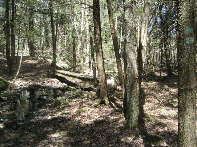
Towards the very end, about a third of a mile from the car, we came to a bog bridge. I thought this was a perfect end because almost every other trail in the park has at least one of these. And, I thought it was a nice way to close out my adventures in Bigelow Hollow…
Just before the six mile mark, we came to a dirt road and followed that for a stretch. It was nice to walk on generally flat, even ground for a stretch. We again debated if we should eat, but decided to press on.
Around the six and half mile mark, we reached our highest elevation for the day. The Walk Book has it listed at 990 feet. But, my GPS tells me it is either a.) 999 feet or b.) 1047 feet. For my “Peaks” page, I’m counting it at 990 feet, but if it is really 1047 feet, that makes it a top 3 elevation. As it stands, it is top five…for now.
Also around this point, the Walk Book refers to something called Peter Rabbit Rock. Apparently, it is called this because someone carved the outline of a rabbit on the flat rocky area next to the trail. When I read about this before my first Bigelow Hollow hike, I was excited. Sadly, we never did see it. But I’m pretty sure, looking back at the maps and comparing it to Map My Hike, it isn’t too far from where we finally decided to eat lunch.
As we were sitting there, chatting and eating, we heard the “scream” of a Red-Tailed Hawk about 20 feet overhead. We watched her soar on the thermals for a few minutes and I was happy that I got my wish. She was gorgeous.
Over the final mile and three quarters, we descend back to where the Ridge Trail meets up with the white access trail that leads to the parking lot. This final stretch descends steeply at first, then more gradually, then steeply again. And, there was some trail confusion but, as you can gather from the fact that I’m typing this recap, we found our way.
Towards the very end, about a third of a mile from the car, we came to a bog bridge. I thought this was a perfect end because almost every other trail in the park has at least one of these. And, I thought it was a nice way to close out my adventures in Bigelow Hollow…
In closing out the Nipmuck Trail, I’ve now successfully completed my fourth “long-distance” trail. I had a great time hiking with my dad. And, it was especially neat to start this trail in the dead of winter and end on a picture perfect spring day.
I’ve enjoyed hiking in the warmer weather, but the increase in bugs…especially the ticks…has left me to consider putting away my hiking gear until October. With the completion of four long-distance trails, I really don’t want to start another one and leave it unfinished for a long period of time. More importantly, I’ve really enjoyed my journeys over the last seven months and I want hiking to stay fresh. So, I’m really leaning toward a break for a few months.
I still have some things planned for over the summer, including the prospect of hiking out of state, but we’ll have to see how those plans turn out. Also, those of you who really know me…and my tendency to be OCD…know that giving up the things I like to do for any period of time will be hard. So, this might be all talk (or type) and it might not…only time will tell…
Distance to 2013 Goal: 192.71
