WARE is all the DELevation?
Hike #52
Trap Pond State Park (Laurel, DE)
Distance: 5.31 miles
Approx Time to Complete: 2 hours
Date Hiked: 7/4/2013
Date Published: 7/10/2013
Hike #52
Trap Pond State Park (Laurel, DE)
Distance: 5.31 miles
Approx Time to Complete: 2 hours
Date Hiked: 7/4/2013
Date Published: 7/10/2013
My out-of-state hiking plans started when Jaci and I decided to take a week and a half off from work around the 4th of July. Before we got married, we would vacation a lot in Ocean City, Maryland. In the two years since we were married, we had spent our vacations elsewhere. She thought, and I agreed, that it was time to return to OC. Once we decided we were going to bring Roscoe (it would be his first time coming on vacation with us), I also thought it would be a good idea to find some places for us to hike.
About 30 minutes west of Ocean City, on Maryland’s eastern shore, is a town called Salisbury, which is where we found a dog-friendly Residence Inn. While researching suitable hiking locations, I found Trap Pond State Park, which is located about 20 minutes north of where we would be staying.
Trap Pond State Park, located in Laurel, Delaware was one of Delaware’s first state parks. The park’s central feature, Trap Pond, was created in the 1700s to supply power to a sawmill. At the time, the sawmill harvested large baldcypress trees from the area. Today, the park features the northernmost natural stand of baldcypress trees in the United States.
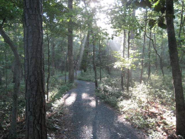
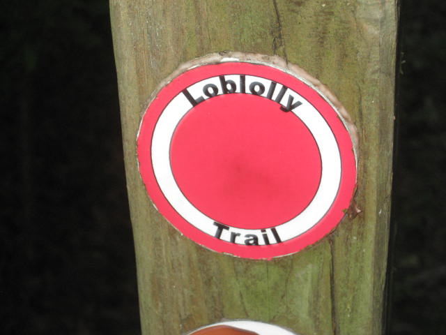
There are several trails within the park, but only one circles the park in a loop fashion which allows the hiker to travel almost the entire park. The Loblolly Trail, a crushed stone path, loops around Trap Pond and features the aforementioned baldcypress trees. This, being the longest trail throughout the park, was the one I selected.
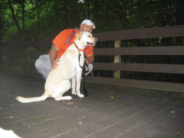
On the day of the hike, Independence Day, I woke up early (actually setting the alarm on vacation) and made my way north up Rt. 13. Roscoe was excited to be hiking for the first time in two months, and I can’t say I blame him…I was pretty excited myself. The park didn’t open until 8am so we would have to get creative with our parking situation. So, I parked in the northwest corner of the park at the boat launch.
The trail wasn’t hard to find. It actually runs right through the boat launch area. I did, however, have trouble picking up a GPS signal…a fact that would come into play later when I approached the end of my hike. After two months of waiting, we hit the trail…
About 30 minutes west of Ocean City, on Maryland’s eastern shore, is a town called Salisbury, which is where we found a dog-friendly Residence Inn. While researching suitable hiking locations, I found Trap Pond State Park, which is located about 20 minutes north of where we would be staying.
Trap Pond State Park, located in Laurel, Delaware was one of Delaware’s first state parks. The park’s central feature, Trap Pond, was created in the 1700s to supply power to a sawmill. At the time, the sawmill harvested large baldcypress trees from the area. Today, the park features the northernmost natural stand of baldcypress trees in the United States.
There are several trails within the park, but only one circles the park in a loop fashion which allows the hiker to travel almost the entire park. The Loblolly Trail, a crushed stone path, loops around Trap Pond and features the aforementioned baldcypress trees. This, being the longest trail throughout the park, was the one I selected.
On the day of the hike, Independence Day, I woke up early (actually setting the alarm on vacation) and made my way north up Rt. 13. Roscoe was excited to be hiking for the first time in two months, and I can’t say I blame him…I was pretty excited myself. The park didn’t open until 8am so we would have to get creative with our parking situation. So, I parked in the northwest corner of the park at the boat launch.
The trail wasn’t hard to find. It actually runs right through the boat launch area. I did, however, have trouble picking up a GPS signal…a fact that would come into play later when I approached the end of my hike. After two months of waiting, we hit the trail…
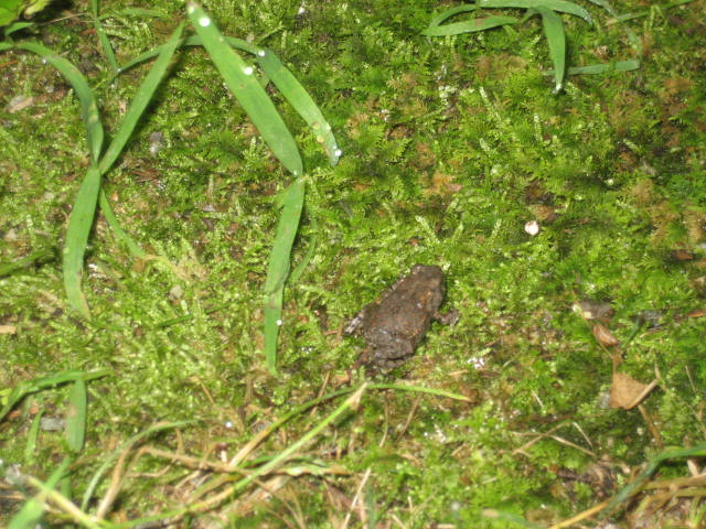
The trail starts by heading east, away from the pond. Immediately we crossed paths with our first animal of the day, when this tiny frog hopped across the gravel right in front of us…
Shortly after, we entered into the area of the park that is a campground. It was still early, so we did our best to be as quiet as possible. Soon, the trail passed the park office / store…which meant it crossed the road that serves as an entrance to the campground. We didn’t have any trouble, though, because Roscoe was still on-leash and would remain so for the rest of our hike. I was really worried about ticks…this being our first hike where the high grass ran right along the side of the trail. But, ticks turned out to be a non-issue.
For the first mile or so, the trail continues to head west to east and travels not too far from a road. This is a pretty rural area so there wasn’t too much traffic, but occasionally we could hear a car or two. At almost exactly the one mile mark, the trail makes a hard right turn and starts heading south. There aren't any blazes on the trees along the trail, but the path is clearly marked because of the crushed stone. There is also a turn arrow on a wooden post to let you know where to turn. Also, at only 78 feet above sea level, I had reached the highest elevation of the day.
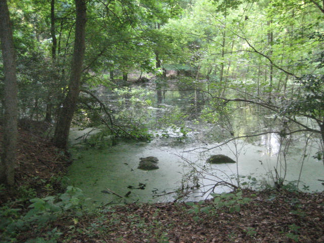
As the trail descends, it continues to head in a south by southeast direction and it starts to head back towards the pond. We passed a few areas of water and Roscoe's attention was drawn to what sounded like larger frogs…
For the first mile or so, the trail continues to head west to east and travels not too far from a road. This is a pretty rural area so there wasn’t too much traffic, but occasionally we could hear a car or two. At almost exactly the one mile mark, the trail makes a hard right turn and starts heading south. There aren't any blazes on the trees along the trail, but the path is clearly marked because of the crushed stone. There is also a turn arrow on a wooden post to let you know where to turn. Also, at only 78 feet above sea level, I had reached the highest elevation of the day.
As the trail descends, it continues to head in a south by southeast direction and it starts to head back towards the pond. We passed a few areas of water and Roscoe's attention was drawn to what sounded like larger frogs…
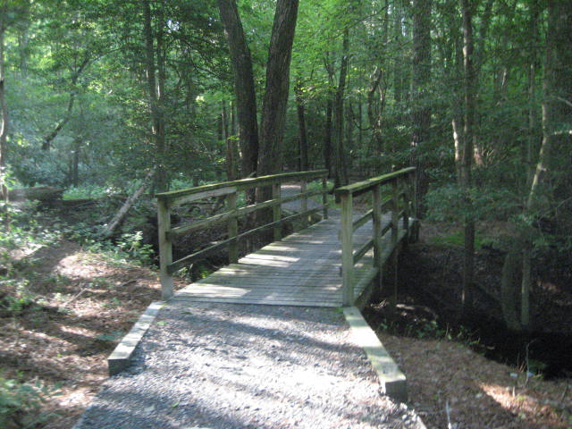
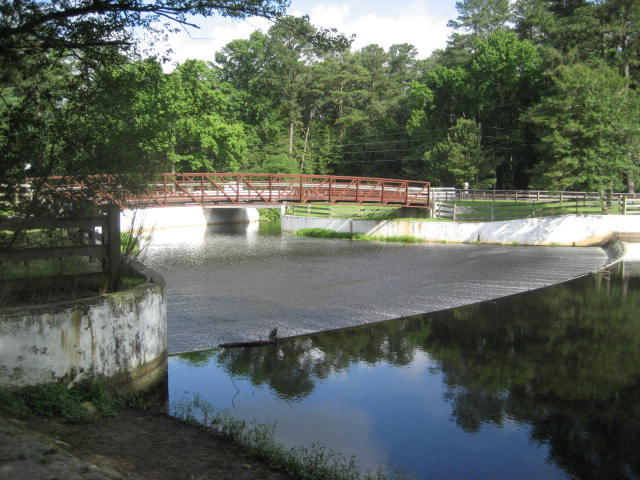
Because of the water in the area, there are several cool bridges…
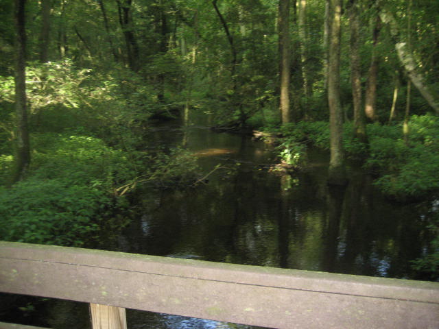
The map I found on the park’s website noted a Scenic Overlook near the bridge at the eastern shore of the pond, which is really more of a swamp at this point. There wasn’t much of an overlook, but we did find an abundance of biting flies in this section. Those of you who remember my last July hike (Hike # 4), will recall the biting fly that tormented me through the woods of Rhode Island. The biting flies in Delaware apparently hunt in packs. So, miles two through four of this hike were not nearly as enjoyable as the first mile.
The biting flies were especially vicious as we reached the two and a half mile mark. Here we made another hard right turn and started heading west. Around the three mile mark, we caught a short break from the swarm. It was also around this point in our journey that we reached Raccoon Pond…
The biting flies were especially vicious as we reached the two and a half mile mark. Here we made another hard right turn and started heading west. Around the three mile mark, we caught a short break from the swarm. It was also around this point in our journey that we reached Raccoon Pond…
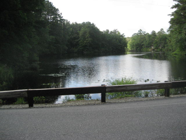
Raccoon Pond, according to an informational plaque closer to the entrance of the park, originally supplied power to a grist mill and a sawmill in the area. Today it is a hotspot for local fisherman. I got a chuckle when I noticed that more than a few had got their lines caught in a low-voltage power line which ran along the shore. This thing was literally covered with fishing line and bobbers.
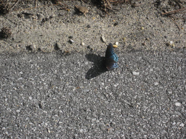
Before re-joining the trail, I snapped a picture of a butterfly which was resting his wings…
Before re-joining the trail, I snapped a picture of a butterfly which was resting his wings…
Upon re-entering the woods, the trail turns to the north, and the swarm was quickly back upon us. So, we picked up the pace with a little jog. Shortly after, we crossed paths with a couple who were out biking and the poor lady almost crashed because of the flies. The next section of the trail followed a little more closely to Trap Pond, even brushing up against the shore of the pond once or twice.
Around the four and a half mile mark, the trail comes to a sign which reads “Pets Not Permitted Beyond This Point”. So, we made a left hand turn and started to follow a paved road through one of the parking lots of the park. There was a softball field in the area and it made me excited for our upcoming game.
After a short walk, we reached the intersection of the American Holly Trail…
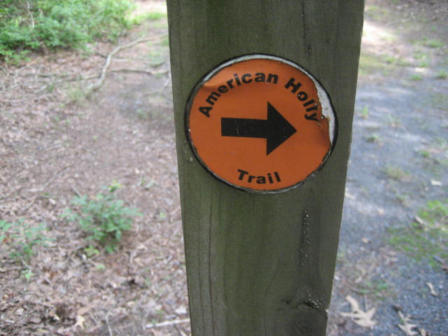
At just over half a mile, the American Holly Trail is the third longest of the four trail in the area. Since, at this point, we had veered a bit off course, I would only be traveling a short section of the trail. Since we were returning to a semi-woodsy area, I was again concerned about the biting flies. We were fortunate that only one landed on me and I was able to get the best of him before he could get the best of me. The American Holly Trail eventually led us to the Baldcypress Nature Center…
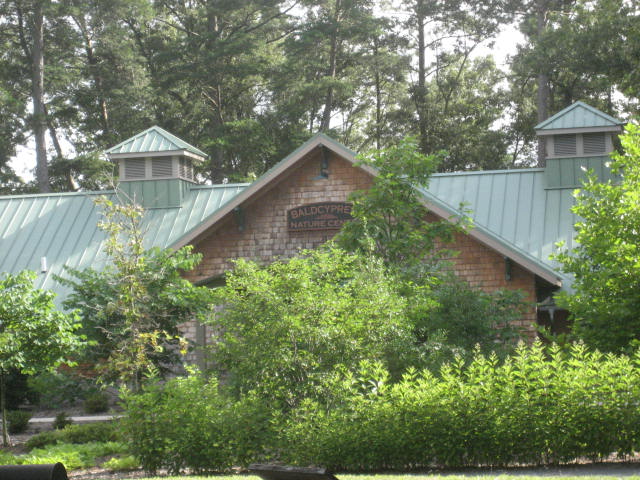
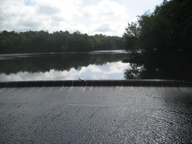
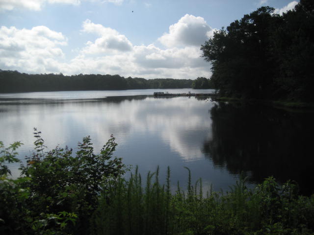
It was still early, so the Nature Center wasn’t open yet. And, I was traveling with my dog so I wouldn’t have been able to go in anyway. But, this looks like a nice little nature center. Just outside the area of the center, there was a playground with picnic tables. Some early arrivals (the park had just officially opened a few minutes before we reached this area) were setting up for the day. I stopped here to take a few pictures of the area around the pond…
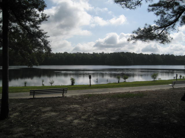
The final quarter mile or so of my hike covered the northwestern shore of the pond. My MapMyHike map makes it look like I swam across the shore, but I didn’t. We followed the gravel trail over a few cool pedestrian bridges along the shoreline and eventually made our way back to the Jeep.
Overall, this was an enjoyable hike. My only complaints are that there weren’t a lot of elevation changes (in fact there were almost none) and the biting flies were out of control. But, I expected both of those given that I was hiking in Delaware in July. Next, I will recap another out-of-state hiking adventure through Susquehanna State Park in Maryland. Stay tuned…
Distance to 2013 Goal: 187.4
