Walking in the Spider Webs
Hike #53
Susquehanna State Park (Havre de Grace, MD)
Distance: 4.43 miles
Approx Time to Complete: 1.75 hours
Date Hiked: 7/8/2013
Date Published: 7/11/2013
Hike #53
Susquehanna State Park (Havre de Grace, MD)
Distance: 4.43 miles
Approx Time to Complete: 1.75 hours
Date Hiked: 7/8/2013
Date Published: 7/11/2013
For my second vacation hike, Roscoe and I made our way up to Susquehanna State Park in Havre De Grace, MD. The second half of our vacation was spent in the Baltimore area, so it took us about 40 minutes to get from the hotel to the shores of the Susquehanna River.
Back when I lived in Baltimore area, I would travel home to CT quite often and, on my way, I would pass over the Milliard E. Tydings Memorial Bridge. If you are familiar with I-95 in Maryland, you know the one I’m talking about. The bridge spans high above the Susquehanna River and driving over it leaves you subject to crosswinds. Because of the height of the bridge, I figured any hiking in the area would allow for some good elevation changes. And, since I had a good feeling the hike through Trap Pond State Park wouldn’t allow for any elevation…I planned for this second vacation hike to be through Susquehanna State Park.
The hike-planning process wasn’t without its challenges. For starters, the park’s website doesn’t provide any maps of the area. And, I wasn’t sure of the reliability of what I did find using a Google search. In the end, I figured…at worst…the map I found would at least get me to a parking location and I could locate a trail or two from there.
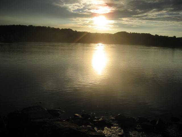
The morning of the hike, Roscoe and I were up at 5am (seriously, who gets up this early on vacation?) and we made our way to a parking area located near the intersection of Rock Run Road and Stafford Road…within the park limits but nothing that would force me to pay a fee. We jumped out of the Jeep, I took the picture you see above (sunrise overlooking the Susquehanna), and we started exploring the area.
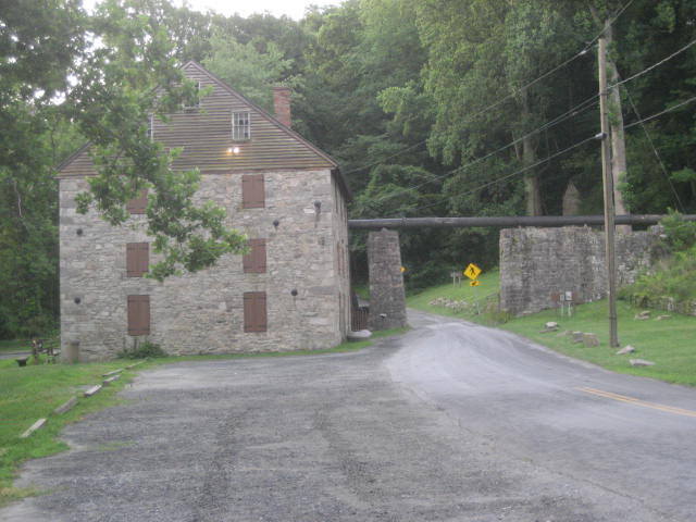
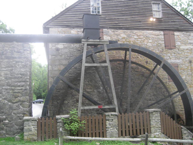
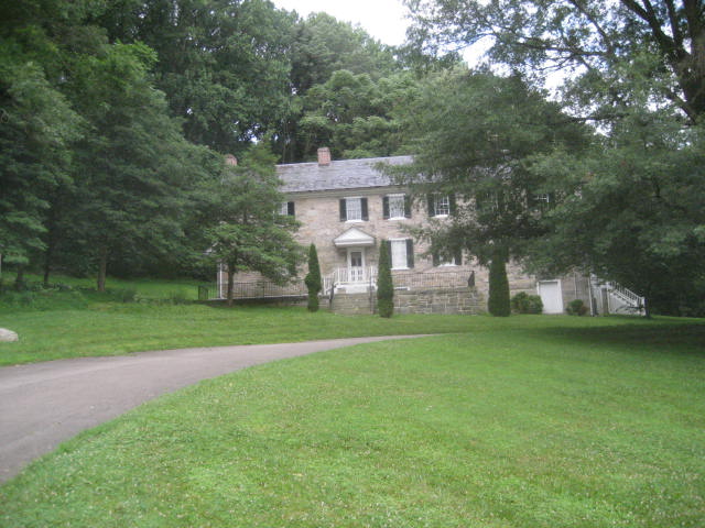
Naturally, I had some difficulty finding an initial trail. But, I was able to get some great pictures of the historic buildings in the area…including a grist mill (first and second pictures below) and the Carter Archer House (third picture). According to an informational plaque in the area, Archer was a Union soldier who became a Confederate soldier and died soon after switching sides. I’ll be honest, I wasn’t expecting this much history when I planned my hike…but I was thrilled to find it…
Back when I lived in Baltimore area, I would travel home to CT quite often and, on my way, I would pass over the Milliard E. Tydings Memorial Bridge. If you are familiar with I-95 in Maryland, you know the one I’m talking about. The bridge spans high above the Susquehanna River and driving over it leaves you subject to crosswinds. Because of the height of the bridge, I figured any hiking in the area would allow for some good elevation changes. And, since I had a good feeling the hike through Trap Pond State Park wouldn’t allow for any elevation…I planned for this second vacation hike to be through Susquehanna State Park.
The hike-planning process wasn’t without its challenges. For starters, the park’s website doesn’t provide any maps of the area. And, I wasn’t sure of the reliability of what I did find using a Google search. In the end, I figured…at worst…the map I found would at least get me to a parking location and I could locate a trail or two from there.
The morning of the hike, Roscoe and I were up at 5am (seriously, who gets up this early on vacation?) and we made our way to a parking area located near the intersection of Rock Run Road and Stafford Road…within the park limits but nothing that would force me to pay a fee. We jumped out of the Jeep, I took the picture you see above (sunrise overlooking the Susquehanna), and we started exploring the area.
Naturally, I had some difficulty finding an initial trail. But, I was able to get some great pictures of the historic buildings in the area…including a grist mill (first and second pictures below) and the Carter Archer House (third picture). According to an informational plaque in the area, Archer was a Union soldier who became a Confederate soldier and died soon after switching sides. I’ll be honest, I wasn’t expecting this much history when I planned my hike…but I was thrilled to find it…
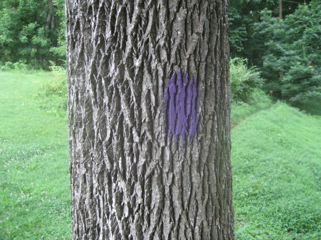
Of course, I was here to hike. So, after poking around the area of the Archer House for a while, I stumbled upon a purple-blazed trail. Looking at my map, and recalling my drive through the area earlier, I could tell this trail would most likely lead me to the Blue Trail, a trail which serves as a main artery of the trail system. So, we hit the Purple Trail to begin our hike…
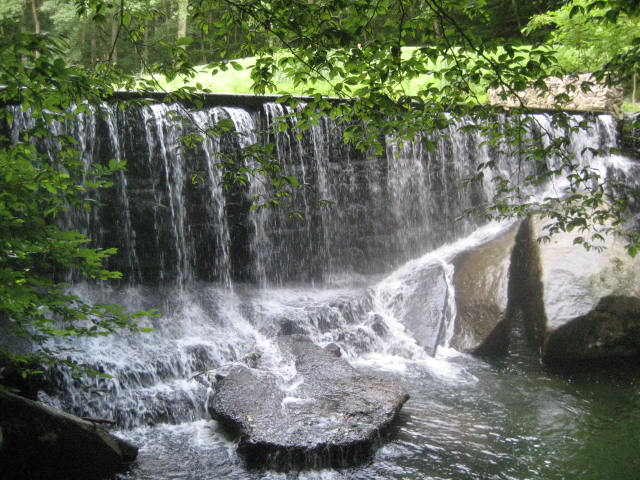
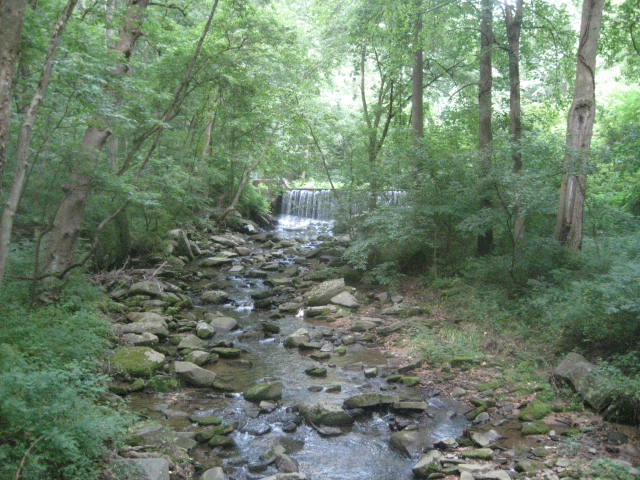
The Purple Trail starts out heading generally south. If we followed this trail to its end, we would eventually swing back to the east and then north, making a “u”shape on the map. The first stretch follows along a small stream (called Rock Run), the highlight of which is this man-made waterfall…
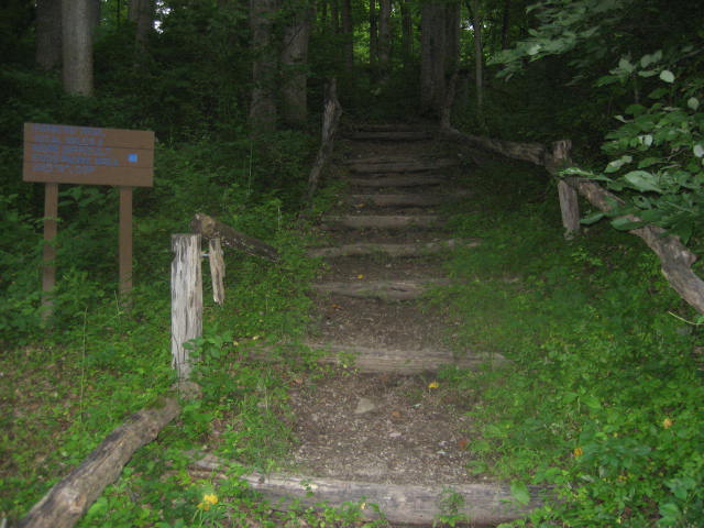
After only a quarter of a mile heading due south on the Purple Trail, we found the Blue Trail. We made a right on the Blue Trail, dropped down a small embankment to cross Rock Run, and re-ascended the other side to Rock Run Road. On the other side of the road, we came to a man-made staircase…
We followed the Blue Trail until it intersected with the Orange Trail. Along the way, I encountered another reason why hiking in the summer is less enjoyable. Not ticks…not biting flies…but spider webs. I’m not one of those people who are afraid of spiders. I actually don’t mind when I find them in the house because I understand they eat other insects which would turn our home into their own. But, I must have walked through at least 20 spider webs…some of which still had HUGE spiders on them. It was so bad that, when I got back to the Jeep later, I actually had a web form between the left strap of my pack and my shirt…good times.
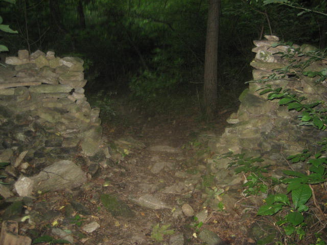
There is a confusing sign where the Blue and Orange trails intersect which claims that both trails are the “more difficult” trail. I have a suspicion that none of these travels are overly challenging (our greatest elevation change of the day was just over 300 feet). So, I elected to make a left on the “more difficult” Orange Trail and we followed that, again heading south. Along the way we passed through an old stone boundary marker. I took a picture because I found it interesting how different this one looked from those I was used to seeing on my hikes in CT…
There is a confusing sign where the Blue and Orange trails intersect which claims that both trails are the “more difficult” trail. I have a suspicion that none of these travels are overly challenging (our greatest elevation change of the day was just over 300 feet). So, I elected to make a left on the “more difficult” Orange Trail and we followed that, again heading south. Along the way we passed through an old stone boundary marker. I took a picture because I found it interesting how different this one looked from those I was used to seeing on my hikes in CT…
Around the two mile mark, I had a decision to make. I could turn left (east) and follow the trail back to Rock Run Road…or I could turn right (west) and head deeper into the park. I elected to head deeper into the park. So, we made a right and followed the Orange Trail until we came to Wilkinson Road. Just before we reached the road, I encountered a dead tree stump which was covered in termites…

Two and three quarters of a mile into the hike, we reached Wilkinson Road. We were approaching the area of the park maintenance complex. We also found a hay field. At this point, I was growing tired of walking through spider webs so I decided to give myself a break and stick to the road for a bit. I knew eventually Wilkinson Road would intersect with the Blue Trail and I could take that trail back to the parking area. So, we followed the road for about three quarters of a mile.
Three and a half miles in, we reached the intersection with the Blue Trail. I made a right and started heading back to the Jeep. Instead of sticking to the Blue Trail, we made a left and followed a separate trail back to the intersection of Wilkinson Road and Rock Run Road. I followed the road back to the Jeep, but before I got there I stopped to take another picture of the falls…at a distance this time.
Three and a half miles in, we reached the intersection with the Blue Trail. I made a right and started heading back to the Jeep. Instead of sticking to the Blue Trail, we made a left and followed a separate trail back to the intersection of Wilkinson Road and Rock Run Road. I followed the road back to the Jeep, but before I got there I stopped to take another picture of the falls…at a distance this time.
All in all, our out-of-state adventures were fun. The hiking was really easy, especially considering I haven’t hiked in two months. Yes, it was hot….yes, it was buggy…but it was good to get back out there and stretch our legs. And, in the process, I increased the number of states which I’ve hiked to four. I’m hoping to get in one more out-of-state hike this summer. If I do, I’ll recap it. If not, we’ll chat in October.
Distance to 2013 Goal: 182.97
Distance to 2013 Goal: 182.97
