Records Are Meant to be Broken
Hike #54
Mount Snow (West Dover, VT)
Distance: 4.86 miles
Approx Time to Complete: 2.25 hours
Date Hiked: 7/12/2013
Date Published: 7/19/2013
Hike #54
Mount Snow (West Dover, VT)
Distance: 4.86 miles
Approx Time to Complete: 2.25 hours
Date Hiked: 7/12/2013
Date Published: 7/19/2013
For my final out-of-state hike during the summer of 2013, I was going to shatter some personal bests…and I didn’t even know it until the day of the hike. Here’s how it went down…
Earlier in the year, we got word that one of Jaci’s college roommates…who is originally from Vermont…was getting married. I was excited because the bride and groom are known in our circle of friends as the dancers of the group. So, I knew their wedding was going to be a dance-all-night kind of event. I also knew that if they were going to be married in Vermont it would mean 1.) additional time off from work and 2.) actual true hiking…not just what we call hiking here in Connecticut.
When I began “planning”my hike in Vermont, I knew I wanted elevation and I knew that I wanted steep climbs. I never imagined that I would end up hiking to an elevation three times higher than my previous personal best. Originally, I planned to hike nearby Haystack Mountain…which, for some unknown reason, I thought to only be a 2,000 foot elevation. But, as events unfolded, I would instead be hiking Mount Snow.
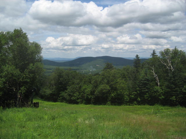
Mount Snow, originally named Mount Pisgah, is part of the Green Mountain range which runs from southern Vermont to northern Vermont. Mount Snow is located in the Southern Green Mountains, where the elevations aren’t quite as high (for Green Mountain standards) but still dwarf anything we have here in Connecticut. At 3,556 feet above sea level, Mount Snow is the 39th highest peak in Vermont…but 1,233 higher than Connecticut’s highest peak…and 2,481 feet higher than my previous highest peak (Soapstone Mountain in Somers, CT).
On the day of the hike, Jaci and I dropped Roscoe off at the kennel for the weekend then made the drive from East Hartford, CT to Mount Snow. As we approached the area around Mount Snow, I dropped Jaci off at a local salon so she could hang out with the rest of the girls in the bridal party while they got their nails done. My plan was to check in to our room, but when I got to the hotel, the nice lady at the front desk informed me it wouldn’t be ready for another couple of hours. So, in response, I kindly asked her for a hiking map. She directed me to the Mount Snow Sports Store. From there, the staff at Mount Snow Sports provided me with a map and sent me on my way.
Normally, when I head out for my hikes, I like to wear long pants (I even wore them in the 90 degree weather in Delaware a week earlier). But, since our room wasn’t ready, I decided not to change. I didn’t feel like changing in the public restroom on the ground floor. It was nice and all, but I have this phobia about public restrooms (a tale for another day). So, I simply put on my hiking boots and pack…and hit the trail. I would be hiking in shorts for the first time.
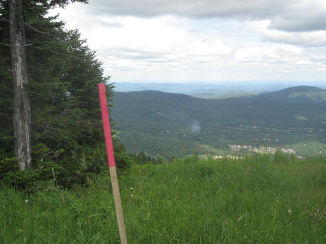
The hike began humbly enough, the first stake (yes, stake…not blazes on trees) for the Yellow Trail could be found right outside of Mount Snow Sports…
Earlier in the year, we got word that one of Jaci’s college roommates…who is originally from Vermont…was getting married. I was excited because the bride and groom are known in our circle of friends as the dancers of the group. So, I knew their wedding was going to be a dance-all-night kind of event. I also knew that if they were going to be married in Vermont it would mean 1.) additional time off from work and 2.) actual true hiking…not just what we call hiking here in Connecticut.
When I began “planning”my hike in Vermont, I knew I wanted elevation and I knew that I wanted steep climbs. I never imagined that I would end up hiking to an elevation three times higher than my previous personal best. Originally, I planned to hike nearby Haystack Mountain…which, for some unknown reason, I thought to only be a 2,000 foot elevation. But, as events unfolded, I would instead be hiking Mount Snow.
Mount Snow, originally named Mount Pisgah, is part of the Green Mountain range which runs from southern Vermont to northern Vermont. Mount Snow is located in the Southern Green Mountains, where the elevations aren’t quite as high (for Green Mountain standards) but still dwarf anything we have here in Connecticut. At 3,556 feet above sea level, Mount Snow is the 39th highest peak in Vermont…but 1,233 higher than Connecticut’s highest peak…and 2,481 feet higher than my previous highest peak (Soapstone Mountain in Somers, CT).
On the day of the hike, Jaci and I dropped Roscoe off at the kennel for the weekend then made the drive from East Hartford, CT to Mount Snow. As we approached the area around Mount Snow, I dropped Jaci off at a local salon so she could hang out with the rest of the girls in the bridal party while they got their nails done. My plan was to check in to our room, but when I got to the hotel, the nice lady at the front desk informed me it wouldn’t be ready for another couple of hours. So, in response, I kindly asked her for a hiking map. She directed me to the Mount Snow Sports Store. From there, the staff at Mount Snow Sports provided me with a map and sent me on my way.
Normally, when I head out for my hikes, I like to wear long pants (I even wore them in the 90 degree weather in Delaware a week earlier). But, since our room wasn’t ready, I decided not to change. I didn’t feel like changing in the public restroom on the ground floor. It was nice and all, but I have this phobia about public restrooms (a tale for another day). So, I simply put on my hiking boots and pack…and hit the trail. I would be hiking in shorts for the first time.
The hike began humbly enough, the first stake (yes, stake…not blazes on trees) for the Yellow Trail could be found right outside of Mount Snow Sports…
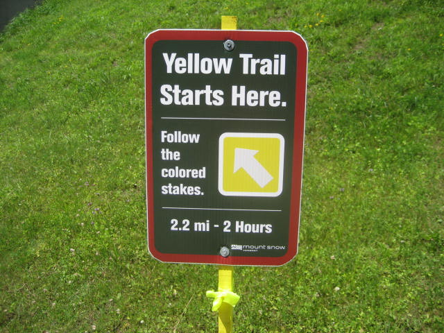
From the first stake in the ground, I located the second stake and made my way toward it. For some reason, even though I would soon be ascending 1500 feet from the base of a MOUNTAIN to the summit, I elected to take a small staircase up the first hill located near the starting point. I was embarrassed for myself and literally shook my head after I realized what I had done…
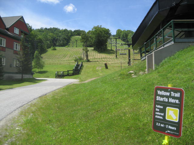
From the area around the staircase, the Yellow Trail makes a left turn and heads due south. It also passes by a few of the ski lifts and eventually links up with one of the mountain bike trails and the Green Trail. The two trails stay linked for a bit, but the Yellow Trail soon makes a slight right turn and starts to climb. However, since the Green Trail keeps going straight…and because there were no blazes signaling a turn, I missed it. So, I added a bit of distance to my hike….but quickly realized my error and doubled back.
When I got back to the area where the Yellow Trail turns off from the Green Trail, I immediately wished I had taken the time to put on my sweatpants. The grass was very long and I soon had visions of my legs covered in ticks. I was fortunate that I never ended up with any on me, but I was uneasy the whole rest of the trip up the mountain…and, later, I made several “detours” around areas of overgrowth.
Once I was in the long grass, I was committed. I was going to make my way to the top and nothing was going to stop me...except for the occasional tick check. It wasn’t until about halfway up the mountain that I noticed the map provided by Mount Snow Sports had elevation markers on it. And it wasn’t until a few minutes later that I noticed the markers on the map were numbered. And it hit me that I was going to climb to over 3500 feet. I was excited…
Also about halfway up, I got an interesting text message from Jaci. When I dropped her off at the salon, she left her keys in the car. So, both keys were now in my pack. When I grabbed her keys I thought I would be able to get up the mountain and back in time for her to get ready for the rehearsal at the church that evening. Only now was informed that she needed to be in the lobby by 3:00 in order to get to the rehearsal on time…and it was 1:15. So, now the question wasn’t whether or not I could climb to personal record heights…it was whether or not I could climb to personal record heights AND get back in less than two hours. So, I put a little hop in my step.
My attempt to follow the Yellow Trail was cut short by some areas where the grass was a little higher than I expected. When I came to those spots, I simply followed the gravel paths (like a Jeep trail) that lead to the top. I checked to make sure these paths were not mountain bike trails, as most of the trails in the area which are reserved for mountain bikes are also closed to hiking. Makes sense.
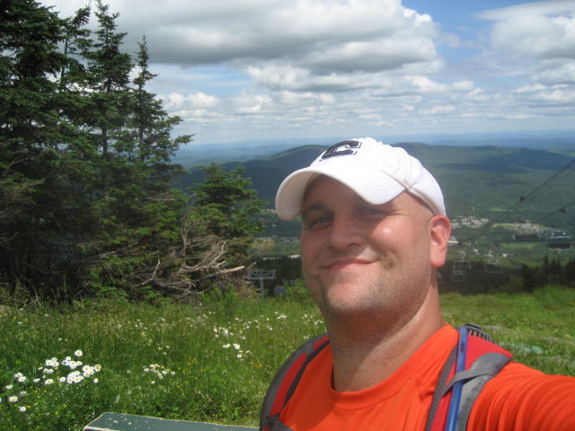
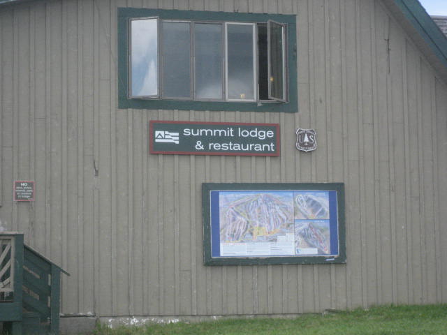
Around 2:00pm, I reached the summit…
My attempt to follow the Yellow Trail was cut short by some areas where the grass was a little higher than I expected. When I came to those spots, I simply followed the gravel paths (like a Jeep trail) that lead to the top. I checked to make sure these paths were not mountain bike trails, as most of the trails in the area which are reserved for mountain bikes are also closed to hiking. Makes sense.
Around 2:00pm, I reached the summit…
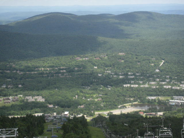
This was awesome! I felt literally like I was on top of the world…close enough to touch the clouds overhead…it was really a great experience. I can only imagine how those who have summitted greater heights than this must feel.
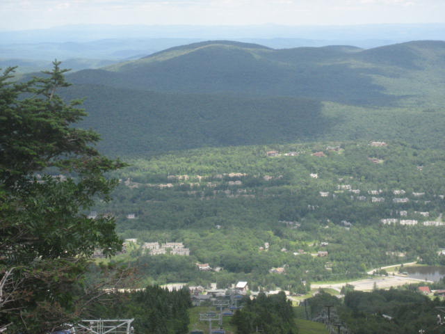
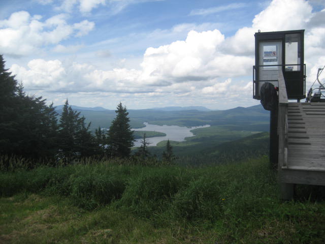
I took as much time as I could to enjoy the top of the mountain. I took the pictures you see above (including the picture at the start of this recap), took a deep breath, and started on my journey back...via the Pink Trail…
I took as much time as I could to enjoy the top of the mountain. I took the pictures you see above (including the picture at the start of this recap), took a deep breath, and started on my journey back...via the Pink Trail…
The hike down wasn’t as eventful, but I did pass a pair of turkeys (I can never seem to get my camera ready in time). I also had to alter my plans a bit. Originally, I planned to take the Pink Trail all the way back. But, this trail was somehow more overgrown than the Yellow Trail. So, about a quarter of the way back down, I made a right and followed the Blue Trail...
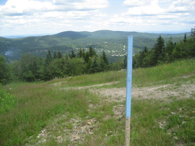
The Blue Trail, which was basically another loose gravel trail, would eventually lead me back to the Yellow Trail. From the Yellow Trail, I made it back to the parking lot (avoiding the stairs this time) by 2:45 where Jaci was waiting. So, in the end, thanks to a quick 45 minute descent back down the mountain, she was able to get ready in time for the rehearsal. Me? I had a date with a ham and cheese sandwich…possibly the greatest sandwich I’ve ever had in my life (not really…but, at the time, I was THAT hungry). I also thought maybe I could catch a nap before I had to leave for the rehearsal dinner, but the adrenaline was flowing and there was no way I was going to sleep.
Now I have a new challenge…
How in the world do I go back to hiking in Connecticut after this???
Distance to 2013 Goal: 178.11
Now I have a new challenge…
How in the world do I go back to hiking in Connecticut after this???
Distance to 2013 Goal: 178.11
