All Hope Ye Who Enter
Hike #60
Trail(s): Lake Mansfield Trail, The Long Trail, and Clara Bow Trail (Stowe, VT and Underhill, VT)
Date Hiked: 10/26/2013
Date Published: 10/28/2013
Hike #60
Trail(s): Lake Mansfield Trail, The Long Trail, and Clara Bow Trail (Stowe, VT and Underhill, VT)
Date Hiked: 10/26/2013
Date Published: 10/28/2013
(Note: The following recap is for Hike #60. You might notice I've skipped the recaps for Hikes #58 and #59. I’m saving those recaps until I’ve completed all of the trails within Sleeping Giant State Park.)
The story of Hike #60 begins when Jaci and I decided to head up to Stowe, Vermont to celebrate our third wedding anniversary. We had previously been to Stowe on our first anniversary and we thought it would be fun to visit there again. Being selfish, I was hopeful she wouldn’t mind if I took a few hours to do some hiking and figured she could spend the few hours I was gone to get in some shopping. As it would turn out, I would be able to get in a few hours of hiking and still join her for shopping.
Once I decided to hike in Stowe, I started looking up some hikes in the area. A few hikes led up to some high elevations, but those I viewed early on in the decision process wouldn’t take me any higher than my previous highest elevation (Mt. Snow…also in Vermont). After some
internalized debate, I started looking at the prospect of hiking to the summit of Mount Mansfield. Sadly, as the week wore on, the weather
forecast was calling for rain. And, while I thought I had gained the ability to climb the section of the Long Trail which would lead to the summit of Mount Mansfield, I didn’t think I could make the same climb in the rain. As it turned out, the decision not to make the climb was made for me when the higher elevations of Stowe received 6 inches of snow the night before we made the drive from CT.
As we were driving up Route 100 on Friday, the mountains around Smuggler’s Notch came in to view. I said “are they making snow up there
already?” Come to find out, the snow was natural and…while it wasn’t very deep on the ski slopes…it would completely shut down any difficult hiking I hoped to do. We stopped at the Green Mountain Club headquarters right on Route 100 between Waterbury and Stowe. You can (and should) read more about the Green Mountain Club at http://www.greenmountainclub.org/ For the sake of this recap, you only need to know that they were very helpful in suggesting hikes in the area that might allow for some good views…if the weather held off. I purchased a book (Day Hiker’s Guide to Vermont) and a map and we were on our way. After checking in at our hotel and enjoying dinner, I scoured the book and decided to hike along the Lake Mansfield Trail. I even convinced Jaci to drop me off at the trailhead and pick me up three hours later.
The following morning, the day of the hike, we were up early (just before sunrise) and on our way. The trailhead was located at the Lake Mansfield Trout Club and was only about 30 minutes from our hotel. If you are in the area, the trailhead can be found by following Route 100 to Moscow Road. Moscow Road will eventually become Nebraska Valley Road. From May through October, the trail can be accessed from a public parking location. The sign near the trailhead notes that this is for day hikers and should not be used for overnight parking if you are thru-hiking the Long Trail. After November 1st, there is a gate on the trout club road which is closed…and there is another parking location in the area which should be used.
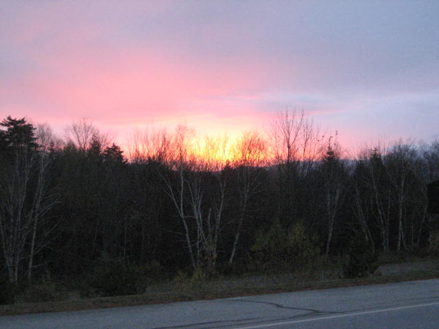
As we were driving down the mountain from our hotel, the sun was coming up and poking through the clouds. Sadly, this would be the only time I would see the sun for the next couple of days…
The story of Hike #60 begins when Jaci and I decided to head up to Stowe, Vermont to celebrate our third wedding anniversary. We had previously been to Stowe on our first anniversary and we thought it would be fun to visit there again. Being selfish, I was hopeful she wouldn’t mind if I took a few hours to do some hiking and figured she could spend the few hours I was gone to get in some shopping. As it would turn out, I would be able to get in a few hours of hiking and still join her for shopping.
Once I decided to hike in Stowe, I started looking up some hikes in the area. A few hikes led up to some high elevations, but those I viewed early on in the decision process wouldn’t take me any higher than my previous highest elevation (Mt. Snow…also in Vermont). After some
internalized debate, I started looking at the prospect of hiking to the summit of Mount Mansfield. Sadly, as the week wore on, the weather
forecast was calling for rain. And, while I thought I had gained the ability to climb the section of the Long Trail which would lead to the summit of Mount Mansfield, I didn’t think I could make the same climb in the rain. As it turned out, the decision not to make the climb was made for me when the higher elevations of Stowe received 6 inches of snow the night before we made the drive from CT.
As we were driving up Route 100 on Friday, the mountains around Smuggler’s Notch came in to view. I said “are they making snow up there
already?” Come to find out, the snow was natural and…while it wasn’t very deep on the ski slopes…it would completely shut down any difficult hiking I hoped to do. We stopped at the Green Mountain Club headquarters right on Route 100 between Waterbury and Stowe. You can (and should) read more about the Green Mountain Club at http://www.greenmountainclub.org/ For the sake of this recap, you only need to know that they were very helpful in suggesting hikes in the area that might allow for some good views…if the weather held off. I purchased a book (Day Hiker’s Guide to Vermont) and a map and we were on our way. After checking in at our hotel and enjoying dinner, I scoured the book and decided to hike along the Lake Mansfield Trail. I even convinced Jaci to drop me off at the trailhead and pick me up three hours later.
The following morning, the day of the hike, we were up early (just before sunrise) and on our way. The trailhead was located at the Lake Mansfield Trout Club and was only about 30 minutes from our hotel. If you are in the area, the trailhead can be found by following Route 100 to Moscow Road. Moscow Road will eventually become Nebraska Valley Road. From May through October, the trail can be accessed from a public parking location. The sign near the trailhead notes that this is for day hikers and should not be used for overnight parking if you are thru-hiking the Long Trail. After November 1st, there is a gate on the trout club road which is closed…and there is another parking location in the area which should be used.
As we were driving down the mountain from our hotel, the sun was coming up and poking through the clouds. Sadly, this would be the only time I would see the sun for the next couple of days…
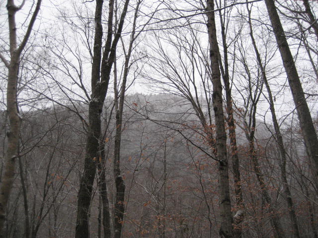
After driving down one side of the mountain, we made our way over to the trailhead, but not before heading back up to some higher
elevations. Along the way, we started to see some snow flurries, but it wasn’t accumulating...yet.
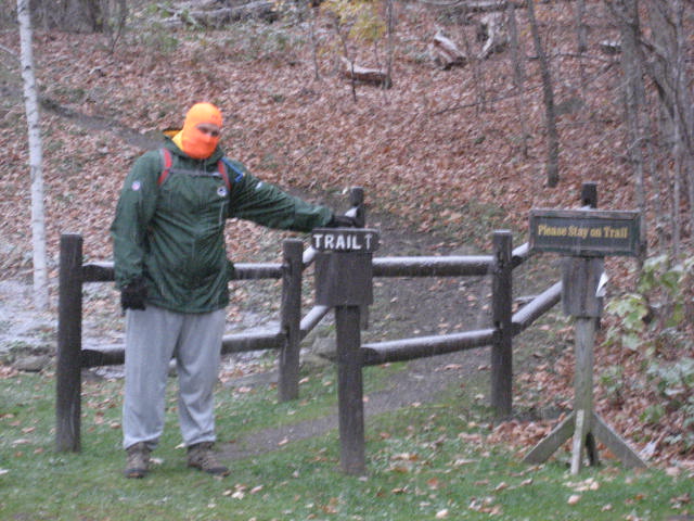
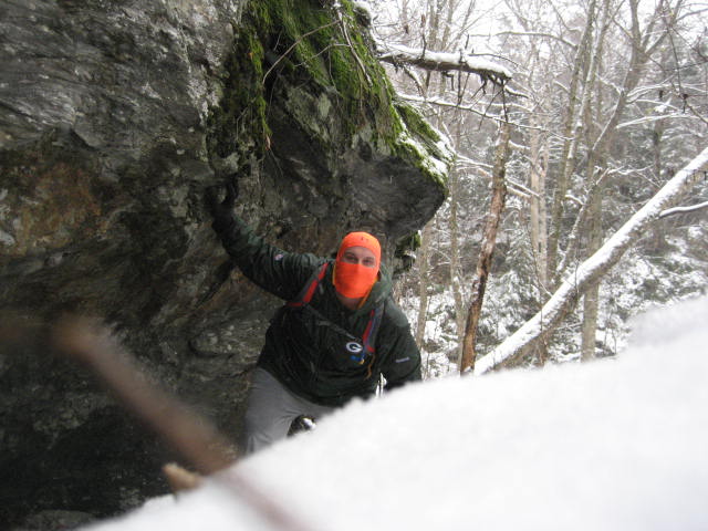
After I geared up, Jaci took this picture of my standing at the trail head…
elevations. Along the way, we started to see some snow flurries, but it wasn’t accumulating...yet.
After I geared up, Jaci took this picture of my standing at the trail head…
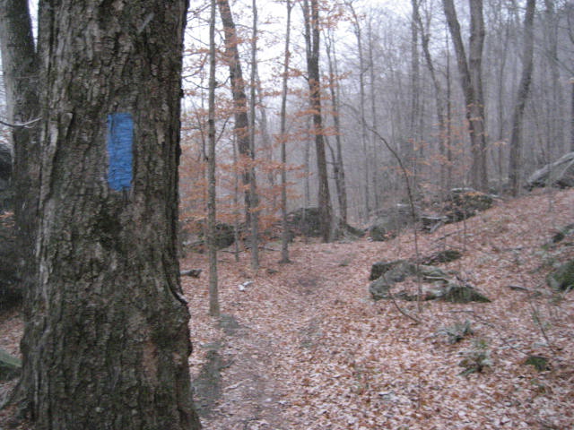
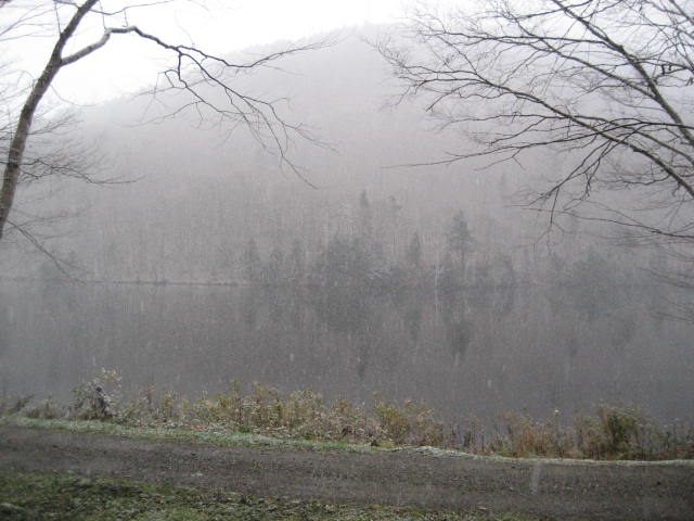
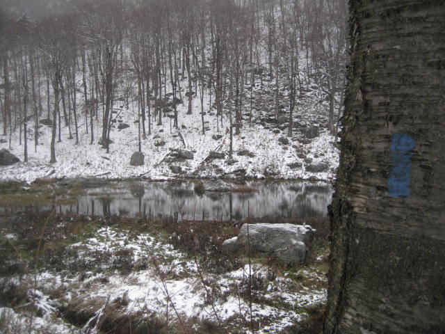
From the parking lot, the trail heads due east along the north edge of Mansfield Lake and runs parallel to a dirt road. I was happy to see the trail blazed in blue…
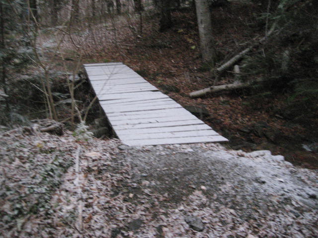
After a short walk, the trail descends to join the dirt road but quickly leaves it again and eventually comes to a footbridge…
|
|
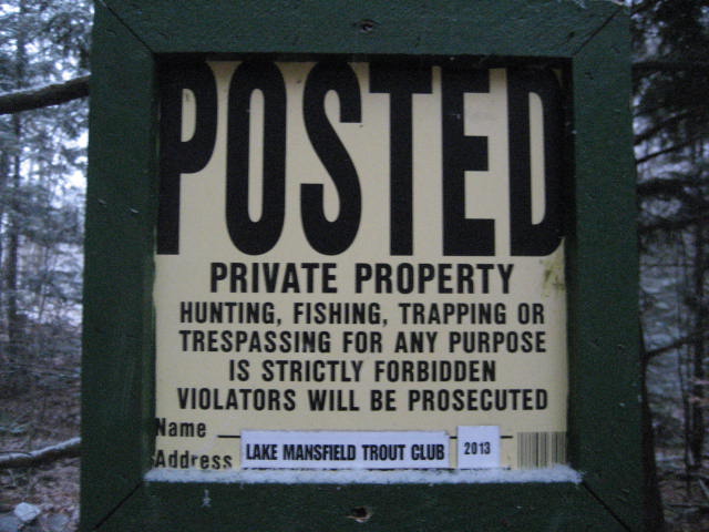
The trail does its best to avoid the road. The lake and a quarter mile from its shores are all part of trout club land. There are plenty of signs in the area, warning hikers against trespassing, but the trout club has been kind enough to let hikers use their land for more than a century. Return their kindness by staying on the trail...
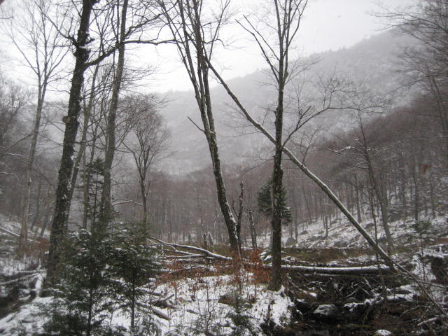
After about a half of a mile, near the west end of the lake, the trail rejoins the dirt road and makes a slight right (heading northwest). Here it begins to climb while following an old logging road. As I was climbing, I kept looking to my left and I could see, through the snow flakes and rain, a large mountain looming…
I spent the next mile or so climbing, stopping every once in a while to reflect on the elements and how much I felt like Frodo…sans fellowship…attempting to climb over the Misty Mountains in The Fellowship of The Ring. Along the way, I passed a section where the water was running off the side of the hill on to the trail, creating this little waterfall effect…
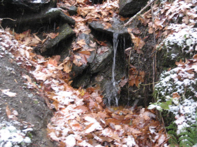
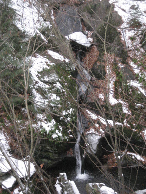
As it turns out, the rain creating the water-fall like effect you see above was only a preview of coming attractions. About a mile and a half in, the trail comes to a much larger falls…and this one was not created by the rainy conditions. The picture below doesn’t do it any justice, but it was impressive and, if I had to guess, I would say the water drops at least 50 feet…
|
|
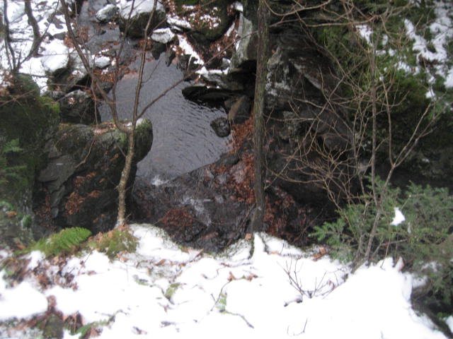
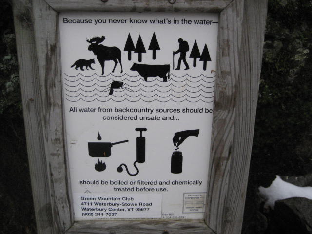
There was also a spigot in the area. The day hiker’s guide notes that this is the water source for Taylor Lodge, a shelter which can be used by Long Trail thru-hikers. There was an interesting sign, reminding hikers about the need to filter or treat backcountry water…
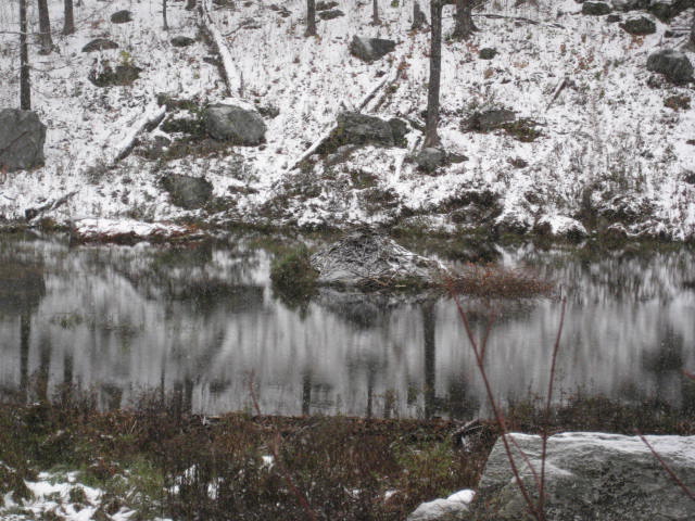
After the falls, I walked a little bit before I came to a beaver meadow. There is a large pond in the area, with a beaver hut in the middle…
|
|
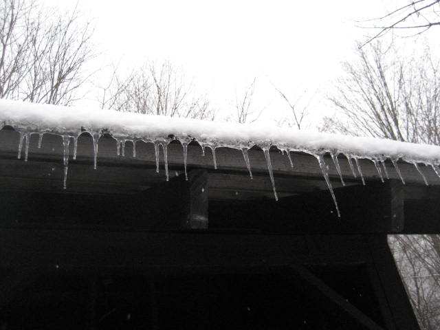
As I continued to climb, I noticed more and more snow accumulating. I laughed to myself when I realized how much earlier I was hiking in snow when compared to last year (my first snow hike last year was on December 1st). At around the 1.6 mile mark, I came to Taylor Lodge.
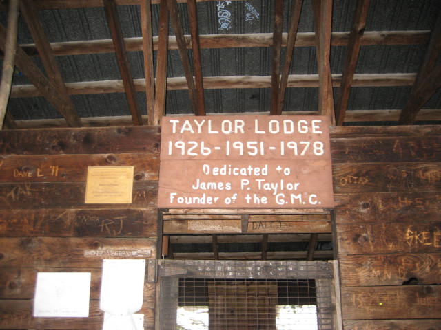
Taylor Lodge (elevation: 1,850 ft.) is dedicated to James P. Taylor, the founder of the Green Mountain Club. Originally constructed in 1926, the lodge has been damaged by fire a few times, but it still stands today and provides overnight shelter to those brave enough to hike the Long Trail from end to end. On this day, I was thankful for the means to get out of the rain and snow for just a few moments…
Taylor Lodge (elevation: 1,850 ft.) is dedicated to James P. Taylor, the founder of the Green Mountain Club. Originally constructed in 1926, the lodge has been damaged by fire a few times, but it still stands today and provides overnight shelter to those brave enough to hike the Long Trail from end to end. On this day, I was thankful for the means to get out of the rain and snow for just a few moments…
|
|
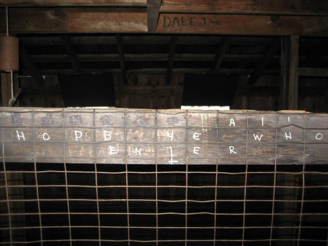
The final picture above shows an inscription, carved above the door to the shelter, which reads “Abandon All Hope Ye Who Enter”. If you don’t recognize the quote, don’t feel bad…I misplaced it too. It is from Dante’s Inferno. I like that someone had the good sense to cross out “Abandon” and make the message a positive one.
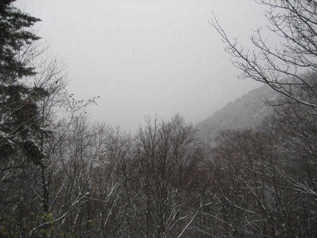
From the lodge, there is supposedly a good view. But, on this day, all I could see was clouds and snow…
From the lodge, there is supposedly a good view. But, on this day, all I could see was clouds and snow…
I took a minute to leave a note in the register, basically just recounting the drive up from CT the day before and how I wasn’t about to let a little snow ruin my hiking plans. After I put the register back, I wasn’t quite ready to start heading back to the trailhead. I still had plenty of time before I needed to head down in order to meet Jaci at our arranged time. So, I decided to see what the Long Trail was like.
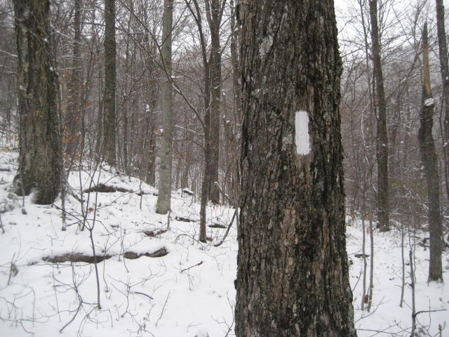
The Long Trail, which extends 273 miles from Vermont’s border with Massachusetts to Vermont’s border with Canada, was built from 1910 to 1930. It is maintained by the Green Mountain Club, whose responsibilities include keeping the trail blazed in white…
The Long Trail, which extends 273 miles from Vermont’s border with Massachusetts to Vermont’s border with Canada, was built from 1910 to 1930. It is maintained by the Green Mountain Club, whose responsibilities include keeping the trail blazed in white…
It is the oldest long-distance trail in the United States…and I hope one day to travel more miles of it. For this hike, however, I would cover only .4 miles of it. But the small section I did was a lot of fun. It climbed up a short, steep hill and then descended for quite a bit. After the .4 miles, I came to an intersection with the Clara Bow Trail…
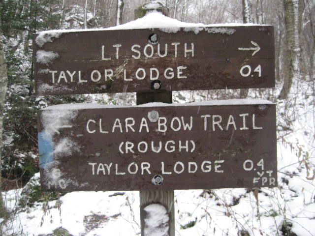
I had seen signs for the Clara Bow Trail around Taylor Lodge, so I knew this would connect back to the Lake Mansfield Trail but all of the signs said “rough”. Having read a lot about this area the week before hiking up here, I knew that this was not a matter of the trail maintainers being overly cautious. In this neck of the woods, if the sign says “rough” it meant rough. But, I still had some extra time and I knew I could always double back if the trail got too crazy.
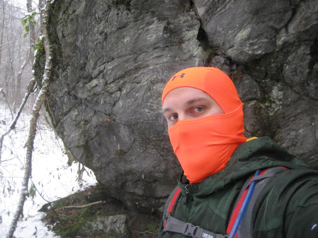
The Clara Bow Trail, while relatively short at .4 miles, packs a lot of punch in a small distance. For the entire time, I was either climbing or descending. I stopped, where I could, along the way to take some pictures next to some HUGE boulders…
The Clara Bow Trail, while relatively short at .4 miles, packs a lot of punch in a small distance. For the entire time, I was either climbing or descending. I stopped, where I could, along the way to take some pictures next to some HUGE boulders…
|
|
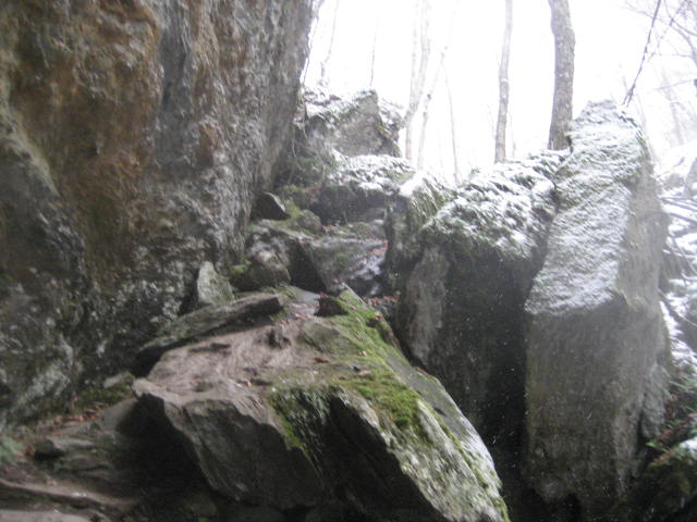
I kept waiting for the moment to come where I would say “okay, this is too much for me”…but it never came. That isn’t to say the trail isn’t challenging, because it most certainly is. But, I felt confident the whole way. The most difficult section involved descending the rocky segment in the photo below into a cave/den section…
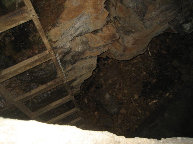
The only way out of this cave/den thing, was to climb a ladder which was held in place by a couple of ropes. Some of you reading this know how much I despise ladders. I don’t even like to climb them when hanging Christmas lights. So, I didn’t even stop to take a picture from the bottom of the cave. I quickly ascended the ladder and made it up the other side. Only then did I stop to take a picture of what I just did…
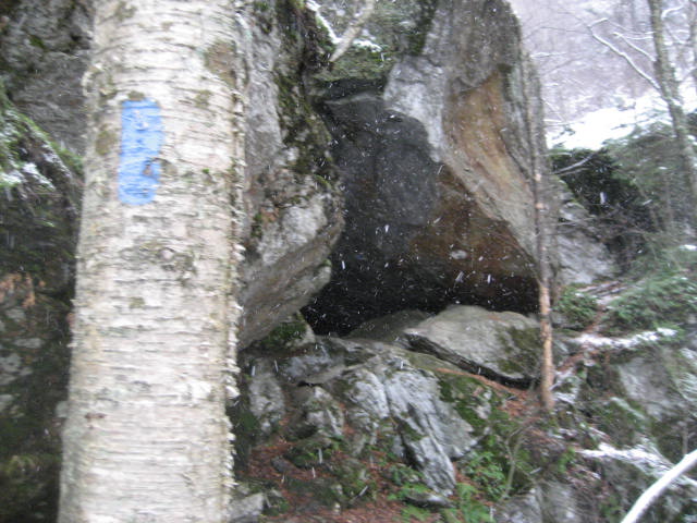
After climbing out of the cave area, I followed the trail a little bit but turned back to get a look at what the entrance to the cave looked like if you were to approach from the opposite way…
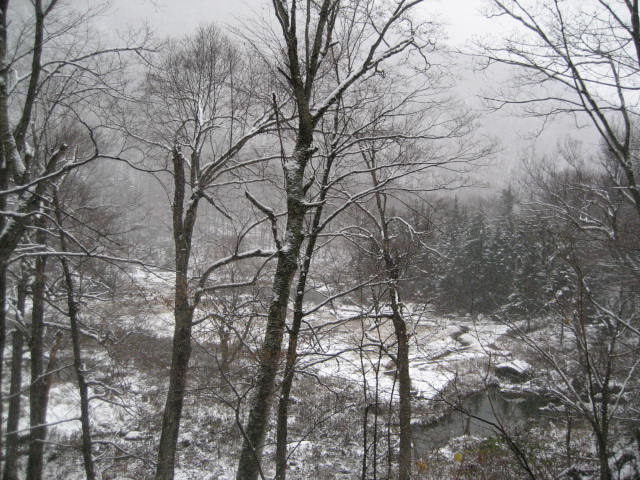
Eventually, I worked my way to a section which overlooks the same beaver meadow I had seen earlier…
And, finally, I made my way back to Taylor Lodge…

From the lodge, I turned back on to the Mansfield Lake Trail and made my way out to the trailhead. My first hike along the trails around Mount Mansfield left me wanting so much more. I can’t wait for my next trip to Stowe…
Distance to 2013 Goal: 152.30
Distance to 2013 Goal: 152.30
