Lockout / Take Two
Hike #122
Nehantic Trail
Fish Road to Pachaug Trail Convergence (Voluntown, CT)
Hike Distance: 8.7 Miles
Section Distance (Per CFPA Walk Book): 4.2 Miles
Date Hiked: 1/10/2015
Date Published: 1/10/2015
Hike #122
Nehantic Trail
Fish Road to Pachaug Trail Convergence (Voluntown, CT)
Hike Distance: 8.7 Miles
Section Distance (Per CFPA Walk Book): 4.2 Miles
Date Hiked: 1/10/2015
Date Published: 1/10/2015
Six days prior to the hike
described in this recap, I attempted to cover this same section of the Nehantic
Trail. Roscoe and I even got up early,
made the seventy minute drive from our home in Central CT to Southeast CT, and
started to gear up. Then, through
circumstances which I still can’t explain, I ended up locked out of the
car. The keyless remote was still in my
bag, which was on the floor in front of the passenger seat, so it should’ve been
IMPOSSIBLE for me to have gotten locked out.
Regardless, I had to call Jaci. I
refused to call roadside assistance and be charged for this mess. And, I was in the middle of the woods so I
doubt they could find me. Luckily, I did
have my phone so I was able to guide Jaci to my location and she unlocked the
car. I’m just thankful to have such a
dedicated wife and that I made the discovery of being locked out before I
started hiking. By the time she made the drive, I didn’t feel much like hiking
this section of trail anymore. So, I
took Roscoe over to Gay City State Park and we hiked 4.4 miles there. I was happy I was able to get some hiking in,
and knock my miles to 500 down to 486.6.
Six days later, we found ourselves back at the trailhead. Ready for a second take.
To reach the trailhead from Hartford:
Follow Route 2 east to I-395 North. From I-395 North, take exit 85 and go straight at the end of the exit ramp. At the next light, turn right on Route 138 and follow that through Voluntown Center (where Routes 138, 165 and 49 converge). Stay on Route 138 and bear right at the fork where Route 165 continues straight. Turn right on unpaved Green Fall Road and follow it to a stop sign. Turn right on Fish Road. The parking location is just passed the trail on the left side of Fish Road.
For this hike, I planned to head northbound on the Nehantic until I reached the Pachaug Trail Convergence, some 4.2 miles away. I was familiar with the area so I also anticipated this hike would take me over generally flat terrain. What I didn’t anticipate was the temperature being as low as it turned out to be. When we left the car at 6:45am, it was single digits.
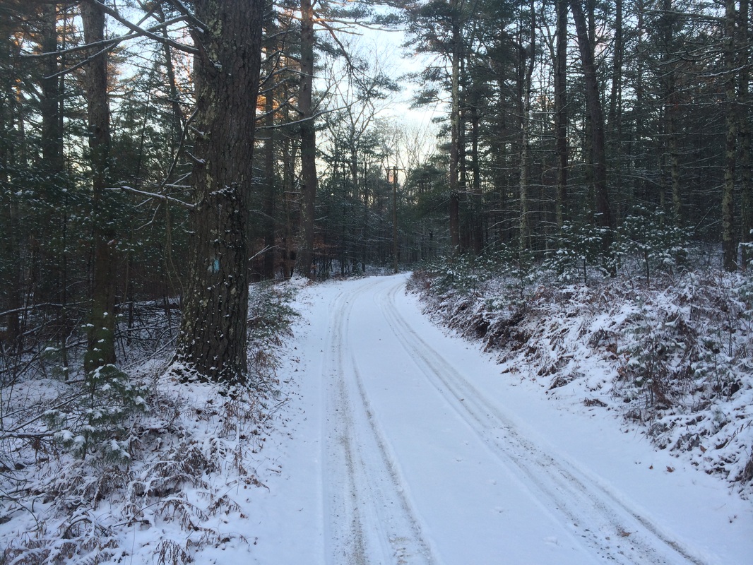
We started by heading due east, following the road. It wasn’t long before we reached the trail, turned left, and started heading north.
The Walk Book doesn’t note anything of significance in the first 1.8 miles of this section, so I wasn’t expecting to see much. And, I was right. However, I did notice what appeared to be another set of dog tracks in the snow. And, since the tracks didn’t have accompanying human tracks, I can only assume the tracks belonged to a coyote. Sadly, I never saw anything other than the tracks.
Approximately 1.8 miles in, shortly after crossing a foot bridge over a small brook, we reached a private access road and turned left…
Six days later, we found ourselves back at the trailhead. Ready for a second take.
To reach the trailhead from Hartford:
Follow Route 2 east to I-395 North. From I-395 North, take exit 85 and go straight at the end of the exit ramp. At the next light, turn right on Route 138 and follow that through Voluntown Center (where Routes 138, 165 and 49 converge). Stay on Route 138 and bear right at the fork where Route 165 continues straight. Turn right on unpaved Green Fall Road and follow it to a stop sign. Turn right on Fish Road. The parking location is just passed the trail on the left side of Fish Road.
For this hike, I planned to head northbound on the Nehantic until I reached the Pachaug Trail Convergence, some 4.2 miles away. I was familiar with the area so I also anticipated this hike would take me over generally flat terrain. What I didn’t anticipate was the temperature being as low as it turned out to be. When we left the car at 6:45am, it was single digits.
We started by heading due east, following the road. It wasn’t long before we reached the trail, turned left, and started heading north.
The Walk Book doesn’t note anything of significance in the first 1.8 miles of this section, so I wasn’t expecting to see much. And, I was right. However, I did notice what appeared to be another set of dog tracks in the snow. And, since the tracks didn’t have accompanying human tracks, I can only assume the tracks belonged to a coyote. Sadly, I never saw anything other than the tracks.
Approximately 1.8 miles in, shortly after crossing a foot bridge over a small brook, we reached a private access road and turned left…
My MapMyHike app tells me this
road is called Welles Road and there are No Trespassing signs, but there are
also plenty of blazes.
Roughly 2.4 miles in, we crossed Route 138. This is a semi-dangerous road crossing, so I leashed Roscoe and didn’t pause to get a picture.
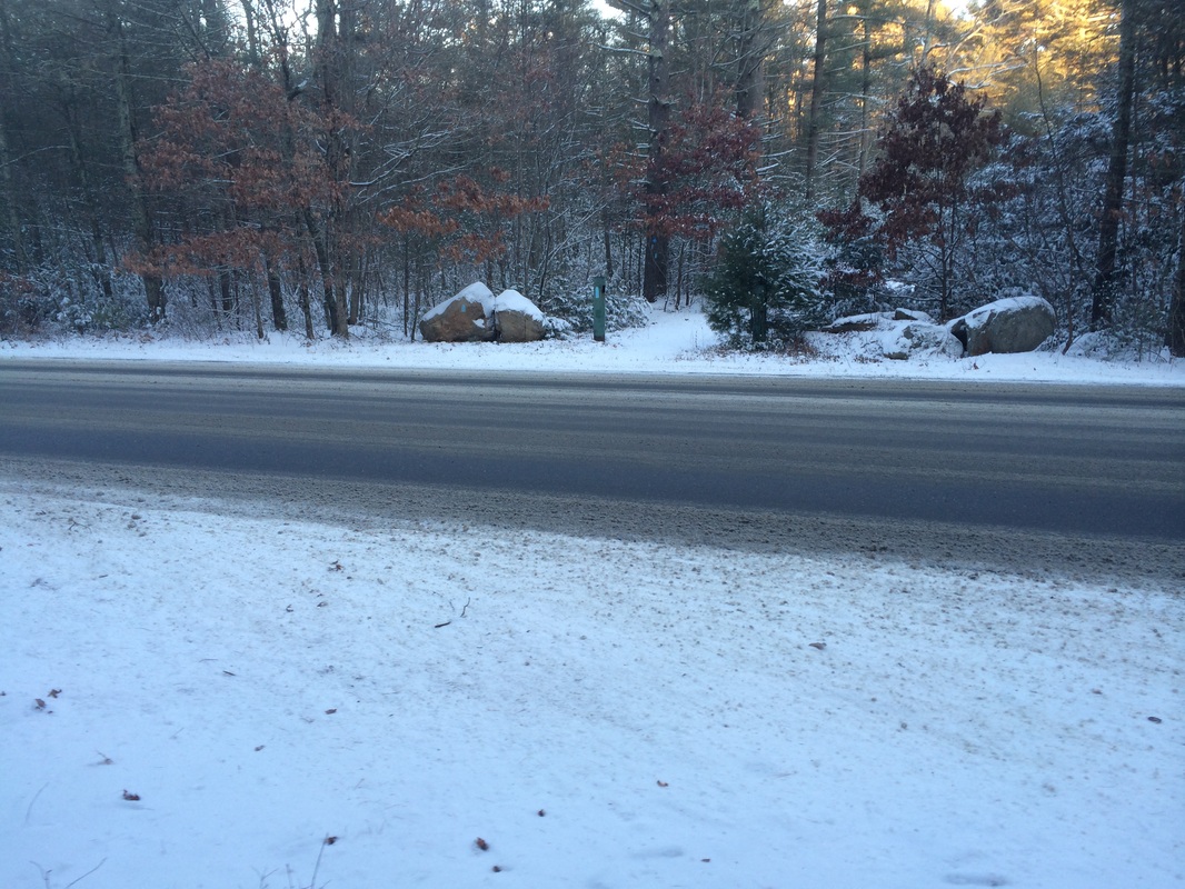
Approximately 2.7 miles in, we crossed Shetucket Turnpike. A less dangerous road crossing, I still leashed Roscoe but was able to get a picture this time…
Roughly 2.4 miles in, we crossed Route 138. This is a semi-dangerous road crossing, so I leashed Roscoe and didn’t pause to get a picture.
Approximately 2.7 miles in, we crossed Shetucket Turnpike. A less dangerous road crossing, I still leashed Roscoe but was able to get a picture this time…
Roughly 3.0 miles in, we
reached Route 49 and turned right to follow the road for a stretch…
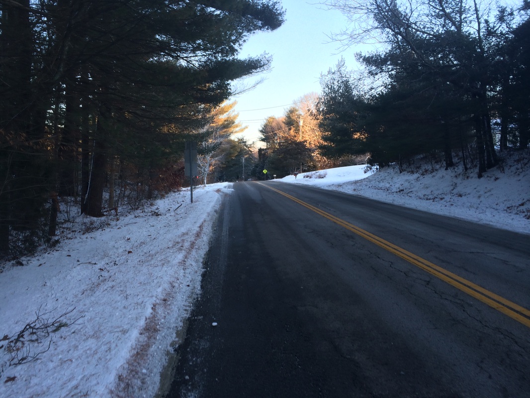
Roscoe was, again, on leash
as we made our way due north on Route 49.
Approximately 3.5 miles in, shortly after crossing the Pachaug River, we reached the Pachaug State Forest entrance at a park road and turned left…
Approximately 3.5 miles in, shortly after crossing the Pachaug River, we reached the Pachaug State Forest entrance at a park road and turned left…
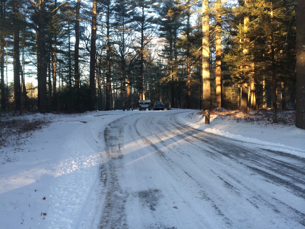
As you might be able to tell
from the picture above, there is additional parking here. And, this is actually the end of a section in
the Walk Book. I had planned to hike
additional miles so we kept going, even though it was freezing out.
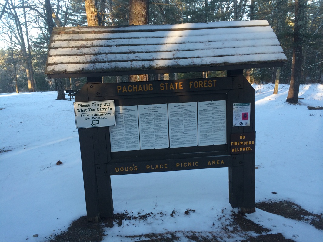
Passing the parking area, we walked through a picnic grove…Doug’s Place Picnic Area, according to the sign…
Passing the parking area, we walked through a picnic grove…Doug’s Place Picnic Area, according to the sign…
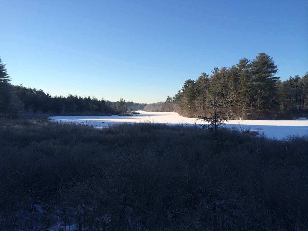
To the left, slightly off
trail, I noticed an observation deck overlooking a pond and made a note to get
a closer view on my return trip. That
pond is in the picture at the top of this recap.
Roughly 4.0 miles in, we crossed the park road (Headquarters Road) and continued due north until we reached the Pachaug Trail convergence...
Roughly 4.0 miles in, we crossed the park road (Headquarters Road) and continued due north until we reached the Pachaug Trail convergence...
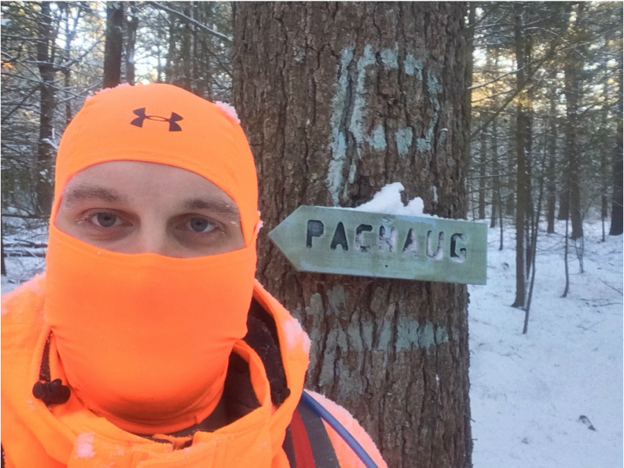
Now, approximately 4.4 miles
in, I stopped to take that selfie (you can tell it was really cold by the icicles that formed around the exposed parts of my face, specifically my eye lashes) and turned to hustle back to the warmth of the
car…stopping only to take a picture at the pond overlook.
This was a fun and easy hike. The only challenging aspect of it was the brutal cold.
Until next time…
This was a fun and easy hike. The only challenging aspect of it was the brutal cold.
Until next time…
For a map of this hike, along with elevation data, please click here.
Total 2015 Distance: 22.1
(477.9 to Goal)
