No Bull
Hike # 101
Appalachian Trail
Hoyt Road (Sherman, CT) to Bulls Bridge Road (Kent, CT)
Direction of Travel: Northbound
Section Distance (Per CFPA Walk Book): 4.1 Miles
Hike Distance: 8.65 Miles
Date Hiked: 5/11/2014
Date Published: 5/12/2014
In my last recap, I mentioned how I felt I was ready for bigger and better things...ready to take my game to the next level. So, I decided it was time to see what the Connecticut portion of the Appalachian Trail has to offer. That's right! The granddaddy of them all! The AT!
The Appalachian National Scenic Trail is a white-blazed trail system which extends from Springer Mountain in Georgia to Mount Katahdin in Maine. Covering roughly 2200 miles, the trail also passes through the eastern states of North Carolina, Tennessee, Virginia, West Virginia, Maryland, Pennsylvania, New Jersey, New York, Massachusetts, Vermont, and New Hampshire.
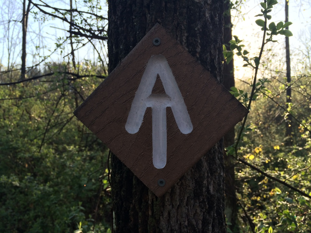
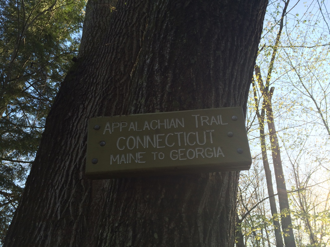
The Connecticut section of the Appalachian Trail, which is managed by the volunteers of the Connecticut chapter of the Appalachian Mountain Club (CT-AMC), covers roughly 52 miles of our state. The trail is unique by Walk Book standards in that it is the only CT400 required trail which is not managed by the Connecticut Forest & Parks Association. The trail enters Connecticut from New York just north of Hoyt Road in Sherman. It was here I found a suitable parking location (with enough room for maybe four or five cars) and started my journey on the Connecticut section of the AT…
Hike # 101
Appalachian Trail
Hoyt Road (Sherman, CT) to Bulls Bridge Road (Kent, CT)
Direction of Travel: Northbound
Section Distance (Per CFPA Walk Book): 4.1 Miles
Hike Distance: 8.65 Miles
Date Hiked: 5/11/2014
Date Published: 5/12/2014
In my last recap, I mentioned how I felt I was ready for bigger and better things...ready to take my game to the next level. So, I decided it was time to see what the Connecticut portion of the Appalachian Trail has to offer. That's right! The granddaddy of them all! The AT!
The Appalachian National Scenic Trail is a white-blazed trail system which extends from Springer Mountain in Georgia to Mount Katahdin in Maine. Covering roughly 2200 miles, the trail also passes through the eastern states of North Carolina, Tennessee, Virginia, West Virginia, Maryland, Pennsylvania, New Jersey, New York, Massachusetts, Vermont, and New Hampshire.
The Connecticut section of the Appalachian Trail, which is managed by the volunteers of the Connecticut chapter of the Appalachian Mountain Club (CT-AMC), covers roughly 52 miles of our state. The trail is unique by Walk Book standards in that it is the only CT400 required trail which is not managed by the Connecticut Forest & Parks Association. The trail enters Connecticut from New York just north of Hoyt Road in Sherman. It was here I found a suitable parking location (with enough room for maybe four or five cars) and started my journey on the Connecticut section of the AT…
|
|
The first part of the trail
wasn’t what I expected. It was a lot flatter than I anticipated. It passes
through a bog on what looks like rock gardens and it was a little muddy from
the rain a day earlier. Roughly
1/2 a mile in, I passed an alternate parking location and then carefully crossed
a brook. 2/10 of a mile later, I reached
and crossed Route 55…
North of Route 55, the trail
crosses another low-lying area and I again found myself skipping through the
mud…but this would be the worst of it. The
remaining sections weren’t nearly as muddy as the first mile or so.
A short while after crossing Route 55, and after bearing east for a bit, the
trail turned sharply back to the northwest. It was here I started the steep ascent to the
summit of Tenmile Hill (elevation: 1,000 feet).
I was excited to reach the summit of my first named AT peak…and I’m in a
lot better shape than I used to be…so, with a little pep in my step, this was a
quick climb for me. Beginners might find
this to be a challenge but, as I found out on my return journey, coming the
other way is even more challenging.
Note: advanced hikers will find both ways to be easy and AT thru-hikers
will just laugh at this stuff. Personally,
I was just happy to be out here…
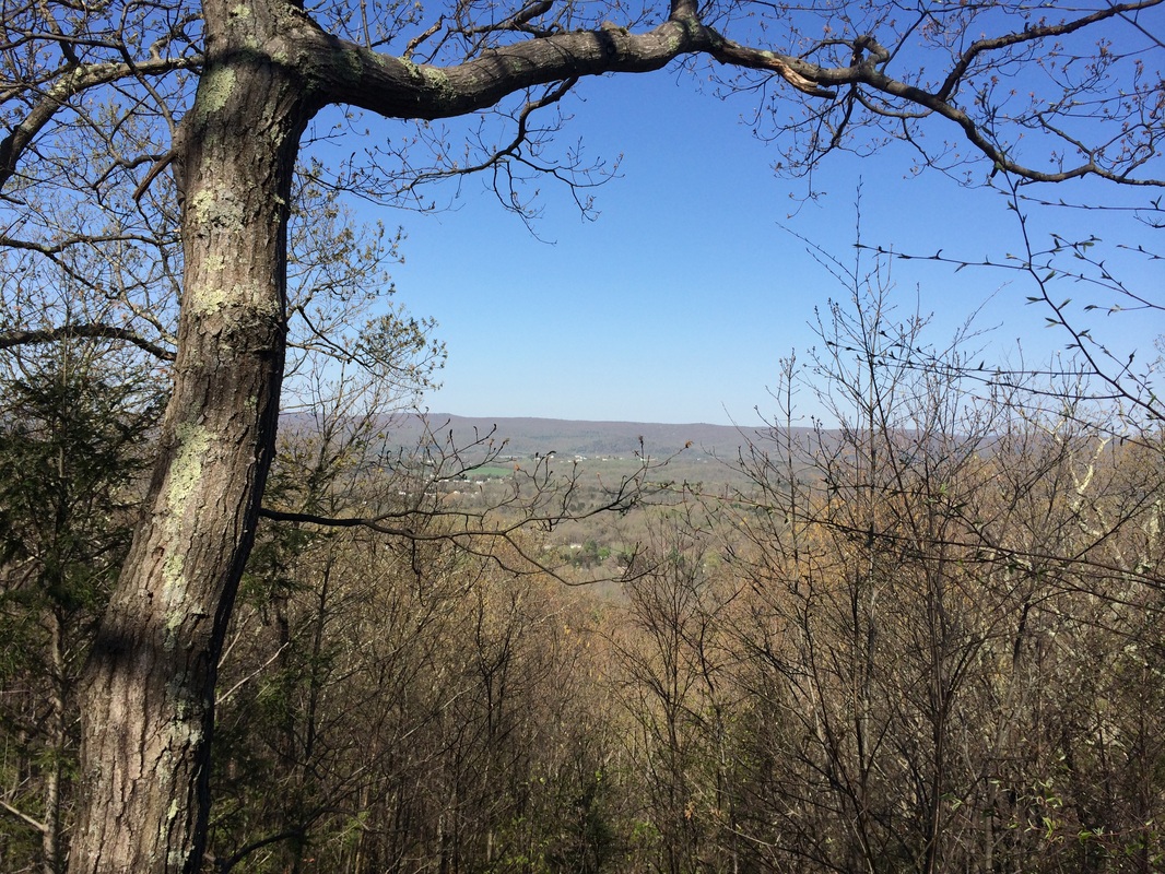
The view you see in the photo
above is not visible from the trail…but there is a short, blue-blazed side
trail which leads directly to an overlook.
Take a minute and check out the view.
After all, you hiked all the way up here…right?
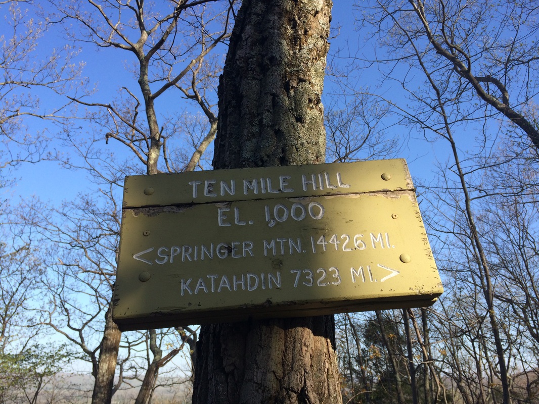
There is also an interesting sign at the summit of Tenmile Hill which provides not only elevation information, but it also lets you know exactly where you on the trail. From this point, it is exactly 1,442.6 miles to the trail’s southern terminus…and 732.3 miles to the trail’s northern terminus…
There is also an interesting sign at the summit of Tenmile Hill which provides not only elevation information, but it also lets you know exactly where you on the trail. From this point, it is exactly 1,442.6 miles to the trail’s southern terminus…and 732.3 miles to the trail’s northern terminus…
Fortunately for me, I was only
doing an 8 mile day-hike. But, if I were
travelling the entire 2200+ miles of trail end-to-end…thru-hiking from Georgia
to Maine for months on end…I would only be 2/3 of the way done at this
point. I thought about that…and I have
to give the thru-hikers who complete the entire trail a lot of credit.
North of the summit of Tenmile Hill, the trail descends. The Walk Book notes this is a gradual descent but I felt it was a little more challenging than "gradual". I also couldn’t help but notice it seemed to go on forever…and then I started to dread the return trip back to my car. It was around this time I also saw a coyote. This isn’t the first time I’ve seen a coyote while hiking…but this is the first time I’m absolutely positive that it was a coyote…no questions asked.
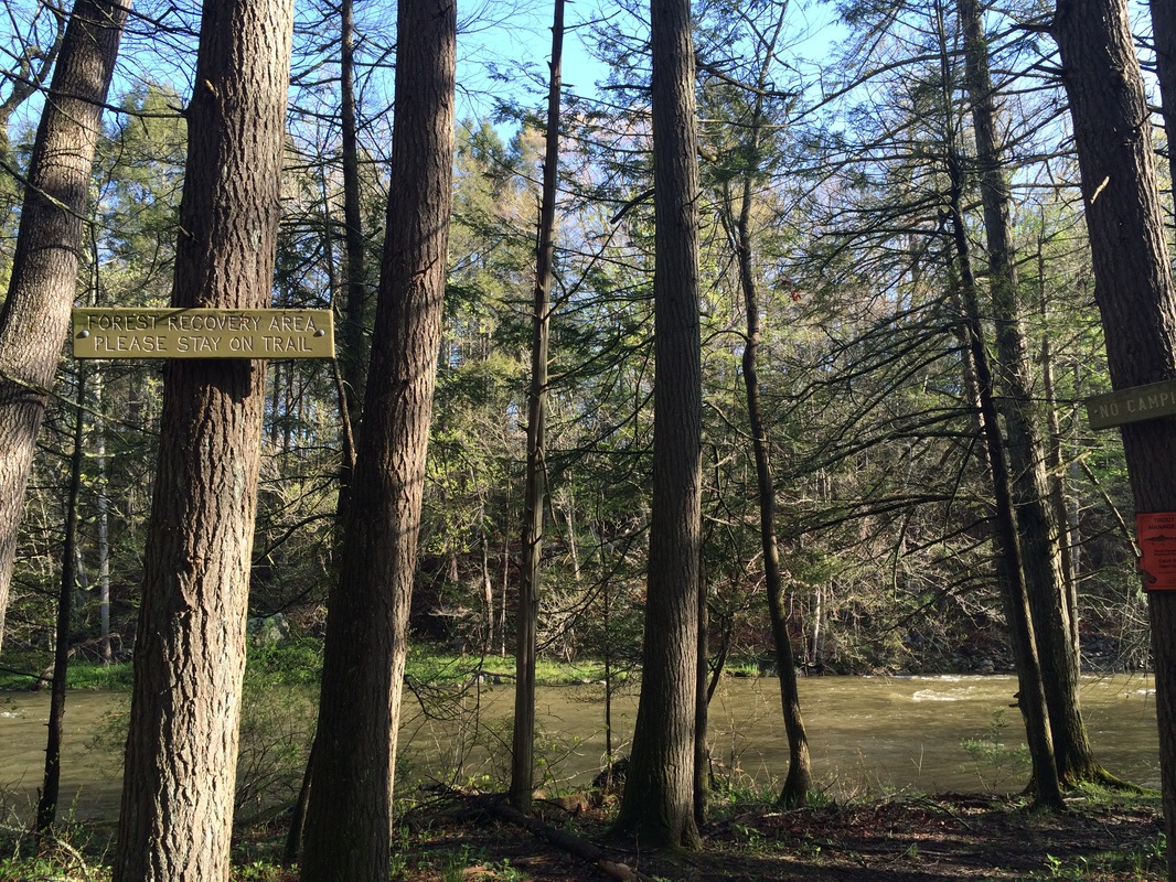
Approximately 2.6 miles in, I reached the south bank of Tenmile River…
North of the summit of Tenmile Hill, the trail descends. The Walk Book notes this is a gradual descent but I felt it was a little more challenging than "gradual". I also couldn’t help but notice it seemed to go on forever…and then I started to dread the return trip back to my car. It was around this time I also saw a coyote. This isn’t the first time I’ve seen a coyote while hiking…but this is the first time I’m absolutely positive that it was a coyote…no questions asked.
Approximately 2.6 miles in, I reached the south bank of Tenmile River…
Here, the trail swings right (east) and
follows the river bank for about 4/10 of a mile, before it reaches the Tenmile
River Lean-to and Tenmile River Campsite.
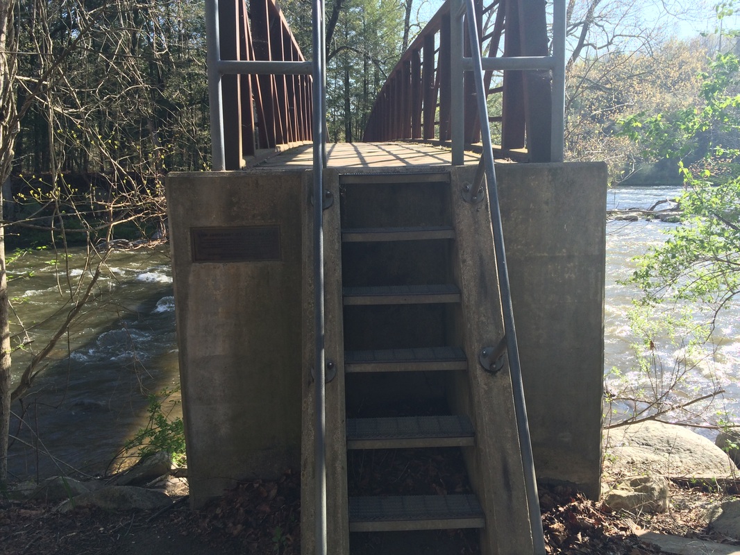
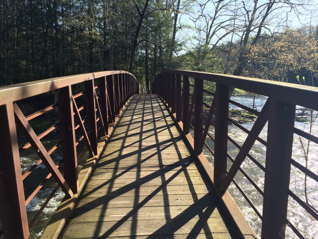
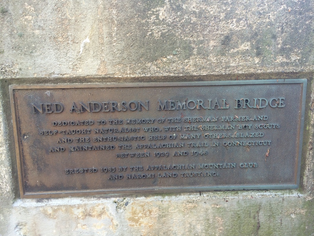
Roughly 3.1 miles in, at the confluence of the Tenmile and Housatonic Rivers, I turned left (north) and crossed the Ned Anderson Memorial Bridge…
Roughly 3.1 miles in, at the confluence of the Tenmile and Housatonic Rivers, I turned left (north) and crossed the Ned Anderson Memorial Bridge…
|
|
The footbridge, which spans 120
feet, was built in 1983 as a memorial to CFPA volunteer Nestell Kipp “Ned” Anderson,
who laid out the original Connecticut portion of the AT and maintained it for
20 years.
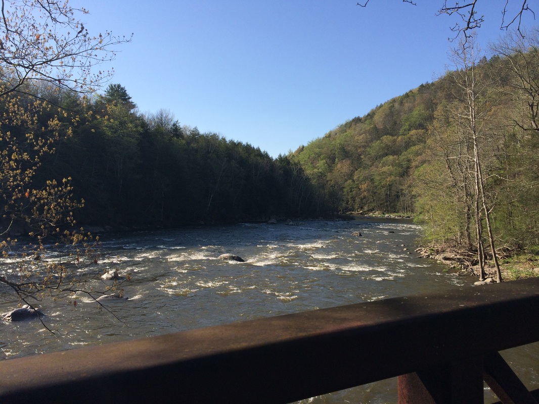
After crossing the bridge, the trail climbed a bit, ascending to a ledge which overlooks the Housatonic River. There are some good views up here, but most of them were obstructed by trees, so I don’t have any photos to share. But, the trail overlooks the rapids of the river from maybe about 100 feet above the water. This was probably my favorite part of this hike.
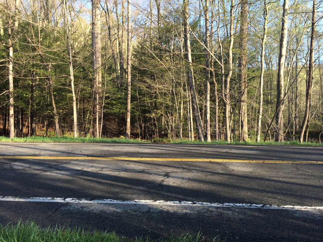
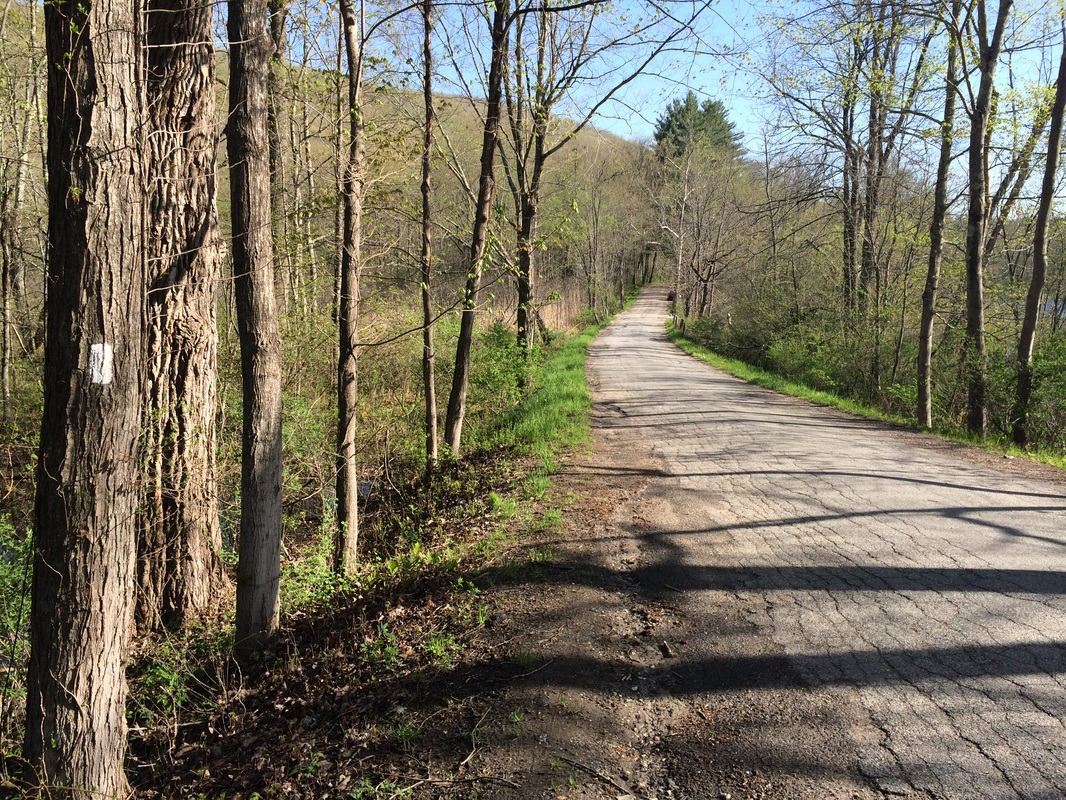
Approximately 3.6 miles in, the trail reached and followed a dirt road for a stretch, before turning sharply to the left (west). Half a mile later, I reached Bulls Bridge Road, my designated turn around point for this hike. I stopped to take a picture of Schaghticoke Road, which is where I will pick up the AT next time…
After crossing the bridge, the trail climbed a bit, ascending to a ledge which overlooks the Housatonic River. There are some good views up here, but most of them were obstructed by trees, so I don’t have any photos to share. But, the trail overlooks the rapids of the river from maybe about 100 feet above the water. This was probably my favorite part of this hike.
Approximately 3.6 miles in, the trail reached and followed a dirt road for a stretch, before turning sharply to the left (west). Half a mile later, I reached Bulls Bridge Road, my designated turn around point for this hike. I stopped to take a picture of Schaghticoke Road, which is where I will pick up the AT next time…
I turned away from Schaghticoke
Road and made my way back south…back along the ledge overlooking the
Housatonic, back over Ned Anderson Memorial Bridge, back along Tenmile River,
back up the summit of Tenmile Hill, and back to Hoyt Road where I had left my
car roughly three hours earlier.
I really enjoyed my first hike along the AT. I found it to be a much easier trail than I anticipated. I imagine a lot of that has to do with the fact that I’ve been getting in even better shape since the start of the 2014…but I also imagine that the general ease of the trail will change, becoming more and more challenging as I continue to make my way north.
Until next time...
For a map of this hike, along with elevation data, please click here.
Total 2014 Distance: 225.76
