Play Ball
Hike #118
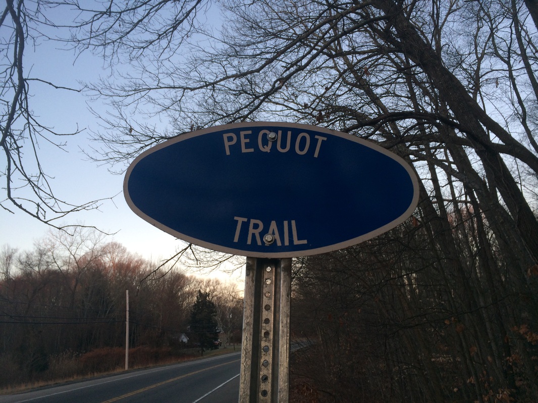
Pequot Trail
Milton Green Memorial Park to Route 165 (Preston, CT)
Direction of Travel: Northbound
Hike Distance: 9.36 Miles
Section Distance (Per CFPA Walk Book): Approximately 4.0 Miles
Date Hiked: 12/14/2014
Date Published: 12/15/2014
Hike #118
Pequot Trail
Milton Green Memorial Park to Route 165 (Preston, CT)
Direction of Travel: Northbound
Hike Distance: 9.36 Miles
Section Distance (Per CFPA Walk Book): Approximately 4.0 Miles
Date Hiked: 12/14/2014
Date Published: 12/15/2014
Note: The day before the hike described in this recap, I took
Roscoe to Gay City State Park in Hebron, Connecticut. While there, I re-hiked some of the trails
which I’ve previously recapped (Hikes # 11 and 12). I’m not going to recap those trails again
here. However, that hike added 4.64
miles to my total for 2014, brining my mile count to 414.40.
For this hike, I decided to continue working on the trails described in the East version of the Connecticut Forest and Parks Association Walk Book. After the Cockaponset Trail, which I hiked/recapped last week, the Walk Book describes the Nayantaquit Trail, the Salmon River Trail, the Shenipsit Trail, the Nipmuck Trail, the Natchaug Trail, and the Old Furnace Trail (in that order). I’ve already hiked/recapped all of those trails. So, it was time to focus on the Pequot Trail.
From the Walk Book:
The 7.6-mile blue-blazed Pequot Trail extends southeast from near Norwich through Preston and Ledyard. Varied terrain, views, rhododendron, hemlocks, and old cemeteries along the trail add interest to the hike. Plans are underway to lengthen the Pequot Trail and return the southern terminus to its original location at the junction with the Narragansett Trail at Lantern Hill in North Stonington. Check CFPA’s website for updated information, www.ctwoodlands.org.
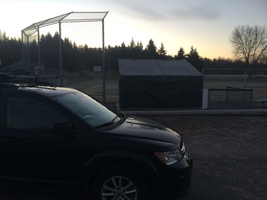
My plan was to cover the trail over the course of two hikes. This had less to do with the total distance of the trail (more than 15 miles out-and-back) and more to do with my concerns about the parking situation at the two trailheads. Based on the descriptions in the Walk Book, I thought I would find the best parking near the half-way point of the trail, off of Lincoln Park Road in Preston. The Walk Book notes there is suitable parking at a ball field.
To reach the ball field parking area, I drove Route 2 east through Norwich to Route 2A/117. I made a right and followed 2A/117 until I found the park. I made a sharp left on Lincoln Park Road and parked near the first base side dugout…
For this hike, I decided to continue working on the trails described in the East version of the Connecticut Forest and Parks Association Walk Book. After the Cockaponset Trail, which I hiked/recapped last week, the Walk Book describes the Nayantaquit Trail, the Salmon River Trail, the Shenipsit Trail, the Nipmuck Trail, the Natchaug Trail, and the Old Furnace Trail (in that order). I’ve already hiked/recapped all of those trails. So, it was time to focus on the Pequot Trail.
From the Walk Book:
The 7.6-mile blue-blazed Pequot Trail extends southeast from near Norwich through Preston and Ledyard. Varied terrain, views, rhododendron, hemlocks, and old cemeteries along the trail add interest to the hike. Plans are underway to lengthen the Pequot Trail and return the southern terminus to its original location at the junction with the Narragansett Trail at Lantern Hill in North Stonington. Check CFPA’s website for updated information, www.ctwoodlands.org.
My plan was to cover the trail over the course of two hikes. This had less to do with the total distance of the trail (more than 15 miles out-and-back) and more to do with my concerns about the parking situation at the two trailheads. Based on the descriptions in the Walk Book, I thought I would find the best parking near the half-way point of the trail, off of Lincoln Park Road in Preston. The Walk Book notes there is suitable parking at a ball field.
To reach the ball field parking area, I drove Route 2 east through Norwich to Route 2A/117. I made a right and followed 2A/117 until I found the park. I made a sharp left on Lincoln Park Road and parked near the first base side dugout…
I immediately started to
think about softball season. I was
making this hike four months (to the day) after the thrilling championship win
in our co-ed league. I can’t wait to
defend our title in the spring. #damage
For the first of my Pequot hikes, I decided to head north. I geared up and hit the trail with my furry companion. We followed Lincoln Park Road, starting this hike via road walk.
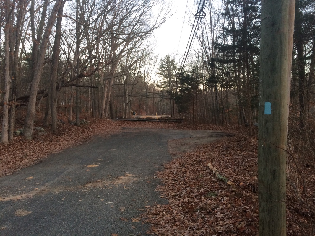
Approximately 6/10 of a mile in, we reached the end of Lincoln Park Road at this dead-end…
For the first of my Pequot hikes, I decided to head north. I geared up and hit the trail with my furry companion. We followed Lincoln Park Road, starting this hike via road walk.
Approximately 6/10 of a mile in, we reached the end of Lincoln Park Road at this dead-end…
Just beyond the dead end is
Route 2. When we reached the road, we
made a left and followed it for a bit, passing a gas station in the
process.
Roughly 8/10 of a mile in, we made a right and entered the woods on the north side of Route 2…
Roughly 8/10 of a mile in, we made a right and entered the woods on the north side of Route 2…
Once in the woods, the trail
follows a single-wide path.
Later, it follows a series of woods roads. There are CFPA signs advising the trail is only
for foot traffic, but that doesn’t slow down the ATV crowd at all. There were several places where the trail
turned to mud, causing me to have to bushwhack a bit in order to get around mud
holes.
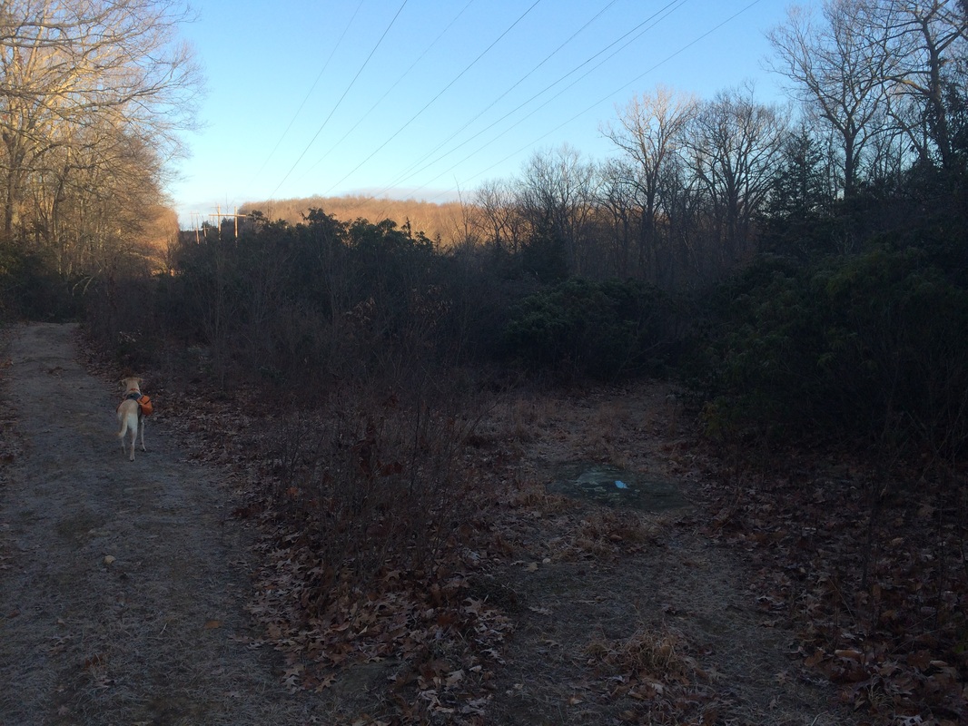
Approximately 2.1 miles in, we crossed a power line cut…
Approximately 2.1 miles in, we crossed a power line cut…
From here, the trail will
follow the power lines due north until it reaches its northern terminus near
Route 165. Fortunately, it doesn’t
exactly follow the straight-line cut. In
some spots, the trail leads far enough away from the power lines that I almost
forgot they were there. If I did forget,
the trail did a good job of reminding me.
Roughly 2.7 miles in, we crossed back over to the eastern side of the power line cut…
Roughly 2.7 miles in, we crossed back over to the eastern side of the power line cut…
It was around this time, I
started getting excited because the Walk Book notes a view in the area. Looking around, I couldn’t see a ridgeline
that looked like it would lead to any views.
And, I wasn’t sure what I would see when I got there (the Walk Book
notes something about the Thames River and Millstone Power Plant). But, I was hopeful nonetheless.
Approximately 3.3 miles in, after climbing a pretty steep incline and reaching the power lines again, we came to a “view”…
Approximately 3.3 miles in, after climbing a pretty steep incline and reaching the power lines again, we came to a “view”…
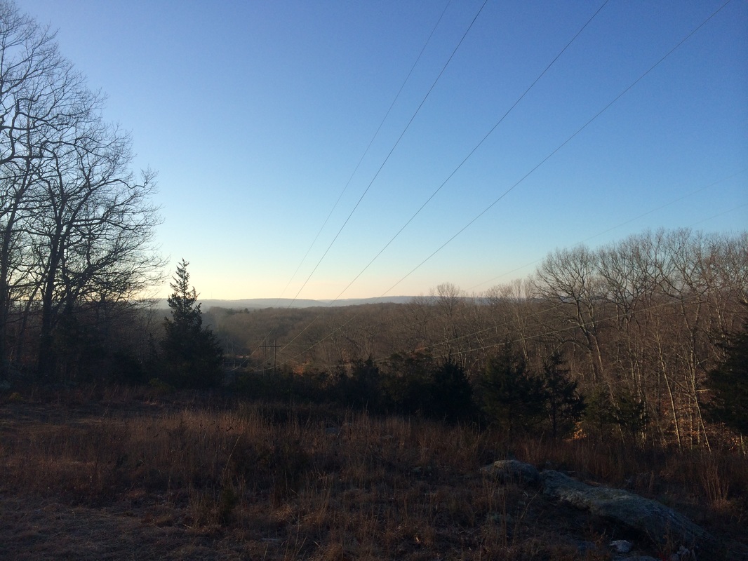
At first, I thought this was
the view noted in the Walk Book. But I
couldn’t see the Thames River or the Millstone Power Plant. According to the Walk Book, both of these
should be visible from the noted view.
It is possible this isn’t the correct spot (the mileage was off by 1/2 a
mile). But, this was the only thing resembling
a view on the entire hike. Eventually,
we crossed the power line cut and found ourselves on the west side again.
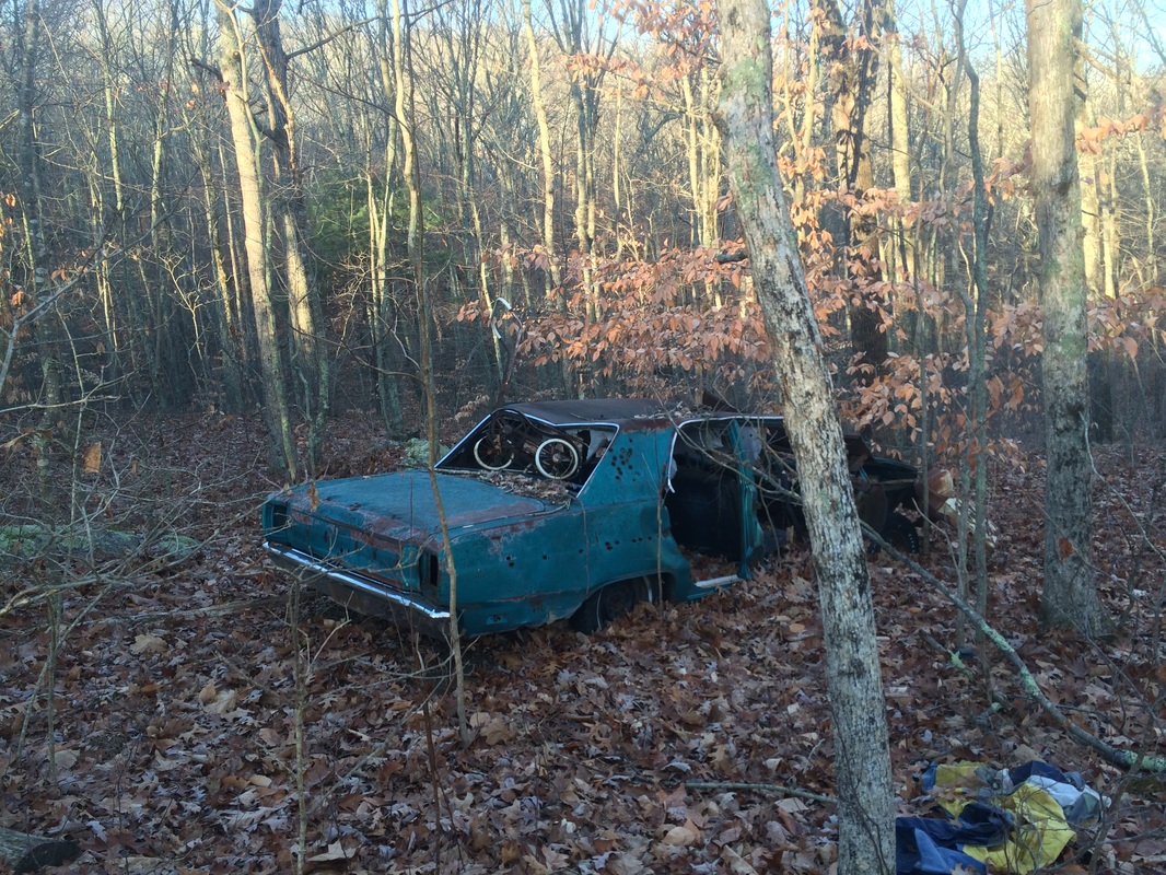
Roughly 3.9 miles in, we passed this old car and approached the power lines again…
Roughly 3.9 miles in, we passed this old car and approached the power lines again…
We didn’t immediately cross
the power line cut. But, if you’ve been
paying attention, you know what is coming.
Approximately 4.2 miles in, we crossed the power line cut…
Approximately 4.2 miles in, we crossed the power line cut…
Thankfully, this was the
last time we had to cross on the outbound trip.
And, as frustrated as I was with all of this back and forth, I knew the
fourth crossing meant we were approaching the northern trailhead.
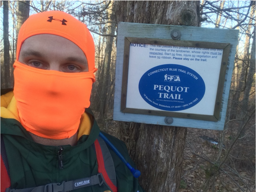
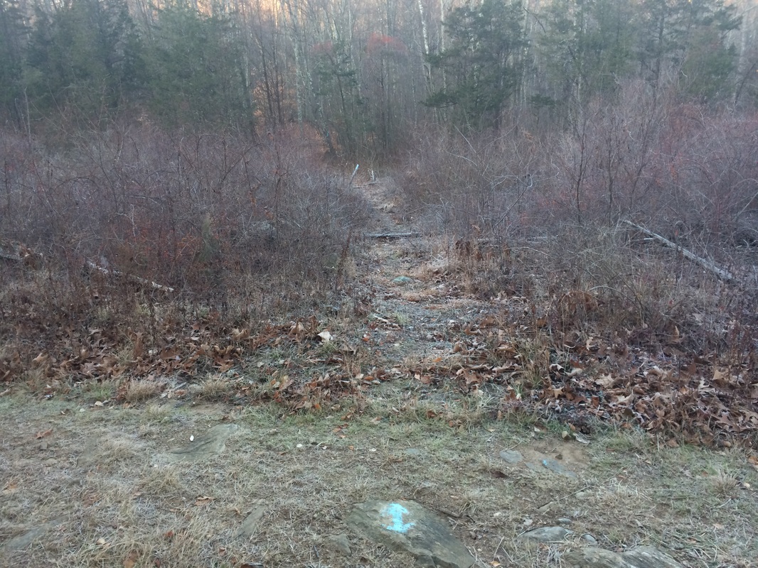
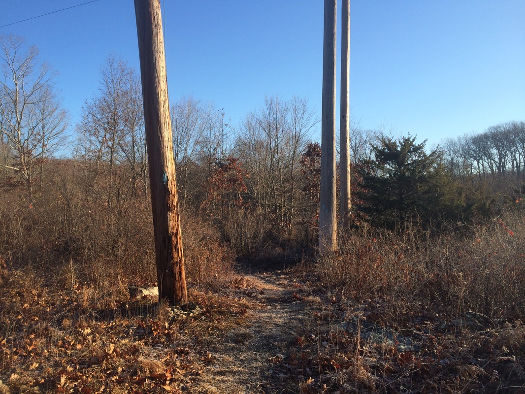
Roughly 4.8 miles in, we reached the northern terminus and I took the picture at the top of the recap.
We didn’t linger because the end of the trail is someone’s driveway. I know I wouldn't want some guy and his dog hanging out in my driveway. Also, I was in a bit of a hurry to get back to the car so I could get home, shower, and head somewhere to watch the Packers game. We turned around and started retracing our steps back to the parking area.
I’d be lying if I said I wasn’t a little disappointed with my first experience on the Pequot. It wasn’t all bad, but there is a lot of ATV damage to certain sections of the trail. And, the other sections just kind of follow the power line cut I crossed all those times. Also, there aren’t a lot of elevation changes (I covered more than 9 miles in just over 3 hours). Hopefully my second hike will be more enjoyable.
Until next time…
For a map of this hike, along with elevation data, please click here.
Total 2014 Distance: 423.76
