To Return
Hike #80
Date Hiked: 1/11/2014
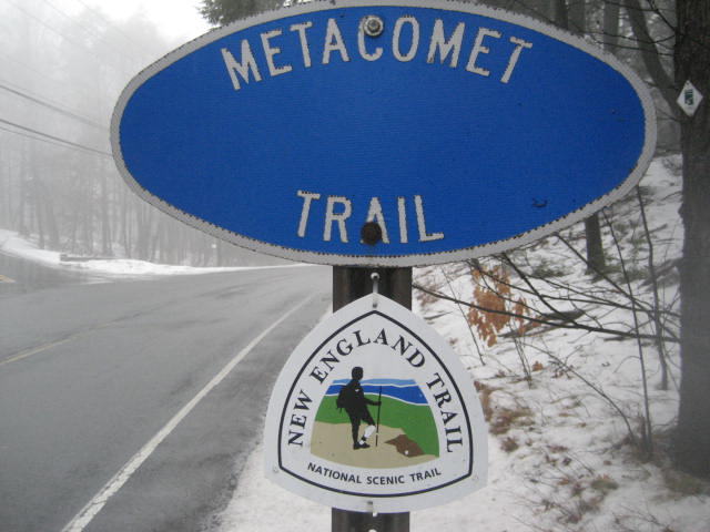
Metacomet Trail, Monadnock Trail
Rt. 168/Mountain Road (Suffield, CT) to Rising Corner Road (Southwick, MA)
Distance: 5.31 miles round trip (Approx. 2.9 miles one way)
Date Published: 1/11/2014
Hike #80
Date Hiked: 1/11/2014
Metacomet Trail, Monadnock Trail
Rt. 168/Mountain Road (Suffield, CT) to Rising Corner Road (Southwick, MA)
Distance: 5.31 miles round trip (Approx. 2.9 miles one way)
Date Published: 1/11/2014
When I originally started planning Hike # 80, I was going to continue making my way through the trails of Westwoods in Guilford, CT. Then I realized I had an appointment scheduled to have some work done on my car at the dealership in Enfield, CT…and it didn’t make much sense to drive from one end of the state to the other. So, I started looking for other options. I considered heading up to Mount Tom in Holyoke, MA (only about a 20 minute drive from Enfield) but then I remembered the forecast was calling for rain…and it didn’t make much sense to do a hike with good views. In the end, I settled on returning to the northern most section of the Metacomet Trail.
A short time after I originally completed this section (back in April of 2013), it was announced that the original trail route was re-opened. Now, instead of a lengthy road walk down Mountain and Warnertown Roads, the trail sticks to the Metacomet Ridge as it makes its way to the CT/MA border. Having already completed this section, I wasn’t required to hike it again, but I was compelled to do so when I realized I would be in the area. Also, I spent most of my time on the original hike wishing the trail was located where it now is. What good is wishing for something if you aren’t going to make use of it once you get your wish…right?
After the work on my car was complete, I made the short drive over to where Route 168 (Mountain Road) intersects with Phelps Road in Suffield. There are a number of small parking areas here. I picked one and set out. Since I spent most of the morning sitting in the waiting area of the car dealership, this was going to a solo trip…sorry Roscoe.
I started by crossing Mountain Road and following the trail into the Hugh M. Alcon Wildlife Preserve.
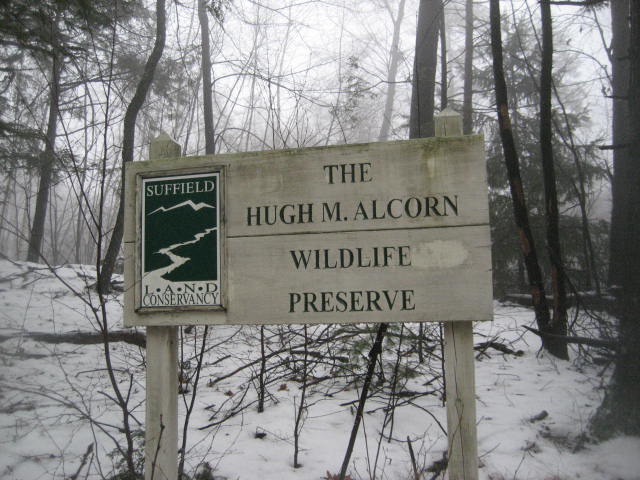
Hugh Meade Alcon Jr was a U.S. lawyer and political figure. A native of Suffield, Alcon attended Dartmouth College and Yale Law School. The wildlife preserve which today carries his name covers more than 14 acres.
Upon entering the preserve, the trail turns left and starts heading uphill. For the next 2.9 miles, the trail runs due north, parallel to Mountain and Warnertown Roads. After the initial climb, the trail comes to a power line cut. I imagine there are some good views from up here. Sadly, on this day, it was raining so I could barely make out the road below.
On the other side of the power lines, the trail climbs another short hill and then it heads gradually downhill until it reaches the next section. I felt like I was descending forever.
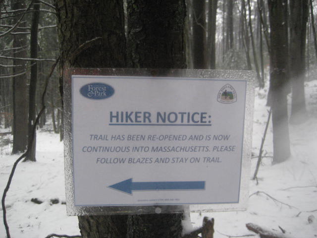
Around the 2.3 mile mark, I came to a sign which proclaims the trail is open again (although I can’t figure out why there is a left arrow…the trail continues straight). I already knew that, otherwise I wouldn’t have bothered redoing this section, but I’m sure this notice comes as great news to people who aren’t expecting it.
Upon entering the preserve, the trail turns left and starts heading uphill. For the next 2.9 miles, the trail runs due north, parallel to Mountain and Warnertown Roads. After the initial climb, the trail comes to a power line cut. I imagine there are some good views from up here. Sadly, on this day, it was raining so I could barely make out the road below.
On the other side of the power lines, the trail climbs another short hill and then it heads gradually downhill until it reaches the next section. I felt like I was descending forever.
Around the 2.3 mile mark, I came to a sign which proclaims the trail is open again (although I can’t figure out why there is a left arrow…the trail continues straight). I already knew that, otherwise I wouldn’t have bothered redoing this section, but I’m sure this notice comes as great news to people who aren’t expecting it.
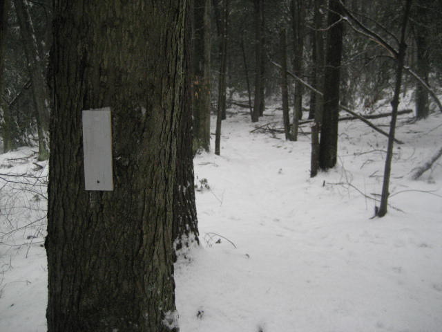
Shortly after the notice, the blazes change from Metacomet blue to Monadnock white…
I still haven’t figured out if the change in color means I had crossed over into Massachusetts, but I believe it does. And, if I’m correct, that meant I was done with the Metacomet Trail (again). It also meant, from this point on, I was starting a new trail. And, now that I’ve started it…I guess that means I have to finish it. From the CT/MA border, the Monadnock Trail stretches more than 50 miles to Mount Monadnock in New Hampshire. So, I wasn’t going to complete the entire trail in a day. But, as I branch out of CT and into other New England states, the Monadnock is on my list of trails to work on in 2014.
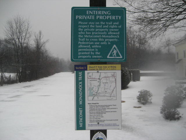
Around the 2.9 mile mark, I came to Rising Corner Road. I was happy to find there was a parking location here and decided to head back to my car.
Around the 2.9 mile mark, I came to Rising Corner Road. I was happy to find there was a parking location here and decided to head back to my car.
Along the way, I took advantage of a few shortcuts. There are some sections of the trail which take advantage of some nice views. But, on this day, there were no views to be had. So, in some places, I stuck to the “bypass” trails. I was surprised to see how much distance this cut out of my hike. To be honest, I think my MapMyHike app was on the fritz because of the temperature and the rainy conditions.
This section is generally easy, compared to some of the other sections of the Metacomet…but the fact that it now follows the ridge makes it a much better (and slightly more challenging) section than the road walk it was the last time I hiked it. I think it is really great news that the trail was restored to its original location. And, I think everyone who completed the Metacomet end-to-end while the last section was a road walk should return to check out this “new” section of the trail.
This section is generally easy, compared to some of the other sections of the Metacomet…but the fact that it now follows the ridge makes it a much better (and slightly more challenging) section than the road walk it was the last time I hiked it. I think it is really great news that the trail was restored to its original location. And, I think everyone who completed the Metacomet end-to-end while the last section was a road walk should return to check out this “new” section of the trail.
For a map of this hike, along with elevation data, please click here.
Total Miles in 2014: 28.41
