From the Sand to the Summit
Hike # 107
Mount Ascutney State Park
Windsor, VT
Hike Distance: 10.24 Miles
Date Hiked: 6/29/2014
Date Published: 7/1/2014
Hike # 107
Mount Ascutney State Park
Windsor, VT
Hike Distance: 10.24 Miles
Date Hiked: 6/29/2014
Date Published: 7/1/2014
Note: The hike described in the
following recap is not recommended for beginners.
One of the reasons I love Connecticut is its close proximity to both shoreline and mountain top. Granted, the beaches in the area aren’t as nice as beaches in Florida…and, the mountains in the area aren’t as high the mountains in Colorado…but, we have a nice mixture of waves and peaks and we don’t have to travel very long (usually under a couple of hours) to reach either.
This past weekend, I found myself taking full advantage of both sand and summit. On Saturday, I made a two hour drive with Jaci and Roscoe for a nice family trip to Narragansett, Rhode Island. There, we visited my friend Tim and his family to celebrate his daughter’s third birthday. We spent a couple of hours at the beach and had a great time catching up with old friends. On Sunday, I made another two hour drive with Roscoe for what would prove to be a very challenging hike to the summit of Mount Ascutney.
I originally planned to hike Ascutney (elevation: 3144 feet), which made its way on to my radar from the Day Hiker’s Guide to Vermont, a little later in the summer. But, after talking about it with a friend from softball, my interest in the mountain increased so much that I decided to fast track it. I’m glad I did this because I suspect the combination of bugs and heat a couple of weeks from now would’ve made the hike unbearable.
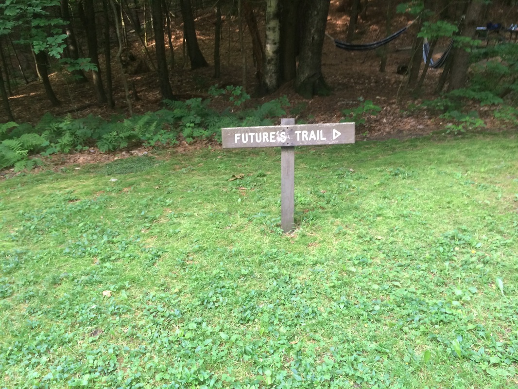
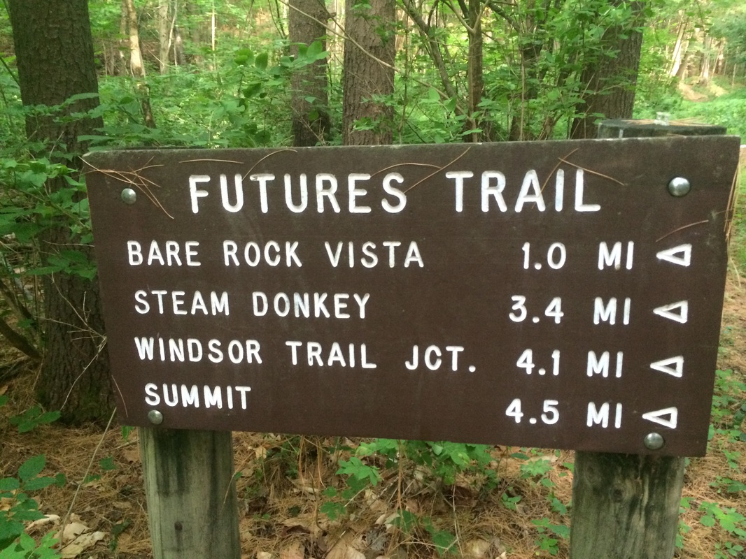
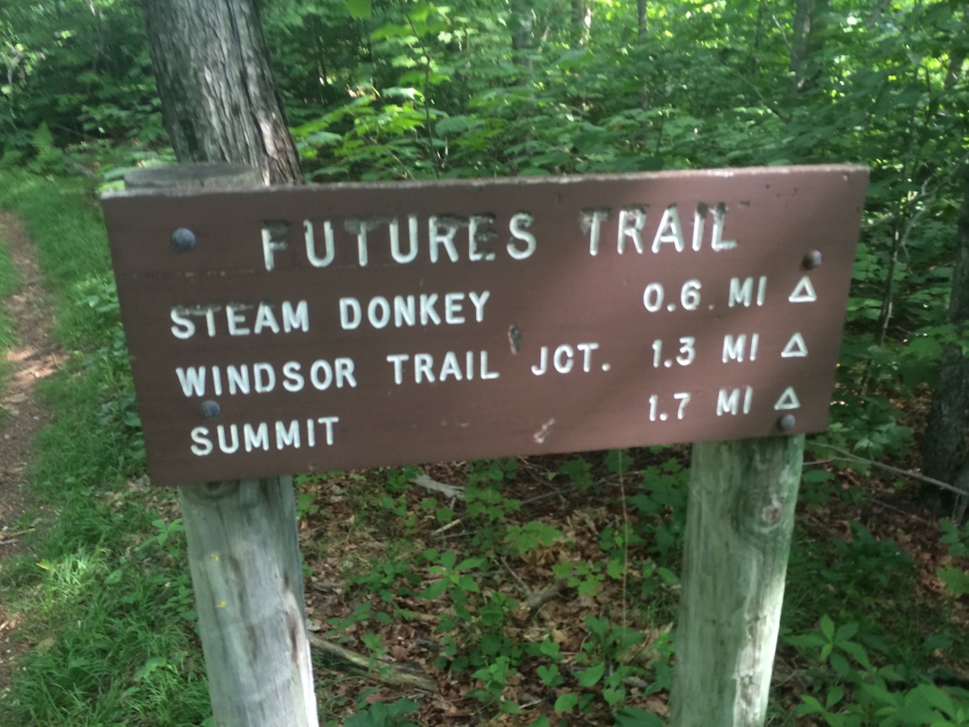
Mount Ascutney is a monadnock located in southern Vermont. The mountain’s first hiking trail was built in the 1850s. Today, five trails approach the summit. Three of the trails (Windsor, Weathersfield, and Brownsville) take their names from the towns which roughly mark their town of origin. The Bicentennial Trail climbs through the West Windsor Town Forest to meet up with the Weathersfield Trail just below the summit. For this trip, I elected to take the longest of the five trails…the Future’s Trail.
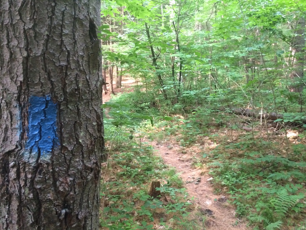
Marked with blue blazes, the Future’s Trail leads roughly 4.8 miles…over a 2600 foot elevation gain…from Ascutney State Park to the Windsor Trail, about ½ a mile below the summit of Mount Ascutney. The Day Hiker’s Guide promised that “although it takes longer to ascend via this route, the trail offers several interesting views that compensate for the additional effort.” Well, they got the additional effort part right…but I was disappointed to find that there was only one additional vista…more on that in a moment.
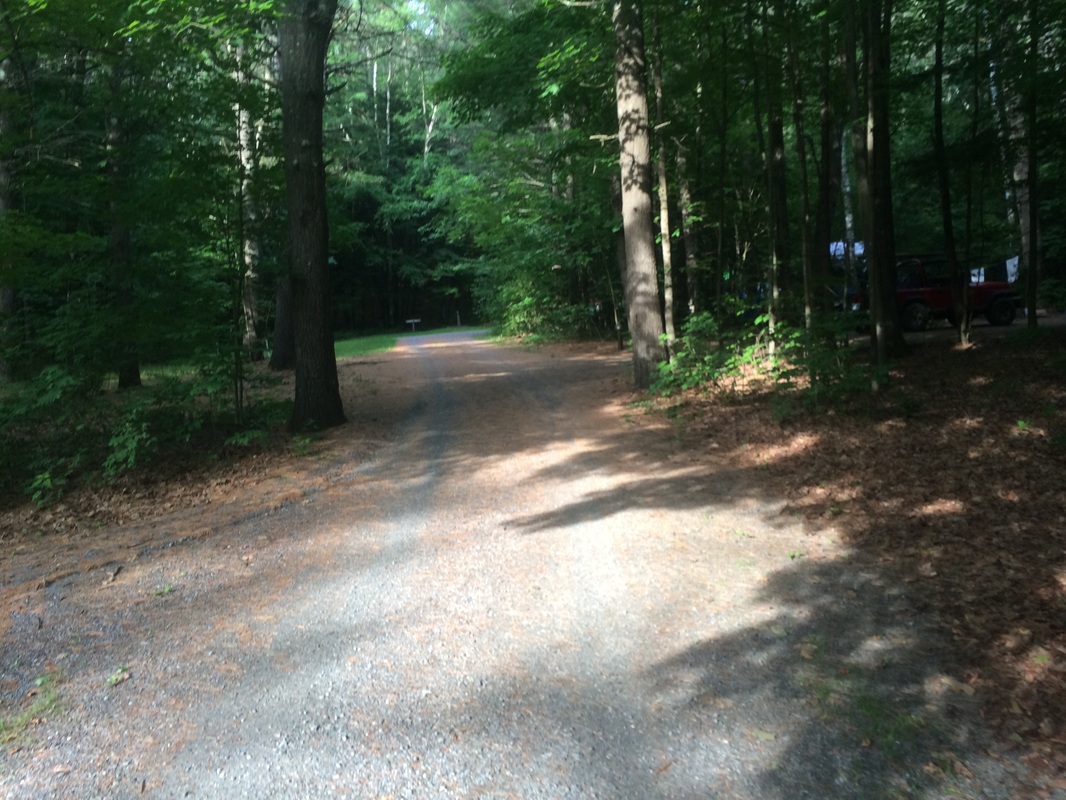
To the trailhead from CT: Take I-91 North through all of Massachusetts to exit 8 in Vermont. Bear right at the end of the ramp on VT-131. In ½ mile, turn left on US-5/VT-12. In 1.2 miles, turn left on VT-44A (Back Country Road). In 1.1 miles, turn left to enter the park. From the contact station near the park entrance, follow the signs for the Future’s Trail (there are a couple of parking locations near campsites)…
One of the reasons I love Connecticut is its close proximity to both shoreline and mountain top. Granted, the beaches in the area aren’t as nice as beaches in Florida…and, the mountains in the area aren’t as high the mountains in Colorado…but, we have a nice mixture of waves and peaks and we don’t have to travel very long (usually under a couple of hours) to reach either.
This past weekend, I found myself taking full advantage of both sand and summit. On Saturday, I made a two hour drive with Jaci and Roscoe for a nice family trip to Narragansett, Rhode Island. There, we visited my friend Tim and his family to celebrate his daughter’s third birthday. We spent a couple of hours at the beach and had a great time catching up with old friends. On Sunday, I made another two hour drive with Roscoe for what would prove to be a very challenging hike to the summit of Mount Ascutney.
I originally planned to hike Ascutney (elevation: 3144 feet), which made its way on to my radar from the Day Hiker’s Guide to Vermont, a little later in the summer. But, after talking about it with a friend from softball, my interest in the mountain increased so much that I decided to fast track it. I’m glad I did this because I suspect the combination of bugs and heat a couple of weeks from now would’ve made the hike unbearable.
Mount Ascutney is a monadnock located in southern Vermont. The mountain’s first hiking trail was built in the 1850s. Today, five trails approach the summit. Three of the trails (Windsor, Weathersfield, and Brownsville) take their names from the towns which roughly mark their town of origin. The Bicentennial Trail climbs through the West Windsor Town Forest to meet up with the Weathersfield Trail just below the summit. For this trip, I elected to take the longest of the five trails…the Future’s Trail.
Marked with blue blazes, the Future’s Trail leads roughly 4.8 miles…over a 2600 foot elevation gain…from Ascutney State Park to the Windsor Trail, about ½ a mile below the summit of Mount Ascutney. The Day Hiker’s Guide promised that “although it takes longer to ascend via this route, the trail offers several interesting views that compensate for the additional effort.” Well, they got the additional effort part right…but I was disappointed to find that there was only one additional vista…more on that in a moment.
To the trailhead from CT: Take I-91 North through all of Massachusetts to exit 8 in Vermont. Bear right at the end of the ramp on VT-131. In ½ mile, turn left on US-5/VT-12. In 1.2 miles, turn left on VT-44A (Back Country Road). In 1.1 miles, turn left to enter the park. From the contact station near the park entrance, follow the signs for the Future’s Trail (there are a couple of parking locations near campsites)…
|
|
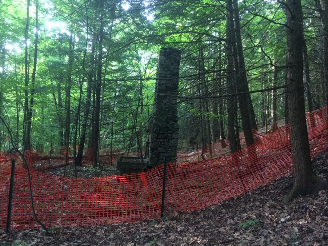
From campsite # 22, the trail
heads due south past an old fireplace.
The Guide notes this is left over from a CCC camp which was located here
in the 1930s…
|
|
As it continues to head due
south then due west, the trail climbs steeply over a series of long
switchbacks. Approximately 1.0 mile from
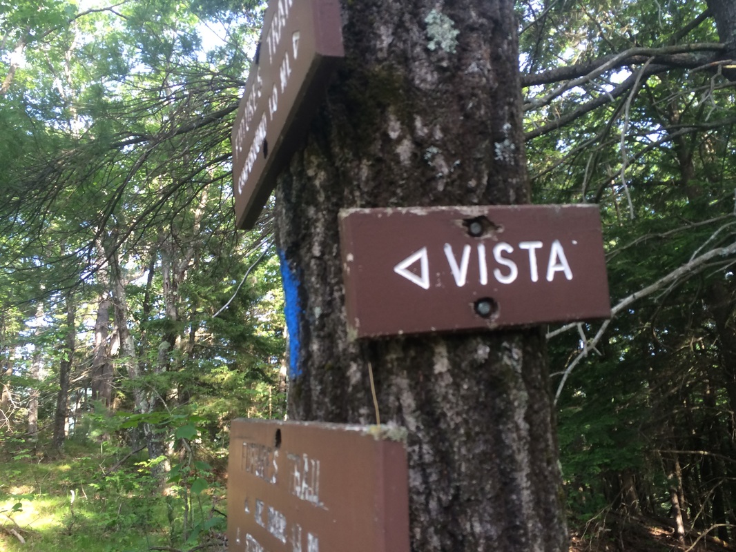
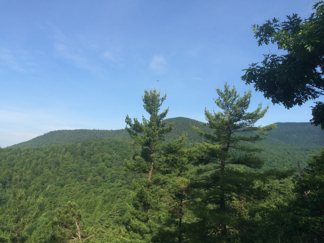
the start of the trail (1.2 miles from where I parked), we made a slight left
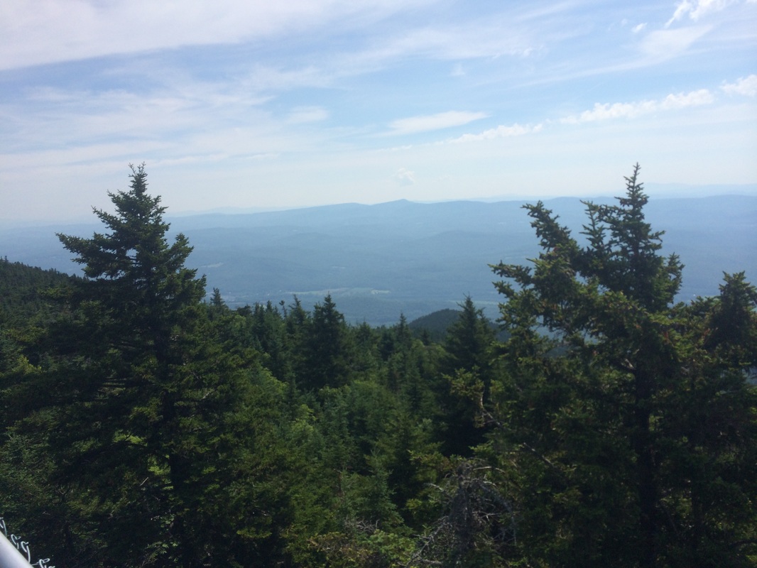
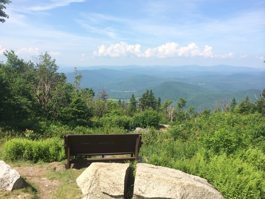
and followed a short side trail to reach Bare Rock Vista, and some nice views…
|

|
|
|
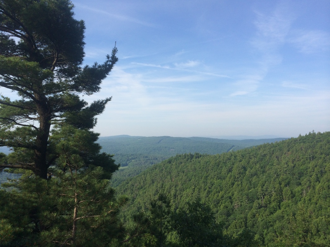
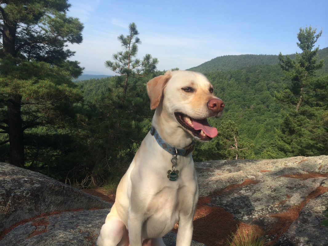
After rehydrating and catching
our breath, we made our way back to the main trail and continued to follow it
as it descended for a short stretch before ascending steeply again. Roughly 2.1 miles from the start of the trail
(2.3 miles from where I parked), we crossed a power line cut…
Shortly after, we reached a
gravel parking lot which was just off of Mountain Road, the paved roadway which
eventually leads to the parking area just below the summit. We stopped again to rehydrate and catch our
breath. But, the bugs were starting to
become a problem so we didn’t linger. We
continued to follow the trail and, approximately 2.6 miles in, crossed the
power line cut again.
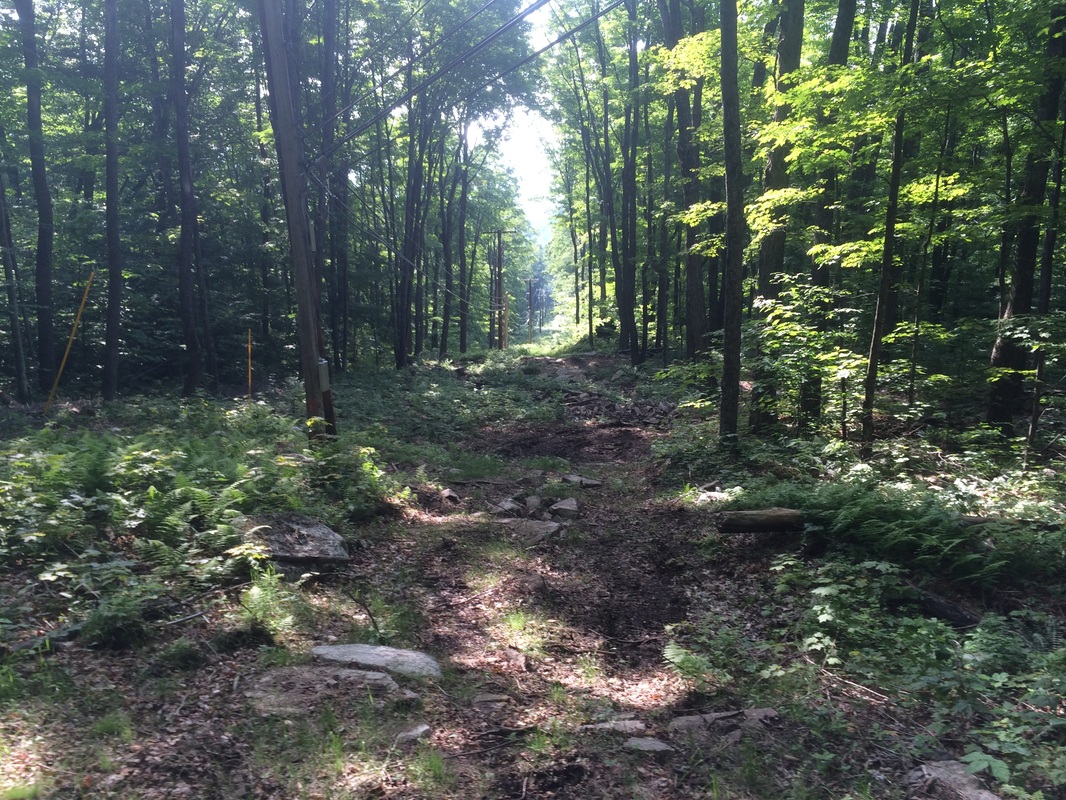
Roughly .3 of a mile later, we crossed the power line cut for a third time. The blue blazes now lead us to an old woods road. It was very muddy and very buggy. This was not my favorite part of the hike. It is also where my GPS distances started to differ from the distances provided by The Guide.
Approximately 2.8 miles from the start of the trail (per The Guide) but 3.1 miles from where I parked (per GPS), we crossed the paved Mountain Road. I was starting to get excited as we were getting ever closer to the “Steam Donkey”…
I felt like a “Steam Donkey” as
I continued to drip sweat all over the trail.
It was hot and the bugs were having their way with me. I just wanted to be at the summit, but we still had almost two miles to go.
I recall the next section as particularly steep. It’s always difficult to say which section of any hike was the steepest, but I remember stopping at least three times in a period of five minutes to catch my breath. I think Roscoe was even feeling it, as he didn’t seem to be cruising up this ascent as he has on most of our other hikes, including our recent hike up Mount Greylock.
Roughly 3.4 miles from the start of the trail (per The Guide) but 3.8 miles from where I parked (per GPS), we reached the junction with the Steam Donkey Trail, a short (1/10 of a mile) spur trail which would lead us to the “Steam Donkey”…
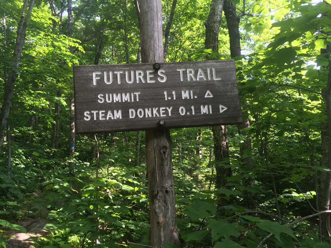
I honestly didn’t know what I
would find when we reached the “Steam Donkey”.
The Guide noted some steam powered machine used in the 1900s for logging
on steep terrain. I’m so accustomed to
being disappointed by this stuff whenever I’m hiking back home in CT. So, I was pleasantly surprised when we got
there and I found this century-old contraption which was taller than me…
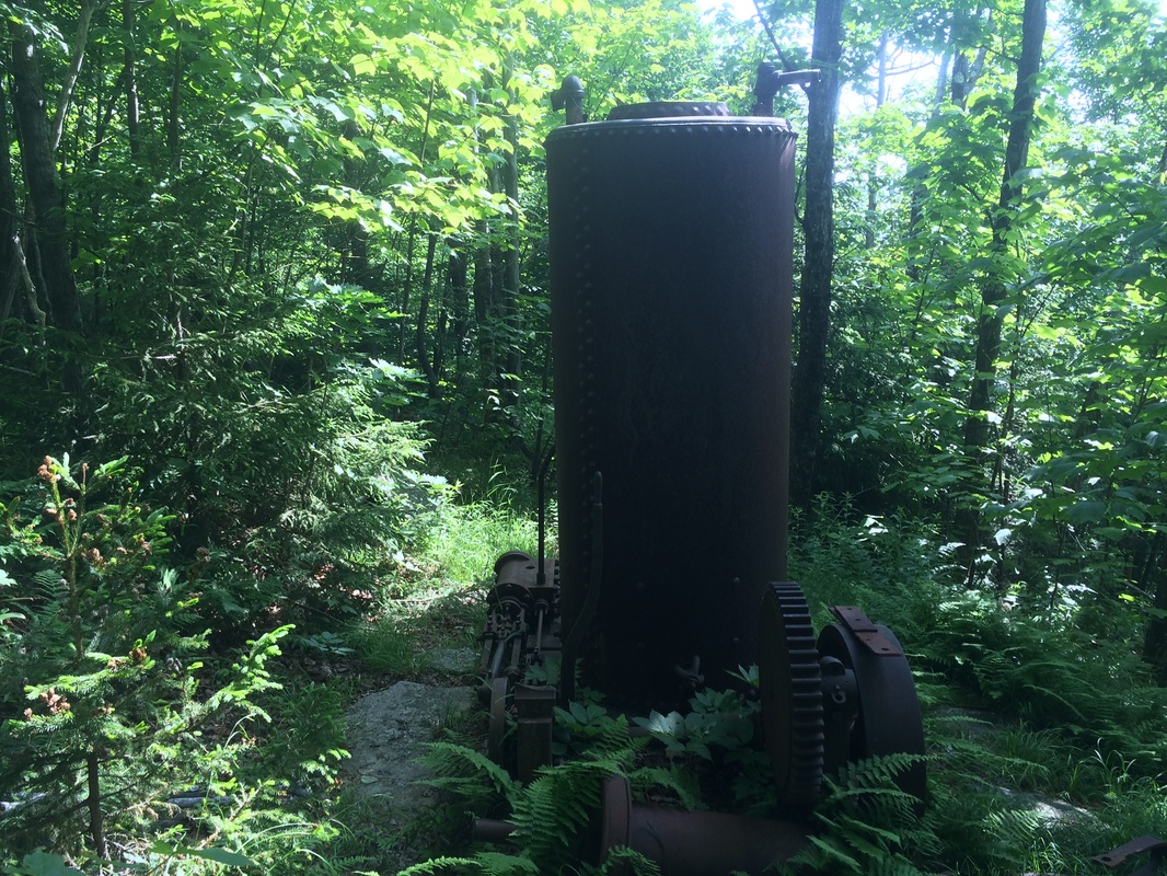
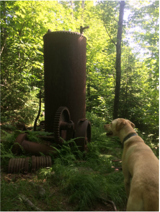
I would’ve loved to explore the
area around the “Steam Donkey” more, but we still had a bit of distance before we
reached the summit and the bugs were becoming increasingly annoying. So, we doubled back to the Future’s Trail.
Approximately 3.6 from the start of the trail (per The Guide), but 4.4 miles in (per GPS), we reached another trail junction. Here, the Futures Trail Link connects the Future’s Trail to the Summit Trail and provides a shortcut to the summit. But, honestly, why would you come all this way only to start taking shortcuts now? Naturally, we stayed on the Future’s Trail.
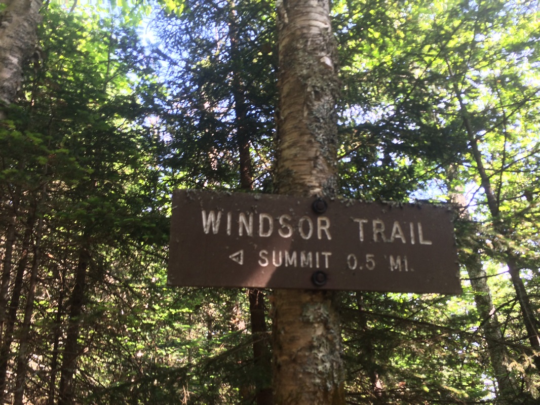
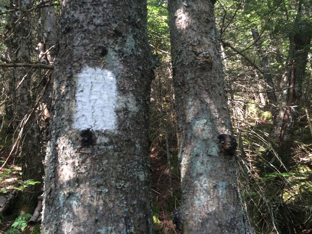
Roughly 4/10 of a mile more, now 4.8 miles in, we reached the end of the Future’s Trail. Here, approximately ½ of a mile from the summit, we picked up the Windsor Trail and started following white blazes…
Approximately 3.6 from the start of the trail (per The Guide), but 4.4 miles in (per GPS), we reached another trail junction. Here, the Futures Trail Link connects the Future’s Trail to the Summit Trail and provides a shortcut to the summit. But, honestly, why would you come all this way only to start taking shortcuts now? Naturally, we stayed on the Future’s Trail.
Roughly 4/10 of a mile more, now 4.8 miles in, we reached the end of the Future’s Trail. Here, approximately ½ of a mile from the summit, we picked up the Windsor Trail and started following white blazes…
|
|
After 2/10 of a mile, we
reached another trail junction. Here, a
short spur trail leads to Castle Rock, which provides views of the Connecticut
River Valley…
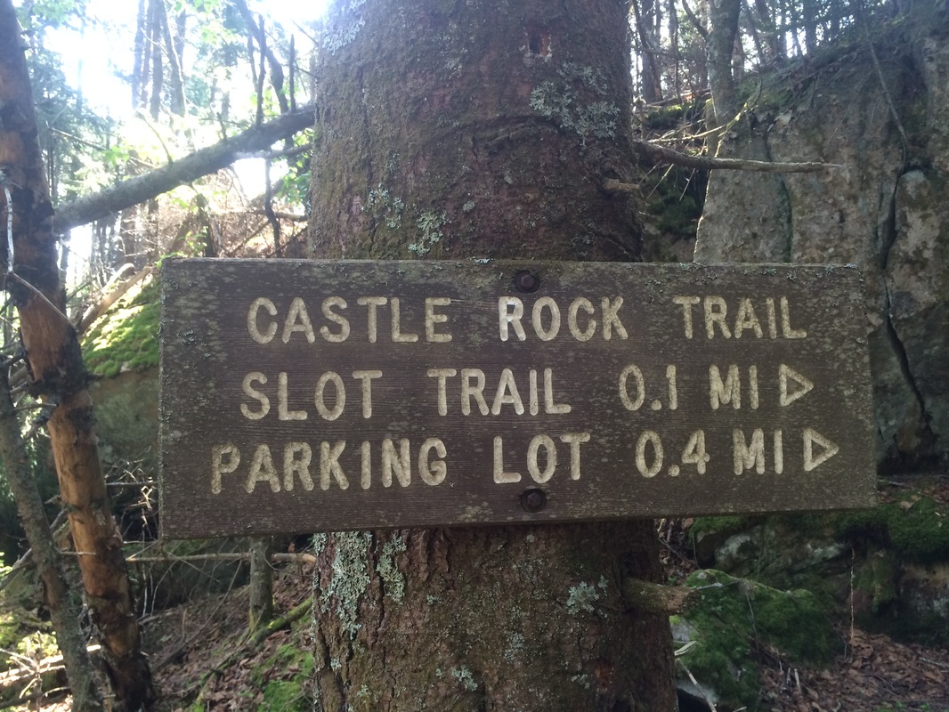
I didn’t know about the views
until I got home and re-read the trail description for the Windsor Trail. But, I probably wouldn’t have stopped
anyway. Any views at this point wouldn’t
be able to match what was coming at the summit.
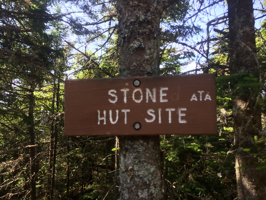
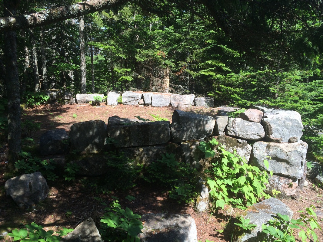
As we approached the area of the summit, we stopped to take a few pictures at the Stone Hut site. I guess there used to be a stone hut here, which dated back to 1858. Now, only the foundation remains…
As we approached the area of the summit, we stopped to take a few pictures at the Stone Hut site. I guess there used to be a stone hut here, which dated back to 1858. Now, only the foundation remains…
|
|
Approximately 5.2 miles in, the
trail leveled off and we started following yellow blazes. We had reached the Summit Trail and were
nearing the end of our grueling climb…
After 1/10 of a mile, we
reached the observation tower. It was
obvious Roscoe wasn’t going to make the climb up the steps (he always has
trouble on steps with no back), so I tied him to one of the supports and made
the solo climb to the platform. The
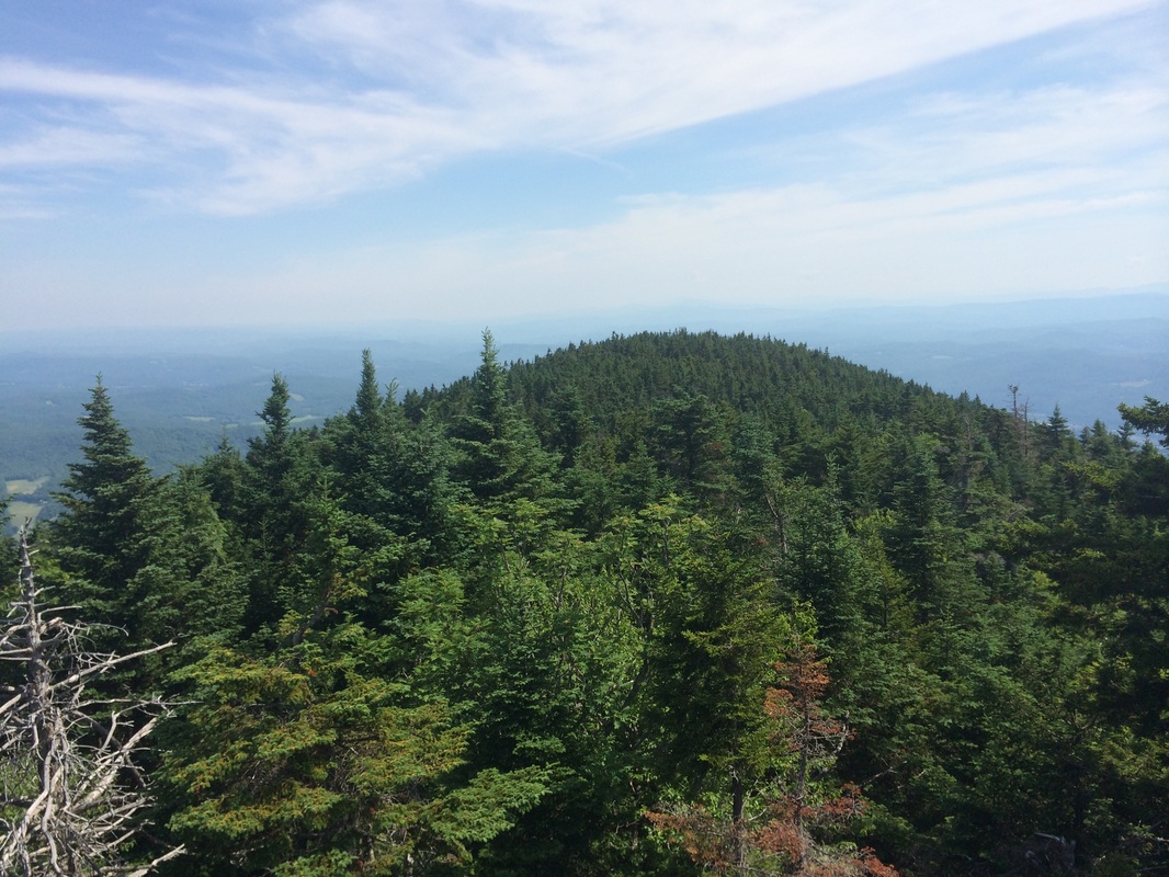
views from the top were awesome…
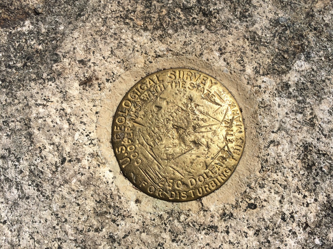
I might never have realized
that the tower does not sit on the true summit.
Fortunately, while I was on the platform enjoying the views, I overheard
a group of guys discussing it. Phrases like
“just over there” and “survery marker” caught my attention. So, I quickly hustled back down the steps of
the tower, untied Roscoe, and we followed them over to the true summit.
While I waited to get a picture of the marker, I struck up a conversation with one of the men. He was an older gentleman, maybe in his 70s, and we discussed my (slowly evaporating) fear of heights. He suggested I take up rock climbing and I have to admit it has crossed my mind in the past. Either way, I’m a lot better with these cliffs and observation towers than I was 100 hikes ago.
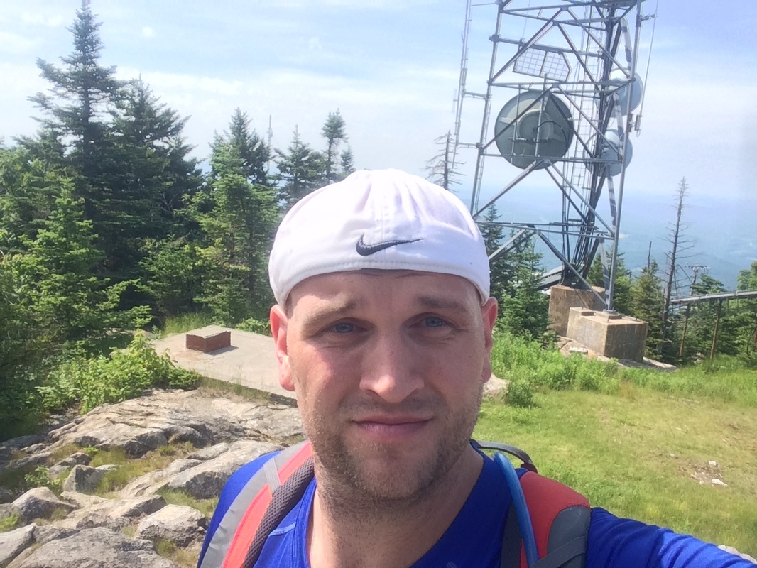
Eventually, after 5.4 miles of pretty much all climb, I was able to get a picture of the survey marker and a selfie at the summit…a “summelfie”, if you will...
While I waited to get a picture of the marker, I struck up a conversation with one of the men. He was an older gentleman, maybe in his 70s, and we discussed my (slowly evaporating) fear of heights. He suggested I take up rock climbing and I have to admit it has crossed my mind in the past. Either way, I’m a lot better with these cliffs and observation towers than I was 100 hikes ago.
Eventually, after 5.4 miles of pretty much all climb, I was able to get a picture of the survey marker and a selfie at the summit…a “summelfie”, if you will...
After a few more moments, we
started the process of descending the mountain.
On the way up, I had made the decision to take the paved road the whole
way back (in an effort to thwart the onslaught of bugs). Now, I just needed to get back to the parking
lot near the summit so I could pick up the road.
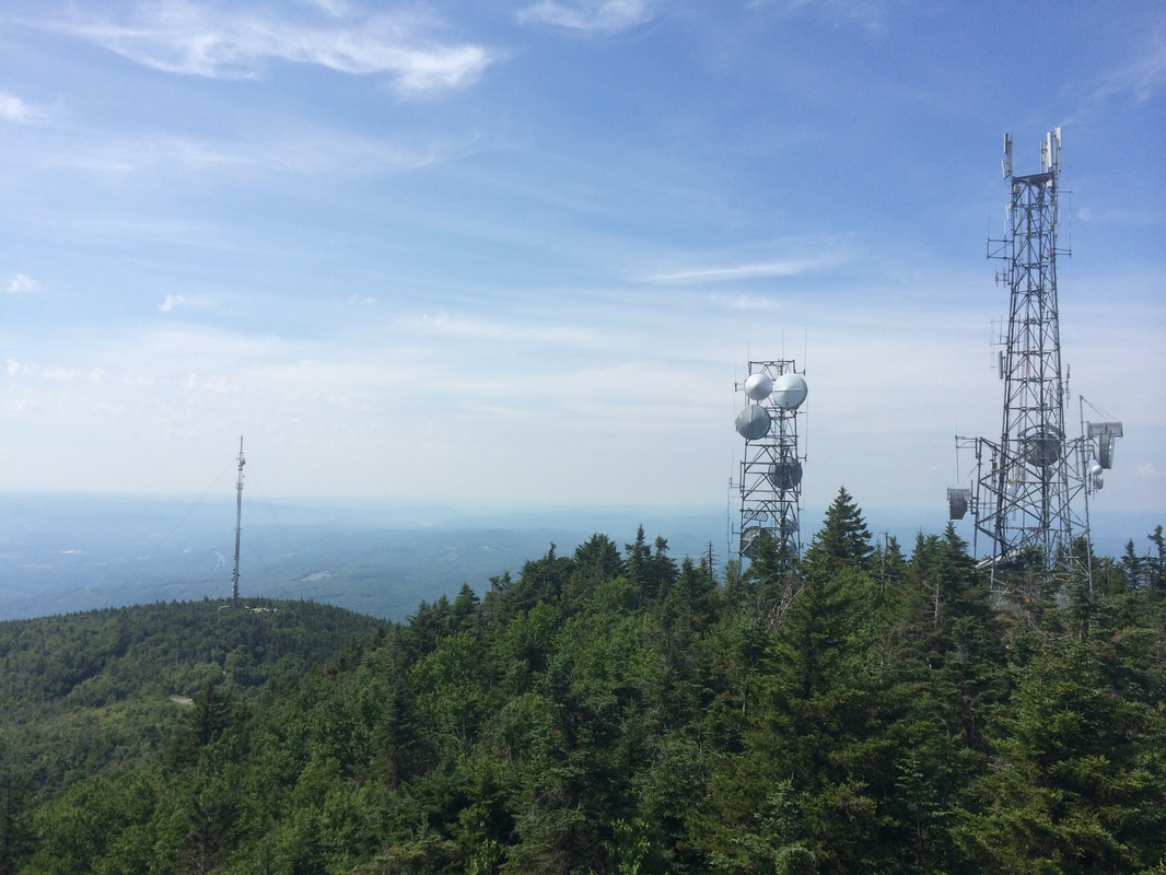
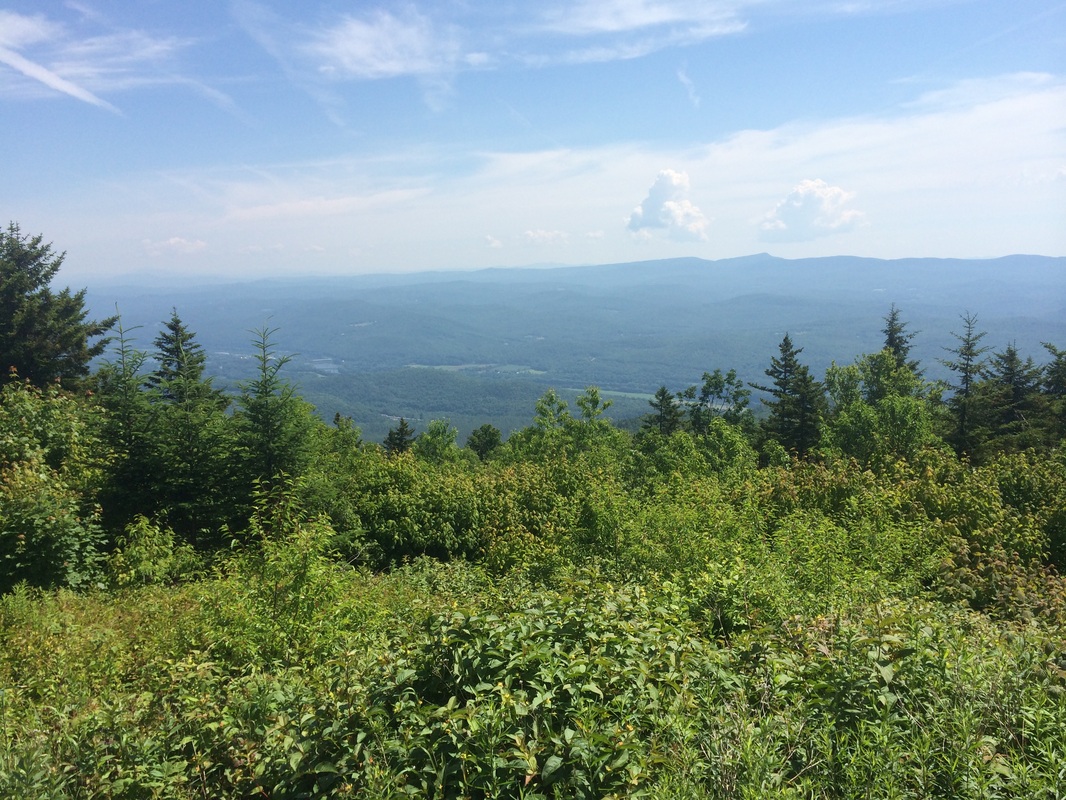
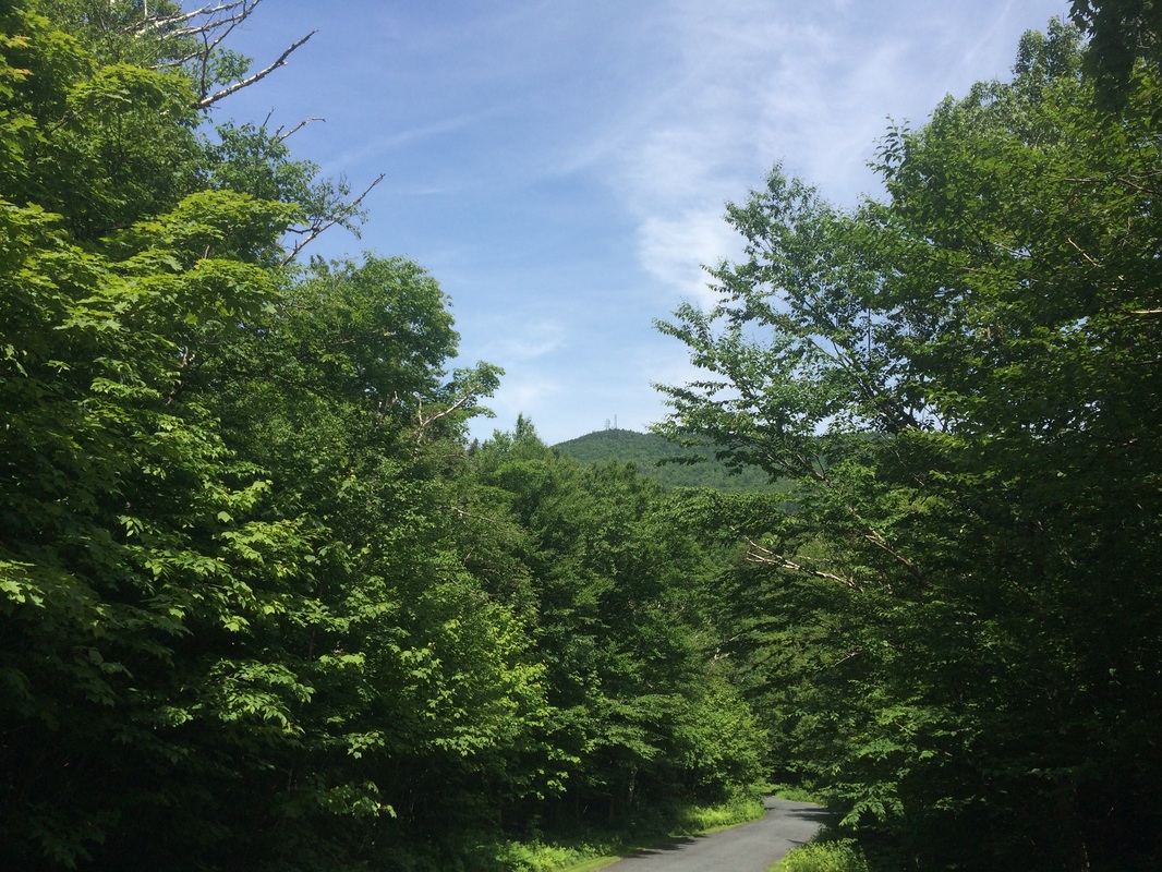
I started by following the Summit Trail. Note: there are sections of the Summit Trail which are actually two trails, the Slab Trail and the Slot Trail. I took the Slab Trail, which turned out to have a few fun sections. Eventually, after about 4/10 of a mile, we made it to the parking lot and started following the road back down. Along the way, we stopped a few times to enjoy some of the views and I could try to convince Roscoe to drink some water (I don’t know why…but the louder he pants, the less likely he is to drink the water I brought for him). One nice section of road walk even allowed us a chance to look back up at the radio towers near the summit (third picture below)…
I started by following the Summit Trail. Note: there are sections of the Summit Trail which are actually two trails, the Slab Trail and the Slot Trail. I took the Slab Trail, which turned out to have a few fun sections. Eventually, after about 4/10 of a mile, we made it to the parking lot and started following the road back down. Along the way, we stopped a few times to enjoy some of the views and I could try to convince Roscoe to drink some water (I don’t know why…but the louder he pants, the less likely he is to drink the water I brought for him). One nice section of road walk even allowed us a chance to look back up at the radio towers near the summit (third picture below)…
Now, you might read through the
previous section of this recap and think “oh man, he wimped out and took the
road the whole back”. I promise you,
this was the most brutal road walk I’ve ever experienced. The road is graded at such an angle that it
is absolute murder on the knees. Even as
I type this, I can still feel the impact of my awkwardly placed footsteps on my
back. I assure you this was not an “easy
way out”. Would the trail have been even
more challenging? Maybe…but, I just
didn’t have the mental toughness to deal with the bugs.
And, speaking of bugs, we’ve officially reached the time of year when I’m ready to pack up my gear and call it quits for the summer. I tried my best to escape the heat by heading north for my hikes, but even Vermont was too hot this weekend. I spent a good majority of this hike envisioning myself carrying a passed out Roscoe down the mountain while bugs continue to attack my face. And, that made this trip less enjoyable than it should’ve been. I still had a great time and I look forward to hiking again sometime after Labor Day. But, after almost 300 miles since January 1st, I’m ready for a break. Until next time…
And, speaking of bugs, we’ve officially reached the time of year when I’m ready to pack up my gear and call it quits for the summer. I tried my best to escape the heat by heading north for my hikes, but even Vermont was too hot this weekend. I spent a good majority of this hike envisioning myself carrying a passed out Roscoe down the mountain while bugs continue to attack my face. And, that made this trip less enjoyable than it should’ve been. I still had a great time and I look forward to hiking again sometime after Labor Day. But, after almost 300 miles since January 1st, I’m ready for a break. Until next time…
For a map of this hike, along with elevation data, please click here.
Total 2014 Distance: 291.82
