There’s No Business like Snow
Business
Hike #127
Tunxis Trail, Shelter Four Loop Trail
Farmington River Turnpike to Route 202 (New Hartford, CT)
Hike Distance: 8 Miles
Section Distance (Per CFPA Walk Book): Approximately 3.4 Miles
Date Hiked: 2/1/2015
Date Published: 2/1/2015
Hike #127
Tunxis Trail, Shelter Four Loop Trail
Farmington River Turnpike to Route 202 (New Hartford, CT)
Hike Distance: 8 Miles
Section Distance (Per CFPA Walk Book): Approximately 3.4 Miles
Date Hiked: 2/1/2015
Date Published: 2/1/2015
Note: The day before the hike described
in this recap, I took Roscoe…with my friend Eric…to Gay City State Park in
Hebron, Connecticut. While there, I
re-hiked some of the trails which I’ve previously recapped (Hikes # 11 and
12). I’m not going to recap those trails
again here. However, that hike added 3.4
miles to my total for 2015, bringing my mile count to 62.0.
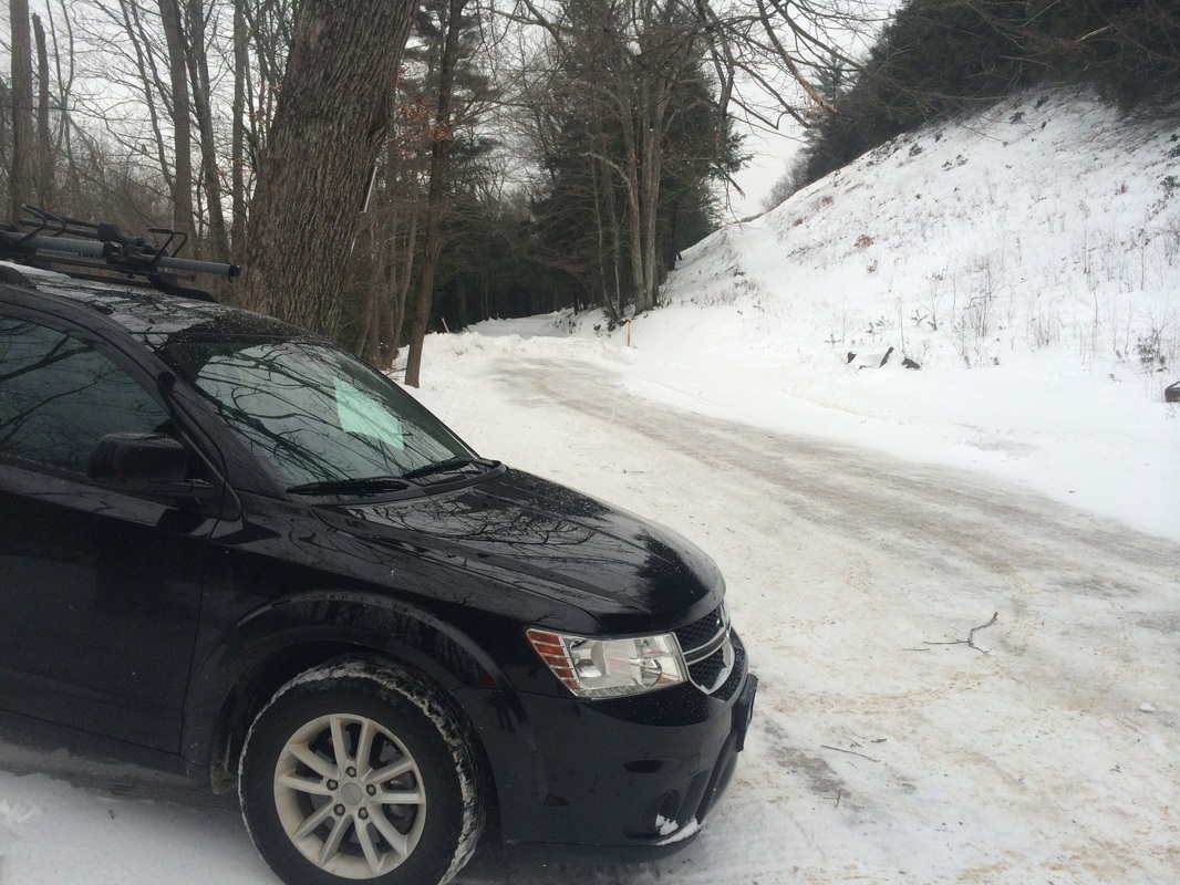
For this hike, I wanted to pick up the Tunxis mainline where I last left off…at Route 202 in New Hartford. There is a small parking area, with room for five or six cars, on the north side of Route 202. Unfortunately, the parking area was unavailable because of snow banks left behind by the snow plows clearing the road after Blizzard Juno. When it comes to winter in New England, what a difference a week makes! So, I acquainted myself with the back roads of New Hartford and eventually settled on doing this hike in reverse. I found suitable parking on Farmington River Turnpike (close to Route 44), near Satan’s Kingdom State Recreation Area.
To reach the parking location from Hartford:
Follow Route 44 West through Canton. Just before the Canton/New Hartford town line, turn right on Breezy Hill Road. Make a quick left on Farmington River Turnpike. Pass Frey Road (on the right) and continue straight to the parking area.
I geared myself up, geared
Roscoe up, and we hit the trail. We
started by following Farmington River Turnpike in a southwesterly direction…
Approximately 1/2 of a mile in,
we reached Breezy Hill Road and made a right.
Immediately, we made another right and followed the blue blazes along
Route 44. Now heading due west, we
crossed the Satan’s Kingdom Gorge section of the Farmington River.
Satan’s Kingdom takes its name from Colonial settlers’ belief that the area was inhabited by scoundrels. Today, the area is actually quite enjoyable. During the summer, tubing on the Farmington River is a favorite activity for locals and Satan’s Kingdom provides a put-in location.
On the other side of the bridge, we made a left and started following Satan’s Kingdom Road.
Roughly 1 mile in, the trail leaves the road. I put on my snow shoes, unleashed Roscoe, and we entered the woods…
The trail in this section is
one of my favorites. It hugs the steep
ledge over the west side of the gorge tightly and allows for some very nice
views through the pines to the rushing water of the Farmington River
below. I enjoyed this section even more
on my return trip to the car, when the sun was shining brightly on the other
side of the gorge. I wish I had pictures
to show, but the pines…which add flavor to the actual view…made it impossible
to get a good shot.
Eventually, the trail returns to Satan’s Kingdom Road (the unpaved portion) and continues following the road due south.
Approximately 1.4 miles in, we passed the northern terminus of the blue-yellow blazed Tipping Rock Loop Trail…
Eventually, the trail returns to Satan’s Kingdom Road (the unpaved portion) and continues following the road due south.
Approximately 1.4 miles in, we passed the northern terminus of the blue-yellow blazed Tipping Rock Loop Trail…
One day, I will return to
this section and hit up some of the side trails to the west. For today, we continued southbound on the
mainline Tunxis.
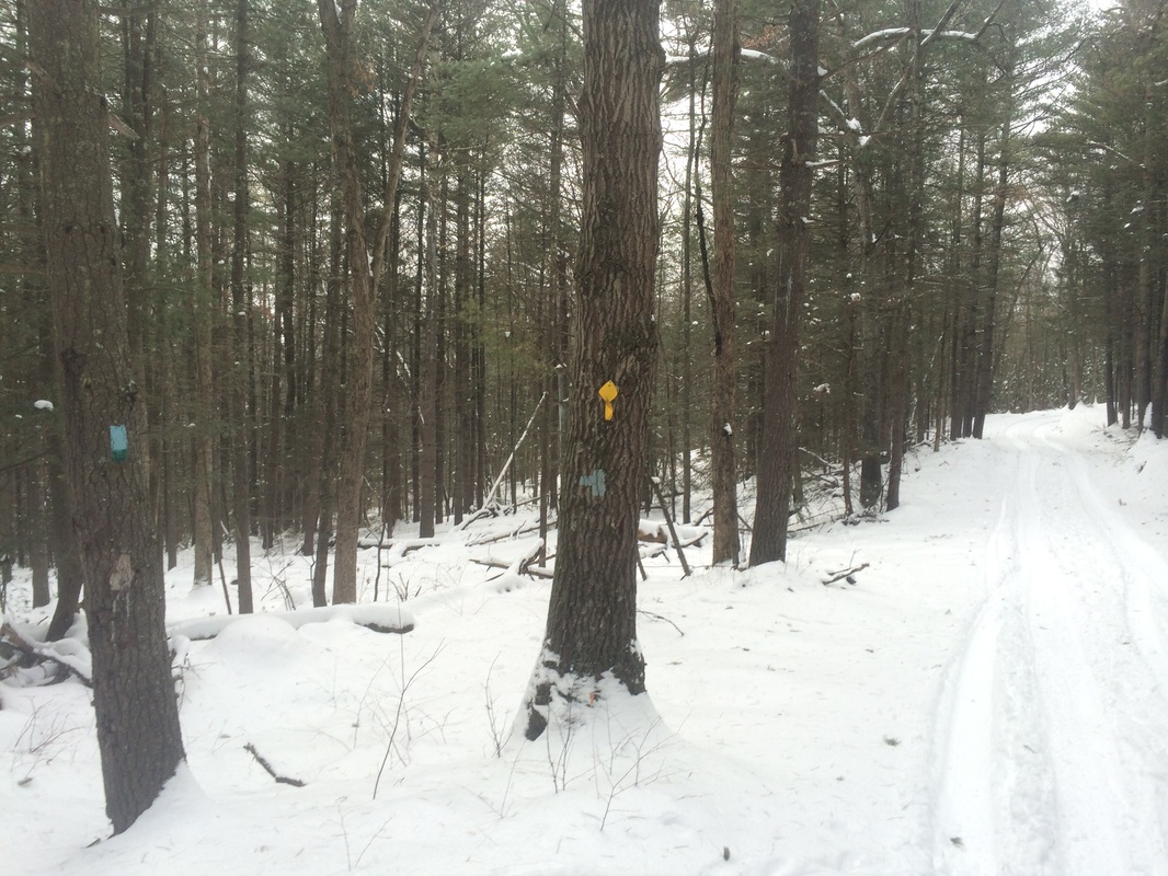
Roughly 1.6 miles in, we passed the northern terminus of the blue-green blazed Shelter Four Loop Trail at this fork in the road…
Roughly 1.6 miles in, we passed the northern terminus of the blue-green blazed Shelter Four Loop Trail at this fork in the road…
A slight left turn would
allow us to hike the Shelter Four Loop Trail, but I had planned to hike it on the return trip to
the car. So, again, we stuck to the
mainline Tunxis.
Approximately 2.5 miles in, we passed the southern terminus of the Shelter Four Loop Trail…
Approximately 2.5 miles in, we passed the southern terminus of the Shelter Four Loop Trail…
We still had more than a
mile of mainline left to cover to the south of this spot. So, we continued following the unpaved /
unplowed road and the solid blue blazes of the mainline Tunxis.
Approximately 2.8 miles in, we crossed under some power lines. Shortly after, we passed the southern terminus of the Tipping Rock Trail…
Approximately 2.8 miles in, we crossed under some power lines. Shortly after, we passed the southern terminus of the Tipping Rock Trail…
Roughly 3.3 miles in, still
following blue blazes, we left the road to take a more direct path to the
southern terminus of this section. This would
afford me the opportunity to take in some seasonal views, including what the
Walk Book calls Bee Mountain (the good).
But, it also meant leaving behind the
vehicle-and-cross-country-ski-packed snow, climbing a short incline, and
descending a rather long decline (the bad).
I enjoyed the views but again found that the pictures don’t do them any
justice.
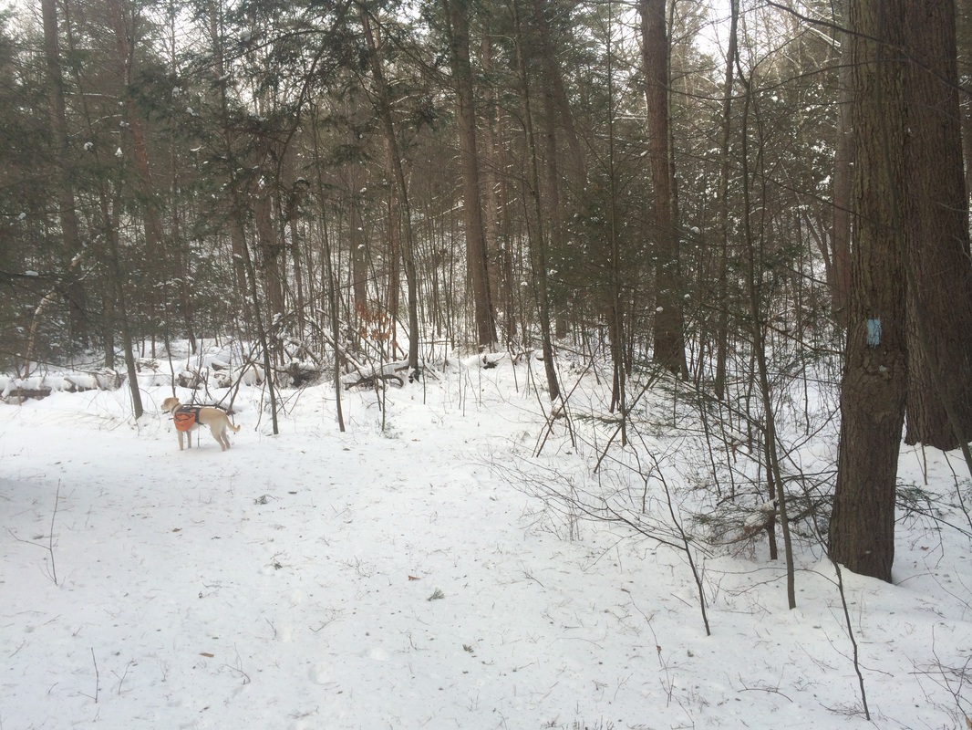
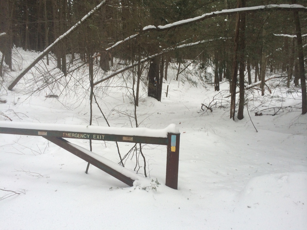
Approximately 3.8 miles in, we reached the gate near the parking area off of Route 202…
Approximately 3.8 miles in, we reached the gate near the parking area off of Route 202…
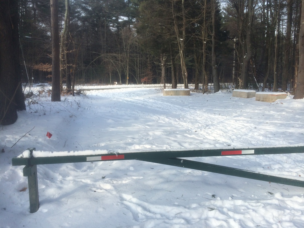
Having reached the southern
terminus of this section, I stopped only to take the picture above then turned
and started the trek back to the car.
However, we didn’t exactly follow our tracks in the snow. I was concerned about the steep climb back up
to the views of Bee Mountain in my snow shoes (ironic given how the rest of
this hike played out). So, I elected to
bypass the climb and stick to the forest road.
This allowed for a more gradual climb but also added a bit of distance to my
hike so it wasn't a complete cop-out.
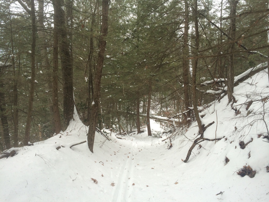
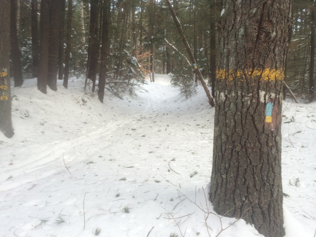
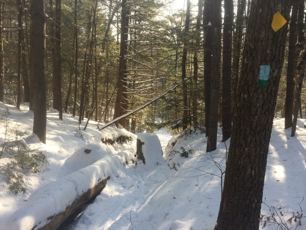
Roughly 5.2 miles in, we turned right at the southern terminus of the Shelter Four Loop Trail…
Roughly 5.2 miles in, we turned right at the southern terminus of the Shelter Four Loop Trail…
From the Walk Book:
The blue/green-blazed Shelter Four Loop forms a short loop when combined with the Tunxis Mainline Trail, providing an option for a short but satisfying hike.
As you might be able to tell from the picture above, the Shelter Four Loop Trail descends steeply away from the mainline Tunxis. We followed the blue and green blazes down to another woods road…Bampton Road, according to the Walk Book. We crossed a stream and, after approximately 8/10 of a mile, found ourselves at a forest gate and another woods road near the Farmington River. This caught me a bit off-guard because I didn’t recall any mention of the river in the Walk Book description for the Shelter Four Loop Trail. Sadly, my Walk Book was at home so I couldn’t double-check. All I had was my map and, thankfully, my MapMyHike app. I could tell that this new woods road would bring us in the general direction of the mainline trail because I could see the little red line I had made through the area earlier. So, I set out on the road in the direction of the red line.
Thinking back, I do recall seeing some turn blazes near what I thought was the end of the Shelter Four Loop, prior to the woods road. But, there was a left turn blaze followed immediately by a right turn blaze so I thought I was doing the right thing by following the cross-country ski tracks in front of me. This turned out to be a big mistake as the woods road I had been following led us to a dead end as it approached the gorge. Shortly before the dead-end, the cross-country skier made a hard left and…somehow…went up a steep incline. I could only assume that he or she was trying to hook back up with the mainline trail, but I didn’t know his for sure. So, I stayed straight…now following the tracks of someone else in snow shoes.
On a day with less snow cover, maybe a good hiker could climb the west cliffs of the gorge…sans snow shoes. But, I am not that hiker and today was not that kind of day. Apparently, the person I had been following realized the same thing because the snow shoe tracks I had been following eventually stopped and turned around. I did the same, making my way back to where the cross country skier ascended the steep cliff. I decided if someone could do it in skis then it could be done in snow shoes too. Wishing not to backtrack all the way to where I lost the Shelter Four Loop Trail, I made the climb. I promise there is no better calf workout in the world then climbing a steep snowy cliff in snow shoes. By the time I got to the top, my legs were burning enough to melt the snow around me.
A short jog to the west and we had returned to the mainline Tunxis, a lot farther north than I expected. I’ll have to return to this section to hit up some of the other side trails anyway. When I do, I’ll figure out what happened with the Shelter Four Loop Trail and finish it. For now, we made a right and followed the mainline Tunxis northbound back to the car.
This was a great hike. After narrowly avoiding disastrous hikes the week before and the day before this one, I’m glad I finally got it through my thick skull to bring my snow shoes. However, I get the impression…from the description in the Walk Book…the next section of the Tunxis isn’t going to be the best for snow shoe hiking. So, I’m going to put the Tunxis on hold again for a bit. Maybe I’ll pick it up again after the spring thaw.
Until next time…
For a map of this hike, along with elevation data, please click here.
Total 2015 Distance: 70.0
(430.0 to Goal)
