Stowe-Away
Hikes # 109 & 110
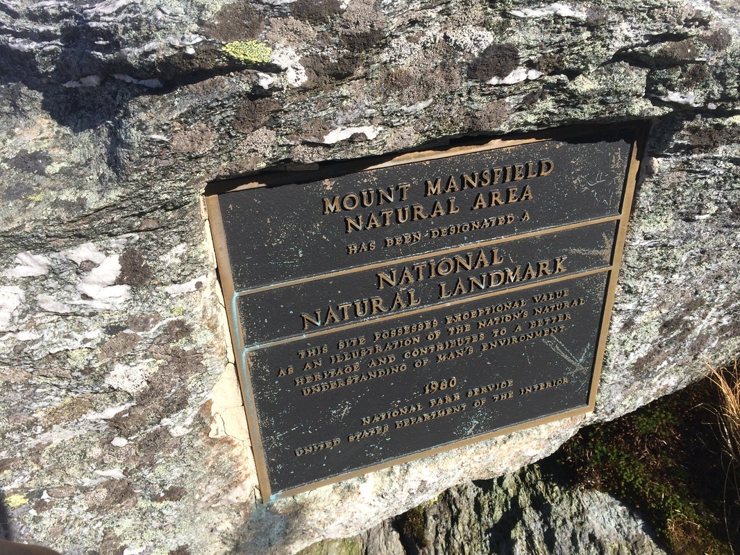
Mount Mansfield Area
Underhill, VT and Stowe, VT
Hike Distance: 7.22 Miles & 3.04 Miles (10.26 Total Miles)
Dates Hiked: 10/2/2014 & 10/3/2014
Date Published: 10/10/2014
The first week of October 2014, Jaci and I celebrated our 4th Anniversary in Stowe, Vermont. Our actual anniversary isn’t until the 23rd, but we had experienced bad weather on our previous anniversary trips. So, we elected to move the celebration up a few weeks and take advantage of the seasonal changing of the leaves. Once we finalized our trip, I started planning a few hikes and hoping for good weather (the last time we were in Stowe, I hiked in the rain...sleet...and even a little snow). As we moved closer to the trip, it looked like the weather would hold up for Thursday and Friday (which would turn out to be a perfect day), but Saturday would be a wash out. I was disappointed because I would only get to make two of the three hikes, but I was looking forward to those two.
Hike # 109
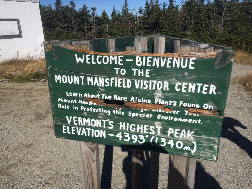
The morning of the first hike, we woke up early and started to get ready for breakfast (which we planned to spend at the Dutch Pancake Café at the Grey Fox Inn). Before we set out, I made my way out to our balcony to enjoy the sunrise. I took a picture of Vermont’s highest peak, Mount Mansfield (elevation: 4,393 feet)…
Hikes # 109 & 110
Mount Mansfield Area
Underhill, VT and Stowe, VT
Hike Distance: 7.22 Miles & 3.04 Miles (10.26 Total Miles)
Dates Hiked: 10/2/2014 & 10/3/2014
Date Published: 10/10/2014
The first week of October 2014, Jaci and I celebrated our 4th Anniversary in Stowe, Vermont. Our actual anniversary isn’t until the 23rd, but we had experienced bad weather on our previous anniversary trips. So, we elected to move the celebration up a few weeks and take advantage of the seasonal changing of the leaves. Once we finalized our trip, I started planning a few hikes and hoping for good weather (the last time we were in Stowe, I hiked in the rain...sleet...and even a little snow). As we moved closer to the trip, it looked like the weather would hold up for Thursday and Friday (which would turn out to be a perfect day), but Saturday would be a wash out. I was disappointed because I would only get to make two of the three hikes, but I was looking forward to those two.
Hike # 109
The morning of the first hike, we woke up early and started to get ready for breakfast (which we planned to spend at the Dutch Pancake Café at the Grey Fox Inn). Before we set out, I made my way out to our balcony to enjoy the sunrise. I took a picture of Vermont’s highest peak, Mount Mansfield (elevation: 4,393 feet)…
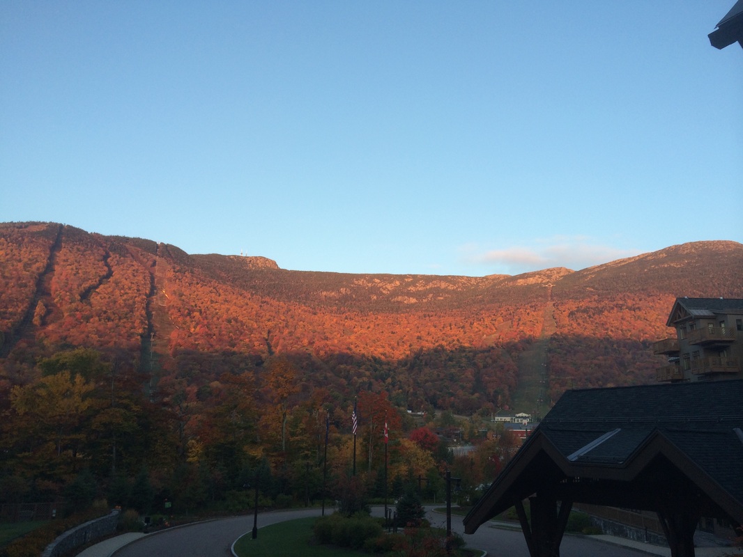
Mount Mansfield is known for its distinctive ridgeline, which resembles the profile of a human face. Look again at the picture above and, from left to right, you might see the forehead, nose (with rocky cliffs), lips (the ski trail to the far right leads up to the bottom lip), and chin. Unlike a normal human face, the chin is actually the highest point. I was excited to find this would be our view every morning. And, I was even more excited to finally hike to the summit…but more on that in a moment.
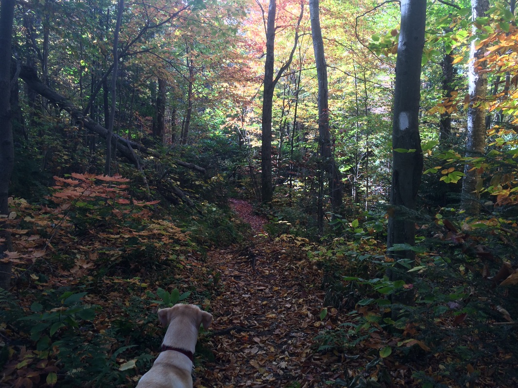
The first hike would take me and Roscoe from Stevensville Road in Underhill along the Nebraska Notch Trail, which we would use as a lengthy access trail to connect in to the Long Trail. Before we set out for the trailhead, we took a moment to enjoy the changing leaves around the Dutch Pancake Café and fuel up (I elected to get a blueberry pancake with a side of three scrambled eggs)…
The first hike would take me and Roscoe from Stevensville Road in Underhill along the Nebraska Notch Trail, which we would use as a lengthy access trail to connect in to the Long Trail. Before we set out for the trailhead, we took a moment to enjoy the changing leaves around the Dutch Pancake Café and fuel up (I elected to get a blueberry pancake with a side of three scrambled eggs)…
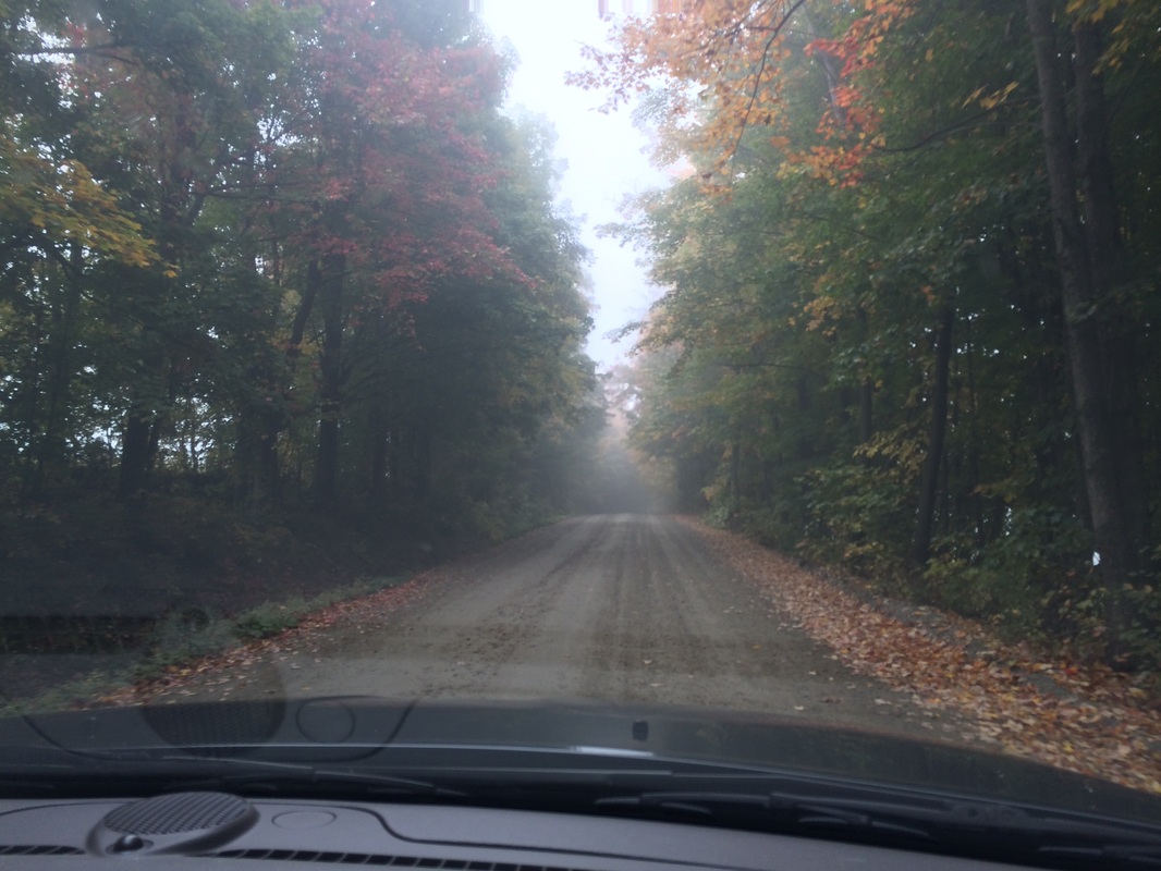
After breakfast, we made the hour long drive over to Stevensville Road. We had to go up Mountain Road through Smuggler’s Notch to get there (basically going entirely around Mount Mansfield) because there isn’t a direct route from where we were, on the east side of the mountain, to the drop off point in Underhill, on the west side of the mountain. This was the first time Jaci and I had been through Smuggler’s Notch because, by the time we visited Stowe on our previous trips, the road is closed just beyond the hotel (it is typically closed from the end of October through April). Right away, we could see why the road would have to be closed during the winter…this thing is treacherous even during perfect driving conditions.
Eventually, we made our way over to the west side of Mount Mansfield. The morning fog was starting to lift and, even from the car, I could tell it was going to be a great day for a hike…
Eventually, we made our way over to the west side of Mount Mansfield. The morning fog was starting to lift and, even from the car, I could tell it was going to be a great day for a hike…
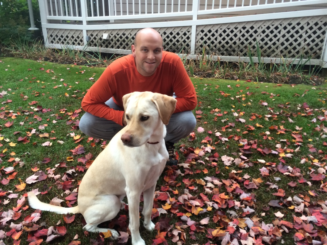
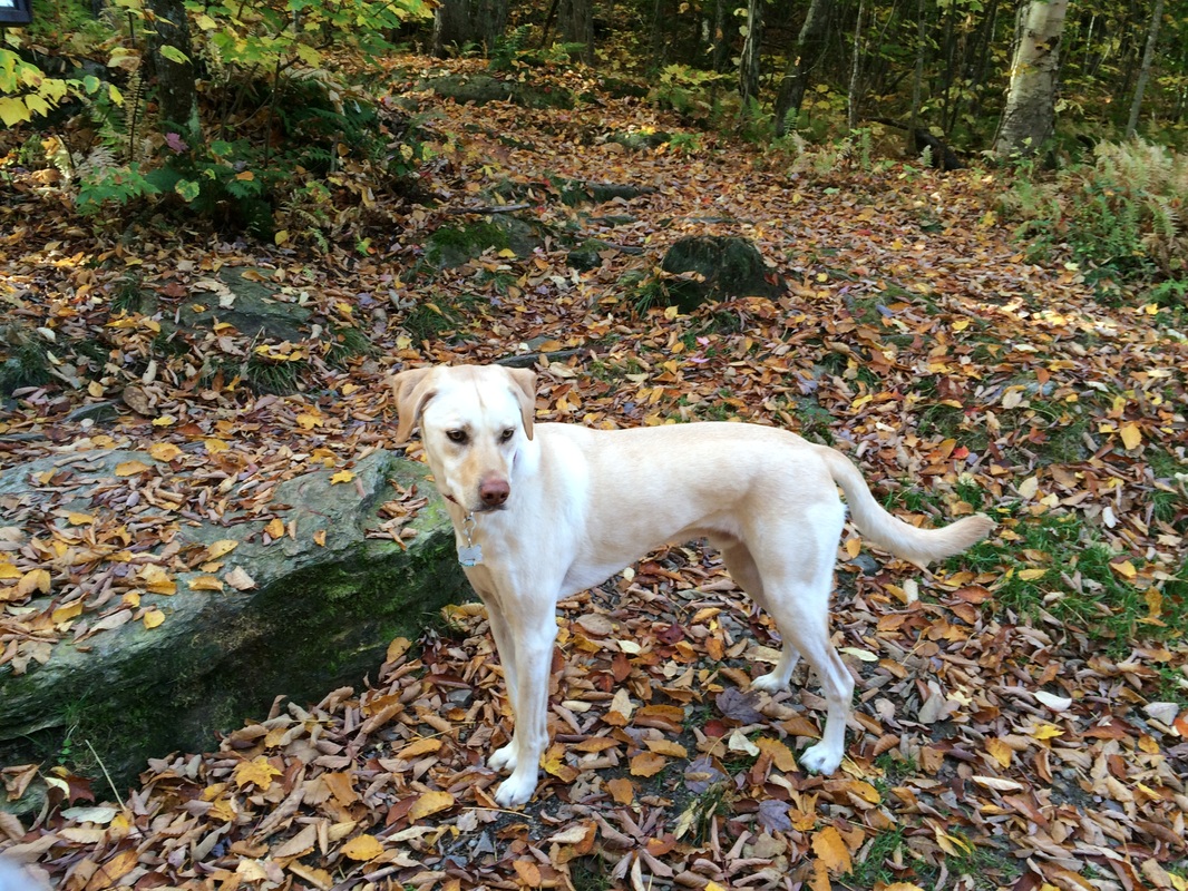
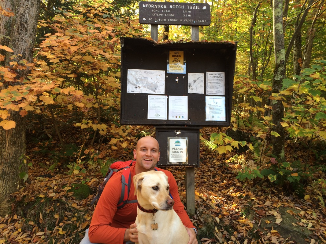
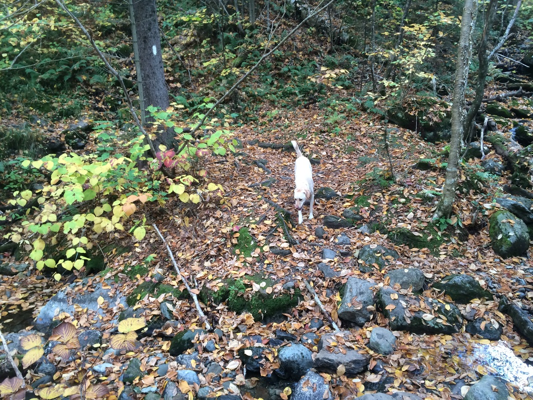
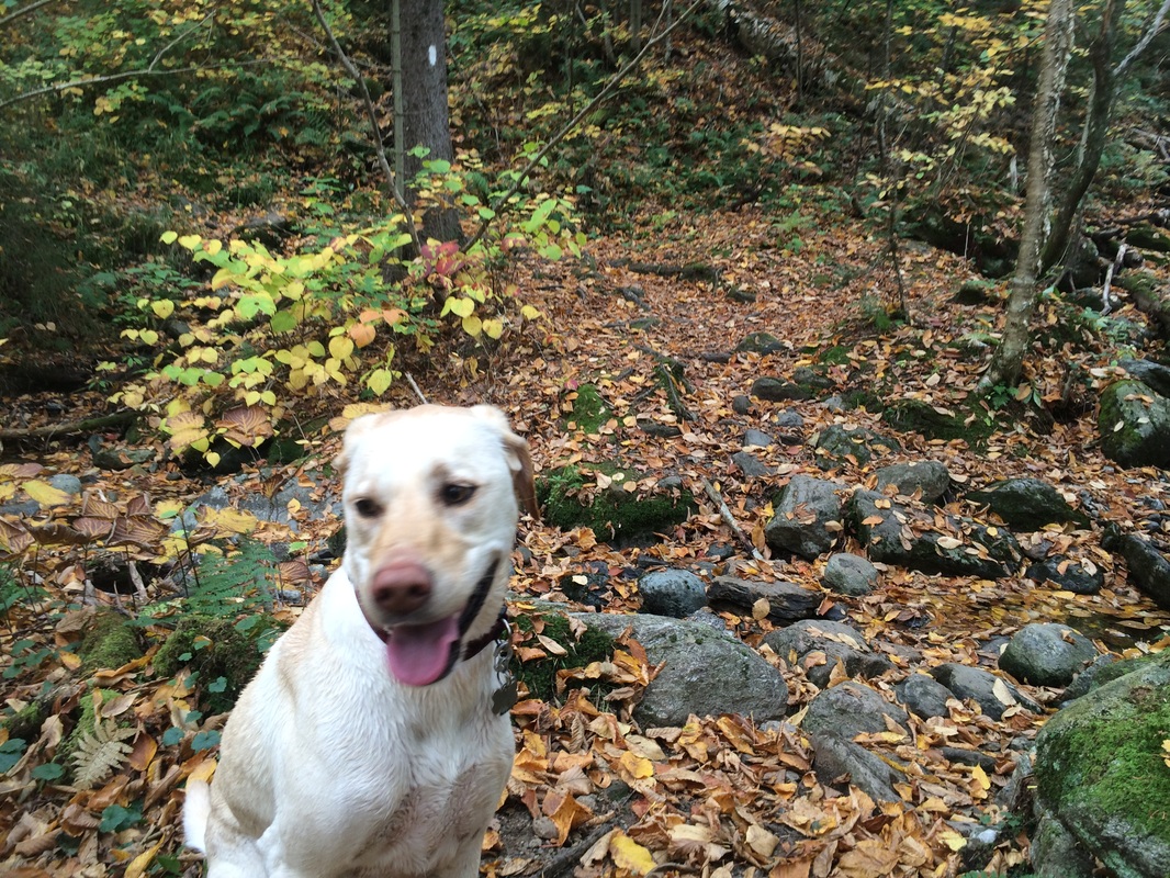
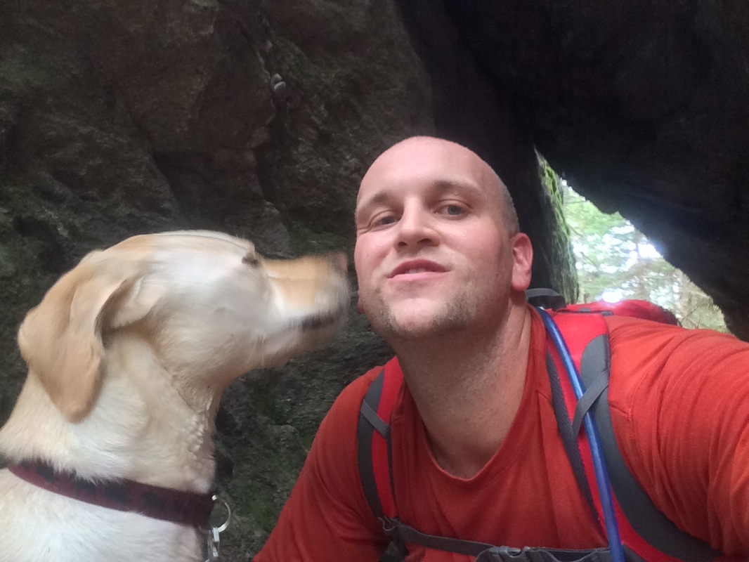
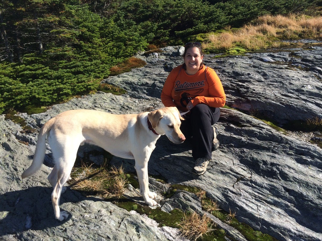
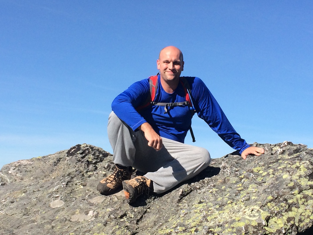
We arrived at the Stevensville drop off point at around 9:45am, which was exactly the time I had planned. Roscoe and I geared up, I confirmed with Jaci that she would pick us up in approximately four hours, and we hit the trail…but not before a quick, pre-hike photo session…
|
|
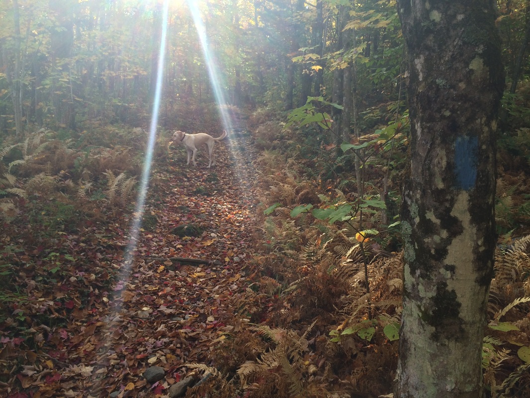
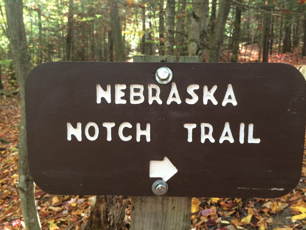
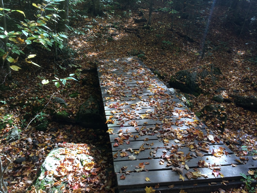
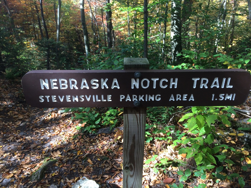
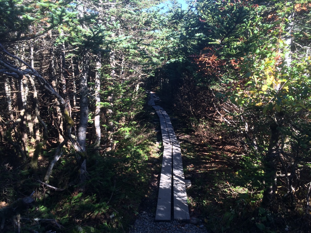
We set out, due south, following the blue blazes of the Nebraska Notch Trail…
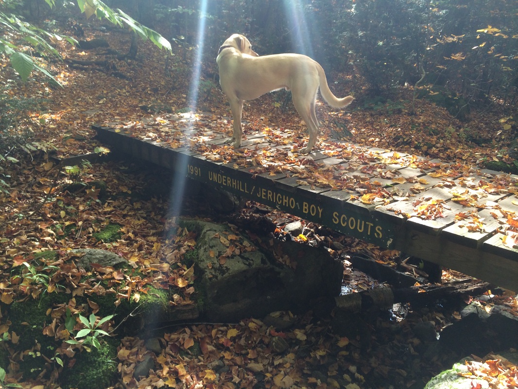
I found the Nebraska Notch Trail to be very enjoyable. It wasn’t “flat” but there wasn’t a lot of big elevation changes. This was the perfect trail to warm me up for what was ahead. Roughly 1.4 miles in, we came to a brook and crossed it on a footbridge. According to a sign on the bridge, it was constructed by the Underhill and Jericho Boy Scouts in 1991…
|
|
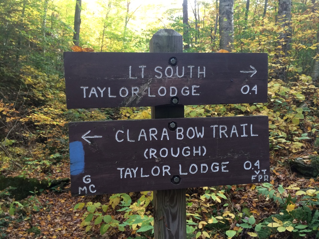
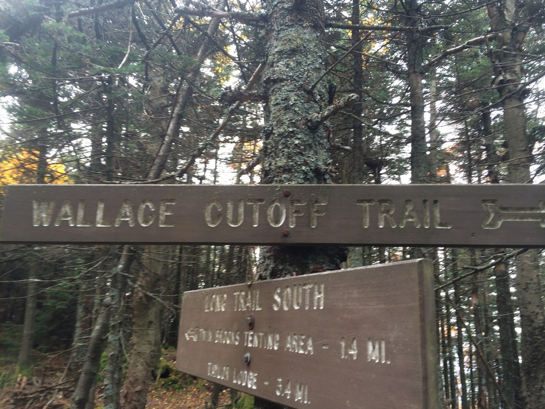
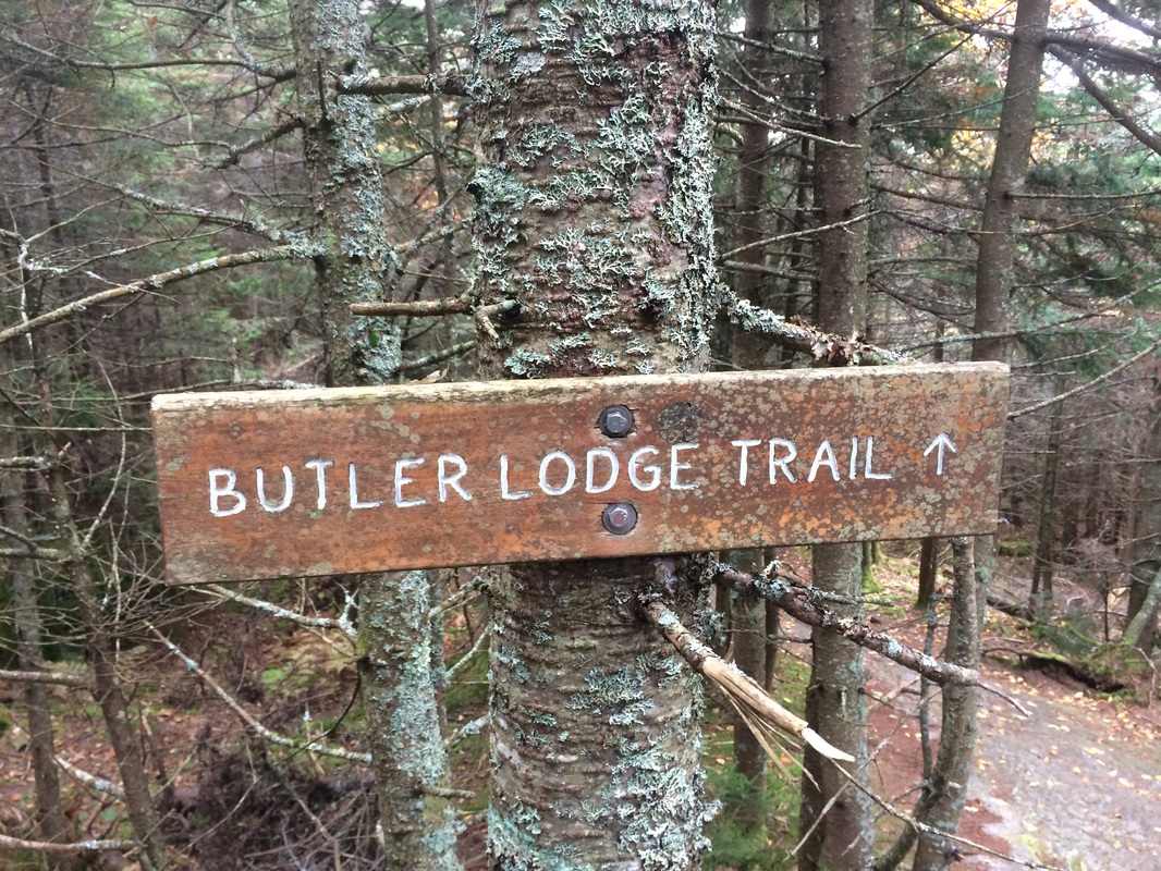
On the other side of the bridge, there is a short but steep(ish) hill which brought us to where the Nebraska Notch Trail intersects with the Long Trail…
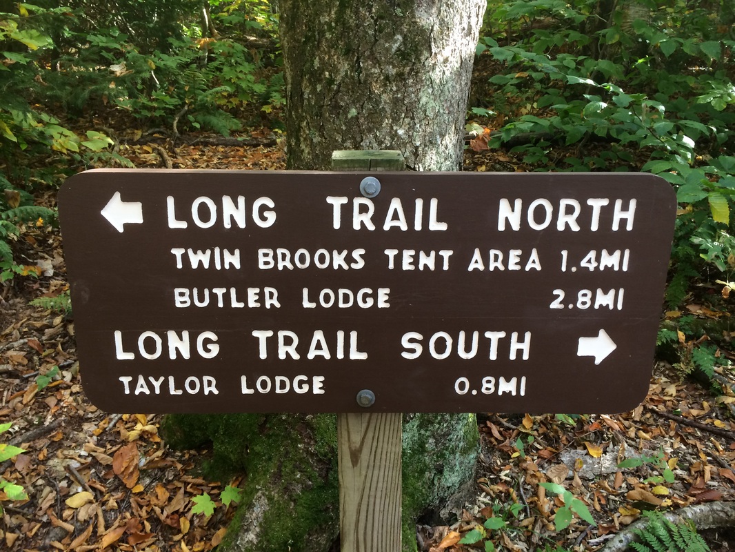
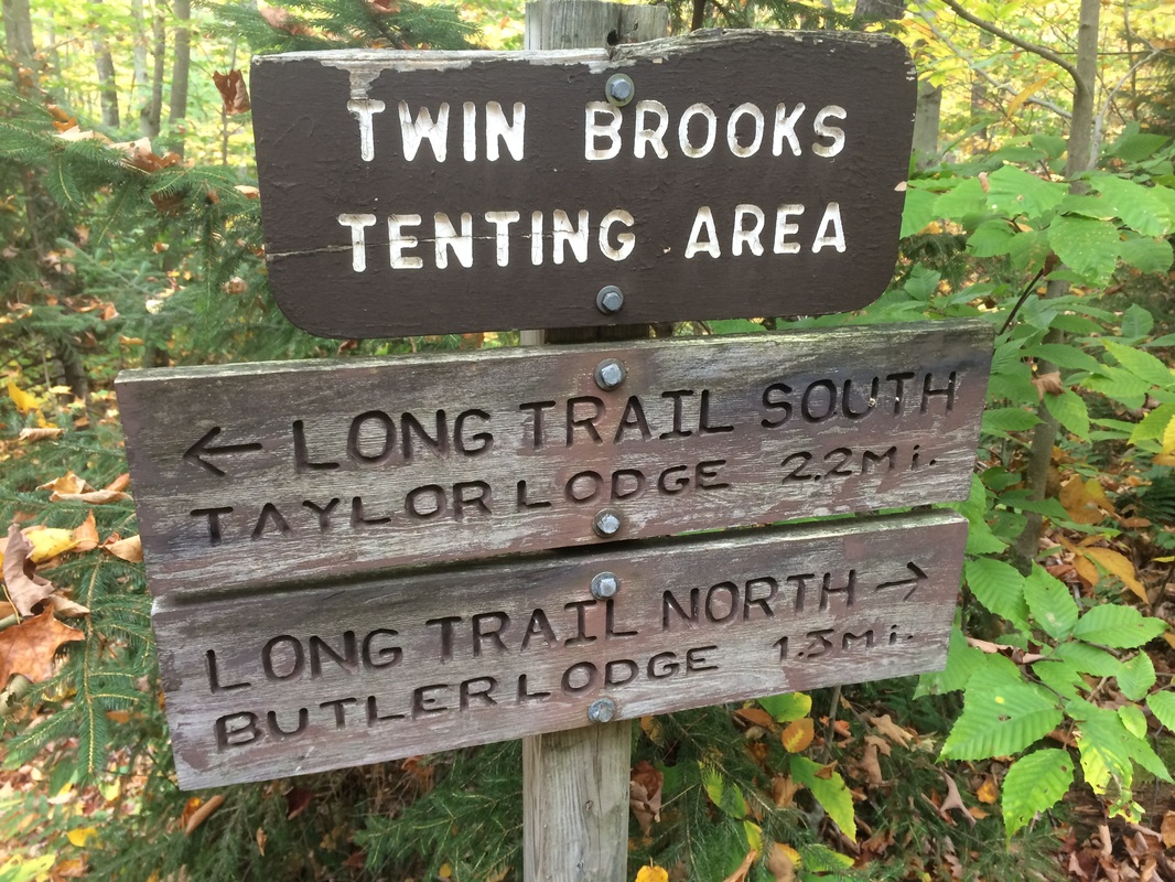
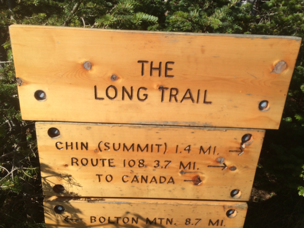
As the sign above shows, heading northbound on the Long Trail would bring me to the area of Butler Lodge (my ultimate destination for the day). However, there was approximately 3/10 of a mile on the Long Trail to the south (between the Nebraska Notch Trail junction and the Clara Bow Trail junction) I hadn’t yet covered. So, I made the right turn to follow the white blazes of the Long Trail southbound, which was actually due east…
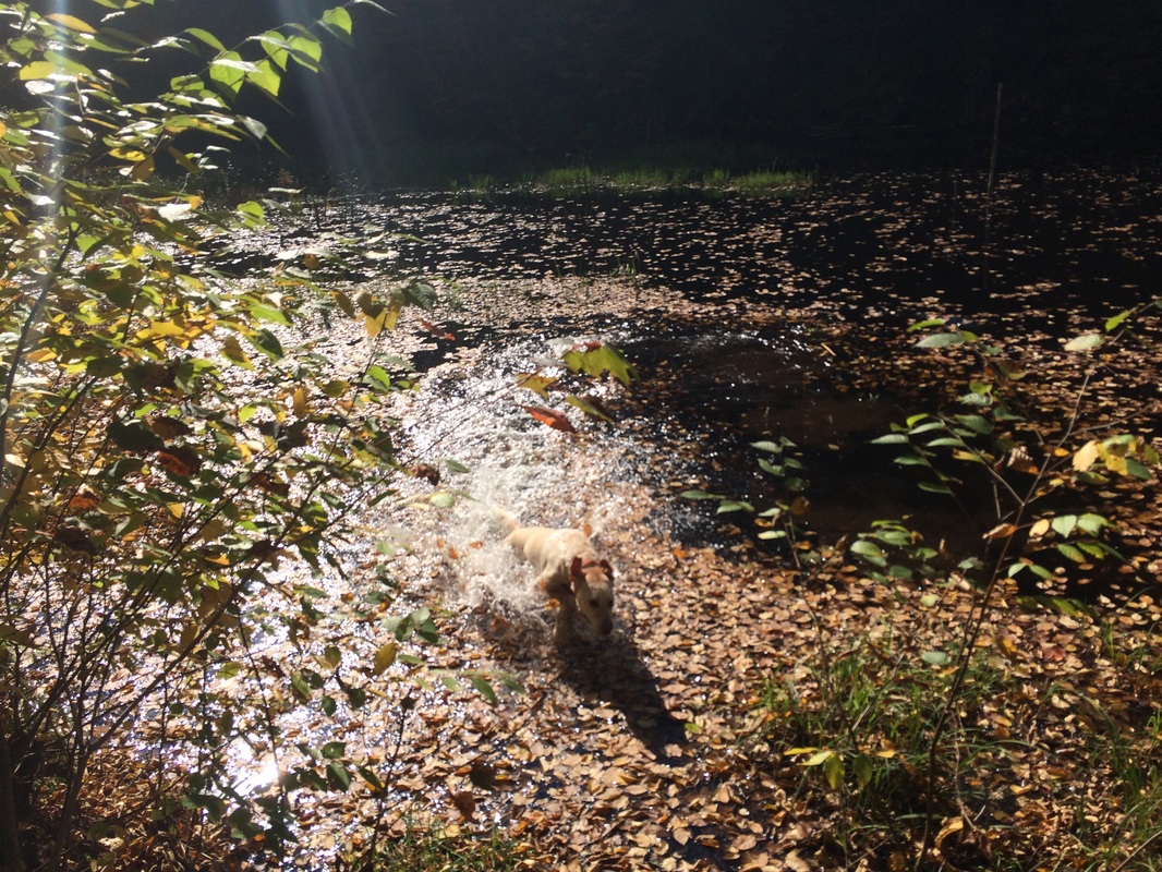
We followed the white blazes of the Long Trail, passing by an area of beaver activity, until we reached the Clara Bow Trail...
Last year, I used the Clara Bow Trail to start my way back to the parking area near Lake Mansfield. I really enjoyed that trail and I highly suggest a quick detour if you have the time. At this point, I wasn’t sure how much additional time I would have...and I was more interested in covering new ground than retracing my previous steps. So, I turned around and started making my way northbound on the Long Trail. Along the way, Roscoe decided to take a quick dip in the beaver pond…
It wasn't long before I passed back through the area where the Long Trail intersects with the Nebraska Notch Trail…
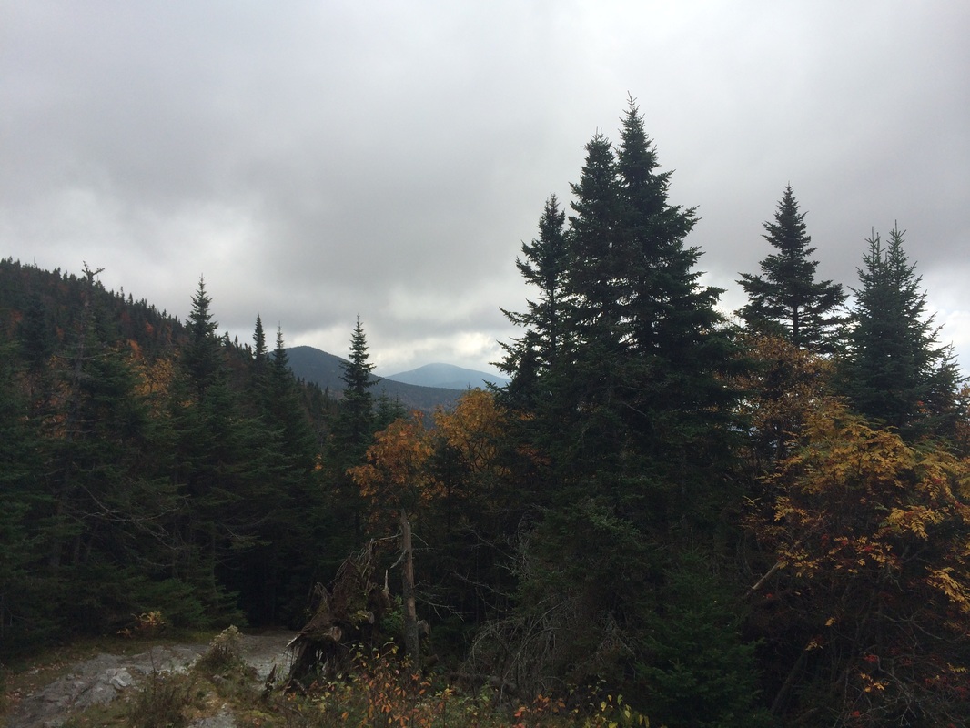
Now, roughly 2.1 miles in, I stopped to catch my breath. While doing my research prior to the hike, I noted the next section (entirely along the Long Trail), would take me from an elevation of around 1400 feet to about 3100 feet. Once I was done resting/rehydrating, we were back on our way.
I was surprised to find that the elevation didn’t change steadily. The next section actually started out pretty flat. There were some minor elevation changes here and there, but nothing like what I was expecting. At least not right away.
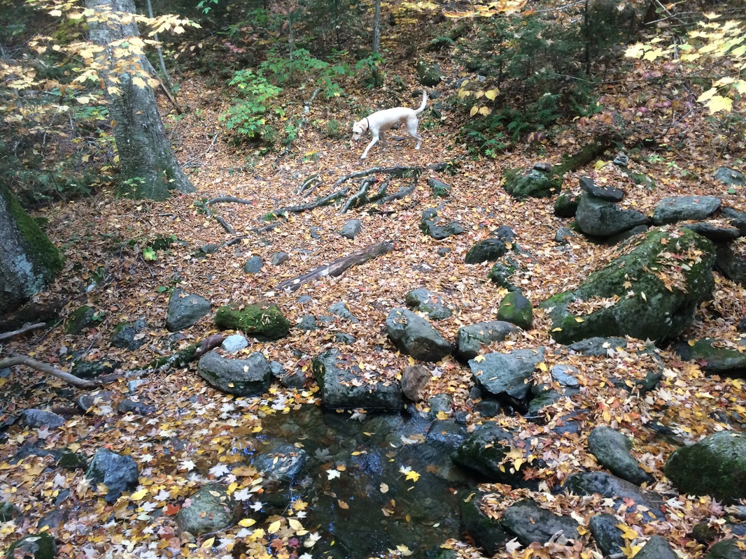
Approximately 3.3 miles in, we crossed a couple of brooks…
I was surprised to find that the elevation didn’t change steadily. The next section actually started out pretty flat. There were some minor elevation changes here and there, but nothing like what I was expecting. At least not right away.
Approximately 3.3 miles in, we crossed a couple of brooks…
|
|
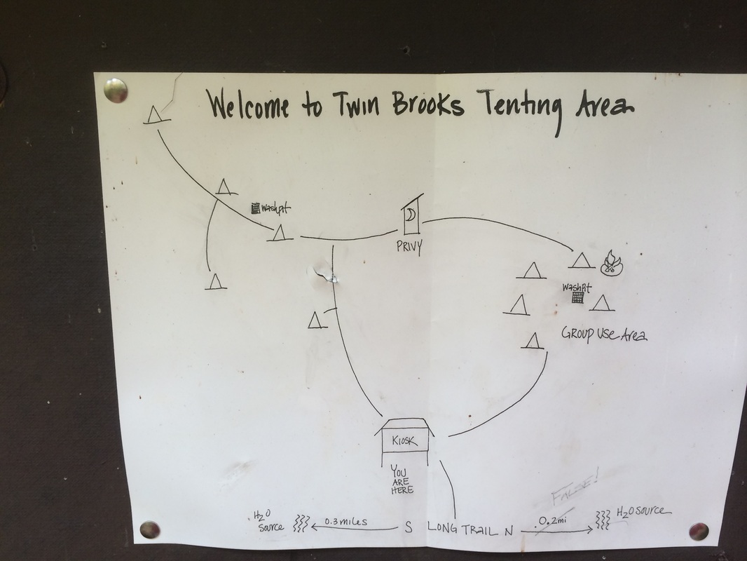
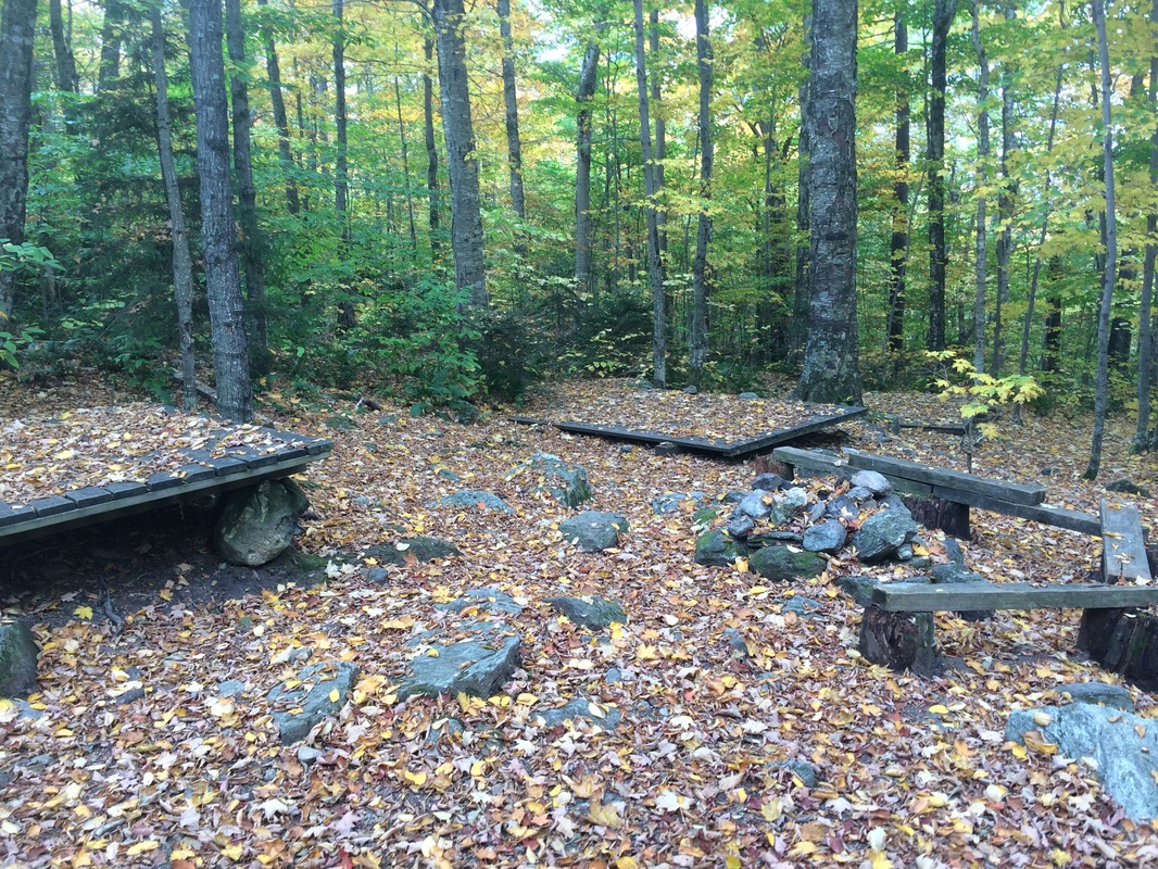
And, about 1/3 of a mile later, we reached the Twin Brooks Tenting Area. I was ahead of schedule, so I decided to take the short side trail and explore the tenting area...
|
|
From the Green Mountain Club Day Hiker's Guide to Vermont:
The Twin Brooks Tenting Area was rebuilt in 1997 by Burlington Section volunteers in memory of Roland Boucher, a dedicated trail maintainer. Tent platforms are provided, and small wood fires are permitted in the established fire ring near the group site. The water supply is the brook 0.2 mi. south on the LT.
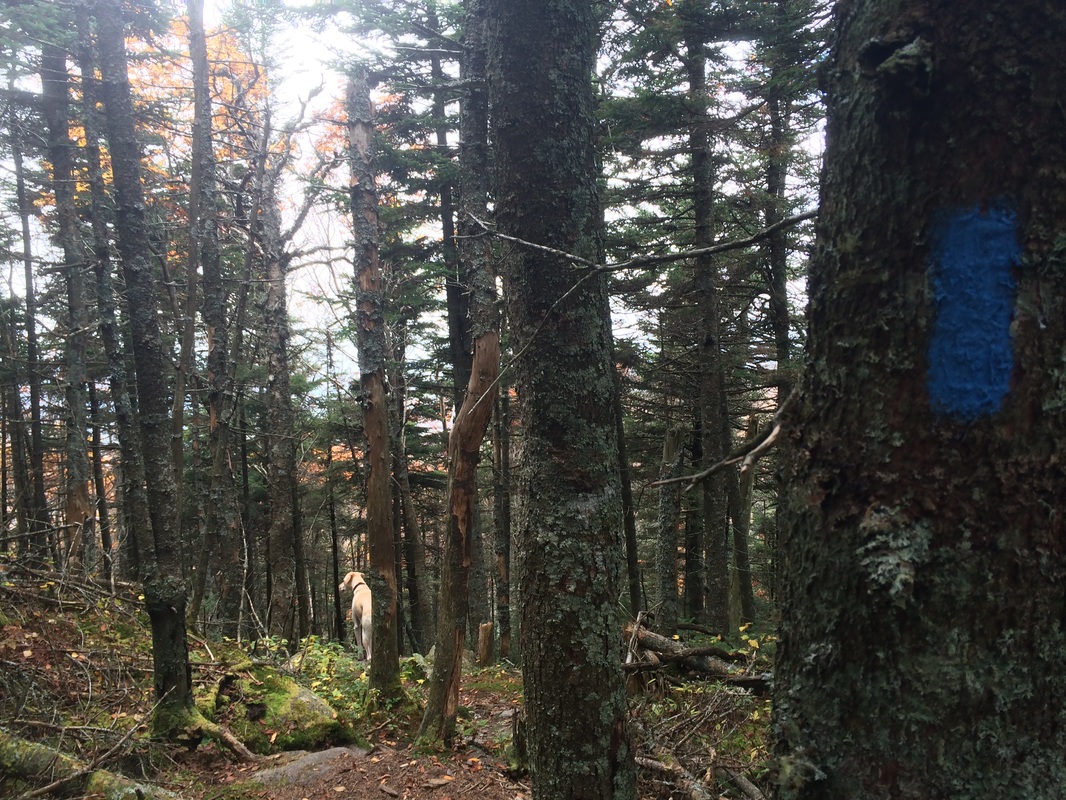
After exploring the area, we made our way back to the Long Trail and continued heading northbound. Soon after, the elevation started to change more rapidly. Roughly 4.2 miles in, we reached an area where the trees completely switched over to pine. The smell here was amazing. I have a pine candle from Yankee Candle I usually light up while I’m typing these recaps…it is nothing compared to the real thing I experienced in this section. Take a minute to catch your breath here and you won’t regret it.
Now, approximately 4.8 miles in, we reached the Wallace Cutoff, which would take us to my planned final destination for the day…Butler Lodge…
The Twin Brooks Tenting Area was rebuilt in 1997 by Burlington Section volunteers in memory of Roland Boucher, a dedicated trail maintainer. Tent platforms are provided, and small wood fires are permitted in the established fire ring near the group site. The water supply is the brook 0.2 mi. south on the LT.
After exploring the area, we made our way back to the Long Trail and continued heading northbound. Soon after, the elevation started to change more rapidly. Roughly 4.2 miles in, we reached an area where the trees completely switched over to pine. The smell here was amazing. I have a pine candle from Yankee Candle I usually light up while I’m typing these recaps…it is nothing compared to the real thing I experienced in this section. Take a minute to catch your breath here and you won’t regret it.
Now, approximately 4.8 miles in, we reached the Wallace Cutoff, which would take us to my planned final destination for the day…Butler Lodge…

At this point, we were way ahead of schedule so…instead of making the left turn to follow the Wallace Cutoff…I decided to continue northbound along the Long Trail and see what else it had to offer. Roughly 5.0 miles in, we reached the Needle’s Eye…an opening created by two large boulders…
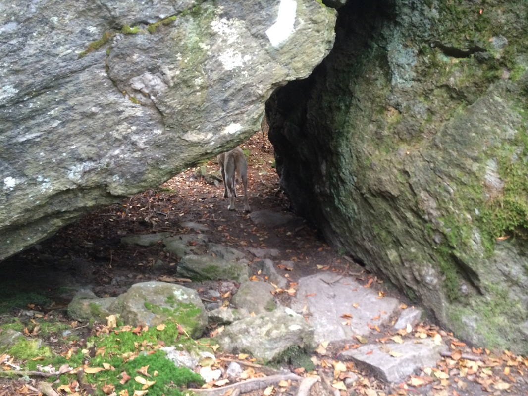
While doing my research on this section, in the event I ended up with extra time, I read about the Needle’s Eye and I was worried my 6'2" frame wouldn’t fit. I’m happy to report, not only did I fit, but I was able to get through it without having to crawl on the ground. A simple duck was all that was required…even though the picture above might lead you to believe otherwise.
Just on the other side of the Needle’s Eye, we reached the Forehead Bypass Trail…
Just on the other side of the Needle’s Eye, we reached the Forehead Bypass Trail…
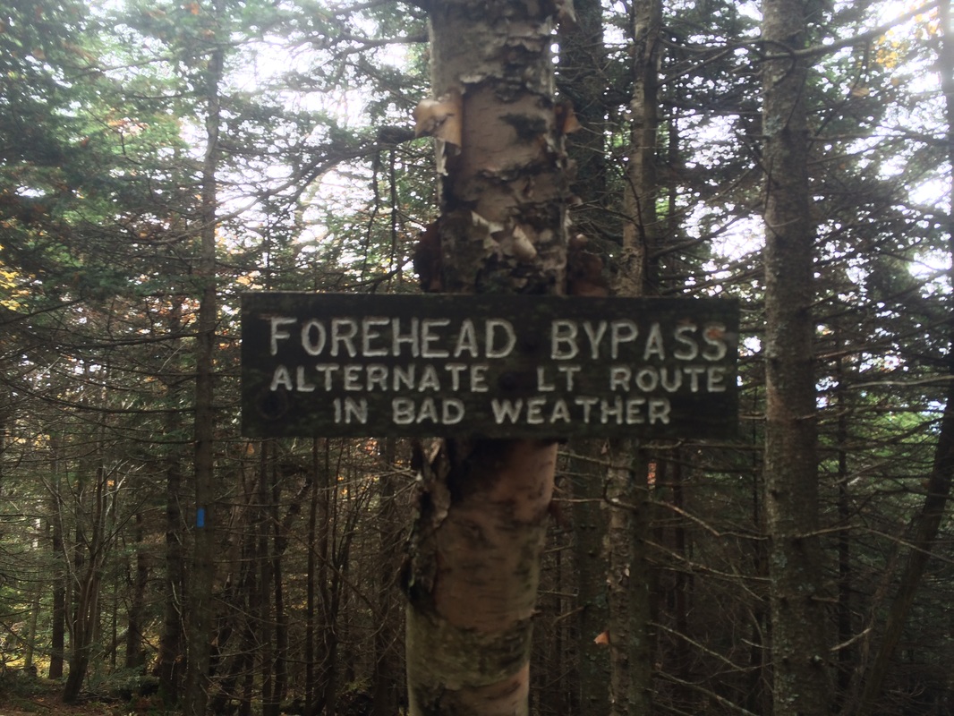
As you can see in the photo, the Forehead Bypass Trail is the suggested route to…well, to bypass the forehead, duh…in inclement weather.
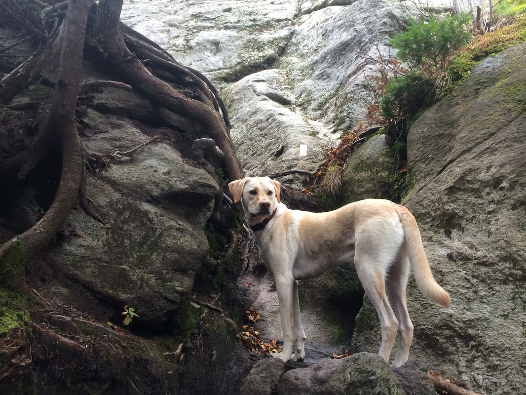
My research, and the fact that there is a bypass trail for inclement weather, led me to believe that the next section of the Long Trail would be tricky. I even read about a section with ladders. The weather wasn’t bad on this day…far from it…but I was travelling with a four-legged friend who, to my knowledge, has never climbed a ladder before. Still, nothing beats research on the ground so I decided to press on and see just how far we could go. I still had plenty of time to kill. But, I also didn’t want Roscoe climbing up any sections he wouldn’t be able to climb back down on the return trip. So, when we reached the point in the picture below, I knew it was time to turn around…
My research, and the fact that there is a bypass trail for inclement weather, led me to believe that the next section of the Long Trail would be tricky. I even read about a section with ladders. The weather wasn’t bad on this day…far from it…but I was travelling with a four-legged friend who, to my knowledge, has never climbed a ladder before. Still, nothing beats research on the ground so I decided to press on and see just how far we could go. I still had plenty of time to kill. But, I also didn’t want Roscoe climbing up any sections he wouldn’t be able to climb back down on the return trip. So, when we reached the point in the picture below, I knew it was time to turn around…
I’ll pick up the Long Trail at this point the next time I’m hiking by myself in the area and complete the section which leads up to, and over, the forehead. On this day, we turned around…stopped for some quick pictures in the Needle’s Eye on the return journey…and eventually made our way back to the Wallace Cutoff, now approximately 5.2 miles in…
The Wallace Cutoff is a short, blue-blazed trail (only about 1/10 of a mile long). It descends somewhat steeply before meeting up with the Butler Lodge Trail…
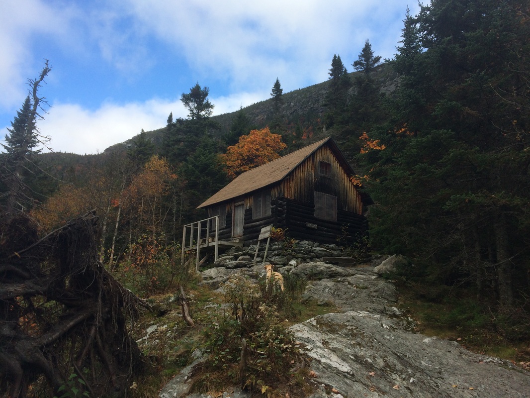
Roughly 5.3 miles in, we reached the area around Butler Lodge…
From the Green Mountain Club Day Hiker's Guide to Vermont:
Butler Lodge, of log construction, was originally built by the Long Trail Patrol in 1933 and reconstructed by Burlington Section volunteers led by Leo Leach in 2000. It is named for Mabel Taylor Butler, who was a member of the Burlington Section and loved the Green Mountains. The reconstructed lodge was dedicated in celebration of James C. Taylor, an LT end-to-end hiker. There are bunks and loft space for 14. Water, though unreliable in later summer, is available at a small brook 75 feet to the east of the lodge. A GMC caretaker is in residence during the hiking season to assist and educate hikers, help maintain the lodge and local trails, and compost sewage to protect water quality. A fee is charged for overnight use. Wood fires are prohibited at Butler Lodge. From the lodge, there are views of the Champlain Valley and Adirondacks to the west and the south escarpment of the forehead of Mount Mansfield to the north.
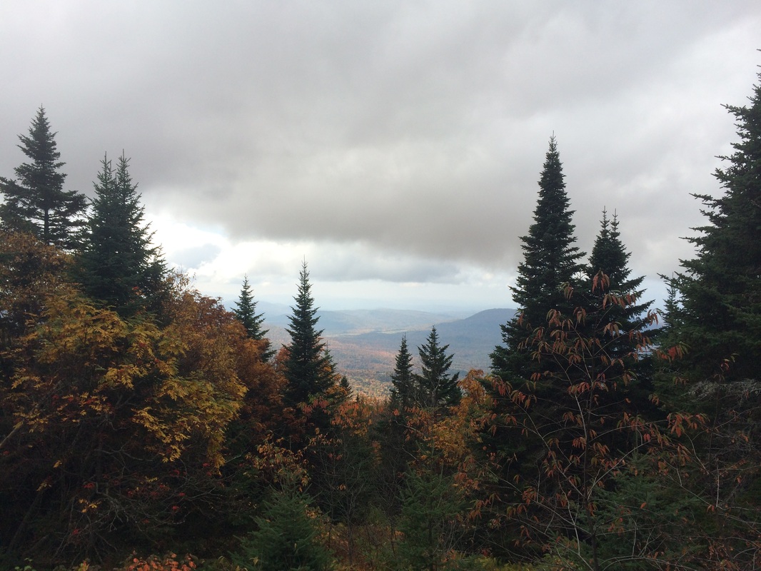
At this point, I was still well ahead of schedule. So, I took a few moments to enjoy the views described in the Guide...
Butler Lodge, of log construction, was originally built by the Long Trail Patrol in 1933 and reconstructed by Burlington Section volunteers led by Leo Leach in 2000. It is named for Mabel Taylor Butler, who was a member of the Burlington Section and loved the Green Mountains. The reconstructed lodge was dedicated in celebration of James C. Taylor, an LT end-to-end hiker. There are bunks and loft space for 14. Water, though unreliable in later summer, is available at a small brook 75 feet to the east of the lodge. A GMC caretaker is in residence during the hiking season to assist and educate hikers, help maintain the lodge and local trails, and compost sewage to protect water quality. A fee is charged for overnight use. Wood fires are prohibited at Butler Lodge. From the lodge, there are views of the Champlain Valley and Adirondacks to the west and the south escarpment of the forehead of Mount Mansfield to the north.
At this point, I was still well ahead of schedule. So, I took a few moments to enjoy the views described in the Guide...
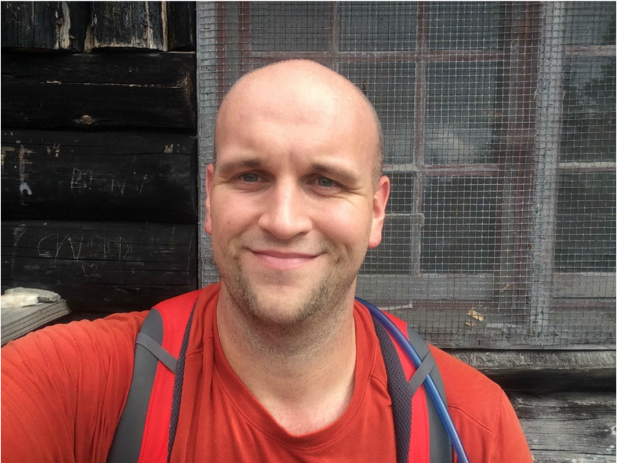
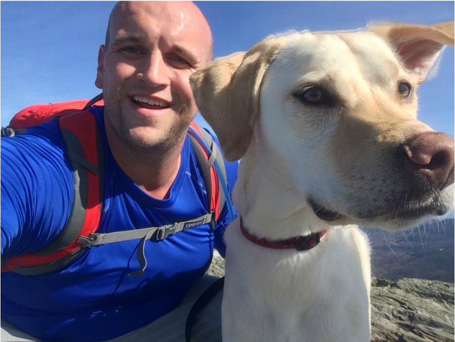
I also took a selfie while sitting on the front porch of the lodge…
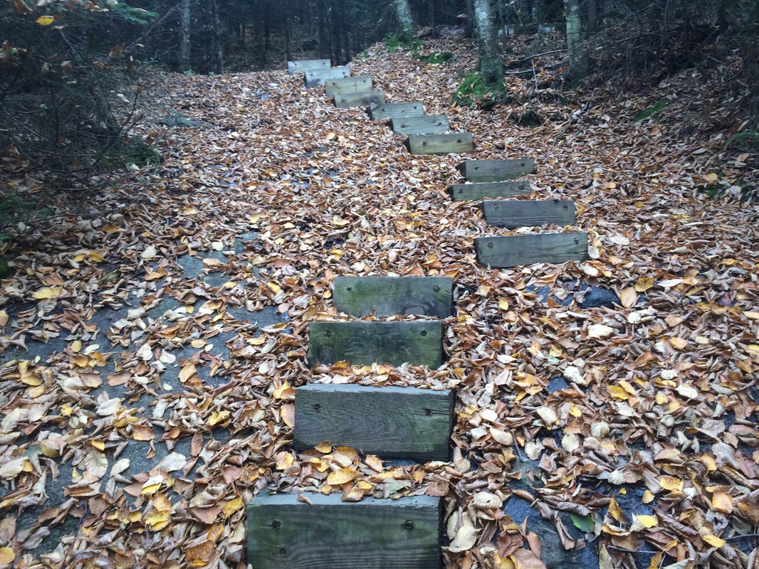
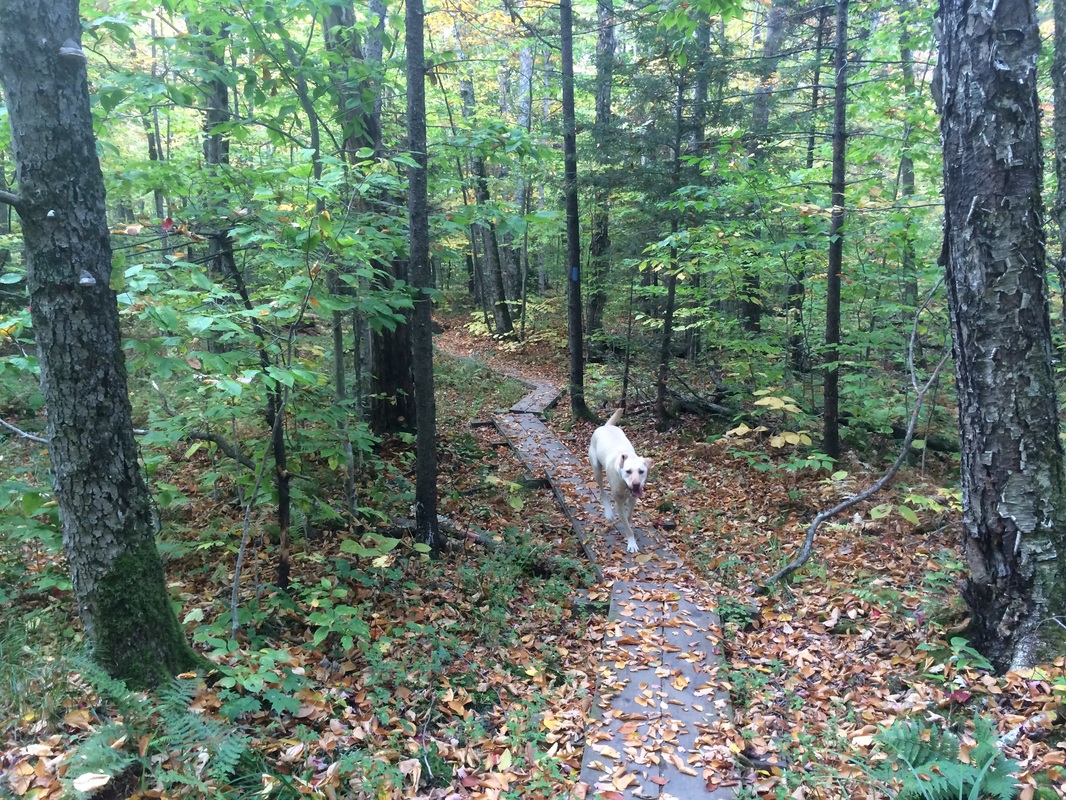
Eventually, we made our way down off of the front deck/porch of the lodge and started our descent back to the parking area. We used the 1.8 mile Butler Lodge Trail to complete our "loop"…
|
|
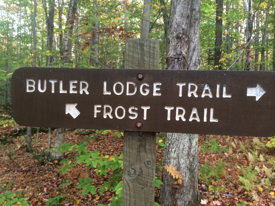
Approximately 7.0 miles in, still on the Butler Lodge Trail, we passed the Frost Trail (on our left even though the picture below shows it on the right...I had to turn around to get the picture). At this point, I knew it wouldn’t be long before we reached the parking area…
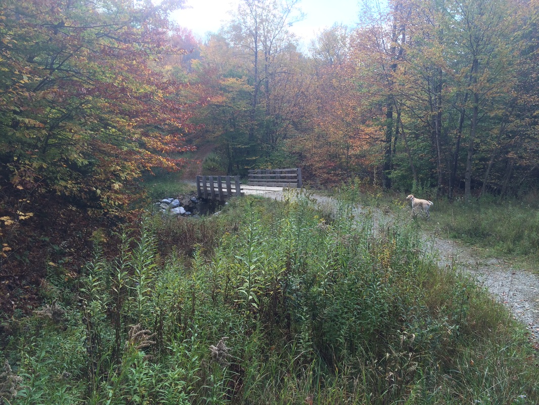
Soon after, the trail brought us to a forest road and we followed it back out to the parking area...
All in all, this was a very nice hike and I was thankful the weather held up even though the original forecast predicted it would be cloudy…
For a map of this hike, along with elevation data, please click here.
Hike # 110
The following day, we were up early again for our planned hike along the Long Trail from the Nose to the Chin (the Mount Mansfield Summit). I convinced Jaci to join Roscoe and me on this hike by explaining we could drive on the Mount Mansfield Toll Road to within a mile and a half of the summit…and that it was only about a 300 foot elevation change once we were on foot.
We started the day, like we do most of our days when we are in Stowe, at the Dutch Pancake Café. This time, I opted for a Chocolate Chip and Banana pancake…but stuck with the side of three scrambled eggs. Once we were done, we made our way over to the Toll Road. Normally, I would turn my nose up to people who drive up to the top of a mountain instead of climbing it. But, in this case, I wanted Jaci to come along so I was able to brush my pride aside. One day, I promised myself, I’ll climb Mount Mansfield from Route 108 to the top.
I found the Toll Road to be extremely difficult driving. Only the first 1/4 of a mile or so is paved, there are multiple hairpin turns, and…as with most driving situations these days…the other drivers simply just aren’t careful enough. After about 20 minutes of holding our breath, we made it to the parking area near the Nose. We all jumped out of the jeep, geared up, and hit the trail…
As you can see in the first photo above, Mount Mansfield is home to some rare alpine plants. From the Green Mountain Club Day Hiker’s Guide to Vermont:
The Mount Mansfield summit ridge supports the largest community of alpine tundra found in Vermont. This unique and delicate plant life is remnant of an era when ice sheets covered northern New England. Few species are able to survive the extreme conditions of the summit ridge; those that do grow very slowly and hang in a delicate balance. Although these plants are hardy to weather, they are extremely fragile to foot traffic.
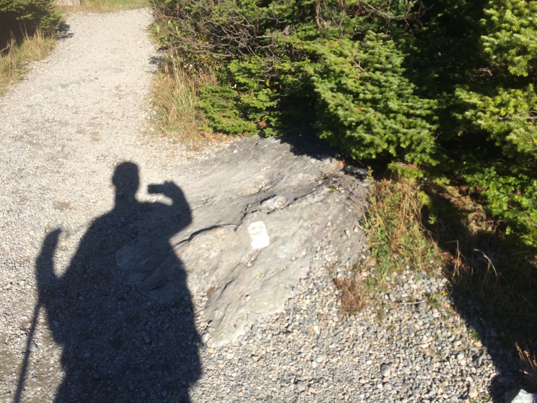
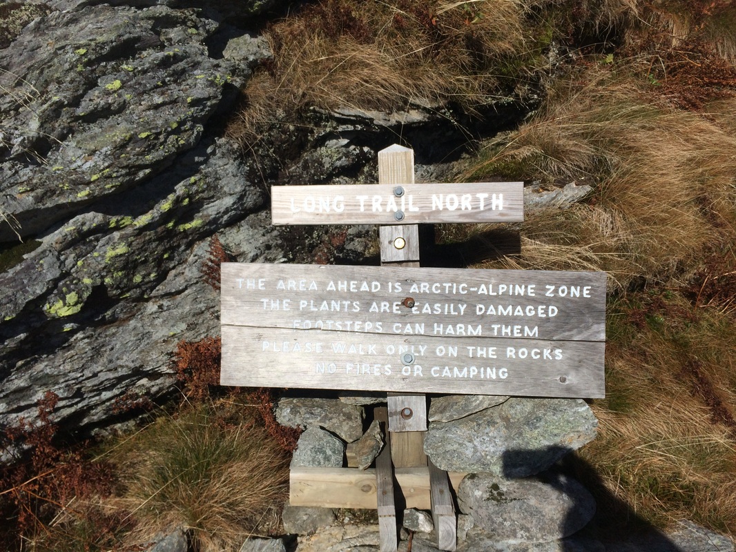
To protect the tundra, hikers are encouraged to walk on rocks where possible and the trail is defined by pathways made out of white string. The string, which is barely visible in a few of the pictures we took, is easy to see from the trail. While Jaci and I did our best to stay on the rocks, Roscoe wasn’t as concerned. I did my best to keep him off the fragile tundra, but (even while on a leash), he has a mind of his own. At only 75 pounds, and only crossing the divider a couple of times, I doubt he did too much damage...and I was able to limit any damage he might’ve done by keeping him on leash. If you decide to bring your dog on this hike, please keep him/her leashed at all times. It might make your hike a little more challenging, but it is worth it for the preservation of this fragile plant species...
The Mount Mansfield summit ridge supports the largest community of alpine tundra found in Vermont. This unique and delicate plant life is remnant of an era when ice sheets covered northern New England. Few species are able to survive the extreme conditions of the summit ridge; those that do grow very slowly and hang in a delicate balance. Although these plants are hardy to weather, they are extremely fragile to foot traffic.
To protect the tundra, hikers are encouraged to walk on rocks where possible and the trail is defined by pathways made out of white string. The string, which is barely visible in a few of the pictures we took, is easy to see from the trail. While Jaci and I did our best to stay on the rocks, Roscoe wasn’t as concerned. I did my best to keep him off the fragile tundra, but (even while on a leash), he has a mind of his own. At only 75 pounds, and only crossing the divider a couple of times, I doubt he did too much damage...and I was able to limit any damage he might’ve done by keeping him on leash. If you decide to bring your dog on this hike, please keep him/her leashed at all times. It might make your hike a little more challenging, but it is worth it for the preservation of this fragile plant species...
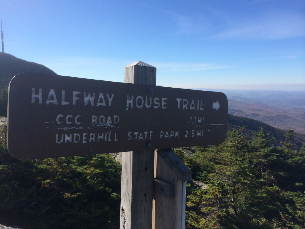
Approximately 2/10 of a mile in, we reached the first trail junction of the day. Here, the 2.5 mile Halfway House Trail joins the Long Trail after climbing 2,000 feet up the western side of Mount Mansfield…
Beyond the Halfway House Trail, the Long Trail climbs briefly before reaching Frenchman’s Pile…
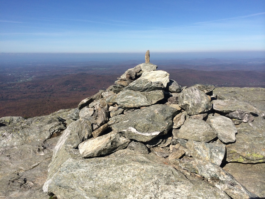
Frenchman’s Pile, a cairn, marks the spot where a traveler was killed by lightning many years ago.
Roughly 3/10 of a mile later (now about 1/2 of a mile in), we reached Drift Rock…
Roughly 3/10 of a mile later (now about 1/2 of a mile in), we reached Drift Rock…
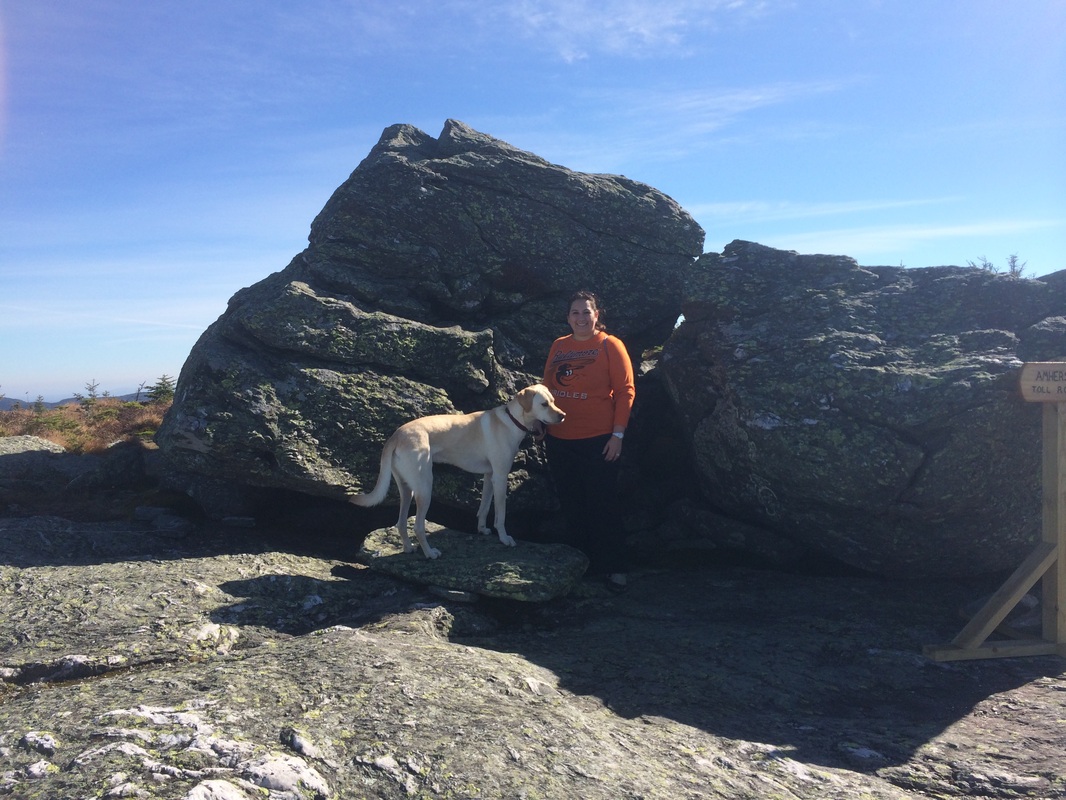
Drift Rock, a large glacial erratic, marks the north end of the Amherst Trail. The Guide advises the Amherst Trail provides a sheltered route between Drift Rock and the Summit Station (near where we parked our car), bypassing Frenchman’s Pile.
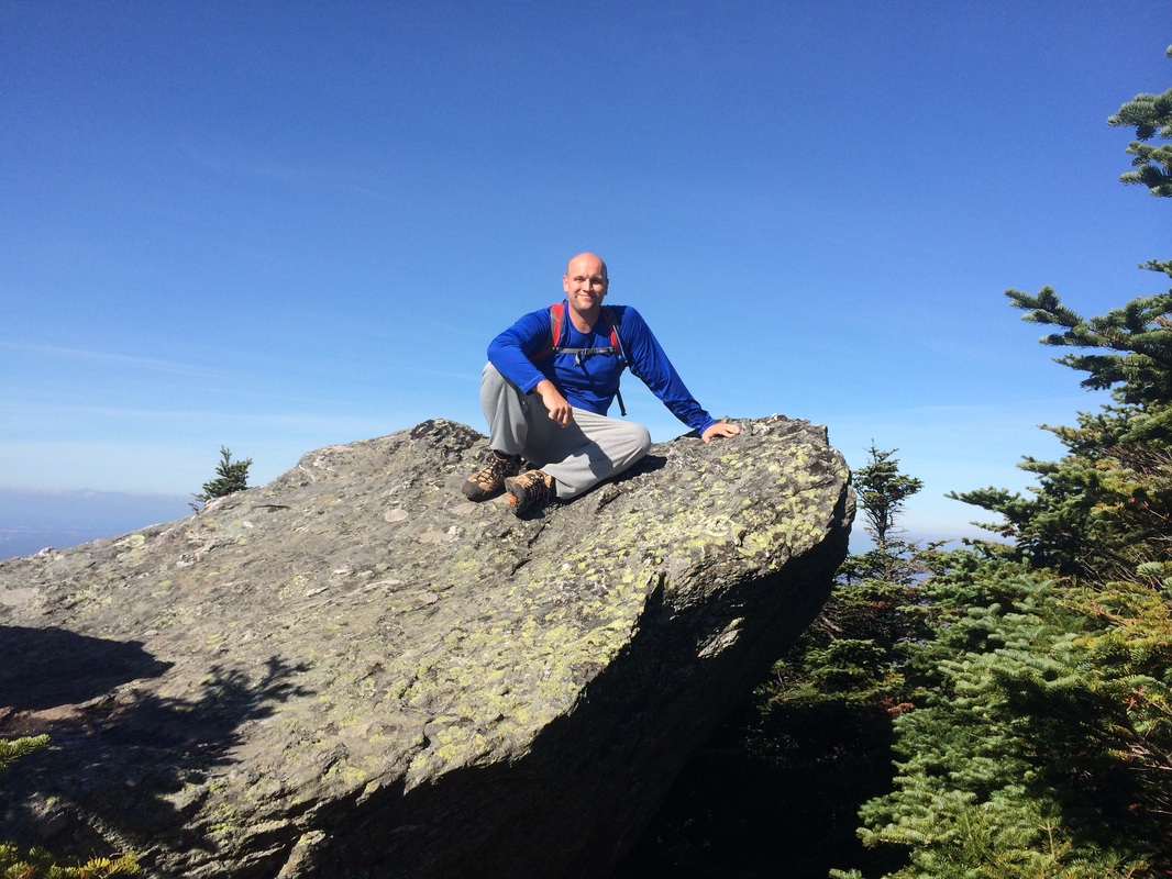
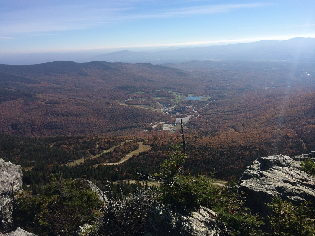
As we continued to make our way to the summit, we stopped for a few photo opportunities. In the first set of pictures below, I took a moment to climb to the top of a rock feature and Jaci got some great pics. Then, I was able to get a cool picture of the lodge where we were staying. After I spent the previous two days looking at the ridge from the balcony of our room, it was neat to experience the opposite view…
As we continued to make our way to the summit, we stopped for a few photo opportunities. In the first set of pictures below, I took a moment to climb to the top of a rock feature and Jaci got some great pics. Then, I was able to get a cool picture of the lodge where we were staying. After I spent the previous two days looking at the ridge from the balcony of our room, it was neat to experience the opposite view…
|
|
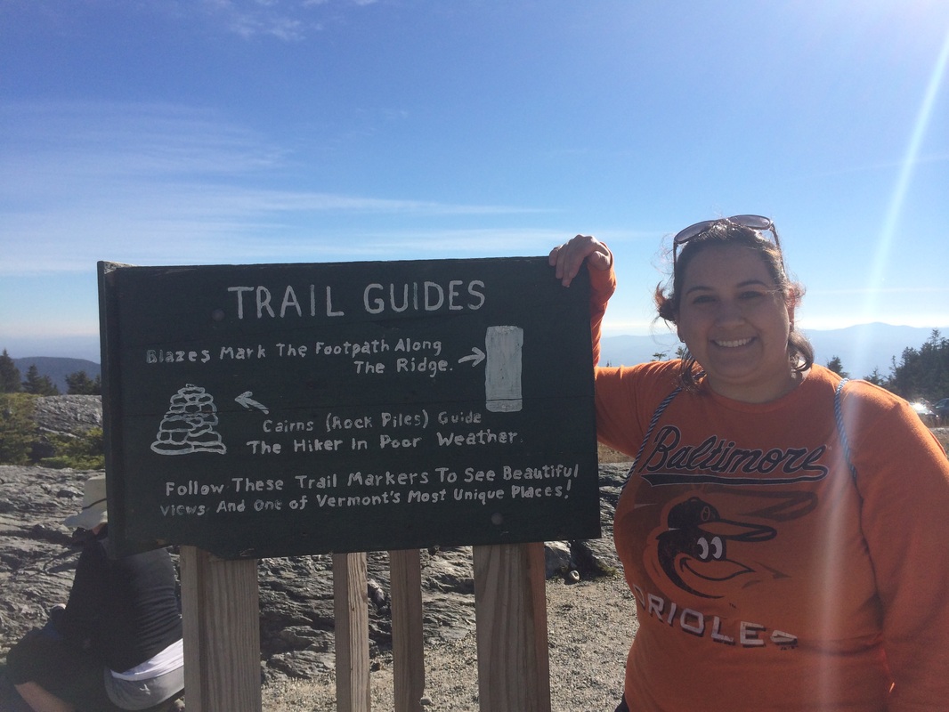
As we continued to approach the summit, we passed several other side trails (there are a lot of them up here) and saw a few reminders about the fragile tundra…
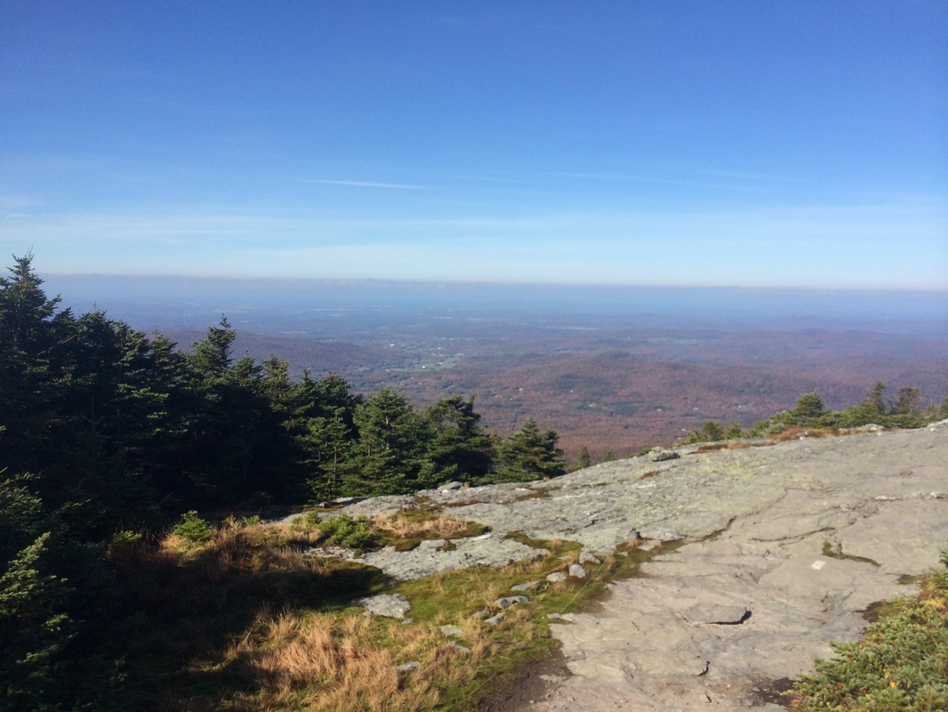
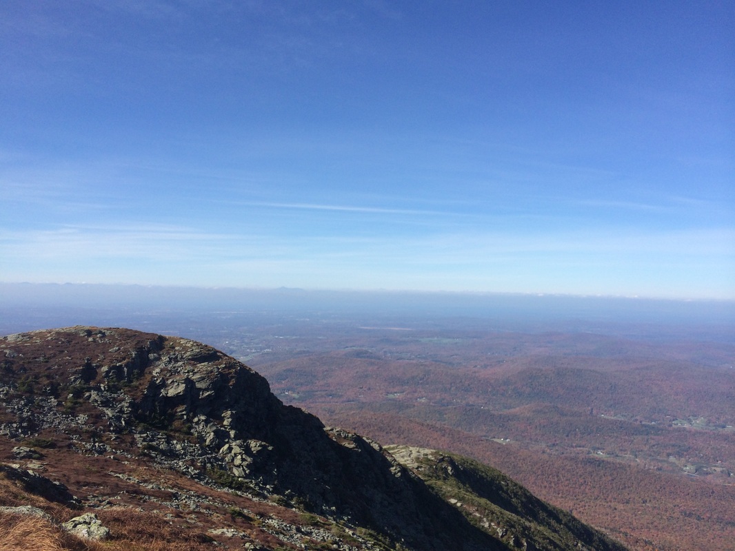
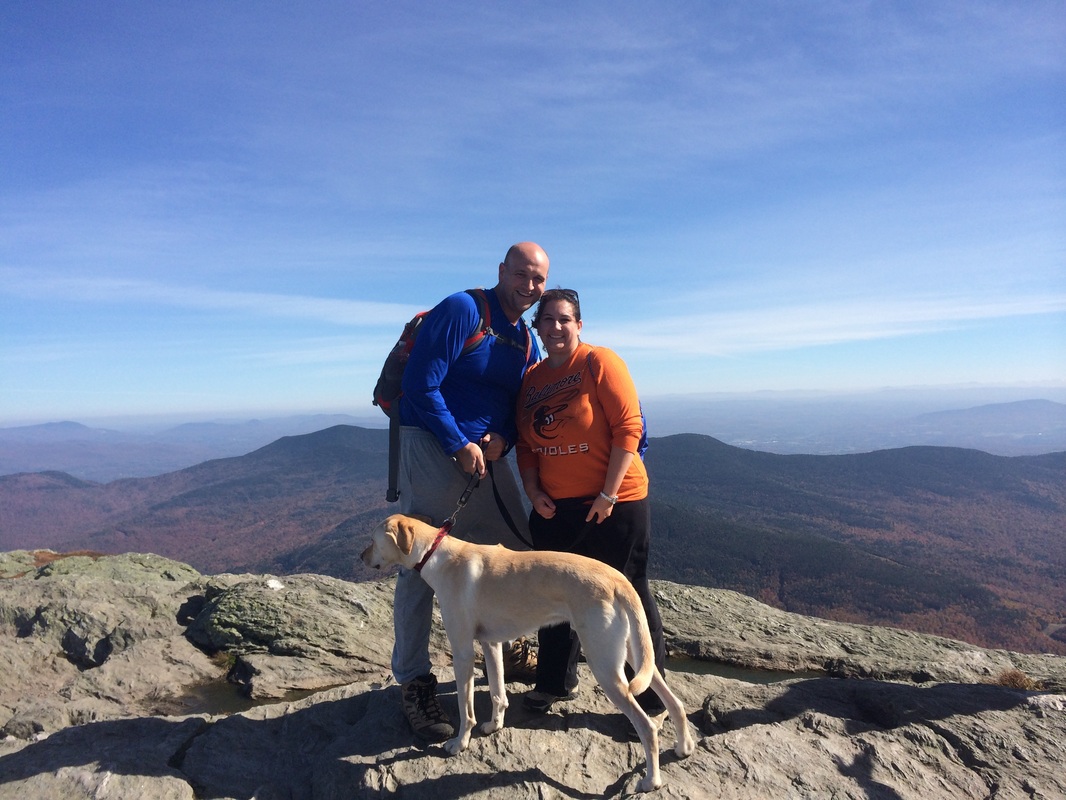
Approximately 1.5 miles in, we reached the summit of Mount Mansfield and took a few moments to enjoy 360 degree views…
|
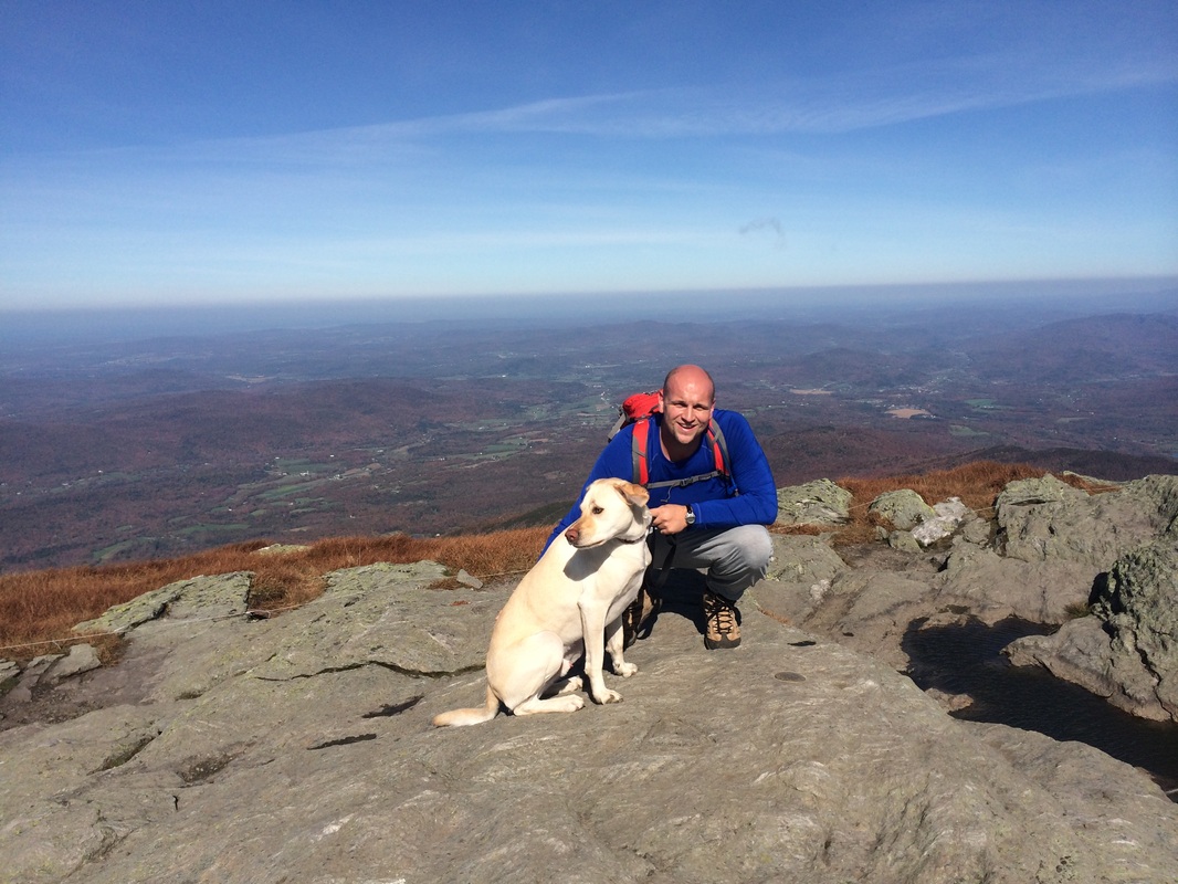
|
Once we were done enjoying the views, we started the journey (along the same route) back to the car.
This was a really enjoyable hike. If the weather is nice, I recommend it for anyone who is in the area…even if you don’t have a lot of skill or have never hiked before. We had a perfect day and we saw a girl in flip flops…and another girl was barefoot while carrying a six week old puppy. If you are in to more hardcore hiking, there are plenty of other challenging ways to reach the summit of Mount Mansfield, just be careful and research the trails/weather forecasts before you go.
Until next time…
For a map of this hike, along with elevation data, please click here.
Total 2014 Distance: 304.84
