Waiting for a Train
Hike # 89
Westwoods Trails (Guilford, CT)
Hike Distance: 4.33 Miles
Date Hiked: 2/8/2014
Date Published: 2/11/2014
This day was originally set aside for the next section of the Mattabesett Trail. But, three days before our hike, Central CT was hit with about 10 inches of snow. Those of you familiar with this blog know that I’m not opposed to hiking in the snow. But, even I have my limits. So, instead of forcing the issue, I decided to head down to the shoreline where I figured there would be less accumulation. Even this was a gamble though because the shoreline received more snow than Central CT on the Monday before this hike. This gamble wouldn’t entirely work out in my favor…but not because of the accumulation of snow…because, as I’ve said before, the trails within Westwoods are the most ridiculous group of trails I’ve ever encountered.
I would be joined on this hike by my dad and my friend Mark. Roscoe was sitting this one out because I wasn’t sure how deep the snow would be and I figured, no matter how deep, there would be a layer of sharp ice on top. I also assumed, since the snow had only fallen on Wednesday, the trails wouldn’t be well travelled yet.
For the most part I was right. The snow accumulation in Guilford wasn’t nearly what it was in Haddam/Durham, but it was probably still too deep for Roscoe (although, we did see other dogs while we were hiking). Some of the trails were well travelled, while others weren’t travelled at all. After the first hour, we decided it was best to either have a really well travelled trail (where the snow was packed and we could almost walk on air) or not travelled at all (where we could each make our own path). For some reason, we struggled on the lightly travelled trails where we were almost forced to sync our stides/footsteps with the one person who had gone ahead of us.
The worst part of this hike was the fact we spent most of the day in the southernmost part of Westwoods, on the White Circle trail looking for the multiple offshoots of White Square trails. I’ve discussed this at length before (I even provided a photo example of how confusing the White Circle/White Square situation can be in other areas of Westwoods), so I’m not going to complain about too much here. But, I will reiterate my statement that there HAS to be a better system. Use a different color…or make one of the two a triangle blaze…something so there isn’t quite as much “Is that a circle or a square?” going on.
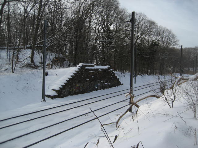
The best part of this hike was the fact we spent most of the day within seeing/hearing distance of the Amtrak train tracks which cut through this section of Connecticut. When I was living in Baltimore, Jaci would come down from CT to visit quite often. A couple of times, she took the train…until we realized that, after parking, the train was almost as expensive as flying…and the travel time is cut down by more than half. There was something cool and unique about walking along the trail and then, all of a sudden, a train goes whizzing by…and, another moment later, it was gone. We weren’t fortunate enough to have one go by while we were hiking directly along the side of the tracks (one trail comes within a few feet of the tracks), but a few times we saw and heard them from a distance.
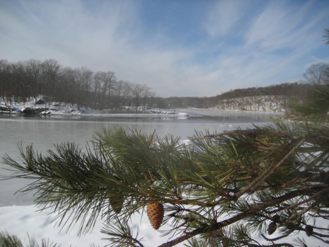
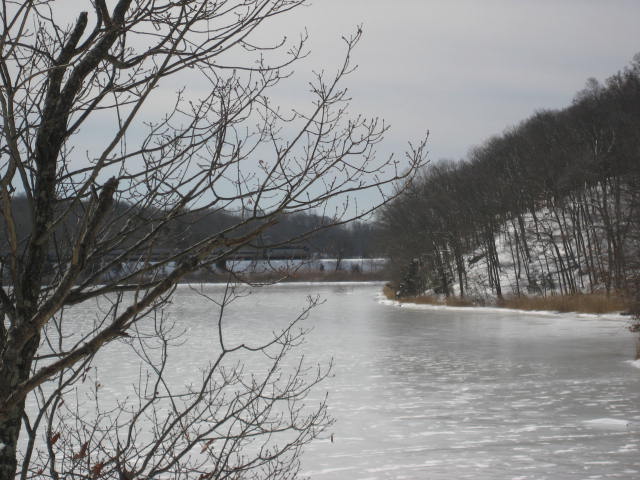
Below is a collection of pictures from the hike. There aren’t many. And, I didn’t have Jaci’s good camera with me because I was worried about falling in the snow (I never did fall, but I slid a couple of times so it was the right decision to leave the expensive camera at home). Regardless, the shots I did get should give you a taste of what the southernmost section of Westwoods is like. Look closely at the last one and you might find one of those trains which eluded me and my camera all morning.
Hike # 89
Westwoods Trails (Guilford, CT)
Hike Distance: 4.33 Miles
Date Hiked: 2/8/2014
Date Published: 2/11/2014
This day was originally set aside for the next section of the Mattabesett Trail. But, three days before our hike, Central CT was hit with about 10 inches of snow. Those of you familiar with this blog know that I’m not opposed to hiking in the snow. But, even I have my limits. So, instead of forcing the issue, I decided to head down to the shoreline where I figured there would be less accumulation. Even this was a gamble though because the shoreline received more snow than Central CT on the Monday before this hike. This gamble wouldn’t entirely work out in my favor…but not because of the accumulation of snow…because, as I’ve said before, the trails within Westwoods are the most ridiculous group of trails I’ve ever encountered.
I would be joined on this hike by my dad and my friend Mark. Roscoe was sitting this one out because I wasn’t sure how deep the snow would be and I figured, no matter how deep, there would be a layer of sharp ice on top. I also assumed, since the snow had only fallen on Wednesday, the trails wouldn’t be well travelled yet.
For the most part I was right. The snow accumulation in Guilford wasn’t nearly what it was in Haddam/Durham, but it was probably still too deep for Roscoe (although, we did see other dogs while we were hiking). Some of the trails were well travelled, while others weren’t travelled at all. After the first hour, we decided it was best to either have a really well travelled trail (where the snow was packed and we could almost walk on air) or not travelled at all (where we could each make our own path). For some reason, we struggled on the lightly travelled trails where we were almost forced to sync our stides/footsteps with the one person who had gone ahead of us.
The worst part of this hike was the fact we spent most of the day in the southernmost part of Westwoods, on the White Circle trail looking for the multiple offshoots of White Square trails. I’ve discussed this at length before (I even provided a photo example of how confusing the White Circle/White Square situation can be in other areas of Westwoods), so I’m not going to complain about too much here. But, I will reiterate my statement that there HAS to be a better system. Use a different color…or make one of the two a triangle blaze…something so there isn’t quite as much “Is that a circle or a square?” going on.
The best part of this hike was the fact we spent most of the day within seeing/hearing distance of the Amtrak train tracks which cut through this section of Connecticut. When I was living in Baltimore, Jaci would come down from CT to visit quite often. A couple of times, she took the train…until we realized that, after parking, the train was almost as expensive as flying…and the travel time is cut down by more than half. There was something cool and unique about walking along the trail and then, all of a sudden, a train goes whizzing by…and, another moment later, it was gone. We weren’t fortunate enough to have one go by while we were hiking directly along the side of the tracks (one trail comes within a few feet of the tracks), but a few times we saw and heard them from a distance.
Below is a collection of pictures from the hike. There aren’t many. And, I didn’t have Jaci’s good camera with me because I was worried about falling in the snow (I never did fall, but I slid a couple of times so it was the right decision to leave the expensive camera at home). Regardless, the shots I did get should give you a taste of what the southernmost section of Westwoods is like. Look closely at the last one and you might find one of those trains which eluded me and my camera all morning.
For a map of this hike, along with elevation data, please click here.
Total 2014 Distance: 92.59 Miles