Turn
Tunxis Trail (Burlington Region, Part 1)
Hike # 93
Hike Distance: 12.58 Miles
Date Hiked: 3/25/2014
Date Published: 4/15/2014
The title for this recap is partly from a new show on AMC about spies during the American Revolution. I haven't seen the show yet, but I've heard it is good. And, the subject of the show is important as it relates to this hike. The title is also partly from the fact that I spent a good portion of this hike looking for a turn which felt like it would never come. Finally, the title is also partly from the fact that, once I found the turn, I made several other twists and turns which were completely unexpected.
The morning of March 25th was a chilly one here in Connecticut. After my last hike on the Tunxis, I was eager to see more of it. So, I set out for the next regional section in Burlington. I was also getting ready to head to Florida for a week and Roscoe was staying behind with Jaci. So, I was looking forward to what would be our last "woods bonding experience" for a while. Don't question my relationship with my dog...it is what it is.
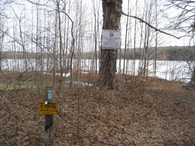
We set out, after rush hour traffic died down on this Tuesday morning, for Marsh Road in Bristol. Here, on the Bristol/Plymouth town line...at the southwest corner of Old Marsh Pond (also known as Bristol Reservoir #7), the Tunxis mainline starts up again. The Connecticut Walk Book advises there is parking on the side of the road near the trailhead, but the map might be a little out of date. I had a hard time believing I would be able to park where the Walk Book was telling me I could and not end up with a ticket. No problem...I just drove around a bit and found a nice spot off of East Plymouth Road, just south of Preston Road, in Plymouth. I geared up, got Roscoe out of the car, and we started our hike by heading south on East Plymouth Road.
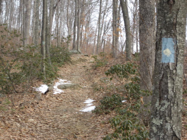
After 1/4 of a mile, we made a left turn on to Marsh Road and (after a short trot up a small hill) we reached the trailhead.
Tunxis Trail (Burlington Region, Part 1)
Hike # 93
Hike Distance: 12.58 Miles
Date Hiked: 3/25/2014
Date Published: 4/15/2014
The title for this recap is partly from a new show on AMC about spies during the American Revolution. I haven't seen the show yet, but I've heard it is good. And, the subject of the show is important as it relates to this hike. The title is also partly from the fact that I spent a good portion of this hike looking for a turn which felt like it would never come. Finally, the title is also partly from the fact that, once I found the turn, I made several other twists and turns which were completely unexpected.
The morning of March 25th was a chilly one here in Connecticut. After my last hike on the Tunxis, I was eager to see more of it. So, I set out for the next regional section in Burlington. I was also getting ready to head to Florida for a week and Roscoe was staying behind with Jaci. So, I was looking forward to what would be our last "woods bonding experience" for a while. Don't question my relationship with my dog...it is what it is.
We set out, after rush hour traffic died down on this Tuesday morning, for Marsh Road in Bristol. Here, on the Bristol/Plymouth town line...at the southwest corner of Old Marsh Pond (also known as Bristol Reservoir #7), the Tunxis mainline starts up again. The Connecticut Walk Book advises there is parking on the side of the road near the trailhead, but the map might be a little out of date. I had a hard time believing I would be able to park where the Walk Book was telling me I could and not end up with a ticket. No problem...I just drove around a bit and found a nice spot off of East Plymouth Road, just south of Preston Road, in Plymouth. I geared up, got Roscoe out of the car, and we started our hike by heading south on East Plymouth Road.
After 1/4 of a mile, we made a left turn on to Marsh Road and (after a short trot up a small hill) we reached the trailhead.
|
|
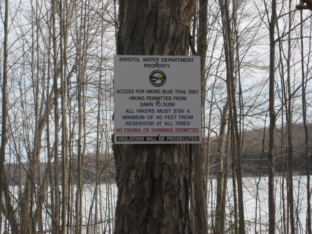
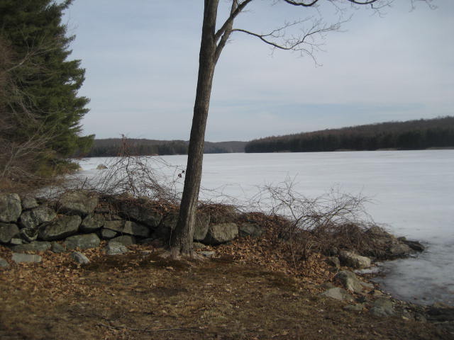
There are several signs here which remind hikers this is Bristol Water property and urge people to remain at least 50 feet from the shore of the pond. Fortunately, there is an early section of the trail which brings you pretty close to the edge of the shore. Enjoy this view while you can...it is the best one you'll get.
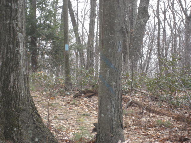
Shortly after leaving the edge of the pond, the trail enters a pine forest. At around 8/10 of a mile from the trailhead, the mainline Tunxis comes to a junction with the White Dot Trail...blazed blue with a white dot in the middle. You'll know you are in the right area because the trail comes to a "T" at an old woods road. To the left, the White Dot Trail (on the left below) heads out to East Plymouth Road before turning right. Note: there is another parking location where the trail turns on East Plymouth Road...but I wouldn't find that out until later on this hike. To the right of the "T" junction, is the mainline Tunxis (on the right below).
|
|
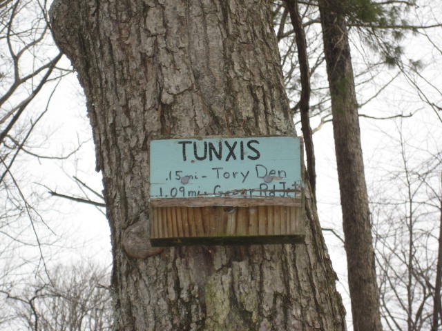
After making the right to remain on the mainline Tunxis, we followed the old woods road for 7/10 of mile. At that point, roughly 1.5 miles in to the mainline Tunxis, we came to another intersection of trails. Here, the mainline turns right (solid blue blaze in the picture on the right below) and heads off to the Mile of Ledges...which the Walk Book advertises as "the most rugged section of the entire Tunxis Trail system." I wasn't exactly sure what to expect and the trail conditions were still a little icy so I elected to save the Mile of Ledges for another day. Instead, I opted to stay straight and follow the Yellow Dot Trail (third picture below) towards Tory Den.
|
|
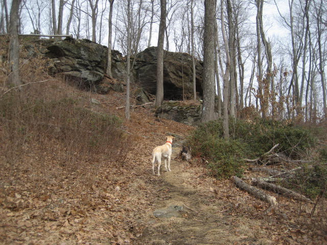
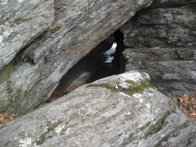
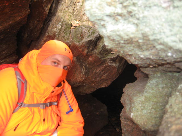
It wasn't long, maybe 1/10 of a mile or so before we reached the area of Tory Den. In the pictures below, you can see the massive set of rocks that make up the area around the den. But, the highlight here is the den itself and the local history that comes with it. Here, during the Revolutionary War, Stephen Graves (a farmer from the nearby town of Harwintown, Connecticut...who was loyal to the crown) hid from the Patriots. According to the Walk Book, Graves' wife would sound a horn whenever the Patriots would approach and Graves would run for the hills (literally). It is also believed that Moses Dunbar (Graves' brother-in-law) hid from the Patriots here. Dunbar is important because he was the only Connecticut citizen to be hanged as a traitor. Finally, Tory Den is believed to have been one of the locations The Leatherman used as one of his overnight stops while making his circular journey. Some of you might recall I had previously visited another one of Leatherman's "caves", on Hike # 73.
|
|
After
we explored the area around Tory Den, we set off again on the Yellow Dot
Trail…continuing due north. The next
mile or so is pretty straight, but there are a few turns along the way…and a
handful of ups and downs. Eventually,
the trail comes to a junction with another blue/yellow blazed trail. This trail, which leads to the right, is actually
an access trail to/from Greer Road…where the Walk Book advises there is
additional parking. As of this recap,
I’ve been unable to confirm the parking location. But, I might use it on a future hike through
the area. If I do, I’ll be sure to let
you know.
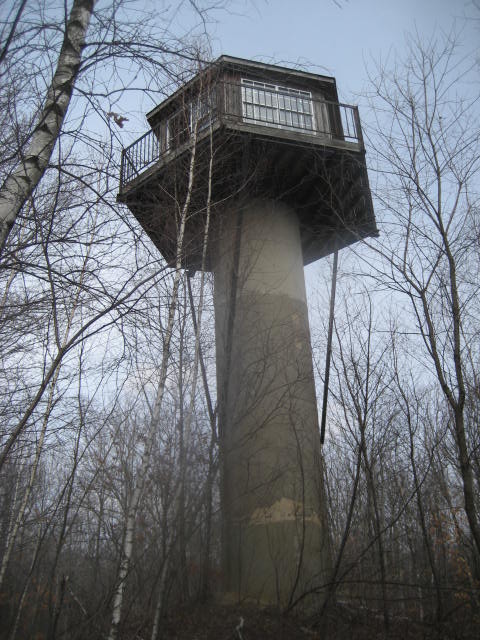
From the access trail, we made a slight left and continued heading due north on the Yellow Dot Trail. The next mile and a half or so is pretty straight, mostly flat, and…honestly…pretty boring. The Walk Book mentions a ledge with limited views in winter…but the trees were still bare and I don’t recall any views. It also mentions stone foundations, what sounds like a unique tree, and a stone bridge…none of which I remember. I did, however, at one point notice an interesting looking tower just off trail and decided to take a closer look. I’m not certain, but I believe this is an abandoned fire tower. I was close to the Nassahegan State Forest at this point so I guess it could be an old fire tower. I was fortunate to be making this trip before the trees are full of leaves. I imagine this tower is pretty well hidden from view in the summer months.
From the access trail, we made a slight left and continued heading due north on the Yellow Dot Trail. The next mile and a half or so is pretty straight, mostly flat, and…honestly…pretty boring. The Walk Book mentions a ledge with limited views in winter…but the trees were still bare and I don’t recall any views. It also mentions stone foundations, what sounds like a unique tree, and a stone bridge…none of which I remember. I did, however, at one point notice an interesting looking tower just off trail and decided to take a closer look. I’m not certain, but I believe this is an abandoned fire tower. I was close to the Nassahegan State Forest at this point so I guess it could be an old fire tower. I was fortunate to be making this trip before the trees are full of leaves. I imagine this tower is pretty well hidden from view in the summer months.
After
exploring the area around the tower, we made our way back to the trail and
continued our journey north. Roughly 2.7
miles from where we turned off of the mainline to join the Yellow Dot Trail, we
emerged from the woods and started following Johnnycake Mountain Road. At first the road is unpaved, but we
eventually made our way out to the paved portion.
It
was around this time that I started to wonder how far I was from the turn for
the White Dot Trail. I hadn’t originally
planned on coming this way, so I didn’t have a map. If you are familiar with this blog then you
know I always suggest bringing a map, but I thought I had committed it to
memory well enough ahead of time. I knew
that the Yellow Dot Trail went due north…and that I would eventually find the
White Dot Trail, which would lead me west and south back to my vehicle. So, I wasn’t overly concerned about not
having a map. What started to bother me
was the fact that the little yellow dots within the blue blazes started to look
like white dots, even though I never made a turn significant enough to put me
on a new trail...or so I thought.
I continued on the Yellow Dot Trail, questioning if it even was the Yellow Dot Trail anymore, but moving forward all the same. Roughly 3.0 miles from where we turned off of the mainline trail (2.9 miles from Tory Den), the Yellow Dot Trail reached Old Field Road…and we made a right. A tenth of a mile later, the trail made a slight left and reentered the woods. Half a mile after that, still wondering what trail I was even on, I reached a trail junction. Blue blazes with white dots to my left…blue blazes with white dots to my right…and what looked like blue blazes with white dots behind me. Oh my. My immediate thought was that the trail to my left and right HAD to be the White Dot Trail, but I wasn’t sure. The dots in the blazes for the new trail looked just like the trail I was on. I took a chance and made a left, now heading due west.
As I would eventually find out, my decision to turn left at the trail junction was the right one...and I had finally found the White Dot Trail. But, it was a long time before I found out for sure. As it turns out, I hadn’t done enough research ahead of time…which is a mistake I’ll never make again. I can’t even believe…after over 90 hikes…I’m still making rookie mistakes. This is the kind of stuff that happens when you get overly confident and don’t have a back-up plan from the start. Then again, this is Connecticut...one of, if not THE most densely populated states in the country. Even if I got lost, I was bound to find civilization again at some point. Add to that the fact that I was always on marked trails and the bottom line is I wasn't ever in any real danger.
Over the next 5.8 miles, the White Dot Trail would take us west then south and return us to the area where I had left my vehicle earlier in the day. For now, though, the trail led us through the woods behind some houses in what appeared to be a new development. We followed the blazes, eventually emerging on to a paved road and then reentering the woods quickly. Then, something happened which made this hike a unique experience.
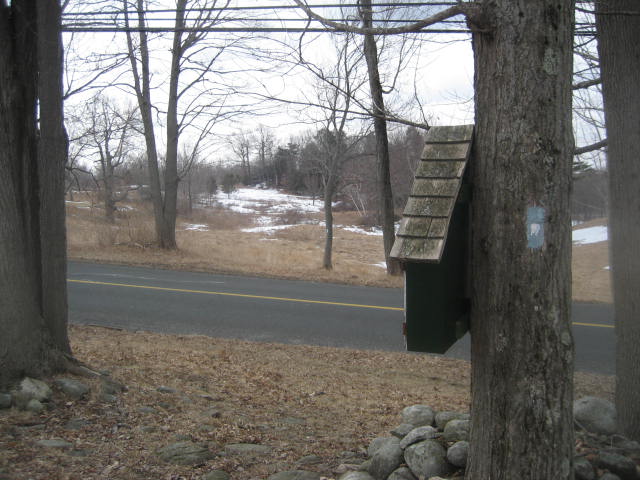
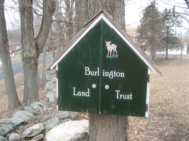
Roughly 2/10 of a mile from where we turned off of the Yellow Dot Trail, the White Dot Trail comes to a massive open field. The Walk Book mentions a couple of stiles in this area, which could be used to cross a pair of electric fences…only the fences are now gone…and so are the stiles. I was mildly disappointed by the fact that the stiles are gone…even though I didn’t know of their past existence until I got home and checked the Walk Book. Now, the trail just turns lazily this way and that through the massive open field…until it reaches and crosses Johnnycake Mountain Road (the same Johnnycake Mountain Road I walked earlier while still on the Yellow Dot Trail). You’ll know you are in the right area when you see the Burlington Land Trust sign nailed to this tree.
I continued on the Yellow Dot Trail, questioning if it even was the Yellow Dot Trail anymore, but moving forward all the same. Roughly 3.0 miles from where we turned off of the mainline trail (2.9 miles from Tory Den), the Yellow Dot Trail reached Old Field Road…and we made a right. A tenth of a mile later, the trail made a slight left and reentered the woods. Half a mile after that, still wondering what trail I was even on, I reached a trail junction. Blue blazes with white dots to my left…blue blazes with white dots to my right…and what looked like blue blazes with white dots behind me. Oh my. My immediate thought was that the trail to my left and right HAD to be the White Dot Trail, but I wasn’t sure. The dots in the blazes for the new trail looked just like the trail I was on. I took a chance and made a left, now heading due west.
As I would eventually find out, my decision to turn left at the trail junction was the right one...and I had finally found the White Dot Trail. But, it was a long time before I found out for sure. As it turns out, I hadn’t done enough research ahead of time…which is a mistake I’ll never make again. I can’t even believe…after over 90 hikes…I’m still making rookie mistakes. This is the kind of stuff that happens when you get overly confident and don’t have a back-up plan from the start. Then again, this is Connecticut...one of, if not THE most densely populated states in the country. Even if I got lost, I was bound to find civilization again at some point. Add to that the fact that I was always on marked trails and the bottom line is I wasn't ever in any real danger.
Over the next 5.8 miles, the White Dot Trail would take us west then south and return us to the area where I had left my vehicle earlier in the day. For now, though, the trail led us through the woods behind some houses in what appeared to be a new development. We followed the blazes, eventually emerging on to a paved road and then reentering the woods quickly. Then, something happened which made this hike a unique experience.
Roughly 2/10 of a mile from where we turned off of the Yellow Dot Trail, the White Dot Trail comes to a massive open field. The Walk Book mentions a couple of stiles in this area, which could be used to cross a pair of electric fences…only the fences are now gone…and so are the stiles. I was mildly disappointed by the fact that the stiles are gone…even though I didn’t know of their past existence until I got home and checked the Walk Book. Now, the trail just turns lazily this way and that through the massive open field…until it reaches and crosses Johnnycake Mountain Road (the same Johnnycake Mountain Road I walked earlier while still on the Yellow Dot Trail). You’ll know you are in the right area when you see the Burlington Land Trust sign nailed to this tree.
|
|
After
crossing Johnnycake Mountain Road, the trail brought us to another large open
field. The next 1.9 miles included some
slight turns (it even heads north again at one point) and some ups and downs,
but overall there isn’t a lot to type about here. That’s not to say the woods in this area of
the state aren’t beautiful…they totally are…but there aren’t any real
highlights. I did, however, enjoy the
quiet of the woods. It made for some
great reflection time…which is really what it is all about for me, anyway.
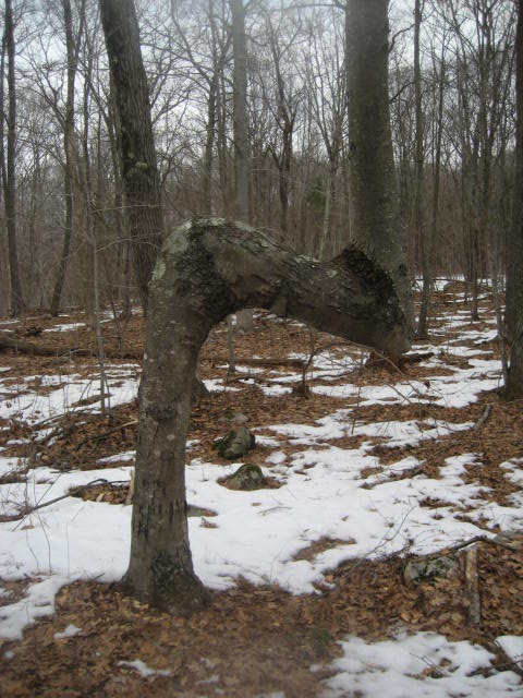
Roughly 2.5 miles after leaving the Yellow Dot Trail behind, the White Dot Trail makes a hard left and starts heading due south. It will continue to head due south, in an almost perfectly straight line, for the next 3.3 miles. It also follows an old woods road, so there isn’t anything technically challenging about this portion of the hike. It was just me and my dog, strolling through the woods, enjoying the day…and wondering about this oddly shaped tree.
Roughly 2.5 miles after leaving the Yellow Dot Trail behind, the White Dot Trail makes a hard left and starts heading due south. It will continue to head due south, in an almost perfectly straight line, for the next 3.3 miles. It also follows an old woods road, so there isn’t anything technically challenging about this portion of the hike. It was just me and my dog, strolling through the woods, enjoying the day…and wondering about this oddly shaped tree.
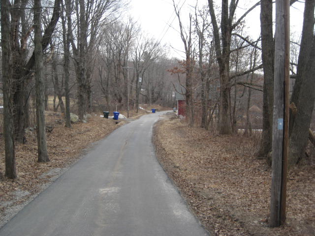
Approximately
7/10 of a mile after making the hard left turn on the White Dot Trail, the dirt
road we had been traveling on became paved.
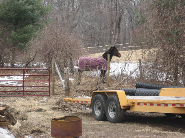
The trail keeps following the road, Blueberry Hill Road, south. Along the way, we passed a farm…so I stopped
to get a picture of a horse. Like I
said, the highlights were few and far between out this way…but horses are cool.
|
|
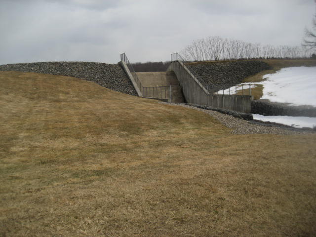
The
trail continues to follow Blueberry Hill Road, which later turns to gravel, for
a total of about 9/10 of a mile. Then, it
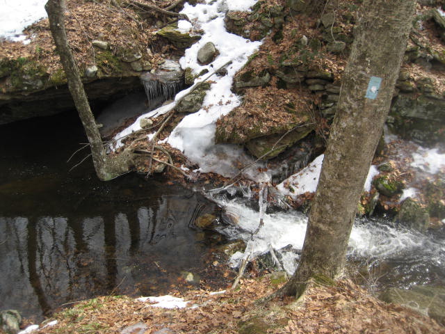
passes a gate and enters Bristol Water Department land. As we continued to head south, we passed
Bristol Reservoir # 3. I stopped to take
a picture of a spillway.
About
a tenth of a mile after leaving Blueberry Hill Road for the Bristol Water
Department service road, we came to an interesting water “crossing”. I say “crossing” because this brook was not
passable where the trail wanted me to cross.
Roughly 10 miles in, I thought I was going to have to turn around and find
another route back to my car.
Fortunately, I was able to head upstream a bit and cross the brook on a
fallen tree…using what little balance I have to get across.
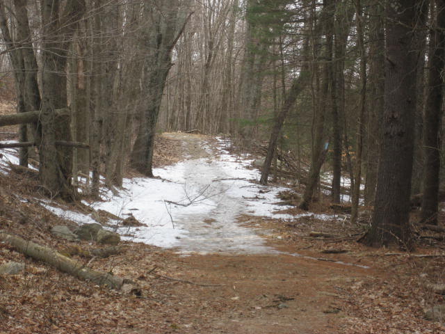
The
remaining 1.6 miles of the White Dot Trail were mostly uneventful. According to the Walk Book, there are a
couple of large maple trees along the way, which is where Stephen Graves (see
my notes about Tory Den above) once lived.
But, I didn’t see the trees. One
other note about this last section is that the area on East Plymouth Road near
the Harwinton/Plymouth town line is where the Patriots whipped Steven Graves
for being a Tory. That’s right, the
Patriots eventually caught Graves and he paid the price for being a traitor!
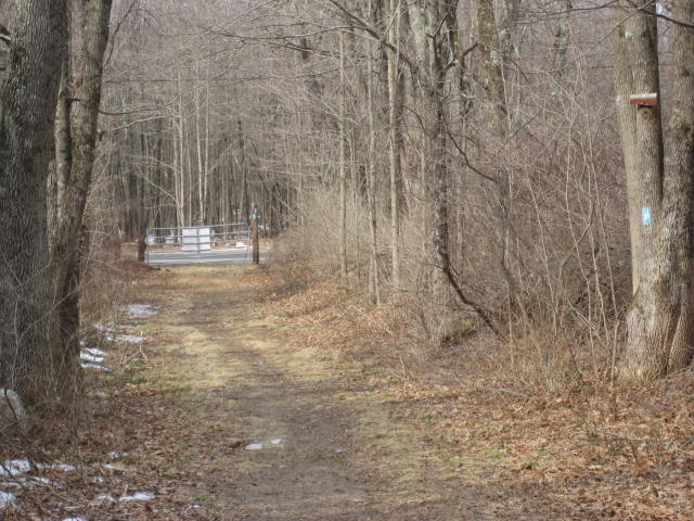
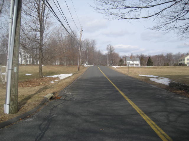
After following East Plymouth Road due south for about 4/10 of a mile, the White Dot Trail makes a hard left (east) and passes by a wooden gate. There is another parking location here with room for two or three cars, which makes it better than the one I left my vehicle at earlier today. We followed the White Dot Trail for a stretch longer before reaching the mainline Tunxis. It was here, roughly 12 miles ago, that we made a right and followed the mainline east. Now that we completed one big giant loop, we made a right and followed the mainline south…retracing our steps from earlier in the day…passing near Old Marsh Pond. Instead of following the mainline all the way back to the trailhead, only to then follow a series of roads back to where I left my car, I decided to take an unmarked trail (a shortcut) to end the day.
I really enjoyed my second hike on the Tunxis. I find the history in this area of the state fascinating and, while small in physical appearance, Tory Den totally lives up to the historical expectations I had for it. Next up on the Tunxis, the “Mile of Ledges”…but first, I was off to Florida for a “hike” along the edge of Lake Okeechobee.
For a map of this hike, along with elevation data, please click here.
Total
2014 Distance: 148.27 Miles
