Walk of Flame
Hike #128
Savannas Preserve State Park
Port Saint Lucie, Florida
Hike Distance: 5.4 Miles
Date Hiked: 3/23/2015
Date Published: 3/29/2015
Hike #128
Savannas Preserve State Park
Port Saint Lucie, Florida
Hike Distance: 5.4 Miles
Date Hiked: 3/23/2015
Date Published: 3/29/2015
The winter of 2015 hasn’t been
kind to me or my attempt at hiking 500 miles in a calendar year. I haven’t been completely confined to the
house, but I’ve been forced to spend all of my hiking time on familiar trails (Gay
City State Park in Hebron and Case Mountain in Manchester). As a result of the snowpack, my overall pace
has all but stalled. From February 8th
to March 21st, I logged only 48.3 miles. This brought my total distance for 2015 to
118.3 miles. But, after hiking 70 miles from January 1st to February
1st, this current total can only be described as disappointing. Fortunately, I was able to take a week long break
from the frigid New England weather by visiting my grandparents in Florida and
I was hopeful a few hikes while there would allow me to make up some ground.
Unlike last year, when I walked around the perimeter of Lake Okeechobee (Hike #94), I didn’t do a lot of pre-planning for this visit. I knew I didn’t want to hike the Lake Okeechobee Scenic Trail again because I was looking for something a little more challenging. And, I knew I didn’t want to drive as far because I thought less car time would equal more hike time. So, I did a quick google search and found Savannas Preserve State Park, roughly 10 miles from where my grandparents live.
From floridastateparks.org:
Freshwater marshes, or 'savannas,' once extended all along Florida's southeast coast. Stretching more than 10 miles from Ft. Pierce to Jensen Beach, this preserve is the largest and most intact remnant of Florida's east coast savannas. A good place for visitors to start is the Environmental Education Center, where they can learn about the importance of this unique and endangered natural system. Picnic tables are available near the center. Canoeing, kayaking, and fishing in the wetlands are popular activities. Wildlife enthusiasts and photographers can enjoy the diversity of habitats this undisturbed area offers. Over eight miles of multi-use trails provide opportunities for hiking, bicycling, and horseback riding. Guided walks and canoe trips are available by reservation.
To reach Savannas Preserve State Park:
The Environmental Education Center is located approximately 2 miles east of U.S. 1 on Walton Road in Port St. Lucie. The address is: 2541 Walton Road, Port St. Lucie, FL 34952.
Before starting my hike through the marsh, I decided to make a quick stop at the Education Center. The ranger on duty, a woman named Wren, was extremely helpful. We talked for a few minutes about what I might encounter on my hike and she even paid the $3 entrance fee for me (I forgot to bring cash). In order to make sure my debt was paid, I paid double the entrance fee when I returned later in the week (I’ll add another recap for that hike soon). I also bought a hat to protect my pasty dome from the Florida sunshine. I felt confident I was now ready for my hike so I set out, following the road from the main parking lot back towards Walton Road.
I started my hike by following the White Trail, which extends due north for more than 5 miles from Walton Road to Easy Street. The first section of trail follows a dirt road…
Unlike last year, when I walked around the perimeter of Lake Okeechobee (Hike #94), I didn’t do a lot of pre-planning for this visit. I knew I didn’t want to hike the Lake Okeechobee Scenic Trail again because I was looking for something a little more challenging. And, I knew I didn’t want to drive as far because I thought less car time would equal more hike time. So, I did a quick google search and found Savannas Preserve State Park, roughly 10 miles from where my grandparents live.
From floridastateparks.org:
Freshwater marshes, or 'savannas,' once extended all along Florida's southeast coast. Stretching more than 10 miles from Ft. Pierce to Jensen Beach, this preserve is the largest and most intact remnant of Florida's east coast savannas. A good place for visitors to start is the Environmental Education Center, where they can learn about the importance of this unique and endangered natural system. Picnic tables are available near the center. Canoeing, kayaking, and fishing in the wetlands are popular activities. Wildlife enthusiasts and photographers can enjoy the diversity of habitats this undisturbed area offers. Over eight miles of multi-use trails provide opportunities for hiking, bicycling, and horseback riding. Guided walks and canoe trips are available by reservation.
To reach Savannas Preserve State Park:
The Environmental Education Center is located approximately 2 miles east of U.S. 1 on Walton Road in Port St. Lucie. The address is: 2541 Walton Road, Port St. Lucie, FL 34952.
Before starting my hike through the marsh, I decided to make a quick stop at the Education Center. The ranger on duty, a woman named Wren, was extremely helpful. We talked for a few minutes about what I might encounter on my hike and she even paid the $3 entrance fee for me (I forgot to bring cash). In order to make sure my debt was paid, I paid double the entrance fee when I returned later in the week (I’ll add another recap for that hike soon). I also bought a hat to protect my pasty dome from the Florida sunshine. I felt confident I was now ready for my hike so I set out, following the road from the main parking lot back towards Walton Road.
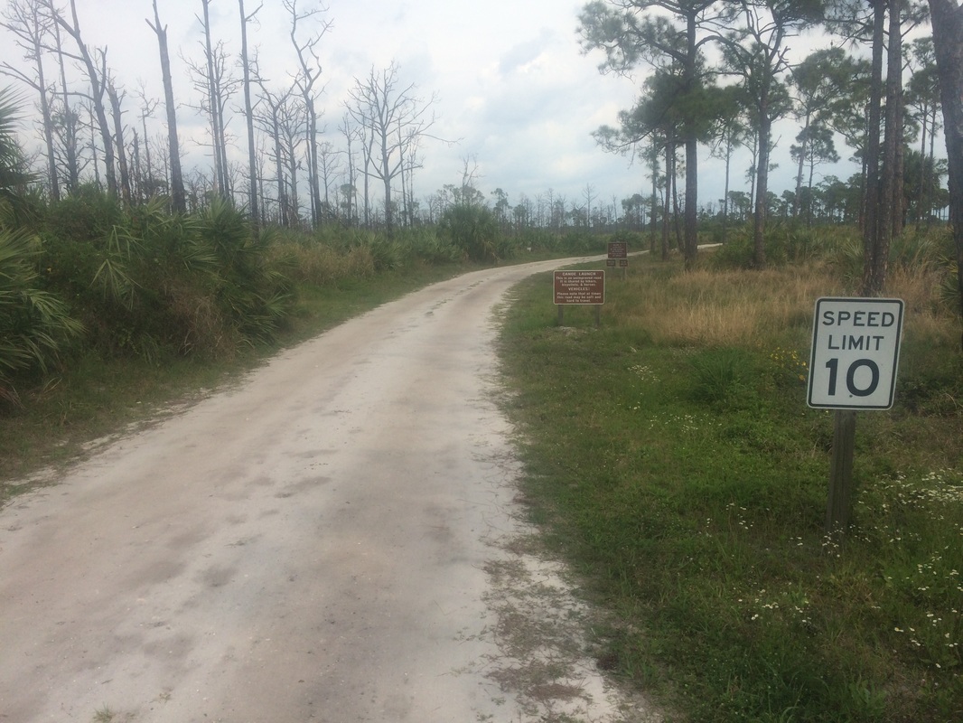
I started my hike by following the White Trail, which extends due north for more than 5 miles from Walton Road to Easy Street. The first section of trail follows a dirt road…
|
|
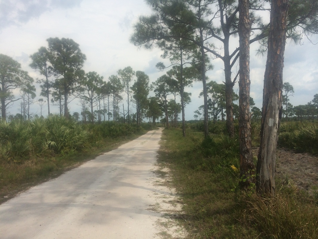
Roughly 7/10 of a mile in,
at a fork, the White Trail bears left…
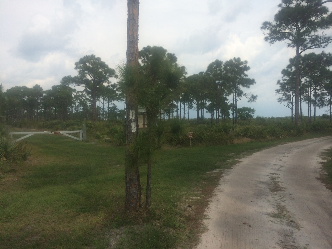
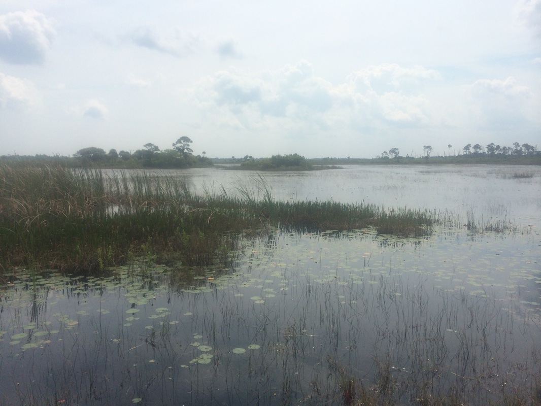
Here, the dirt road bears
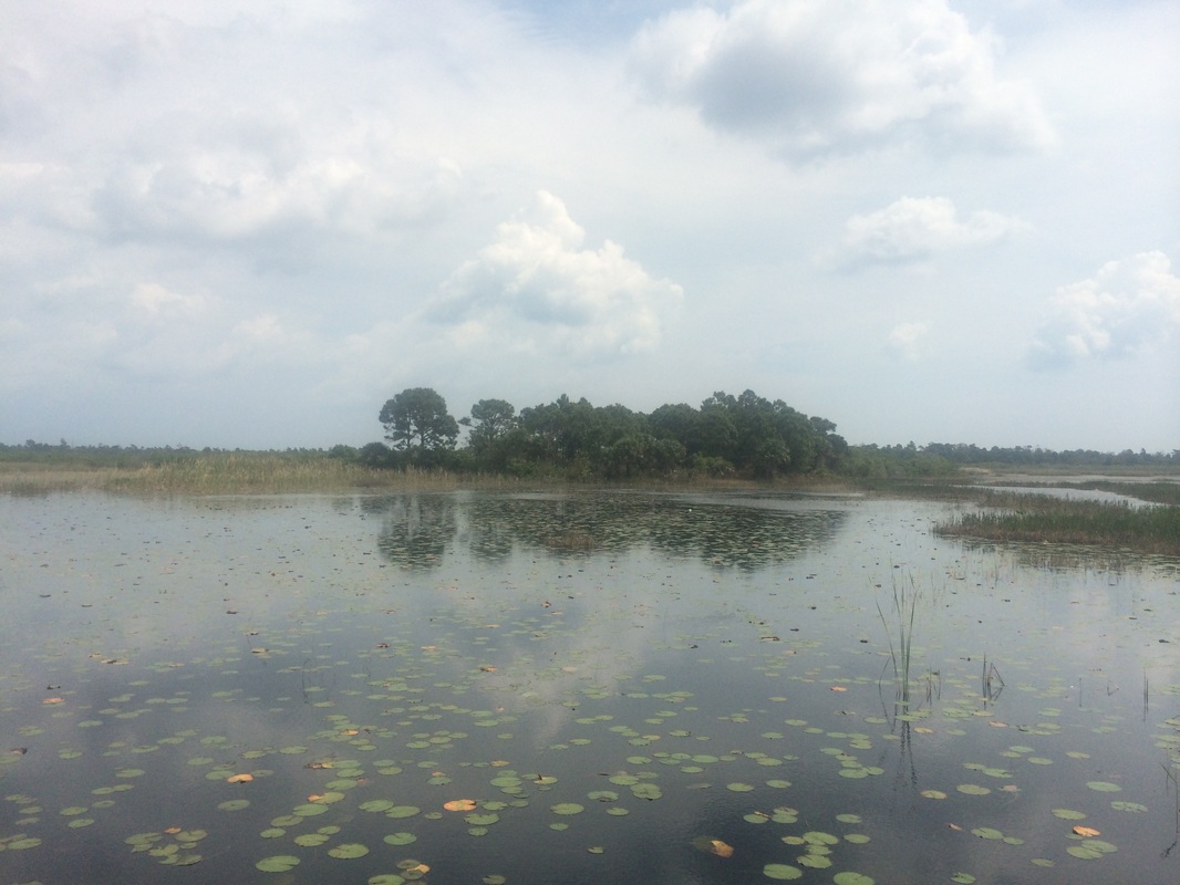
right to the canoe launch area. Prior to
continuing my journey along the White Trail, I decided to take a short detour
and check out the canoe launch area.
After a quick walk, I changed my shirt (it wasn’t too hot for long
sleeves and I figured I’d be better protected from the sun), get a few pictures
(below) and doubled back to the White Trail…
|
|
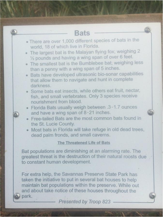
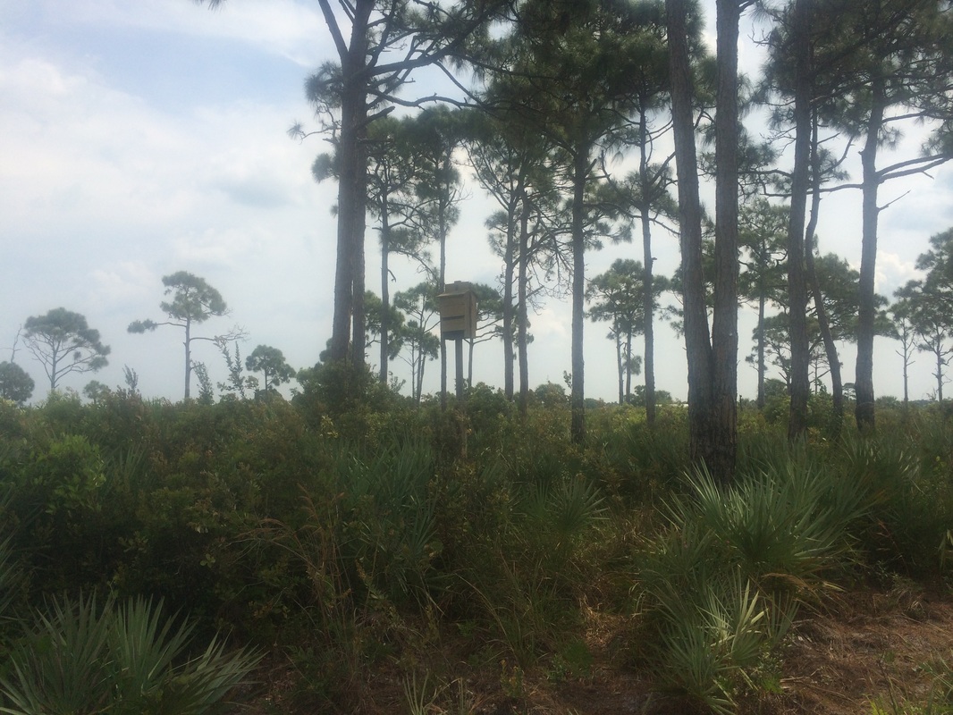
Now, back on the White Trail
heading due north, I passed by an informational sign and a bat house…
Approximately 1.1 miles in,
I reached the Yellow Trail and…at the suggestion of Wren the Ranger…turned
right to follow it…
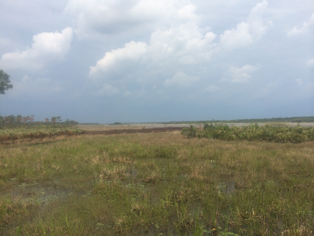
The Yellow Trail took me
from the relative shade of the pine flatwoods to the edge of the marsh.
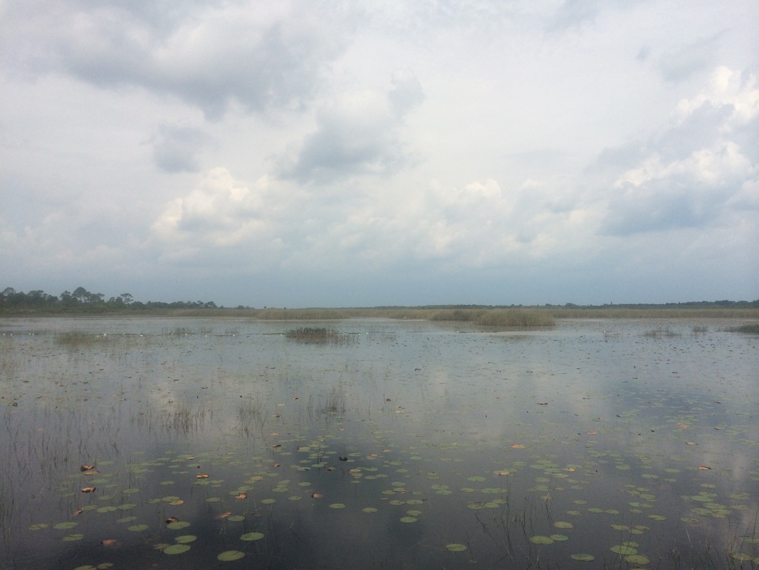
Roughly 1.4 miles in, I crossed a wet area on this bridge…
Roughly 1.4 miles in, I crossed a wet area on this bridge…
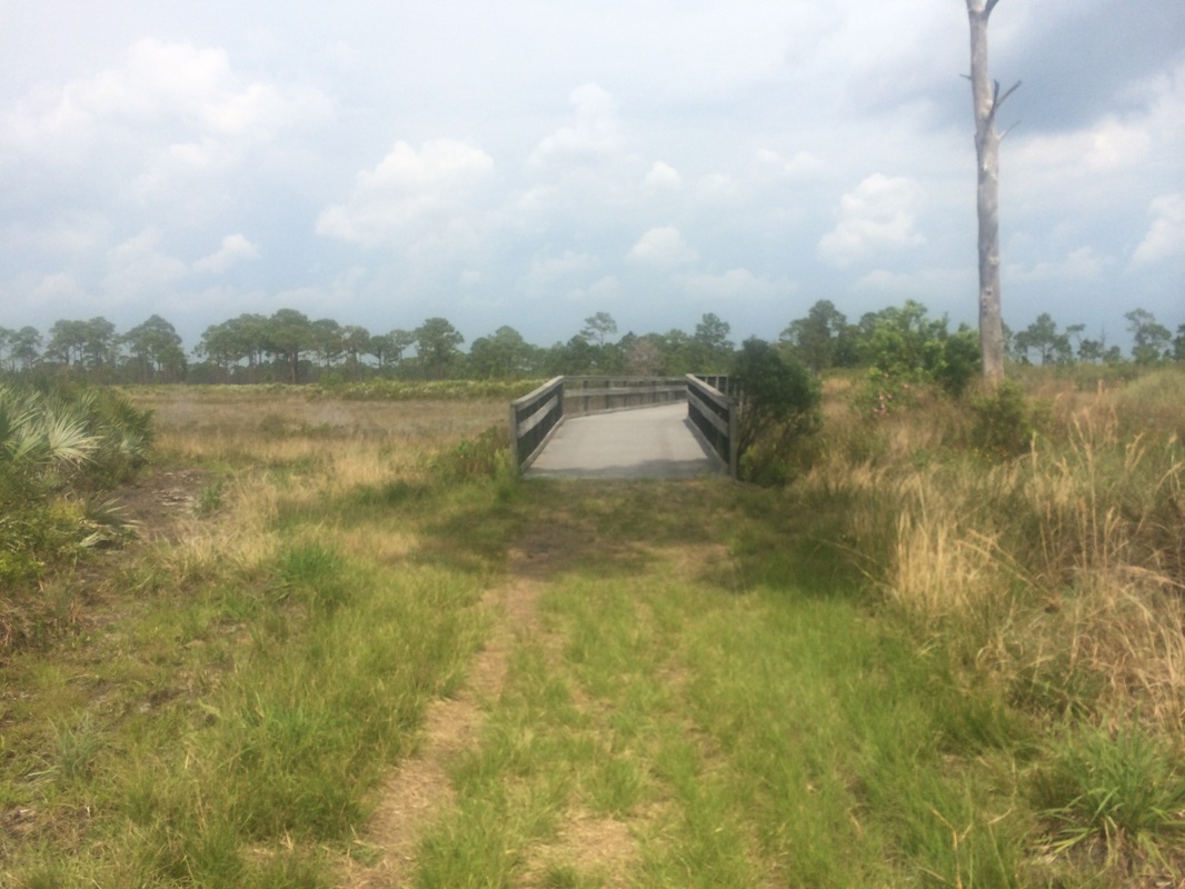
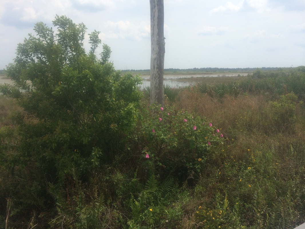
The bridge offered some good
views of the marsh and I was able to get a picture of some early-blooming
flowers…
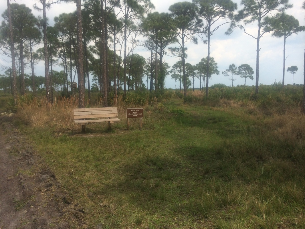
There is even a bench for
those interested in stopping for a rest.
I could see some clouds to the east and the forecast called for rain
with possible thunderstorms so I didn’t linger.
Approximately 1.8 miles in, I crossed another wet area on a second bridge…
Approximately 1.8 miles in, I crossed another wet area on a second bridge…
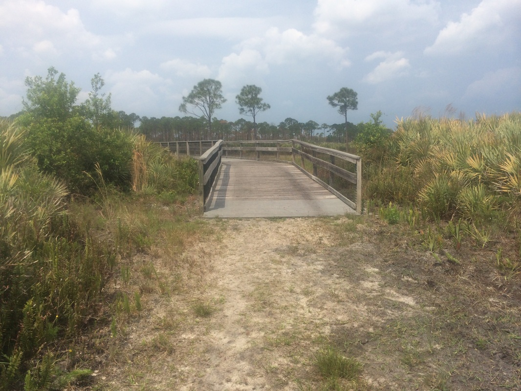
From this bridge, I could
see the power lines which extend from Saint Lucie Nuclear Power Plant off in
the distance…
Those power lines, barely
visible to the center of the frame in the picture above, cross the White Trail more
than 4 miles north of where I was currently standing. I’m always impressed by the way the
relatively flat terrain of Florida allows one to see objects so far away.
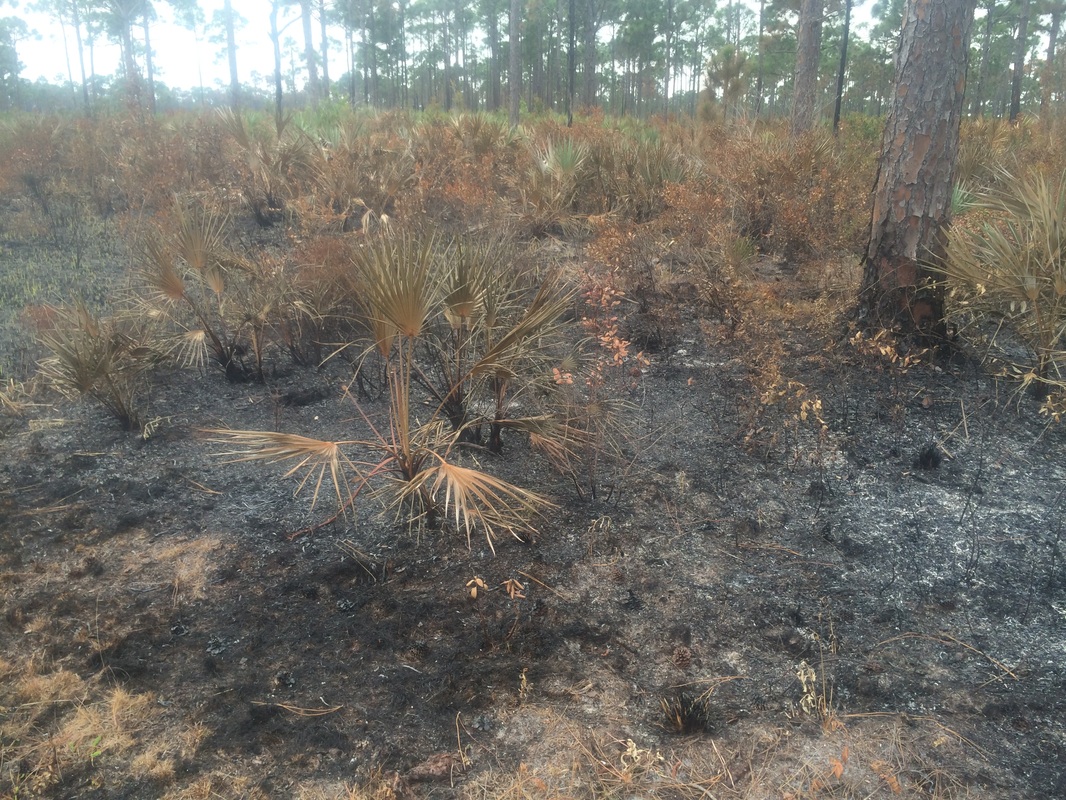
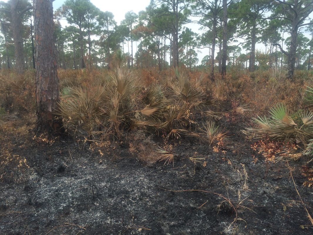
On the other side of the bridge, now heading due west and back towards the White Trail, I saw what looked like fire damage along the trail…
On the other side of the bridge, now heading due west and back towards the White Trail, I saw what looked like fire damage along the trail…
|
|
I recalled seeing something
on the drive over about a “controlled burn” but this topic never came up when I
was discussing the area with Wren the Ranger.
I wasn’t sure what was going on.
Roughly 1.9 miles in, I reached the White Trail and turned right. Then, I saw this sign…
Roughly 1.9 miles in, I reached the White Trail and turned right. Then, I saw this sign…
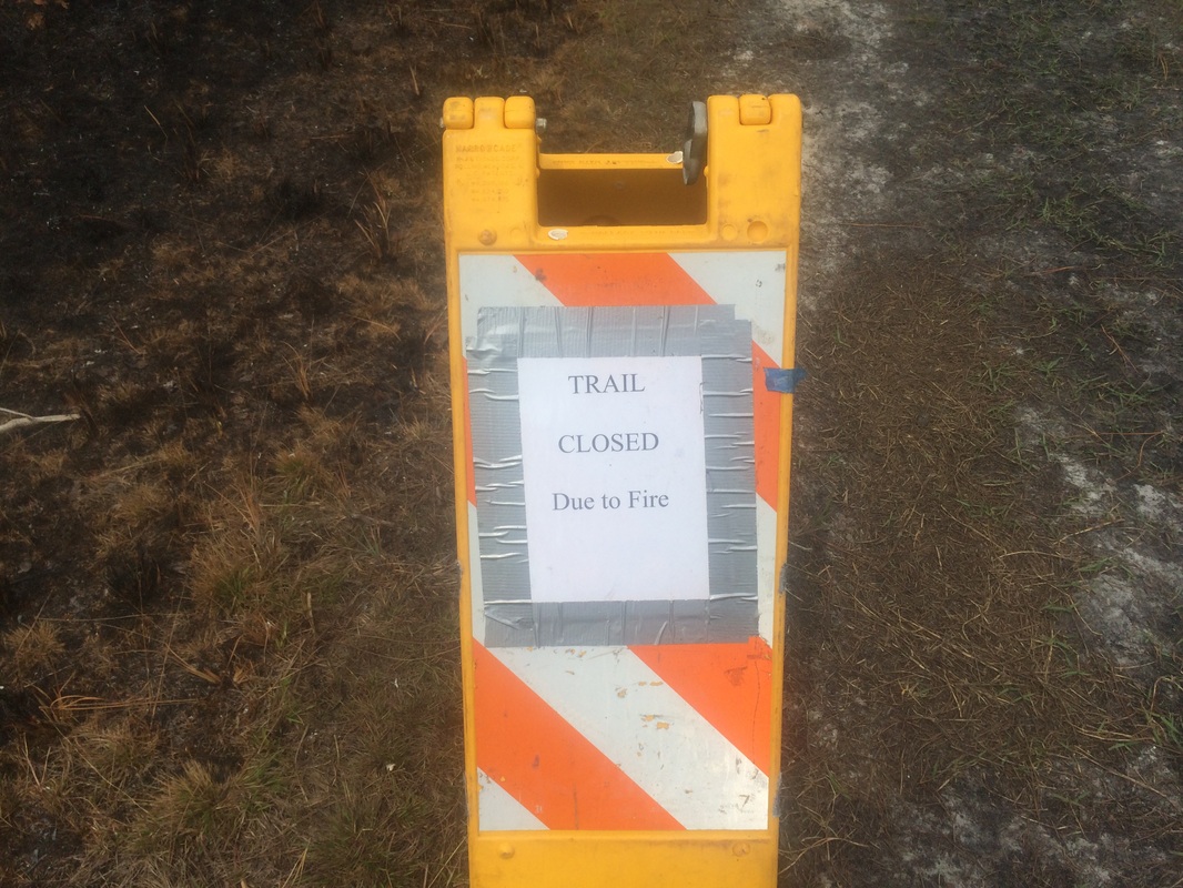
If I were more of a “risk-taker”
than a “rule-follower” I would’ve considered the fact that the trail closure
never came up when I was discussing the hike with the park ranger…I would’ve
considered this fact for a minute and then continued on my hike as if I never
saw the sign…I would’ve justified this decision by telling myself I would continue
on until I saw evidence of actual danger…and I would’ve wondered if this was
damage was from a natural phenomenon, like lightning, or if the fire was man
made. Later, I might’ve seen some smoke,
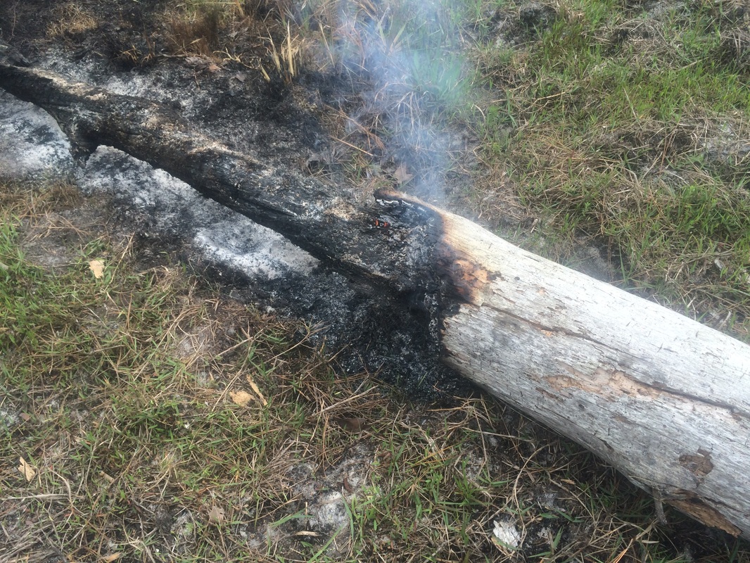
but it would’ve been far enough off trail I would decide to keep going. Later still, I might’ve seen a fallen tree just
off trail which was still on fire/smoking.
And, if I did see a fallen tree still ablaze, it might look something
like this…
At this point, I probably
would’ve considered the danger more real than previously thought. I probably would’ve also considered the
worsening weather and decided to start the trek back to the car, passing the area where I first encountered the trail closure. Either way, I would now be heading due south
along the White Trail. And, I would pass the junction of the Red Trail on the right along with this
interesting large animal trap…
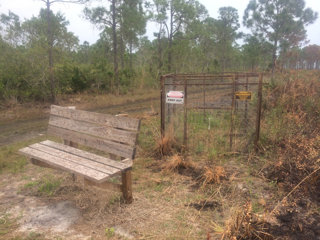
The brief research I did prior to this hike included some discussion about feral pigs in the area. Wren the
Ranger also mentioned something about them but I hadn’t even given them a
second thought until I saw this cage.
Later, still heading southbound along the White Trail, I reached an area where the trail was just about washed out…
Later, still heading southbound along the White Trail, I reached an area where the trail was just about washed out…
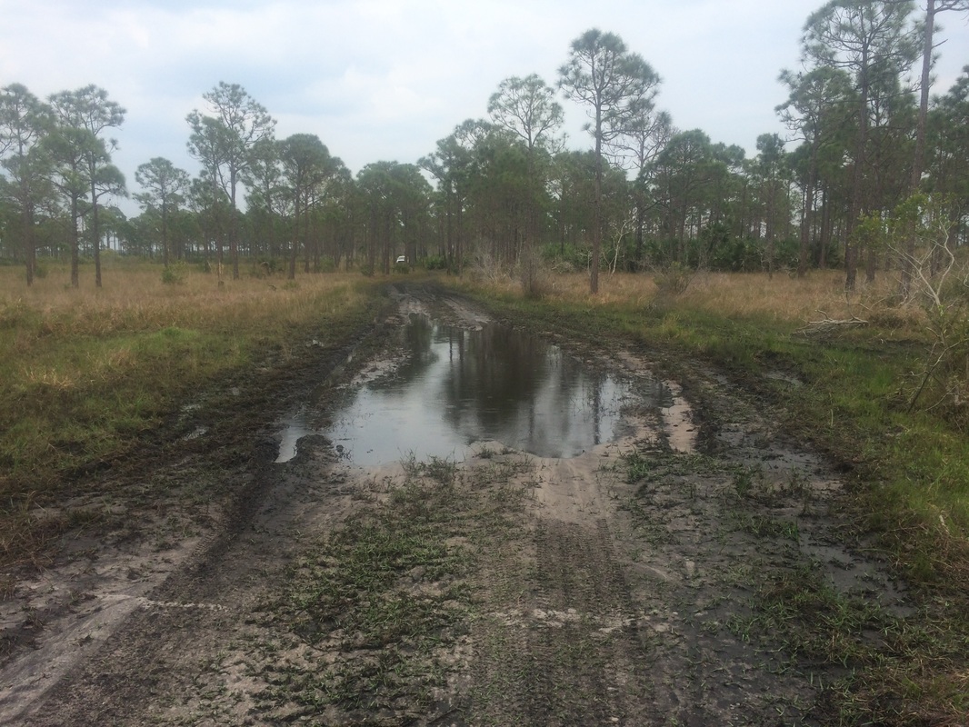
Look closely and you might
see drops of rain in the mud puddle. At
this point, the weather was really starting to deteriorate. I was able to make my way around the mud
puddle just off trail to the right. In
the mud, I noticed what looked like the tracks of a pig. Sadly, other than the cage I’d seen earlier, this
was the only evidence of feral pigs in the area.
I followed the White Trail, passing the canoe launch area, all the way back to the parking area of the education center where I earlier left the car. As I was putting my gear back in the car and doing my post-hike stretch, the skies opened up…
I followed the White Trail, passing the canoe launch area, all the way back to the parking area of the education center where I earlier left the car. As I was putting my gear back in the car and doing my post-hike stretch, the skies opened up…
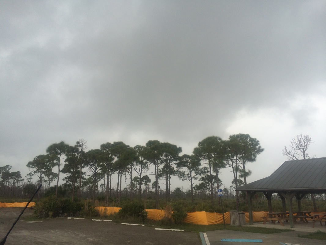
I was thankful I made it
back to the car when I did because the drive back to my grandparents’ house was
in a torrential rain. It never did see
any lightning or hear any thunder, but I wouldn’t have wanted to finish my hike
in that rainstorm.
This was a fun hike. I was disappointed I didn’t get to see any wild animals, but I was happy to hike on something other than two feet of packed snow…even if it was on mostly mud-covered trails, and hypothetically through a forest fire.
Until next time…
This was a fun hike. I was disappointed I didn’t get to see any wild animals, but I was happy to hike on something other than two feet of packed snow…even if it was on mostly mud-covered trails, and hypothetically through a forest fire.
Until next time…
For a map of this hike, along with elevation data, please click here.
Total 2015 Distance: 123.7
(376.3 to Goal)
