October Mountain, December Hiking
Hike #148
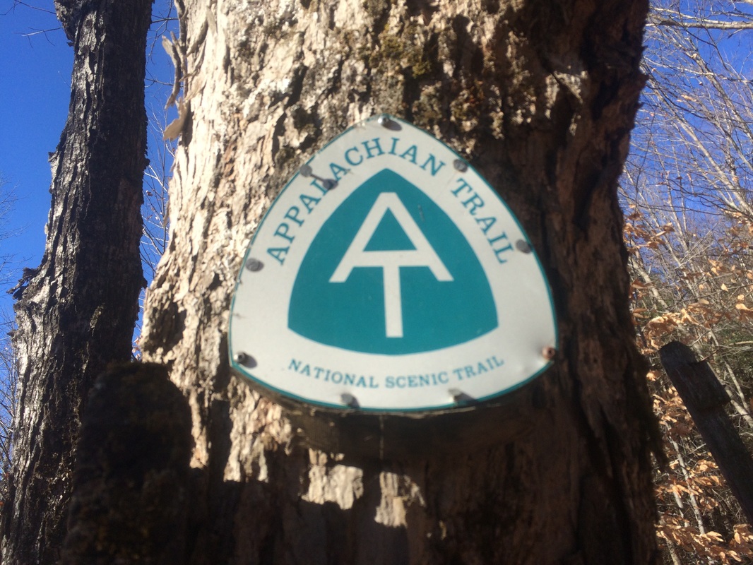
Appalachian Trail
Washington Mountain Road to Finerty Pond (Washington, MA)
Hike Distance: 12.2 Miles
Date Hiked: 12/6/2015
Date Published: 12/7/2015
Hike #148
Appalachian Trail
Washington Mountain Road to Finerty Pond (Washington, MA)
Hike Distance: 12.2 Miles
Date Hiked: 12/6/2015
Date Published: 12/7/2015
Note: The day before the hike described in this recap, I took Roscoe over to the Case Mountain trails in Manchester, Connecticut. While there, I re-hiked some of the trails which I’ve previously recapped (Hikes # 7, 8, and 9). I’m not going to recap those trails again here. However, the hike added 11.8 miles to my total for 2015, bringing my mile count to 443.6.
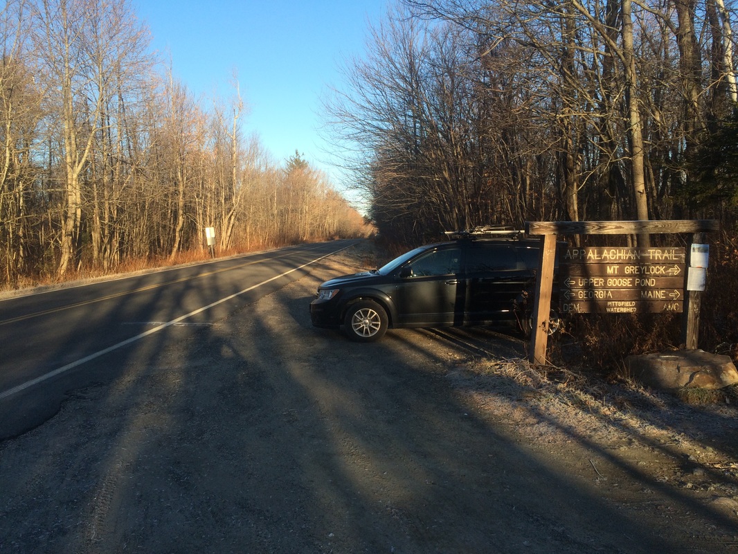
On my previous Appalachian Trail hike (#147), I covered the section of trail between Upper Goose Pond Cabin Trail and Finerty Pond. For this hike, I would park at the lot off of Washington Mountain Road in Washington, Massachusetts and make my way southbound to connect with the area around Finerty Pond where I left off last time…
To reach the trailhead:
Follow I-91 North to I-90 West (tolls) toward Albany. Take Exit 2 for U.S. 20 East. Turn left on U.S. 20 East. In approximately 4 miles, turn left on Becket Road. In approximately 2 miles, bear left on Yokum Pond Road. In approximately 1 mile, bear right on County Road. In approximately 1.5 miles, turn left on McNerney Road. McNerney Road becomes Washington Mountain Road. The parking location is on the right side of the road, approximately 5 miles from the turn off of County Road…
Follow I-91 North to I-90 West (tolls) toward Albany. Take Exit 2 for U.S. 20 East. Turn left on U.S. 20 East. In approximately 4 miles, turn left on Becket Road. In approximately 2 miles, bear left on Yokum Pond Road. In approximately 1 mile, bear right on County Road. In approximately 1.5 miles, turn left on McNerney Road. McNerney Road becomes Washington Mountain Road. The parking location is on the right side of the road, approximately 5 miles from the turn off of County Road…
Alternatively, to avoid the tolls on I-90, you could enter the address for Blueberry Hill Airport (a private airfield) in your GPS and select another route.
My own journey to reach the trailhead was one of the more interesting drives I’ve ever made. After driving more than 90 minutes and getting to within a mile or so of the parking location, I found a section of Washington Mountain Road closed. Reflecting back on it now, I think there was an attempt to let drivers know of a detour. But, it either wasn't a very good attempt or I was too tired from not getting much sleep the night before. Either way, I ended up creating my own detour and I spent the next 45 minutes driving on the gravel roads of October Mountain State Forest. If ever I needed a reminder the decision to trade in my Charger was a good one, this was it. I eventually made my way to the trailhead, but the frustrating drive up set the tone for the rest of the hike.
Once I was all geared up, I started my southbound portion of the hike. I crossed Washington Mountain Road and started following white blazes due west…
On the other side of Washington Mountain Road, the trail follows a gravel road…
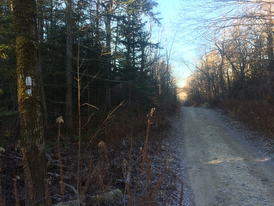
According to the map this is Beach Road. The trail follows the road for less than 1/10 of a mile before turning left, entering the woods, and continuing due south.
The first mile and a half or so of this section is pretty nice. Of course, I was already in a foul mood. So, when I encountered several muddy areas with plank walks, I became increasingly frustrated. The overnight low temperatures left a level of frost on the planks which only served to make them useless. I enjoyed this area much more on the walk back to the car later, but still neglected to take any pictures.
Approximately 1.5 miles in, after skirting around a beaver pond, I crossed West Branch Road…
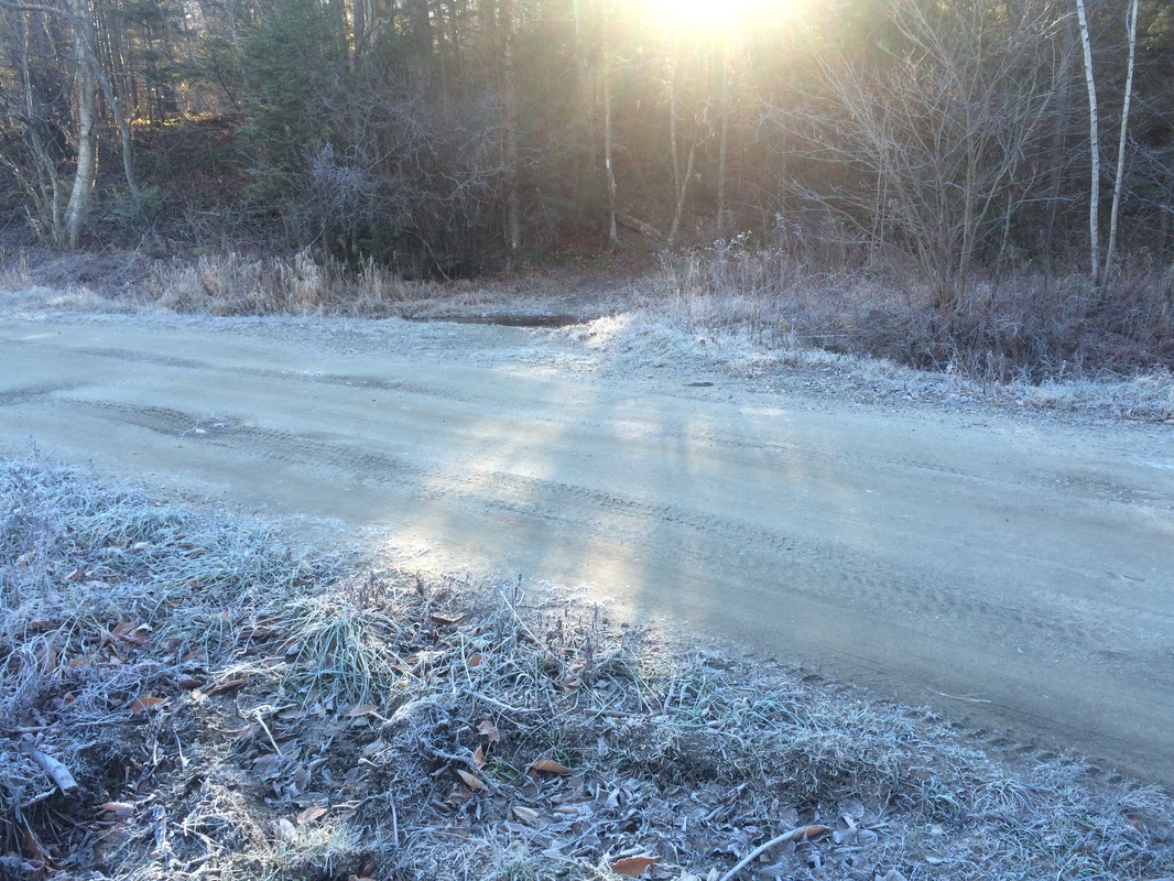
I really like this picture because it shows just how cold it is getting overnight. Later, when I came back through, the frost was gone. It might not feel like it back home in central Connecticut, but winter is coming.
On the other side of the road, the trail heads uphill for a bit. I noted how there weren’t any major elevation changes in this section. But, there are plenty of minor changes which slowed my pace considerably.
Roughly 2.1 miles in, I passed the side trail for the October Mountain Shelter on my right…
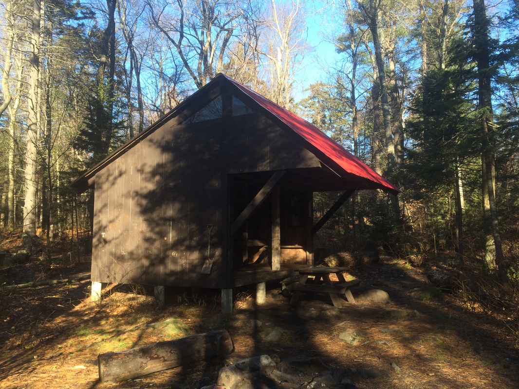
The side trail is much shorter than some of the other shelter trails I’ve encountered recently. I could actually see the shelter through the trees, right from the AT. But, I had to follow the side trail to take the picture you see above.
Approximately 2.5 miles in, I crossed an unmarked trail. There wasn’t much to see so I didn’t bother taking a picture. Later on, I would cross two more unmarked trails and all three look fairly similar. Some hikers might not even realize the other trails are there. If not for the signs which serve as reminders the AT is for foot traffic only, I probably would’ve missed them. I’m assuming these trails are for snowmobiles in the winter because they looked too overgrown to have had any recent activity, ATV or otherwise.
Roughly 3.3 miles in, after hiking up and down a hill with a gradual incline/decline, I crossed the second unmarked trail.
Approximately 3.8 miles in, after climbing another hill with a gradual incline, I reached the summit of Bald Top (elevation: 2040 feet). The name would make you think this “peak” would be barren and would allow for good views of the surrounding area. And, that may have been true in the past. But, there is an abundance of trees at the top and no views. Additionally, there isn’t a sign to mark the highest point. I only knew I reached the top because it was at exactly the point on my GPS where I thought it would be. Look for a large jumble of rocks right around the 3.8 mile mark.
Roughly 4.1 miles in, after descending from Bald Top, the trail turns right on an unpaved portion of County Road. I tried to take a picture of a small parking location, with room for maybe two cars, but I must’ve been moving around too much because it came out blurry.
Approximately 4.6 miles in, after a short descent from County Road, I made the first in a series of brook crossings, including Mountain Brook. Like the alternate trail crossings, these brook crossings are all pretty similar so I don’t have any pictures to share.
Roughly 5.5 miles in, I crossed the third unmarked trail. I was approaching the area where I left off on my previous hike. But, I was surprised to find I was heading uphill. I thought I did the bulk of the downhill stuff last week. At this point, I was tired…and hungry…and I just wanted to reach the halfway point so I could take a break. The first half of this hike was turning out to be surprisingly challenging.
Approximately 6.1 miles in, I finally reached the rock jumble near the “All-Seeing Eye” tree where I turned around on my previous hike. I took off my pack, snacked on a protein bar, and rested for a few minutes before starting the trip back to my car.
I wish I could do this hike over and eliminate the experience of the 45-minute detour beforehand. Looking back now, I think this one was a lot more enjoyable than I perceived it to be while I was doing it. I enjoyed the hike back to the car a lot more than the hike out and it is the same section of trail. I think that speaks volumes about this section of trail and how it helped me clear my head. Around the halfway point, I was ready to shut it down for the rest of the year…closing out the AT for 2015 and giving up on my goal to reach 500 miles. Now, I’m refocused…rededicated…and ready to get after it again in a few more days.
Until next time…
For a map and an elevation graph of my outbound trip, please click here.
Total 2015 Distance: 455.8 (44.2 to Goal)
